
-
 2215 Hits
-
 83.1% Score
-
 16 Votes
|
|
Mountain/Rock |
|---|---|
|
|
62.21461°N / 6.55115°E |
|
|
More øg Romsdal |
|
|
Hiking, Scrambling |
|
|
Summer |
|
|
3520 ft / 1073 m |
|
|
Overview
Saksa 1073 m
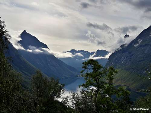
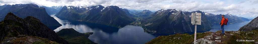
Saksa 1073 m is a beautiful mountain belonging to the Sunnmøre Alps, overlooking the village of Urke on the superb Hjørundfjord, located in Norangsdalen. The particular position of the mountain dominating the intersection between Norangsfjorden and Hjørundfjord ensures you can enjoy a spectacular view to the two fjords from the top.
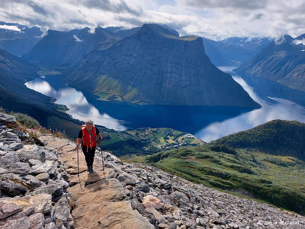
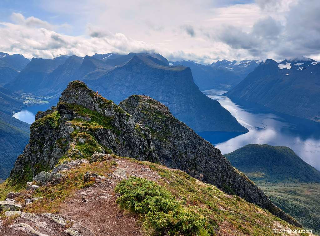
The mountain has three peaks, with the northernmost being the highest point. The route starting from Urke is a climb on a fantastic mountain with an unspeakable view of the fjords and as icing on the cake an interesting but not too demanding final rocky ridge to reach the real summit.
Getting There
The itinerary up to Mount Saksa starts in the small village of Urke. There are several ways to reach Urke.
- The simplest way is coming from the South: take the road 60 towards Hellesylt, leave it to take the road 655 to Tryggestad on the left and continue along the valley reaching the village of Urke.
Route
Saksa Normal route from Urke
Summit altitude: 1073 m
Difficulty: Alpine F
Vertical gain: 1000 meters
Starting point: parking lot in Urke
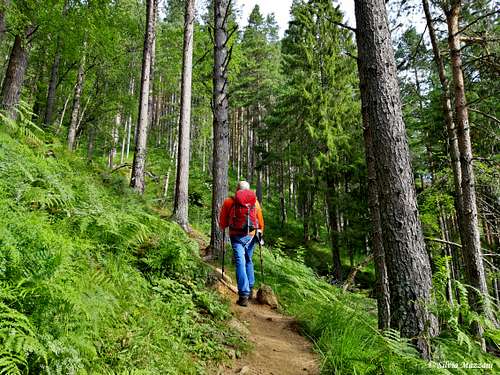
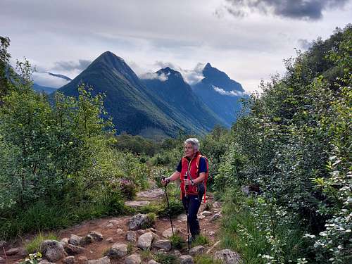
The start of the itinerary is located in Urke from the Saksa parking lot along the road 655. The first part of the trail leads up though the forest. A shorter and steeper variant starts from a small parking lot along a narrow road which is a side road of the road 655 right next to the campsite (signpost along the road 655). The two itineraries rejoin just above in the forest. Starting from Leknes along the 655 it is possible another itinerary (much longer) which joins the other one at the flat basin at the end of the climb in the forest. The steeper variant is described here.
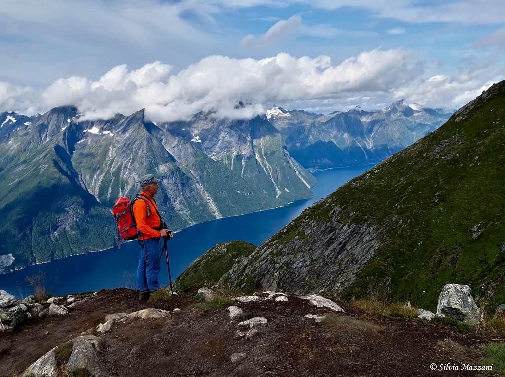
Go through a wooden gate, climb over a fence by means of a wooden ladder and continue climbing into the forest until you reach some wooden buildings (toilet and hut). Here you enter the upper step. Cross the flat basin, where there is a short detour to the bear cave and a summit log. The trail to Saksa heads to the right and along the path that becomes gradually steeper you cross the tree line and exit onto open ground. The final rocky cusp of Saksa begins to become visible and all around the very daring profiles of the pointed vines of the Sunnmore Alps begin to appear, including the very steep Slogen and below us the indelible image of the two fjords that meet.
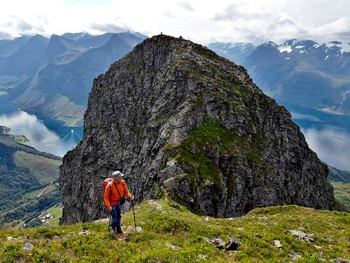
Fantastic! At one point the slope has a steeper section equipped with some fixed ropes, after which a long zigzag staircase built by the Nepalese Sherpas with enormous flat granite stones begins. The view from here is exceptional. Thus you arrive near the first peak, the fore-summit, which can be reached by traversing to the left on easy rocks. Here a flag and the summit book have been placed.
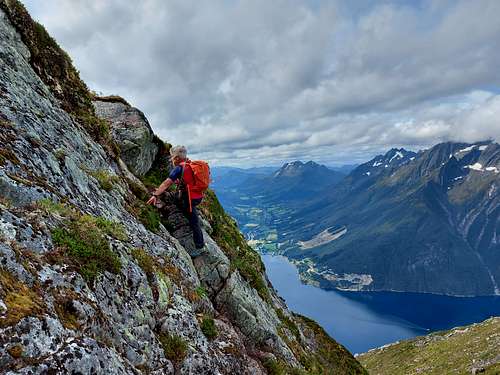
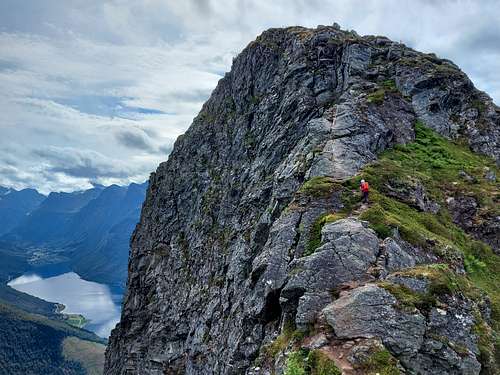
A few easy rock climbing steps are required to reach the highest peak. You begin to descend on the opposite side to that of ascent along a lively rocky spur which in the last section is aided with a metal chain. You reach a small saddle from where you go up to a second elevation and then descend to a second saddle, from which with the last ascent to the summit. The view is absolutely stunning!
Descent: retrace the same ascent route
Red Tape
No fees no permits required
When to Climb
The best season in the Sunmøre Alps goes from the end of June and lasts until the middle of September.
Accomodations
Different possibilities of accomodation in the Norangsdalen. Camp site in Urke. Alternatively hotels in the close village of Øye.