


|
|
Area/Range |
|---|---|
|
|
56.74370°N / 4.29016°W |
|
|
Hiking, Mountaineering, Trad Climbing, Sport Climbing, Toprope, Bouldering, Ice Climbing, Mixed, Scrambling, Skiing |
|
|
Spring, Summer, Fall, Winter |
|
|
4409 ft / 1344 m |
|
|
The Hills of Mons Graupius
Although contentious, I think it’s fair to say that the British Isles have no great mountain ranges, and when I say great, I am of course referring to height and scale, rather than quality and character. After all, its highest mountain, Ben Nevis, only manages to reach a paltry height of 1344 metres; a height which would render it unnoticeable if it belonged to any of Europe’s other main mountain ranges. These shortcomings in elevation have led to a peculiar phenomenon whereby various writers, travellers and artisans, in an attempt to extol the beauties of these mountains (and there are many), have resorted to likening the British ranges to those of continental Europe. Possibly the earliest example of this comes from William Camden, who in 1586 wrote of Snowdonia “…man may truely, if hee please, terme these mountaines the British Alpes”. There may be earlier examples, but Camden’s work was so influential that it’s likely that he was largely responsible for this trend; and as the British gentry became increasingly mobile, the custom of imitating Camden, or perhaps imitating the imitators of Camden, grew also, turning the practice into something of a cliché. |

|
Yet, despite the need of some Britons to exaggerate the nature of their mountains, such exaggerations were not needed for describing their mountaineers; because for as long as mountains have been climbed for exploration, for the challenge or simply for fun, British mountaineers and climbers have been at the forefront of the sport, pushing its limits increasingly upwards. I do not wish to disparage the achievements of other nations; Alpine countries such as Italy, Germany, Austria, France and Switzerland have all produced exceptional mountaineers of the highest quality, but these countries have had the benefit of their own large mountains and are therefore at an advantage when it comes to climbing them. In spite of this lack of high mountain terrain, in the mid 19th century it was British members of the Alpine Club who, along with their native guides, explored vast tracts of the Alps, Pyrenees, and Caucasus; in the late 19th/early 20th centuries it was members of the Climbers' Club and Scottish Mountaineering Club who recorded routes of unmatched difficulty throughout the world; and in 1953 it was a British led expedition who were first to reach the summit of Mount Everest. The exploits of British mountaineers and climbers continue to this day. |


|
Now it’s only a matter of opinion, and I’m sure that there are countless other factors that have played a part in this unusual propensity for Alpine climbing, but I feel that credit must largely be given to that rare quality which British mountains possess, and in particular that of the Grampian Mountains; because despite their small size, they have a character and prowess that can easily match the best Europe, if not the world, has to offer. So before I guide you across the sections, paragraphs and pictures of this page, which will hopefully illustrate why this is all so true, please allow me to indulge myself in the old cliché, and declare that the Grampian Mountains, above all others, are the true heirs to the title of the British Alpes, for they are higher, rockier and wilder than all others that call these islands home. |
Overview
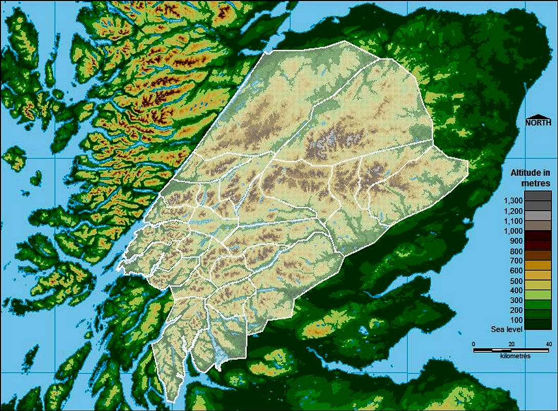
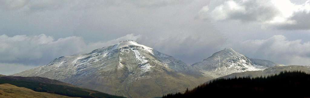
 Beinn Laoigh (Photo by Boydie) Beinn Laoigh (Photo by Boydie)Appropriately it was the inhabitants of one of Europe’s most mountainous countries who lay the foundations for the range’s modern name. The earliest reference is found in Roman historian Cornelius Tacitus’ biography of his father-in-law Gnaeus Julius Agricola, who was governor of Britain between 78 and 85 AD. Tacitus describes how Agricola “…marched with an army equipped for expedition… and arrived at the Grampian hill, where the enemy was already encamped”; and on the slopes of Mons Graupius he met and defeated the combined forces of the Caledonian tribes. ‘Mons’ of course directly translates as ‘mountain’, however the meaning and significance of the word ‘Graupius’ remains unknown. The exact location of the battle is also unknown, though most favour a location somewhere in the eastern portion of the Grampian massif, possibly at Raedykes, Megray or Kempstone Hill. During the Middle Ages the range was formally known as the Mouth or Mound, and remained so until 1520 when, in a 16th century equivalent of a typo, Scottish philosopher Hector Boece misspelled the battle’s name as “Mons Grampius", and the modern name, The Grampian Mountains, was born. In his Britannia, Camden refers to the “…[un] inhabitable, lofty, and rugged ridges of the Mountaine Grampius”, proving the name was at least in use by the early 17th century. Despite these early references the name doesn’t seem to have been widely used, and up until the 19th century, the area was generally considered to be more than one range; a view still held by many today. In both Scottish Gaelic and the Doric dialect of the Lowland Scots, the mountains have no single name, with a number of names being used instead. Grampian Region translates into Scott’s Gaelic as "Roinn a' Mhonaidh". And so to defining the extent of these mountains. By most modern definitions, the Grampians occupy a huge area, in fact they cover almost half of the land-area of Scotland. They extend southwest to northeast between the Highland Boundary Fault and Gleann Mòr (the Great Glen) and encompass the highest, most famous mountains in Britain, including those of Glen Coe, the Cairngorms and Lochaber. Like Europe’s other large mountain range’s, the mountains and sub-ranges of the Grampians are remarkably diverse, generally being steeper and rockier in the west and becoming more rounded and subdued in the east. |


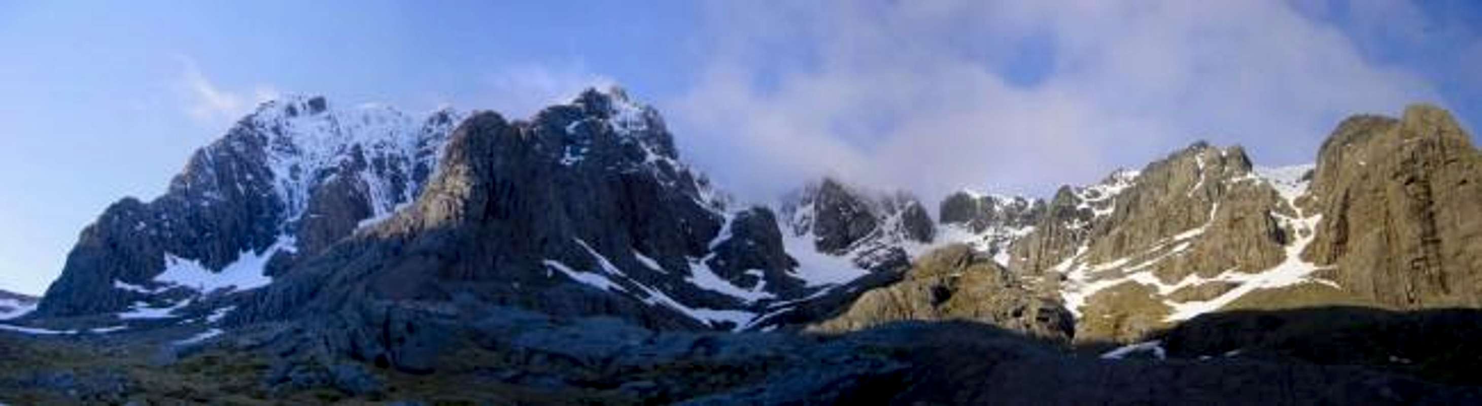
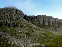
Located in the far western corner of the range is Britain’s highest mountain, Ben Nevis, which as previously mentioned, reaches 1345 metres above sea level, and owing to its northerly latitude harbours a covering of snow for much of the year. At the opposite end of the range (the eastern part for those not paying attention) the Cairngorm Mountains include among their ranks a substantial number of Britain’s highest peaks, including the country’s second highest, Ben Macdui (1309 metres). Up until the late 18th century Ben Macdui was thought to exceed even Ben Nevis in height, however, in 1794 The Ben was re-measured using more up-to-date surveying methods and Ben Macdui lost its place on the top-spot. In-between these two high points lie a ramshackle assortment of mountains, lochs and wild places of great scenic beauty, which are rich in natural heritage, and of enormous cultural value. These characteristics combine to create an area of vast wealth to the outdoor enthusiast; and outdoor enthusiasts of all kinds will find something to satisfy them here.  Ewen Buttress (Photo by Thomas Tom-Thomas) Ewen Buttress (Photo by Thomas Tom-Thomas)Thanks to the area's northerly latitude, each winter its mountains become laden with snow and ice, which when accumulated in their countless gullies and on their many buttresses, provide a seasonal paradise for winter climbers. Routes range from easy snow ascents, through to delicate ice routes, and on to challenging mixed climbing, which involves moving over both rock and ice. The North East Face of Ben Nevis, and the Northern Corries of the Cairngorm Mountains, are particularly popular, and both are home to routes of world-class quality and difficulty. Winter climbing in Britain originated in these mountains, with early members of the Cairngorm Club and Scottish Mountaineering Club laying the foundations for what the sport would become today. Early pioneers such as Raeburn and Naismith developed their techniques here, which they would later apply to the mountains of Europe, the Caucasus and the Himalaya; a practice which is continued by British climbers today.  Centurion (Photo by Dan Bailey) Centurion (Photo by Dan Bailey)In the summer, when the snows have thawed and the rock has dried, the crags become the abode of the rock climber and scrambler, who come enticed by the prospect of matching wits with some of the highest, steepest rock faces in these isles. Again Ben Nevis and the Cairngorms are probably the most popular locations, and they are joined by the area's other impressive ranges including the mountains of Glencoe, Lochnagar, Tyndrum and the Arrochar Alps. Hikers will find something to enjoy in all seasons, with some form of trail providing access to almost every mountain in the area. Popular trails give way to less visited paths, which in turn give way to almost untouched wildernesses, which if it weren’t for the local fauna, would go unseen for years. Several long-distance treks cross the area, including the famous West Highland Way, a 152 kilometres (95 miles) long network of paths, running from Milngavie north of Glasgow to Fort William at the foot of Ben Nevis. Essentially, there is something for everyone here.  Route Major (Photo by Stuart Buchanan) Route Major (Photo by Stuart Buchanan)Every British hiker, climber and mountaineer worth their salt will have made at least one foray into the Grampians in pursuit of their sport. And if they haven’t, they’re probably planning on doing so very soon. In pubs and bar rooms across the country tales are told of climbers, who did battle with the rock and the elements, and overcame seemingly insurmountable odds, to return home little heroes; and later affectionate recollections of those who didn’t. For while these mountains may be small, they are not without danger, and every year exposure, falls and avalanches claim the lives of the experienced and inexperienced alike. However, if the mountains are treated with the respect they deserve, a trip to the Grampians could produce some of the greatest mountain experiences you’ll ever enjoy. This page will act as your guide to these mountains. It will provide you with general information about the area, brief descriptions for each sub-range, and an outline of what sights you might see while visiting. It will also function as a window to Summitpost’s other Grampian pages, and help direct you to more detailed, locally specific information which the site holds, and will hopefully help you plan your visit to the area. |
The Ranges of the Grampian Mountains
As previously mentioned the Grampian Range is home to a variety of mountain environments, which can be further divided into a number of distinct sub-ranges. The sub-ranges are based on those of the Scottish Mountaineering Club guidebooks, however, in places, definitions may vary. The divisions between the sub-ranges are not necessarily definitive, as some mountains may fit as easily into one sub-range as another, in such cases, the boundaries drawn on the map below may be considered 'fuzzy'. This section illustrates these divisions, containing photos and brief descriptions for each of the sub-ranges, as well as an interactive map to guide you through the area. For ease of use the sub-ranges have been grouped into three sections based on their geographical location – East, Central and West. |
| How to use this section The Map: The map is interactive and you can find out the name of the sub-range by hovering your mouse cursor over the highlighted areas. Click on a highlighted area to be taken to its description on this page. Tip: Look out for these  |
Western Grampians
Ben Nevis' North East Face (Photo by Ron Walker)
The Nevis Range is a 16km long spine of mountains that runs from Loch Linnhe in the west to Lairig Leanach in the east. The range of course takes its name from Ben Nevis, which at 1345 metres is Britain's highest mountain. Dotted along the chain are a number of Britain’s other high mountains including Aonach Beag and Aonach Mor. In the far east the mountains of the Grey Corries offer a quieter, more personal experience than their larger neighbours. The range is probably Britain's most popular winter climbing venue, with Ben Nevis being the central attraction. Its North East Face is riddled with steep gullies and buttresses which draw climbers from across Europe. The main winter attraction is its mixed climbing, which involves climbing over a combination of rock, ice and snow; and whether its ridges, gullies or slabs, the range has routes that will appeal to everyone. Compared to the rest of the British Isles, the routes on Ben Nevis are longer than anywhere else, and display an Alpine-like seriousness. In summer, when the snow and ice has melted, the mountain's rock routes come into condition, and vary from easy scrambles to extremely challenging multi-pitch technical climbs. Many of the routes are historically important, having either been first ascended during rock climbing's embryonic years in the late 19th century, or have been created by some of the UK's most talented climbers who were responsible for pushing the standards of climbing as we know them. |

The Mamores from Stob Ban. From left to right: Sgurr a' Mhaim, Stob Choire Mhail, Stob Coire a' chairn (background), Sgur an lubhair and Am Bodach (background). (Photo by Nanuls)
Sandwiched neatly between the well known, and often visited, mountains of the Nevis Range in the north and the mountains of Glencoe in the south, are one of Scotland's most picturesque little ranges – The Mamores. The range comprises of an almost continuous spine of peaks and ridges which run some 18km from the River Kiachnish in the west to Abhainn Rath in the east. Although the range's mountains cannot match their neighbours for height, its highest mountain Binnein Mor only reaches 1130 metres, they can certainly match them in sheer beauty and grandeur. Anyone who has walked along the Waters of Nevis to suddenly be greeted by the 300ft high Steall Waterfall will be able to attest to that. The Range's most rewarding outing is probably a completion of the undeniably superb Ring of Steall route, which if done in snowy conditions, offers some of the best winter mountaineering anywhere in Scotland. The route traverses 15km of pristine ridge which presents little difficulty for the most part, but often throws in passages highly entertaining low-grade winter climbing, creating a truly enthralling experience that goes beyond what one would normally expect from mountains of this small stature. |
 Aonach Eagach (Photo by Dan Bailey) Aonach Eagach (Photo by Dan Bailey) |  Buachaille Etive Mor (Photo by Tony Simpkins) Buachaille Etive Mor (Photo by Tony Simpkins) |  The Pap of Glen Coe (Photo by Munroitis) The Pap of Glen Coe (Photo by Munroitis) |
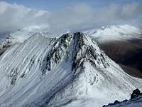
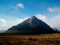
Stretching from Glen Etive in the east to the shores of Loch Leven in the west, Glencoe is one of the finest and most famous ranges in the Grampians of Scotland. The area is internationally renowned for its beautiful scenery and for the tragic massacre that took place in 1692. The mountains here offer a wide range of climbing, scrambling and hill walking opportunities all year long; and in the summer months Glencoe is always packed with tourists eager to experience its splendour. The walk up and into the Lost Valley is one of particular interest to the average visitor, and is one that even the unfitest person is willing to undertake. The highest peak in the range, and also in all of Argyll, is Bidean nam Bian which stands at 1150m. It is a massive peak that is hidden from view from almost every side by the multitude of complex ridges and peaks that encompass it. This is no more apparent than when the Bidean massif is viewed from the A82 road, where the Three Sisters of Glencoe rise steeply from the glen floor and the cone shaped peak of Stob Coire nan Lochan contrive to obscure the view of this giant beauty. On the eastern edge of Glencoe sits the famous Buachaille Etive Mor. When driving north to Glencoe, this peak dominates the view to the left of the road, and it is for this reason that it has become one of the most photographed peaks in Scotland. In fact, in surveys conducted to find the most popular peaks in Scotland, the Buachaille Etive Mor consistently features in the top five. |


|
The Glen Etive Hills run westerly from the Black Mount Range in the east, through Loch Etive, until reaching the shores of Loch Creran on the west coast of Scotland. To the north and the south the ranges of Glencoe and Cruachan bound this beautiful and picturesque area. The area is large and there are many fine peaks enclosed within. Most of the peaks are best accessed from Glen Etive, with probably the best of the bunch being Ben Starav at 1078m. The mountain is an impressive bulk that rises gracefully from the head of Loch Etive, and one that is usually ascended in conjunction with Glas Bheinn Mhor (997m). There are a couple of peaks in the range that can be climbed from outside Glen Etive. To the east, Meall nan Eun (928m) can be ascended via Loch Dochard. From Victoria Bridge on the southern side of the Black Mount Range a long but very tranquil walk in provides a pleasant alternative. To the west of the range, Beinn Sgulaird (937m) is generally climbed from Elleric, in Appin, to the north east of Loch Creran. |


From the shores of Loch Tulla in the south, the peaks of the Black Mount run in an almost continuous unbroken line all the way north to Glen Etive. It is a small, but often frequented range that contains many beautiful peaks. The range's name originates from the name of the forest, The Black Mount Forest, that once domineered the landscape. After many years of deforestation, it is now difficult to believe that this area was once rich with diverse vegetation, however, the fact that the name has now become synonymous with the mountains means this piece of history remains intact. At 1108m, the highest mountain in the range is Meall a’Bhuiridh, which is host to the Glencoe ski centre. It would possibly be the finest hill in the range if it were not for the scarring that this development has caused on its north eastern side. This then leaves, arguably, Stob Ghabhar (1090m) with the tag of the grandest peak in the range. The splendour of its corries and complex ridges has no equal and it's from this peak that the classic hiking/mountaineering route in the range, the Clachlet Traverse, begins. Starting from Victoria Bridge to the south east of Stob Ghabhar, the route takes some 17km to complete, visiting up to eight peaks on route (depending on the exact logistics of your route) before the final descent from Sron na Creise down to the Glen Etive road. The mountains here offer many different opportunities throughout the seasons with hiking, mountaineering, ice climbing, scrambling and skiing all possible here at various points during the year. |
 Ben Cruchan (Photo by Antony Walker) Ben Cruchan (Photo by Antony Walker) |  Ben Cruchan (Photo by marsco) Ben Cruchan (Photo by marsco) |  Ben Cruchan (Photo by Antony Walker) Ben Cruchan (Photo by Antony Walker) |
Lying to the north of the beautiful Loch Awe and bounded by Glen Strae, and Loch Etive to the east and west, the Cruachan Group is a small, but popular destination on the western side of the Grampian Mountains. The range's name is basically a collective term taken from its principal peak, Ben Cruachan (1126m). Ben Cruachan has throughout the years been a mountain that has drawn the attention of any passing visitors, with Dorothy Wordsworth and Thomas Newte being a couple of people to have their thoughts on the area well documented. The 1960's saw the construction of the Ben Cruachan Hydro-Electric Power Station, which eventually opened in 1967. Almost a quarter of a million cubic tonnes of rock and soil were removed from the bottom of the mountain in order to create a vast tunnel to house the necessary equipment. The station pumps the water from nearby Loch Awe some 350 metres uphill into a storage reservoir. From here, the water is then passed back downhill through the electricity turbines that are inside the central cavern. |


The Tyndrum Hills sit in a prominent location to the north, south and west of the small village of Tyndrum, hence the name of the range. Historically Tyndrum itself, has always been a place that draws people to it. It originated as a meeting place for drovers on their way to the markets in the south many years ago, and now, with the influx of tourists, walkers of the West Highland Way and peak baggers, finds itself firmly rooted as a popular venue in the Grampians. The fact that Tyndrum has a good public transport network of rail and bus makes the area all the more accessible. The area spans from Glen Falloch in the south east to Glen Orchy in the north west, and located within these glens lies a fine multitude of mountains. The pinnacle of the group, without a shadow of a doubt, is the majestic Ben Lui which reaches a height of 1130m. Described by many as 'The Queen of the Scottish Mountains' the view of Coire Gaothaich and its twin north east ridges under a blanket of snow is just simply sublime. |


|
To the north and west of the long and narrow straights of Loch Long lie the peaks of Cowal & The Arrochar Alps. The main peaks of the area are to be found in Arrochar, and this range was to become synonymous in the early development of rock climbing in the southern half of the Grampians. This was mainly due to two principle factors. The first was the ease of accessibility to the range via the West Highland Railway Line, this being before cars were readily available; and the second was the draw of its principal peak, The Cobbler, also known as Ben Arthur (884m). Certainly not the highest peak in the range, The Cobbler is definitely the most noteworthy and most visited. The distinctive outline of its three rocky peaks is a most impressive sight and is easily recognisable from various points in the lower half of the Grampians. It can sometimes be hard to find a resemblance to a cobbler on the mountain, but John Stoddart best described it in his book 'Local Scenery and Manners in Scotland, 1799-1800' by saying 'This terrific rock forms the bare summit of a huge mountain, and its nodding top so far overhangs the base as to assume the appearance of a cobbler sitting at work, from where the country people call it an an greasaiche cròm, the crooked shoemaker'. Most of the peaks in the range are accessed from Arrochar itself, or from the road after it that runs north-east up the Rest and Be Thankful (if you have walked or cycled this road, you'll appreciate the name!) and then continues onwards to Glen Kinglass and Glen Fyne. The exceptions to this are the peaks of Ben Vane and Ben Vorlich which are better approached from Inveruglas or Ardlui on the western shores of Loch Lomond. |
Central Grampians
 The Monadhliath (Proterra) The Monadhliath (Proterra) |  Geal Charn (Photo by Thelma Smart) Geal Charn (Photo by Thelma Smart) |  Carn Dearg (Photo by Graham Ellis) Carn Dearg (Photo by Graham Ellis) |
The Monadhliath Mountains is the largest sub-area within the Grampian Range, although for an area of such vastness it contains only a small helping of distinctive peaks that rise above the 800m mark. From the town of Newtonmore in the east, the range runs north and north-west over much high and boggy moorland until culminating at its northern and western boundaries of Inverness and the great Loch Ness. The latter is definitely worthy of a visit, and not just for the chance of a glimpse of its great monster, Nessie, but also for the sublime beauty that its lengthy shores yield. All of the main peaks in the range are to be found in its south-east corner and they are, in the main, made up of great rounded, bald hills with numerous glens that hold a great abundance of wildlife. Of the four Munros found here, Geal Charn (926m) is the remotest and is therefore climbed on its own. The other three, however, provide an excellent high levelled walk totalling almost 25km in distance that should take the average walker in the region of 7/8 hours to complete the circuit of A'Chailleach (930m), Carn Sgulain (920m) and Carn Dearg (945m). |


The Loch Laggan Hills are home to many fine peaks, the jewel of which is Creag Meagaidh (1130m), a large, well placed mountain which offers some spectacular views over both the Grampian Mountains and the North West Highlands. Owing to an abundance of broken rock and plant life, over the summer months it's probably only of interest to the odd hiker; however, in winter it transforms into a veritable fortress of ice and snow, which yields some of the finest winter routes anywhere in Scotland. The mountain is both large and sprawling, with an extensive summit plateau that radiates several narrow ridges, which in turn enclose a number of deep and rocky corries. The most impressive of which is the north-east facing Coire Adair, a 3km long curtain of rock and ice which reaches almost 500 metres in height, and holds routes which match even those of the eminent Ben Nevis in quality and atmosphere. To the east of Creag Meagaidh is the mighty Carn Liath (1006m), another rounded peak which is home to Coire nan Gall, a small south facing corrie which supports a handful of summer and winter routes. The crag is low lying, meaning that winter routes, most of which are in the lower grades, require a good freeze to come into condition. In summer, the undeveloped nature of the crag makes a wire brush for cleaning lichenous rock a worthy addition to any climbers rack. |
Gael Charn & Loch Pattack (Photo by Boydie)
Ben Alder (1148m) and its neighbouring hills are among Scotland's least accessible mountains, and are one of the few areas in Britain which remain remote from the influence of the internal combustion engine and all the baggage that comes with it. Anyone wishing to visit the area must do so entirely by their own means, be it on foot, bicycle or canoe. In fact, in the depths of winter, when the snow lies heavy on the ground, simply reaching these mountains is an achievement in itself. The eponymous Ben Alder is the area's principle attraction, a complex mountain with a vast summit plateau, extensive cliffs on its north face, and two large corries on its eastern flank. To its north west is Aonach Beag (not to be confused with the Aonach Beag of the Nevis Range), another complex mountain with numerous corries and crags which sweep discontinuously around its northern slopes. The northern end of the mountain is home to two subsidiary peaks worthy of note; Sgor Iurthan and Gael-charn, the latter of which is host to some of the area's most impressive rock faces. Hill walking aside, the area's primary attraction is its winter climbing, with the crags of Ben Alder and Gael-charn yielding many routes of high quality, mostly in the low and mid echelons of the grading spectrum. Due to the area's remoteness, winter visits will require at least one overnight stop, which usually involves wild camping, or a stay in one of the area's several mountain bothies. |
 Stob a' Choire Mheadhoin (Photo by Munroitis) Stob a' Choire Mheadhoin (Photo by Munroitis) |  Meall Cian Dearg (Photo by Alan Sharp) Meall Cian Dearg (Photo by Alan Sharp) |  Stob Choire Easian (photo by Alan Sharp) Stob Choire Easian (photo by Alan Sharp) |
The sublimely placed Loch Treig is surrounded by a number of mountains of diverse character. Although the area is seldom visited by the average hill goer, it is often seen, as the West Highland Railway Line cuts uninterrupted through its centre, skirting its way along the eastern shore of the aforementioned loch while on its way to more settled areas. Despite the presence of the railway, roads and footways are few, and like their eastern neighbours, they are extremely remote and require a concerted effort to reach. The area's most famous peaks are probably the Easians, a five kilometre ridge of mica schist, which runs from north to south along the western shore of the area's eponymous loch. The ridge is home to two fine Munro's; Stob Choire Easian (1115m) and Stob a' Choire Mheadhoin (1105m). They are of greatest interest to the hiker, but are also home to several winter routes with something of an esoteric character. On the Loch's eastern side are Chno Dearg (1046m), Meall Garbh (976m) and Stob Coire Sgriodain (979m), of which Meall Garbh is of most interest. The crags of Creagan Coire Nam Cnamh sit on its eastern side, where in early winter thick ice accumulates readily, creating a wealth of winter routes, most of which are in the lower grades. Anyone willing to expend the energy to reach them will not be disappointed. |


Beginning on the northern shores of Loch Rannoch in the south, the West Drumochter Hills are a spacious landscape with a scattering of peaks, however, as the range starts to stretch northwards towards Dalwhinnie, it narrows, as Loch Ericht in the west and the Pass of Drumochter to the east combine in squeezing its boundaries and compact the peaks in the northern half into a tighter space. The range sits on the border between the Central and Eastern Grampians and the difference between these two areas is clearly apparent from their summits. To the east the rolling summit plateau of the hills fill the horizon with only the occasional glen breaking the line and to the west the peaks present a more rugged and craggy outline. The largest peak in the area is Beinn Udlamain which reaches a height of 1010m. It is a huge rounded peak with a large flat featureless summit, but offers some spectacular views west of the peaks in the Ben Alder Hills range that rise abruptly from the glistening Loch Ericht. |
 Loch Tulla (Photo by daveyboy) |  Rannoch Moor (Photo by JoeHarris) |  Rannoch Moor (Photo by BENDONALD1959) |
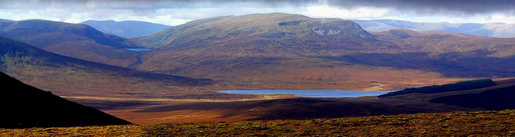
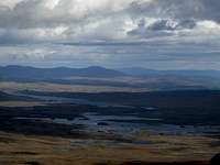
Rannoch Moor is 130km² of flat boggy moorland, which sits at an altitude of just over 300 metres above sea level (that’s around 1,000 feet for those of you still hanging on to the Imperial System) - not somewhere you might immediately consider needed to be described on Summitpost then. In fact, the closest most hikers, climbers and mountaineers will ever get to the area will be while being whisked along the West Highland Line to destinations of a more precipitous nature. That said, the Moor is a significant component of the Grampian landscape, and so, deserves some sort of acknowledgement, after all it may be of interest to someone. So if for some reason you are thinking of visiting the area described by Robert Louis Stevenson as "A wearier looking desert a man never saw", then there are certain things you might want to know about it. Firstly, despite Stevenson’s somewhat negative sentiments, the moor is a place of considerable beauty, dotted with innumerable lochs and lochans, and commanding a vast and seamless panorama of the surrounding mountains. It seems that mountain views can be greatly enhanced when there aren’t other mountains getting in the way. The second thing you might want to know is that the area is notable for its wildlife, and is particularly famous for the sole British location of the Rannoch-rush, which in case you hadn’t already guessed, is named after the moor. It’s also home to several unusual species of ant such as Formica exsecta, the "narrow-headed ant", and Formica pratensis. The moor is one of the last true wildernesses of the British Isles, and is consequently quite difficult to access. The moor can be traversed from north to south along the A82, which passes along its western margin; and can be accessed on its eastern side from the Rannoch Station, a request stop on the aforementioned West Highland Line. Travelling from east to west, or visa versa, can only be done on foot, and a 16km (10 mile) track links Rannoch Station with the Kings House Hotel on the A82. Remember if you do walk this trail, you will also need to walk back again, as the shortest route between the two points by public road is over 160 km (100 miles) long, which I think you’ll agree is a potentially astronomical taxi fare. |

Carn Gorm & An Sgorr (Photo by Boydie)
Glen Lyon is one of the grandest and longest glens in the Central Grampians and thankfully bypassed by most of the tourists due to the minor roads that run through it. It spans around 45km from west to east and throughout its length is dotted with highland scenery such as, glistening lochs and lochans, high mountains and beautiful woodland. The range also ventures slightly north, on its eastern side, towards Loch Rannoch to encompass the solitary peak of Schiehallion, which stands at a height of 1083m. This peak is one that can be clearly seen and easily recognised from the summits of other mountains in other distant ranges, such as Glencoe in the Western Grampians and East Drumochter in the Eastern Grampians. This is due to its isolated position, which is surrounded by deep glens, and its obvious shape that is made up of a single humped back east to west ridge. On the western end of the range lie four peaks that are commonly traversed in a route known as the Glen Lyon Horseshoe. The four peaks that make up this route are; Carn Gorm (1029m), Meall Garbh (968m), Carn Mairg (1041m) and Meall nan Aighean (981m). The peaks are mainly large flat summits that provide a good hill walking trip and in winter conditions give the ski-tourer one of the finest expeditions in the Central Grampians. |

Beinn Achaladair & Beinn an Dothaidh (Photo by Boydie)
The mountains of Bridge of Orchy form a fine range that runs from north of Tyndrum to the south of the desolate Rannoch Moor. To the east and west of the range, the watery expanses of Loch Lyon and Loch Tulla help to compel a feeling of compactness, and it's this aspect that gives the peaks their apparent height and grandeur. One of the most scenic parts of the range has to be the point where the West Highland Railway Bridge straddles the Auch Gleann beneath the conical shape of Beinn Dorain. This view must have caught the gaze of many a walker on the West Highland Way and to many a traveller driving north up the A82. This point is definitely where you start to enter the real highlands of Scotland. Beinn Dorain (1076m) is not the highest in the range, but draws more visitor up its slopes due to its focal point situation next to the road. Bridge of Orchy has always been a popular destination for the hill walker/climber due to the proximity of the train station. It is easily possible to catch the morning train from Glasgow to do a peak or two and be down in time to get the train home for dinner. Maybe even enough time to squeeze in a pint in the hotel across from the station! |


To the north of Crianlarich and Glen Dochart and the south of Loch Lyon lies the tranquil Glen Lochay. Glen Lochay is almost surrounded on all sides by its solitary and peaceful mountains which form a C shaped curve. If it were not for the breach on its eastern side, these peaks would be among the remotest in the Central Grampians. This breach gives the only access in and out of the area, and it is a route that is predominately domineered by forestation. This, however, ceases on reaching the head of Glen Lochay at Kenknock Farm where the landscape becomes desolate and almost treeless. This fact though, does not stop the glen from radiating a certain air of beauty. The mountains in the range are not the most striking in the Central Grampians, but still offer some fine hill walking opportunities. The main peak worthy of mention is Ben Challum (Callum's peak) at 1025m. It isn't the highest peak in the range, but when seen from the head of Glen Lochay, in the east, its pointed outline is somewhat impressive. Unfortunately, this viewpoint is seldom seen, as most people tend to ascend Ben Challum from Strath Fillan in the south west where its appearance is less pleasing. |
To the northeast of the peaceful little town of Killin, lies the ever popular Lawers Range. The Rrange is so called after its principal peak Ben Lawers. It is bounded to the south and east by Loch Tay, to the north by Glen Lyon and to the west by Glen Lochay. The southern section of the Lawers massif and the Tarmachan peaks of the same range are owned by the National Trust for Scotland, who manage numerous areas around the whole of Scotland. Within the Lawers range, the Trust promotes public access, the protection of wildlife and the restoration/protection of the local habitat. Evidence of the work being carried out can be found at the Ben Lawers visitor centre, on the south western slopes of Beinn Ghlas, and it is from this very point that the majority of the ascents in the area begin. This is due to the ample parking and the 430m elevation that is already gained. Generally, the peaks in the Grampians start from sea level and most people will appreciate, and certainly not deny themselves, the opportunity of starting from a slightly elevated position. There are fine peaks to be had within the range and some nice expeditions to be undertaken throughout the entire year across them. The traverse of Ben Lawers and its four accompanying peaks is a fine hill walking trip for the summer months, and should take the average walker no more than ten hours to complete (it would be advisable to arrange transportation to return you to your starting point). Arguably though, the most impressive traverse of the range, especially in winter conditions, is the one across the Tarmachan Ridge. It covers four peaks and contains some airy exposed sections that require a good head for heights. The full traverse should take no longer than 6 hours and has the added benefit of returning you to the visitor centre starting point. |
Cute Couple??? - Ben More and Stob Binnien (Photo by Boydie)
The Crianlarich/Balquhidder Hills are a truly splendid range that offers a fine multitude and array of peaks to explore. The range spans almost 30 kilometres from the east to the west and over 10 kilometres from north to south. From Loch Voiland and Glen Ogle in the south and east, the range sweeps gracefully towards its western and northern boundaries of Glen Falloch and Glen Dochart, where gently sandwiched in between lies the main hub town of Crianlarich. Crianlarich has become such, due to its train station providing ease of access and the factor that the majority of the ranges peaks are best accessed from its outskirts. The range's focal points are most definitely the twin peaks of Ben More (1174m) and Stob Binnein (1165m), which are the highest mountains in the range and ones that are easily recognisable from near and far. With Ben More being the bulkier of the two, and Stob Binnein having a more elegant appearance (even it's chiselled off blunt top nose can't detract this look), they appear as a unified couple, an almost perfect match that has stood the test of time. One of the other popular peaks in the range, especially under winter conditions, is Cruach Ardrain (1046m). Well seen from Crianlarich, the peak emanates three ridges from its summit. The north west ridge reaches out to a point known as Grey Height, The North East Ridge culminates at the rocky peak of Stob Garbh and the South-south East Ridge drops and then rises to gradually reach the summit of the Munro Beinn Tualaichean (946m). |


Stretching from the peaks on the western side of Loch Lubnaig, in a north eastern direction all the way through Loch Earn and onwards to the southern shores of Loch Tay, this area is one that attracts a lot of visitors due to it's location in the Central Grampians. The ever popular town of Callander lies just 16 miles from the city of Stirling, giving easy access for thousands of people from all over the central belt and is therefore the best place to base yourself for climbing in the area. As the area is quite vast, Loch Earn is the name that is applied, in this case, to the area as it is the largest central point available. Compared to other ranges in the Grampians there is a low amount of peaks for an area of such size, however, this does not make it an area of little quality. The two highest and noteworthy mountains in the area are Ben Vorlich at 985m and Stuc a'Chroin at 975m. Both peaks sit adjacent to each other on the southern shores of Loch Earn, and are almost always climbed in conjunction. Together they can be seen prominently showing their heads from various locations in the central belt of Scotland and they have a particular attractiveness when viewed from the east when the sun is setting. |


Ben Lomond, Luss & the Trossachs are predominantly made up of forests and lochs with the lengthy and infamous Loch Lomond being the most visited spot. Due to its close proximity to Glasgow, Loch Lomond can become a very busy place, especially when the sun comes out at weekends, and bank holidays when half of the city decides that a daytrip is a good idea. Tranquillity, however, is merely a stones throw away if you drive north on the eastern side to Inversnaid. Here the lochs of Lomond, Arklet and Katrine collide to give a peaceful and scenic place where the visitor will not be left disappointed. The peaks here are few and far between, but in Ben Lomond itself a fine one is found. Standing at 974m it is the most southerly Munro in Scotland and with the exception of Ben Nevis, probably the most ascended. The peak is generally approached from the south at Rowerdennan, but can also be ascended from the earlier mentioned Inversnaid. A couple of other hills worthy of visiting are Ben Venue (729m) and Ben A'an (454m) on the southern and eastern shores of Loch Katrine in the Trossachs. Both the peaks are small, easily ascended and give surprisingly impressive views. Each of the peaks are usually climbed from Loch Achray to the north of Aberfoyle and can be combined easily into one day. |
Eastern Grampians

The Cairngorms from Carn Aosda (Photo by Boydie)
|
About 35 kilometres from east to west, and 20 kilometres from north to south, the Cairngorm Plateau is the biggest, highest, coldest and snowiest piece of land in all of the British Isles. The average elevation of the plateau is a little over 1000 metres, with rounded, glacial hills dotted across its surface. Other distinctive features of this range are the corries, which dot the plateau, as well as the high passes, Lairigs both carved out by glaciers in the many ice ages this land has seen. Of the 20 highest peaks in the UK, half are in the Cairngorms. Furthermore, the Cairngorms are also home to the highest source of any major river in the UK, the River Dee, which rises on Braeriach at around 1200 metres; as well as the highest loch in Scotland, Loch Avon, which sits at 726 metres. The lower reaches of the north west Cairngorms are home to Rothiemurchus, one of the last ecologically viable expanses of the old Caledonian forest. This is also one of the very few places in Scotland where one may observe a natural tree line. For Scot's standards, the passes through the Cairngorms are also exceptionally high. Whereas in most larger ranges in Scotland there's always a col under 500 metres somewhere, the lowest pass through the Cairngorms is Lairig an Laoigh whose high point is 740 metres. Lairig Ghru, the best known pass in the Cairngorms, and the main route from Deeside to Strathspey before the Lecht road was built, has a high point of 835 metres, probably the highest commonly used pass in Scotland. |


|
The Cairnwell Hills are bounded by the River Dee in the north, Tilt in the west, and the A93 Perth to Braemar road in the east. Although this large, sprawling area of upland boasts a total of eight Munros, which you would imagine would make it an attractive destination for hikers, it has suffered greatly over the years. Sadly, part of the area is now heavily commercialised, largely due to the growth of the ski industry, and in particular the growth of the Glen Shee and Cairnwell Ski Centre. The Cairnwell itself, and its neighbour Carn Aosda, are the most heavily scarred of these Munros, which consequently makes them the most accessible too, as both these summits are covered in ski lifts and access tracks. The Cairnwell has the added extra of three radio towers on its summit. This accessibility is again boosted by the A93 road, which reaches its apex near the two mountains, a point known as the Devils Elbow, and leaving an ascent of about 300 metres to The Cairnwell's summit. In contrast, the area's other hills, located far from both the ski centre and road, are wonderfully isolated, and easily match those of Lochnagar and Glenshee for unadulterated beauty. These large, open, rolling, heather clad hills are rarely visited, and offer something far wilder than their eastern counterparts. An extra peak worth mentioning is Morrone, which at 859m qualifies as a Corbett, and rewards great views over the town of Braemar and east up through the Dee Valley. |


|
This large, rarely frequented, expanse of land is one of those special places that posess a genuine feel of wilderness about it. The only real major road in the area is the one that runs along its south westerly border, the A9, with the only towns of note being situated on its northern and southern extremeties. As mentioned, the expanse of land is vast and contains many large mountains that in the most, are rounded and green. In between these peaks are wide airy glens, where thick heather and much forestation dwell, providing an ample setting for an abundance of red deer, grouse and many other types of wildlife. No surprises then to find this range is a popular destination for deer stalking and grouse shooting. The most popular peak in the range is probably Ben Vrackie (841m) on the outskirts of the town of Pitlochry and not far from the city of Perth. The old Gaelic gives the name as Beinn Bhreacaidh, Speckled Mountain, which is derived from the appearance given off by the hill's composition of white quartzite, black schists and grey mica-schists. The principle hill of the range is most definitely Beinn a'Ghlo, Hill of the Veil or Mist. Beinn a'Ghlo is a complex hill made up of many tops and corries, in fact, an old stalkers legend states that there were nineteen corries, and that if a rifle were fired in one, then it would go unheard in the others. Of the many tops, three of these hold Munro status. These are; Braigh Coire Chruinnbhalgain (1070m), Upland of the Corrie of Round Blisters, Carn Liath (975m), Grey Hill and the highest of the three Carn nan Gabhar (1121m), Hill of the Goats. |


|
Lochnagar and the Glenshee Hills, as they are known, cover a vast area of the eastern Grampian Mountains. The area is split by the A93 pass, linking Perth to Braemar in the west, and the valley of the River Dee (known as Deeside) in the north. The area is characterised by a vast upland plateau known as The White Mounth. The Mounth consists of a series of large, green, rounded and rugged summits, intersected by deep, glacially cut valleys which are furnished with a number of impressive corries. The mass of Lochnagar is the highlight of all the summits, and stands proud when viewed from all angles. Lochnagar also has a stunning corrie cut out of its north face. Out of all the glacially cut valleys in the area, Glen Callater, Glen Muick and Glen Clova are the best known. Glen Muick is probably the most dramatic of these, with its mountain bound loch, the aptly named Loch Muick, setting the scene. The head of the glen is dominated by the cliffs of Creag an Dubh Loch which are known for their demanding, but high quality, winter routes. A great ridge walk starting within Glen Muick combines five of the great summits in the Lochnagar range in one day. These are the summits of Broad Cairn, Cairn Bannoch, Carn a' Coire Boidheach, Carn an t-Sagairt Mor and Lochnagar itself. Be aware though, this route is about 18-20 miles long and is no easy undertaking. On the Glenshee side, another ridge walk combines the summits of Creag Leacach, Glas Maol, Cairn of Claise, Tolmount, Tom Buidhe and Carn an Tuirc. The route is achievable in a single day, but again be aware, this is another serious undertaking. If you wish to take it easy, these various summits are all accessible via the A93 pass. Tolmount and Tom Buidhe can also be accessed from Glen Callater, but this requires a 4 mile approach up from the town of Braemar. Out of all these summits Mount Keen is the most isolated, and has the honour of being the most eastern of all Munros. The easiest method of access is from the Dee Valley near the towns of Aboyne and Ballater. |


|
The Angus Glens, or the 'Braes of Angus' as they are generally known, run roughly from the small town of Forfar, near the east coast, westwards to the boundaries of the Cairnwells & Blairgowrie and northwards to the boundaries of the Lochnagar Range. The area, as the name suggests, is known for its great wealth of scenic glens; Glen Doll, Glen Ogil, Glen Prosen, Glen Esk and Glen Clova are some of the many within the range. In years gone by, some of these glens local inhabitants used to scale the Lair of Aldararie, a hill with a flat grassy area close to the summit, to compete in the areas yearly Highland Games. A walk covering many miles, coupled with an ascent of over 800m, and then the games begin. Shot Putting, Toss the Caber (I wonder who carried the Caber up there?) or any other game after that..!; they made them of stern stuff then..! There isn't a great wealth of notable peaks in the area, but some of these would be the Corbett peaks of Mount Battack and Ben Tirran or the Munro peaks of Mount Keen, Dreish and Mayar. |
Summits of the Grampian Mountains
Obviously, for us here on SummitPost, the mountains themselves are the most important aspect of the Grampian Mountains. The area is home to many famous and iconic British peaks including such attractions as Ben Nevis, Ben Macdui and Lochnagar, which have been the playground of many great climbers including Harold Raeburn, William Naismith, Robin Smith, Don Whillans and Joe Brown to name but a few. The UK seems to have as many definitions to what constitutes a mountain, as it does mountains themselves, and if this page were to list all the possible candidates it would become an unruly mass of names and numbers. Therefore only the two most popular lists, which are applicable solely to Scotland, have been included here - the Munros and the Corbetts, which incidentally compliment each other quite nicely since one carries on where the other leaves off. Furthermore, since there are so many Munros and Corbetts in the Grampian Mountains, so many in fact that listing them all here would cause the page to load at a snail like pace, the lists have been abridged to a Top 25 for each mountain type. For those wishing to see full lists, fear not; they are all illustrated on the maps below, and in addition, have been listed in a manageable form on their own specific list pages, which if you look below, accompany this one. |
| How to use this section The Maps: The maps are interactive and you can get name and height information for the mountains by hovering your mouse cursor over the red triangles. When a little 'hand symbol' appears over a triangle it means that there is a page on Summitpost for that mountain, just click on the triangle to be shown the relevant mountain/rock page. Tip: Look out for these The Tables: This is pretty simple, all you have to do is look at it. The key below explains what the different criteria mean. Key
|

Munros of the Grampian Mountains
| Top 25 Munros: |
| Rank | Photo | Name | M | Ft | Sec. | Area | Sheet 1:25k | Sheet 1:50k | Grid Ref | Map 1:25k | Map 1:50k |
|---|---|---|---|---|---|---|---|---|---|---|---|
| 1. |  | Ben Nevis | 1344 | 4409 | 4A | Fort William Loch Treig Loch Leven | 392 | 41 | NN166712 |  |  |
| 2. |  | Ben Macdui | 1309 | 4295 | 8A | Cairngorms | 403 | 36/43 | NN988989 | | |
| 3. |  | Braeriach | 1296 | 4252 | 8A | Cairngorms | 403 | 36/43 | NN953999 | | |
| 4. |  | Cairn Toul | 1291 | 4236 | 8A | Cairngorms | 403 | 36/43 | NN963972 | | |
| 5. |  | Sgor an Lochain Uaine | 1258 | 4127 | 8A | Cairngorms | 403 | 36/43 | NN954976 | | |
| 6. |  | Cairn Gorm | 1244 | 4081 | 8A | Cairngorms | 403 | 36 | NJ005040 | | |
| 7. |  | Aonach Beag | 1234 | 4049 | 4A | Fort William Loch Treig Loch Leven | 392 | 41 | NN197715 | | |
| 8. |  | Aonach Mor | 1221 | 4006 | 4A | Fort William Loch Treig Loch Leven | 392 | 41 | NN193729 | | |
| 9. |  | Carn Mor Dearg | 1220 | 4003 | 4A | Fort William Loch Treig Loch Leven | 392 | 41 | NN177721 | | |
| 10. |  | Ben Lawers | 1214 | 3983 | 2B | Glen Lyon to Loch Tay | 378 | 51 | NN635414 | | |
| 11. |  | Beinn a'Bhuird North Top | 1197 | 3927 | 8B | Cairngorms | 404 | 36 | NJ092006 | | |
| 12. |  | Beinn Mheadhoin | 1182 | 3878 | 8A | Cairngorms | 403 | 36 | NJ024017 | | |
| 13. | | Stob Choire Claurigh | 1177 | 3862 | 4A | Fort William Loch Treig Loch Leven | 392 | 41 | NN262738 | | |
| 14. |  | Ben More | 1174 | 3852 | 1C | Loch Lomond to Strathyre | 365 | 51 | NN432244 | | |
| 15. | | Ben Avon - Leabaidh an Daimh Bhuidhe | 1171 | 3842 | 8B | Cairngorms | 404 | 36 | NJ131018 | | |
| 16. |  | Stob Binnein | 1165 | 3822 | 1C | Loch Lomond to Strathyre | 365 | 51 | NN434227 | | |
| 17. | | Beinn Bhrotain | 1157 | 3796 | 8A | Cairngorms | 403/404 | 43 | NN954922 | | |
| =18. |  | Derry Cairngorm | 1155 | 3789 | 8A | Cairngorms | 403 | 36/43 | NO017980 | | |
| =18. |  | Lochnagar - Cac Carn Beag | 1155 | 3789 | 7A | Braemar to Montrose | 388 | 44 | NO243861 | | |
| 20. |  | Bidean nam Bian | 1150 | 3773 | 3B | Loch Linnhe to Loch Etive | 384 | 41 | NN143542 | | |
| 21. | | Ben Alder | 1148 | 3766 | 4B | Loch Treig to Loch Ericht | 385/393 | 42 | NN496718 | | |
| 22. |  | Geal-Charn | 1132 | 3714 | 4B | Loch Treig to Loch Ericht | 393 | 42 | NN469746 | | |
| =23. | | Binnein Mor | 1130 | 3707 | 4A | Fort William Loch Treig Loch Leven | 392 | 41 | NN212663 | | |
| =23. |  | Ben Lui | 1130 | 3707 | 1D | Inveraray to Crianlarich | 364/377 | 50 | NN266263 | | |
| 25. |  | Creag Meagaidh | 1128 | 3701 | 9C | Loch Lochy to Loch Laggan | 401 | 34/42 | NN418875 | | |
 | Since a top 25 list isn't exactly the best way to fairly represent the scope of what the Grampian Mountains have to offer, a sub-page has been created providing a full list of Munros in the Grampian Mountains. The page has sensibly been called Munros of the Grampian Mountains |
 Corbetts of the Grampian Mountains
| Top 25 Corbetts: |
| Rank | Photo | Name | M | Ft | Sec. | Area | Sheet 1:25k | Sheet 1:50k | Grid Ref | Map 1:25k | Map 1:50k |
|---|---|---|---|---|---|---|---|---|---|---|---|
| =1. | | Leathad an Taobhain | 912 | 2992 | 6A | Glen Tromie to Glen Tilt | 394 | 43 | NN821858 | | |
| =1. | | Beinn Bhreac | 912 | 2992 | 6A | Glen Tromie to Glen Tilt | 394 | 43 | NN868820 | | |
| 3. | | The Fara | 911 | 2989 | 4B | Loch Treig to Loch Ericht | 393 | 42 | NN598843 | | |
| 4. | | Meall Buidhe | 910 | 2986 | 2A | Loch Rannoch to Glen Lyon | 378 | 51 | NN426449 | | |
| =5. | | Leum Uilleim | 909 | 2982 | 4A | Fort William Loch Treig Loch Leven | 385 | 41 | NN330641 | | |
| =5. | | Beinn nan Oighreag | 909 | 2982 | 2B | Glen Lyon to Loch Tay | 378 | 51 | NN541412 | | |
| 7. | | Beinn Maol Chaluim | 907 | 2976 | 3B | Loch Linnhe to Loch Etive | 384 | 41 | NN135526 | | |
| 8. | | Ben Vuirich | 903 | 2963 | 6B | Pitlochry to Braemar | 394 | 43 | NN997699 | | |
| =9. |  | Beinn Odhar | 901 | 2956 | 2B | Glen Lyon to Loch Tay | 377 | 50 | NN337338 | | |
| =9. | | Beinn Mheadhonach | 901 | 2956 | 6A | Glen Tromie to Glen Tilt | 394 | 43 | NN880758 | | |
| 11. | | Culardoch | 900 | 2953 | 8B | Cairngorms | 404 | 36/43 | NO193988 | | |
| 12. | | Beinn a'Bhuiridh | 897 | 2943 | 3C | Glen Etive to Glen Lochy | 360/377 | 50 | NN094283 | | |
| =13. | | Ben Tirran | 896 | 2940 | 7B | Braemar to Montrose | 388 | 44 | NO373746 | | |
| =13. | | Gairbeinn | 896 | 2940 | 9B | Monadh Liath | 401 | 34 | NN460985 | | |
| 15. | | Creag Mhor | 895 | 2936 | 8B | Cairngorms | 403/404 | 36 | NJ057047 | | |
| 16. | | Beinn a'Chuallaich | 892 | 2927 | 5A | Loch Ericht | 386 | 42 | NN684617 | | |
| 17. | | Creagan na Beinne | 888 | 2913 | 1A | Loch Tay to Perth | 378 | 51/52 | NN744368 | | |
| 18. | | Beinn a'Chaisteil | 886 | 2907 | 2B | Glen Lyon to Loch Tay | 377 | 50 | NN347364 | | |
| =19. |  | The Cobbler [Ben Arthur] | 884 | 2900 | 1D | Inveraray to Crianlarich | 364 | 56 | NN259058 | | |
| =19. | | Cam Chreag | 884 | 2900 | 2B | Glen Lyon to Loch Tay | 377/378 | 50 | NN375346 | | |
| 21. |  | Stob Dubh | 883 | 2897 | 3C | Glen Etive to Glen Lochy | 384 | 50 | NN166488 | | |
| 22. | 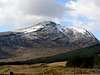 | Beinn Chuirn | 880 | 2887 | 1D | Inveraray to Crianlarich | 364/377 | 50 | NN280292 | | |
| =23. | | Creag Uchdag | 879 | 2884 | 1A | Loch Tay to Perth | 378 | 51/52 | NN708323 | | |
| =23. | | Fraochaidh | 879 | 2884 | 3B | Loch Linnhe to Loch Etive | 384 | 41 | NN029517 | | |
| =23. | | Ben Ledi | 879 | 2884 | 1C | Loch Lomond to Strathyre | 365 | 57 | NN562097 | | |
 | Since a top 25 list isn't exactly the best way to fairly represent the scope of what the Grampian Mountains have to offer, a sub-page has been created providing a full list of Corbetts in the Grampian Mountains. The page has sensibly been called Corbetts of the Grampian Mountains |
Geology
 Simplified Geological Map of Scotland The Grampian Mountains and their neighbours are the last remnants of what was once one of the world's greatest mountain ranges, and that’s not to say that they’re not great now, just one hell of a lot smaller. The geology of the area is characterised by the Dalradian Supergoup which was produced by intensive metamorphism and deformation arising from 'mountain building', caused by continental collision. Formed during the Precambrian and Cambrian periods between 700 and 600 million (and very possibly as recent as 500 million) years ago (ma), the Dalradian sediments and associated volcanics were originally laid down, or in the case of the volcanics erupted onto, the southern margin of a palaeo-continent known as Laurasia, which is represented today largely by the Precambrian basement rocks of North America, Greenland, the north of Ireland and, of course, the Scottish Highlands. Laurasia sat on the northern margins of a vast sea known as the Iapetus Ocean, which was created in Late Proterozoic time (1.6 Ga to 0.6 Ga) by the rifting and pulling apart of a large supercontinent known as Rodinia. The opening started sometime around 650 Ma ago and by the beginning of Ordovician (490 to 443 ma), at 510 Ma, the ocean was at its widest, with a possible width of up to 5000 km. On the opposite side lay the supercontinent of Gondwana, consisting of the basements of South America, Africa, India, Australia, East Antarctica and Western Europe (including southern Ireland, England and Wales). A separate continent, Baltica (comprising of what is today Scandinavia and parts of Russia), lay to the north east of Gondwana, separated by an arm of the Iapetus Ocean known as the Tornquist Sea. During the early Ordovician a micro-continent known as Avalonia (comprising of what today is largely England and Wales), broke away from Gondwana and drifted towards Laurentia. By the late Ordovician, the continental plates of Laurentia, Gondwana and Baltica had started to converge initiating a series of new tectonic and magmatic processes that marked the start of the Caledonian Orogeny. The Dalradian Supergroup underwent deformation and metamorphism as the continental landmasses collided, closing the Iapetus. Geological evidence suggests that Scotland lay on the margin of Laurentia, initially opposite Baltica, while England and Wales lay on the margin of Gondwana/Avalonia, opposite the Newfoundland sector of Laurentia. The terranes were then juxtaposed into their present relative positions by large sinistral (left-lateral) movements on the bounding faults during the later stages of the orogeny. The mid-Ordovician saw the climax of the Caledonian Orogeny in the Scottish Highlands. This ‘Grampian’ Event is particularly well defined in the NE of the Grampian Terrane, where the main deformation episodes and the peak of regional metamorphism are dated by major tholeiitic basic intrusions that were emplaced at around the late Llanvrin time(c. 470 Ma), towards the end of the event. In the central Grampian Highlands and the Northern Highlands Terrane, the comparable event may have been a little later (c. 455 Ma). This continental collision deformed and folded the various sedimentary rocks, which were also metamorphosed, with the recrystalisation of sandstones to quartzites and mudstones to slates. There was also the intrusion of granite magma, derived from the actual partial melting of rocks lower within the crust, where the heat and deformation caused by the continental collision was most intense. |

During the early and mid-Silurian (443 to 417 ma) the Iapetus Ocean finally closed along most of its length, with a triangular remnant of oceanic crust around the Laurentia–Baltica–Eastern Avalonia triple junction. This finally disappeared completely by the early Devonian, with the continents welded together along the lines of the Iapetus and Tornquist sutures. The newly formed supercontinent was known as Laurussia. Both the Northern Highlands and the Grampian terranes underwent tectonic uplift during this period, with significant magmatic events occurring on the extreme ‘north-western’ edge of the Northern Highlands. Calc-alkaline magmatism, with subduction-zone characteristics became widespread and voluminous throughout the former Laurentian terranes throughout the Early Devonian period (417 to 354 ma) and large, essentially granitic, plutons (an intrusive igneous rock body that crystallized from a magma below the surface of the Earth) were emplaced at all crustal levels in the Scottish Highland and Eastern Shetland terranes from early Ludlow to early Lochkovian time. Granitic plutons with lower crustal and mantle characteristics were emplaced at high crustal levels in the Midland Valley Terrane and in the NW part of the Southern Uplands Terrane. High-level granitic plutons and dyke-swarms were emplaced slightly later (Lochkovian to Pragian) in a broad zone that spans the projected position of the Iapetus Suture in the SE part of the Southern Uplands Terrane and in the Lakesman Terrane. Of these, the youngest are those immediately NW of the suture, in the zone in which the Southern Uplands thrust belt was underthrust by Avalonian crust. The late granitic plutons were emplaced during and immediately following the rapid crustal uplift which produced the Caledonian mountain chain. High-level crustal extension led to local fault-bound intermontane basins in the Grampian Highland and Southern Uplands terranes and the larger basins of the Midland Valley Terrane. Rapid erosion of the newly formed mountains resulted in the deposition of great thicknesses of continental molasse sediments in these basins during the latest Silurian and Early Devonian (the ‘Old Red Sandstone’).  The Caledonian Orogeny Since the creation of the range, it has been continually eroded by the forces of nature, with the most significant recent events manifesting themselves in the form of the Quaternary era (1.8 Ma – present day) ice ages. During the Late Devensian Glaciation (c. 126 Ka – 15 Ka) the mountains were completely covered by an ice sheet which exceeded 2,000m in height, and was centred over Rannoch Moor and radiated glaciers in all directions. The ice sheet helped carve the glens and lochs that surround the mountains today, affecting almost every aspect of the visual landscape. The sheer volume of water held as ice during this period meant that global sea levels were some 130 m lower than todays and the Scottish glaciers would have outflowed rapidly out over a vast tundra plain stretching far into what is now the Atlantic Ocean. A brief warm period known as the Windermere Interstadial (c. 15 ka – 13.5ka) saw the disappearance of the glaciers and the return of vegetation to the British Isles. Owing to the lingering effects of glacio-isostatic depression many of the glens would have been inundated by the sea, creating a landscape that may be comparable to the fjords of Norway we see today. Evidence for the type of vegetation that existed in northern and central Scotland during this period is slim, as it was not long before the area saw a return to cold conditions with the onset of the Loch Lomond Stadial, known internationally as the Younger Dryas (c. 12.8 to 11.5 ka). An ice sheet re-formed over much of central Scotland, although this time it would not be large enough to cover the summits of the mountains entirety. Valley glaciers occupied the major glens, and were funnelled around the major landmasses out to sea. Cirque glaciers occupied the higher corries, with glaciers forming in locations such as Coire Leis on Ben Nevis, Coire Ardair on Creag Meaghaidh and the Northern Corries of the Caringorms. The mountains bare the scars of these ice ages in their striated and polished rocks, morainal ridges, perched boulders, ‘U’ shaped valleys and weathered cliff faces which are so familiar to hikers and climbers today. |
Climate

A further factor which greatly affects the rainfall distribution is altitude. Moist air which is forced to ascend hills may be cooled below the dew point to produce cloud and rain. A map of average annual rainfall therefore looks very similar to a topographic map. Rainfall is generally well-distributed throughout the year but there is a marked seasonal variation. The frequency of Atlantic depressions is normally greatest during the winter but, unlike other areas of the UK, Scotland tends to remain under their influence for much of the summer too. Autumn and early winter are the wettest seasons, especially from October to January, and spring and early summer is normally the driest part of the year, especially from April to June. In the highlands the average annual rainfall is over 4000 mm. The occurrence of snow is linked closely with temperature, with falls rarely occurring if the temperature is higher than 4 °C. For snow to lie for any length of time then the temperature normally has to be lower than this. Over most of the area, snowfall is normally confined to the months from November to April, but upland areas often have brief falls in October and May. Snow rarely lies at lower levels outside the period December to March. On average, the number of days with snow falling along the coast varies from less than 10 per winter in the south to 40 in the north, but over 100 days is typical over the highest ground. The number of days with snow lying has a similar distribution, with less than 5 on the coast but over 35 days over the higher ground. On the highest summits, such as Ben Nevis, snow cover typically persists for 6 or 7 months each year. The relatively plentiful supply of snow over the highest ground has led to the development of skiing areas such as Glencoe and the Nevis Range, both near Fort William. Being close to the Atlantic, the western Grampians are one of the more exposed areas of the UK. The strongest winds are associated with the passage of deep depressions close to or across the UK. The frequency and strength of depressions is greatest in the winter half of the year and this is when mean speeds and gusts are strongest. |


July is the warmest month, with mean daily maximum temperatures at low levels inland approaching 20 °C, the highest in Scotland. Elsewhere in Eastern Scotland the mean maxima are somewhat lower, and are less than 16 °C over the higher ground and along the coast. Extreme maximum temperatures can occur in July or August, and are usually associated with heat-waves. In line with the western Grampians, December tends to be the dullest month while May or June are usually the sunniest. Like the western Grampians, rainfall tends to be associated with Atlantic depressions or with convection. Much of Eastern Scotland is sheltered from the rain-bearing westerly winds. This shelter reaches its greatest potential along the coasts of East Lothian, Fife and the Moray Firth and these areas receive less than 700 mm of rainfall in an average year. In contrast, the wettest area is the southern Grampians where the average annual rainfall is over 1500 mm. On average, the number of days with snow falling is about 20 per winter along the coast but over 100 days over the mountains. The number of days with snow lying has a similar distribution, with less than 10 along the East Lothian coast but over 60 days over the higher ground. The relatively plentiful supply of snow over the highest ground has led to the development of skiing areas such as Cairngorm, the Lecht and Glenshee. The Eastern Grampians are one of the more windy parts of the UK, being relatively close to the track of Atlantic depressions. The strongest winds are associated with the passage of deep areas of low pressure close to or across the UK. Just as it is in the Western Grampians, the frequency and strength of these depressions is greatest in the winter half of the year, especially from December to February, and this is when mean speeds and gusts (short duration peak values) are high. |
Over most inland areas of the region the average number of days where gale force is reached is around 5, but places sheltered to the west experience fewer than this and well exposed upland areas have over 20 days with gale in an average year. The highest wind-recording station in the UK is on Cairngorm (1245 metres) which holds the record for the highest gust (150 knots on 20 March 1986). Some useful links: Mountain meteorology of Scotland - A very useful article right here on Summitpost. Foehn Effect - Another Summitpost article, this time about the Foehn Effect. Mountain Conditions - Up-to-date weather forecasts and other information for the Grampian Mountains. |
Wildlife


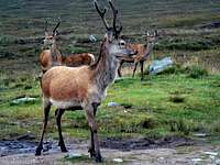

Another British species now unique to Scotland is the wildcat. By appearance the wildcat resembles a very muscular domestic tabby, the coat is made up of well defined brown and black stripes and usually has a ruffled appearance due to its thickness. The Scottish form is the largest in the wildcat family with males typically between 6-9kg (13-17lb) and females 5-7kg (11-15lb), around 50% larger than the average domestic cat. Like most felines wildcats are solitary and largely nocturnal creatures; resting up in hidden thickets, dens or forests by day and patrolling and hunting up to 10km across open ground populated by prey at night. Males and females come together solely to mate in mid winter and for the rest of their lives the cats are alone. Sadly the animal is critically endangered with only 400 individuals remaining in the wild and barely a handful in the captive breeding population. Among the area’s other present, but seldom seen mammals, are the members of Mustelidae (weasel) family which include the badger, otter, pine marten, stoat, American mink, polecat, feral ferret and, of course, the weasel itself. Owing to their nocturnal habits they are notoriously hard to spot, however these once widely persecuted animals are becoming increasingly widespread owing to a combination of successful conservation measures, public awareness and the decline of the fur trade. |
| Recorded species: |
| American Mink (Mustela vison) Bank Vole (Clethrionomys glareolus) Black Rat (Rattus rattus) Brandt's Bat (Myotis brandtii) Brown Hare (Lepus europaeus) Brown Long-eared Bat (Plecotus auritus) Brown Rat (Rattus norvegicus) Chinese Muntjac (Muntiacus reevesi) Common Pipistrelle (Pipistrellus pipistrellus sensu stricto) Daubenton's Bat (Myotis daubentonii) Eastern Grey Squirrel (Sciurus carolinensis) Eurasian Badger (Meles meles) Eurasian Common Shrew (Sorex araneus) Eurasian Pygmy Shrew (Sorex minutus) Eurasian Red Squirrel (Sciurus vulgaris) Eurasian Water Shrew (Neomys fodiens) European Mole (Talpa europaea) European Otter (Lutra lutra) European Rabbit (Oryctolagus cuniculus) European Water Vole (Arvicola terrestris) Fallow Deer (Dama dama) Feral Cat (Felis catus) | Feral Ferret (Mustela furo) Feral Goat (Capra hircus) Feral Sheep (Ovis aries) Field Vole (Microtus agrestis) House Mouse (Mus musculus) Mountain Hare (Lepus timidus) Musk Rat (Ondatra zibethicus) Natterer's Bat (Myotis nattereri) Noctule Bat (Nyctalus noctula) Pine Marten (Martes martes) Polecat (Mustela putorius) Red Deer (Cervus elaphus) Red Fox (Vulpes vulpes) Reindeer (Rangifer tarandus) Roe Deer (Capreolus capreolus) Sika Deer (Cervus nippon) Soprano Pipistrelle (Pipistrellus pygmaeus) Stoat (Mustela erminea) Weasel (Mustela nivalis) West European Hedgehog (Erinaceus europaeus) Wildcat (Felis silvestris) Wood Mouse (Apodemus sylvaticus) |


The ptarmigan is another distinctive member of the grouse family, and in Britain is also unique to Scotland. A plump little bird, in winter it becomes totally white except for its tail and eye-patch, which remain black. It breeds in the highest mountains of Scotland having a preference for the Arctic like landscapes that exist there. Birds are residents, seldom moving far from breeding sites. In severe cold weather, birds may move from the highest ground to the edge of forests. The Cairngorm Plateau and the glens that surround it are an ideal place to spot this little bird. Due to the Grampian’s coastal locations sea birds enrich the areas otherwise largely land based bird communities. With its colourful and almost comical appearance the puffin is a particularly distinctive bird. Each year, nearly a million of these birds appear from the open ocean to take up residence in their burrows around the area’s coast. Feeding mainly on sandeels, puffins waste no time in laying their eggs and rearing their young before disappearing back to sea again. They start congregating in the waters around their breeding sites in April, and generally lay their eggs during May. Throughout June and early July, the birds are very active flying to and from their burrows with food for the chicks. |
| Recorded species: |
| Arctic Skua (Stercorarius parasiticus) Arctic Tern (Sterna paradisaea) Atlantic Puffin (Fratercula arctica) Balearic Shearwater (Puffinus mauretanicus) Bar-headed Goose (Anser indicus) Bar-tailed Godwit (Limosa lapponica) Barn Owl (Tyto alba) Barn Swallow (Hirundo rustica) Barnacle Goose (Branta leucopsis) Barred Warbler (Sylvia nisoria) Bean Goose (Anser fabalis) Black Grouse (Tetrao tetrix) Black-billed Magpie (Pica pica) Black Guillemot (Cepphus grylle) Black-headed Gull (Larus ridibundus) Black Kite (Milvus migrans) Black-legged Kittiwake (Rissa tridactyla) Black Redstart (Phoenicurus ochruros) Black Stork (Ciconia nigra) Black Swan (Cygnus atratus) Black-tailed Godwit (Limosa limosa) Black Tern (Chlidonias niger) Black-throated Diver (Gavia arctica) Blackcap (Sylvia atricapilla) Blue Tit (Cyanistes caeruleus) Bluethroat (Luscinia svecica) Bohemian Waxwing (Bombycilla garrulus) Brambling (Fringilla montifringilla) Brent Goose (Branta bernicla) Carrion Crow (Corvus corone) Chaffinch (Fringilla coelebs) Coal Tit (Periparus ater) Common Blackbird (Turdus merula) Common Bullfinch (Pyrrhula pyrrhula) Common Buzzard (Buteo buteo) Common Chiffchaff (Phylloscopus collybita) Common Coot (Fulica atra) Common Crane (Grus grus) Common Crossbill (Loxia curvirostra) Common Cuckoo (Cuculus canorus) Common Eider (Somateria mollissima) Common Goldeneye (Bucephala clangula) Common Grasshopper Warbler (Locustella naevia) Common Greenshank (Tringa nebularia) Common Guillemot (Uria aalge) Common Kestrel (Falco tinnunculus) Common Kingfisher (Alcedo atthis) Common Linnet (Carduelis cannabina) Common Moorhen (Gallinula chloropus) Common Nightingale (Luscinia megarhynchos) Common Pheasant (Phasianus colchicus) Common Pochard (Aythya ferina) Common Quail (Coturnix coturnix) Common Raven (Corvus corax) Common Redpoll (Carduelis flammea) Common Redshank (Tringa totanus) Common Redstart (Phoenicurus phoenicurus) Common Rosefinch (Carpodacus erythrinus) Common Sandpiper (Actitis hypoleucos) Common Scoter (Melanitta nigra) Common Shelduck (Tadorna tadorna) Common Snipe (Gallinago gallinago) Common Starling (Sturnus vulgaris) Common Swift (Apus apus) Common Tern (Sterna hirundo) Common Whitethroat (Sylvia communis) Common Wood Pigeon (Columba palumbus) Corn Bunting (Emberiza calandra) Corn Crake (Crex crex) Cory's Shearwater (Calonectris diomedea) Crested Tit (Lophophanes cristatus) Curlew Sandpiper (Calidris ferruginea) Dark-bellied Brent Goose (Branta bernicla subsp. bernicla) Dunlin (Calidris alpina) Eurasian Collared Dove (Streptopelia decaocto) Eurasian Curlew (Numenius arquata) Eurasian Dotterel (Charadrius morinellus) Eurasian Jackdaw (Corvus monedula) Eurasian Jay (Garrulus glandarius) Eurasian Marsh Harrier (Circus aeruginosus) Eurasian Oystercatcher (Haematopus ostralegus) Eurasian Reed Warbler (Acrocephalus scirpaceus) Eurasian Siskin (Carduelis spinus) Eurasian Sparrowhawk (Accipiter nisus) Eurasian Teal (Anas crecca) Eurasian Tree Sparrow (Passer montanus) Eurasian Treecreeper (Certhia familiaris) Eurasian Wigeon (Anas penelope) Eurasian Woodcock (Scolopax rusticola) Eurasian Wryneck (Jynx torquilla) European Bee-eater (Merops apiaster) European Golden Plover (Pluvialis apricaria) European Goldfinch (Carduelis carduelis) European Greenfinch (Carduelis chloris) European Honey-buzzard (Pernis apivorus) European Nightjar (Caprimulgus europaeus) European Robin (Erithacus rubecula) European Shag (Phalacrocorax aristotelis) European Storm-petrel (Hydrobates pelagicus) European Turtle Dove (Streptopelia turtur) European White-fronted Goose (Anser albifrons subsp. albifrons) Fieldfare (Turdus pilaris) Gadwall (Anas strepera) Garden Warbler (Sylvia borin) Garganey (Anas querquedula) Glaucous Gull (Larus hyperboreus) Goldcrest (Regulus regulus) Golden Eagle (Aquila chrysaetos) Goosander (Mergus merganser) Great Bittern (Botaurus stellaris) Great Black-backed Gull (Larus marinus) Great Cormorant (Phalacrocorax carbo) Great Crested Grebe (Podiceps cristatus) Great Egret (Ardea alba) Great Grey Shrike (Lanius excubitor) Great Northern Diver (Gavia immer) Great Skua (Stercorarius skua) Great Spotted Woodpecker (Dendrocopos major) Great Tit (Parus major) Greater Canada Goose (Branta canadensis) Greater Scaup (Aythya marila) Greater White-fronted Goose (Anser albifrons) Green Sandpiper (Tringa ochropus) Green Woodpecker (Picus viridis) Green-winged Teal (Anas carolinensis) Greenland White-fronted Goose (Anser albifrons subsp. flavirostris) Grey Heron (Ardea cinerea) | Grey Partridge (Perdix perdix) Grey Phalarope (Phalaropus fulicarius) Grey Plover (Pluvialis squatarola) Grey Wagtail (Motacilla cinerea) Greylag Goose (Anser anser) Gull-billed Tern (Gelochelidon nilotica) Hawfinch (Coccothraustes coccothraustes) Hedge Accentor (Prunella modularis) Hen Harrier (Circus cyaneus) Herring Gull (Larus argentatus) Hooded Crow (Corvus cornix) Hoopoe (Upupa epops) Horned Lark (Eremophila alpestris) House Martin (Delichon urbicum) House Sparrow (Passer domesticus) Iceland Gull (Larus glaucoides) Icterine Warbler (Hippolais icterina) Jack Snipe (Lymnocryptes minimus) Lapland Longspur (Calcarius lapponicus) Leach's Storm-petrel (Oceanodroma leucorhoa) Lesser Black-backed Gull (Larus fuscus) Lesser Redpoll (Carduelis cabaret) Lesser Scaup (Aythya affinis) Lesser Whitethroat (Sylvia curruca) Little Auk (Alle alle) Little Grebe (Tachybaptus ruficollis) Little Gull (Larus minutus) Little Plover (Charadrius dubius) Little Stint (Calidris minuta) Little Tern (Sternula albifrons) Long-billed Dowitcher (Limnodromus scolopaceus) Long-eared Owl (Asio otus) Long-tailed Duck (Clangula hyemalis) Long-tailed Skua (Stercorarius longicaudus) Long-tailed Tit (Aegithalos caudatus) Mallard (Anas platyrhynchos) Mandarin Duck (Aix galericulata) Manx Shearwater (Puffinus puffinus) Meadow Pipit (Anthus pratensis) Mealy Redpoll (Carduelis flammea subsp. flammea) Merlin (Falco columbarius) Mew Gull (Larus canus) Mistle Thrush (Turdus viscivorus) Montagu's Harrier (Circus pygargus) Mute Swan (Cygnus olor) Northern Fulmar (Fulmarus glacialis) Northern Gannet (Morus bassanus) Northern Goshawk (Accipiter gentilis) Northern Lapwing (Vanellus vanellus) Northern Pintail (Anas acuta) Northern Shoveler (Anas clypeata) Northern Wheatear (Oenanthe oenanthe) Osprey (Pandion haliaetus) Paddyfield Warbler (Acrocephalus agricola) Pallas's Leaf Warbler (Phylloscopus proregulus) Parrot Crossbill (Loxia pytyopsittacus) Peregrine Falcon (Falco peregrinus) Pied Flycatcher (Ficedula hypoleuca) Pied Wagtail (Motacilla alba subsp. yarrellii) Pink-footed Goose (Anser brachyrhynchus) Pomarine Skua (Stercorarius pomarinus) Purple Sandpiper (Calidris maritima) Razorbill (Alca torda) Red Grouse (Lagopus lagopus) Red Kite (Milvus milvus) Red Knot (Calidris canutus) Red-breasted Merganser (Mergus serrator) Red-legged Partridge (Alectoris rufa) Red-necked Grebe (Podiceps grisegena) Red-throated Diver (Gavia stellata) Redwing (Turdus iliacus) Reed Bunting (Emberiza schoeniclus) Ring Ouzel (Turdus torquatus) Ring-billed Gull (Larus delawarensis) Ringed Plover (Charadrius hiaticula) Rock Pigeon (Columba livia) Rock Pipit (Anthus petrosus) Rock Ptarmigan (Lagopus muta) Rook (Corvus frugilegus) Rosy Starling (Sturnus roseus) Ruddy Duck (Oxyura jamaicensis) Ruddy Turnstone (Arenaria interpres) Ruff (Philomachus pugnax) Sabine's Gull (Larus sabini) Sand Martin (Riparia riparia) Sanderling (Calidris alba) Sandwich Tern (Sterna sandvicensis) Scottish Crossbill (Loxia scotica) Sedge Warbler (Acrocephalus schoenobaenus) Short-eared Owl (Asio flammeus) Sky Lark (Alauda arvensis) Slavonian Grebe (Podiceps auritus) Smew (Mergellus albellus) Snow Bunting (Plectrophenax nivalis) Snow Goose (Anser caerulescens) Snowy Owl (Bubo scandiaca) Song Thrush (Turdus philomelos) Sooty Shearwater (Puffinus griseus) Spotted Crake (Porzana porzana) Spotted Flycatcher (Muscicapa striata) Spotted Redshank (Tringa erythropus) Stock Pigeon (Columba oenas) Stonechat (Saxicola torquata) Surf Scoter (Melanitta perspicillata) Tawny Owl (Strix aluco) Tree Pipit (Anthus trivialis) Tufted Duck (Aythya fuligula) Twite (Carduelis flavirostris) Two-barred Crossbill (Loxia leucoptera) Velvet Scoter (Melanitta fusca) Water Rail (Rallus aquaticus) Western Capercaillie (Tetrao urogallus) Whimbrel (Numenius phaeopus) Whinchat (Saxicola rubetra) White Wagtail (Motacilla alba subsp. alba) White-tailed Eagle (Haliaeetus albicilla) White-throated Dipper (Cinclus cinclus) White/Pied Wagtail (Motacilla alba) Whooper Swan (Cygnus cygnus) Willow Ptarmigan (Lagopus lagopus) Willow Warbler (Phylloscopus trochilus) Winter Wren (Troglodytes troglodytes) Wood Sandpiper (Tringa glareola) Wood Warbler (Phylloscopus sibilatrix) Woodchat Shrike (Lanius senator) Yellow Wagtail (Motacilla flava) Yellow-billed Diver (Gavia adamsii) Yellowhammer (Emberiza citrinella) |
Reptiles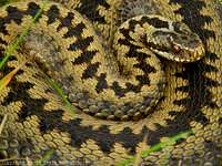 Adder (Vipera berus) (Photo by daveyboy) Reptiles are quite rare in Scotland in general, the climate generally being unfavourable towards cold-blooded animals - Adder (Vipera berus), grass snake (Natrix natrix), common lizard (Zootoca vivipara) and slow-worm (Anguis fragilis) are the most widespread. Adders were once much more common that they are today but unfortunately, perhaps because of their venomous bite, they have been persecuted almost everywhere in Britain and their numbers are now much smaller. Nowadays adders are generally confined to the drier valley floors and coastal plain, however they can sometimes be found in peat bogs or on wet patches of sphagnum moss. Grass-snakes do better, their preference for damp, even watery habitats make them naturally suited to the region. Among the area’s more unusual visitors are leathery turtle (Dermochelys coriacea), loggerhead turtle (Caretta caretta), green turtle (Chelonia mydas) and Kemp's Ridley (Lepidochelys kempii) which have all been recorded along the western coast. |
| Recorded species: |
| Adder (Vipera berus) Common Lizard (Zootoca vivipara) Grass Snake (Natrix natrix) Green Turtle (Chelonia mydas) | Kemp's Ridley (Lepidochelys kempii) Leathery Turtle (Dermochelys coriacea) Loggerhead Turtle (Caretta caretta) Slow-worm (Anguis fragilis) |
Amphibians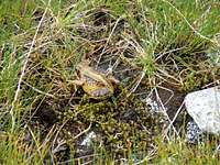 Common Frog (Rana temporaria) (Photo by Boydie) Amphibians are relatively few with common frog (Rana temporaria), common toad (Bufo bufo) and palmate newt (Triturus helveticus) being the most common. The common frog can live at some surprisingly high altitudes, sometimes breeding in the highest ponds or peat bogs, even when snow is on the ground and the water partially iced-over. Because of the low temperatures and poor feeding environments some of these higher pools offer, tadpoles can be extremely slow to develop, sometimes taking a year to grow to the size of normal tadpoles. The common toad on the other had prefers the damp and shady ponds of the area’s valleys, and is rarely found on the high ground. Palmate newt is the only species of newt found throughout the area, although great crested newt (Triturus cristatus) and smooth newt (Triturus vulgaris) can be found locally. |
| Recorded species: |
| Common Frog (Rana temporaria) Common Toad (Bufo bufo) Great Crested Newt (Triturus cristatus) | Palmate Newt (Lissotriton helveticus) Smooth Newt (Lissotriton vulgaris) |
| Recorded species: |
| Allis Shad (Alosa alosa) Anglerfish or Monkfish (Lophius piscatorius) Arctic Charr (Salvelinus alpinus) Atlantic Salmon (Salmo salar) Ballan wrasse (Labrus bergylta) Bib (Trisopterus luscus) Black goby (Gobius niger) Brill (Scophthalmus rhombus) Brook Charr (Salvelinus fontinalis) Brown Trout (Salmo trutta subsp. fario) Brown/Sea Trout (Salmo trutta) Bull rout (Myoxocephalus scorpius) Butterfish (Pholis gunnellus) Chub (Leuciscus cephalus) Coalfish (Pollachius virens) Cod (Gadus morhua) Common Bream (Abramis brama) Common Carp (Cyprinus carpio) Common dragonet (Callionymus lyra) Common Goby (Pomatoschistus microps) Common Sturgeon (Acipenser sturio) Conger eel (Conger conger) Corkwing (Crenilabrus melops) Crucian Carp (Carassius carassius) Cuckoo wrasse (Labrus mixtus) Dace (Leuciscus leuciscus) Eckstrom's Topknot (Zeugopterus regius) European Eel (Anguilla anguilla) | Fifteen-spined stickleback (Spinachia spinachia) Five-bearded rockling (Ciliata mustela) Flounder (Platichthys flesus) Fries's Goby (Lesueurigobius friesii) Goldsinny (Ctenolabrus rupestris) Grass Carp (Ctenopharyngodon idellus) Grayling (Thymallus thymallus) Greater pipefish (Syngnathus acus) Greater sand-eel (Hyperoplus lanceolatus) Grey gurnard (Eutrigla gurnardus) Grey Trigger-fish (Balistes carolinensis) Herring (Clupea harengus) Lesser Sand Eel (Ammodytes tobianus) Minnow (Phoxinus phoxinus) Orfe (Leuciscus idus) Perch (Perca fluviatilis) Pike (Esox lucius) Rainbow Trout (Oncorhynchus mykiss) Roach (Rutilus rutilus) Rudd (Scardinius erythrophthalmus) Sea Bass (Dicentrarchus labrax) Sea Trout (Salmo trutta subsp. trutta) Smelt (Osmerus eperlanus) Stone Loach (Barbatula barbatula) Tench (Tinca tinca) Thick-lipped Mullet (Chelon labrosus) Three-spined Stickleback (Gasterosteus aculeatus) |
 Minke Whale (Balaenoptera acutorostrata) - It's not a fish but we needed a picture of some sort of sea dwelling animal (Photo by munroitis) Cartilaginous FishThe waters and sea lochs around the Grampian coast are home to, and visited by, a number of cartilaginous fish i.e. jawed fish with paired fins, paired nostrils, scales, two-chambered hearts, and skeletons made of cartilage rather than bone. In the summer months basking sharks often frequent the area and are often seen close to land and enclosed bays, usually swimming slowly close to the surface with its huge fin (up to two metres high) breaking the water. The species is one of the world’s largest fish, second only to the whale shark, and will often grow as much as 11 metres in length and can weigh up to 7 tonnes. As it swims it opens its mouth, which is itself over one metre wide, allowing hundreds of litres of seawater to flow out through its widely-stretched gills, which are in turn used trap all kinds of plankton. |
| Recorded species: |
| Basking Shark (Cetorhinus maximus) Catsharks (Scyliorhinidae) Dogfish (Scyliorhinus canicula) | Mackerel sharks (Lamnidae) Skate (Dipturus batis) Smooth Hound (Mustelus mustelus) |
| Recorded species: |
| Brook Lamprey (Lampetra planeri) Hagfish (Myxine glutinosa) | River Lamprey (Lampetra fluviatilis) Sea Lamprey (Petromyzon marinus) |
Marine Mammals Grey Seal (Halichoerus grypus) (Photo by Nanuls) Various types of marine mammal can be found along both east and west coasts of the Grampian mountain area. Seals are among the most common with two species, Atlantic grey seal and common seal, sharing the coastline. Large colonies of both species exist locally, for example there is a resident population of between 500 and 1,000 common seal inhabiting the Moray Firth alone. Atlantic grey seals are more common on the rockier west coast, and Scotland can boast a population of up to120,000 individuals, 40% of the world total. The seals spend most of the time in the water but rarely travel far from the coast, usually remaining within 20 km of the shore. The Moray Firth is also host to the most northerly population of bottlenose dolphin in the world, with between 100 and 250 individuals frequenting the Firth. It is one of only two resident populations in the UK (the other being Cardigan Bay in West Wales). Although bottlenose dolphins are numerous locally, the harbour porpoise is the most common cetacean in Scottish waters, and can be found almost everywhere along the coast. It may be found anywhere there are shallow seas but particularly around the Hebrides and Northern Isles. A number of whales occasionally frequent the area, the most common being the minke whale. The whales are largely dark in colour with white or pinkish undersides and have pointed heads. Their body length averages 7 to 10 metres and they weigh in at up to 10 tonnes. They are one of the few whales still commercially hunted, though not in Scottish waters. One of the more unusual visitors to the area is the distinctively coloured orca, or killer whale, which are one of the most widespread mammals on Earth. Male orcas can grow between 7-8m and weigh over 5,000kg while females grow between 5-7m and weigh over 3,000kg. They have a huge dorsal fin - 1.8m (6ft) high. Orcas are the top predators in the ocean, with a hugely varied diet, and count the seals which swim off the Grampian coast among their prey. Like the other marine mammals they are highly social animals and live in groups called pods. |
| Recorded species: |
| Atlantic White-sided Dolphin (Lagenorhynchus acutus) Bearded Seal (Erignathus barbatus) Bottle-nosed Dolphin (Tursiops truncatus) Common Dolphin (Delphinus delphis) Common Porpoise (Phocoena phocoena) Common Seal (Phoca vitulina) Grey Seal (Halichoerus grypus) Humpback Whale (Megaptera novaeangliae) | Killer Whale (Orcinus orca) Minke Whale (Balaenoptera acutorostrata) Risso's Dolphin (Grampus griseus) Sei Whale (Balaenoptera borealis) Sowerby's Beaked Whale (Mesoplodon bidens) Sperm Whale (Physeter catodon) White-beaked Dolphin (Lagenorhynchus albirostris) |

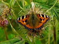

| Recorded species: |
| Hymenoptera (ants and bees) Scottish Wood Ant (Formica aquilonia) Narrow-headed wood ant (Formica exsecta) Great yellow bumblebee (Bombus distinguendus) The mason bee (Osmia inermis) The mason bee (Osmia uncinata) The northern Colletes (Colletes floralis) Lepidoptera (butterflies and moths) Chequered Skipper (Carterocephalus palaemon) Dark-bordered beauty (Epione parallelaria) Netted mountain moth (Semiothisa carbonaria) Sword-grass moth (Xylena exsoleta) Slender Scotch burnet (Zygaena loti scotica) New Forest burnet (Zygaena viciae argyllensis) | Diptera (flies) The hoverfly (Blera fallax) The hoverfly (Hammerschmidtia ferruginea) The cranefly(Lipsothrix ecucullata) The stiletto fly (Spiriverpa lunulata) Coleoptera (beetles) The reed beetle (Donacia aquatica) Plecoptera (stoneflies) The stonefly (Brachyptera putata) Mollusca (snails) Round-mouthed whorl snail (Vertigo genesii) |
Nature Conservation
|
The UK has a responsibility to ensure the conservation and enhancement of habitats and species in both a national and international context. One approach to achieving this is the establishment of a system of protected sites. The national sites providing statutory protection for flora, fauna, or geological or physiographical features are Sites of Special Scientific Interest (SSSIs) (Areas of Special Scientific Interest (ASSIs) in Northern Ireland) and Marine Nature Reserves (MNRs). As well as underpinning other national designations (such as National Nature Reserves), this system also provides statutory protection for terrestrial and coastal sites which are important within Europe (Natura 2000 network) and globally (such as Wetlands of International Importance). Further designations exist for sites outside of the national suite (such as Local Nature Reserves), varying in the level of protection afforded. Apart from designations for sites with particular natural features, there are also landscape designations which aim to protect areas of either national (e.g. Areas of Outstanding Natural Beauty) or international (e.g. natural World Heritage Sites) significance in terms of their outstanding scenic importance. Because the Grampian Mountains have such a rich natural heritage and wide variety of habitats much of its landscape is protected by both national and international legislation. There are over 500 Sites of Special Scientific Interest (SSSI) within, and in close proximity to, the area's boundary as defined on this page. An SSSI is a conservation designation denoting a protected area within the UK, and may be designated for a wide number of reasons based on their merits as areas of scientific interest. Sites may be notified due to their biological or geological interest and a minority of sites are notified for both. SSSIs are the basic 'building block' of nature conservation legislation and most other legal nature/geological conservation designations are based upon them, including National Nature Reserves, Ramsar Sites, Special Protection Areas, and Special Areas of Conservation. |
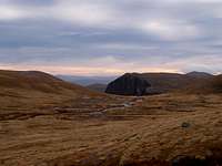 The sub-Arctic/Alpine environments of the Cairngorms are protected by six tiers of national and international nature and landscape desingations - National Park, SSSI, NNR, SAC, SPA and Ramsar (Photo by KNEEP) |  Lochs Etchachan, Uaine, Coire an Lochain, Einich and Avon (pictured) are protected under the Ramsar Convention as exceptional examples of high altitude oligotrophic lochs and support highly specialised populations of zooplankton and phytoplankton (Photo by johnloguk) |  The Nevis Range is protected as a Special Area of Conservation for its Siliceous alpine and boreal grasslands, Alpine and subalpine calcareous grasslands, high altitude siliceous screes and snow-beds, and chasmophytic vegetation (Photo by daw37) |
The Grampian Mountains also has around 20 National Nature Reserves (NNR), which are in effect the next line of protection for nationally important environmental areas. NNRs are usually designated for their broader ecological value rather than for the presence of any rare species. There are however a number of sites which hold important numbers of scarce or rare species. A number of factors may contribute to the designation of a NNR. These may include; how fragile a site is, the size of the site, how 'natural' the site is and the presence of species rich communities. The NNR network represents almost every kind of vegetation type found in the UK. There is also a large number of sites protected under international law. Special Areas of Conservation and Special Protection Areas are part of the Natura 2000 Networks of sites and are therefore strictly protected under European law. Special Areas of Conservation (SACs) are strictly protected sites designated under the EC Habitats Directive. Article 3 of the Habitats Directive requires the establishment of a European network of important high-quality conservation sites that will make a significant contribution to conserving the 189 habitat types and 788 species identified in Annexes I and II of the Directive (as amended). The listed habitat types and species are those considered to be most in need of conservation at a European level (excluding birds). Of the Annex I habitat types, 78 are believed to occur in the UK. Of the Annex II species, 43 are native to, and normally resident in, the UK. Special Protection Areas (SPAs) are strictly protected sites classified in accordance with Article 4 of the EC Directive on the conservation of wild birds (79/409/EEC), also known as the Birds Directive, which came into force in April 1979. They are classified for rare and vulnerable birds, listed in Annex I to the Birds Directive, and for regularly occurring migratory species. In the UK, the first SPAs were identified and classified in the early to mid 1980s. Classification has since progressed and a regularly updated UK SPA Summary Table provides an overview of both the number of classified SPAs and those approved by Government that are currently in the process of being classified (these are known as potential SPAs, or pSPAs). |

Lairig Ghru, Glen Geusachan and Bod an Deamhain (Devil's Point) (Photo by Nanuls)
 Hover your mouse cursor over the map to highlight the Grampian SAC's
| Site Name | Area (ha) | Latitude | Longitude | Grid Reference |
|---|---|---|---|---|
| Ardmeanach | 374.79 | 56 24 10 N | 06 09 40 W | NM433312 |
| Ballochbuie | 1881.73 | 56 59 30 N | 03 19 06 W | NO199897 |
| Barry Links | 789.67 | 56 28 45 N | 02 45 00 W | NO538321 |
| Ben Alder and Aonach Beag | 6658.26 | 56 50 40 N | 04 29 50 W | NN477753 |
| Ben Lui | 2059.5 | 56 23 40 N | 04 48 40 W | NN265260 |
| Ben Lawers | 5027.59 | 56 33 15 N | 04 13 30 W | NN633424 |
| Ben Nevis | 9317.18 | 56 47 30 N | 04 57 00 W | NN198705 |
| Buchan Ness to Collieston | 207.52 | 57 26 20 N | 01 48 30 W | NK115387 |
| Caenlochan | 5204.16 | 56 52 30 N | 03 17 30 W | NO213767 |
| Cairngorms | 57685.02 | 57 04 36 N | 03 39 15 W | NN995993 |
| Carn nan Tri-Tighearnan | 4151.29 | 57 25 50 N | 03 56 40 W | NH833394 |
| Cawdor Wood | 161.6 | 57 30 50 N | 03 55 30 W | NH847487 |
| Coyles of Muick | 135.16 | 57 00 30 N | 03 06 30 W | NO327913 |
| Creag Meagaidh | 6144.58 | 56 57 45 N | 04 32 55 W | NN451886 |
| Creag nan Gamhainn | 15.75 | 57 15 35 N | 03 24 15 W | NJ153196 |
| Culbin Bar | 612.88 | 57 37 45 N | 03 46 30 W | NH940613 |
| Dinnet Oakwood | 19.73 | 57 04 10 N | 02 53 00 W | NO464979 |
| Drumochter Hills | 9445.56 | 56 52 00 N | 04 11 30 W | NN664772 |
| Eileanan agus Sgeiran Lios mór | 1139.62 | 56 34 05 N | 05 26 15 W | NM888471 |
| Endrick Water | 239.11 | 56 03 20 N | 04 24 00 W | NS506873 |
| Firth of Lorn | 20975.01 | 56 13 00 N | 05 43 00 W | NM696089 |
| Firth of Tay & Eden Estuary | 15412.53 | 56 22 00 N | 02 57 00 W | NO420294 |
| Flanders Mosses | 1073.58 | 56 09 30 N | 04 12 00 W | NS633985 |
| Garron Point | 15.58 | 56 59 00 N | 02 10 08 W | NO890885 |
| Glen Coe | 2966.07 | 56 38 40 N | 05 01 00 W | NN151543 |
| Glen Creran Woods | 703.88 | 56 34 00 N | 05 14 55 W | NN004463 |
| Glen Shira | 65.34 | 56 17 52 N | 05 00 34 W | NN138158 |
| Glen Tanar | 4180.09 | 57 01 20 N | 02 53 30 W | NO459927 |
| Green Hill of Strathdon | 640.77 | 57 14 00 N | 03 08 00 W | NJ316164 |
| Hill of Towanreef | 1885.92 | 57 18 30 N | 02 57 00 W | NJ428246 |
| Insh Marshes | 1158.78 | 57 05 30 N | 03 58 00 W | NH808018 |
| Kinveachy Forest | 2849.36 | 57 14 15 N | 03 54 00 W | NH853179 |
| Kippenrait Glen | 61.56 | 56 10 30 N | 03 56 50 W | NS791997 |
| Ladder Hills | 4357.94 | 57 13 00 N | 03 14 55 W | NJ246147 |
| Lismore Lochs | 108 | 56 29 55 N | 05 31 45 W | NM828396 |
| Loch Creran | 1226.39 | 56 31 56 N | 05 20 30 W | NM945428 |
| Loch Etive Woods | 2639.54 | 56 28 30 N | 05 11 00 W | NN040360 |
| Loch Lomond Woods | 1454.33 | 56 12 00 N | 04 40 45 W | NN338040 |
| Loch Ruthven | 201.15 | 57 19 54 N | 04 16 48 W | NH628291 |
| Lower Findhorn Woods | 181.43 | 57 33 00 N | 03 40 00 W | NJ003523 |
| Lower River Spey – Spey Bay | 652.6 | 57 40 12 N | 03 07 00 W | NJ334650 |
| Meall na Samhna | 1883.03 | 56 27 50 N | 04 27 55 W | NN481329 |
| Moidach More | 929.05 | 57 27 05 N | 03 36 30 W | NJ035412 |
| Mòine Mhór | 1150.41 | 56 04 50 N | 05 31 05 W | NR812934 |
| Monadhliath | 10671.11 | 57 05 10 N | 04 16 20 W | NH623017 |
| Moray Firth | 151341.67 | 57 49 00 N | 03 43 36 W | NH976821 |
| Morrone Birkwood | 318.4 | 56 59 40 N | 03 25 30 W | NO134901 |
| Mortlach Moss | 12.02 | 57 29 30 N | 02 49 50 W | NJ502449 |
| Morven and Mullachdubh | 916.76 | 57 07 30 N | 03 04 30 W | NJ349043 |
| Muir of Dinnet | 415.76 | 57 06 05 N | 02 53 35 W | NJ459015 |
| Ness Woods | 847.12 | 57 11 30 N | 04 35 30 W | NH434142 |
| Onich to North Ballachulish Woods | 619.06 | 56 42 44 N | 05 11 06 W | NN042619 |
| Rannoch Moor | 10102.96 | 56 37 49 N | 04 41 36 W | NN348519 |
| Red Moss of Netherley | 92.53 | 57 02 10 N | 02 14 00 W | NO860940 |
| Reidside Moss | 87.17 | 57 36 00 N | 02 39 55 W | NJ602568 |
| River Dee | 2446.82 | 57 03 20 N | 03 04 30 W | NO493981 |
| River South Esk | 478.62 | 56 42 10 N | 02 55 00 W | NO450567 |
| River Spey | 5729.48 | 57 22 15 N | 03 30 00 W | NJ095319 |
| River Tay | 9497.72 | 56 34 00 N | 04 05 00 W | NN818481 |
| River Teith | 1312.4 | 56 17 00 N | 04 17 15 W | NN584126 |
| Sands of Forvie | 734.05 | 57 20 00 N | 01 58 00 W | NK020270 |
| Slochd | 91.78 | 57 19 00 N | 03 57 29 W | NH821270 |
| Tarbert Woods | 1595.97 | 55 47 00 N | 05 34 30 W | NR759602 |
| Taynish and Knapdale Woods | 966.27 | 56 02 25 N | 05 33 25 W | NR785887 |
| Tayvallich Juniper and Coast | 1213.47 | 55 58 50 N | 05 40 05 W | NR712825 |
| The Maim | 484.58 | 57 04 00 N | 03 12 30 W | NO268977 |
| Trossachs Woods | 374.95 | 56 14 10 N | 04 25 15 W | NN500075 |
| Turclossie Moss | 62.77 | 57 36 28 N | 02 11 33 W | NJ885575 |
| Turflundie Wood | 86.36 | 56 18 50 N | 03 18 00 W | NO196142 |
| Upper Strathearn Oakwoods | 152.48 | 56 20 38 N | 03 51 54 W | NN847184 |
 Hover your mouse cursor over the map to highlight the Grampian SPA's
| Site Name | Area (ha) | Latitude | Longitude | Grid Reference |
|---|---|---|---|---|
| Abernethy Forest | 5793.46 | 57 13 22 N | 03 18 10 W | NJ213154 |
| Anagach Woods | 392.78 | 57 19 45 N | 03 34 30 W | NJ049278 |
| Ballochbuie | 1881.73 | 56 59 30 N | 03 19 06 W | NO199897 |
| Ben Alder | 2860.21 | 56 50 25 N | 04 29 45 W | NN478749 |
| Buchan Ness to Collieston Coast | 208.62 | 57 26 20 N | 01 48 30 W | NK115387 |
| Caenlochan | 5975.28 | 56 52 54 N | 03 17 30 W | NO213774 |
| Cairngorms | 50903.74 | 57 04 30 N | 03 38 30 W | NO005994 |
| Craigmore Wood | 654.09 | 57 17 00 N | 03 37 00 W | NJ026224 |
| Creag Meagaidh | 2872.64 | 56 57 00 N | 04 35 00 W | NN429873 |
| Darnaway and Lethen Forest | 1828.61 | 57 32 45 N | 03 41 45 W | NH985519 |
| Drumochter Hills | 9445.56 | 56 51 54 N | 04 14 48 W | NN631771 |
| Firth of Tay and Eden Estuary | 6923.29 | 56 24 30 N | 03 05 00 W | NO332245 |
| Forest of Clunie | 19349.38 | 56 40 00 N | 03 35 00 W | NO030539 |
| Fowlsheugh | 10.15 | 56 54 45 N | 02 11 45 W | NO881801 |
| Glen Tanar | 4180.09 | 57 01 10 N | 02 53 30 W | NO459924 |
| Inner Moray Firth | 2339.23 | 56 50 25 N | 04 21 15 W | NN564745 |
| Kinveachy Forest | 2849.36 | 57 14 15 N | 03 54 00 W | NH853179 |
| Knapdale Lochs | 112.39 | 55 51 30 N | 05 35 00 W | NR755684 |
| Loch Ashie | 162.29 | 57 22 44 N | 04 17 00 W | NH627343 |
| Loch Flemington | 21 | 57 32 32 N | 03 59 15 W | NH810519 |
| Loch Knockie and Nearby Lochs | 395.92 | 57 05 45 N | 04 35 00 W | NH435035 |
| Loch Lomond | 510.49 | 56 03 45 N | 04 30 30 W | NS438883 |
| Loch of Kinnordy | 85.09 | 56 40 30 N | 03 02 40 W | NO360542 |
| Loch of Lintrathen | 186.4 | 56 40 40 N | 03 11 00 W | NO275546 |
| Loch of Skene | 120.89 | 57 09 30 N | 02 21 30 W | NJ783075 |
| Loch of Strathbeg | 615.94 | 57 37 24 N | 01 53 00 W | NK070592 |
| Loch Ruthven | 201.15 | 57 19 54 N | 04 16 48 W | NH617278 |
| Loch Spynie | 93.62 | 57 41 00 N | 03 16 42 W | NJ238666 |
| Loch Vaa | 44.6 | 57 14 20 N | 03 48 00 W | NH914179 |
| Lochnagar | 1431.28 | 56 56 30 N | 03 16 00 W | NO229841 |
| Montrose Basin | 984.61 | 56 42 40 N | 02 30 20 W | NO691578 |
| Moray and Nairn Coast | 2410.25 | 57 38 54 N | 03 43 48 W | NH968633 |
| Muir of Dinnet | 157.6 | 57 05 00 N | 02 55 00 W | NO444995 |
| Rannoch Lochs | 1170.19 | 56 40 00 N | 04 37 00 W | NN397558 |
| River Spey Insh Marshes | 1158.87 | 57 05 23 N | 03 59 48 W | NH790016 |
| South Tayside Goose Roosts | 331.01 | 56 15 54 N | 03 50 00 W | NN865096 |
| Tips of Corsemaul and Tom Mor | 83.71 | 57 26 32 N | 03 00 35 W | NJ394395 |
| Troup,Pennan and Lions Heads | 172.11 | 57 41 00 N | 02 15 05 W | NJ850658 |
| Ythan Estuary, Sands of Forvie and Meikle Loch | 1016.24 | 57 20 30 N | 01 57 30 W | NK025279 |
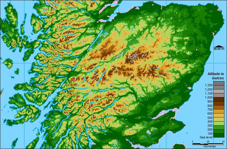 Hover your mouse cursor over the map to highlight the Grampian Ramsar Sites
| Site Name | Area (ha) | Latitude | Longitude | Grid Reference |
|---|---|---|---|---|
| Cairngorms Lochs | 172.99 | 57 04 08 N | 03 47 27 W | NN914989 |
| Firth of Tay and Eden Estuary | 6918.42 | 56 24 30 N | 03 05 00 W | NO332245 |
| Inner Moray Firth | 2339.25 | 57 29 70 N | 04 21 15 W | NH588474 |
| Loch of Kinnordy | 85.09 | 56 40 30 N | 03 02 40 W | NO360542 |
| Loch of Lintrathen | 216.81 | 56 40 40 N | 03 11 00 W | NO275546 |
| Loch of Skene | 120.9 | 57 09 30 N | 02 21 30 W | NJ783075 |
| Loch of Strathbeg | 615.94 | 57 37 24 N | 01 53 00 W | NK070592 |
| Loch Ruthven | 201.15 | 57 19 54 N | 04 16 48 W | NH617278 |
| Loch Spynie | 93.62 | 57 41 00 N | 03 16 42 W | NJ238666 |
| Montrose Basin | 984.62 | 56 42 40 N | 02 30 20 W | NO691578 |
| Moray and Nairn Coast | 2412.27 | 57 38 54 N | 03 43 48 W | NH968633 |
| Muir of Dinnet | 157.6 | 57 05 00 N | 02 55 00 W | NO444995 |
| Rannoch Moor | 1519.43 | 56 39 20 N | 04 35 40 W | NN410545 |
| River Spey - Insh Marshes | 1158.77 | 57 05 24 N | 03 59 48 W | NH790016 |
| South Tayside Goose Roosts | 331.01 | 56 15 54 N | 03 50 00 W | NN865096 |
| Ythan Estuary and Meikle Loch | 314.17 | 57 20 30 N | 01 57 30 W | NK025279 |
Shooting Season
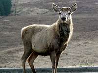
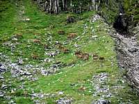
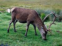
In order to enable hill walkers and climbers to plan routes that skirt around the main routes used for planned deer stalking activities, the following website provides detailed information and contact numbers; Hill Phones The following links are from the Hill Phones website and cover the following areas and mountains; Eastern Grampians1. Invercauld The main peaks affected: Ben Avon and Beinn a’Bhuird The main peaks affected: Carn an t-Sagairt Mor and Carn an Tuirc 3. Balmoral / Lochnager and Glen Clova The main peaks affected: Lochnagar, White Mounth, Broad Cairn and Tom Buidhe 4. Glen Shee The main peaks affected: Carn a’Gheoidh and Creag Leacach 5. Fealar The main peaks affected: Carn an Righ and Beinn Iutharn Mhor The main peaks affected: Beinn a’Ghlo and Beinn Dearg Central Grampians1. Corrour The main peaks affected: Beinn na Lap, Sgor Gaibhre and Leum Uilleim The main peaks affected: Meall Glas and Sgiath Chuil 3. Balquhidder The main peaks affected: Beinn a’Chroin, Stob a’Choin and Beinn Chabhair Western GrampiansThe main peaks affected: Sgurr Eilde Mor and Stob Coire Easain The main peaks affected: Beinn Bhuidhe and Ben Vane Grouse Shooting Can you spot him? (Photo by mountainmanjohn) Every year on the 12th of August, or as it is more commonly known the 'Glorious Twelfth', the grouse shooting season kicks off and runs right through until the 10th of December. Shooters travel from all over the world to participate in this activity and it is estimated that this contributes significantly to the estimated 240 million pounds that Grouse shooting brings to the Scottish economy. The grouse live naturally, in abundance, among the heather clad slopes of the Grampian mountains. It is not only grouse that can be shot, there is also the chance of shooting other wild birds such as ptarmigan or pheasants. The British Association for Shooting and Conservation (BASC) provides detailed information on grouse shooting and all shooting related activities in the UK. |
Brief Guide to Gaelic
Gaelic is a very rich language topographically, and this basic guide to some of its elements should hopefully provide useful information that will assist in understanding how/why the mountains in Scotland are derived and to enrich your knowledge of the local environment. It should be noted that in Gaelic a describing word would be placed at the end of a mountain name; i.e. Sgorr (peak) Dhearg (red), Sgorr Dhearg translated is Red Peak. This would read in English as Peak Red. For a full detail of Gaelic mountain pronunciations I recommend the following book; Scottish Hill and Mountain Names by Peter Drummond. Glossary |
| Gaelic word | English translation | Pronunciation |
| Achadh | field | achagh |
| Adharcan | Lapwing | ogharkan |
| Airidh | sheiling | aa'rea |
| Allt | stream, river | ault |
| Aonach | ridge | onach |
| Ard, Aird | high place | aird |
| Ba | cattle | baa |
| Ban | white, pale | baan |
| Beag | little | bayk |
| Bealach | pass, col | byalach |
| Beinn, Bheinn, Ben | mountain | byn |
| Beith | Birch | bay |
| Bidean | pinnacle | beetyan |
| Binnean | high, conical hill | beenyan |
| Blar | cleared space, field | blaar |
| Both | Hut | bo |
| Breac | speckled | brechk |
| Buidhe | yellow | booya |
| Cas | steep | cas |
| caorach | sheep | koreech |
| Caorunn | Rowan | koran |
| Carn | cairn | kaarn |
| Ceann | head, headland | kyaan |
| Cioch | breast | keeach |
| Ciche | genetive of cioch | keecha |
| Clach | stone | klach |
| Coille | wood, forest | kilya |
| Creag | crag, rock, cliff | krayk |
| Damh | Stag | dav |
| Darach | Oak | darach |
| Dearg | red | dyerack |
| Dubh | black | doo |
| Eas | waterfall | es |
| Eilidh | Hind | aalay |
| Eilean | island | aalyan |
| Eun | bird | ayn |
| Fada | long | fata |
| Fas | deserted place | faas |
| Feadag | Plover | fedak |
| Fionn | white, holy | fyoon |
| Fraoch | Heather | froch |
| Fuar | cold | fooar |
| Fuaran | Well, spring | fooaran |
| Gabhar | Goat | gaavar |
| Garbh | rough | garv |
| Geal | white | gyal |
| Gearr | short | gyar |
| Githas | Pine | gyoo'as |
| Glas | grey, green | glas |
| Gorm | green, blue | goram |
| Guala | shoulder of hill | gooala |
| Iolaire | Eagle | yi'lara |
| Labhar | loud | lavar |
| Lairig | pass | laarik |
| Leacach | stony slope | lyech-kach |
| Leathad | broad slope, brae | lyehat |
| Liadh | grey | lyeea |
| Madadh-ruadh | Fox | matagh-rooagh |
| Maol | bare top | moel |
| Meall | round top | myowl |
| Mheadhoin | middle | ve-aan |
| Mor, Mhor | large | moar |
| Muileann | mill | mool-an |
| Mullach | top, summit | mooll-ach |
| Odhar | dun coloured | ouar |
| Roid | bog | rot |
| Ruadh | red | rooagh |
| Sgorr, Sgurr | rocky peak | skoor |
| Sneachd | snow | shnyach |
| Sron | nose | srawn |
| Stob | point | stop |
| Tarmachan | Ptarmigan | taramachan |
| Trilleachan | Oyster-catcher, Sand-piper | treel-yachan |
| Uaine | green, pallid | ooanya |
| Uinneag | window | oonyak |
Mountain Conditions
| This West Highlands weather forecast is generated by the Met Office Weather Widget | This East Highlands weather forecast is generated by the Met Office Weather Widget |
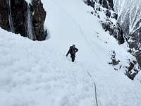


Most youth hostels or mountain hotels will offer some form of daily avalanche forecast however, if this isn’t available, the Scottish Avalanche Information Service (SAIS) offer up-to-date online forecasts for five locations in the Grampian Mountains, as well as help and guidance about avalanche safety. Furthermore, the Scottish Mountaineering Club have published an excellent book, A Chance in a Million? - Scottish Avalanches, which contains clear, well-illustrated guidance for winter climbers and hill walkers of all abilities. ResourcesSome useful links on weather conditions: Mountain Meteorology of Scotland - an article by Proterra on the Scottish climate and its weather Metcheck - 7 day weather forecast Abacus Mountaineering - Climbing conditions The Scottish Mountain Weather Service offers detailed daily mountain weather forecasts for most of the Highlands. West Highlands - The West Highlands area includes Ben Nevis and Creag Meagaidh and extends north to those hills accessible from Glenfinnan (Road to the Isles) and Glen Spean. In the east, it includes all the mountains from Ben Alder, south to Loch Lomond and Trossachs NP. The area also includes two islands - Arran and Mull. East Highlands - The East Highlands area covers all the northeast Grampians north from Loch Lochy in the west, to the Cairngorm, Monadhliath, Cairnwell and Lochnagar areas in the east. Some useful links on avalanche conditions: The Mountaineering Council of Scotland - Information on avalanches The Scottish Avalanche Information Service (SAIS) - Information and forecasts The Scottish Avalanche Information Service also host a series of blogs run by members of their observer teams. This blogs act as a means for local SAIS observers to quickly pass on some of their local knowledge to mountain users. Currently there are four active blogs: SAIS Lochaber SAIS Northern Cairngorms SAIS Southern Cairngorms SAIS Creag Meagaidh Web Cameras: Webcams are an excellent way of getting up-to-date weather information for Scotland’s mountains. Currently there are only a few cameras located in the Grampian Mountains and even fewer which are actually reliable. The section below provides links to the very best. These feeds are hosted by external sites, so obviously we can’t be held responsible if a camera happens to be malfunctioning. |
 | Ben Nevis, Lochaber View of Ben Nevis from Tomacharich, Fort William, courtesy of www.visit-fortwilliam.co.uk |
| | Ben Nevis, Lochaber View from Nevisport shop in Fort William, courtesy of Nevisport (obviously) |
 | Buachaille Etive Mor, Glencoe View of The Buachaille , courtesy of Kings House Hotel |
 | Cairngorm Summit Weather Station View of from the Cairngorm Summit Weather Station looking South-West over the Northern Corries, courtesy of the Department of Physics at Heriot-Watt University |
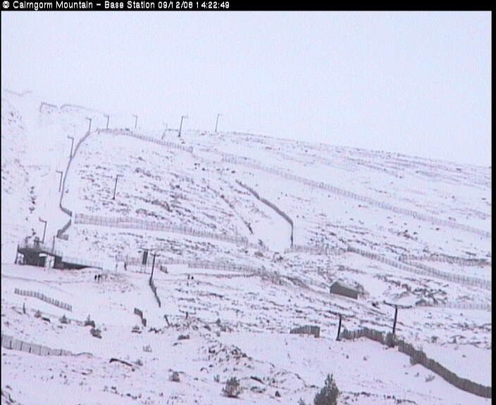 | Cairngorm Ski Area - Base Station View of the Cairngorm’s from the Ski Area Base Station, courtesy of www.cairngormmountain.com |
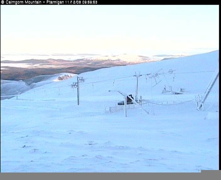 | Cairngorm Ski Area - Ptarmigan Building View of the Cairngorm’s from the Ptarmigan Building on the plateau, courtesy of www.cairngormmountain.com |
 | Knoydart View of Knoydart and the entrance to Loch Hourn taken from Sabhal Mòr Ostaig College on Skye, courtesy of the BBC. Knoydart isn't in the Grampian Mountains but the camera is worth checking anyway. |
Mountain Rescue
The Grampian Mountains are served by sixteen mountain rescue teams which are distributed across the whole area: |
|
For more information on Scottish mountain rescue teams take a look at the Mountain Rescue Committee of Scotland’s website - www.mrcofs.org |
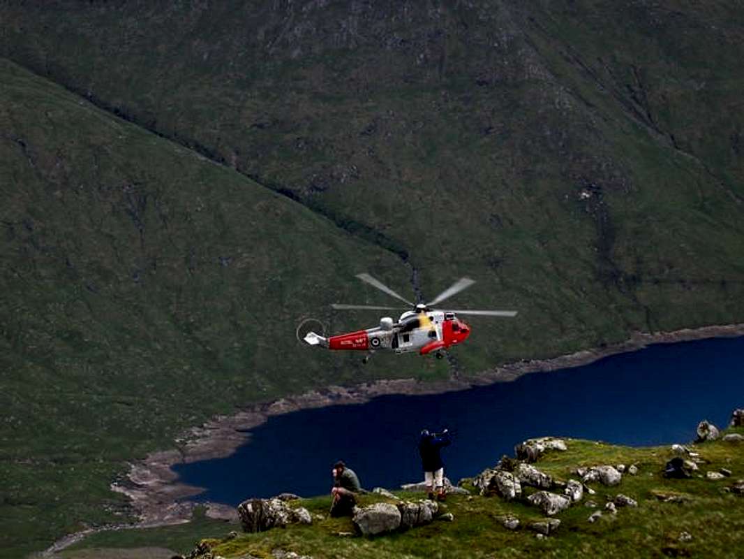 A mountain rescue on Ben Cruchan (Photo by munroitis) |  A mountain rescue on Ben Cruchan (Photo by munroitis) |
|
Teams should only be called out if you are in extreme difficulty and that your life, or the life of another, is under threat. As with all of the UK’s emergency services, to contact mountain rescue, phone 999 and ask for mountain rescue (obviously). For Mountain Rescue Air lift:
|
Red Tape
|
There is no red tape in Scotland due to the Land Reform (Scotland) Act 2003 which incorporated the Scottish Outdoor Access Code. This code, which commenced on the 9th of February 2005, has established statutory rights of access to land and inland water for outdoor recreation. There are however certain aspects that should be taken into account when in the Scottish countryside:
|
Transport and Logistics
Getting ThereBy Car The Grampian Mountains are easy to reach by car. The area is huge so I'm not going to list every road route here; I would advise consulting Google Maps, or an equivalent for further information. There is no good or bad approach, but on occasions roads may be closed due to heavy snowfall. |
View Larger Map
|
By Bus Bus travel is widely available throughout the area, both in the form of coach travel and service buses. Service bus information can be obtained from CityLink the UK Bus Timetable Website Directory, while the National Express website has information on coach timetables. In more remote areas, the smaller villages and settlements are serviced by Postbuses run by the Post Office; timetables can be found on the Post Office’s Royal Mail website. By Rail There are two main lines servicing the Grampian region, the West Highland Line and the Highland Main Line. The West Highland Line runs from Glasgow in the south to Fort William in the North, with a branch of the line diverging at Crianlarich to service Oban in the west. The line stops at a number of remote stations, including the Rannoch and Corrour Stations, which give unrivalled access to some of the range’s least accessible areas. Be aware that if you are travelling to Glasgow by train, you will probably need to make your own way from Glasgow Central to Glasgow Queen Street Stations to make your connection. The Highland Main Line runs from Edinburgh in the South to Inverness in the north and services much of the eastern portion of the Grampians. The line links some of the largest towns in central Scotland, but more importantly, it visits Aviemore, the self-proclaimed gateway to the Cairngorms. Further information on timetables and tickets can be obtained from ScotRail or National Rain Enquiries. |
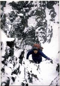
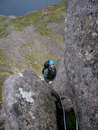
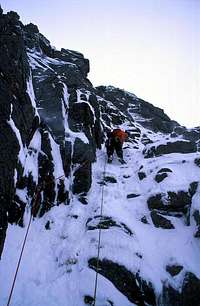
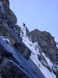
|
By Air Dotted around the margins of the Grampian Mountains are a number of airports and airfields which are receive both domestic and international flights. For mountain access, Inverness Airport must be the best placed of all these, located as it is, only a short distance from the Cairngorm Mountains. Unfortunately the airport only receives domestic flights. An alternative to Inverness is BAA Aberdeen Airport, which is almost as convenient, and although it mostly deals in domestic flights, does receive some from Europe. In the south BAA Glasgow Airport, Glasgow Prestwick Airport and BAA Edinburgh Airport also offer easy access to the area, and have the benefit of receiving international flights. Hub TownsThroughout the Grampians region there are numerous towns that are ideal for accommodation, food and drink, replenishing stocks, historical places and yearly events that take place at certain points of the year. Below is a selection of five 'Hub' towns that we feel are best placed for climbing/hiking in the Grampians. These towns give ease of access to numerous of the sub A&R's in the east, west and central Grampians. Aviemore Most visitors to Scotland’s mountains will have heard of Aviemore, the self proclaimed gateway to the Highlands. It was one of the first skiing resorts to be established in Scotland with the opening of the Chairlift in 1960, and despite some varying snow conditions, remains a popular British destination to this day. The town is located within the Cairngorms National Park and is only a short drive from the trail heads for some of Scotland's most popular hiking and climbing destinations. The town has many restaurants, hotels and shops, most of which specifically cater for outdoor enthusiasts. Furthermore, Scotland's National Outdoor Training Centre, Glenmore Lodge, is located only a few miles away, and offers a variety of mountain courses for people of all abilities. An extensive online guide to the town and the Cairngorm area, which contains detailed tourist information and useful resources, can be found on www.visitaviemore.com. |

Stob Bàn's North East Face (Photo by JoeHarris)
|
Braemar Braemar has the honour of being the highest and most mountainous parish in the British Isles, with each of its 182,000 acres being more than 1000ft above sea level. Sandwiched between the Cairngorm Mountains in the north and the hills of Lochnagar in the south, the town is well positioned for those visiting the area for the purpose of climbing its mountains. In fact there are some 24 Munros within the parish's boundary, three of which are over 4,000ft. Although smaller, and home to fewer facilities than its northern neighbour Aviemore, it has enough shops and B&B's to keep most visitors in supplies and accommodation. In September the Braemar Gathering Highland Games are held and are often attended by Her Majesty Queen Elizabeth. The games were reputedly founded in the 11th Century by Malcolm Canmore, and which has been run in its present form since 1832 by Braemar Royal Highland Society, the oldest surviving Friendly Society in Scotland. An extensive online guide to the town and the area, which contains detailed tourist information and useful resources, can be found on www.braemarscotland.co.uk. Fort William Fort William is the largest town on the Scottish west coast north of Helensburgh. It's location and proximity to the areas mountains make it the principal centre for the whole Western Highlands, an area of about 10,000 square kilometres (4,000 square miles). Fort William in particular serves the Lochaber area, which encompasses everything south to Ballachulish and Glencoe, east to Invergarry and Tulloch, north to Loch Cluanie, and west to Kinloch Hourn and Mallaig. Because of its regional importance, one will find many more amenities and services here than in most other places of a similar population. Many of these facilities are aimed specifically at hill walkers and climbers making an ideal base for visiting the area’s mountains, which include Scotland’s highest, Ben Nevis. An extensive online guide to the town and Lochaber area, which contains detailed tourist information and useful resources, can be found on www.visit-fortwilliam.co.uk |
  |
|
Callander The town of Callander is located in Perthshire on the eastern extremities of the Loch Lomond & Trossachs National Park. It is a beautiful little town that is a popular tourist destination in the summer months. It is located in the heart of the A&R Loch Earn and is close to the A&R's of Glen Lochay, Glen Lyon and Lawers. The local tourist information centre can be found on www.aboutbritain.com. On the main street of Callander the following types of shops can be found; outdoor shops, souvenier shops, cafes and restaurants, pubs, cycle and fishing hire and of course the quintessential chippie. There are two large car parks available just off the main street. The Callander World Highland Games takes place usually every July. Check the following link for detailed dates, Highland Games. Local transportation is regular during the day, buses run Monday to Friday with a reduced Saturday and Sunday service. Citylink provides a service from Edinburgh to Fort William that stops off at Callander and a local bus (The Trossachs Trundler) runs during the summer months between Callander and Aberfoyle. There are plenty of taxi's available everyday. Crianlarich The name Crianlarich comes from the Gaelic Low Pass and with the surrounding peaks of the nearby ranges rising grandly around, it's clear to see how the old Gaels came by this name. Of the five hub towns in this section, Crianlarich is definitely the smallest and the one with the least facilities, however it makes its entrance here due to its prime location. As the town sits on the junction of the two main roads that lead into the northern section of the western Grampians (the A85 & A82 roads), it is virtually impossible to access this area from the south without adding considerable time to your journey. This is best shown by the fact that all the national bus operators in Scotland will inevitably stop and pass through here on route to the north-west from Glasgow or Edinburgh. Crianlarich also has a train station which provides ease of access to the ranges in the area. The train station has been operational since the late 1800's and is the point where the Oban and Fort William bound trains part company. The town doesn't offer the same degree of facilities as the previous five, but accommodation and food & drink are aplenty. Further facilities are only a stones throw away to the north west in the town of Tyndrum. The name Tyndrum originates from the Gaelic Tigh an Druim - House on the Ridge. It was originally a popular gathering place for cattle drovers heading south to the markets, whereas it is now a popular gathering place for tourists and walkers heading north. How times change. The town has plenty of facilities and one of the businesses that probably sticks in everyone's minds is the amusingly named The Green Welly Stop |
Camping and Accommodation
|
There is a wide variety of camping and accommodation available throughout the whole of the Grampian Mountains. Contained within this section are places to stay in the major cities within the area and a small local selection of the different types of camping and accommodation available for the Eastern, Central and Western regions. On occasions the same venue is mentioned in two different sections. This is due to the proximity to bordering ranges and the fact that they can provide the best base for climbing in more than one place. |
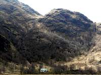

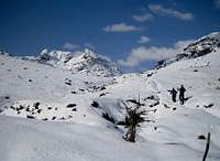
|
Some of the areas within the Grampians are fairly remote and as a result, accommodation is limited or non existent (e.g. Glen Etive in the west and the Ben Alder Hills in the central belt). As a result of this it may be necessary to stay out with the immediate area and travel a small distance to reach your destination. Another option that is available, is wild camping. Wild camping is totally legal in Scotland, again due to the Land Reform (Scotland) Act 2003 that was mentioned in the previous section. Here are some of the basic rules that should be adopted when wild camping:
The Mountaineering Council of Scotland provides an invaluable leaflet providing a full breakdown of the dos and don'ts of wild camping in Scotland. Wild Camping, A guide to good practice. † There are some hotels that permit wild camping within their grounds, as long as you abide by their rules. Where relevant. these are highlighted below. Western Grampians |

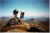
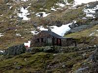
|
Hotels Clan MacDuff - Centrally located in Fort William for the Nevis range Mamore Lodge Hotel - 700ft above sea level on the slopes of Am Bodach in the Mamores Clachaig Inn - Slap bang in the middle of Glencoe † Kings House hotel - Excellent base at the start of Glencoe, for the northern half of the Black Mount and Glen Etive † Bridge of Orchy Hotel - Situated close to the southern half of the Black Mount range Inveroran Hotel - Excellent base for the Black Mount range Glenorchy Lodge Hotel - In Dalmally, close to the Cruachan group Portsonachan Hotel - On the shores of Loch Awe close to Cruachan Tyndrum Lodge Hotel - Within easy distance of the Tyndrum hills Tarbet Hotel - A short drive away from Ardgoil & The Arrochar Alps B&B's Crolinnhe - On the shores of Loch Linnhe, near the Nevis range Glenlochay Guest House - On the banks of the River Nevis close to the Nevis range and the Mamores Scorrybreac Guest House - Situated in the heart of Glencoe Fern Villa - In Ballachulish, just 1 mile from Glencoe Craigroyston - Located near the Cruachan group Riverside Cottage - In Dalmally, close to the Cruachan group Strathfillan House - Pleasant accommodation close to the Tyndrum hills Glengarry House - Situate close to the Tyndrum hills Rowantree Cottage - Overlooking Loch Long and the Arrochar Alps Lodges Linnhe Lochside Holidays - Camping, touring and lodges 5 miles from the Nevis range Lochay Holiday Park - Camping and lodges centrally placed for the Nevis range and Mamores Glen Nevis Holidays - Lodges and camping in the shadow of Ben Nevis Invercoe lodges and campsite - Situated close to Glencoe and the southern Mamores Port Selma Lodges - On the west coast and in driving distance of western Glen Etive and Cruachan The Lodge, Auch Estate - Ideal for the Black Mount or Glencoe Tigh an Daraich Lodges - Situated close to the Cruachan group Ben More Lodge - Located just 6 miles away from the Tyndrum hills Youth Hostels/Bunkhouses Glen Nevis Youth Hostel - Directly across from the starting path to Ben Nevis Ben Nevis Inn bunkhouse - Also located close to the starting path to the Ben Blackwater Hostel - In Kinlochleven on the southern side of the Mamores Glencoe Independent Hostel - Central located for anything in Glencoe with Glen Etive in close driving distance Glencoe Youth Hostel- Good location for exploring the Glencoe area Bridge of Orchy Bunkhouse - Situated close to the southern half of the Black Mount range Inveraray Youth Hostel - Within driving distance of the Cruachan group and Ardgoil & The Arrochar Alps Crianlarich Youth Hostel - Located in the near vicinity of the Tyndrum hills Campsites Linnhe Lochside Holidays - Camping, touring and lodges 5 miles from the Nevis range Lochay Holiday Park - Camping and lodges centrally placed for the Nevis range and Mamores Glen Nevis Holidays - Lodges and camping in the shadow of Ben Nevis Blackwater Hostel - In Kinlochleven on the southern side of the Mamores Red Squirrel Campsite - Located close to Glencoe village and within driving distance of Glen Etive Loch Awe Holiday Park - Situated to the west of Loch Awe and the Cruachan Group Tyndrum Wigwams - Cheap quality accommodation near to the Tyndrum hills Ardgarten campsite - Situated on the southern foot of the Arrochar Alps Central Grampians |
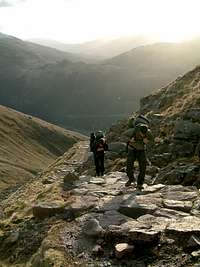

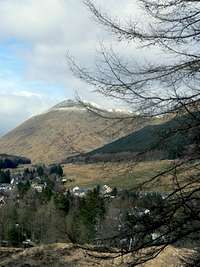

|
Hotels Laggan Gaskmore Hotel - Centrally situated and within driving distance for the Monadliath and Loch Laggan hills The Inn Dalwhinnie - Ideally placed for the West Drumochter Hills or for walking into the Ben Alder hills Killiecrankie Hotel - In Blair Athol in the south of West Drumochter Aberfeldy Weem Hotel - Ideally located for the Glen Lyon & Lawers ranges Fortingall Hotel - Located close to the Lawers and Glen Lyon ranges Killin Hotel - Situated next to the Lawers range and close to the Glen Lochay hills The Coach House Hotel - Located near the Lawers range and nearby Glen Lochay Clachan Cottage Hotel - On the shores of Loch Earn and centrally located for the Loch Earn group Ben Sheann Hotel - Situated in Strathyre, within the Loch Earn group and close to the eastern Crianlarich/Balquhidder hills † Bridge of Orchy Hotel - Situated at the bottom of the Bridge of Orchy hills range Tyndrum Lodge Hotel - Within 6 miles of the Bridge of Orchy hills and the western Crianlarich/Balquhidder hills The Crianlarich Hotel - In the centre of the village, next to the western Crianlarich/Balquhidder hills Rowardennan Hotel - At the foot of Ben Lomond in the Ben Lomond, Luss & The Trossachs range Colquhoun Arms Hotel - In the centre of Luss, on the western side of Loch Lomond B&B's Coig na Shee - Picturesque guest house close to the Monadhliath Distant Hills Guest House - Near to the Loch Trieg and Loch Laggan hills Balsporran Cottage - Situated at the Drumochter Pass and ideal for West Drumochter and Ben Alder hills The Firs Guest House - Located in the south of the West Drumochter range Coshieville House - In the shadows of Schiehallion in the Glen Lyon range Balnearn Guest House - Perfectly placed for anything in the Glen Lyon or Lawers ranges Rosebank House - In the heart of the Loch Earn group Strathfillan House - Pleasant B&B moments away from the Crianlarich hills Culag B & B - Next to Loch Lomond and the Luss hills The Hawthorns - Ideal for Ben Lomond and the Trossachs Lodges Croft Holidays - Just outside Newtonmore, close to the Monadhliath mountains Burnbank Lodges - A short trip from the Loch Treig and Loch Laggan hills Athol Estates Lodges - Ideal for anything in the West Drumochter area Killin Highland Lodges - Located close to the Lawers range and within driving distance of Glen Lochay Loch Tay Highland Lodges - A stones throw away from the Lawers range and close to Glen Lyon and Glen Lochay The Lodge, Auch Estate - On the doorstep of the Bridge of Orchy hills Leny Estate - Scottish Log cabin in Loch Earn Ben More Lodge - Within minutes of the Crianlarich hills Forest Hills Lochside Resort - Quality accommodation in the heart of the Trossachs Inverbeg Holiday Park - On the shores of Loch Lomond, near the Luss hills Youth Hostels/Bunkhouses Aviemore Youth Hostel - Close to the Monadliath mountains Newtonmore Independent Hostel - Even closer to the Monadliath mountains Glen Corrie Independent Hostel - Good base for anything in the Loch Treig or Loch Laggan areas Loch Ossian Youth Hostel - Good location for the Loch Trieg and Ben Alder hills Pitlochry Youth Hostel - In close proximity of Glen Lyon and the West Drumochter hills Culdees Bunkhouse - Ideally placed for the Glen Lyon and Lawers area Ben Lawers Bunkhouse - The perfect base for anything in the Lawers range Comrie Youth Hostel - Ideally placed for visiting the Loch Earn group Bridge of Orchy Bunkhouse - Right next to the train station in Bridge of Orchy Crianlarich Youth Hostel - Situated close by the Crianlarich hills range Rowardennan Youth Hostel - On the banks of Loch Lomond beneath Ben Lomond Campsites Alvie & Dalraddy Estates - In the small town of Kincraig, close to the Monadhliath mountains Spey Bridge Caravan Site - Caravan park close to the Monadhliath mountains Bunroy Caravan & Camping - Well situated for the Loch Treig and Loch Laggan hills Blair Castle Caravan Park - Situated close to West Drumochter and Glen Lyon Aberfeldy Caravan Park - Located close to the Glen Lyon area Cruachan Farm Caravan & Camping Park - Located close to the Lawers range Mains Farm - Good accommodation in the Loch Earn group area Tyndrum Wigwams - Just a short journey from the Crianlarich Hills Beinglas Campsite - Beneath Beinn Chabhair in the Crianlarich Hills Millarrochy Bay - In Drymen, on the shores of Loch Lomond Eastern Grampians |
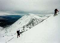
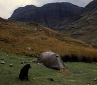

|
Hotels The Auld Kirk - An old church, providing quality food and accommodation close to the Lochnagar hills Braemar Lodge - East of the Cairngorms and north of Lochnagar and the Cairnwells Laggan Gaskmore Hotel - Closely situated to the Cairngorms National Park Kirkmichael Hotel - A short distance from Glenshee The Spittal of Glenshee Hotel - Even closer to Glenshee The Inn Dalwhinnie - Ideally placed for the East Drumochter and Atholl hills Killiecrankie Hotel - In Blair Athol and ideal for East Drumochter and Atholl Glen Clova Hotel - In the heart of the Angus glens B&B's Glenernan Guest House - In Ballater, next to the Lochnagar hills Coig na Shee - Picturesque guest house close to the Cairngorms Strathspey House - In Aviemore, next to the Cairngorms National Park Gordons of Braemar - Close to the Cairngorms, Lochnagar and the Cairnwells West Freuchies - In Blairgowrie, close to the Cairnwells Balsporran Cottage - Situated at the Drumochter Pass and ideal for East Drumochter and Atholl Dalgreine Guest House - Located next to the East Drumochter and Atholl hills Muirhouses Farm - In Kirriemuir, close to the Angus glens Lodges Glenmore Lodge - Scotland's national outdoor training centre located in the heart of the Cairngorm Mountains Croft Holidays - Just outside Newtonmore, close to the Cairngorms Ballater Lodge -Excellent accommodation close to the Lochnagar hills and Mount Keen Gulabin Lodge - closest accommodation to Glenshee Ski Slopes and the Cairnwell Hills Jenny's Bothy Crofthouse - Self-catering accommodation two and a half miles from the Lecht Ski Centre Slochd Mhor Lodge - Situated between the Monadhliath Mountains and Cairngorms Glenbeag Mountain Lodges - Swedish log cabin accommodation in Spittal of Glenshee Athol Estates Lodges - Ideal for anything in East Drumochter and Atholl Youth Hostels/Bunkhouses Aviemore Youth Hostel - At the gateway of the Cairngorms National Park Tomintoul Youth Hostel - To the north east of the Cairngorms Cairngorm Lodge Youth Hostel - Yes you guessed it, it's close to the Cairngorms National Park Invervey Youth Hostel - Centrally located in the Cairngorms Braemar Youth Hostel - Close to the Cairngorms and the Lochnagar hills Prosen Youth Hostel - In the south east of the Angus glens Abernethy Bunkhouses - A number of small bunkhouses which can accommodate 6 to 80 people Ardenberg Bunkhouse - A bunkhouse somewhere to the north of the Caringorms Aviemore Bunkhouse - Handy bunkhouse accommodation in Aviemore Ballater Bunkhouse - New for 2009, ideally placed for days on Lochnagar and the Angus Braemar Lodge Bunkhouse - Close to the Cairngorms and the Lochnagar hills Fraoch Lodge - Hostel Accommodation in Boat of Garten Glenfeshie Hostel - Located a few miles upstream from Feshie Bridge Lazy Duck Hostel - The smallest independent hostel in Scotland Newtonmore Hostel - Good for both Central and Eastern Grampians Prosen Hostel - Ideal accommodation for the Angus Glens Rucksacks Braemar - Ideal location for Lochnagar, Southern Cairngorms and Glenshee Hills Campsites High Range - Camping, chalets and lodges in the Cairngorms Rothiemurchus Camp & Caravan Park - Tranquil camping in a unique forest setting Spey Bridge Caravan Site - Caravan park close to the Cairngorms Alvie & Dalraddy Estates - In the small town of Kincraig, close to the Cairngorms Ballater Caravan Park - Close to the Lochnagar hills Blair Castle Caravan Park - Situated close to the East Drumochter and Atholl hills Five Roads Caravan Park - In Blairgowrie, close to Glenshee and the Cairnwells Wood Leisure Blairgowrie Holiday Park - In Blairgowrie, close to Glenshee and the Cairnwells Wood Leisure Corriefodly Holiday Park - Close to Glenshee and the Cairnwells Drumshademuir - Outside Forfar, close to the Angus glens |
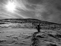
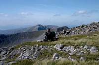

Major CitiesWithin the Grampian region there are numerous large cities that can provide the visitor with a wide selection of accommodation. Most of these cities are within an hours travelling time of at least one Area and Range in the Grampians. General accommodation in Inverness General accommodation in Aberdeen General accommodation in Dundee General accommodation in Perth General accommodation in Stirling General accommodation in Edinburgh General accommodation in Glasgow |
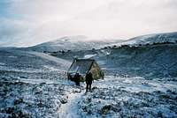
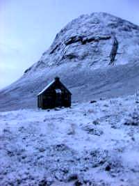
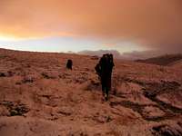
Maps
| Ordnance Survey |
| Ordnance Survey Travel Map - Route Scale 1:625 000 (1 inch to 10 miles) Great Britain 2008 Ordnance Survey Travel Map - Tour Scale 1:500 000 (1 to 5 km, 1 inch to 8 miles) Sheet 12 - Scotland | Ordnance Survey Travel Map - Road Scale 1:250 000 (1 cm to 2.5 km, 1 inch to 4 miles) Sheet 1 - Northern Scotland, Orkney & Shetland Sheet 2 - Western Scotland & the Western Isles Sheet 3 - Southern Scotland & Northumberland |
| Ordnance Survey Landranger Map Scale 1:50 000 (2 cm to 1 km, 1¼ inches to 1 mile) |
| Ordnance Survey Explorer Map Scale 1:25 000 (4 cm to 1 km or 2½ inches to 1 mile) |
| Harvey Map Services |
| Harvey National Park Atlas Scale 1:40 000 Loch Lomond and The Trossachs National Park Atlas Harvey British Mountain Map Scale 1:40 000 Cairngorms & Lochnagar Ben Nevis Harvey Superwalker Map Scale 1: 25 000 Arrochar Alps Ben Avon Ben Lawers Ben Ledi & hills north of Callander Ben Lomond Ben Nevis Ben Venue, Loch Ard & Queen Elizabeth Forest Park Cairn Gorm Crianlarich Glen Coe Lochnagar and Glen Shee Ochil Hills | Harvey Summit Map Scale 1:12 000 Ben Nevis Harvey Cycling Map Scale 1:80 000 East Perthshire Harvey National Trail Map Great Glen Way Speyside Way West Highland Way Harvey Mountain Charts Munro and Corbett Chart Long Distance Path Chart Panorama of Central Scotland |
Guidebooks

External Links
|
General The Mountaineering Council of Scotland - Scotland's official mountaineering body Scottish Mountaineering Club - Scotland's national mountaineering club Mountain Rescue Committee of Scotland - the national representative body of Scotland’s mountain rescue teams Scottish Ski Club - home page of the Scottish Ski Club Visit Scotland - website for the Scottish Tourist Board Undiscovered Scotland - online guide to Scotland Munro Magic - information of the Munros Scottish Natural Heritage - Scotland's statutory body for the protection of landscapes Joint Nature Conservation Committee - Britain's statutory body for the protection of wildlife Walk Highlands - Scottish walks and accommodation The West Highland Way - Official website of Scotland's premier long distance route Hill Phones - Information for hill walkers about stalking activities Deer Stalking Scotland - A guide to deer stalking in Scotland BASC - The British Association for Shooting and Conservation Mountain Conditions West Coast Mountain Guides - Avalanche information, climbing conditions and weather forecasts. Abacus Mountaineering - Climbing conditions The Scottish Avalanche Information Service (SAIS) - Avalanche information Winternet-Scotland - Scottish mountaineering conditions Weather Mountain Weather Information Service (MWIS) - mountain weather forecast Metcheck - 7 day weather forecast Met Office - Weather from the Met Office Travel National Rai - UK Train Timetable ScotRail - Scottish Train Timetables Showbus - bus timetables for the UK Citylink - Scottish bus timetables Inverness Airport - home page of Inverness airport BAA Glasgow Airport - homepage of Glasgow airport Glasgow Prestwick Airport - home page of Glasgow Prestwick Airport BAA Edinburgh Airport - home page of Edinburgh Airport Caledonian MacBrayne Ferries - ferry information and timetables for the west of ScotlandAccommodation The Mountain Bothies Association - information on bothies (mountain huts) in Scotland Scottish Youth Hostel Association - home page of the SYHA Scottish Independent Hostels - a directory of independent hostels in Scotland Maps and Guidebooks Ordnance Survey - Britain's national mapping agency Harvey Map Services - an excellent selection of maps designed specifically for outdoor enthusiasts Cicerone Guidebooks - guidebooks for people of all abilities Scottish Mountaineering Club - guidebooks and publications for and about Scottish mountains |
rgb2 - Apr 20, 2009 1:37 pm - Voted 10/10
webcam correctionsRE Webcams section. The Nevisport website appears to be not active. The Cairngorm ski area cameras are not displayed. Otherwise, 10 for this page! April 20, 2009
Nanuls - Apr 20, 2009 2:22 pm - Hasn't voted
Re: webcam correctionsThanks for the heads up therel; both sites seem to have had updates since this pages' code was written. Links have now been updated! Cheers Dan
TheMunroist - Jul 19, 2009 4:55 pm - Voted 9/10
just a queryExcellent page, there's some great info in there but why have you put Badenoch and Lochaber with the Grampians? or have I missed the boat here? maybe sub-ranges may be an idea? cheers
Boydie - Jul 19, 2009 6:31 pm - Hasn't voted
Re: just a queryHi. How you doing? You may find this link from the forum helpful in the reasoning behind why we done what we done. The discussion prior to this might explain the thinking also. Original discussion Hope this helps. Cheers, Stephen
TheMunroist - Jul 20, 2009 6:17 am - Voted 9/10
ThanksThanks very much, just trying to get my bearings, new to the site...
Nanuls - Jul 20, 2009 7:22 am - Hasn't voted
Re: ThanksNo worries, sorry, what exactly is your question? I'm a little unclear. Cheers Dan
TheMunroist - Jul 20, 2009 10:47 am - Voted 9/10
sorryWhy have you not given Lochaber and Badenoch seperate pages as opposed to placing them together with the Grampians. I see them as both seperate mountainous and geological areas.
Nanuls - Jul 20, 2009 2:02 pm - Hasn't voted
Re: sorryHi there, We wanted to create an overarching page that would cover the whole of the central Scotland i.e. that area south of the Great Glen and north of the Southern Uplands, of which Lochaber (at least in part) and Badenoch, are a part of. According to most definitions, they are certainly not separate from the Grampians, although Lochaber is also part of the Northwest Highlands. Correct me if I'm wrong, but Lochaber and Badenoch aren't really geological entities, like say the Cairngorms or the Ben Nevis Range are, but administrative units. Our sub-areas are loosely based on those of the SMC, but largely take their boundaries from actual geological formations and regimes that best represent the topography of the landscape. A great deal of discussion went into the placement of these boundaries, and in some areas boundaries are not definite, but 'fuzzy', something that's difficult to map in this way. Partly because of this, and partly because of matters of consistency, we felt that administrative areas or boundaries were too rigid to be used on a page such as this. As Stephen suggests, check out the forum discussion for more info, it should give you an idea of where we are coming from with this. Cheers Dan
TheMunroist - Jul 20, 2009 2:20 pm - Voted 9/10
Re: replyAh... now i do understand that the logic of that cheers and keep up the good work on Scotland's mountain pages!
Ken A - Aug 23, 2015 9:28 am - Hasn't voted
Update West Coast Mountin Guides web addressHi, Under 'External Links' and 'Mountain Conditions' could you please update the URL for West Coast Mountain Guides to: http://www.westcoast-mountainguides.co.uk/category/news/ Much appreciated! Ken Applegate
lewismc - Sep 11, 2015 2:12 am - Hasn't voted
Shape Files for GrampiansHi Folks, Does anyone have a shape file for the Grampians and/or Sub-ranges such as that one used within "The Sub-ranges of the Grampian Mountains" picture on this page? I would love to get my hands on one. Thanks in advance. Lewis
Nanuls - Sep 11, 2015 3:05 pm - Hasn't voted
Re: Shape Files for GrampiansHi Lewis I used MapInfo to create these maps so MapInfo Tabs exist, but not Shape Files. I'm afraid however that the files are all on my desktop hard drive which is currently packed up in storage. I've recently moved house (to the Cairngorms funnily enough) and I'm afraid it's going to stay there until I'm out of rented accommodation and into my own place... which may be some time. I would happily provide it if I get it out before then though. What do you intend to use it for by the way? Cheers Dan
brian@thisisbliss.com - Jul 30, 2019 6:00 am - Voted 10/10
Broken link for Loch Awe Holiday ParkHello, We love this post! Please can you update our Holiday Park with the correct link? In the Campsites section at the bottom of the post. Loch Awe Holiday Park is now found at https://www.argyllholidays.com/parks/loch-awe-holiday-park Many thanks