

|
|
Area/Range |
|---|---|
|
|
44.81670°N / 118.1025°W |
|
|
Hiking, Mountaineering, Scrambling, Skiing |
|
|
Spring, Summer, Fall, Winter |
|
|
9106 ft / 2776 m |
|
|
Geographic Overview
The Blue Mountains are one of the largest uplifts in Oregon. The Blue Mountains stretch from east of Prineville southeast to just north of Burns, east almost to Baker City, and north into Southeast Washington. The Blue Mountains consist of five sub-ranges. From west to east, these are the Ochoco, Aldrich, Strawberry, Greenhorn, and Elkhorn Mountains.
The Blue Mountains are separated from the Wallowa Mountains by the Grand Ronde and Powder Rivers. The highest point in the Blue Mountains is Rock Creek Butte in the southern Elkhorn Mountains. These ranges are mostly exotic terranes that have been accreted to the advancing North American Continent over the past 300 million years. The rocks comprising the Blue Mountains represent oceanic crust, marine sediments, volcanic islands, and granitic intrusions. Geologically, the Wallowa Mountains are also considered a part of the Blue Mountain province, but for the purposes of this site they will be considered to be a separate range. The first recorded use of the name "Blue Mountains" was in 1811 by David Thompson of the North West Company of Montreal.
Aldrich Mountains
The Aldrich Mountains are named after Henry Oliver Aldrich, killed by Indians on the ranges namesake peak; Aldrich Mountain. These mountains border the south side of the John Day Valley on its west end. Best access for the Aldrich Mountains is via Fields Creek Road roughly 13 miles east of Dayville on Highway 26. A highlight of the Aldrich Mountains is the Cedar Grove Botanical Area, a stand of Alaskan Yellow Cedar isolated far from its indigenous environment in the wetter coastal ranges to the west.
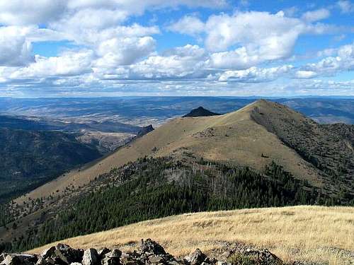
North Ridge of Fields Peak
Fields Peak - 7362 ft
Moore Mountain - 7060 ft
Moon Mountain - 7043 ft
Ingle Mountain - 6771 ft

Elkhorn Mountains
The northeasternmost of the Blue Mountains (with the exception of the excluded Wallowas), the Elkhorns are a range of high elevation peaks laying between the North Fork of the John Day River and Baker Valley. Baker City and Sumpter are excellent jumping-off points for access into the Elkhorn Mountains.
Rock Creek Butte
Rock Creek Butte - 9106 ft
Elkhorn Peak - 8931 ft
Van Patten Butte - 8929 ft
Angell Peak - 8646 ft
Lees Peak - 8626 ft
Lakes Lookout - 8522 ft
Peak 8525 - 8525 ft
Gunsight Mountain - 8342 ft
Mount Ireland - 8321 ft

Greenhorn Mountains
The Greenhorn Mountains either named for the Green-horn on Vinegar Hill, or Greenhorn Miners are located between the Middle Fork of the John Day River and the North Fork of the John Day River. Best access to the Greenhorns is via the Middle Fork Road which originates 1 mile north of Austin Junction. This road runs along the south side of the Greenhorn Mountains.
Vinegar Hill
Vinegar Hill - 8131 ft
The Greenhorn - 7804 ft
Indian Rock - 7700 ft

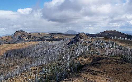
Monument Rock Wilderness / Southeast Blue Mountains
Named after the summit cairn on Monument Rock built by pioneer sheepherders, the Monument Rock Wilderness lies southwest of remote Unity in Eastern Oregon. This wilderness includes the highpoints of Table Rock, Bullrun Rock, and Monument Rock. Further east and southeast are Ironside Mountain and Castle Rock.
Bullrun Rock
Ironside Mountain - 7811 ft
Monument Rock Wilderness Peaks - 7879 ft
Castle Rock - 6837 ft

Ochoco Mountains
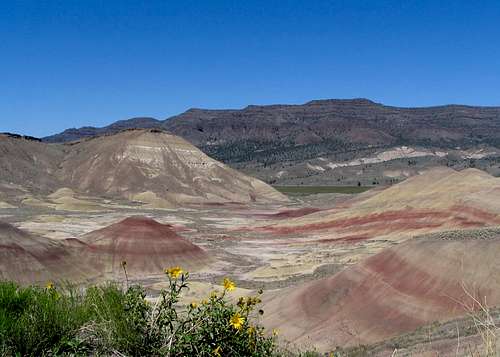
Covering the largest area of the Blue Mountains is the sprawling butte lands of the Ochoco Mountains. Located between the Aldrich Mountains and Central Oregon, the Ochocos vary from the taller mountains such as Lookout Mountain in the west, to the John Day Fossil Beds and Sutton Mountain in the North, to desert in the southeast near Burns. Although not nearly as tall as the other Blue Mountain Ranges, the Ochocos posses a variety of mountain types not found in its taller sibling ranges. Access to the Ochocos can be found at many points between Dayville in the east and Prineville in the west.
Sutton Mountain
Snow Mountain - 7183 ft
Lookout Mountain - 6926 ft
Spanish Peak - 6871 ft
Sutton Mountain - 4694 ft

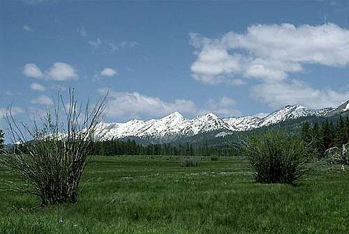
Strawberry Mountains
Named after wild strawberries found growing on Strawberry Mountain, this range of highly glaciated peaks borders the south side of the John Day Valley on its east end. There are many roads into the Strawberry Mountains, most of which head south off of Highway 26 between John Day and Prairie City.
Strawberry Lake-High Lake Rim
Strawberry Mountain - 9038 ft
Graham Mountain - 8570 ft
Indian Spring Butte - 8529 ft
Slide Mountain - 8521 ft
Canyon Mountain - 7999 ft
Indian Creek Butte - 7886 ft
Baldy Mountain - 7358 ft

North John Day Valley Range
A range of shorter peaks and hills bordering the north side of the John Day Valley, this undefined range is split by Highway 395 running north of Mt Vernon. Its highpoint, Dixie Butte lies at its east end, while the Picture Gorge lies on its west end. Hidden within this range is popular Magone Lake, formed by landslide sometime in the past there is a fully developed campground here with lots of opportunities for swimming and fishing, a great place to relax. **note** In some instances Dixie Butte is listed as part of the Greenhorns Mountain Range.
Dixie Butte
Dixie Butte - 7592 ft
Nipple Butte - 6156 ft
USDA / Forest Service Links
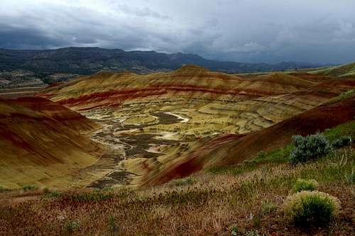
The Painted Hills
Malheur National Forest
Ochoco National Forest
Wallowa-Whitman National Forest
Weather
Prineville
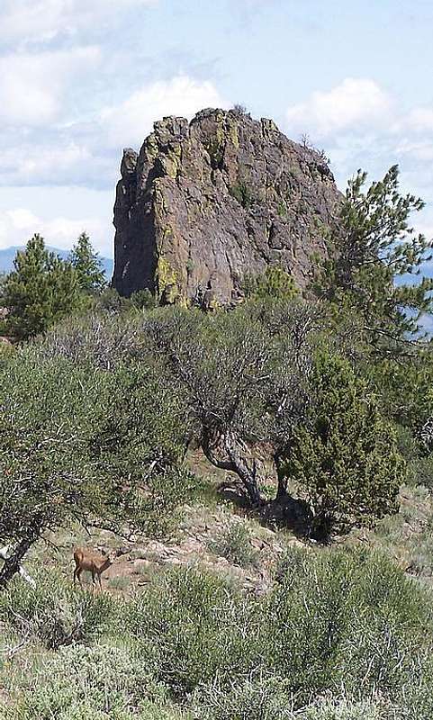
Castle Rock sub-pinnacle
John Day
Baker City
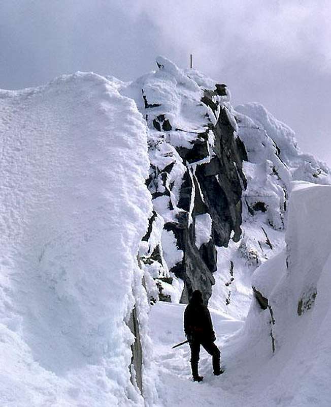
Lakes Lookout Summit
LaGrande
Banners
Crook County Highpoint:
Highpoints of the Aldrich Mountains
Highpoints of the Strawberry Mountains
Rock Creek Butte highpoint of the Elkhorn Mountains