|
|
Mountain/Rock |
|---|---|
|
|
44.32444°N / 118.28379°W |
|
|
Baker |
|
|
Hiking |
|
|
Spring, Summer, Fall |
|
|
7879 ft / 2402 m |
|
|
Overview
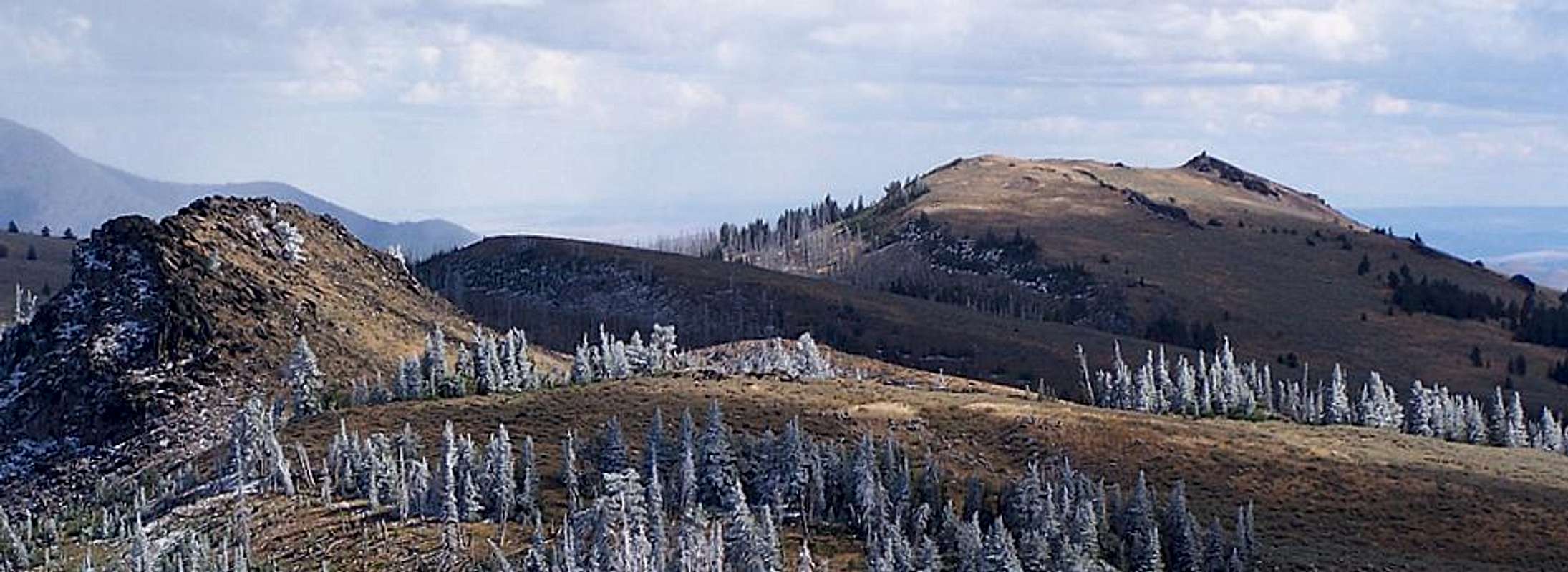
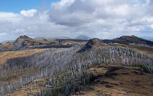
Bullrun Rock, Monument Rock and Table Rock are three glacially carved peaks of similar elevation and close proximity at the headwaters of the Malheur River. Like points on a crown, each rocky summit lies atop the Monument Rock Wilderness in a high elevation alpine meadow that has scattered Douglas and Subalpine Fir spread across it. In the midst of these three peaks are several smaller rockpiles that offer some entertaining bouldering and rock climbing opportunities. Although lacking the elevation and prominence of nearby mountains, this is one of the more enjoyable areas to explore in the Southern Blue Mountains and is scarcely visited lending to a true feeling of isolation. In the summer of 2002 a lightning strike ignited a forest fire that burned over 25k acres along the northern ridge of the Monument Rock Wilderness. Although a fairly large forest fire burning down many trees around the wilderness, the view in this area was barely affected.Below; Bullrun Rock

The highest peak affording the best view is 7879 foot Bullrun Rock at the head of Bullrun Mountain. Access to Bullrun Rock is a steep but short climb up its southwest face to a narrow summit ridge and a 150 foot sheer cliff on the opposite side of the rock. To the southeast is a good view of Ironside Mountain's blackened summit cone and the sagebrush desert beyond. Bullrun Rock is a two mile hike across the summit area meadow following a faint sometimes disappearing trail. As mentioned below Bullrun Rock can also be reached from a trail originating at Bullrun Creek 2500 feet below to the north.
Below; Table Rock

The next highest point is Table Rock at 7815 feet. The westernmost of the three peaks is the location of an active fire lookout manned from the beginning of summer until snowfall drives out L.O. personnel in early fall. You can drive to the summit of this rock which lays just above the trailhead for the other two peaks. From the lookout you have a great view west across Glacier Mountain and into the Strawberry Mountains. To the northeast 3000 feet below is the small town of Unity; which thirty years ago was a thriving logging community with active sawmill. With a population slightly over 100 now, Unity is merely a ranching community that claims to be the gateway to the Monument Rock Wilderness. 200 feet below Table Rock is the Bullrun Rock trailhead.
Below at right; Monument Rock

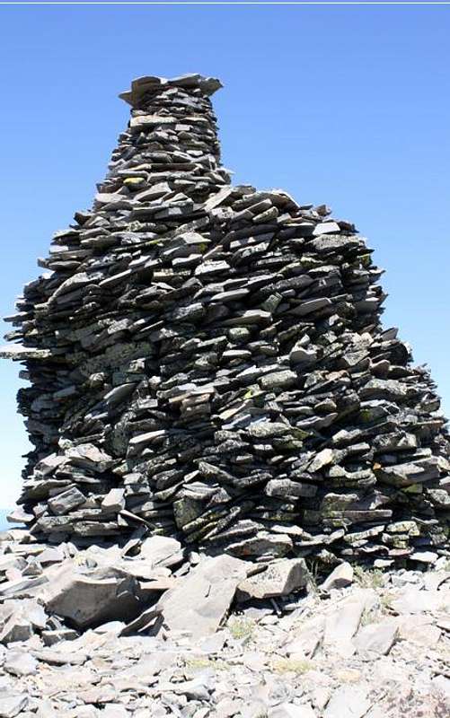
To the southeast rises 7738 foot high Monument Rock; the location of the wilderness' namesake rock cairn. Nearly ten feet in height and over 4 feet in diameter, this massive rock structure is visible from several miles away. The Grant County Chamber of Commerce website suggests that the cairn on Monument Rock was erected by pioneer era sheepherders. If you make the hike out to Monument Rock expect to see a curious chipmunk or two watching you from the depths of the rocky artifact. Monument Rock is a short 1 mile bushwhack from Bullrun Rock, and is most easily reached after summiting that peak via trail. Although no trail exists you will be travelling through an open alpine meadow so routefinding is easy.
Getting There
From Prairie City turn south onto South Bridge Street and remain on this road which will turn into County Road 62. Follow CR62 up the John Day Valley roughly 8.5 miles to NFD 13 on the east side of the road which travels up Deardorff Creek. Follow paved NFD 13 for twelve miles up and between Baldy Mountain and Lookout Mountain where you will see NFD 1370 on the left, a two lane gravel road travelling east. This road leads all the way to Table Rock lookout approximately 10.5 miles from the turnoff. The roads here are well labeled along the way to Table Rock L.O.The Monument Rock Wilderness can also be accessed from Unity via the South Fork of the Burnt River Road-Bullrun Road. There are several different approaches from this direction including the Bullrun Mountain route which gains 2500 feet from Bullrun Creek to Bullrun Rock summit. From Unity travel 1 mile west on South Fork Burnt River Road and turn south onto Bullrun Road which leads up into Bullrun Creek and the trailhead roughly 4 miles ahead. At four miles in length this route could be a very enjoyable snowshoe trip in winter months when access via the L.O. road is impossible.
Red Tape
These three peaks lay in the Monument Rock Wilderness so obey posted Wilderness rules with regards to campfires and off road travel. A Northwest Forest Pass is not required.Camping
There is an outhouse at the Elk Flat Spring hunters camp which is 4 miles from the Table Rock L.O. alongside NFD 1370. This campsite is merely a clearing with a few fire rings, but offers the only real camping opportunity within 10 miles of the Monument Rock Wilderness trailhead. There is a spring here that may run dry late in the summer. The nearest reliable source of water is the North Fork of the Malheur River which you cross shortly after turning off of NFD 13 onto NFD 1370. Although not a campground, there are several spots to camp alongside this beautiful high elevation river where NFD 1370 crosses it.To the north of the Monument Rock Wilderness is Unity Lake Campground a little more than 4 miles north of Unity on Highway 245. Unity Lake is a moderate sized reservoir that is popular with fishing and boating enthusiasts. As such the campground is developed and clean.
When to Hike
As long as the roads are open these peaks can be climbed anytime of year as its a short jaunt from car to each summit. With that in mind, snow and mud will most likely make roads impassable from mid October to early June. Fall and winter months means hunters are active in the area, dress accordingly.


