|
|
Mountain/Rock |
|---|---|
|
|
44.30013°N / 118.62822°W |
|
|
Grant |
|
|
Hiking |
|
|
Summer, Fall |
|
|
8570 ft / 2612 m |
|
|
Overview
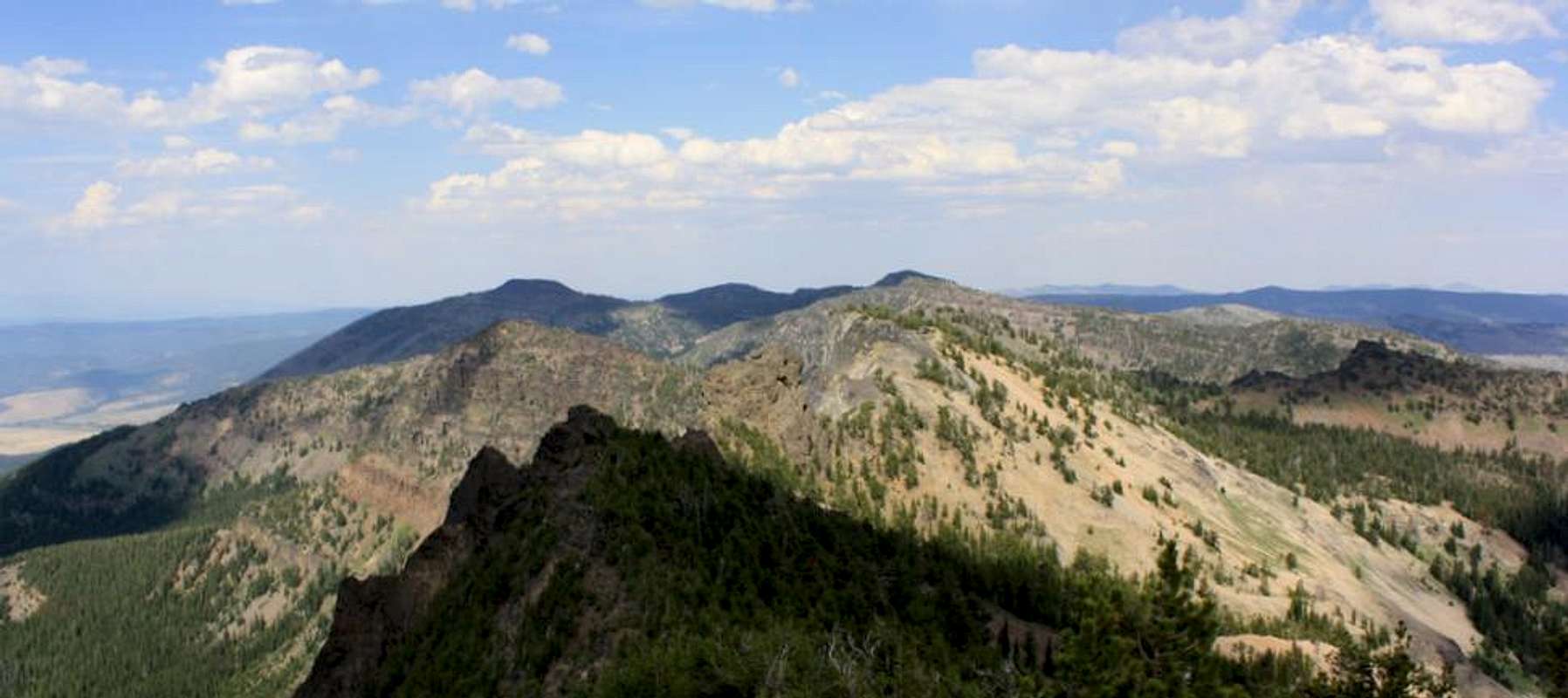
Graham Mountain; the second highest of the Strawberry Mountains lies between Slide Mountain and Kimport Ridge directly east of Strawberry Mountain. This relatively obscure peak with 820 feet of prominence is hidden behind Slide Mountain and is not as readily visible from the John Day Valley as its nearby siblings. As such, this mountain is rarely hiked and no trail exists to the summit. Whichever route you decide to take, like nearby Slide Mountain expect a full day of hiking to make the roundtrip to the summit and back to the trailhead. Reaching the summit can be precarious, as steep cliffs and talus protect the summit block. Be mindful of the loose rock and falling when making the final ascent up Graham Mountain as you are literally in the middle of nowhere.The canyons to the southeast and southwest of Graham Mountain have been badly burned by forest fires. With this being the case hiking into Graham Mountain using the Slide Mountain route would be the most scenic and undoubtedly the coolest as it runs under a dense forest canopy. Approaching from Logan Valley in the south will take you through several miles of burned out wasteland, undoubtedly much hotter and drier in Eastern Oregon's summer months. A third potential route would be to summit from Road's End near Indian Spring Butte.
On a clear day from Graham Mountain you can see south to the Steens Mountains, north to the Elkhorns, and east to Ironside Mountain. Like Canyon Mountain, there is a wooden marker posted on the summit, however at some point in the past it has been knocked down and lies next to the summit rock now with supporting wire strewn all about it.
Getting There
In Prairie City which is 13 miles east of John Day, turn south off of Highway 26 onto South Bridge Street. Follow South Bridge Street until you see the turnoff on the right for Strawberry Campground / Wilderness which is Bridge Street / county road 60. Follow this road 11 miles alongside Strawberry Creek to its termination at the Strawberry Campground.If hiking in from the south again turn south onto South Bridge Street in Prairie City, however remain on this road which will turn into County Road 62 and follow it alongside the John Day River roughly 20 miles to Summit Prairie where you will turn right onto Forest Service Road 16. You will remain on FSR 16 until reaching Logan Valley where you will turn north onto FSR 1648 which skirts around the North edge of the valley. Follow FSR 1648 roughly 3-4 miles until you see FSR 021 on the right (north side of the road, shortly after crossing Big Creek). Take this road 1.5 miles to a split where you will then take a left onto FSR 039 which terminates at the Meadow Fork Big Creek Trail.
Red Tape
At the Strawberry Campground no parking fee is required for dayhikers, a fee is required for overnight parking or camping however. The Malheur National Forest website lists current restrictions for the area.Camping
Campsites are available for a fee at the Strawberry Campground at the trailhead for Strawberry Lake. Strawberry Campground has running water, tent sites, and trailer sites. Strawberry Lake, and Slide Lake, both in the vicinity of the Slide Mountain route are beautiful high elevation lakes with fishing potential and plentiful camping locations.If hiking into Graham Mountain from the south, Big Creek Campground in Logan Valley offers lies in a scenic alpine valley south of Strawberry Mountain alongside a rippling stream. There are mountain bike trails here, and a variety of wildlife can be seen from designated viewing areas in the valley.
When to Climb
Mid June to Mid September when snow is absent from the wilderness. Be sure to take water if approaching from the south, if approaching from the Slide Mountain route plentiful water is available. Wear bright colors in the fall as this is a popular hunting area.Below, the High Lake Rim with Graham Mountain seen behind it


