
-
 3529 Hits
-
 75.81% Score
-
 6 Votes
|
|
Route |
|---|---|
|
|
37.90530°N / 107.5564°W |
|
|
Ice Climbing |
|
|
Winter |
|
|
Half a day |
|
|
WI3/4 |
|
|
Overview
Burn's Gulch Ice
Ice Climber Hut Eureka
Most people when they come to Eureka are seeking to climb Colorado classic and multi pitch ice climbs such as Whorehouse Hoses or Stairway to Heaven and do not bother with a long approach for only one pitch long ice fall. Despite writing this, I enjoyed the outing and got also some aerobic work out while breaking the trail through the snow.
Jack Roberts in his Colorado Ice provides only a very brief description: 2 lines only. "Burns Gulch is directly across the road (east) from the previous four climbs. It is very obvious near a small canyon." He was not exactly accurate with his description, the previous four climbs (Just Another Gully Climb, Tempered by Fire, Another Frozen Delight, another Iced Chimney) are little lower on the road.
![Sunrise, Eureka]()
Sunrise, Eureka![Approach to Burns Gulch]()
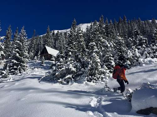
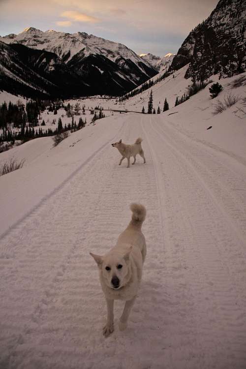
Approach to Burns GulchFrom the Main Street in Silverton, continue onto good dirt road - Hwy 110 - which is snowplowed for the first 9 miles. As you pass through Silverton turn right onto 110 = county road 2, if you go straight uphill on 110, it will take you to Silverton Ski area. Drive past Howardville through a valley, past Minnie Gulch, all the way to Eureka (9miles). Park at the large parking lot on the west side of the road. There is a dry toilet (hard to access in the winter since the door gets buried in the snow).
Hike up on the snow filled road = county Road 2 = above the Eureka Lodge (Jack Robert's in his Colorado Ice climbs calls by its old name Outward Bound Hotel). Continue up the road, there is usually a trail by climbers accessing climbs off this road. You will be passing on the west side (left) First Gully WI3, Second Gully WI3, Goldrush WI4/5, Fat City WI4/5 - higher up above the road, Just Another Gully Climb WI3 and Tempered by Fire WI4/5. On the east side (your right) is a deep creek Animas River and across are classic climbs as Highway to Hell and Stairway to Heaven.
Mountain Project provides more information.
Elevation in Eureka: 9,862 feet (=3,006 meters)
Elevation at Burns Gulch: 10,436 feet
Eureka is an abandoned mining community nine miles northeast of Silverton on Hwy. 110. Highway 110 is a bit misnomer, as it is an unpaved road that connects Silverton to Lake City via Cinnamon Pass. The first section of the road is well maintained and accessible by low clearance 2WD vehicles. The road is kept open even in the winter, and there is a nice cross country ski trail next to it leading back to Silverton.
The climb itself is relatively safe from avalanche danger, but the road is not and you will have to cross several avalanche paths - check Northern San Juan Avalanche Forecast prior going out.
The climb itself is relatively safe from avalanche danger, but the road is not and you will have to cross several avalanche paths - check Northern San Juan Avalanche Forecast prior going out.
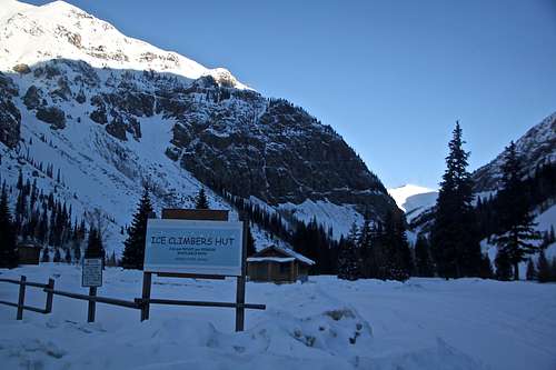
Climber's Hut - if you need to spent a night, there is a climber's hut in Eureka - very simple hut, one room with beds (no mattress), table and chairs. There is a stove and wood to make fire. I think there is a jar where you can (and should) leave money for lodging.
Getting There
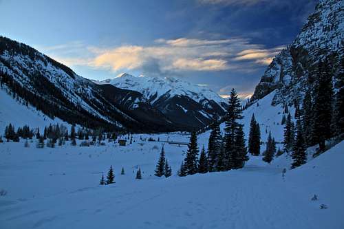
Sunrise, Eureka
Approach to Burns Gulch
Hike up on the snow filled road = county Road 2 = above the Eureka Lodge (Jack Robert's in his Colorado Ice climbs calls by its old name Outward Bound Hotel). Continue up the road, there is usually a trail by climbers accessing climbs off this road. You will be passing on the west side (left) First Gully WI3, Second Gully WI3, Goldrush WI4/5, Fat City WI4/5 - higher up above the road, Just Another Gully Climb WI3 and Tempered by Fire WI4/5. On the east side (your right) is a deep creek Animas River and across are classic climbs as Highway to Hell and Stairway to Heaven.
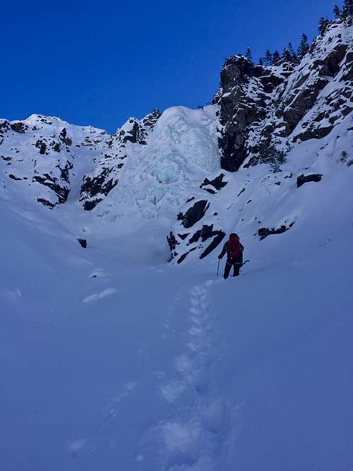
Burns Gulch is located on the east side (right) higher up the road. We crossed the bridge (private property) and tried to avoid mining area as much as possible by moving north above the river into the gully leading to the base of the climb. We passed a small cabin (see photo). The climb is visible from the road if you are higher up (we crossed the river before we could spot it)
Approach Hike: ~ 1 hr, depending on how much snow is on the route and above off trail (about 2.5 miles above Eureka)
Route Description
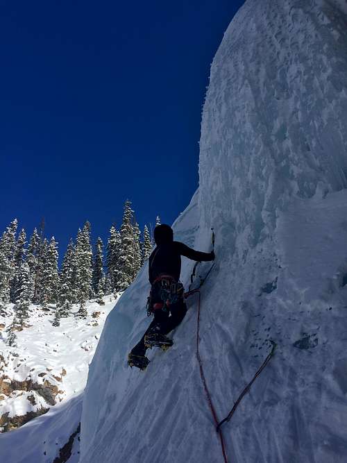
Burns Gulch is a large wide climb with many variations. Choose your way up this ice fall based on your comfort level. The left side offering some WI3 climbing and the right side is more steep with WI4 sections.There is a small flat platform (a few meters long and wide) with a tree, there are anchors on tree (good condition in January 2018). Pay attention to ice fall from the climber above.
We used 70 meter rope and were fine with climbing on the right side and having belayer always away from the climber, so we did not get hit by ice. There was no problem with rappelling with one rope since the lower section of ice is low angled.
Length: 40 meters on the left, 30 meters on the right side
There is no cell phone reception anywhere in Eureka. It is a good idea to have with your some kind of emergency safety device (I carry with me SPOT).
 Approach to 1st and 2nd Gully, and Burns Gulch Ice | 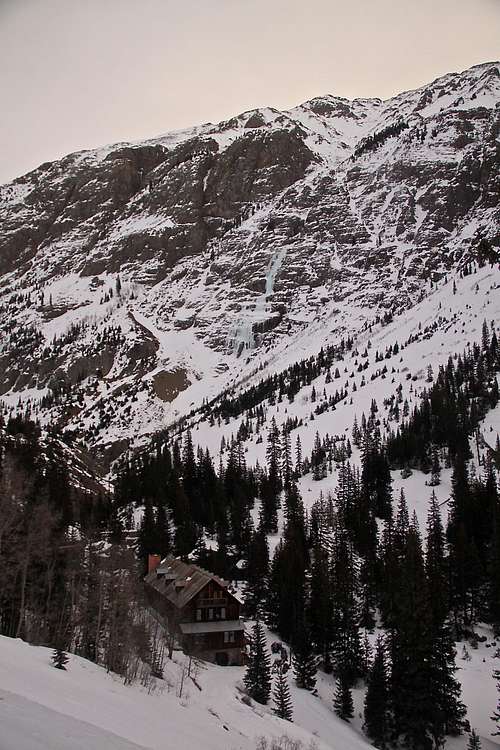 Eureka Lodge |
 Burns Gulch Ice | 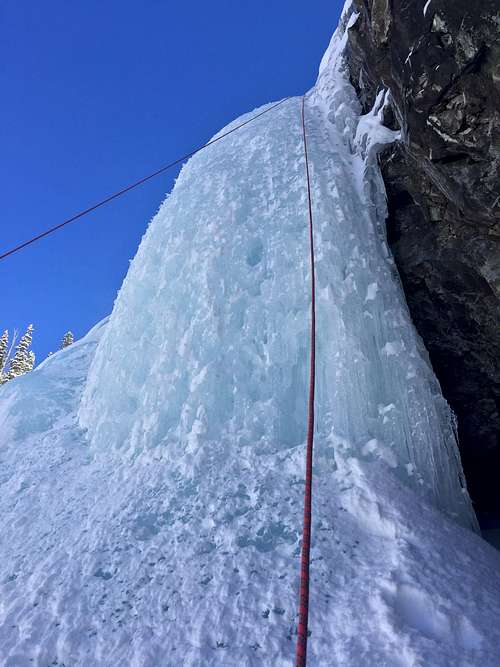 Burns Gulch |
Essential Gear
- Personal climbing gear: boots, crampons, harness, helmet, ice tools, belay device
- One 70 meter rope sufficient
- Rack of ice screws and slings
- Material to set up v-threads for emergency and practice (there are anchors/slings around a tree above the icefall)
- Trekking poles for the approach
- Hot beverage
- Extra gloves, ? hand warmers