
|
|
Mountain/Rock |
|---|---|
|
|
46.39969°N / 13.86050°E |
|
|
7851 ft / 2393 m |
|
|
Overview
Geographical structure: Eastern Alps > Julian Alps > Triglav group.Cmir is the nice mountain on the start of Vrata valley. Many mountaineers think that Cmir is Triglav. Because when you look from Mojstrana or from road to Kranjska Gora is the first high mountain and it is in front of Triglav.
In English Cmir is called Tsmeer.
Cmir is located on the NE side of Triglav. It is in the middle of Triglav group and it is one of the most important mountains in this section. It is above Vrata valley on the NW side and its faces are very huge and high. On the E and SE sides there is the secret valley called Za Cmirom. It is one of most popular areas for tour skiing. Cmir is connected on the SW side over SW ridge with another powerful mountain Begunjski vrh, 2461m. On the north faces of these two mountains is famous feratta on Triglav called Tominskova pot. Theirs north faces are sequel of Triglav north face.
Cmir is constituted of the main summit and in the NE ridge is another mountain called Nad Kuhinjo spica, 2266m, which has beautiful north face. This face is very popular by climbers and has many visitors.
 ..
.. ..
.. ..
.. .
.The photos of Cmir on other pages.
Cmir is popular of its NW face, nice secured marked route over SW ridge and tour skiing through valley Za Cmirom.
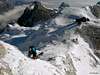
The valley Za Cmirom is located in the middle of Triglav group and it is in Summer very lonely. But the other story is in Winter when you find there many tour skiers. You can ski there to beginning of June.
 |  |  |  |  |
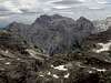
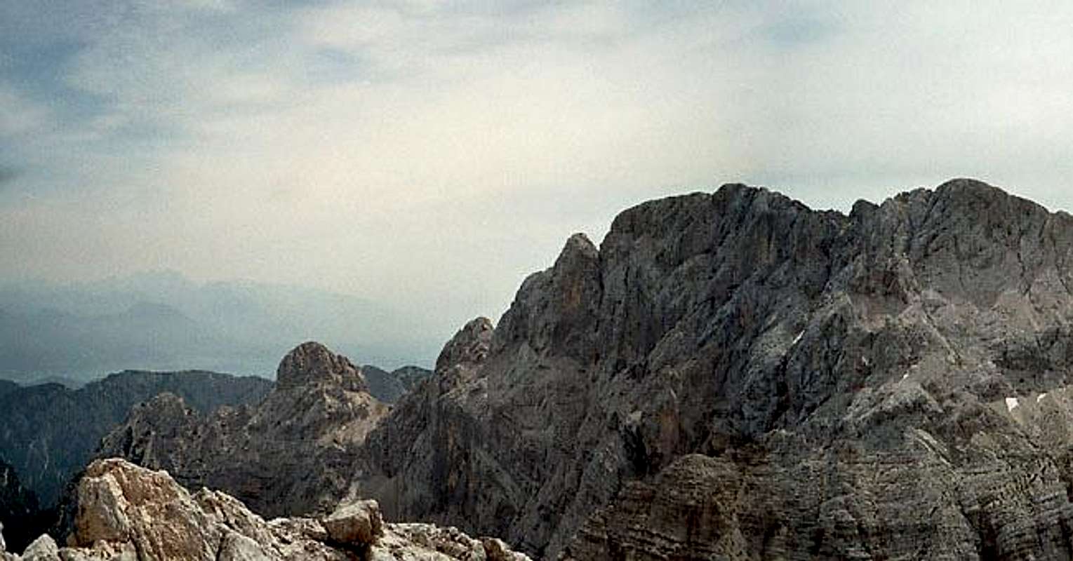
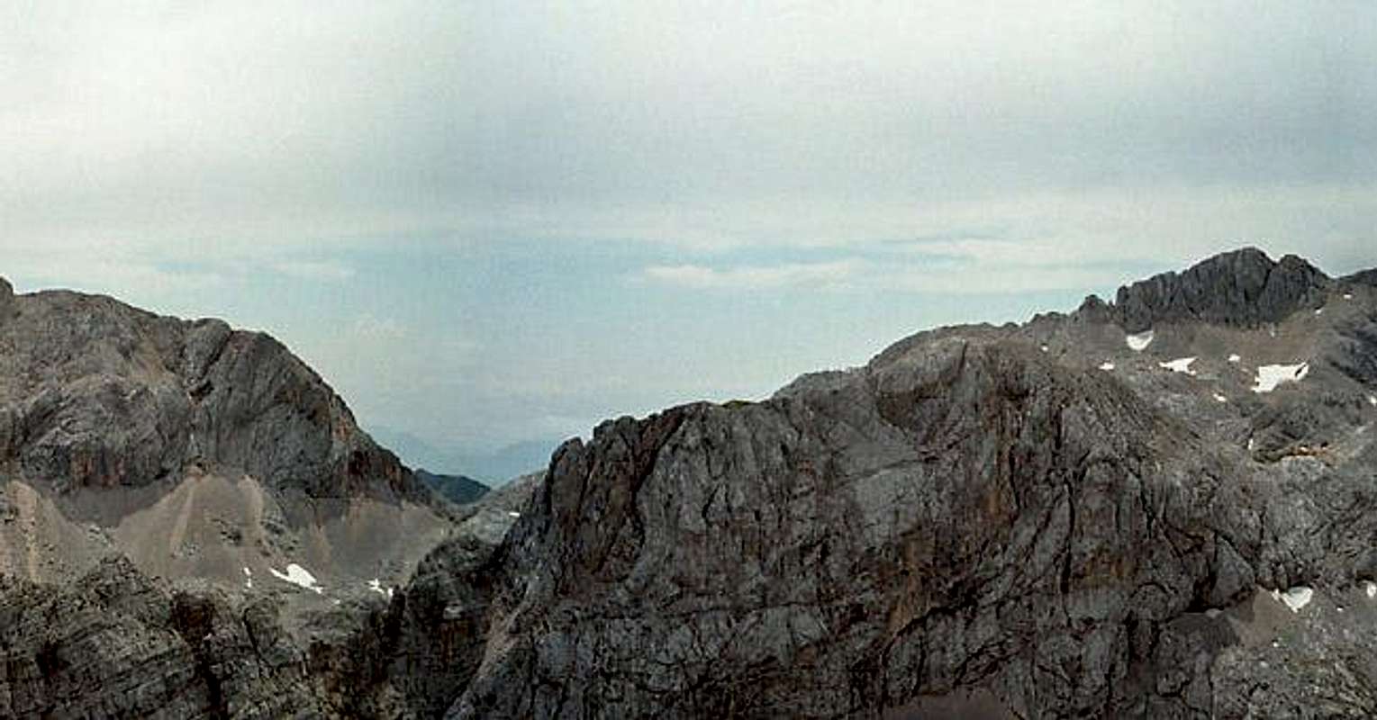
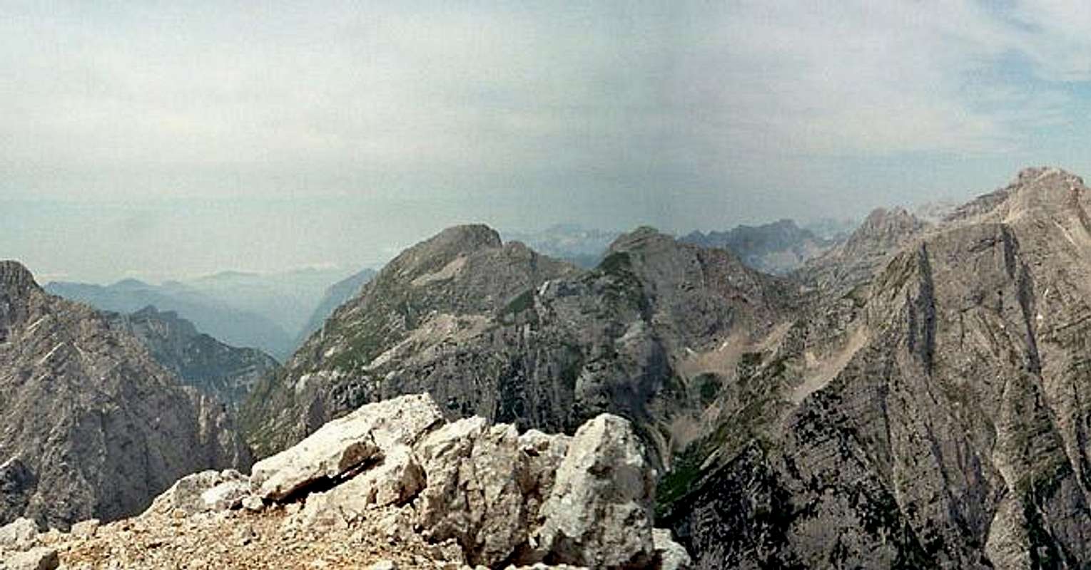
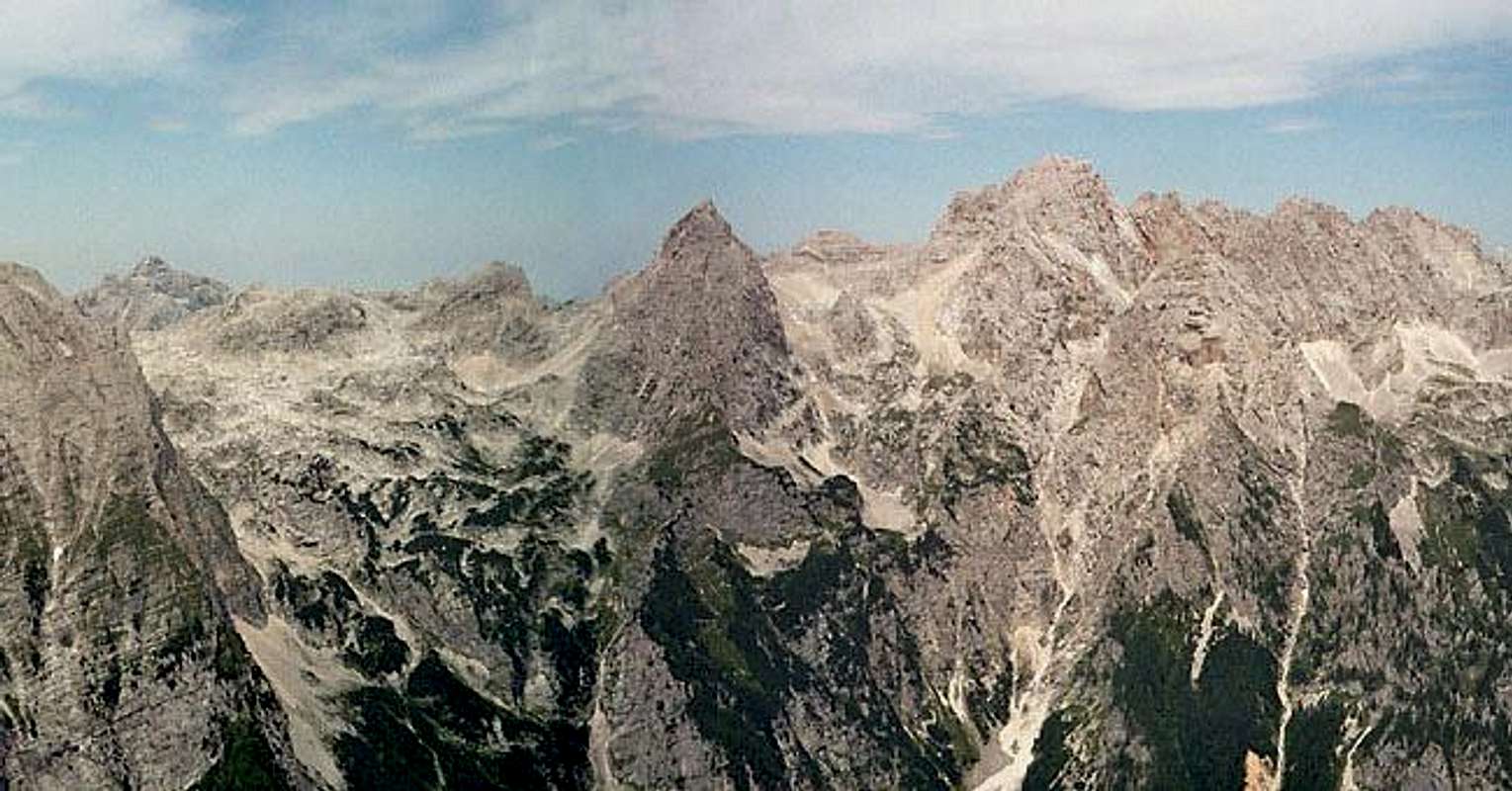
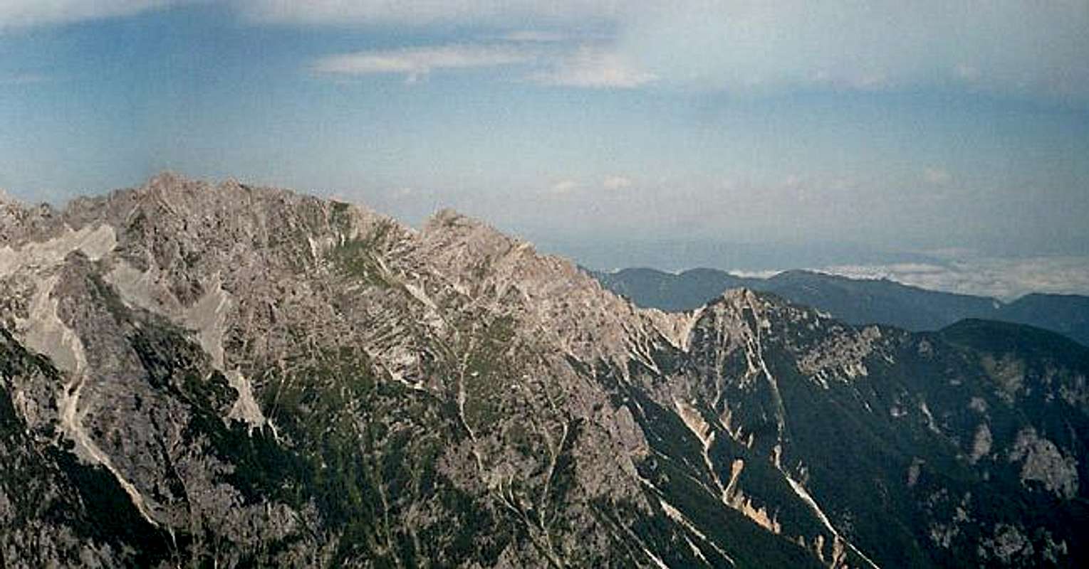
Summit Panorama
MacesnovecLuknja pecRjavinaVrbanova spicaRzBegunjski vrhTriglavLuknja PassPihavecBovški gamsovecRazorStenarPrisojnikDolkova spicaSkrlaticaRokaviVeliki OltarDovski krizSkrnataricaKukova spicaVrtasko slemeVrtaski vrh
 |  |  |  |  |  |
Getting There
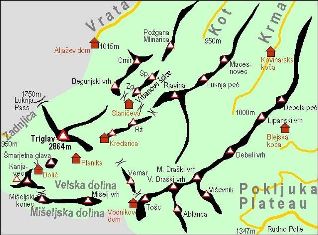
The map of Triglav group.
The heart of the region is Kranjska Gora resort town, 84 kilometers from the Slovenian capital Ljubljana. But you must drive from Kranjska Gora to Mojstrana and then to Vrata valley, which is the main starting point for approach on Cmir.
Vrata valley
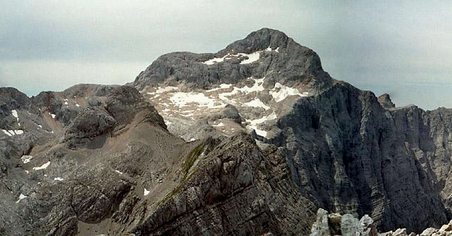
Vrata (Door) is probably the most beautiful alpine valley in Slovenia. It is glacial valley, beginning bellow mighty Triglav and it’s gigantic north wall, spreading towards northeast till Mojstrana village and upper Savska Dolina valley. Powerful creek Triglavska Bistrica runs through it, which source is just bellow Triglav’s Face. Sides of the Vrata valley are very steep and high. Two of the Slovenia’s highest peaks are rising above it. On the north side is Skrlatica (2740m) while on the south is Triglav (2864m) and many other above 2500m. View on Triglav’s 1200m high and few kilometers wide north face is one of the most impressive in whole of the Alps!
Getting There
By Plane:
If you want to reach Ljubljana by plane check a timetable on the site of Adria Airways, a national airline.
By Bus:
From Ljubljana buses depart towards Kranjska Gora every 60 minutes.
By Train:
From Ljubljana trains depart in Kranjska Gora direction quite often but only up to Jesenice town. There you have to change to bus, which come from Ljubljana anyway.
By Car:
From Ljubljana 84km.
From central Europe via Villach, Austria: Via Karavanke tunnel (around 40km) or Korensko Sedlo pass (around 30km).
From western Europe via Udine, Italy: exit Udine – Villach highway in Tarvisio. Tarvisio – Kranjska Gora – Gozd Martuljek 25km.
Maps:
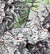 <--- The map of the nearness of Cmir. Cmir is on the right side of the map. (only the letter C is seen)
Routes Overview
Cmir is approachable over only one marked route over SW ridge from Dom Valentina Stanica (hut). The description of route you can read here.Here are named some climbing route in faces of Cmir.
Here is also popular alpinist skiing route on NW face of Cmir.
 |  |  |  |
Red Tape
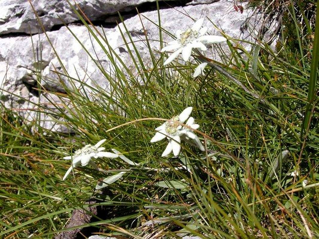
An Alpine edelweiss is very often in this lonely area.
No limitations but Cmir is located in the Triglavski Narodni park so you must be kind to the nature and other beauties.
When To Climb
The best time for reach the Cmir over the normal marked route over SW ridge is Spring, Summer and Autumn.For climbing in NW face is the best time July and August.
For tour skiing through the valley Za Cmirom is best time from March to May.
 |  |
Mountain Huts
Triglavski Dom na Kredarici (2515m) (Triglav Hut on Kredarica) is largest and highest lying hut in Slovenia. It is placed just above the pass between Kredarica (2540m) and Triglav (2864m). It was built by Slovenian mountaineering society in 1896 behind the idea of Jakob Aljaz. Since then it was resized many times. Today’s look is from 1984. In 1992 chapel was erected next to the hut. Every hour its bell rings. Later another object was erected next to the hut. It is open during whole year because it is also a meteorological station. In winter season it is partially supplied but meteorologists always prepare some hot meal and tea. It has 300 beds, 5 dining rooms and is still overcrowded in summer. It also has cold water, power generator and GSM public phone. Due to open spaces around and high lying position, view from the hut is extraordinary. Huge Triglav only obscures it towards west.
Dom Valentina Stanica pod Triglavom (2332m) (Valentin Stanic Hut Below Triglav) stands on the small head at the edge of Kotel basin and above steeply falling Kot valley. Beside Planika and Kredarica it is third ‘Triglav’ hut. First hut on this location was built in 1887 by German-Austrian Mountain Society. In 1961 new and enlarged hut was reopened. Hut has 136 beds, cold water, power generator etc. Hut also has beautiful view towards Triglav, which from here shows its very powerful side. Hut is open from beginning of July till the end of September.
ALJAZEV DOM hut (1015m) is placed in Vrata valley. It is accessible by car, 12km from Mojstrana village, which lies on the main road from Ljubljana to Kranjska Gora resort. It was opened in 1896. In 1909. the hut was destroyed by avalanche. New hut was opened the next year where it stands today. It has 150 beds and is open from beginning of May till the end of October. Winter room has 8 beds. From the hut view is beautiful on the peaks around the valley, which rise wildly above it and especially on Triglav and its North face.
Camping
Camping inside the Triglav National Park is forbidden. Beside the mountain huts there are plenty of hotels and private apartments in the towns and villages, which surround the area. Here are few links where you can find info on accommodations closer and further away:Kranjska Gora
Mojstrana
Bled
Mountain Conditions
Mountain conditions in Julian Alps are well known, thanks to Kredarica (2515m) hut and meteo station, which is below the Triglav.You can observe current conditions and forecast for Kredarica on the Wunderground meteo site. Here is direct link to Wunderground - Kredarica page.
Some weather informatin can also be found here.
Bor - Oct 12, 2005 3:27 pm - Hasn't voted
Untitled CommentHehe! :-) great work! The name of Vrbanova spika is Vrbanove spice and already has a page on SP.
Thanks!
Gangolf Haub - Oct 12, 2005 3:37 pm - Voted 10/10
Untitled CommentHey it's your page - I'm sure you can figure out how it works :-)
Vid Pogachnik - Oct 12, 2005 3:53 pm - Voted 10/10
Untitled CommentNice pan, Gangolf! Thanks for adding it!
Hey Bor, I know you'll read this - have you noticed that Josh added the Google maps feature, the program which D Smith created, on each SummitPost page. On the menu left now you have also the 'INTERACTIVE MAP' choice. This really means that summit coordinates must be precise. And we still have a mess in Julian Alps and around. See these maps and correct coordinates of 'your' mountains, please. (And you, Gangolf, don't read this! Because being such a workoholic you might do this instead of Bor.)
Cheers!
Velebit - Oct 12, 2005 7:37 pm - Voted 10/10
Untitled CommentYes, great panorama! Vrabona Spika -> very funny :-)
Thanks Vid for pointing this out (google earth map added to each page)! I didn't notice it till you mentioned. That's great! And I don't have to learn how to make those initial maps :-)
I actually used, as I told you, Google Earth to determine exact coordinates of Velebit peaks and areas and added coordinates also to the top of each peak section on each page so anyone can just simply copy/paste those values into 'Fly to' option and software will take you exactly there. That is even better than this generated map. It is pin point precise.
I used this method: zoomed to each peak very closely, added new placemark to the peak, than leveled to horizontal and circled around a peak to be sure I placed it on the very highest point (also checked altitude data), then just left click on the placemark and went to edit and from there copied exact latitude and longitude.
I would love to do that for Julians too but unfortunately many parts are under clouds so that is not possible. Any solutions Vid? Anyway I guess my coordinates are quite precise for Julians because I used maps to calculate them.
Vid Pogachnik - Oct 13, 2005 8:24 am - Voted 10/10
Untitled CommentHi, Sasa!
Yes, having now Google maps on SP is great. I don't have any solution for Julian Alps. True, they are mostly under clouds. But anyway, the majority of Earth is on Google still in low resolution. Some areas - for example our Savudrija peninsula and your Piran bay (ha, ha) are already in high resolution. I can't wait to see all Alps in high resolution.
Your method to determine coordinates is fine, but, hm, complicated. I don't use for that the 3D maps, but simply go on maps we have here on SP, zoom in and double clck where I think the summit is.
Gangolf Haub - Oct 11, 2005 3:38 pm - Voted 10/10
Untitled CommentThe good thing about elf powers is that you can mess with other people's pages :-)
As discussed here's your summit panorama. Please check the names - they are very hard to learn! Also check the caption - I think there are more groups than two but you know better than I do.
I have seen more summits than you labelled - can we have these too?
Bor - Oct 12, 2005 3:27 pm - Hasn't voted
Untitled CommentHehe! :-) great work! The name of Vrbanova spika is Vrbanove spice and already has a page on SP.
Thanks!
Gangolf Haub - Oct 12, 2005 3:37 pm - Voted 10/10
Untitled CommentHey it's your page - I'm sure you can figure out how it works :-)
Vid Pogachnik - Oct 12, 2005 3:53 pm - Voted 10/10
Untitled CommentNice pan, Gangolf! Thanks for adding it!
Hey Bor, I know you'll read this - have you noticed that Josh added the Google maps feature, the program which D Smith created, on each SummitPost page. On the menu left now you have also the 'INTERACTIVE MAP' choice. This really means that summit coordinates must be precise. And we still have a mess in Julian Alps and around. See these maps and correct coordinates of 'your' mountains, please. (And you, Gangolf, don't read this! Because being such a workoholic you might do this instead of Bor.)
Cheers!
Velebit - Oct 12, 2005 7:37 pm - Voted 10/10
Untitled CommentYes, great panorama! Vrabona Spika -> very funny :-)
Thanks Vid for pointing this out (google earth map added to each page)! I didn't notice it till you mentioned. That's great! And I don't have to learn how to make those initial maps :-)
I actually used, as I told you, Google Earth to determine exact coordinates of Velebit peaks and areas and added coordinates also to the top of each peak section on each page so anyone can just simply copy/paste those values into 'Fly to' option and software will take you exactly there. That is even better than this generated map. It is pin point precise.
I used this method: zoomed to each peak very closely, added new placemark to the peak, than leveled to horizontal and circled around a peak to be sure I placed it on the very highest point (also checked altitude data), then just left click on the placemark and went to edit and from there copied exact latitude and longitude.
I would love to do that for Julians too but unfortunately many parts are under clouds so that is not possible. Any solutions Vid? Anyway I guess my coordinates are quite precise for Julians because I used maps to calculate them.
Vid Pogachnik - Oct 13, 2005 8:24 am - Voted 10/10
Untitled CommentHi, Sasa!
Yes, having now Google maps on SP is great. I don't have any solution for Julian Alps. True, they are mostly under clouds. But anyway, the majority of Earth is on Google still in low resolution. Some areas - for example our Savudrija peninsula and your Piran bay (ha, ha) are already in high resolution. I can't wait to see all Alps in high resolution.
Your method to determine coordinates is fine, but, hm, complicated. I don't use for that the 3D maps, but simply go on maps we have here on SP, zoom in and double clck where I think the summit is.