
|
|
Mountain/Rock |
|---|---|
|
|
36.23576°N / 112.38507°W |
|
|
Scrambling |
|
|
Spring, Fall, Winter |
|
|
4748 ft / 1447 m |
|
|
Overview
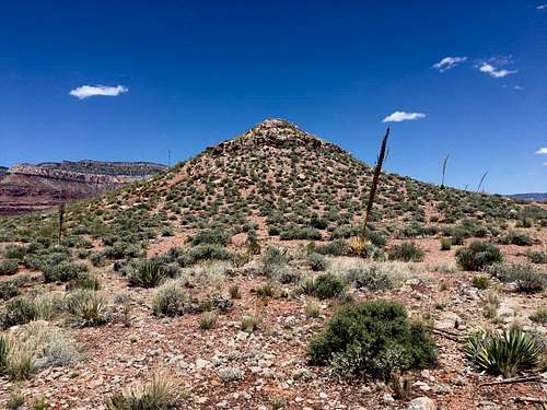
Fiske Butte is about the journey, not the destination. The small summit has at most 60' of prominence, and is really nothing more than a small bump in the canyon that someone happened to name. But don't let that discourage you. The hike out to the butte is a challenging, route-finding adventure: scrambling trail-less through multiple layers of sandstone cliffs to a perch right above the Colorado River, with views to the Walthenburg and Shinumo Rapids below. This is an intense Grand Canyon adventure to a summit that only sees about one party per year.
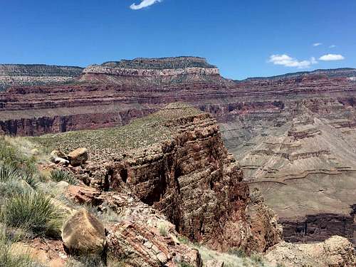
The tiny summit that is Fiske Butte.
Getting There
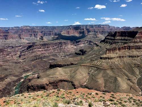
East from the summit
Route
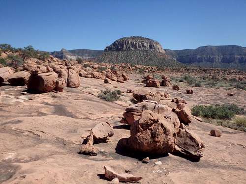
The Rock Garden on the approach
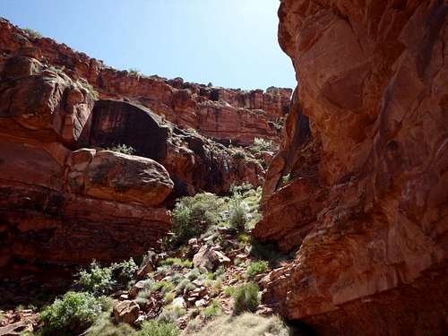
Approach: From the South Bass Trailhead, hike about 2 miles down switchbacks through the Coconino to reach the Darwin Plateau. Mount Huethawali will dominate the view as you descend. Once on the plateau, you'll need to continue slightly east to avoid some of the Redwall cliffs formed by a shallow drainage off the plateau dropping to the west. Leave the trail once you spot a good line through the Redwall (shouldn't be more than easy class 2) and traverse Huethawali's southern and western slopes, eventually reaching Spencer Terrace. The cross country gets easier at Spencer Terrace, and you can find nice smooth slabs by cheating to the west. About halfway across the Terrace, you'll pass 'The Rock Garden,' a collection of large sandstone boulders sprinkled across the slabs, looking like glacial erratics in the Sierras. Continue up and over a small rise to reach a Promontory and the start of the scrambling.
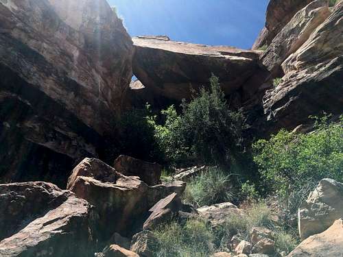
The top of the scrambling. Descent crack right of center.
The Route: The route is complex, confusing and definitely requires some patience and assumed backtracking. Here's a rought outline, YMMV: From the point farthest north on Spencer Terrace, hike southeast along the cliff edge about 20 yards to a cairned crack which drops through the first cliff band about 50'. Traverse the brushy ledges north to either a number of class 3-4 cracks that drop down to the next level or a large sandstone flake leaning up against the cliff with a bunch of small boulders wedged between that can be scrambled down. Descend the brushy slopes another 30-40' or so and look for a relatively smooth class 3 drainage slightly to the north to get yet another layer lower. From here there are two main options- continue traversing north and drop down several layers through some tougher class 3 cracks to the top of a broad, boulder strewn gully, or reverse course back to the south, using some easier class 2 lines to get to just above the final major cliff band. If staying south, traverse just above the cliff band back north where you'll meet up with the cairned route halfway down the broad gully at the crux of the climb.
Beneath the crux.
The crux: To descend the final series of cliffs, you'll need to drop underneath two massive boulders wedged together to form a large tunnel. Beta suggests this crux is class 3, although I suspect a few holds have broken loose since the original rating and I would personally put it more at class 4. There are at least 3 different openings you could try, although I found the easiest option to be to a smaller opening to the left of the main opening, which has some serious overhang. This opening has two small ledges partway down which are slanted a bit awkwardly. There are some footholds out of sight below, you'll kind of need to feel for them as you go. Some very careful stemming and ungraceful squirming should get you safely to the base. Another option is to try to use narrow slabs to the left of the boulders to descend next to them. There is a thin move that I bailed on given lack of handholds, but wouldn't be bad if you had a spot or a handline hanging from above. Once through the tunnel, continue down the gully down one or two more steps, then traverse the remaining distance north to the small anticlimactic (in terms of size, not views) summit.
Several entries in the summit register suggest that one or two parties have climbed it from the Tonto Trail 1500' below, but I don't know the logistics of that route.
This hike is entirely on NPS land, and technically a permit is required for any overnight use in the area of South Bass Trail including the trailhead, which has several nice campsites. That being said, this area is not frequently patrolled, and you could probably get away with camping there and not picking up a permit first- up to you if you'd like to risk it.
Crossing through the Havasupai Land is another issue. While most information online and even a sign at the gate suggests a $25 fee to pass through (which to be fair, is cheaper than what the NPS charges for entrance these days), based my most recent interaction with a tribal member at Dodd Tank, the Havasupai now expect you to call in advance to make a reservation to pass through, and seem to charge a similar fee structure as Havasu Falls- per hiker/ per day, even if you're on NPS land the entire time. I can not find this information anywhere else, and it may have been a misinformed tribe member, but something to be aware of if you're planning a trip to this part of the Grand Canyon.
As with most hiking in Arizona, Fall and Spring are the best. Summer can be brutally hot, and this peak has significant cross country with no water sources, including the rim. Winter can bring serious ice on the upper portions of the South Bass Trail, although microspikes should work fine in an average year. A good winter storm can easily make the road impassable with mud, so it might be worth waiting for the roads to dry out after a major storm rolls in. This area of the north rim can be popular with Elk hunting in the fall, so it may be something to bear in mind if you don't like the sound of shotguns ringing when you're exploring the canyon.![Anticlimactic Summit]()
Anticlimactic Summit
Anticlimactic Summit
This entire area of the canyon is considered at-large backcountry camping including the trailhead, and permits are required by the NPS. There are also some really nice spots along the rim near Signal Hill, heading towards Havasupai Point. The closest water is the Colorado River, so bring more than you think you'll need, car trouble would not be unheard of given the condition of the roads.
My Trip Report: The Mountains Are Calling