
-
 6242 Hits
-
 83.56% Score
-
 17 Votes
|
|
Mountain/Rock |
|---|---|
|
|
37.78501°N / 107.50386°W |
|
|
San Juan |
|
|
Hiking |
|
|
Spring, Summer, Fall, Winter |
|
|
13220 ft / 4029 m |
|
|
Overview
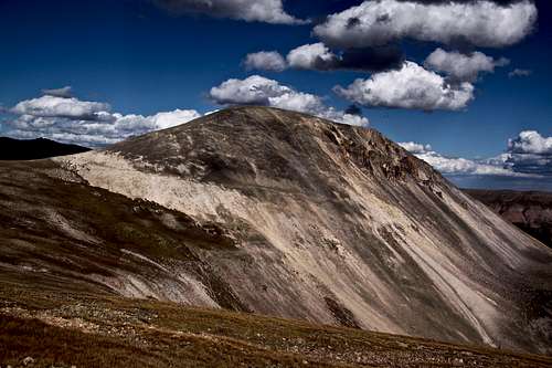
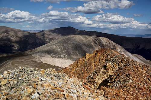
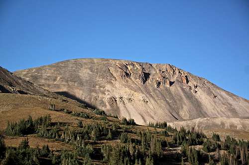
Greenhalgh Mountain as seen from the slopes of Sheep Mountain A
Guide to the Colorado Mountains edited by Randy Jacobs with Robert M. Ormes briefly mentions that for Sheep Mountain and for Greenhalgh Mountain descend one mile east down from the Stony Pass. Ascend easy west slopes of Sheep Mountain, and then cross Sheep Mountain towards Greenhalgh. There are not many descriptions of this hikes on the internet, but it is not really needed. Both peaks are easily identified and route finding is obvious.
Continental Divide Trail and Colorado Trail cross the road just a little bit over 1/2 mile below the pass. Both are popular with hikers and great trails to walk.
The road to 12,588 foot Stony Pass provides access to the "Bend" area of the Continental Divide. If one checks the map of the Continental Divide Trail, it does make a big nearly U or V shape towards the west and then returns back. Canby Mountain sits right on the Continental Divide.
Colorado Rank: 463
Parent Lineage: Sheep Mountain
Class: 2
Nearby Mountains:
Canby Mountain: 13,478 feet, 2.5 miles
Sheep Mountain: 13,292 feet, 0.76 miles
"Stony Pass Peak": 13,165 feet, 2.7 miles
Pole Creek Mountain: 13,716 feet, 4.06 miles
King Solomon Mountain: 13,220 feet, 4.99 miles
Little Giant Peak: 13, 416 feet, 5.24 miles
Half Peak: 13,841 feet, 5.84 miles
Hunchback Mountain: 13,136 feet, 5.71 miles
Getting There
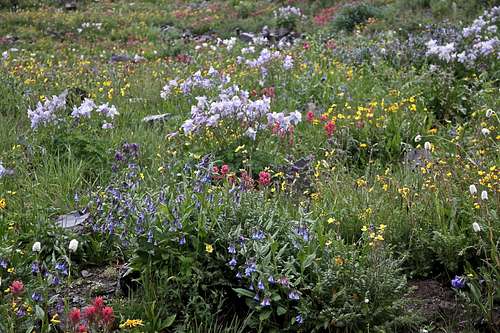
Wildflowers - Stony Pass
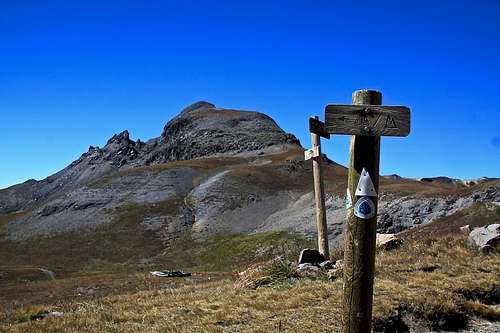
Stony Pass Peak and Continental Divide and Colorado Trail
High clearance 4WD vehicle is necessary.
From Silverton drive north east past the courthouse and veer right onto County Road 2. On some maps this road is marked as #110. Pavement ends after a couple of miles. Around 4.2 miles you reach Howardsville (mostly some mining buildings). Turn here onto FS Road 589 - it is signed for Stony Pass/Cunningham Gulch. Shortly you come to an intersection - one to the left is signed for Old Mine Tour, the other one close to the creek continues straight. It does not matter which one you choose, both reconnect after 1-2 miles, and neither is technically challenging. There is more traffic on the Old Mine Tour fork of the road. Soon, you have to leave Cunningham Gulch and start your climb up the Stony Pass - FS 737. It is again marked and hard to miss. The road will begin to degrade some and high clearance 4WD is needed here. The road is steep at some sections and exposed and at other sections making passing other vehicles difficult. Mid July to August there are amazing wildflowers.
Stony Pass is a popular destination with ATVs and other off road vehicles. You are standing at 12,590 feet without any physical work!
A small parking spot for hiking Green Mountain A/Greenhalgh Mountain is located on the north side of the road, about 1 mile east from the summit of Stony Pass. It is unsigned. There is a little campfire (no woods nearby - you need to bring your wood if planning a fire) at the parking lot and it is a good spot to spend a night if needed.
Continental Divide Trail and Colorado Trail are located just above this unsigned parking area - about a couple hundred meters higher.
Route
Saddle between Sheep and Greenhalgh Mountains
Greenhalgh Mountain as seem from Sheep Mountain A
Approach via Sheep Mountain makes a perfect sense. Ascend gentle west slopes of Sheep Mountain and then continue along a narrow and exposed Sheep's Mountains ridge. Descend the loose scree on the east side of Sheep Mountain to the saddle between Sheep and Greenhalgh Mountain. There are a few cairns in the saddle, but not really an established trail. I found the loose east slopes scree on Sheep Mountain the most unpleasant part of the hike. I caused a few rock avalanches while descending.
Ascend gentle and stable talus on west slopes of Greenhalgh Mountain - about midway up is a huge well engineered cairn. Continue up on an easy terrain, stable talus, class 2 until you reach another large summit. Both Sheep Mountain A subsumit and Greenhalgh Mountain's summit are huge, one can wander on the top trying to figure out the actual highest point. There was a little shelter and a few small cairns. I did not find summit register here.
Per reports eastern slopes are loose, I did not attempt that route, needed to return west towards my car.
Descend back to Greenhalgh Mountain - Sheep Mountain A saddle and find the easiest way down south. There appeared to be a faint trail used mostly by elk. I continued along the southern slopes of Sheep mountain towards west. This seemed much easier than going all the way to the road and then ascending up. I found a little trail leading by a remains of some shelter. The trail eventually took me all the way back to the parking lot. The views were spectacular.
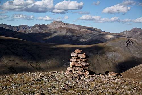
Summit views and along the hike
 Pole Creek Mountain | 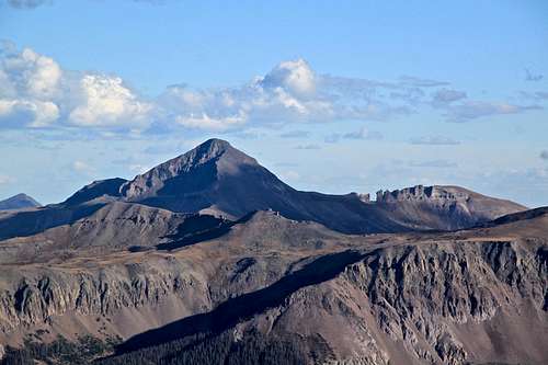 Rio Grande Pyramid |
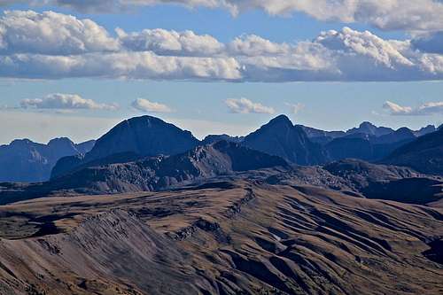 Guaridan and Silex with Hunchback Mountain in front of them | 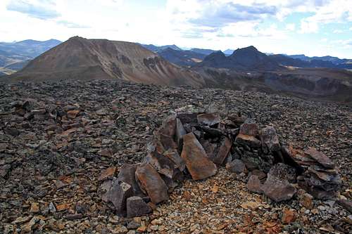 Sheep Mountain A and summit shelter on Greenhalgh |
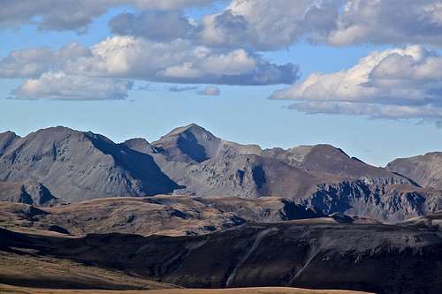 Handies Peak | 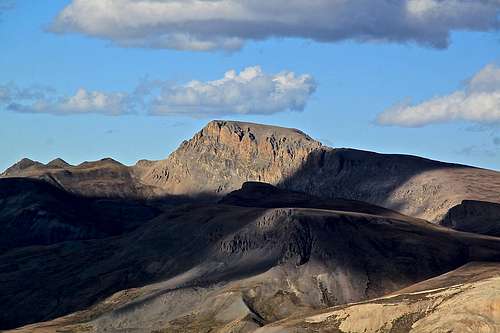 Half Peak |
 Greenhalgh Mountain as seen from the south | 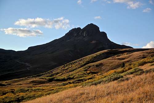 Returning towards parking lot |
Red Tape
There are no fees to drive the 4WD road to Stony Pass, hike, or camp along the road. The area is pretty remote, but during the peak season expect a lot of ATVs and 4WD vehicles on the road. You will be passing popular hiking trails: Continental Divide Trail and Colorado Trail.
You can park/sleep/camp at a small parking lot just below Stony Pass (about a couple hundred meters below above mentioned trails).

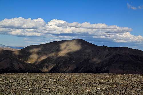
Sheep and Greenhalgh Mountains as seen from the road to Beartown