|
|
Mountain/Rock |
|---|---|
|
|
38.50810°N / 119.2945°W |
|
|
Lyon |
|
|
10859 ft / 3310 m |
|
|
Overview
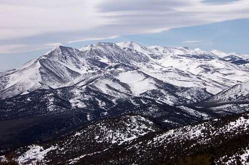
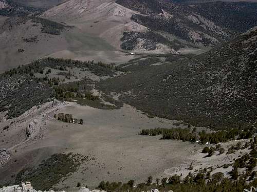
Signature pic: Brian Hughes nice shotThe Sweetwater Mountain range from Nevada Highway 338
A member of the little known Sweetwater Mountain range, found between
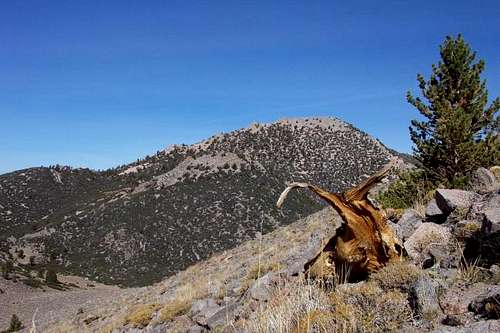
Wellington, Nevada and Bridgeport California, Middle Sister is not the highest peak in this range. What sets it apart is the fact that the highpoint of Lyon county (Nevada) is located on the shoulder of this mountain at the 10570 foot level, which makes it a desirable mountain to climb for those of us who are chasing Nevada county highpoints as well as summits.
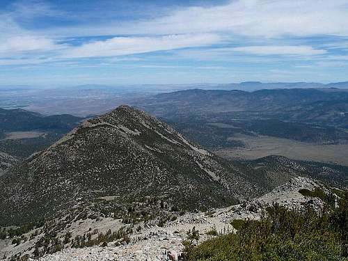
The summit itself is a nice prize as it is an outstanding viewpoint giving a 360 degree looks at both California and Nevada mountain ranges. No register was present at the top but it is probable that fewer than 10 to 15 people climb to the summit each year. It can be made part of a link up with other peaks in the area.
So why did I put the page title as "Middle Sister (Ca / Nv) ?
Well, it is kind of a 'twofer'. You can get a Nevada county highpoint and a California summit. This is very unique and the only situation similar is Boundary Peak, Nevada's highest point. When you do Boundary, you are not getting the highest point on the mountain, that distinction belongs to Montgomery Peak, which is higher but in California. If Montgomery were in Nevada, Boundary would be kind of a subordinate peak, not nearly as important as it is. So it is with the fact the Lyon county's highpoint rests on the side of Middle Sister. It adds value to both of them.
It might be of interest to you to check out another Sweetwater Mountain,
Mount Patterson since Mt. Patterson is the highest of the Sweetwater Peaks and is one of California's fifty most prominent peaks.
Getting There
Probably the most direct approach is to come in from Nv highway 338 (on the east) via FS road 050. Follow this road for about 3.2 miles (it takes a curve to the north) and you'll notice a rough jeep track heading off to the southwest. This is a pretty rough road and unless you have decent clearence, you might be well served to find a spot where you can park on the main road. The elevation here is about 7000 feet but if you can take the jeep road (you'll pass through one gate), you'll save a mile each way and about 500 feet of elevation. Drive until you come to some corrals and park here.The Little Smith Valley route (see sidebar)
The distance from the corral area to the summit and back is about 12 miles with an elevation gain of over 3300 feet.
Red Tape
None that I am aware of. The area is managed by the Toiyabe National Forest and you can find more information hereWhen To Climb
You could probably climb this peak anytime of the year although it would be easiest when the snow is about gone, say May through late October.Ski touring would be likely when sufficient snowfall is present.
Other peaks that might be of interest in the Sweetwater range.
Mt. Patterson 11,673
Wheeler 11,664
So. Sister 11339
East Sister 10,402
Camping
Several road camps were visible off of FS 050. Bring water as this is a very dry area. No fees were noticed posted anywhere. You could find a campsite on or near the mountain but water would be a major concern and would keep this best done as a dayhike.Mountain Conditions
No websites about this area could be found when I searched the internet looking for additional information.Information may be obtained by trying the following ranger station:
Toiyabe National Forest, P.O. Box 595
Bridgeport 93517
(619) 932-7070
Nevada County Highpoints
So why all the interest in doing county highpoints? Well, it can be an addicting pursuit for those of us who are into this fun. Since Nevada has 17 counties, that means 17 highpoints to chase after. Here is an excellent resource if you'd like to get more information on this - the County highpointer organization page and specifically, the Nevada page, complete with map and trip reports.The Weather near the mountain
Click for weather forecast

Click for weather forecast
Map of route and area
Lyon County Nevada
Here's what I found out about this county. As of 2000, the population was 34,501. Its county seat is Yerington.History
Lyon County was one of the nine original counties created in 1861. It was named after General Nathaniel Lyon who died in the Civil War in Missouri in 1861. Its first County Seat was Dayton, which had just changed its name from Nevada City in 1862, which had been called Chinatown before that. After the Dayton Court House burned down in 1909, the seat was moved to Yerington in 1911. There were stories that it was named for Captain Robert Lyon, a survivor of the Pyramid Lake War in 1860, but Nevada State Archives staff discovered a county seal with the picture of the Civil War general and settled the conflict.
Amtrak's passenger train, the California Zephyr goes through Lyon County. The nearest Amtrak passenger stations are Sparks and Winnemucca, Nevada. The California Zephyr runs from the San Francisco Bay Area to Chicago via Salt Lake City, Denver and Omaha. Interstate 80 also passes through Lyon county.
External Links
- Traverse of the Sweetwater mountains
- Trip report by Jobe Wymore and Jeanne Allen
- Scott Surgent's Trip report


