
|
|
Mountain/Rock |
|---|---|
|
|
37.88348°N / 107.82933°W |
|
|
Mountaineering |
|
|
Summer |
|
|
13319 ft / 4060 m |
|
|
Overview
North face of Palmyra Peak from ski slopes
Palmyra Peak is the highest point of Telluride Ski Resort in the San Juan Mountains of southwestern Colorado. Palmyra is not a ranked peak. It is a high point on the jagged northern ridgeline of the 13470 ft Silver Mountain. From the ski resort of Telluride, however, Palmyra appears as a prominent peak.
No ski lifts go to the summit of Palmyra Peak. In winter, skiers can take the Prospect Express Lift to an elevation of 11820 ft and then follow signs up the steep northwestern ridgeline of Palmyra Peak to a spot where my GPS measured an elevation of 13240 ft.
In summer, the top of the Prospect Express lift can be reached from the north, by following any path up the ski runs starting at the ski village at an elevation of 9500 ft (plus/minus a few hundred feet depending on where you start), or from the south via the 11200 ft Alta Lakes. You can then follow the signs marking the boundary of the ski area up the northwestern ridgeline of Palmyra to 13240 ft (The northwestern ridgeline starts grassy but higher up turns into a very steep dirt slope that goes among cliffs). To reach the summit, you must go to the east side of the peak and do some degree of Class III rock climbing (Without proper equipment, I was not prepared to cross this snow bank and could not go above 13240 ft).
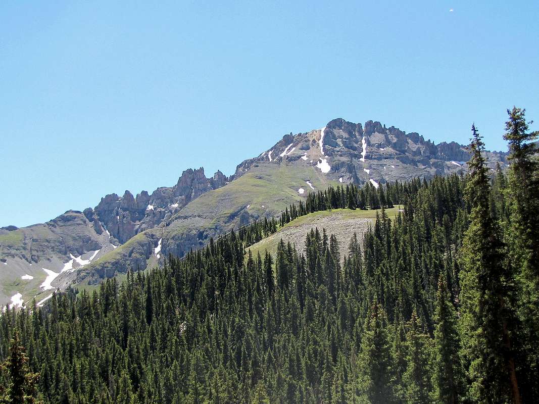
Northeastern face of Palmyra Peak
(L) Palmyra Peak, (R) Silver Mountain, northwestern face
Getting There & Route via Ski Village
The route described here starts at the spot where “Double Cabin” ski run goes under “Mountain Village Blvd.” near “Station Village Parking”. You must pay to park at the garage near here or stay at one of the nearby condos/hotels.See Telluride Ski Trail Map.
From the town of Telluride drive a few miles west and turn south on Route 145. After a few miles, you will a sign for “Ski Area/Mountain Village”. Turn east onto “Mountain Village Blvd.” and drive a few miles until you see the sign for “Village Plaza”. “Double Cabin” ski run goes under the Boulevard immediately to the east of the plaza. You will not see any signs. Parking is at the nearby pay garage.
Elevation at the Start of the Hike: 9545 ft
One Way Distance per my GPS: 4.1 miles
Vertical Gain: 3774 ft
From the mentioned starting point, I hiked up the Double Cabin ski run and turned onto Sundance to reach the top of Sunshine Express and then Ute Ski Lifts. I then followed other ski runs to reach the top of Prospect Express Lift at an elevation of 11820 ft.
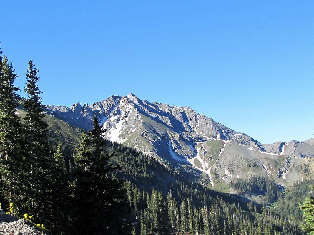
Palmyra Peak from the lower parts of Sundance ski run.
 |
Views to the north from the ski slopes.
 Dallas Peak Dallas Peak | |
 Dallas & Gilpin Peaks Dallas & Gilpin Peaks |
 Dallas & Campbell Peaks Dallas & Campbell Peaks |
 (L) Palmyra Peak, (R) Silver Mountain (L) Palmyra Peak, (R) Silver Mountain | |
 Dallas Peak Dallas Peak |
 St. Sophia Ridge St. Sophia Ridge |
 Dallas Peak, Gilpin Peak & Mt. Emma Dallas Peak, Gilpin Peak & Mt. Emma | |
 Whipple Mountain Whipple Mountain |
 Iron Mountain Iron Mountain |
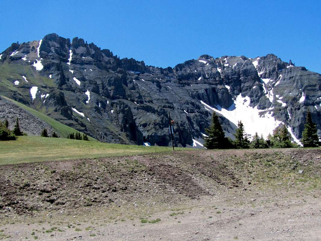
Palmyra Peak from the top of Prospect Express Lift. The steep northwestern ridgeline of Palmyra seen.
 |
Hiking up the steep northwestern ridgeline.
 |
 |
 |
 |
 |
The Wilsons and Alta Lakes from the ridgeline.
 The Wilsons and Alta Lakes The Wilsons and Alta Lakes |
Looking down from the top of the ridgeline.
 |
Summit of Palmyra from Point 13240 ft.
 Summit of Palmyra Summit of Palmyra |
Views from Point 13240 ft.
 Umcompahgre & Wetterhorn Umcompahgre & Wetterhorn |
 Mt. Sneffels Mt. Sneffels |
 Airport Airport |
 Point 13463 ft Point 13463 ft |
 Wasatch Mountain Wasatch Mountain |
 Point 13446 ft Point 13446 ft |
 Little Cone Little Cone |
 Lena Lake Lena Lake |