
-
 7163 Hits
-
 79.04% Score
-
 10 Votes
|
|
Mountain/Rock |
|---|---|
|
|
37.87689°N / 107.81325°W |
|
|
San Miguel |
|
|
Hiking, Mountaineering, Scrambling |
|
|
Spring, Summer, Fall, Winter |
|
|
13460 ft / 4103 m |
|
|
Overview
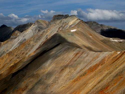 San Joaquin Ridge
The area is within Uncompahgre National Forest.
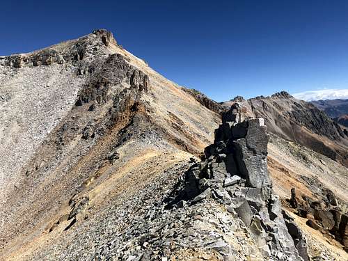 Ridge between Silver and San Joaquin
San Joaquin couloir is a popular back country ski destination - the couloir is nicely viewed from Telluride ski resort. The couloir is steep and narrow (15 feet at places), only for advanced back country skiers and avalanche training.
![another loose section]() another loose section
another loose section![One of many false summits]() One of many false summits
One of many false summits
![Trail to Oscar's Pass]() Trail to Oscar's Pass
Trail to Oscar's Pass
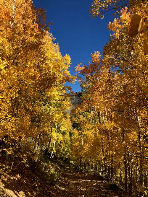
![Nice autumn colors]() Nice autumn colors
Summer and early autumn are obviously the easiest months. The autumn with aspens changing colors is especially spectacular!
Nice autumn colors
Summer and early autumn are obviously the easiest months. The autumn with aspens changing colors is especially spectacular!
Colorado Rank: 284
Parent Lineage: Line Parent: Silver Mountain Proximate Parent: Wasatch Mountain
Class: 2+
The Guide to Colorado Mountain with Robert Ormes (sort of a bible of Colorado mountains) provides only very brief mention and a different route up from Bear Creek. "For Lena Basin, leave the trail here and ascend south and southwest. Silver Mountain (13,470') is an extended east-west side ridge with its main summit at the head of the basin. Palmyra Peak (13,319') is a north extension of Silver Mountain, accessible from Lena Basin by its northeast ridge. San Joaquin Ridge is likewise a north extension of Silver further east, and reached by steep climb out of the basin's east fork."
Nearby Mountains:
- Silver Mountain B 0.98 miles
- Palmyra Peak 0.99 miles
- "Oscars Peak" 1.07 miles
- Wasatch Mountain 1.31 miles
- "T 12" 1.78 miles
- La Junta Peak 1.98 miles
- Lookout Peak 2.07 miles
- Unnamed 13145 A 2.38 miles
- Bridal Peak 2. 58 miles
Getting There
From Telluride drive south on Highway 145 past the turn off for Mountain Village until you hit the turn off for Ophir. Drive east to the town past the Ophir Wall (good rock climbing) to the small community of Ophir. The road is a good dirt road leading to Ophir Pass. I chose to park in the town of Ophir between the two parts of housing. There was a pull put on the road. Ophir gets often avalanches, so people build home in clusters away from avalanche pathways.
2 WD low clearance vehicle is fine on this outing, but NOT if you choose to drive up the Ophir Pass Road and cut towards Million Dollar Highway.
Route
As any mountain there are many different ways to reach its summit. I will describe my hike as a loop starting from Ophir, ascending south slopes of Silver Mountain, traversing onto San Joaquin Ridge and finally along the ridge all the way to Oscars Peak. This loop can be also done in an opposite direction.
The ridge between Silver Mountain and San Joaquin took a longer time than I expected. It went over several points and one point I had to go back since I ran into steep cliffs on its east side. I found a small south facing gully, it was loose, but not very technical and was able to bypass these cliffs, reaching the ridge and finishing the route from Silver to San Joaquin in the ridge proper. Expect a long time on the ridge - make sure the weather is co-operative.
The summit of San Joaquin from the west was loose and zig zagging up the loose terrain and between rocks was not more than 2+ in difficulty. There was a small cairn (I made it bigger), summit register, but pen was not working. The ridge from San Joaquin to Oscars Peak was easier and went much faster. There is a nice trail on the east side of Oscars Peak, part of the Hardrock 100 mile endurance run leading back to Ophir Pass road.
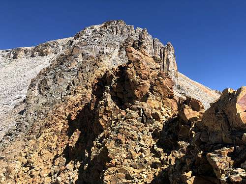 another loose section
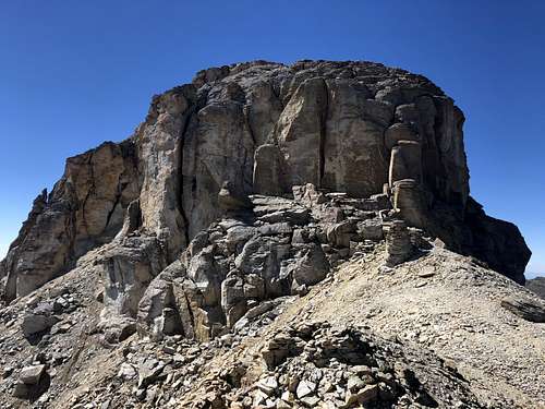 One of many false summits
Red Tape
Hiking, climbing and parking your vehicle is free.
Do not expect much services in Ophir. I don't think there is even a convenience store. Nearby Telluride is worth while a visit.
When to Climb
 Trail to Oscar's Pass
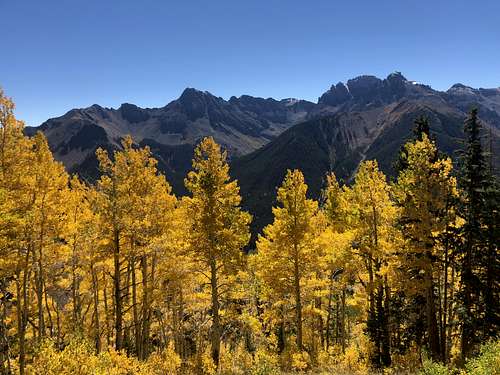 Nice autumn colors
Spring can provide an interesting outing if snow is stable. There is a north facing couloir if one is coming from Telluride side.
I would like to mention that Ophir area is infamous for avalanches and if you have time you can you tube some scary looking avalanches recorded from people's homes.
When you drive through the little settlement of Ophir, check out the distribution of houses - structures are close together in safe areas and town appears to be separated by a huge avalanche path (see the photo on the left).
Always check northern San Juan avalanche conditions prior venturing out during the snow season!
Camping
There are no designated Forest Service campgrounds near Ophir and along the FR630 = Ophir Pass Road. There are a few primitive sites where you can camp overnight, make sure you are not on a private land. I think there would be ok camping at the trailhead going up to Oscar's Pass, but you would need a 4 WD vehicle to drive a short section of this 4 WD road, which shortly changes into a trail (this trail is a section of famous Hardrock 100 mile endurance run).
There is a developed Sunshine campground along the Highway 145 - no reservations, first come first serve basis. Only 15 sites.
Matterhorn campground is larger and there are showers available there. It is also located along Highway 145, little bit further south.
External Links