-
 15778 Hits
-
 84.82% Score
-
 19 Votes
|
|
Mountain/Rock |
|---|---|
|
|
37.15135°N / 117.61773°W |
|
|
Inyo |
|
|
Hiking |
|
|
Spring, Fall, Winter |
|
|
7062 ft / 2152 m |
|
|
Overview
Sandy Peak, with its remote setting and excellent views down into Eurkea Valley and Eureka Dunes, makes for an excellent desert scramble. Some people commented in the summit log that the hike along the ridge is a bit long and boring, but as Andy Zdon says, "opening oneself up to the tremendous views in every direction, particularly when the Inyos and Sierras are draped in snow makes this ridge anything but boring. Just pleasant hill walking in great desert surroundings".Eureka Valley is also a great place to hang out. The Dunes are fun to play around on and the view of the Last Chance Range towering above them is amazing. Not too many people seem to visit this area, so you'll likely have the peak to yourself and run into few people at the dunes, if you choose to visit them too.
The hike goes at about 11 miles round trip and around 2700 ft of gain. The elevation gain is spread out along the 5.5 miles fairly evenly making for a gentle ascent for the most part. Fossilized sea shells can be found along the ridge with a good pair of eyes. Hard to believe this place was once below water!
Getting There
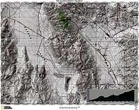
The following directions are mostly from Andy Zdon's book, which I found very helpful.From Big Pine, CA, take highway 168 east 2.4 miles to the Death Valley Road (Forest Service Road 9S18, also known as the Waucoba-Saline Valley Road) and turn southeast (right). Follow this paved (at first) road and well-graded dirt (from Eureka Valley onward) road as it crosses the Inyo Crest and drops into Eureka Valley before climbing again up into the Last Chance Range. Keep following the road to the crest of the Last Chance range to a very broad open saddle and park (4900 ft.). If you start heading back downhill a ways and end up at Crankshaft Junction, you've gone too far. Backtrack from Crankshaft Junction 3 miles back to the saddle. I found the topo helpful when locating the saddle and where to park.
You can also reach the area from northern Death Valley en route to Crankshaft Junction. Once at the junction turn left and head uphill to the saddle.


