
|
|
Mountain/Rock |
|---|---|
|
|
33.38820°N / 116.218°W |
|
|
Hiking |
|
|
Spring, Summer, Fall, Winter |
|
|
5755 ft / 1754 m |
|
|
Overview
 Google Earth Image of Route
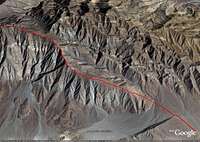
 Clark Well Area
 Start of Ridge to Villager Peak
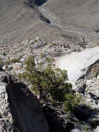
 Rugged Terrain along trail to Villager Peak
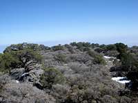
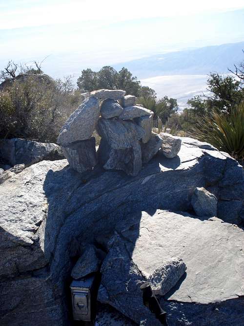 Villager Peak Summit Carin
 Ridge to Rosa Point along trail to Villager Peak
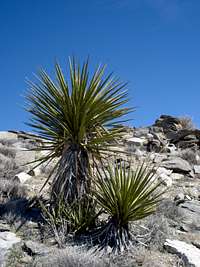
Villager peak is located in the Santa Rosa Mountains in the Anza-Borrego State Park, within the county of San Diego. It lies between Rabbit peak to the north and Rosa Point to the southeast. More often than not, these peaks are combined into one outing. The most common route to Rabbit Peak involves hiking over Villager Peak. Clark Valley (and Dry Clark Lake) is to the west and the highest mountain in the Santa Rosa Mountains, Toro Peak, to the northwest. The perplexing Salton Sea is directly to the east.
This peak generally offers solitude, ruggedness and nice views combined with strenuous hike (~ 5000 feet elevation gain in 6.5 miles). It is best to hike it in the winter, as summer temperatures can be extreme.
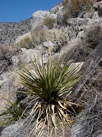
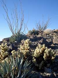
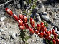
The flora and fauna mainly consist of cacti (barrel, hedgehog and teddy-bear cholla), ocotillo and agave. However there are some yuccas, nolina and decrepit looking pinyon pines and juniper at higher elevations.
The range contains an extensive population of Peninsular Bighorn Sheep.
Getting There
Here is a Google Map that you can use to calcuate directions for your specific destination: Just click on the green ballon and select "get directions".View Larger Map
Here are the directions from the HPS website:
Drive east on I-10 to the 86S expressway in Indio.
Drive south toward El Centro on SR 86S Expressway for about 35.5 miles to Salton City.
Turn west on the Borrego-Salton Seaway (S22).
Continue 14.8 miles to a parking area on the right (just past the 32 mile marker) and a dirt road on the left (south). Park in this area on either side of the road. There is a call box numbered S22-319 on the north side of the road. The road on the south of S22 is signed, "Thimble Trail". This is a good car camping spot.
It is also possible to reach the trailhead by driving east on S22 from Christmas Circle in Borrego Springs for about 13.1 miles.
Routes:
 Topo Map
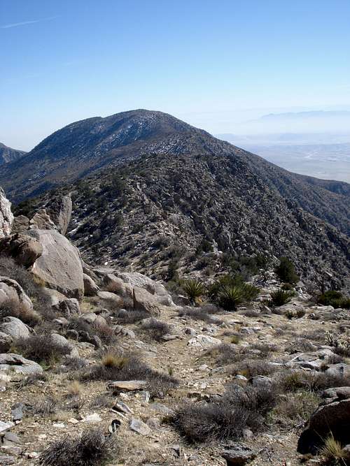 Ridge Leading to Villager from Rabbit.
The main route for hiking Villager is via the south ridge directly from SR22. Here is the route description from the HPS website:
From the parking area (980'), the route is evident. It is the ridge coming south down from Villager Peak. Hike north across the desert, just past the east end of "Lute" ridge (see topo map), to the prominent ridge on the left (west) side of Rattlesnake Canyon. Go up the steady slope of the ridge over several false summits and up to the summit. On the descent, take care at 4400' not to follow the southeast ridge down into Rattlesnake Canyon. Continue on the south trending ridge.
You can download actual GPS tracks for this route from the following website.
For the more adventurous mountaineer Villager Peak can also be climbed from the west via the very steep main ridge from the Clark Well area. Some of the Sierra Club trip reports mention this route. Be warned that the steepest part of the ridge is at its base, therefore I would think it would be wisest to ascend via this route to make sure you don’t stuck navigating terrain too steep for your comfort on your descent. This would be the shortest route to Villager, although probably not much faster than the usual route unless you are very proficient on steep, class 2 (or possibly class 3) terrain.
Camping
You can camp anywhere in the area that you desire. Many people camp upon the summit of Villager peak and journey on to Rabbit Peak or Rosa Point. There are also many campspots along the ridge as you ascend, if you get tired. However there is no water enroute. You must either pack all of your water or go when there is snow and melt your own.History
Named by the USGS (1939), for the two Cahuilla Indian villages that once existed on opposite sides of this mountain. Ranger Paul Reimecka states that the Desert moiety of the Cahuilla existed on the east facing side, whereas, the Pass moiety once existed in Rock House Canyon and it was their village that gave the canyon its name. Both groups were later moved from here, and their descendants still live near the peak in the Los Coyotes and Santa Rosa Indian Reservations.Name first appears on the USGS Rabbit Peak quad (1959).
Peak was added to the HPS Peak List in 1966.
Source: Sierra Club Hundred Peak Website for Villager Peak
External Links
Sierra Club Hundred Peak Websites:Villager Peak
Rabbit Peak
Rosa Point
Plant guide
An interesting Article from DesertUSA.com.
Flora Photo Album
The following are typical cacti and plants that grow in and around Villager Peak. The journey up to the summit takes you through many different climate zones and a beautiful array of desert life. Take time to enjoy the flora this area has to offer, it is truly one of a kind.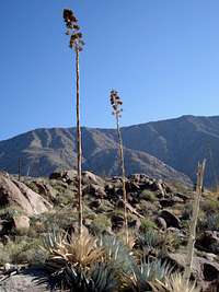 Agave Agave |
 nolina nolina |
 Ocotillo Ocotillo |
 cholla cactus cholla cactus |
|---|---|---|---|
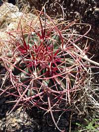 Barrel Cactus Barrel Cactus |
 Teddy Bear Cholla - these guys attack! Teddy Bear Cholla - these guys attack! |
 Flowering Fishhook Cactus Flowering Fishhook Cactus |
 Mojave Yucca Mojave Yucca |
 Ocotillo flowers Ocotillo flowers |
 Barrel and Ocotillo Barrel and Ocotillo |
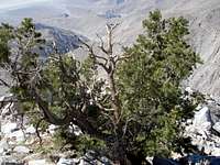 Pinyon Pine Pinyon Pine |
 pancake prickly pear pancake prickly pear |
 Creosote Brush Creosote Brush |
 Juniper Bush Juniper Bush |
 Chaparral on Rabbit Peak Chaparral on Rabbit Peak |
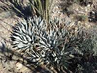 Silver Agave Silver Agave |