
|
|
Mountain/Rock |
|---|---|
|
|
42.62872°N / 0.68645°E |
|
|
Mountaineering |
|
|
9810 ft / 2990 m |
|
|
Overview

Tuc de Molliers
This page as well as describing the mountain, also provides some useful information about the 'normal' route of ascent.
The Pico de Salenques is located within the Posets - Maladeta National Park in the Aragon region of the central Pyrenees. It is a beautiful area of high mountains and deep valleys some of which are farmed and others are left to their wild state for the birds, animals and flora that inhabit them.
The peak is located almost centrally on a high level ridge that connects the peaks of Molliers and Tempestats.
Given good clear weather, the peak provides a commanding view of the Aneto/Maladeta range and the glacier below them.
All these mountains are in the most amazing area of mountain scenery and as well as containing the highest Pyrenean peak of Aneto.
There are many challenges available here for all walkers and mountaineers.
Getting There
Plan d'Estan seen from the slopes below the slopes of Salvaguardia
Access to the area is from the town of Benasque which is a great place to visit and provides all the necessaries of life including accommodation, dining, shopping and a well stocked mountain emporium.
From the town centre, head north up the road towards France until a right hand turning appears with signage to the Hospital de Benasque which is a Hotel.
Carry on down this turn off until the roads splits where a left hand fork heads downwards to the Hospital. Take the right hand fork for a few kilometres until you reach a car park area at La Beserta.
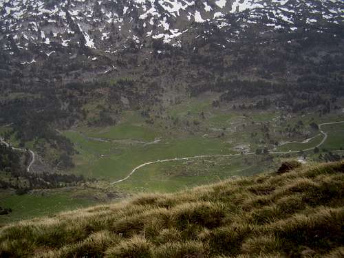
At peak times you may not always be allowed to drive to the car park and will be directed to park at the Plan d'Estan (pictured) back down the road towards the Hospital. The normal route to Pico de Salenques commences at La Besurta where there is a very large car park and also a place selling refreshments in high season.
the Route
Ahead is the Pic del Aigualluts
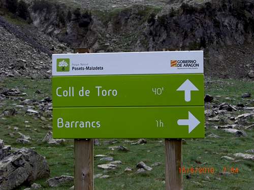
Helpful signage
Head east from the Besurta car park and follow the signs indicating the Refugio de Renclusa and the Forau dels Aigualluts.
Keep on the trail until it splits with the right hand section heading up to the refugio, then stay heading east and after descending into a green valley, approach the interesting sight of the Forau.
The Forau marks the apparently mysterious end of the melt water river from the Aneto glacier but actually the water re-appears many kilometres away in the Val D'Aran at Uelhs de Joèu after travelling underground for seven kilometres.
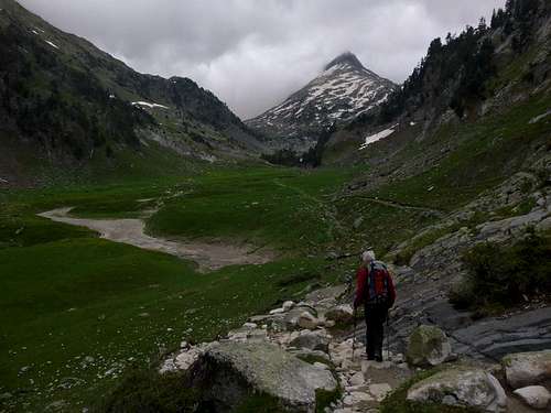
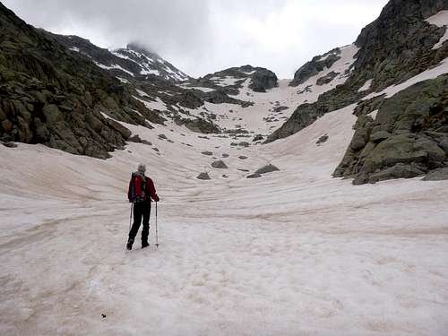
Passing by the Forau, you then will arrive at the boggy valley where the Pic dels Aigualluts rears up ahead. Here you have a choice of two valleys to ascend. To your left, the Escaletta and right, the Barrancs. This is the one you need to follow and to do this you will need to cross the streams that flow out of the valley of the Escaletta to reach the valley of Barrancs. Once across you can follow the course of the Rui de Barrancs upwards.
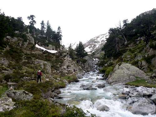
Rui de Barrancs
Depending on the season there may be a lot of snow as you ascend the valley.
Trail markers if not covered with snow will help you follow the line but once in the narrow confines you can't really go wrong.
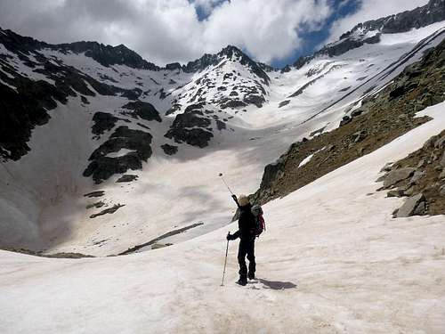
Head for the gap
Although this may look like the ridge between Molliers and Tempestats it isn't and there is still a long way to go. Once through the obvious gap, you are are last in sight of your objective. The ground falls away into a bowl into which you need to descend.
Directly ahead is another ridge, this is the high level ridge mentioned in the overview and may be climbed without too much difficulty but if this way is taken, the route from there to the summit of Salenques has to be gained by rock climbing methods.
Instead, the normal route takes a line on the left to gain another ridge that connects Salenques with the Pic de Barrancs (2892m.).
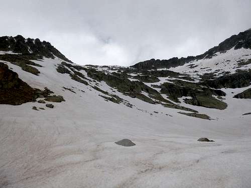
The bowl
So here you need to cross the bowl and ascend the steep slopes on the left to gain this connecting ridge.
Loss of height can be avoided somewhat by contouring around the bowl and this will save some breath for the climb up to the ridge.
The climb up to the ridge between Salenques and Barrancs
Once the ridge has been gained, head in a southerly direction for the summit of Salenques.
The ridge line is straight forward but some scrambling can be enjoyed along the way if you want a bit of variety.

Rock scrambling may be choosen

Pico de Salenques summit

A view from Pico de Salenques summit
The summit rocks soon appear and just in case there are any doubts, a previous ascendant has kindly left a marker on the cairn.
Not that I personally endorse the marking of summits as I prefer to find them in their virgin state.
However, we do realise that probably many thousands of boots have preceded our own.
Red Tape
Just follow the rules of the National Park, no permits are required for climbing or walking in the area.When to Climb
If you like crowds, climb in the peak periods of July and August, otherwise, spring and autumn can be pleasant but the shorter days of autumn will make your scheduling a bit more onerous.My recommendation is to go there in May/June when you get long days, generally good weather and consolidated snow.
Camping, Refugios and Hotels
Wild camping overnight is generally not allowed in the National Park although if you're packed up and away in the early hours you are not going to have problems.(leave no traces of your presence behind and take your rubbish home with you)
There are a number of campsites in the valley of Benasque and of course there is the excellent Renclusa refugio close at hand.
For those of sound financial means, accommodation can be found at the Hospital de Banasque.