


-
 3787 Hits
-
 80.49% Score
-
 12 Votes
|
|
Area/Range |
|---|---|
|
|
45.69430°N / 7.80259°E |
|
|
Hiking, Mountaineering |
|
|
Spring, Summer, Fall, Winter |
|
|
Note
La montagna chiama i suoi figli, ed essi rispondono fedelmente al suo appello… Osvaldo Cardellina, Diario alpinistico, 1964-65 Page texts: @ OsvaldoCardellina "Osva", passed away on May 2, 2022. Page owners: Christian Cardellina e Osvaldo Cardellina. Any updates from September 12, 2022: Antonio Giani, page administrator, friend and climbing companion. Testi della pagina: @ OsvaldoCardellina "Osva", scomparso il 2 maggio 2022. Proprietari pagina: Christian Cardellina e Osvaldo Cardellina. Eventuali aggiornamenti dal 12 settembre 2022: Antonio Giani, amministratore della pagina, amico e compagno di salite. |
Dames de Challand Overview
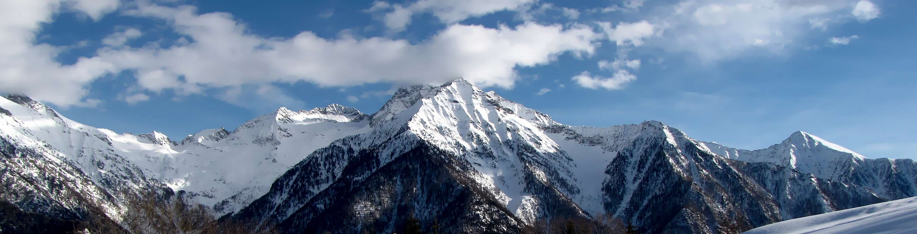 |
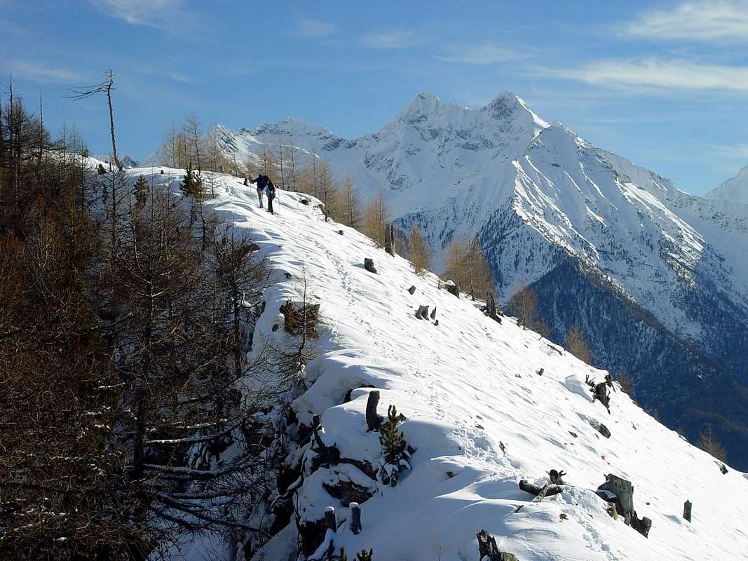
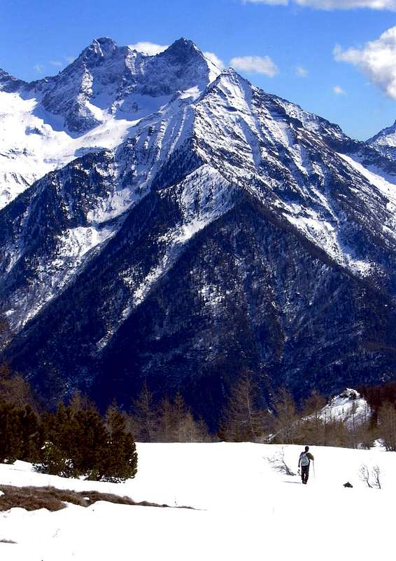
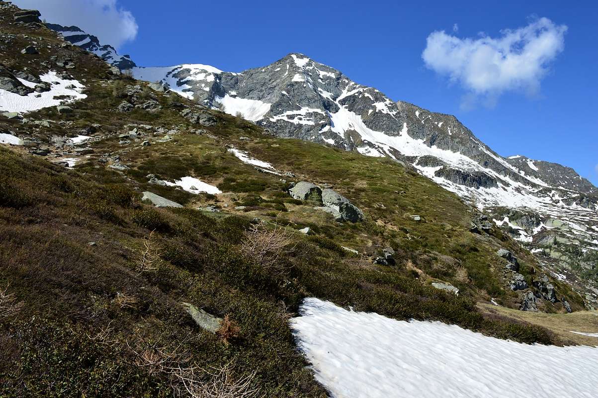
From Verrès Commune (390m) up to the North in the Ayas Valley, also known as the Valley Champoluc or even of Evançon from the name of its long Torrent. Left to the right (East) on her beautiful Castle Square (it plays a famous "Carnival"), after an initial steep section that exceeds through 4 Kilometres with 300 meters of altitude, while the other side stands the "Collegiate Church of Saint Gilles", is reached, after approximately 5 kilometres, the Commune of Challant Saint Victor (765m) and after many, always through the Regional Road, to Challant Saint Anselme (1.060m). From this a road deviates from the Regional Road nearby Brusson Resort, locality Quincod (1.030m) and through a Municipal reaches in succession the Villages of Tilly (954m) and Tollegnaz (1.041m), where it ends. This is the gateway to the Walloon of Chasten that stretches Eastward until you reach the Hill of the same name (2.549m), above the Valley of Gressoney. From Tollegnaz take the trail toward the Southeast signed n° 2, left to right for a detour to Rovère Pasture, a second for the Alp Leuria (1.575m) and a third this time to the left (North) to Raala (1.653m), reaching the upper deck stone Pont Chevalier in the vicinity of Pastures of Ciavanisse (1.403m), where ford the creek Chasten. After this brief descent to the bottom of the Vallon same, goes decidedly to the East through the forest and, after crossing again also return, will then approach the Alps Grun (1.501m), Seuc, Pra Baluard (1.709m), all along the Torrent of Chasten, up to the fork around 1.830/40 meters amongst more open pastures. From this point there are two distinctly different and opposing ways to reach the Chasten Pass, neighbor a small carving immediately below a pointed rocky beak. This is situated between the South Ridge of Mont Nery in the North and the Northeast Quota 2.836 meters above the Monte Voghel (2.925m) and the two splendid "Dames de Challand", which define, together with other two minor peaks, the walloon in the South. After it rises the next Walloon of Dondeuil.
 |
 |
 |
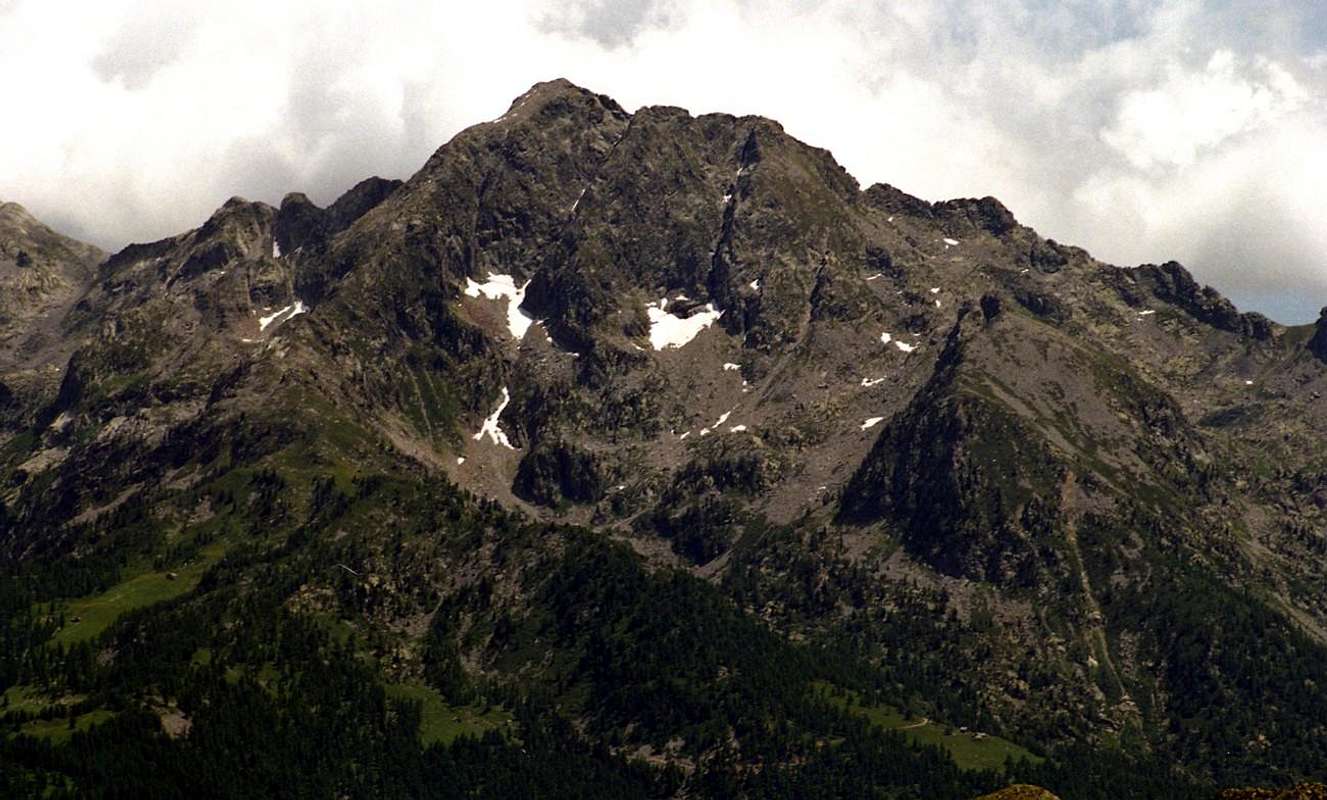
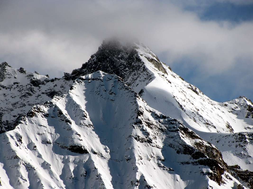
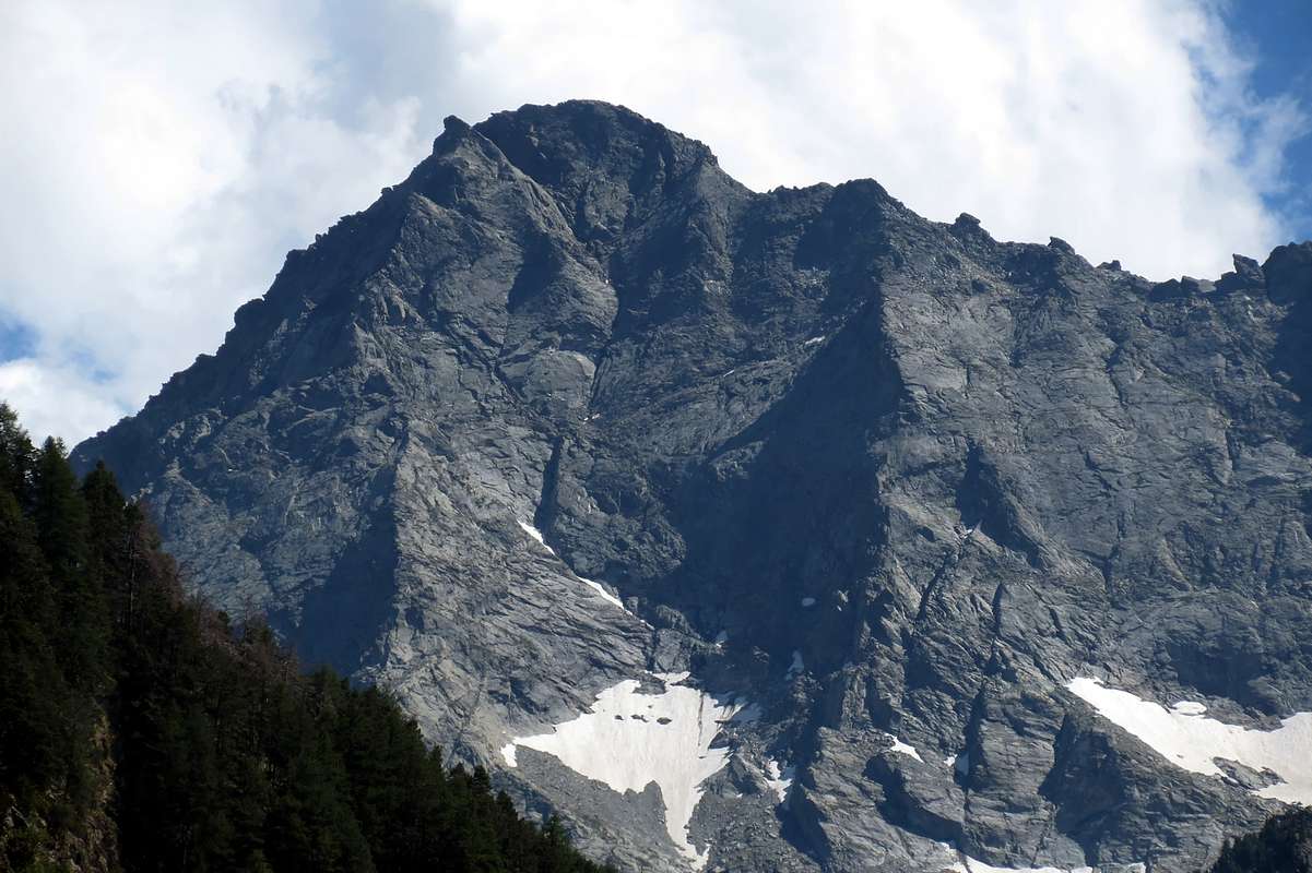
b) - From the fork to continue toward the north with the path "basic" n° 2 reaching the Alps le Sort (1.984m) and, after fording the Torrent Chasten, to Pera Piccolla (2.242m), located at the bese a secondary South-southwest Spur that descends from pre-summit East of the Tip Soleron. Here the same turned decidedly to the East and, beyond the most northern branch of the same to the inside of a very small vallon below the Mont Nery, reaches the previous route (about an hour longer). The pass, quite high and located in the manner of carving at a small rocky spire, permit the transit through good trails in the lower part and more less in the highest, between the Municipalities of Challand Saint Anselme in the Ayas Valley and in that of Issime Gressoney, both in their middle-part. From the same stunning views of Becca Vlou and Torché, known as "Les Dames de Challand", which rise to over 500 meters with their Northeast, Northern and Northwestern rocky Walls above the miserable remains of ancient glaciers, while on the opposite side rise the broken walls of the Mont Nery also called Becca de Frudière, who still remains, thanks to its greater height, the true "Lord of the Valley".
Da Verrès (390 m) si sale verso Settentrione nella Val d'Ayas, detta anche Valle di Champoluc od ancora dell'Evançon dal nome del suo lungo Torrente. Lasciato sulla destra (Est) il suo bel Castello quadrato (si svolge un famoso "Carnevale"), dopo un primo ripido tratto che in 4 Kilometri supera ben 300 metri di dislivello, mentre dalla parte opposta si erge la "Collegiata di Saint Gilles", si perviene, dopo circa 5 kilometri, al Comune di Challant Saint Victor (765 m) e dopo altrettanti, sempre tramite la Strada Regionale, quello di Challant Saint Anselme (1.060 m). Da questo una Strada Municipale si distacca dalla Regionale per il comprensorio di Brusson e dalla località Quinçod (1.030 m), raggiungendo in successione i Villaggi di Tilly (954 m) e Tollegnaz (1.041 m), ove termina. Questa é la porta d'ingresso per il Vallone di Chasten allungantesi verso Oriente fino a raggiungere l'omonimo Colle (2.549 m), soprastante la Valle di Gressoney. Da Tollegnaz prendere il sentiero verso Sudest segnato n° 2, e, lasciata sulla destra una prima deviazione verso Rovère, una seconda per l'Alpe Leuria (1.575 m) ed una terza questa volta sulla sinistra (Nord) verso l'Alpe Raala (1.653 m), raggiungere l'alto ed antico ponte in pietra detto Pont Chevalier in prossimità dei pascoli di Ciavanisse (1.403 m), dove si guada il Torrente di Chasten. Dopo questa breve discesa verso il fondo del vallone stesso, continuare decisamente ad Est attraverso la foresta e, dopo averlo attraversato nuovamente, proseguire sul fondo del medesimo avvicinandosi in progressione alle Alpi di Grun (1.501 m), Seuc, Pra Baluard (1.709 m) fino ad un bivio a quota 1.830/40 metri circa, posto tra più aperti pascoli. Da questo punto si presentano due diverse e nettamente contrapposte possibilità per raggiungere il Colle di Chasten. Questi é situato tra la Cresta Sud del Mont Nery a Settentrione e quella Nordest della Quota 2.836 metri, che precede il Monte Voghel (2.925 m) e le due splendide "Dames de Challand", che delimitano, insieme ad altre cime secondarie, il vallone a Sud. Dopo si eleva il successivo del Dondeuil. Vediamole: a) - proseguire verso Sud con il sentiero n° 1 verso le Alpi di Merendiù Bassa ed Alta (1.915 m, 2.184 m); le prime sono poste contro la parete di un masso e le seconde, ormai in stato avanzato di rovina, dopo aver guadato il piccolo torrente, trovansi in un largo bacino di pietrame proprio al di sotto di queste tre Sommità. Da questo punto il sentiero, con i resti di un antico lastricato, volge decisamente a sinistra (Nordest) e, "accompagnando" la Cresta Nord-nordest del Monte Voghel, raggiunge, dopo essersi collegato con il sentiero dell'itinerario successivo, una ben più piccola conca formata da "clapeys" (grandi massi sparsi) appena sotto il colle; tramite una piccola traccia ed alcune roccette nella parte finale, facilmente lo si raggiunge (01h'00/01h'15 da Merendiù; 04h'00/04h'15 da Tollegnaz). Questi antichi alpeggi costituivano sicuramente, vista la lunghezza dell'avvicinamento e la totale mancanza di rifugi o bivacchi, il punto di appoggio nonché di partenza per le rudi ascensioni del Versante Settentrionale di Vlou e Torché. Ragazzi di grande tempra come il Verreziese Amilcare Crètier e l'Aostano Alessandro "Dino" Charrey (cadrà sulla vergine Parete Est dell'Emilius insieme al fratello Jean ed a Cino Norat esattamente nell'anno successivo, con un solo giorno di differenza), che negli Anni Venti avevano iniziato il discorso osando di affrontarle effettuandone la prima ascensione assoluta sulla verticale Parete Nord della Torché. Poi i giochi del Destino coi suoi numeri facevano si che i due fratelli Charrey avevano scalato in prima ascensione la Parete Nord della Becca di Vlou, giusto una settimana prima. Grandi arrampicatori, ma anche grandi camminatori com'esigevano le ascensioni di quei tempi. Un vero trait d'union con l'"Alpinismo Classico" di tempi appena precedenti. Il pensiero personale và anche all'amico Torinese, Notaio in Aosta, Ottavio Bastrenta, che, riprendendo il discorso, il 6 di Agosto del 1956 aveva tracciato in salita solitaria l'itinerario più alto su questo versante salendo la Cresta Nord della Vlou. Nell'anno successivo si ripete il 10 di Agosto, insieme a Ezio Capello, su quella Nordest sempre della Vlou. Due belle imprese degne di un Alpinista della "Scuola Giusto Gervasutti" di Torino, dalla quale "orgogliosamente" proveniva. Ed ancora con il medesimo Ezio Capello (un vero "specialista" di quest'area con molte ascensioni nel suo curriculum) dieci giorni appresso và a ripetere la Via China-Solvay del Settembre 1935. Ma i primi "Esploratori" in assoluto di questo versante erano stati Franco Gatta e Gian Luca Peyretti con la salita dello Sperone Nord della Becca di Vlou il 30 Agosto del 1925 e lo stesso con Gino Levi che il 13 Settembre dello stesso anno avevano effettuato un tentativo sulla Nord della Becca Torché, riuscito soltanto in parte.
b) - Dal bivio procedere verso Nord con il sentiero "di base" n° 2 raggiungendo l'Alpe la Sort (1.984 m) e, dopo aver guadato il Torrent di Chasten, quella di Pera Piccolla (2.242 m), posta alla bese d'uno sperone secondario (Sud-sudovest) che scende dall'ante sommità Est della Punta di Soleron. Qui il medesimo volge decisamente ad Oriente e, oltrepassando il ramo più Settentrionale dello stesso allo interno d'un valloncello sottostante il Mont Nery, raggiunge il precedente itinerario (circa un'ora in più). Il passo, abbastanza elevato e situato a guisa d'intaglio presso una guglietta rocciosa, permette il transito, tramite sentieri buoni nella parte inferiore ed alquanto meno in quella più alta, tra i Comuni di Challand Saint Anselme nella Valle di Ayas e Issime in quella di Gressoney, entrambe nel loro settore medio. Dallo stesso splendide vedute su Becca di Vlou e Becca Torché, conosciute come "Les Dames de Challand", che innalzantesi per oltre 500 metri con le loro rocciose Pareti Nordest, Nord e Nordovest sopra i miseri resti d'antichi ghiacciai, mentre dalla parte opposta si propongono le rotte pareti del Mont Nery, che, grazie alla sua maggior altezza, rimane pur sempre il vero "Signore della Valle".
 |
 |
 |
 |
 |
Getting There
BY CAR:
- From TORINO, MILANO, etc: Motorway A5. Exit at IVREA or Quincinetto (PIEDMONT) From IVREA Town: in West (Southern side) to Pont Saint Martin, Verrès Municipalities in East from Aosta Town. From Courmayeur Resort: in East-southeast to Aosta, Nus, Chatillon, Saint Vincent, Verrès Municipalities. From Verrès to Val d'Ayas Valley From Verrès (549m), with Regional Road, to Challant Saint Victor (765m), Challant Saint Anselme-Quincod (1.030m), Tollegnaz Village (1.041m), Archésaz Hamlet (1.146m), Brusson (1.332m) Municipalities; wanting, continuing to Northwest to Antagnod-Ayas (1.709m) Commune, below Mounts Tantané and Zerbion also in North towards Champoluc (1.570m) and Saint Jacques (1.670m) Communes at the end of Evançon or Ayas Valley and under the Western side of Monte Rosa (Rollin Hump, Breithorns, Pollux and Castor).
- From FRANCE: through the Mont Blanc Tunnel to Entrèves/Courmayeur. By Little Saint Bernard Pass, closed since November until half May to La Thuile Valley - Pré Saint Didier - Aosta - Verrès Municipalities. It is not necessary to take Motorway A5: you can drive on SS.26, in the direction of AOSTA - IVREA - TURIN.
BY PLANE:
- Aeroporto "Corrado Gex" Saint Christophe (Aosta).
Summits & Passes
- Description clockwise starting from the West above Estoul/Graines to Hills, Passes & Summits to get to the West-northwest over Challand St. Anselme-Quinçod/Tilly. (For the approaches see above Overview)
2) - Cleve de Moula (2.241m). With same preceding route through Southwestern slopes (EE/F; 2h'45/3h'00).
3) - Fourchette or La Forchetta also Nanta Pass (2.202m). From Moula Alp through previous routes to Cleve de Moula; from the path to the same with short deviation North on Southern slopes also through traverse on watershed (EE/F; 2h'00/2h'10).
4) - Pointe Champ-Long or Champlon (2.671m). From Mont Solaron through crossing and East-southeast Ridge also from Cleve de Moula Alp through a small and traces on South Slope and Southwest Crest in terminal part (EE/F+; 2h'15/2h'30 from Moula; 4h'00/4h'30 Allesaz).
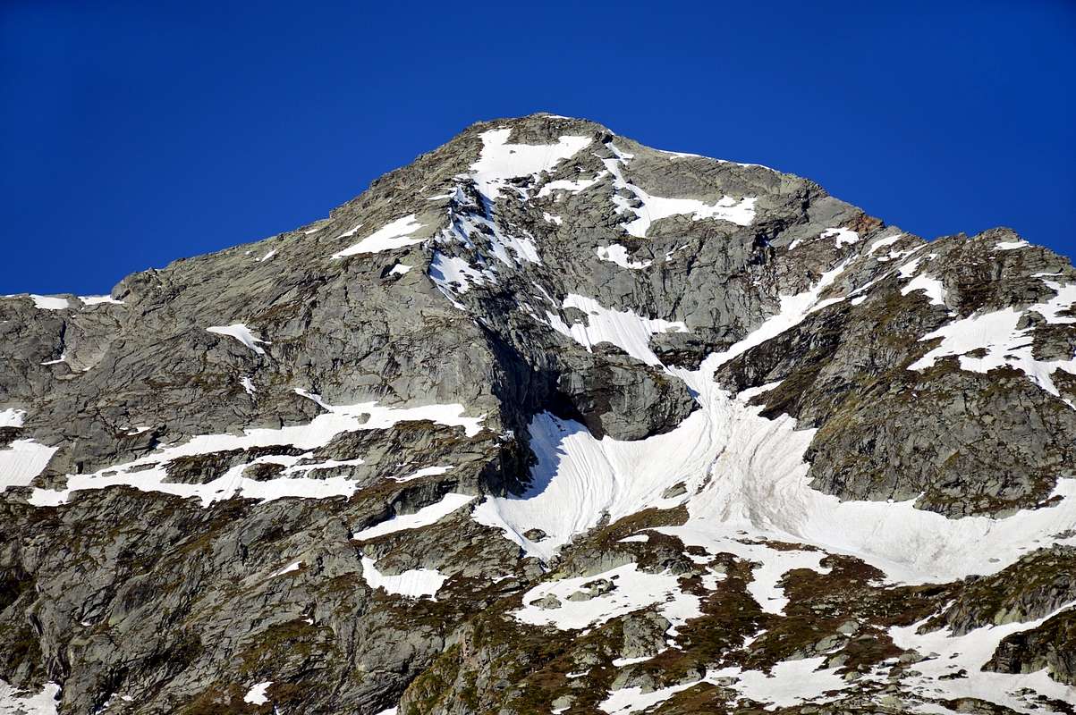
5) - Mont Solaron or Punta di Soleron (2.888m). From Alp Pera Picolla (2.242m; see the Approach above in Overview) through steep Southern Slope, pathless, of large Saddle about 2.895 meters and Southeast Crest.
 |
a) - From Tollegnaz to Chasten Pass (see above Overview with short crossing in descent at the base of Southern Spur; climbing of 650 meters, by Ezio Capello, lone in July 10th, 1955. Safe and amusing climbing on good rock with passages of II°/III° (A/PD+; 2h'30/3h'00 from base).
b) - Always from Chasten Pass with same traverse to base of South Wall; climbing of 550 meters, by Dino Boiardi and Ezio Capello in July 24th, 1954. Less safe and less amusing climbing on rotten and dangerous rock; passages of II° and III° on first part with exit out by a gully on East Crest (A/PD+; 3h'00/3h'30 from the base).
c) - From Chasten Pass, neighbor the Eastern border; from pass before through a small track of 800 meters to the North and after, climbing on rocky slabs, tosmall saddle around 2640/50 meters. Continue through the South-southwestern Slope of large Saddle about 2.890/5 meters and West Ridge to the Western Ante Top (3.027m) and Top (EE/F+; from F+ to PD-; 2h'00/2h'15 from pass; 6h'00/6h'15 from Tollegnaz Village, same time from Issime-Champriond Commune (953m, 967m), through the path n° 2, in Gressoney Valley).
7) - Chasten Pass (2.549m). See the route in Overview (E/F; 4h'00/4h30 from Tollegnaz also Allesaz Vilolages).
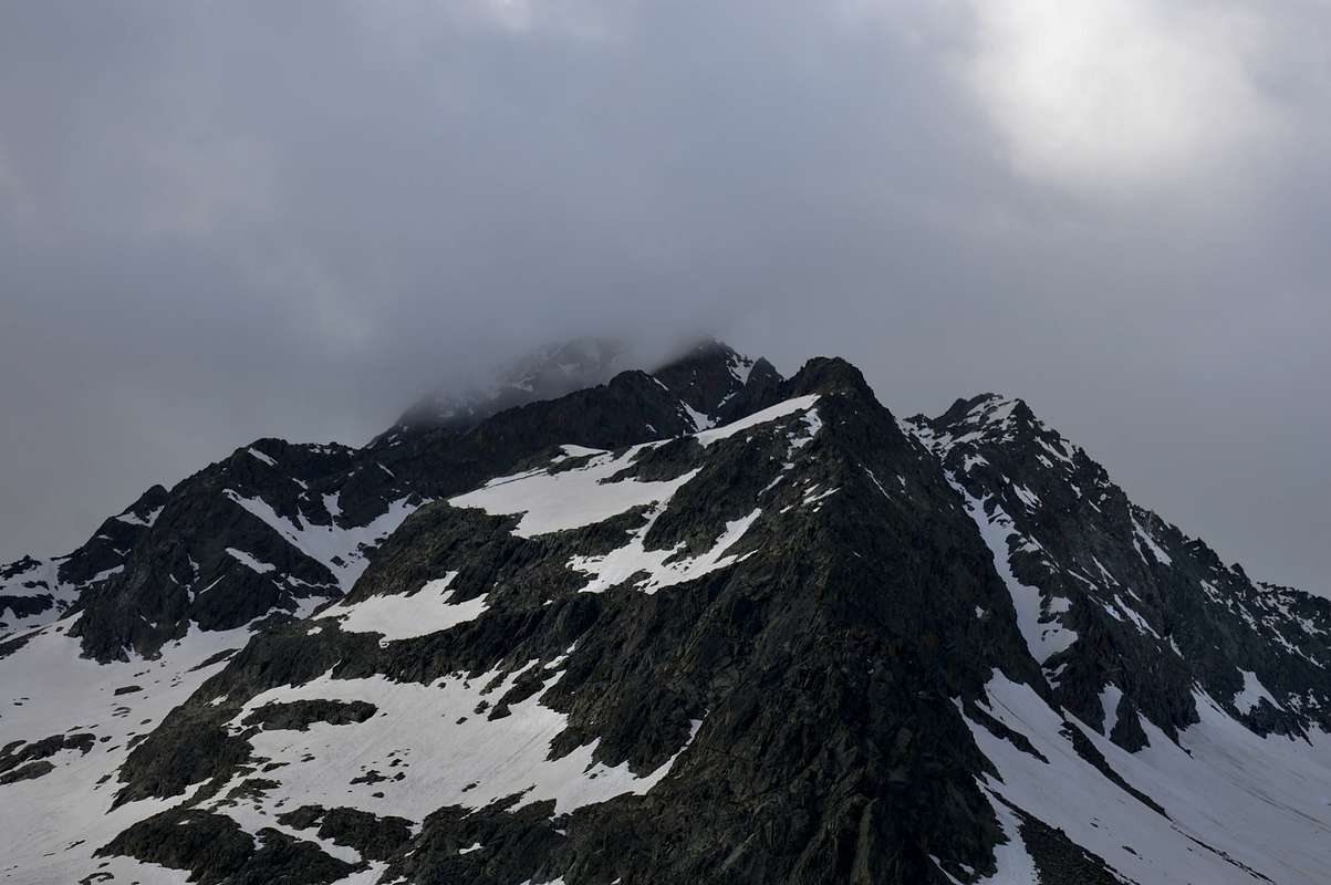
8) - Monte Voghel (2.767m). This mountain is located on the end of the Ridge Northeastern of Mont Nery, where precipitates with a large rock face above the Forca Walloon and the Alp Henniciuken (2.000m), in the Gressoney Valley. The constant fall of stones from the same, despite the compact appearance of its plates, to prohibit forced by the beginning of 2000 the path (barrier with sign) downhill to the Village of Trenta (1.158m) at the Lys Torrent; here you have to use to get off the trail n° 1A, after a short climb to Mount Taf, shall be directed towards the Northeast, reaching the Weissmatten Cable Car (2.043m), whence the Camping Gressoney. You can climb from the Pass of Frudiera reaching the collar of about 2.680 meters on the the Northeast Crest of Nery and through the easy and short, but exposed to the Southeast, Southwest Ridge (EE/A; 1h'15/1h'30 from pass); or going directly scree followed by large blocks on the West Slope. So June 25th, 1995 by Osvaldo and Marco Cardellina Cossard starting Estoul Village at the Ranzola Hill and subsequent crossing on Mont Rena, Mont Taille and Mont Taf to the Hill of Frudiera; from this through upper moraine with the final climb through the West Wall and descent to the collar 2.680m, via the Southeast Ridge.
a) - Through North Edge of 400 meters with exit out up to the West Crest (Normal)in terminal part, by Franco Gatta and Gian Luca Peyretti August 30th, 1925 (A/AD+; 3h'00 from base; 7h'00/7h'30 Tollegnaz).
b) - Through the "hollow" North Face of 450 meters with direct exit out to Summit, by Alessandro "Dino" and Jean Charrey August 19th, 1928 (A/AD+/D-; 03h'00 from base; 07h'00/07h'30 Tollegnaz).
c) - Through Northern Spur of 530 meters, passages of II°/III°/IV°/III°+ and one of V° (avoidable) in terminal part with exit out on East Crest near the Top, by Ottavio Bastrenta, lone August 06th, 1955 (A/AD+; 4h'00 from base; 7h'30/8h'00 Tollegnaz).
d) - Through Northeastern Spur of around 270 meters, in total 400 (Variant of left), passages of II°/III° and connection with North Spur, by Ezio Capello, F. Demaestri, F. Ribetti and G. Ribetti July 14th, 1957 (A/AD-; 03h'00 from base; 6h'30/7h'00 Tollegnaz).
e) - Directly through Northeast Face of 350 meters, passages of III°-/III°/IV°, by Ottavio Bastrenta and Ezio Capello August 10th, 1956 (A/AD+; 3h'00 from base; 6h'30/7h'00 Tollegnaz).
f) - Direct Variant in left of 290 meters, in total 350, passages of III°-/III°/III°+, by Edoardo Ferrero solo August 05th, 1979 (A/AD+; 03h'15 from base; 6h'45/7h'15 Tollegnaz).
 |
 |
 |
 |
 |
a) - Through Northern Slope and Northwest Ridge from Merendiù Upper Alp to carving around 2.700 meters with stony ground, debris and easy rocks in terminal part (EE/F; 1h'00 from carving; 3h'00/3h'15 from Merendiù Alpage; 6h'00/6h'30 from Tollegnaz Village).
b) - Through Northern Wall up to the half face, exit out partially on Northwest Ridge with return to North Face in right sector through more easy rocks in final part, by Franco Gatta and Gino Levi in September 13th, 1925 (A/AD/PD+; about 4h'00 from base; 7h'00/7h'30 Tollegnaz).
c) - Through North Wall with parallel Variant in right of about 390 meters, passages of V°-/V°/IV°/IV°+/II°/III° with very exposed climbing, by Battista China and Giuseppe Solvay September 22th, 1935. First repetition by Ottavio Bastrenta and Ezio Capello August 16th, 1956 (A/TD-; 4h'00 from base; 3h'30/3h'45 from Merendiù Alpage; 6h'45/7h'00 from Tollegnaz Village).
d) - Directly through North Wall of 350 meters, passages of III°/IV°/IV°+/V°-/V° and one of V°+ with more exposed climbing, by Dino Charrey and Amilcare Crétier August 26th, 1928. First Winter by Arturo and Oreste Squinobal March 8/9th, 1977 (A/TD; 3h'30 from base; 4h'45/5h'00 from Merendiù Alpage; 8h'00/8h'30 from Tollegnaz Village; 10h'00 from Issime with the route by the first climbers).
e) - Northern Wall through small spur in left of Crétier-Charrey Via of 350 meters, passages of III°/IV°/IV°+ with exposed ascent, by Edoardo and Pier Luigi Ferrero with Renato Gasparetto July 16th, 1978 (A/D+; 3h'00 from base; 4h'00/4h'15 Merendiù Alps; 5h'45/6h'00 Tollegnaz).
f) - Left Sector of North Wall ("Malchiavello Via") of 330 meters, passages of IV°/IV°+/V°/V°+ and one of VI°- with very exposed climbing, by Edoardo and Pier Luigi Ferrero with Renato Gasparetto August 18th, 1982 (A/TD-; 05h'00 from base; 6h'00/6h'30 from Merendiù Alpage; 7h'00/8h'00 from Tollegnaz Village).
11) - Becca Mortens (+ 2.736m). This pyramid is the Torché as the Mont Solaron is at Nery. In fact, either or both of the big shoulders are positioned to base of Western Ridges though good-looking, rarely rose for both the length and the difficulty of the approach, and because "obscured" by a greater fame than the other two highest pyramid. It reaches from Valfrecha (1.053m) above the Village of Tilly and upper Alps of Renou (1.844m) and Le Tron (1.920m) into a small walloon with the same name , but now already at the interior of the vallon of the next Dondeuil, or depression 2.700 meters (see above) for the short Crest East-southeast (2h'00/2h'20 from Le Tron Alp; 4h'45/5h'15 from Valfrecha Pasture). All other routes are not recommended, as it takes place on steep slopes and dangerous most suited for Hunters who do not for Hikers.
12) - Becca di Chavernie (+ 2.100m). This small mountain, above Challand Saint Anselme and Tollegnaz, "grants" instead of the ascent from the Chasten Vallon through the trail that goes up to Pont Chevalier (around 1.400 meters; old stone bridge); from this it is possible to climb along the wooded trails are not marked Slope Northwest, or, continuing to the Pastures of Grun (1.501m) and the next Seuc take a path to the South, before reaching that of Pra Baluard (1.709m). This achieves the Alps Suvveni (1.504m), Branga Solail (1.650m) and Molinet (1.839m), where, after a short time, ending at a small torrent; climbing through rubble move to the top of the collar and Becca Chavernie Mortens and conclude with the easy Crest East-southeast (3h'15/3h'45 from Tollegnaz).
 |
Campings
Remember that free camping is forbidden (except for emergency reasons, over 2.500m, from darkness until dawn).
Mountain Conditions
- You can get meteo information at the official site of the Regione Valle d'Aosta:
- Valle d'Aosta Meteo
- Meteo: You can find more weather information on the website 3B Meteo:
- Meteo Brusson
 |
Books and Maps
BOOKS:
- "Guida delle Alpi Occidentali" di Giovanni Bobba e Luigi Vaccarone C.A.I. Sezione di Torino Volume II (parte II), 25 Maggio 1896.
- "Guida dei Monti d'Italia" Alpi Pennine (Vol. 2) di Gino Buscaini - Club Alpino Italiano/Turing Club Italiano, Luglio 1970 (In Italian).
- "Guida della Regione Autonoma Valle d'Aosta" di Mario Aldrovandi; Ed. S.P.E. di Carlo Fanton, Torino 1964.
- "Val d'Ayas itinerari escursionistici" di Piergiorgio Bosio Ed. Musumeci, Giugno 1983.
- "A piedi in Valle d'Aosta" (Vol. 2), di Stefano Ardito, Ed. Guide iter, Giugno 2004.
- "Gressoney itinerari escursionistici" di Piergiorgio Bosio Ed. Musumeci, Giugno 1984.
- "Alpinismo e Escursionismo in Val d'Ayas" di Giorgio Merlo, Ed. CDA Torino Maggio 1984.
 |
 |
 |
 |
 |
MAPS:
- Meridiani Montagne "Monte Rosa" Carta 1.50.000 con carta di dettaglio 1.20.000.
- L'Escursionista "Val d'Ayas Val di Gressoney Monte Rosa" Carta dei sentieri (n° 8) 1:25.000.
- Comunità Montana Evançon "Carta dei sentieri" (n° 2), 1:30.000.
- Kompass "Breuil/Cervinia-Zermatt" Carta turistica 1:50.000.
- I.G.C. Istituto Geografico Centrale Torino "Cervino e Monte Rosa" 1:50.000.
Important Information
- REGIONE AUTONOMA VALLE D'AOSTA the official site.
- FONDAZIONE MONTAGNA SICURA Villa Cameron, località Villard de la Palud n° 1 Courmayeur (AO) Tel: 39 0165 897602 - Fax: 39 0165 897647.
- A.I.NE.VA. (Associazione Interregionale Neve e Valanghe).
Useful numbers
- Protezione Civile Valdostana località Aeroporto n° 7/A Saint Christophe (Ao) Tel. 0165-238222.
- Bollettino Meteo (weather info) Tel. 0165-44113.
- Unità Operativa di Soccorso Sanitario Tel. 118.