


-
 2963 Hits
-
 78.27% Score
-
 9 Votes
|
|
Area/Range |
|---|---|
|
|
45.79720°N / 7.36318°E |
|
|
Hiking, Mountaineering, Trad Climbing |
|
|
Spring, Summer, Fall, Winter |
|
|
9370 ft / 2856 m |
|
|
Note
La montagna chiama i suoi figli, ed essi rispondono fedelmente al suo appello… Osvaldo Cardellina, Diario alpinistico, 1964-65 Page texts: @ OsvaldoCardellina "Osva", passed away on May 2, 2022. Page owners: Christian Cardellina e Osvaldo Cardellina. Any updates from September 12, 2022: Antonio Giani, page administrator, friend and climbing companion. Testi della pagina: @ OsvaldoCardellina "Osva", scomparso il 2 maggio 2022. Proprietari pagina: Christian Cardellina e Osvaldo Cardellina. Eventuali aggiornamenti dal 12 settembre 2022: Antonio Giani, amministratore della pagina, amico e compagno di salite. |
Overview
Comba or Viou small Basin? The same thing, because Comba means a small valley or a narrow basin and also limited area. A little of all this, because this area of small mountains, which descends towards the City of Aosta and the South entrance of the Great St. Bernard Valley and the adjacent Valpelline, is divided into two very specific areas:
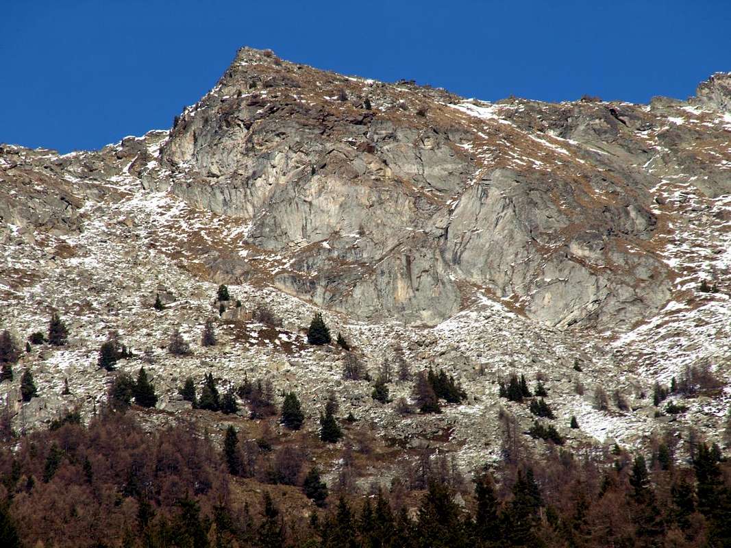
a) - the first moraine-wooded area and then, farther North, distinctly rocky with high walls and steep gorges and horrific falls above and beyond Roisan (843m) Common to reach Valpelline (1.022m), where forking roads with Gran San Bernardo. An area less known, unpopular as surely as little frequented by Hikers and even from Mountaineers.
b) - A deep, narrow valley, shaped hourglass-funnel, separates this from a second more shifted Eastward, although both come down with the direction mainly towards the Southwest and between them separated from the triple border of Roisan, Aosta, St. Christophe. This is very well known and frequented by Hunters and Hikers that Mountaineers, while its Southern and Eastern foothills above Aosta and to St. Christophe are covered with barren forests and pastures to herds of steers, cows and goats.
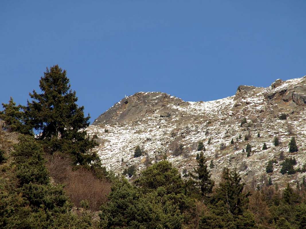
1) - Becca de Roisan or de Pechenville (2.546m). It consists of the first and highest Top westward. It binds to the East with an unnamed summit, here proposed to call Becca de Blavy (2.508m), because right in front of this ancient little village (1.475m), before reaching to Viou, now above the eponymous Comba. This area is the watershed above the Municipalities of Aosta and Roisan, between the Central Valley of Dora Baltea, the beginning of the Valley of the Gran San Bernardo and and that of Valpelline.
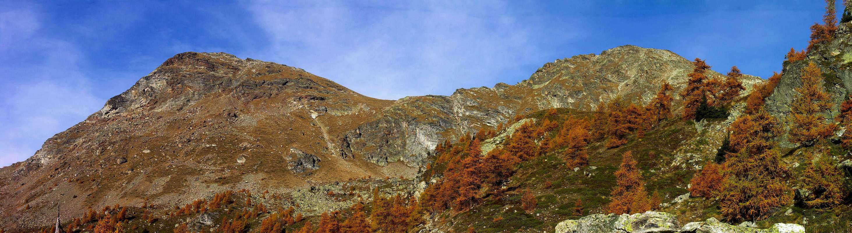 |
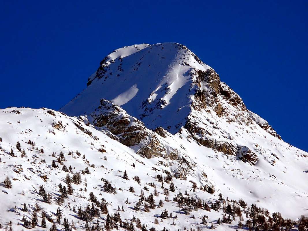
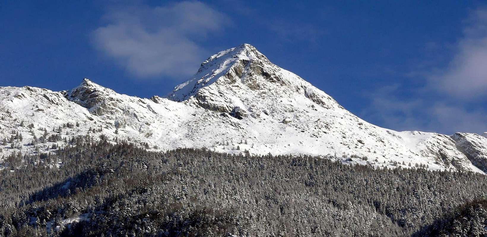
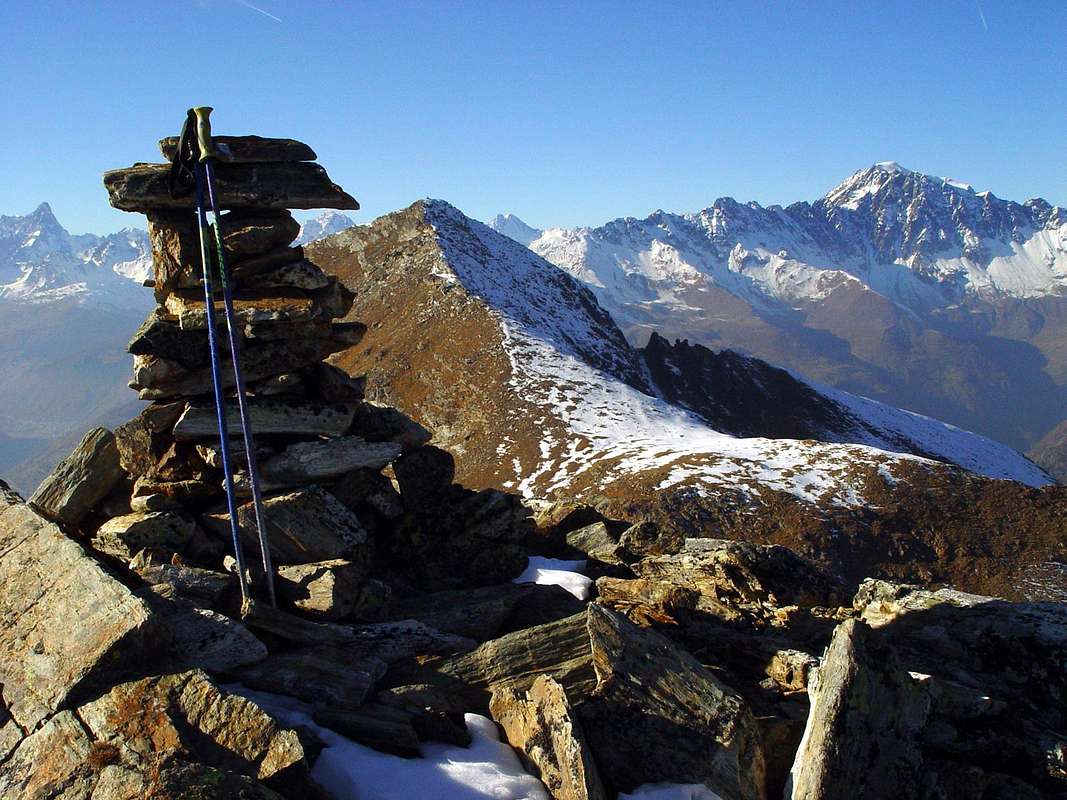
2) - Becca de Viou (2.856m). This is as the highest elevation of the entire enough small basin, content to the East up to the Mont Mary (2.816m) by a partition with the adjacent Senevé or Cénevé Comba formed by its Southern Ridge which descends towards the Dora Baltea Central Valley between Aosta and St. Christophe Municipalities.
Comba o Bacino di Viou? La stessa cosa, poiché Comba significa una piccola valle od uno stretto bacino ed anche un'area limitata. Un pò di tutto ciò, poiché questo settore di piccole montagne, che scende verso la Città di Aosta nonché l'ingresso Meridionale della grande Valle del San Bernardo e l'attigua Valpelline, si divide in due zone ben specifiche:
a) - l'area dapprima morenico-boschiva e poi, più a Settentrione, nettamente rocciosa che con alte pareti e gole ripide ed orripilanti scende sopra ed oltre il Comune di Roisan (843 m) raggiungendo quello di Valpelline (1.022 m), laddove si biforcano le strade con il Gran San Bernardo. Una zona sicuramente tanto poco conosciuta quanto frequentata.
b) - Un profondo e stretto vallone, a forma di clessidra-imbuto, separa questa da una seconda maggiormente spostata ad Est, anche se entrambe scendono con direzione principalmente verso Sudovest e tra loro separate dal triplice confine di Roisan, Aosta, St. Christophe. Risulta conosciuta e frequentata sia da Cacciatori che da Escursionisti ed Alpinisti, mentre le propaggini Meridionali ed Orientali sopra Aosta e verso St. Christophe sono ricoperte da brulle foreste e da pascoli per mandrie di manzi, mucche e capre.
1) - Becca de Roisan oppure di Pechenville (2.546m) Consiste nella prima e più elevata Cima verso Occidente. Si lega ad Oriente con una Sommità innominata, che qui si propone di chiamare Becca de Blavy (2.508 m), poiché proprio di fronte a questo antico villaggetto (1.475m), prima di raggiungere quella di Viou, ormai soprastante l'omonima Comba. Questo settore funge da spartiacque, sopra i Comuni di Roisan ed Aosta, tra la Valle Centrale della Dora, l'inizio della Valle del Gran San Bernardo e quello della Valpelline.
 |
 |
 |
 |
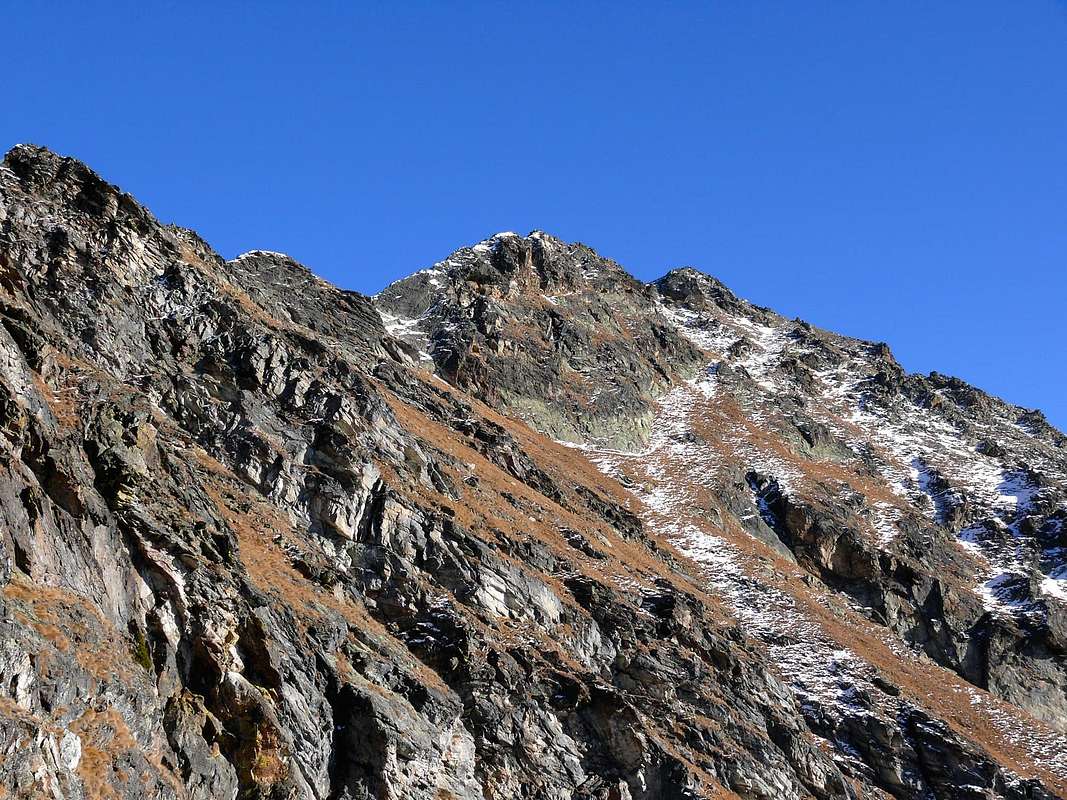 |
2) - Becca de Viou (2.856m). Risulta la massima elevazione dell'intero piccolo bacino o comba, contenuto ad Est sin alla Vetta del Mont Mary (2.815 m) dal divisorio con l'attigua Comba di Senevé o Cénevé formato dal suo Crestone Meridionale discendente in direzione della Valle Centrale della Dora Baltea tra i Comuni di Aosta e St. Christophe.
Topo with the surroundings
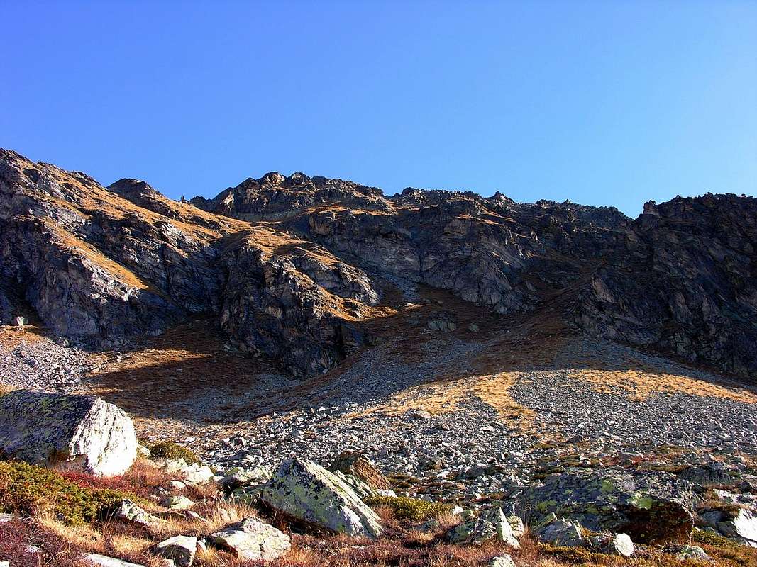
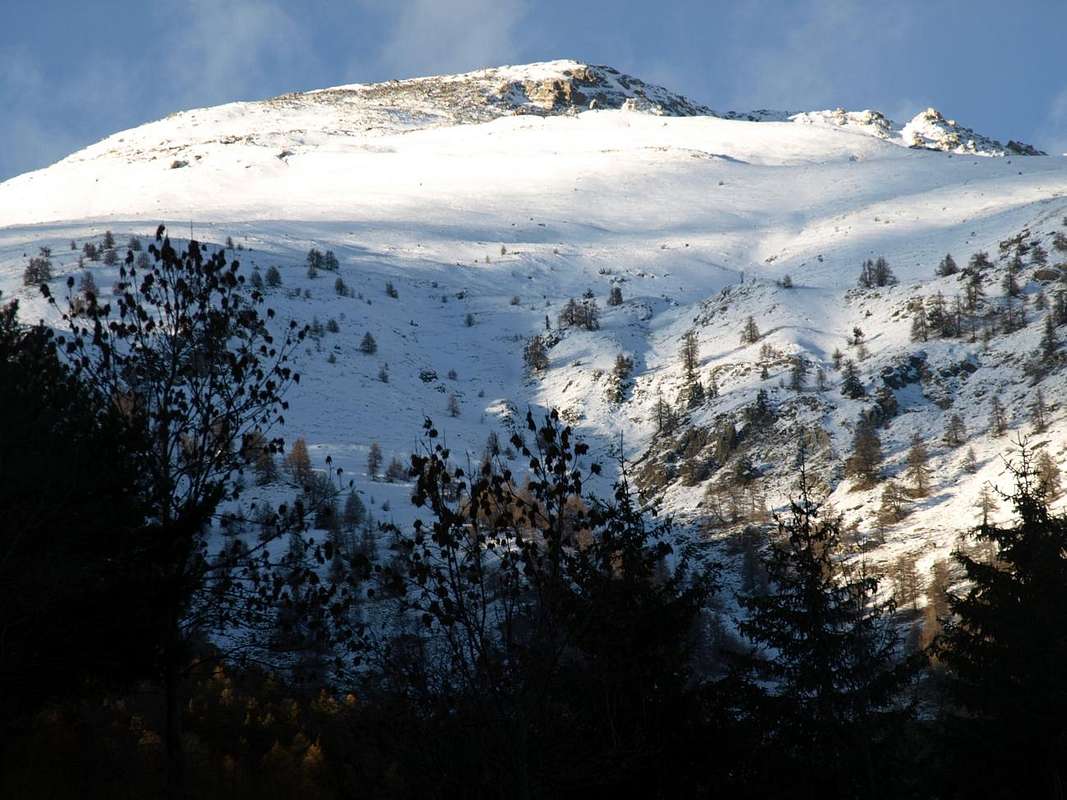
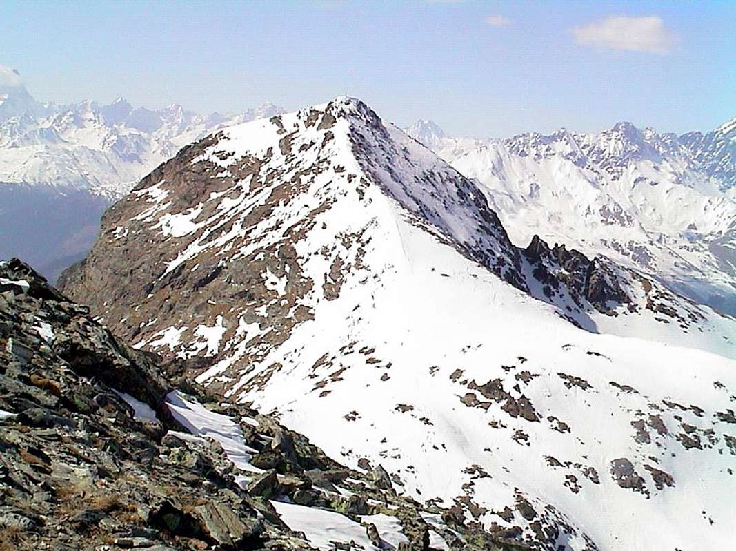
But looking further up into the mountains? This small basin concludes the watershed between the Central Valley of Dora Baltea in the South to the North and the Valpelline. In fact, starting from the Vertex of the Eastern Tsaat a l'Etsena (2.971m), the partition between these two declines gradually forming the Western Summit (2.967m), the Tip Sénevé (2.928m), the Tête d'Arpisson (2.856m), the two small Summit of Les Prèles (2.752/3 meters around) and the Tip of Chamerod (about 2.750 meters), all over the Combe de Sénevé and the Municipality of Quart to reach Mount Mary. From this (2.815m) the watershed from the East / West is directed more towards the West-northwest reaching Colle and Becca Viou (2.856m); over the ridge downhill towards the Becca di Blavy or Quota 2.508 meters, between two small hills, and nameless. As he lays down again and for a short distance in that direction over the ending of Roisan Becca (2.496m) to finally "fall" on the homonymous municipality and the beginning of adjacent Valpelline.
 |
Ma guardando più in alto verso le montagne? Questo piccolo bacino conclude lo spartiacque tra la Valle Centrale della Dora Baltea a Mezzogiorno e la Valpelline a Settentrione. Infatti, partendo dalla Sommità Orientale della Tsaat a l'Etsena (2.971 m) il divisorio tra queste due gradualmente declina formando la Sommità Occidentale (2.967 m), la Punta di Senevé (2.928 m), la Tête d'Arpisson (2.856 m), le due piccole Sommità de Les Prèles (2.752/3 metri circa) e la Puntina di Chamerod (2.750 metri circa), tutte sopra la Comba di Senevé ed il Comune di Quart fino a raggiungere il Mont Mary. Da questo (2.815 m) lo spartiacque da Est/Ovest si indirizza maggiormente verso Ovest-nordovest raggiungendo il Colle e la Becca di Viou (2.856 m); oltre la cresta scende in direzione della Becca di Blavy o Quota 2.508 m, compresa tra due piccoli ed innominati colli. Poi si distende ancora e per breve tratto in quella direzione terminando sopra la Becca di Roisan (2.496 m) per infine "precipitare" sopra l'omonimo Comune e la Valpelline.
Getting There
BY CAR:
- From TORINO, MILANO, etc: Motorway A5. Exit at IVREA or Quincinetto (PIEDMONT) From IVREA Town: in West to Pont Saint Martin, Donnas, Bard, Verrès, St. Vincent, Châtillon, Nus, Quart, St. Christophe, Aosta and Roisan Municipalities. From Courmayeur Resort: in East to Morgex, La Salle, Saint Pierre, Sarre, Aosta, Roisan and Saint Chistophe Municipalities.
- From Aosta Town to Roisan and to St. Christophe Municipalities
- 1) - From Aosta City with the SS.27 towards the Gran San Bernardo reaching the alternative (782m) near Vainey Fraction and following crossroads nearby Moulin locality (765m) and before Gignod Commune (994m). Turning right and with before Southeast, after North directions towards Roisan Commune (768/843m).
- 2) - From Aosta towards Saint Christophe-Prevot (about 640m), reached by Regional Road and to "Chief-town" Sorreley Village; from this, with Municipal, towards Veynes Fraction up to the junction 1.025 meters "Montagne". By the crossroads to the West reaching Parléaz or Parleyaz (1.274m) Blavy (1.475m) small Villages.
- 3) - By Aosta towards Saint Christophe "Chief-town" by the National Road n° 26 in East-northeast; from this before in Northeast after West with the Regional Road to alternative 730 meters below Thovex Village. Crossing West reach the fork 746 meters just below Quota Baden-Powell (792m); continuing Northwest and passing Serod, Porossan (754m, now in Aosta Municipality), Nayves, another Serod, Câche (764m), Closellinaz Dessus Fractions or Hamlets reach Roisan Commune.
- From FRANCE: through the Mont Blanc Tunnel to Entrèves-crossroads to Vény/Ferret Valleys - Mountain Guides of Courmayeur - La Saxe Rock Gym - Courmayeur. By Little Saint Bernard Pass, closed since November until half May to La Thuile Valley - Pré Saint Didier - Courmayeur. It is not necessary to take Motorway A5: you can drive on SS.26, in the direction of AOSTA - IVREA - TURIN.
BY PLANE:
- Aeroporto "Corrado Gex" Saint Christophe (Aosta).
 |
Mountain Condition
- Meteo: you can find all the needed informations at the official site of the Valle d'Aosta Region:
- Valle d'Aosta Meteo
Books and Maps
BOOKS:
- "Guida della Valpelline" de l'Abbè Joseph-Marie Henry - Societè Editrice Valdotaine 1925 II Edition e Collana Reprint Musumeci (1986).
- "Guida dei Monti d'Italia - Alpi Pennine (Vol. 2)" di Gino Buscaini - Club Alpino Italiano/Turing Club Italiano, Luglio 1970 (In Italian).
- "80 itinerari di Escursionismo Alpinismo e Sci Alpinismo in Valle d'Aosta", di Osvaldo Cardellina, Ed. Musumeci, Giugno 1977 (in Italian); seconda Ed. Luglio 1981; terza Ed. Luglio 1984; (in French), prima Ed. Febbraio 1978; seconda Ed. Marzo 1980."
 |
 |
MAPS:
- Kompass "Breuil/Cervinia-Zermatt" Carta turistica 1:50.000.
- I.G.C. Istituto Geografico Centrale "La Valpelline" (carta n° 115) Map1:30.000.
- I.G.M. Istituto Geografico Militare - Map1:25.000.
- L'Escursionista Ed. Rimini "Gran San Bernardo-Ollomont" (carta n° 5) 1: 25.000.
Important Information
- REGIONE AUTONOMA VALLE D'AOSTA the official site.
- FONDAZIONE MONTAGNA SICURA Villa Cameron, località Villard de la Palud n° 1 Courmayeur (AO) Tel: 39 0165 897602 - Fax: 39 0165 897647.
- SOCIETA' DELLE GUIDE DELLA VALPELLINE Etroubles-Strada Nazionale, n° 13 - Tel +39 0165 78559 - Valpelline-Loc Capoluogo, n° 1 - Tel +39 0165 713502 (AO) Italia.
- A.I.NE.VA. (Associazione Interregionale Neve e Valanghe).
 |
 |
 |
 |
 |
Useful numbers
- Protezione Civile Valdostana località Aeroporto n° 7/A Saint Christophe (Ao) Tel. 0165-238222.
- Bollettino Valanghe Tel. 0165-776300.
- Bollettino Meteo Tel. 0165-44113.
- Unità Operativa di Soccorso Sanitario Tel. 118.