


-
 3090 Hits
-
 80.49% Score
-
 12 Votes
|
|
Area/Range |
|---|---|
|
|
45.81000°N / 7.42884°E |
|
|
Hiking, Mountaineering, Trad Climbing |
|
|
Spring, Summer, Fall, Winter |
|
|
10082 ft / 3073 m |
|
|
Note
La montagna chiama i suoi figli, ed essi rispondono fedelmente al suo appello… Osvaldo Cardellina, Diario alpinistico, 1964-65 Page texts: @ OsvaldoCardellina "Osva", passed away on May 2, 2022. Page owners: Christian Cardellina e Osvaldo Cardellina. Any updates from September 12, 2022: Antonio Giani, page administrator, friend and climbing companion. Testi della pagina: @ OsvaldoCardellina "Osva", scomparso il 2 maggio 2022. Proprietari pagina: Christian Cardellina e Osvaldo Cardellina. Eventuali aggiornamenti dal 12 settembre 2022: Antonio Giani, amministratore della pagina, amico e compagno di salite. |
Overview
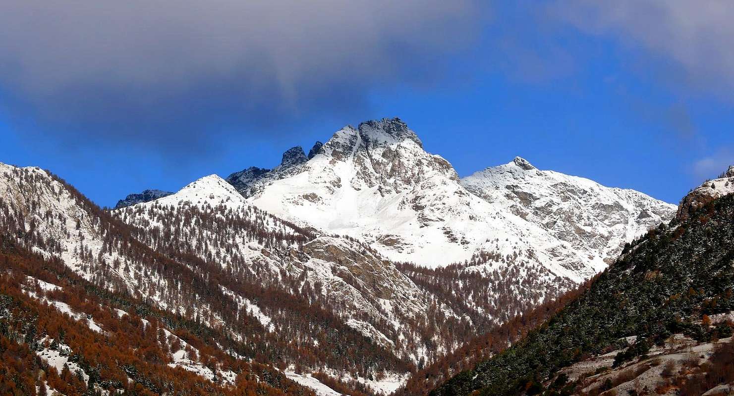 |
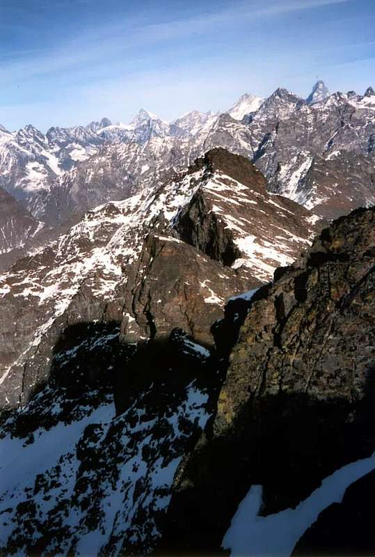
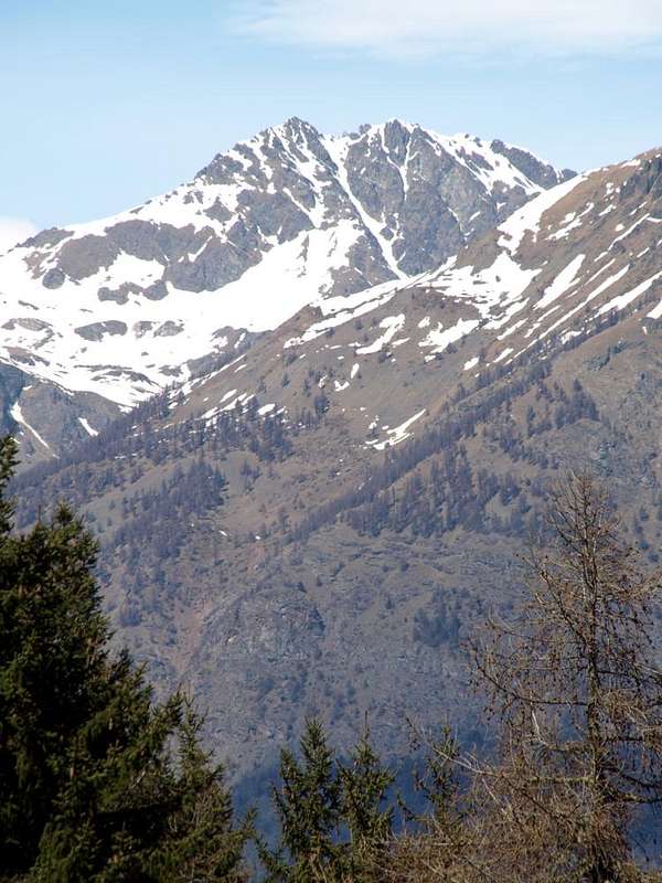
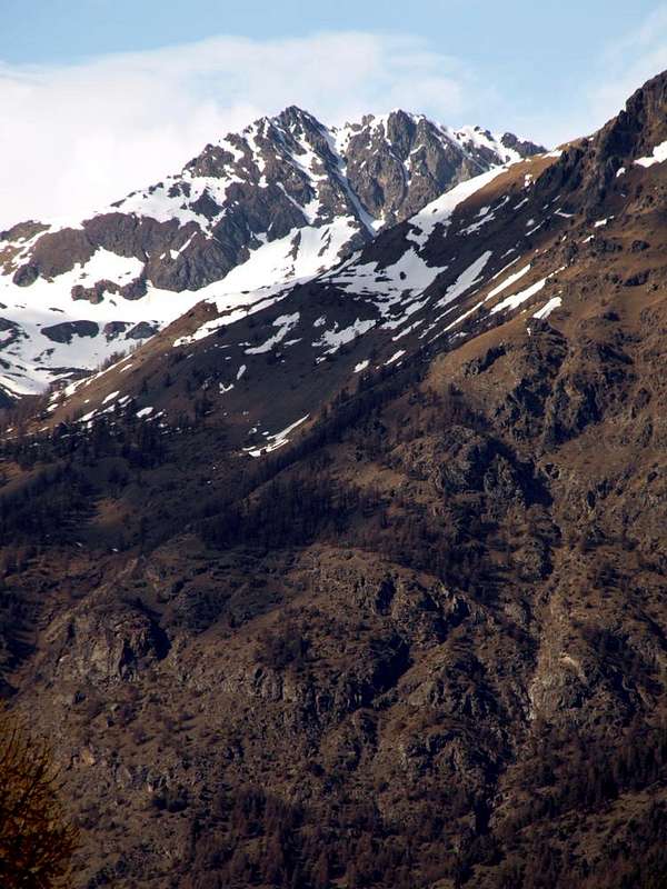
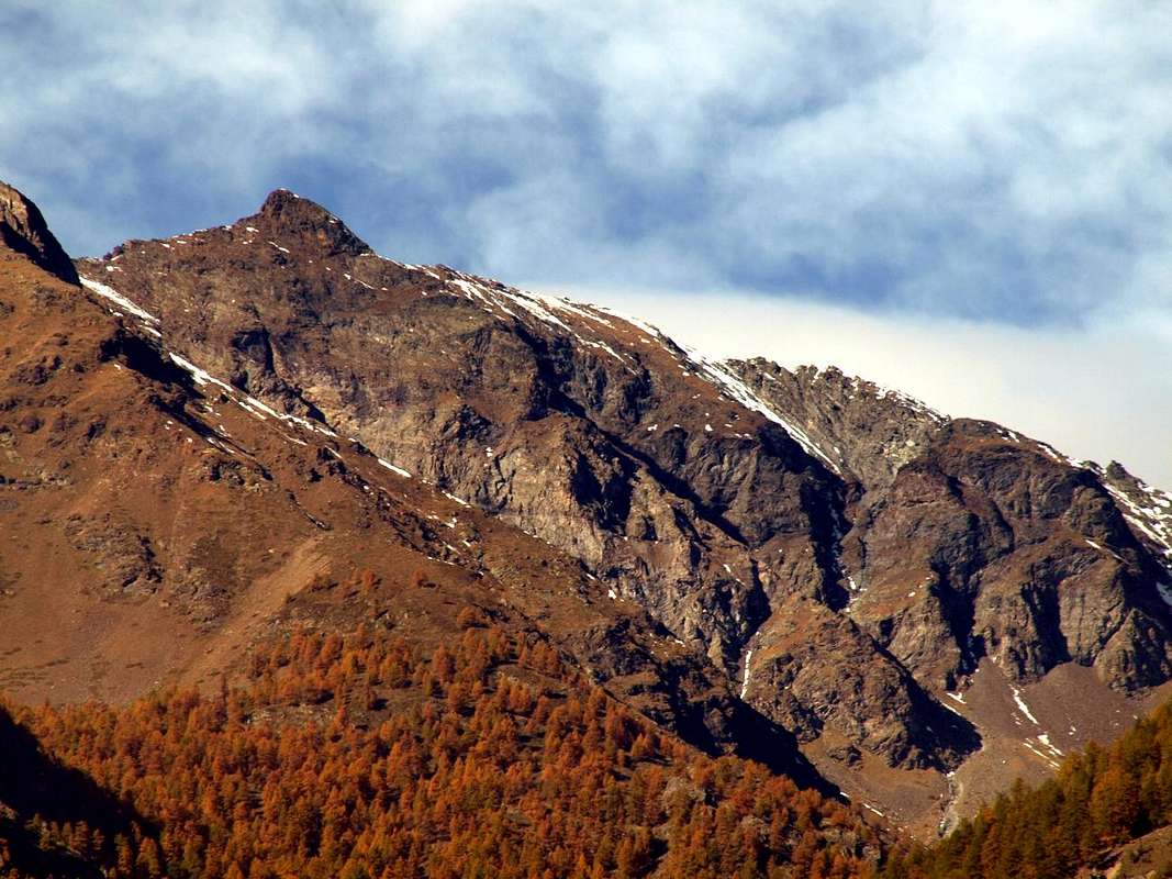
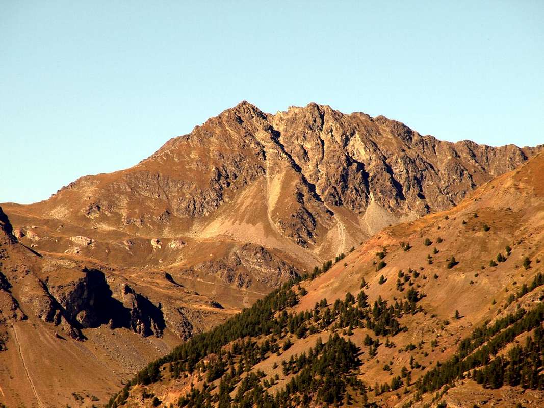
Comba or Dèche small Basin? The same thing, because Comba means a small valley or a narrow basin. Like the one that opens up to the West of the more important Valley of Saint Barthélemy from Monte Faroma (3.073m) reaches the majestic pyramid of Becca di Luseney (3.504m). But here is the first to be the main Summit, offset from the Western watershed that by the Becca Conge (2.954m) is directed towards the South reaching the Punta Joseph Marie Henry (2.918m), the Eastern Tsaat Esena (2.971m) and the Beaks of Fana (2.951m). From the latter down to the Dora Baltea a secondary ridge to the Croix de Fana (2.212m) above the triple Hamlet of Trois Villes. This partition separates the Comba Dèche from that of Sénevé or Cénevé, both in the Municipality of Quart. At the end of the valley opens the important Col Saint Barthélemy (2.639m), the crux of travel in Centuries passed through the valleys and over the Dora Baltea towards the opposite Valpelline. But Comba Dèche, although orographically descends parallel, no longer belongs to the Valley of Saint Barthélemy resulting as small autonomous valley. Surely now is a little known valley and almost eslusivamente frequented by the locals, also because, excluding the Grand Pays (2.726m) reachable from the Col de Léche or de Lechy (2.588m), presents no easy excursions including the Southern and Western Ridges of Mount Faroma or the nearby small pyramid of Punta Verdona (2.868m), at the end of this last and just above the Col de St. Barthélemy. In fact, all these small and neglected Peaks have some brief but not simple and obliged step on bad and rotten rock as the Becca d'Aveille, the Becca Conge, Punta Henry, the two Tsaat a l'Etsena and the nearby Becchi di Fana.
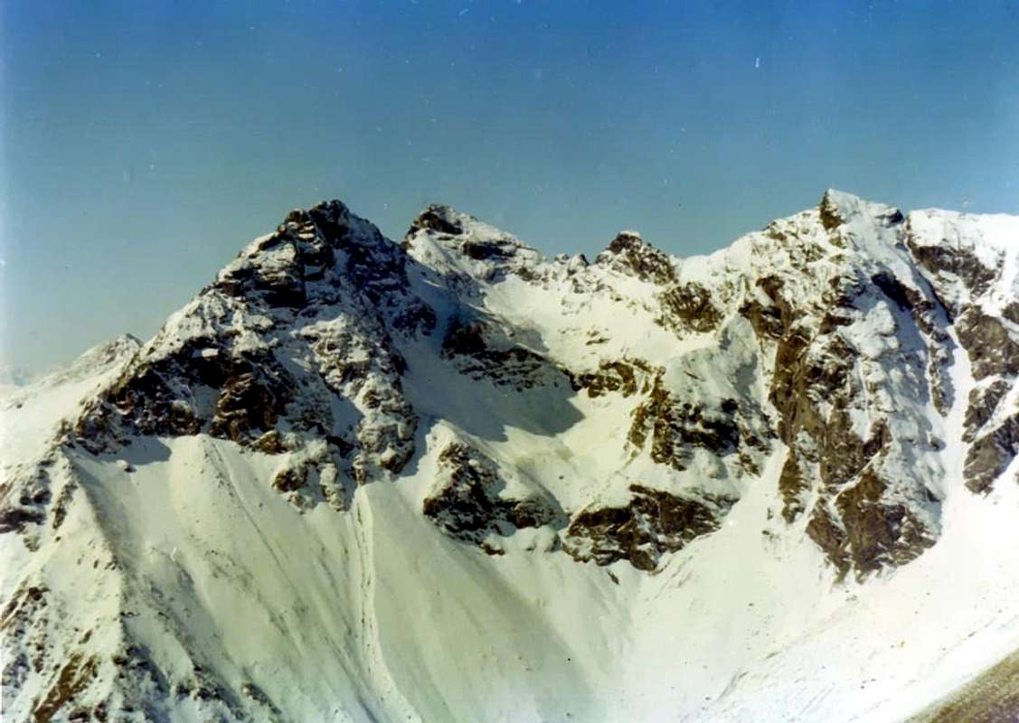
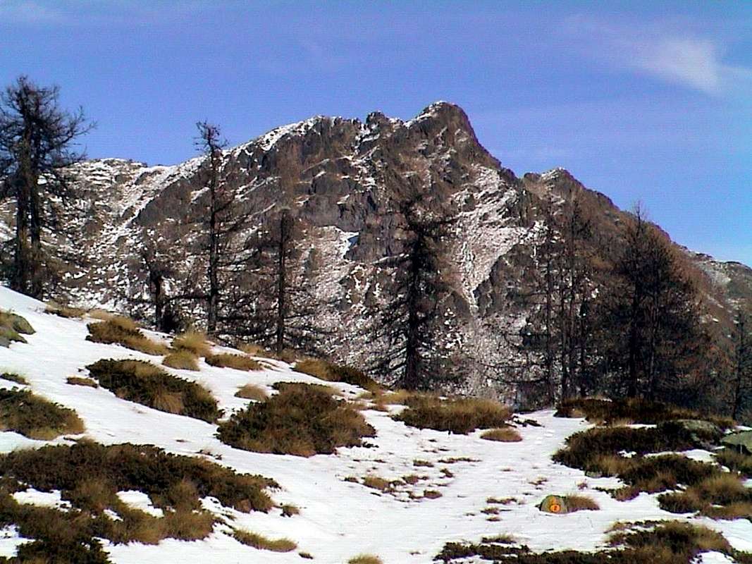
2) - the middle-upper area that dates back to the North from this bottleneck through numerous pastures and reaching the important Hill of Saint Barthelemy with the Valpelline (2.639m), leaving immediately to East the Mount Faroma (3.073m). This is as the highest elevation of the entire basin, content to the East by a partition formed by its South Ridge which reaches Becca d'Aveille separating Comba Dèche from the Valley of Saint Barthélemy and West from the watershed with the Vallon of Verdzignola in Valpelline Valley.
 |
 |
 |
 |
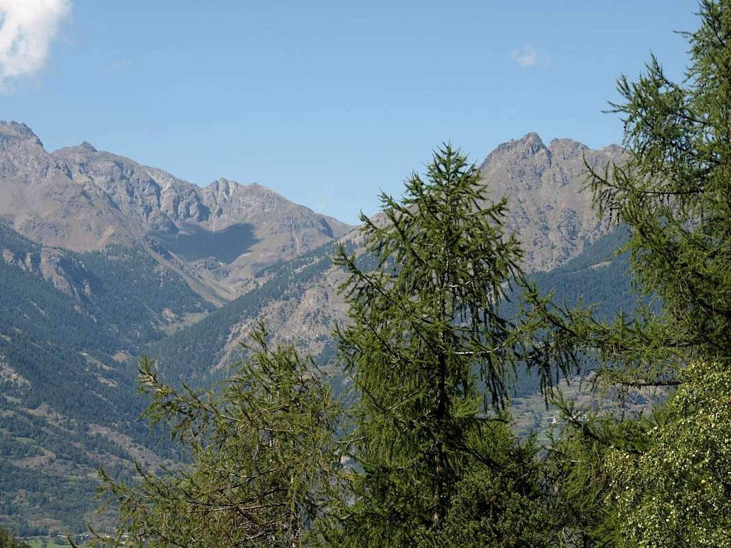 |
Comba o Bacino Dèche? La stessa cosa, poiché Comba significa una piccola valle od uno stretto bacino. Come quello che si apre ad Occidente della ben più importante Valle di Saint Barthélemy che dal Monte Faroma (3.073 m) raggiunge la Becca di Luseney (3.504 m). Qui invece é il primo a costituire la Sommità principale, controbilanciata dallo spartiacque Occidentale che dalla Becca Conge (2.954 m) si indirizza verso Meridione raggiungendo la Punta Joseph Marie Henry (2.918 m), la Tsaat a l'Esena Est (2.971 m) ed i Becchi di Fana (2.951 m). Da questi ultimi scende verso la Dora Baltea una cresta secondaria fino alla Croix de Fana (2.212 m) sopra la triplice Frazione di Trois Villes. Questo divisorio separa la Comba Dèche da quella di Senevé o Cénevé, entrambe nel Comune di Quart. Al termine del vallone si apre l'importante Colle di Saint Barthélemy (2.639 m), punto cruciale di transito nei Secoli passati tra le vallate sopra la Dora Baltea e l'opposta Valpelline. Ma la Comba Dèche, anche se orograficamente scende parallela, non appartiene più alla Valle di St. Barthélemy risultando qual valloncello autonomo. Sicuramente attualmente risulta un vallone poco conosciuto e frequentato quasi eslusivamente dai locali, anche perchè, escluso il Grand Pays (2.726 m) raggiungibile dal Col Léche o de Lechy (2.588 m), non presenta facili escursioni comprese le Creste Sud ed Ovest del Monte Faroma o la vicina Punta di Verdona (2.868 m), al termine di questa ultima ed appena sopra il Colle di St. Barthélemy. Infatti tutte queste piccole e neglette Cime presentano qualche breve ma non semplice passaggio obbligato su roccia alquanto rotta e cattiva come la Becca d'Aveille, la Becca Conge, Punta Henry, le due Tsaat a l'Etsena ed i viciniori Becchi di Fana.
1) - l'area inferiore che, partendo dalla strettoia tra la Croix de Fana (2.212 m) sullo spartiacque Occidentale e la Becca d'Aveille (2.623 m) e flettendo verso Sud-sudest, progressivamente và ad innestarsi sulla Valle di Saint Barthélemy al di sopra dell'omonimo Torrent e dei Comuni di Quart (Ovest) e Nus nella Valle Centrale della Dora Baltea.
2) - la zona medio-alta che da questa strettoia risale verso Settentrione attraversando numerosi alpeggi e raggiungendo lo importante colle di Saint Barthélemy con la Valpelline (2.639 m), lasciando subito ad Oriente il Monte Faroma (3.073 m). Questa risulta come la massima elevazione di questo bacino contenuto ad Est da un divisorio formato dalla sua Cresta Meridionale che raggiunge la Becca d'Aveille separando la Comba Dèche dalla Valle di Saint Barthélemy e ad Ovest dallo spartiacque con il Vallone di Verdzignola in Valpelline.
Getting There
BY CAR:
- From Turin or Milan: Motorway A5. Exit in Aosta East (nearby Nus Commune) continuing to the West on Main Road n°26 to various possibilities near Nus and Quart Fractions. From Switzerland: through the Grand St. Bernard Tunnel or the homonym Pass. Drive to Aosta, then follow, East direction on State Road n° 26, to Quart and Nus Municipalities.
- Specific Road: from Quart Municipality towards Trois Villes Hamlets Just after the Fraction of Quart Commune (Etolin, Vieille Morte, la Plantaz-Chétoz (better), turn to the left or North-northeast, in the direction of Trois Villes (two parkings). Or with alternative road: from Aosta East toll of the highway follow on the right side toward Quart (556m near the Region Amérique); after the roundabout follow up toward Villair. After passing Argnod (857m), Vignil (946m), Fornail (1.082m) and Ville sur Nus (1.106m) turn left towards Trois Villes Avisod (1.398m), wherefrom you must start walking.
- Alternative Road: from Nus Municipality towards Saint Barthélemy Valley From Aosta Town to address him to is long the State Rosd n° 26, after the Commune of Quart coming in that of Nus (reached even with the same Eastern Road by Châtillon Common). From Nus (960m), with Regional Road before in North, towards Marsan (699m), Petit-Fénis (939m), Blavy (1.056m), Hamlets; after through the same but in Northeast crossing Val Dessous and Dessus (1.173m, 1.268) Villages below Mont de Pesse and above St. Barthélemy Torrent. Finally East-northeast towards the locality "Les Fabriques (1.411m), and Issologne (1.514m) Village under Mont Andér and Cima Longhede; hence, turning decisively West, up to Lignan-Saint Barthélemy Hamlet (1.633m).
BY PLANE:
- Aeroporto "Corrado Gex" Saint Christophe (Aosta).
 |
 |
 |
 |
 |
Approaches towards the Comba Dèche
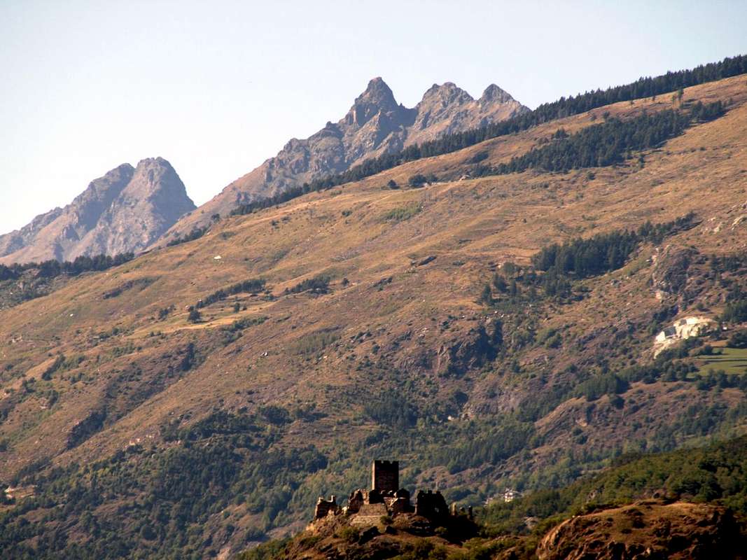
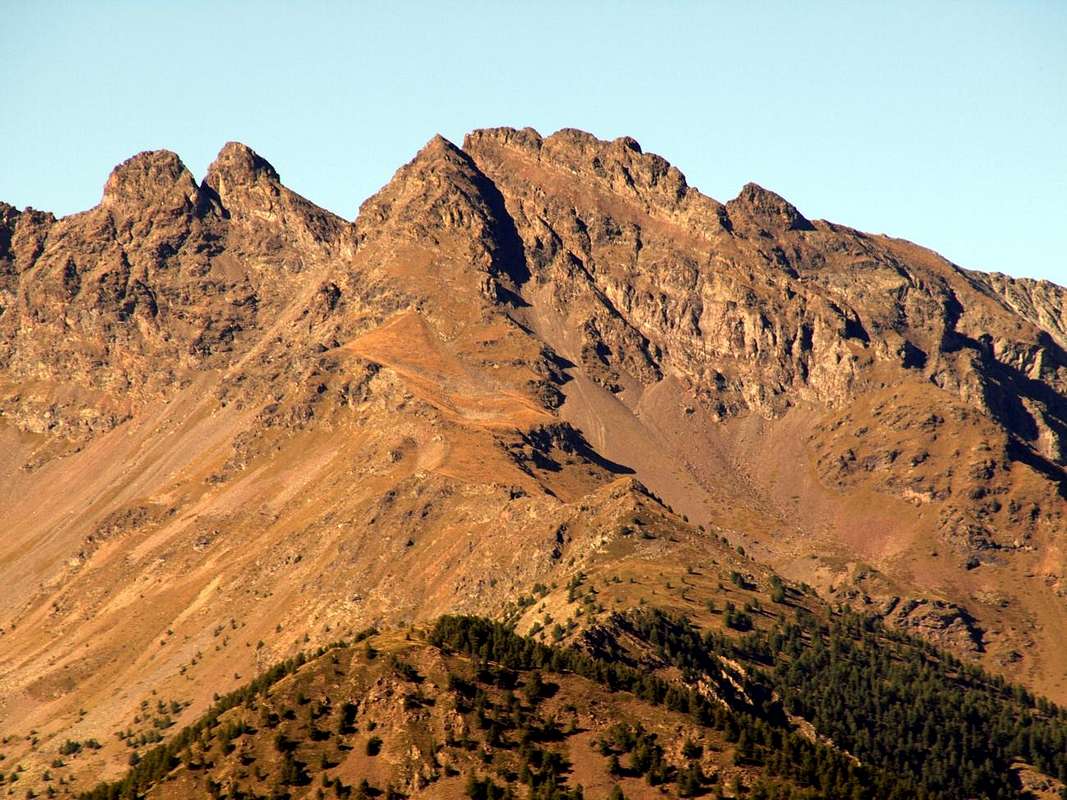
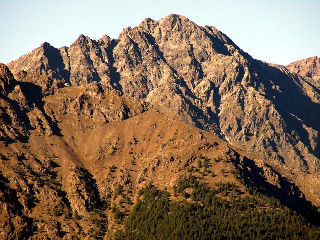
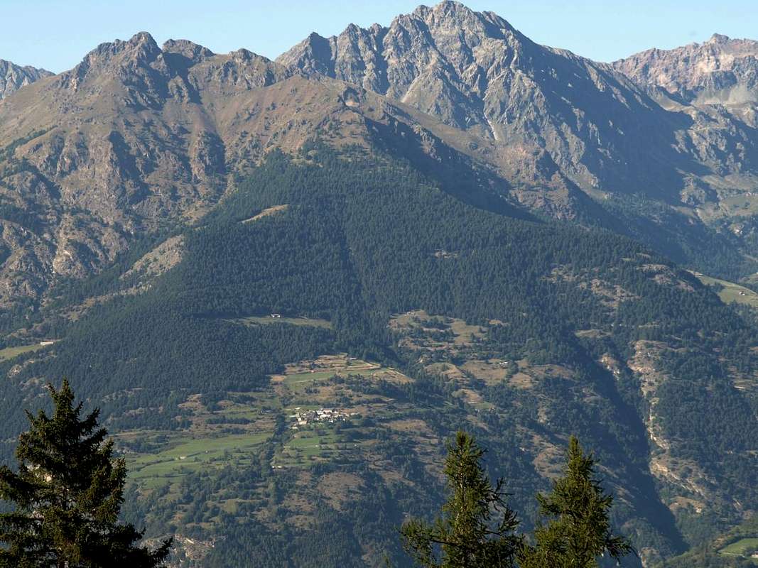
A) - By Quart Common: over the triple Village of Trois Villes (Porsan, Avisod, Fonteil), and now the interior of St. Barthélemy Valley, opens the Comba Dèche, that has a vertical depth reaching the hill with the same name. As well as very important Pass (2.639m) towards the Valpelline, between Becca Conge (2.954m) and Punta Verdona (2.868m) and just before the beautiful pyramid of Mount Faroma (3.073m), now belonging fully to this valley. An aggregation perhaps, for this comba, somewhat arbitrary but certainly practical for even the farm private dirt road that runs, concomitant with the trail n° 3/4 on valley floor, reaching in succession the mountain Pastures of Nouva, Flemagne, Salé, Cré, Brunier, Clavel towards upper La Seyvaz and Valchourda Alpages (2.184m, 2.392m) leave just from Trois Villes beginning on top of Fonteil Village (1.423m).
A) - Da Quart: oltre il triplice Villaggio di Trois Villes (Porsan, Avisod e Fonteil), ed ormai internamente alla Valle di Saint Barthélemy, si allunga la Comba Dèche, che possiede una profondità in verticale raggiungendo lo omonimo nonché molto importante Colle verso la Valpelline (2.639 m), collocato tra la Becca Conge (2.954 m) e la Punta di Verdona (2.868 m) ed appena prima della bella piramide del Monte Faroma (3.073 m), ormai appartenente in modo completo a questa valle. Una aggregazione forse, quella di questa comba, un poco arbitraria ma sicuramente pratica poiché anche la strada poderale ed il concomitante sentiero n° 3/4 che la percorrono raggiungendo in successione le Alpi di Nouva, Flemagne, Salé, Cré, Brunier, Clavel, la Seyvaz e Valchourda (2.184 m, 2.392 m) partono proprio da Trois Villes con inizio al Villaggio superiore di Fonteil (1.423 m).
B) - By Nus Common: through St. Barthélemy Valley, towards the Comba Dèche, starting from the village of Lignan (1.633m) and reaching, through the Regional Road toward the Northwest near the Clémensod (1.655m). From this last part the trail intervalleys n° 105 that reaches the vallon floor of Chaleby-Champanement at the junction immediately above the Pasture of Pleoles Dèsott (1.789m).
 |
 |
 |
 |
1) - From the next fork and on the other side you can reach the trail n° 9 Alpe Fontin (2.003m) and from there back to the Collet Pass (2.500m) between Becca d'Aveille and Grand Pays. A descent diagonally to the North-northwest through route n° 5 towards the Alpe La Seyvaz (2.184m) by connecting to the previous trail from Trois Villes.
2) - Always from the same junction, instead of heading South, back towards the Northwest with the trail n° 8 reaching the Alpe Léchy (2.299m), in the foothills of the Southern Wall of the Mount Faroma. Here comes from the Alps Champanement (2.330m) also the path diagonally n° 105. Continuing with the same, unified, in a small valley you reach the Col Léchy (2.585m), located between the South Ridge of Faroma and Grand Pays (2.724/6m); a short descent through the trail n° 4/105 leads to higher Seiser Valchourda (2.392m), at the end of Comba Dèche and on the slopes of the Hills of Saint Barthélemy and Faroma (2.639m, 2.741m).
B) - Dal Comune di Nus: tramite la Valle di Saint Barthélemy, in direzione della Comba Dèche, partendo dal Villaggio di Lignan (1.633 m) e raggiungendo, tramite la Strada Regionale verso Nordovest quello vicino di Clémensod (1.655 m). Da questo ultimo parte il sentiero intervallivo n° 105 che raggiunge il fondovallone di Chaleby-Champanement al bivio subito soprastante lo Alpeggio di Pleoles Dèsott (1.789 m).
1) - Dal bivio successivo e sul versante opposto si può raggiungere con il sentiero n° 9 l'Alpe Fontin (2.003 m) e da questa risalire al Collet (2.500 m) tra Becca d'Aveille e Grand Pays. Una discesa in diagonale verso Nord-nordovest tramite sentiero n° 5 conduce all'Alpe La Seyvaz (2.184 m) collegandosi alla via precedente da Trois Villes.
2) - Sempre dallo stesso bivio, invece di dirigersi verso Sud, risalire verso Nordovest con il sentiero n° 8 raggiungendo l'Alpe Léchy (2.299 m), ai pedi della Parete Meridionale del Monte Faroma. Qui giunge dall'Alpe Champanement (2.330 m) anche il sentiero in diagonale n° 105. Continuando con lo stesso, unificato, in un valloncello si raggiunge il Col Léchy (2.585 m), posto tra la Cresta Sud del Faroma ed il Grand Pays (2.724/6 m); una breve discesa con il sentiero n° 4/105 porta alla superiore Alpe di Valchourda (2.392 m), al termine della Comba Dèche e proprio ai piedi dei Colli di Saint Barthélemy e Faroma (2.639 m, 2.741 m).
 |
 |
 |
 |
 |
C) - Dal Comune di Nus con la Strada Regionale di collegamento verso Trois Villes: tramite la Valle di Saint Barthélemy, in direzione della Comba Dèche, partendo dal Villaggio di Lignan (1.633 m) e raggiungendo, tramite la Strada Regionale verso Nordovest quello vicino di Clémensod (1.655 m). Da questo continuare con la Strada regionale dapprima a Nordovest verso il fondo del vallone e poi, superato il Torrent de Chaleby, in direzione dei Villaggi di Arlod (1.554 m), Valservière (1.502 m), Effraz (1.487 m), Avion (1.312 m) ed Avisod-Trois Villes (1.390/8 m). Questa via consente di collegare Nus e St. Barthélemy con le Frazioni di Quart, evitando di dovere scavalcare i Colli Collet e Léchy.
Books and Maps
BOOKS:
- "Guida della Valpelline" de l'Abbè Joseph-Marie Henry - Societè Editrice Valdotaine 1925 II Edition e Collana Reprint Musumeci (1986).
- "Guida dei Monti d'Italia - Alpi Pennine (Vol. 2)" di Gino Buscaini - Club Alpino Italiano/Turing Club Italiano, Luglio 1970 (In Italian).
- "80 itinerari di Escursionismo Alpinismo e Sci Alpinismo in Valle d'Aosta", di Osvaldo Cardellina, Ed. Musumeci, Giugno 1977 (in Italian); seconda Ed. Luglio 1981; terza Ed. Luglio 1984; (in French), prima Ed. Febbraio 1978; seconda Ed. Marzo 1980.
 |
 |
MAPS:
- Kompass "Breuil/Cervinia-Zermatt" Carta turistica 1:50.000.
- I.G.C. Istituto Geografico Centrale "La Valpelline" (carta n° 115) Map1:30.000.
- I.G.M. Istituto Geografico Militare - Map1:25.000.
- L'Escursionista Ed. Rimini "Gran San Bernardo-Ollomont" (carta n° 5) 1: 25.000.
Important Information
- REGIONE AUTONOMA VALLE D'AOSTA the official site.
- FONDAZIONE MONTAGNA SICURA Villa Cameron, località Villard de la Palud n° 1 Courmayeur (AO) Tel: 39 0165 897602 - Fax: 39 0165 897647.
- A.I.NE.VA. (Associazione Interregionale Neve e Valanghe).
Useful numbers
- Protezione Civile Valdostana località Aeroporto n° 7/A Saint Christophe (Ao) Tel. 0165-238222.
- Bollettino Meteo (weather info) Tel. 0165-44113.
- Bollettino Valanghe Tel. 0165-776300.
- Unità Operativa di Soccorso Sanitario Tel. 118.