


-
 4868 Hits
-
 81.18% Score
-
 13 Votes
|
|
Area/Range |
|---|---|
|
|
45.81400°N / 7.06119°E |
|
|
Hiking, Mountaineering |
|
|
Spring, Summer, Fall, Winter |
|
|
10912 ft / 3326 m |
|
|
Note
La montagna chiama i suoi figli, ed essi rispondono fedelmente al suo appello… Osvaldo Cardellina, Diario alpinistico, 1964-65 Page texts: @ OsvaldoCardellina "Osva", passed away on May 2, 2022. Page owners: Christian Cardellina e Osvaldo Cardellina. Any updates from September 12, 2022: Antonio Giani, page administrator, friend and climbing companion. Testi della pagina: @ OsvaldoCardellina "Osva", scomparso il 2 maggio 2022. Proprietari pagina: Christian Cardellina e Osvaldo Cardellina. Eventuali aggiornamenti dal 12 settembre 2022: Antonio Giani, amministratore della pagina, amico e compagno di salite. |
Overview
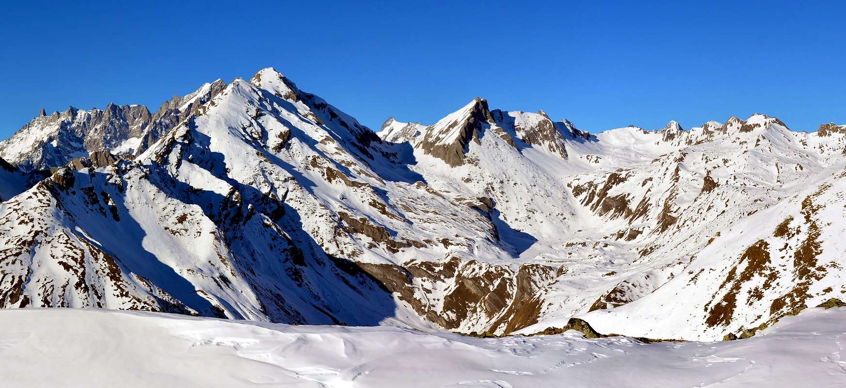
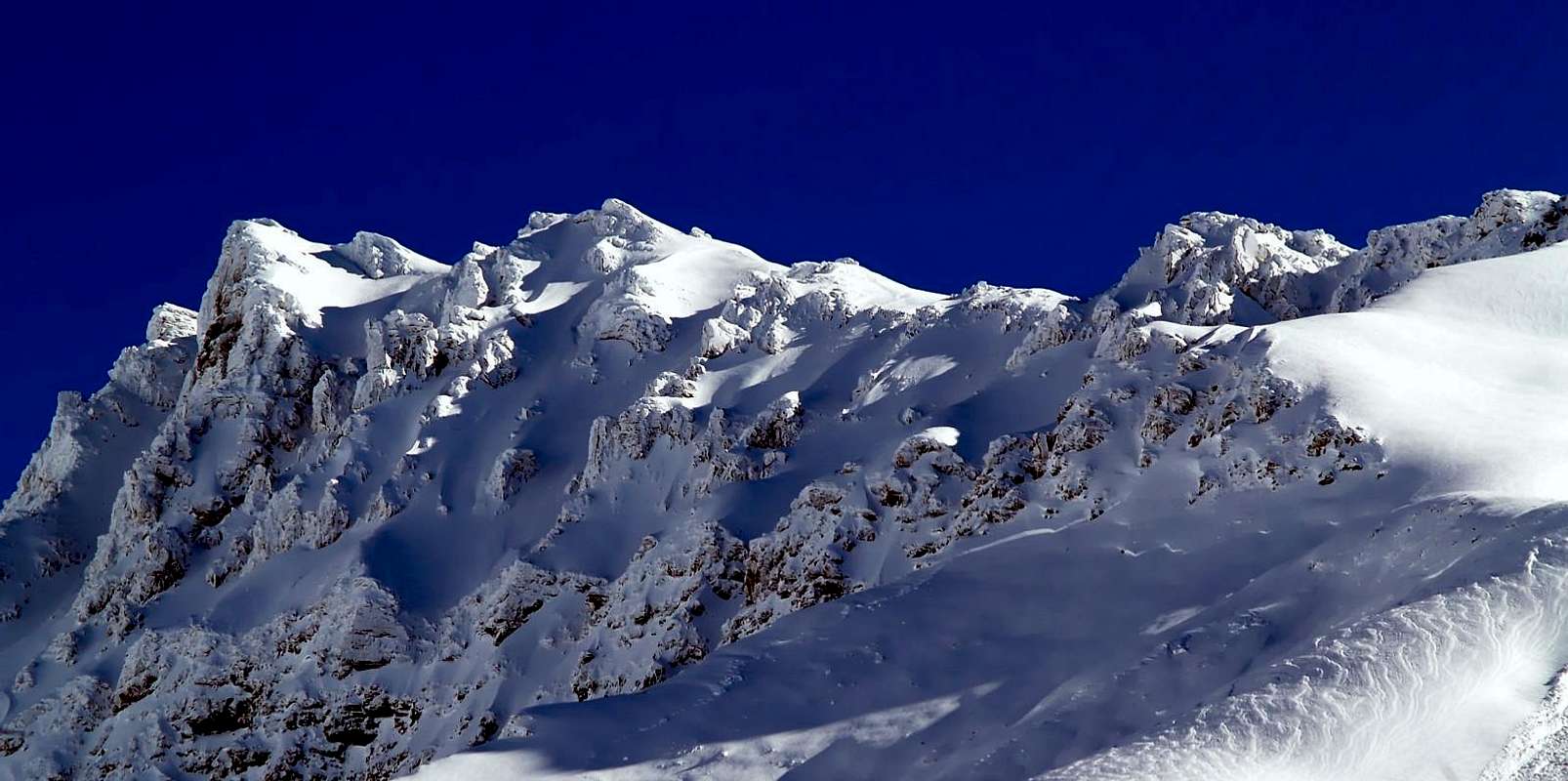
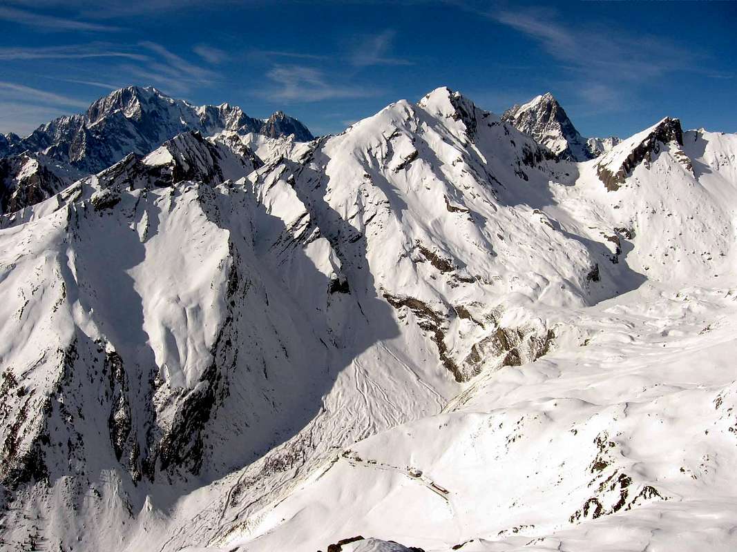
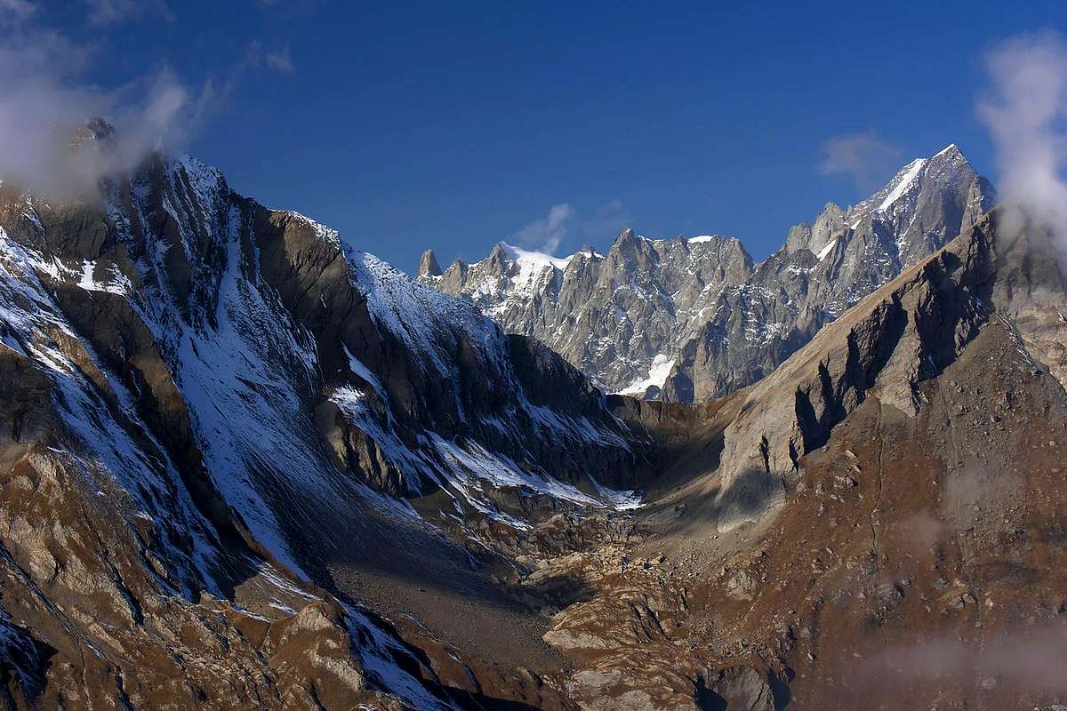
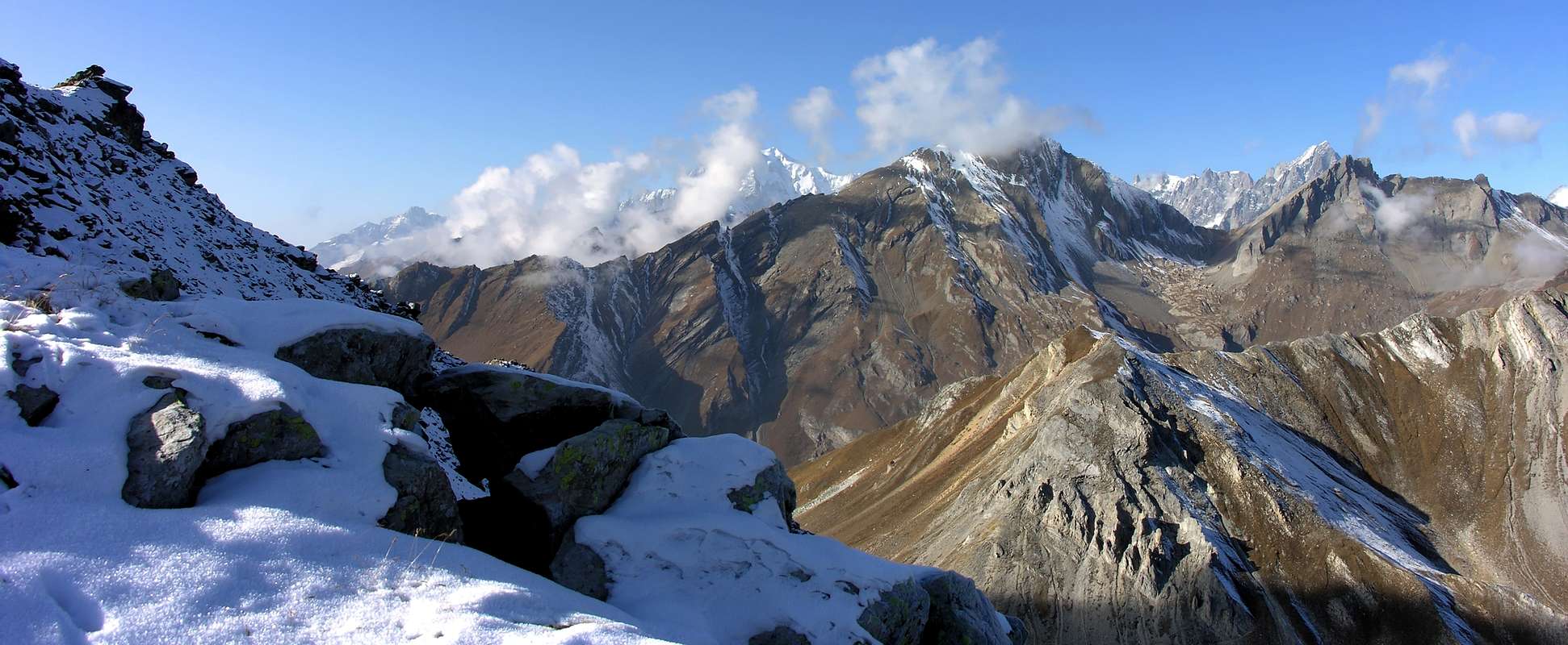
A "Comba", that is to say a wide Basin that turns into a big "Vallone", almost a real Valley spreading like a big leaf above the Municipalities of La Salle Morgex. Two marginal areas (East over Challancin and up to Colle and Court de Bard (2.176m, 2.262m) and West above Morgex-Lavanchers Dailley-up to the Testa Liconi( Head; 2.929m) at the height of a steep vallon unnamed) containing the main Valley Planaval. This in turn is divided into three major ramifications for the West with the Vallons of Liconi Chambave, while in the center extends the homonymous valley which reaches its most extreme culmination on the Aiguille d'Artanavaz and Grand Crêton (both 3.071m) and its natural outlet in Serena Hill (2.547m) on the border with Comba du Merdeux into Valley Great St. Bernard. But the highest Summit and the true symbol of this valley is located on the Grande Rochère (3.332m), located between a side valley that culminates with the Col di Liconi (2.925m) and the major Vallon Chambave reaching on the Colle Battaglione Aosta (2.883m). Both of these passes are directed towards Val Ferret reaching respectively the Vallons Malatrà Arminaz. From this great pyramid they start four ridges in evidence. The first to the West-northwest divides the two valleys above, while the other three constitute the Valley Planaval with the Northeast that bypassed the Aiguilles of Bonalé or Bonalex Malatrà (3.201m, 3.242m), reaches that of Artanavaz, while the opposite continues the divide coming to Testa del Currù after a branch from an altitude of 3.134 meters on the first portion of the West-northwest Ridge. A third more "internal crest said the Varise" drops steeply to the South-southeast, forming the Petite Rochère, the Mont de la Varise, the Tête Noire and the Bec d'Aouille just above Planaval. This serves as a great divider between the main valley and that of Chambave. Abandoned behind the Testa del Currù and the adjacent Aiguille de Chambave (2.990m, 3.067m), the watershed falls over the Colle di Liconi (2.674m) to the East above the beautiful lake of the same name and West Val Sapin, now over Villair di Courmayeur. In addition to the South he reaches the Liconi Head on which place is the "Bivouac Louis Pascal". From this one last douple appendix contains the vallon unnamed cited above coming to Drumiana Head (in Southeast) and the Mont Cormet, just above Pré St. Didier. If it goes to Planaval Village you can see almost it all. All the Trips are long enough but not require great hocks ... And even no a great knowledge of the area, because these little valleys are getting longer openly toward a hill above; just follow the course of streams. A concession to the imagination and the desire to explore that may constitute a small problem instead on ridges and walls, often still shrouded in mystery even if you have previously traveled to the start of the "Classic Mountaineering". But we must be careful because everywhere the rock quality is poor and often steep grassy slopes alternate or even hold the same with dangerous coverage on slabs and cracks. An approach that requires experience and caution, while remaining on the paths or on traditional routes there are no big problems. One last recommendation, perhaps the most important, concerns the Ski-Mountaineering and Snowshoeing: during the cold and bad season and in spring all the slopes are quite exposed to the fall of snowslides and avalanches, and are not to be underestimated even the most Excursions apparently easier. In fact, a series of fatal accidents have already hit in recent years on the simple Western Slope of Punta Felita or Fetita, located in Eastern watershed. Better respect cartels generally positioned in Planaval Village and down Challancin Hamlet ...
Planaval consiste in vallone poco frequentato. Sicuramente il più caratterizzante, ma anche quelli sottostanti di Liconi e Chambave ad Ovest sono interessanti. Una "Comba", cioé un Bacino che si trasforma in espanso Vallone, quasi una vera e propria Valle allargandosi a guisa di grande foglia al di sopra dei Comuni di La Salle e Morgex. Due settori marginali (ad Est sopra Challancin e fino a Colle e Court de Bard (2.176 m, 2.262 m) ed a Ovest sopra Morgex-Lavanchers-Dailley fino a raggiungere la Testa di Liconi (2.929 m) al culmine di un ripido vallone innominato) contengono la Valle principale o di Planaval; questa a sua volta é articolata in tre grandi ramificazioni con ad Occidente i Valloni di Liconi e Chambave, mentre nel centro si distende l'omonimo che raggiunge il suo apice più estremo nell'Aiguille di Artanavaz e Grand Crêton (3.071 m) ed il suo "sbocco" naturale nel Col Serena (2.547 m) ai confini con la Comba du Merdeux nella Valle del Gran San Bernardo. Ma la Cima più elevata nonché vero emblema di questa vallata si trova sulla Grande Rochére (3.332 m), posta tra un valloncello secondario culminante col Col di Liconi (2.925 m) e l'importante Vallone di Chambave arrivante al Colle Battaglione Aosta (2883 m). Entrambi questi colli sono rivolti verso la Val Ferret raggiungendo rispettivamente i Valloni di Malatrà ed Arminaz. Da questa grande piramide si dipartono quattro creste in grande evidenza. La prima verso Ovest-nordovest divide i due valloni suddetti, mentre le altre tre configurano la Valle di Planaval con quella Nordest che, scavalcate le Aiguilles di Bonalé o Bonalex e Malatrà (3.201 m, 3.242 m), perviene a quella d'Artanavaz, mentre quell'opposta continua lo spartiacque arrivando alla Testa del Currù dopo una diramazione dalla Quota 3.134 m sulla prima delle creste. Una terza cresta "interna e della Varise" scende decisamente a Sud-sudest formando la Petite Rochère, il Mont de la Varise, la Tête Noire ed il Bec d'Aouille proprio sopra Planaval. Questa funge da grande divisorio tra la valle principale e quella di Chambave. Lasciate alle spalle la Testa del Currù e l'adiacente Aiguille de Chambave (2.990 m, 3.067 m), lo spartiacque cala sopra il Colle di Liconi (2.674 m) soprastante ad Est l'omonimo splendido lago e ad Ovest la Val Sapin, ormai sopra il Villair di Courmayeur. Oltre a Sud raggiunge Testa di Liconi sulla quale é posto il "Bivacco Luigi Pascal". Da questa un ultima duplice appendice contiene lo scosceso vallone innominato di cui sopra arrivando alla Testa di Drumiana (2404 m, a Sudest) ed al Mont Cormet (2.476 m) appena al di sopra di Pré St. Didier.
Recandosi al Villaggio di Planaval si può osservare quasi tutto. Tutte le Gite sono abbastanza lunghe ma non richiedono ottimi garretti ... E neppure una grande conoscenza del territorio, poiché questi valloni si allungano in modo palese verso un soprastante colle; basta seguire il corso dei torrenti. Una concessione alla fantasia ed al desiderio di esplorazione che si può concretizzare invece su creste e pareti, spesso avvolte ancora nel mistero anche se già visitate all'inizio dell'"Alpinismo Classico". Però bisogna fare attenzione perché ovunque la qualità della roccia risulta scadente e spesso ripidi pendii erbosi si alternano od addirittura ricoprono la medesima "intasando" sia placche che fessure. Un approccio che richiede esperienza e prudenza, mentre restando sui sentieri o sui percorsi tradizionali non sussistono grandi problemi. Un'ultima raccomandazione, forse la più importante, concerne lo Sci-Alpinismo e le Racchette da neve: durante la cattiva stagione ed in primavera tutti i versanti sono alquanto esposti alla caduta di slavine e valanghe, quindi non sono da sottovalutarsi nemmeno le Escursioni apparentemente più facili. Infatti una serie di incidenti mortali hanno di già colpito nelle ultime annate sul semplice Versante Ovest della Punta Felita o Fetita. Meglio rispettare i cartelli in genere posizionati a Planaval e giù alla Frazione di Challancin ...
Hikes
Ascensioni
 |
 |
Getting There
BY CAR:
- From TORINO, MILANO, etc: Motorway A5. Exit at IVREA or Quincinetto (PIEDMONT) From IVREA Town: in West to Pont Saint Martin, Donnas, Hône, Verrès, Arnad, Saint Vincent, Chatillon, Chambave, Nus, Quart, Quart, Saint Chistophe and Aosta; from this last to Sarre, Villeneuve, Saint Pierre, La Salle and Morgex Municipalities. From Courmayeur Resort: in East to Pré St. Didier, Morgex and La Salle Municipalities. From Courmayeur in East or from Aosta West From La Salle, with Regional Road in Northeast, towards Challancin Village (1.610m), Ponteilles (1.741m), Arpilles (1.862m) Pastures to Bard Pass (2.178m) in Arpilles Conca. Or in Northwest towards Cheverel ( 1.486m), Morge (1.629m) and Planaval (1.750m) Villages at the beginning of Planaval Vallon.
- From FRANCE: through the Mont Blanc Tunnel to Entrèves-crossroads to Vény/Ferret Valleys - Mountain Guides of Courmayeur - La Saxe Rock Gym - Courmayeur. By Little Saint Bernard Pass, closed since November until half May to La Thuile Valley - Pré Saint Didier - Courmayeur. It is not necessary to take Motorway A5: you can drive on SS.26, in the direction of AOSTA - IVREA - TURIN.
BY PLANE:
- Aeroporto "Corrado Gex" Saint Christophe (Aosta).
![Planaval ... Testa di Drumiana from East-northeast 2016]()
![Planaval ... Grande & Petite Rochère from SW 2016]()
![Planaval ... Tour de Chatelard of 1235 from North 2016]()
![Planaval ... From Testa di Liconi to Testa Drumiana 2016]()
![Aiguille de Tré-la-Tête going up to Planaval Valley 2016]()
![Birth of Mont Blanc entering into Planaval Valley 2016]()
![Planaval ... Mont Blanc above Aiguille Blanche 2016]()
![Planaval ... Morge or Morges Hamlet & Tête Liconi 2016]()
![From Planaval to Becca Pugnenta & Mont Charvet 2016]()
![Planaval Village <i>(1750m)</i> during the long winter 2016]()


Walks Hikes Ascents into Planaval Valley
Walks
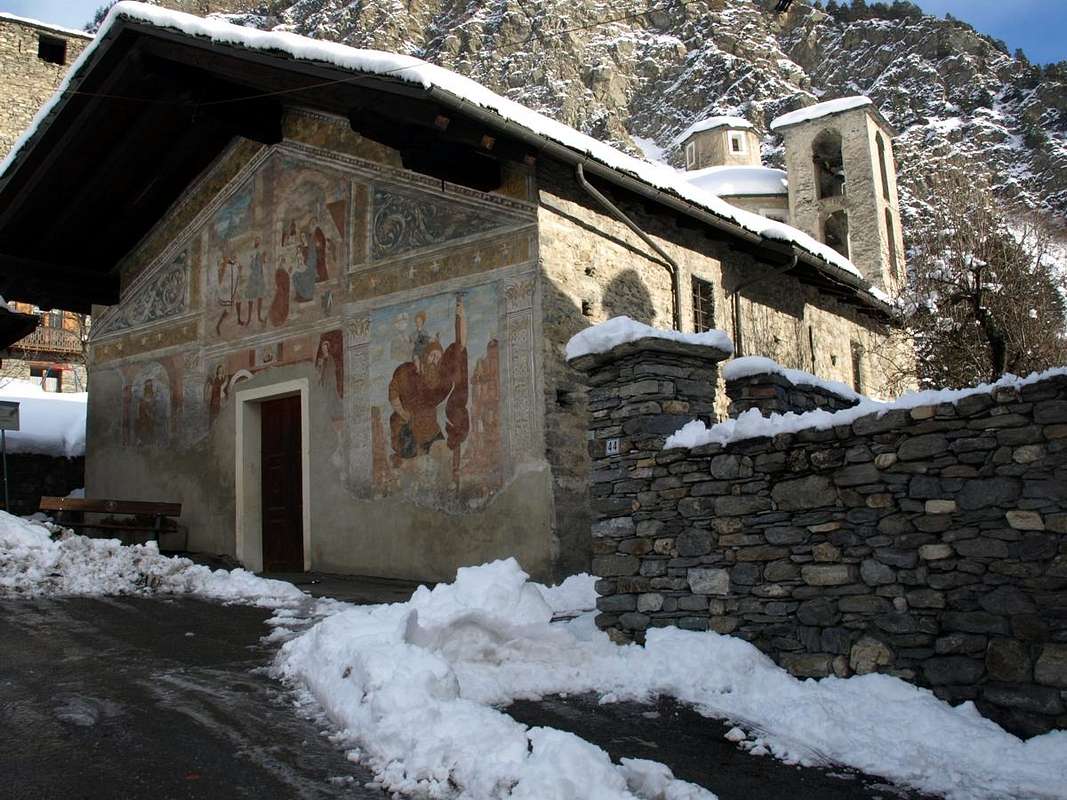
2) - Ecors or Descours Chapel and Tower of XII° Century (1.086m). Short Walk from La Salle center to the North with a possibility of crossing in East through the path n° 1B towards Charvaz Village (1.518m), after the fording on adjacent Torrent de Charvaz inside the wild and deep vallon of the same name (T/F; 0h'30 or 1h'20 until Charvaz).
3) - Madonna des Lourdes from Morge or Planaval Villages (+; 1.878m). Walk almost a Hike from Morge or Morges (1.629m) to the Northwest through the trail n°21, passing nearby the Alp Piginière (1.669m), under the Bec de l'Aouille; otherwise by Planaval (1.750m) towards West with the path n° 20/21 (E/F; 1h'00/1h'15).
4) - Eculés or Maison Blanche Pastures (1.886m, 1.871m). Two brief Walks to the North, both with departure from Planaval Village, on valley floor by a small path not numbered or Northeast through the initial part on the dirt road towards Rantin Alpage concomitant with the trail n° 6/7/3A (E/F; 0h'40 and 0h'30 to Maison Blanche Alp).
5) - Les Ors Damon Middle Alp (2.078m). From Morge or Morges Hamlet (1.629m) with the path n° 3 to the Northeast otherwise by the underlying Challancin Fraction (1.610m) towards Northwest through what n° 2A, concomitant with a farm dirt road, up to the reach the middle amongst the various Ors Pastures (E/F; 1h'20/1h'40).
Passeggiate
1) - Torre di Chatelard del 1235 (1.170 m). Passeggiata in diagonale dal Comune di La Salle verso Nordovest oppure da Morgex località Villair a Nordest sempre con medesimo sentiero n° 5; inoltre da Morgex-Ruine Dessus presso il Château Pascal verso Settentrione ed ancora sentiero n° 5/5A (T/F; 0h'45 oppure 0h'30 dal Villair-Saint Roch).
2) - Cappella e Tour d'Ecors o Descours XII° Secolo (1.086 m). Breve passeggiata dal centro di La Salle verso Nord con possibilità di attraversare ad Est con il sentiero n° 1B al Villaggio di Charvaz (1.518 m), attraversato l'adiacente Torrent de Charvaz all'interno del selvaggio, profondo ed omonimo vallone (T/F; 0h'30 oppure a Charvaz 1h'20).
3) - Madonna des Lourdes dai Villaggi di Morge o Morges o da Planaval (+; 1.878 m). Passeggiata quasi Escursione da Morge (1629 m) a Nordovest tramite il sentiero n° 21, passando dall'Alpe Piginière (1.669 m), al di sotto del Bec de l'Aouille; oppure da Planaval (1.750 m) verso Occidente con il sentiero n° 20/21 (E/F; 1h'00/1h'15).
4) - Alpi Eculés o Maison Blanche (1.886 m, 1.871 m). Due brevi Passeggiate a Nord, entrambe con partenza dal Villaggio di Planaval, con percorso sul fondovalle tramite il sentierino non numerato oppure a Nordest con la parte iniziale sulla strada sterrata poderale verso l'Alpe Rantin concomitante al sentiero n° 6/7/3A (E/F; 0h'40 e 0h'30).
5) - Alpeggio intermedio di Les Ors Damon (2.078 m). Dal Villaggio di Morge oppure Morges (1.629 m) con sentiero n° 3 a Nordest oppure dalla sottostante Frazioncina di Challancin (1.610 m) a Nordovest con il sentiero n° 2A, concomitante alla strada poderale, fino a raggiungere il medio tra i vari Alpeggi di Les Ors (E/F; 1h'20/1h'40).
 |
 |
 |
6) - Col and Court de Bard from Challancin or by Charvaz (2.176m, 2.262 m). Short enough Walk-Hike, even with Snowshoeing, departing from Challancin and passing by Ponteilles and Arpilles Alps (1.741m, 1.862m) with trail n° 2 to the East-northeast or from the underlying Village Charvaz with unnumbered small path towards Northeast to the Col de Bard. From here to the South through the wide grassy plateau and zigzaging amongst some small rocks in the final part to the Summit (E/F; 2h'20/2h'40).
7) - Col Felita, Punte Fetita or Felita by Morge or Challancin (2.557m, 2.623m). Excursion Morge to the Northeast along the trail n° 3 passing through Les Ors Dèsott and Damon Pastures and Le Tramoail des Ors Alp until the pass; then to the Summit with the easy North-northeast Crest (2.100m, 2.078m, 2.390m). Or from Challancin with the path n° 2/2A to the Northeast before towards Ponteilles, then Northwest with n° 2A until to reach Hôpitaux, Les Ors Dèsott and previous route (both E/F; 3h'15/3h'45).
8) - Rantin and Bonalé or Bonalex Alpages by Planaval (2.333m, 2.340m). Two Alps reached consecutively with North Excursion, both starting from the Village of Planaval, with path n°6/7/3A to the Northeast, concomitant with dirt farm road, towards Alpe Rantin and then toward Northwest direction to Bonalé upper Alp (E/F; 2h'15/2h'30).
9) - Col and Testa Serena by Planaval (2.547m, 2.830m). Excursion with the previous route to Alpe Rantin; then, abandoning to the left or North-northwest the above Vallon of Bonalé, continue towards the Northeast under the Costa Serena in West and Testa dei Frà in East with the trail n° 6, reaching the Col Serena or Fenêtre de Sereina, on the border with Comba du Merdeux and Gran San Bernardo Valley. Finally a short Climb along the easy (I°) West-northwest Crest at Serena's Head (EE/F+; 3h'15/3h'45).
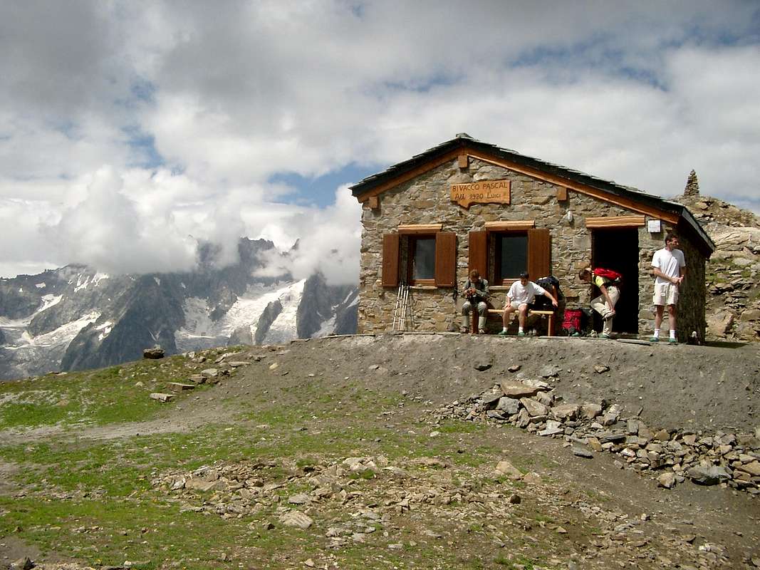
10) - Lake, Hill and Testa Liconi with "Luigi Pascal" Bivouac from Planaval-Piginière, by Morge or directly by Morgex. Achieved Piginière Alp with the trail n° 21, continue to the Northwest through the itinerary n° 4, that goes up from Morgex-Villair-Fenêtre-Chanton (E/F; 1h'45/2h'00), reaching, after a waterfall feature on limestone rocks, the lake (2.555m). This, passing over the North shore, in a short time arrive, through the Arp de Licony (2.662m), at the hill and through a small path not numbered just under the Northern Ridge to the Summit (2.674m, 2.929m; E/F; 4h'15/4h'30). Otherwise by Morge until Piginière, same route with trail n° 21A (E/F; 5h'15/5h'30).
Escursioni
6) - Col e Court de Bard da Challancin o da Charvaz (2.176 m, 2.262 m). Abbastanza breve Passeggiata-Escursione, anche con Racchette da neve, con partenza da Challancin e passando dalle Alpi Ponteilles ed Arpilles (1.741 m, 1.862 m) con sentiero n° 2 ad Est-nordest oppure dal sottostante Villaggio di Charvaz con sentierino non numerato verso Nordest fino al Col de Bard. Indi verso Sud tramite il largo plateau erboso e zigzagando tra qualche roccetta nel finale sino alla Sommità (E/F; 2h'20/2h'40).
7) - Col Felita e Punte Fetita o Felita da Morge o da Challancin (2.557 m, 2.623 m). Escursione da Morge verso Nordest tramie sentiero sentiero n° 3 passando per le Alpi Les Ors Dèsott Damon e Le Tramoail des Ors fino al colle; quindi alla Cima con la facile Cresta Nord-nordest (2.100 m, 2.078 m, 2.390 m). Oppure da Challancin con il sentiero n° 2/2A a Nordest verso Ponteilles e poi a Nordovest con n° 2A fino a raggiungere Hôpitaux, Les Ors Dèsott donde alla precedente via (E/F; 3h'15/3h'45 per entrambi).
8) - Alpi Rantin e Bonalé o Bonalex da Planaval (2.333 m, 2.340 m). Due Alpi raggiunte consecutivamente con Escursione a Nord, entrambe con partenza da Planaval e percorso a Nordest con la sterrata poderale verso l'Alpe Rantin concomitante al sentiero n° 6/7/3A e poi a Nordovest in direzione di quella di Bonalé (E/F; 2h'15/2h'30).
9) - Colle e Testa Serena da Planaval (2.547 m, 2.830 m). Escursione con precedente via fino all'Alpe Rantin; poi, lasciato a sinistra o Nord-nordovest il soprastante Vallone di Bonalé, continuare verso Nordest sotto la Costa di Serena e Testa dei Frà (ad Est) con il sentiero n° 6 raggiungendo il Col Serena o Fenêtre de Sereina, posto al confine con la Comba du Merdeux e la Valle del Gran San Bernardo. Infine breve Ascensione lungo la facile (I°) Cresta Ovest-nordovest alla Testa di Serena (EE/F+; 3h'15/3h'45).
10) - Lago, Colle e Testa di Liconi con Bivacco "Luigi Pascal" da Planaval-Piginière, da Morge o direttamente da Morgex. Raggiunta l'Alpe Piginière col sentiero n° 21, continuare a Nordovest con l'itinerario n° 4, che sale da Morgex-Villair-Fenêtre-Chanton (E/F; 1h'45/2h'00), raggiungendo, dopo una caratteristica cascata sulle rocce calcaree, il lago (2.555 m). Da questo, passando sopra la sponda Settentrionale in breve tempo si arriva, passando all'Arp de Licony (2.662 m), al colle e tramite un sentierino non numerato giusto sotto la Cresta Nord alla Vetta (2.674 m, 2.929 m); (E/F; 4h'15/4h'30). Oppure da Morge con sentiero n° 21A fino a Piginière (E/F; 5h'15/5h'30).
 |
 |
 |
Ascents
11) - Traverse from Crêton du Midi to Grand Crêton from Planaval (2.945m, 3.071m). From the Alps to Bonalé continue for a short time to the North with unnumbered path until you reach a small spring (2.402m); this go to the bottom of the valley following the stream right (South) reaching an enough wide plateau debris. From here there are two ways:
a) - to climb through the steep slope West-southwest of grassy slopes and debris;
b) - attain the carving immediately upstream of the Côte de Serena (2.750 meters, 2.785 m) and continue along the steep ridge Southeast with great exposure on the East-southeast wall, formed by large, steep rocky plates of 50° and still not done. From Crêton du Midi, bypassing the altitude 3.046 meters and through same characteristics and difficulties to Summit of Grand Crêton (3.071m); (EEA/F+/PD-; 4h'45/5h'15).
12) - Crossing from Aiguille de Malatrà towards Aiguille d'Artanavaz by Planaval (3.142m, 3.071m). From Bonalé Alp continue further North through a small path not numbered nor reported running out towards the 2415 metres at the end of the South "Crestone" of Crêton du Midi (3.071m). Ending the path next to the stream at the bottom vallon, progressively it flexes just right following a steep grassy promontory placed between two secondary torrents reaching the altitude of 2740 metres. Cross the undulating vallon above, leaving the left (West) Aiguille de Bonalé, to reach the Lac de Bonalex (2.782m), just below that of Malatrà (E/F; 1h'15/1h'30). From the lake, leaving on the right the way to the Aiguille d'Artanavaz, to cross to the West the moraine until you reach a ridge that bisects the Face Eastern. With this (I°/II°-) reach the small Summit of Aiguille de Malatrà (A/F+/PD-; 2h'15/2h'55; 01h'00 for the small Eastern Face). The descent is via the North-northeast Crest, after a bump just below the Top, easily it falls to a large depression and trough the Southwest Crest easily comes at Aiguille of Artanavaz (EEA/F+; 0h'50 from the saddle; 5h'30/6h'00 in total by Planaval).
13) - Aiguille de Bonalé or Bonalex Southwestern Crest or Normal Route from Planaval (3.201m). Always starting directly from Alpe Bonalé but bending further West you go below and behind the Cresta Southeast entering into a small vallon between the Aiguille and the Grande Rochère. Completely traced the same path without path but through bumps on grasslands, moraines and a snowfield in the final reaching Bonalé Pass (2.925; EE/F; 1h'20/1h'40). This through easy Southwest Crest or Normal passing a short challenging step towards the beginning (II°-) and then possibly placing further East on the steep slopes of scrap (EEA/F+/PD-; 5h'00/5h'30). Down by same via.
14) - Grande Rochére Eastern Face or Standard Via from Planaval (3.332m). To climb this mountain along the Normal Route there are two more possibilities departing from Planaval and through the Eastern Slope:
a) - from the village to take the mule track climbing towards East with a steep diagonal first to Alpe Maison Blanche (1.871m) and the next steep slope marked by crossed several small torrents reaching that of Rantin (2.238m; TE/F 1h'30/1h'45) always with private dirt road to the West for about 1,5 km. later Prà Barlet and Bonalé Alpages where the same ends 2.340m; E/F 2h'30/2h'45). Yet to cross to the West through the grassy slopes to the left of a sharp promontory above the characteristic rocky ledges until you reach a gully with light-colored rocks that aim for the shoulder that descends directly from the Petite Rochère. After passing some steep slopes with schists and grassy stretches, reach a small track, that with scenic route, leads through scree and patches of snow, at the saddle between Petite and Grande Rochère. From this climbing on scree very broken and rotten rocks reach the pyramidal Summit with its trigonometric signal (3.323 m; EEA/F+; 3h'15/3h'45 from Bonalé; 4h'15/4h'45 by Planaval).
b) - Variant Low: always with the same departure down for a short distance to the deck below continuing along the dirt road beside the torrent, concurrent to a small path not numbered with flat way. Then slightly uphill until you reach the Les Eculés Pasture (1.880m). With nice view to the East of the falls, continue on the path along the torrent to the altitude of about 2.080/90 meters through next and steep couloir, almost a real canyon, that leads to Alp Bonalè (EE/F; half hour in less).
15) - Gr. Rochére South Ridge from Bec de l'Aouille through Tête Noire Mont de la Varise and Pt. Rochère by Planaval-Grand Plan (2.535m, 2.785m, 2.941m, 3.267m, 3.332m). This long crossing can be made with different starting points (from Planaval towards Alpe Eculés in North or always from Planaval or Morge Villages with the path n°20 in Northwest reaching Alp Grand Plan (2.187m) in the adjacent Vallon of Chambave) through which to reach the watershed not easily (A/F+/PD-; 7h'30/8h'30).
 |
 |
 |
11) - Traversata from Crêton du Midi Grand Crêton da Planaval (2.945 m, 3.071 m). Dall'Alpe di Bonalé proseguire per breve tempo verso Nord con il sentierino non numerato fino a raggiungere una piccola sorgente (2.402 m); da questa proseguire sul fondo del vallone seguendo il torrentello di destra (Sud) arrivando ad un plateau detritico. Da qui sono possibili due vie:
a) - salire tramite il ripido Versante Ovest-sudovest su pendii erbosi e detriti;
b) - raggiungere lo intaglio subito a monte della Côte de Serena (2.750 metri circa, 2.785 m) e continuare lungo la ripida Cresta Sudest con grande esposizione sulla Parete Est-sudest, ancora inaccessa e formata da ripide placche rocciose a 50°. Dal Crêton du Midi, scavalcata la Quota 3.046 metri proseguire con le medesime caratteristiche nonché difficoltà insino al Grand Crêton (3.071 metri; (EEA/F+; 4h'45/5h'15).
12) - Traversata Aiguille de Malatrà Aiguille d'Artanavaz da Planaval (3.142 m, 3.071 m). Dall'Alpe di Bonalé proseguire più a Nord tramite un sentierino non numerato e neppure segnalato che si esaurisce verso i 2.415 metri circa al termine del Crestone Meridionale del Crêton du Midi (3.071 m). Terminando il percorso a fianco del torrente lungo il suo lato idrografico di destra (Ovest) sul fondo vallone, progressivamente si flette appena sulla destra seguendo un ripido promontorio prativo posto tra due torrentelli secondari raggiungendo l'altitudine di 2.740 metri. Attraversare l'ondulata conca soprastante in genere con residui nevati, lasciando sulla sinistra (Ovest) l'Aiguille de Bonalé, per pervenire al Lac de Bonalex (2.782 m), subito al di sotto di quella di Malatrà ad Ovest e del Grand Crêton ad Est (E/F; 1h'15/1h'30). Dal lago, abbandonando a destra la via per l'Aiguille d'Artanavaz, attraversare verso Ovest la morena fino a raggiungere una crestina che divide in due la Faccia Orientale. Con questa (I°/II°-) arrivare alla piccola Vetta dell'Aiguille de Malatrà (A/F+PD-; 2h'15/2h'55; 01h'00 per la Paretina Est). La discesa avviene tramite la Cresta Nord-nordest che, dopo un'asperità appena sotto la Cima, scende facilmente ad una larga depressione e con la Cresta Sudovest facilmente s'arriva all'Aiguille d'Artanavaz (EEA/F+; 0h'50 dalla sella; 5h'30/6h'00 in totale da Planaval).
13) - Aiguille de Bonalé o Bonalex Cresta Sudovest o Via Normale da Planaval (3.201 m). Sempre dall'Alpe Bonalé ma piegando direttamente più ad Ovest si passa alla base della Cresta Sudest entrando in un valloncello tra l'Aiguille e la Grande Rochère. Risalire completamente lo stesso senza sentiero ma su dossi prativi, morene ed un nevaio nel finale raggiungendo il Colle di Bonalé (2.925; EE/F; 1h'20/1h'40). Da questo con la facile Cresta Sudovest o Normale superando un breve passaggio impegnativo all'inizio (II°-) e poi eventualmente poggiando più ad Est su ripide scarpate di rottami (EEA/F+/PD-; 0h'50/1h'00 per la cresta; 5h'00/5h'30 da Planaval). In discesa con stessa via.
14) - Grande Rochére Versante Est o Via Normale da Planaval (3.332m). Per salire questa montagna lungo la Via Normale esistono due possibilità sempre con partenza da Planaval e tramite il Versante Orientale:
a) - dal villaggio prendere la mulattiera che salendo verso Est con un ripido diagonale raggiunge dapprima l'Alpe di Maison Blanche (1.871 m) ed il successivo ripido pendio attraversato da alcuni torrentelli raggiungendo quella di Rantin (2.238m; TE/F 1h'30/1h'45) sempre con poderale ad Ovest per circa 1,5 km. le successive di Prà Barlet e Bonalé dove la stessa termina (2.340m; E/F 2h'30/2h'45). Attraversare ancora verso Occidente tramite pendii erbosi a sinistra di un caratteristica promontorio acuminato sopra dei salti rocciosi fino a raggiungere un canalone con rocce di colore chiaro che mirano per la spalla che scende direttamente dalla Petite Rochère. Oltrepassati alcuni ripidi pendii con calcescisti e tratti erbosi, raggiungere una piccola traccia che, con percorso panoramico, conduce, attraverso ghiaioni e chiazze di neve, alla sella tra Grande Rochère e Petite Rochère. Da questa risalire ghiaioni e rocce molto rotte raggiungendo la Vetta con relativo segnale trigonometrico (3.323 m; EEA/F+; 3h'15/3h'45 da Bonalé; 4h'15/4h'45 da Planaval).
b) - Variante Bassa: sempre da Planaval scendere per breve tratto verso il sottostante ponte proseguendo lungo la strada poderale a fianco del torrente, concomitante ad un sentierino non numerato. Poi con leggera salita fino all'Alpe Les Eculés (1.880 m). Con bella vista verso Oriente sulle cascate, continuare sul sentierino lungo il torrente fino alla quota di 2.080/90 metri circa superando il successivo e ripido canalone che porta all'Alpe Bonalè (EE/F; mezz'ora in meno).
15) - Gr. Rochére Cresta Sud dal Bec de l'Aouille attraverso Tête Noire Mont de la Varise e Petite Rochère da Planaval-Grand Plan (2.535 m, 2.785 m, 2.941 m, 3.267 m, 3.332 m). Questa lunga traversata può essere effettuata con diversi punti di partenza (da Planaval verso l'Alpe Eculés a Nord o sempre da Planaval o Morge col sentiero n° 20 a Nordovest raggiungendo l'Alpe Grand Plan (2.187 m) nel Vallone di Chambave) con i quali raggiungere non sempre facilmente lo spartiacque (A/F+/PD-; 7h'30/8h'30).
 |
Mountain Conditions
- Meteo: you can find all the needed informations at the official site of the Valle d'Aosta Region:
- Valle d'Aosta Meteo
Books and Maps
BOOKS:
- "Guida dei Monti d'Italia-Alpi Pennine" (Vol. I°) di Gino Buscaini-Club Alpino Italiano/Turing Club Italiano, Luglio 1971 (in Italian).
- "80 itinerari di Escursionismo Alpinismo e Sci Alpinismo in Valle d'Aosta", di Osvaldo Cardellina, Ed. Musumeci, Giugno 1977 (in Italian); seconda Ed. Luglio 1981; terza Ed. Luglio 1984; (in French), prima Ed. Febbraio 1978; seconda Ed. Marzo 1980.
 |
 |
MAPS:
- Kompass "Monte Bianco Valle d'Aosta Sentieri e Rifugi" Carta turistica 1:50.000.
- I.G.C. Istituto Geografico Centrale "Carta dei sentieri e dei rifugi" 1:25.000.
- I.G.M. Istituto Geografico Militare 1:25.000.
Important Information
- Protezione Civile Valdostana località Aeroporto n° 7/A Saint Christophe (Ao) Tel. 0165-238222.
- Bollettino Valanghe Tel. 0165-776300.
- Bollettino Meteo Tel. 0165-44113.
- Unità Operativa di Soccorso Sanitario Tel. 118.