


-
 2380 Hits
-
 79.78% Score
-
 11 Votes
|
|
Area/Range |
|---|---|
|
|
45.74530°N / 7.24296°E |
|
|
Hiking, Mountaineering |
|
|
Spring, Summer, Fall, Winter |
|
|
10043 ft / 3061 m |
|
|
Note
La montagna chiama i suoi figli, ed essi rispondono fedelmente al suo appello… Osvaldo Cardellina, Diario alpinistico, 1964-65 Page texts: @ OsvaldoCardellina "Osva", passed away on May 2, 2022. Page owners: Christian Cardellina e Osvaldo Cardellina. Any updates from September 12, 2022: Antonio Giani, page administrator, friend and climbing companion. Testi della pagina: @ OsvaldoCardellina "Osva", scomparso il 2 maggio 2022. Proprietari pagina: Christian Cardellina e Osvaldo Cardellina. Eventuali aggiornamenti dal 12 settembre 2022: Antonio Giani, amministratore della pagina, amico e compagno di salite. |
Overview
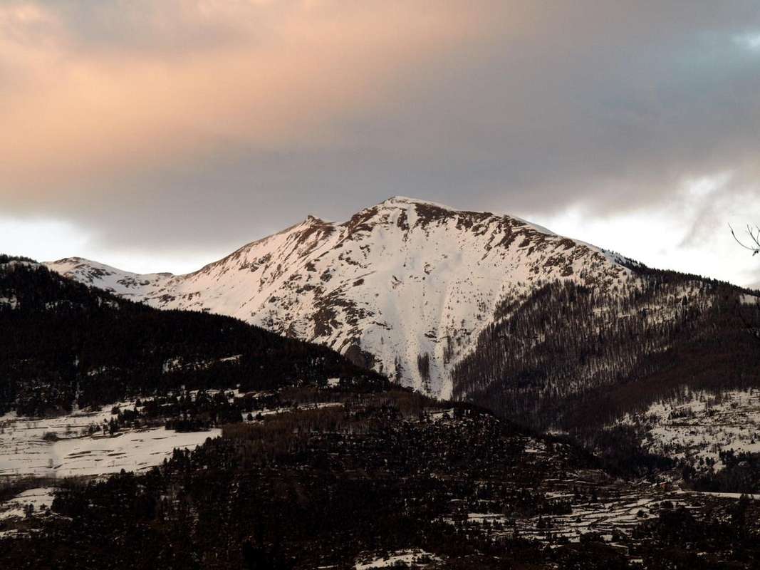
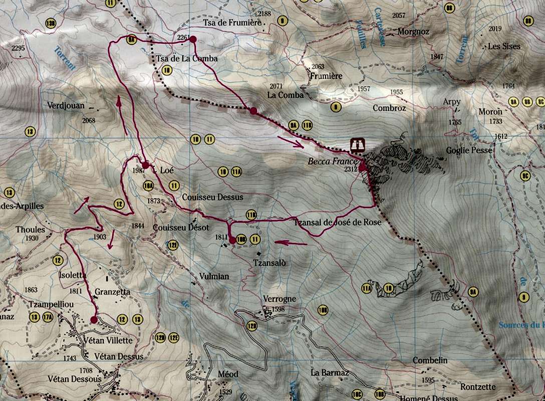
Becca France or of Fallère Valley?
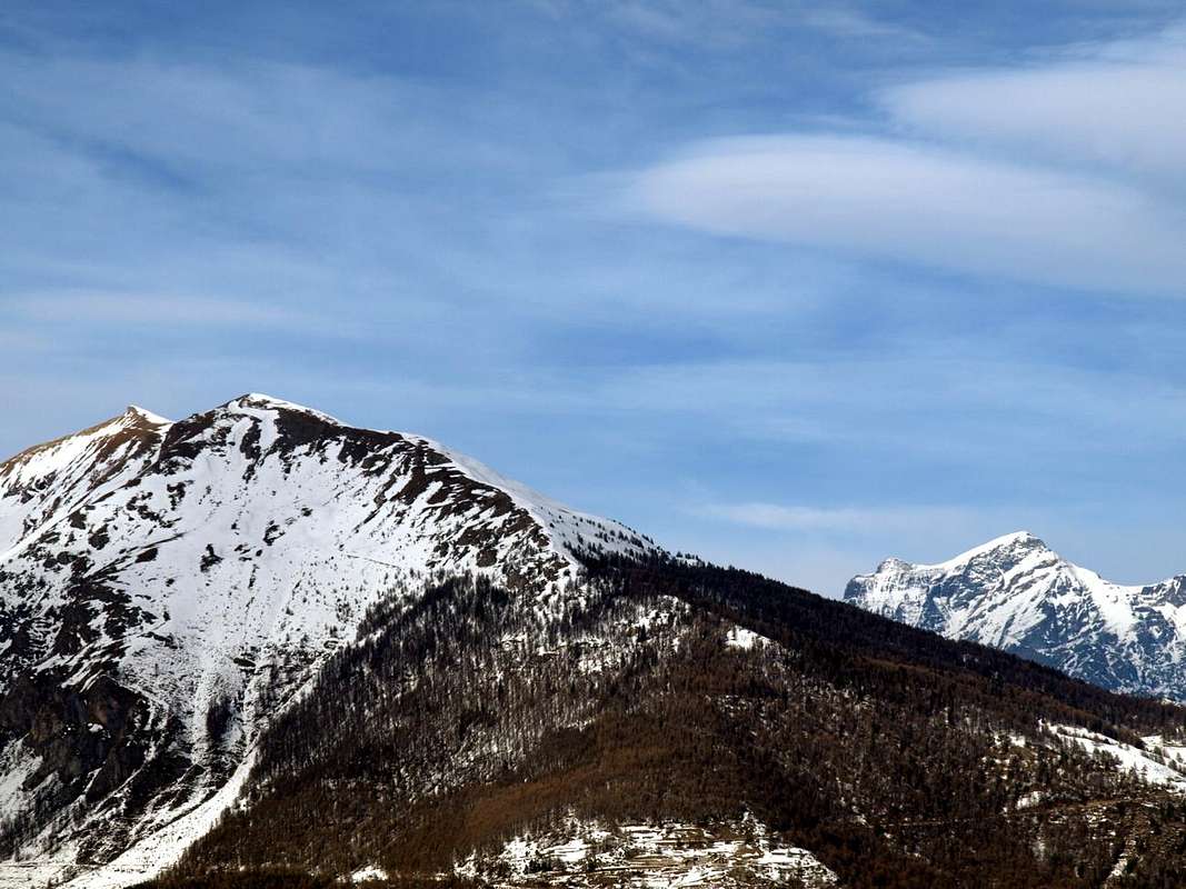
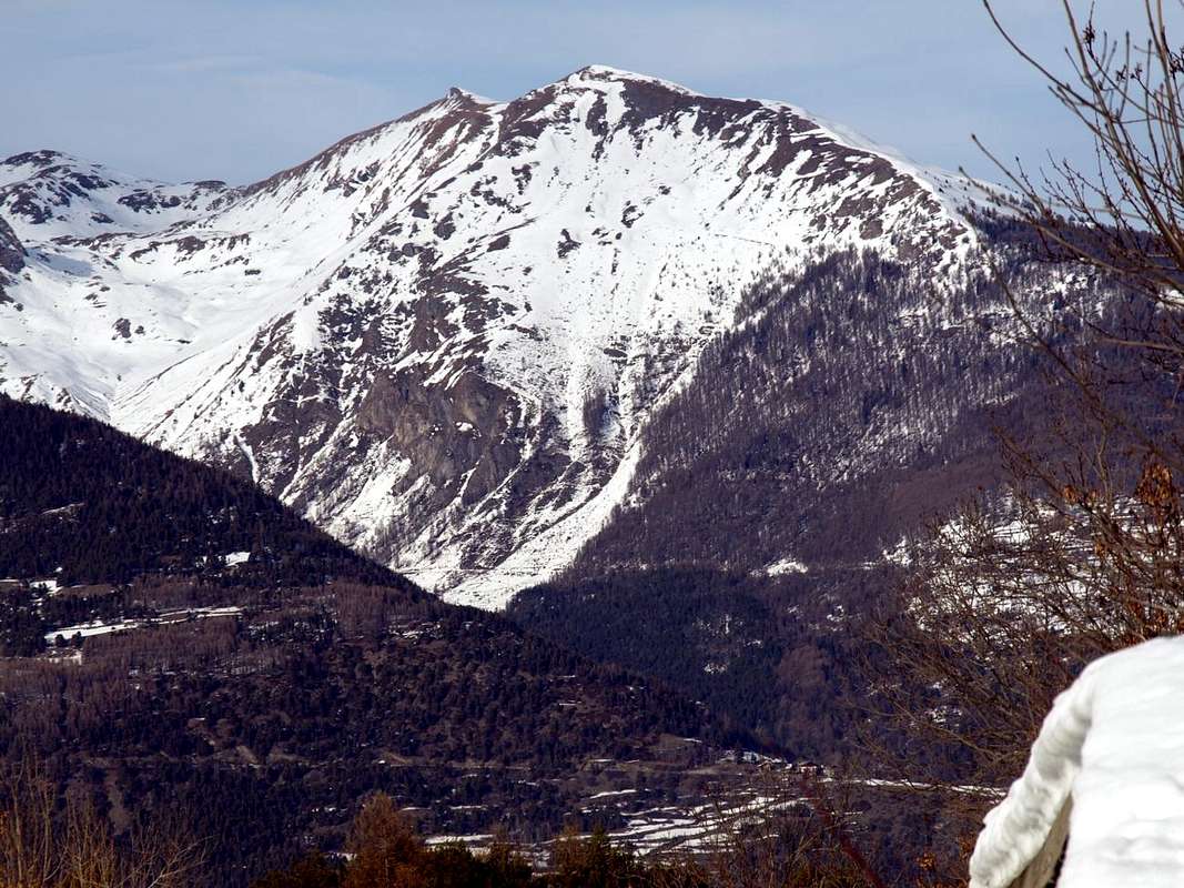
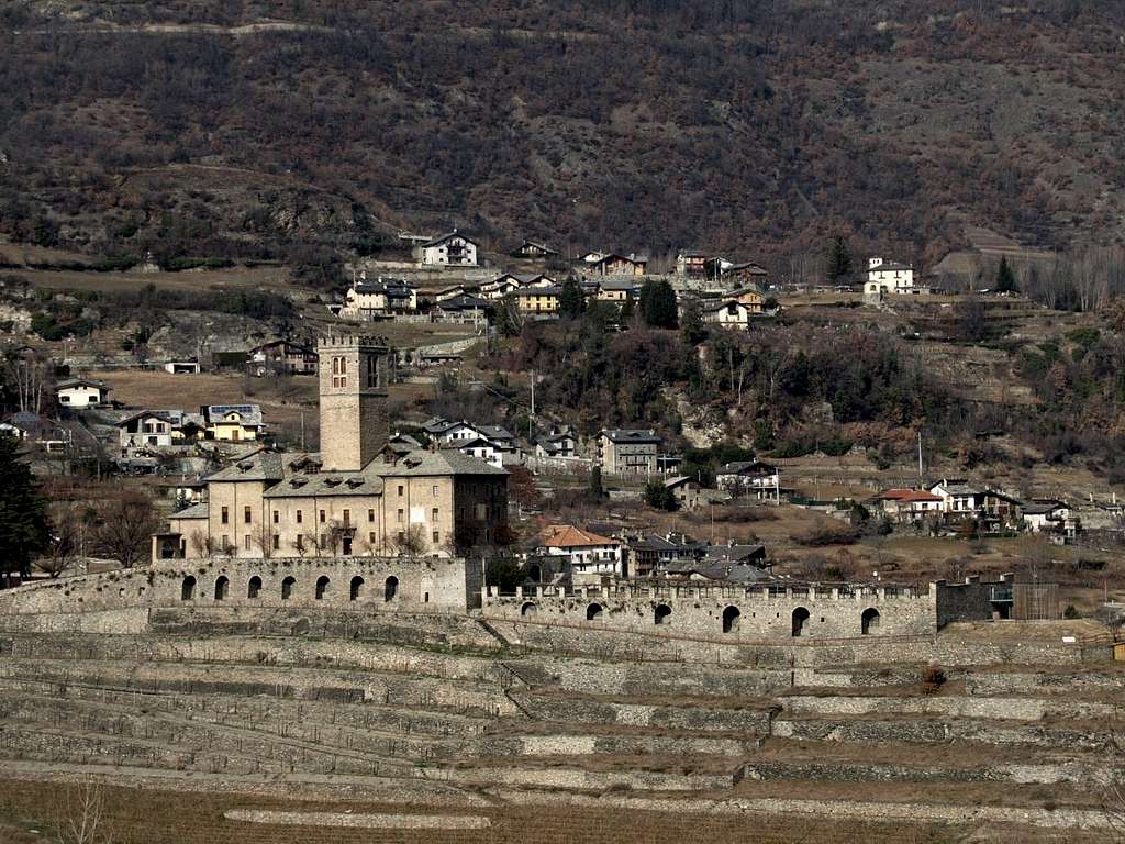
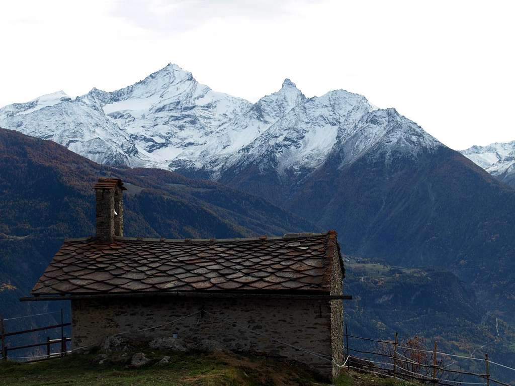
Of this vast area now to Northwest of the City of Aosta we started talking early as May 17th, 2015 with "Western Central Valleys"> always on "My Areas & Ranges". Exposure rather "lata" or extensive and ample but that concerned the whole area to the North of the Dora Baltea. More specifically we were analyzed on "Vétan Basin" and the Eastern "Val Buthier" respectively on February 16 and April 21 always 2016, which went to illustrate the two immediately adjacent valleys to the West and East of the Clusella or Closella Vallone and also Clusellaz. In this work, instead let's take a look at this valley, certainly the most popular and frequented by the Hikers if not the most famous of the three. The same arises from the "bottleneck" placed between the slopes of Becca France (2.312m; to the West) and the Pointe de Metz (2.553m), where the Torrent de Clusellaz "you withdraws" passing between the two Thouraz or Thora (this last to the West and now buried by the terrible landslide of July 6, 1564 with the collapse of the Southeast Wall of Becca France) before descending to Ville sur Sarre Hamlet (1.212m) to after reach the Dora Baltea in the valley floor at Maillod near the Municipality of Sarre. Following the valley stretches toward the North, reaching the watershed with the Valley of the Great St. Bernard Pass with Mont Fallère (3.061m), the highest of the whole area, followed by the Mont d'Arsy to the East (2.826m) and, successively, the Mont de la Tsa (2.741m). Finally, the divider returns to the South reaching first the Tip Chaligne (2.608m) to end with the Pointe of Met or Metz (2.553m), just above the City of Aosta and at the entrance of the Great St. Bernard Valley towards the Municipality of Gignod. A valley that offers beautiful walks, especially to the lakes starting from Lake Fallère (2.415m) but also smaller ones and "mysterious", excursions "classic" as Fallère same or of "exploration" towards the Mont d'Arsy and the 'adjacent to Mont de la Tsa. Also interesting is the "visit" to the numerous mountain pastures scattered everywhere. A varied possibilities of even "bind" to the other neighboring valleys reaching those of Verrogne or even Vétan to the West or Met/Buthier to Northeast. while "bypassing" Eastward to the Met Hill (2.492m) is reserved for the local inhabitants, some "curious" hikers, hunters or photographers of Nature Lovers.
Moreover this area, like a spacious balcony above Avise (762m, 16 km. West by Aosta), St. Nicolas (1.196m; center), St. Pierre (661m; to the East) Commons, it can also be divided in terms of topographical views in two different areas, below the Pointe Aouillette or Pointe Leissé, the two small adjacent Summit that characterize it:
- 1) - the Eastern area that, starting from the long watershed between the Basin of Vétan and the adjacent Vallon of Verrogne at the foot of Mont Fallère (3.061m), reach, after the small saddle 2.206 meters, true door of more Western lateral entrance into the same, the Great Shoulder 2.617 meters and then Pointe Leissé (2.771m), highest elevation of all the neighborhood, here above the Commons of St. Pierre St. Nicolas, the first located in bottom into the Central Valley of Dora Baltea and the second in the middle-lower hill.
- 2) - the upper-middle area, that by Vétan Villages (Dessous Dessus, Villette and Granzetta) as well as by Alpages of Thoules and Grandes Arpilles, expands Westward above the St. Nicolas Municipality average hills and on the valley floor to Avise. This plateau, not very steep and below several grassy-detrital couloirs, dates back to the North through several villages and pastures reaching a small hollow where is located the Alpe isolated Chaz Creuse or Tsecreousa (2.398m) at the foot of the Pointe Aouillette or Oilletta (2.616m). From this last, that binds to the Pointe Leissé via an easy dividing crest with the small Vallon of Leysser, down the partition that reaches the Saddle and the small Mont de Joux (1.930m, 1.978m), before of the Vertosan Vallone and above the little Villages of Vens, Cerlogne, Charbonnière and Cerellaz (1.750m, 1.580m, 1.263/87m, 1.254m).
Vallone della Becca France o del Mont Fallère?
Di questa vasta area subito a Nordovest della Città di Aosta avevamo incominciato a parlare già dal 17 Maggio 2015 con "Western Central Valleys" sempre in "My Areas & Ranges". Un'esposizione piuttosto lata ed estesa che riguardava però tutta la zona a Settentrione della Dora Baltea. Più specificamente sono stati analizzati il "Vétan Basin" e l'Orientale "Val Buthier" rispettivamente il 16 Febbraio ed il 21 Aprile sempre 2016, che andavano ad illustrare i due valloni immediatamente adiacenti ad Ovest ed a Est del Vallone di Clusella o Closella ed anche Clusellaz. In questo lavoro invece andiamo a dare una occhiata a questo vallone, sicuramente il più frequentato dagli Escursionisti se non il più famoso dei tre. Lo stesso si origina dalla "strozzatura" posta tra le pendici della Becca France (2.312 m; ad Ovest) e la Pointe de Metz (2.553 m), là dove il Torrent de Clusellaz si inforra passando tra le due Thouraz o Thora (questa ultima ad Occidente ed ormai sepolta dalla terribile frana del 6 Luglio 1564 con crollo della Parete Sudest di Becca France) prima di scendere verso Ville sur Sarre (1.212 m) per raggiungere la Dora Baltea sul fondovalle a Maillod presso il Comune di Sarre. In seguito la valle si distende verso Settentrione raggiungendo lo spartiacque con la Valle del Gran San Bernardo con il Mont Fallère (3.061 m), il più elevato dell'intera area, seguito ad Est dal Mont d'Arsy (2.826 m) e dal successivo Mont de la Tsa (2.741 m). Infine il divisorio ritorna verso Meridione raggiungendo dapprima la Punta di Chaligne (2608 m) per concludersi con la Punta di Met o Metz (2.553 m), giusto al di sopra della Città di Aosta ed all'ingresso della lunga Valle del Gran San Bernardo verso il "suo" primo Comune, ovvero di Gignod. Una valle che offre belle passeggiate, soprattutto ai laghi iniziando dal Lago Fallère (2.415 m) ma anche a quelli più piccoli, semisconosciuti e quindi "misteriosi", escursioni "classiche" come al Fallère medesimo o di "esplorazione" verso il Mont d'Arsy e l'attiguo Mont de la Tsa. Interessante anche la "visita" ai numerosi alpeggi sparsi ovunque. Possibilità variegata anche di "legarsi" agli altri viciniori raggiungendo quelli di Verrogne od addirittura Vètan ad Ovest oppure di Met e Buthier a Nordest. Lo "scavalcamento" ad Est al Colle di Met (2.492 m) é riservato ai valligiani, a qualche escursionista "curioso", a cacciatori oppure a fotografi Amanti della Natura.

Inoltre quest'area, a guisa di gran balcone sopra i Comuni d'Avise (762 m; 16 Km. ad Ovest d'Aosta), St. Nicolas (1.196 m; centro) e St. Pierre (661 m; Est), può essere suddivisa anche dal punto di vista topografico in due differenti settori, sottostanti alle Punte Aouillette oppure Leissé, le due piccole Sommità che la caratterizzano:
- 1) - l'area Orientale che, partendo dallo spartiacque col Vallone di Verrogne ai piedi del Monte Fallère (3.061 m), raggiunge, dopo la selletta 2.206 metri porta d'ingresso al medesimo, lo Spallone 2.617 metri e quindi la Pointe Leissé (2.771 m), massima elevazione di tutto il bacino, qui soprastante i Comuni di St. Pierre e St. Nicolas nella Valle Baltea.
- 2) - la zona medio-alta della Conca di Vétan che, dai Villaggi di Vétan (Dessous, Dessus, Villette e Granzetta) nonché dagli Alpeggi di Thoules e di Grandes Arpilles e Chaz Creuse tutti situati nella parte più elevata della Conca o Bacino di Vétan, si espande verso Occidente al di sopra dei Comuni di St. Nicolas nella media collina e di Avise sul fondovalle. Questo altipiano, non molto ripido e sottostante a diversi canaloni erboso-detritici, risale verso Settentrione attraversando numerosi villaggi ed alpeggi raggiungendo una piccola conca dove é collocata l'Alpe isolata di Chaz Creuse o Tsecreousa (2.398 m) ai piedi della Pointe Aouillette oppure Oilletta (2.616 m). Da quest'ultima, che si lega alla Pointe Leissé o Leysser tramite facile cresta divisoria col Valloncello di Leysser, scende lo spartiacque che raggiunge la Sella di Joux con laghetto artificiale ai piedi dell'ultima asperità o Mont de Joux (1.930 m, 1.978 m), prima del Vallone di Vertosan e sopra ai Villaggi di Vens, Cerlogne, Charbonnière e Cerellaz (1.750 m, 1.580 m, 1.263/87 m, 1.254 m).

Getting There towards Sarre & Thouraz or to Vétan Basin
BY CAR:
- From TORINO, MILANO, etc: Motorway A5. Exit at IVREA or Quincinetto (PIEDMONT) From IVREA Town: in West (Southern side) to Pont Saint Martin, Donnas, Bard, Aosta to Sarre or contnuing towards Aymavilles, Villeneuve, St.Pierre Municipalities. From Courmayeur Resort: in East to Pré St. Didier, Morgex, La Salle, Saint Pierre Municipalities.
- From Courmayeur or by Aosta Town towards Avise or St. Pierre and Sarre: From Saint Pierre-Pommier (783m), Champretavy, Rumiod, alternative just after Persod (1.351m), Ravoise, Chaillod, Clavel, Cerlogne (1.580m) to Vens small Villages (1.750m), with Regional Road in West-northwest. From this last to Joux Saddle (1.930m): through short descent to Vertosan Vallon From Saint Pierre-Chateau Sarrod de la Tour, Rumiod, Petit and Grand Sarriod (1.444/5m), Gerbore, Vetan Dessous (1.670m) and Dessus (1.737m), with Regional Road to Vetan Basin. From this, through dirt road, towards Genevrine Pasture, Chatalanez, Toules, Grand Arpilles Alps to Chaz Creuse Alp (2.398m).
- From FRANCE: through the Mont Blanc Tunnel to Entrèves-crossroads to Vény/Ferret Valleys - Mountain Guides of Courmayeur - La Saxe Rock Gym - Courmayeur. By Little Saint Bernard Pass, closed since November until half May to La Thuile Valley - Pré Saint Didier - Courmayeur. It is not necessary to take Motorway A5: you can drive on SS.26, in the direction of AOSTA - IVREA - TURIN.
BY PLANE:
- Aeroporto "Corrado Gex" Saint Christophe (Aosta).
Hiking Ski-Mountaineering Little Routes
This wide Conca or Basin, once quite popular for Hiking and some easy Excursion, nowadays instead sees a large attendance to the Ski-Mountaineering classic.
In fact, towards the overhanging Punta Leissé has for years organized a popular race, now even admitted in the circuit of the World Championships, this last discipline. Nevertheless, it remains always possible to make traditional excursions, as well as some beautiful promenade that connects the various mountain pastures, which date back from the valley floor the beautiful and evergreen hill offering stunning panoramic and splendid glances on all. In addition to this pleasant district may constitute a starting point for trips to the adjacent valleys of Vertosan (to the West with excursions towards Court de Bard, Punte Felita, Testa dei Frà, Testa di Serena, Corléans's Crest, Mont Flassin) and Verrogne (to the East and climbings towards Punta Paletta and Hill, Monte Rosso, Mont Vertosan and Col Fenêtre, Mont Fallère through the fairly easy Western or Southwest Ridges and Lago Morto, sited between the two, else Becca France) and, in the latter case, to the new Refuge Mont Fallère (2.385m), in Les Crottes locality and between Mount Fallère and Monte Rosso of Vertosan, as well, bypassing through the small saddle 2.417 meters, also for that of Closellaz where goes up through the path n° 14 along the Traditional Route on Southern Slopes and towards the old Cabin Regina Margherita (2.983m), collapsed and of which remain only the most that miserable perimeter ruins. The path of all these beautiful trips is also completely suited to the Ski-Mountaineering, but also offer the same wonderful experiences through Snowshoeing; in both cases it is, however, required the utmost prudence in assessing the state of the snow. We must not forget that the whole area is facing the South side where the snow retires and turns in advance but at the same time records dangerously high temperatures. All that pleasingly is offered is generally offset by something really very dangerous. As the reverse of each coin ...
 |
 |
 |
 |
 |
Questa larga Conca, una volta piuttosto frequentata per lo Escursionismo, oggigiorno vede invece una grande frequentazione verso lo Sci-Alpinismo classico.
Infatti verso la Punta Leissé é ormai da anni organizzata una rinomata gara, ammessa anche nel Circuito dei Campionati del Mondo, di questa ultima disciplina. Ciò non toglie che rimane sempre possibile effettuare le tradizionali escursioni, nonché qualche bella passeggiata che collega i vari alpeggi, che dal fondovalle risalgono la bella e sempre verde collina offrendo stupende panoramiche. Inoltre questo piacevole comprensorio può costituire punto di partenza per gite verso gli attigui valloni di Vertosan (ad Ovest con gite a Court de Bard, Punte Felita, Testa dei Frà, Testa di Serena, Cresta di Corléans, Mont Flassin) e Verrogne (ad Est e verso Colle e Punta Paletta, Monte Rosso, Mont Vertosan e Col Fenêtre, Mont Fallère tramite l'abbastanza facili Creste Ovest o Sudovest, nonché Lago Morto, posto tra le due, oppure Becca France) ed, in questo ultimo caso, verso il nuovo Rifugio del Mont Fallère (2.385 m), nonché, scavalcando la piccola sella 2.417 metri, anche per quello di Closellaz dove sale tramite il sentiero n° 14 la Via Tradizionale lungo il Versante Meridionale e la vecchia Capanna Regina Margherita (2.983 m), della quale però rimangon sol le più che misere rovine. Il percorso di tutte queste gite inoltre é completamente adatto allo Sci-Alpinismo, ma le medesime offrono anche belle esperienze tramite le Racchette da neve o Ciaspole; in entrambi i casi é richiesta la massima prudenza nella valutazione dello stato nevoso. Non bisogna infatti scordare che tutta l'area é rivolta a Mezzogiorno, lato dove la neve si ritira trasformandosi in anticipo ma che allo stesso tempo registra temperature pericolosamente più elevate. Tutto quello che di piacevole viene offerto é generalmente controbilanciato da qualcosa di molto pericoloso. Come nel rovescio d'ogni medaglia ...
Campings
Remember that free camping is forbidden (except for emergency reasons, over 2.500m, from darkness until dawn).Mountain Condition
- Meteo: you can find all the needed informations at the official site of the Valle d'Aosta Region:
- Valle d'Aosta Meteo
Books and Maps
BOOKS:- "Guida dei Monti d'Italia-Alpi Pennine" (Vol. I°) di Gino Buscaini-Club Alpino Italiano/Turing Club Italiano, Luglio 1971.
- "Dove si specchia il cielo - i laghi della Valle d'Aosta", di Sergio Piotti, Ed. Ferrari Luglio 1996.
- "La Vallée d'Aoste dans votre poche" di Giuseppe Lucca Ed. Musumeci 1978.
 |
 |
- Kompass "Monte Bianco Valle d'Aosta Sentieri e Rifugi" Carta turistica 1:50.000.
- Kompass "Gran Paradiso Valle d'Aosta Sentieri e Rifugi" Carta Turistica 1:50.000.
- I.G.C. Istituto Geografico Centrale Torino "Massiccio del Monte Bianco" (n° 4), Torino, 1998 1:50.000.
- Studio F.M.B. "Monte Bianco-Mont Blanc", Bologna 1988 1:50.000.
- I.G.C. Istituto Geografico Centrale "Carta dei sentieri e dei rifugi" 1:25.000.
- I.G.M. Istituto Geografico Militare 1:25.000.
 |
 |
Important Information
- REGIONE AUTONOMA VALLE D'AOSTA the official site.
- FONDAZIONE MONTAGNA SICURA Villa Cameron, località Villard de la Palud n° 1 Courmayeur (AO) Tel: 39 0165 897602 - Fax: 39 0165 897647.
- A.I.NE.VA. (Associazione Interregionale Neve e Valanghe).
Useful numbers
- Protezione Civile Valdostana località Aeroporto n° 7/A Saint Christophe (Ao) Tel. 0165-238222.
- Bollettino Meteo (weather info) Tel. 0165-44113.
- Unità Operativa di Soccorso Sanitario Tel. 118.