


-
 3250 Hits
-
 80.49% Score
-
 12 Votes
|
|
Area/Range |
|---|---|
|
|
45.80090°N / 7.39988°E |
|
|
Hiking, Mountaineering, Trad Climbing |
|
|
Spring, Summer, Fall, Winter |
|
|
9747 ft / 2971 m |
|
|
Note
La montagna chiama i suoi figli, ed essi rispondono fedelmente al suo appello… Osvaldo Cardellina, Diario alpinistico, 1964-65 Page texts: @ OsvaldoCardellina "Osva", passed away on May 2, 2022. Page owners: Christian Cardellina e Osvaldo Cardellina. Any updates from September 12, 2022: Antonio Giani, page administrator, friend and climbing companion. Testi della pagina: @ OsvaldoCardellina "Osva", scomparso il 2 maggio 2022. Proprietari pagina: Christian Cardellina e Osvaldo Cardellina. Eventuali aggiornamenti dal 12 settembre 2022: Antonio Giani, amministratore della pagina, amico e compagno di salite. |
Overview
 |
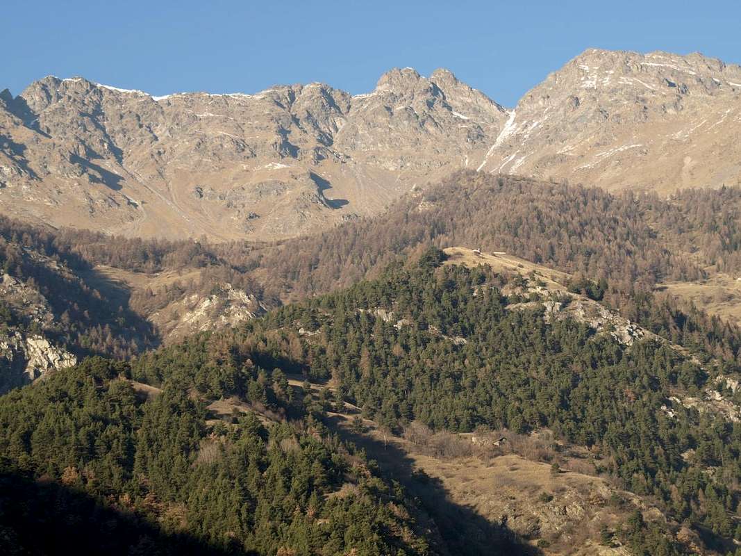
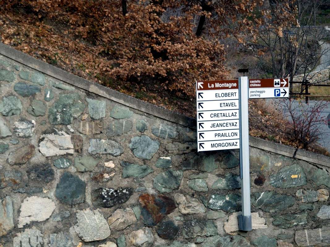
Cenevé Comba or Senevé small Basin? The same thing, because Comba means a small valley or a narrow basin. While in regards to the name, which is also possible to say how Senevì, remains somewhat shrouded in mystery and should be changed by a good "patoisan" or an man with excellent knowledge of the local dialect. Right in front, but on the opposite side of Baltea we also find a Becca Senèva or Séneva which is pronounced either as a word proparoxytone or a slowly word, while in the Basin By we find an Alp of Senevéns or Seitives with or without accent. But both also do not help to solve the "snag". This mountain basin, perfectly hemi circular, overlooking the Municipality of Quart, although it can also be reached from neighboring St. Christophe with the Regional Road that reached the junction for "Montagne" (1.025m) and leaving towards West the branching towards Blavy Village (1.475m), goes in the opposite direction towards the small villages of Cretallaz (1.087m), Jeanceyaz, Morgonaz and Praillon or Prayon (1.128m). This is the entrance to the Western Comba of Sénevé. The other part by the Municipalities of Nus or Quart reaching the triple Village of Trois Villes (1.390/8m), from which starts a farm dirt road that turned to the Northwest, leaving in the bottom Valseinte or Val Sainte, reaches a number of mountain pastures up Alpe di Cénevé (2.206m). This is reached by the first hypothesis through the small Villages of Les Ayettes (1.463m), La Clou (1.420m), Borelly, Chamerod (1.615/24m) and Prailles or Les Prèles. A third intermediate way goes directly on hill Quart, starting from the junction at the Castle of Villair de Quart (740m) and it links with the route from St. Christophe at the Chapel of Jeanceyaz Hamlet (1.092m), while the one that Nus comes from, going up the Valley St. Barthélemy towards Lignan (1.633m), is composed of a narrow asphalt road that passes through these of Clemensod (1.655m), Arlod, Valservière and Effraz (1.487m) reaching to Trois Villes-Avisod at the area of the "Monument aux Maquisards "(1.364m). This basin in turn can be divided into two separate areas in the upper part, while it differs greatly from that lower-bottom that is conveyed in a nasty throat, such as to originate the Valseinte also Val Sainte, near homonym pasture, (1.399/40m) ending at the junction nearby the restored Castle of Villair (740m) and just above the valley floor.
 |
 |
 |
 |
 |
1) - the more Western sector that, starting from the Southeast Slope of Mont Mary (2.815m) on West watershed with Viou-Blavy Parléaz little basin, reach the Cenevé Alp (2.206 m). From this it comes down towards South a large forest crossed by a private dirt road that runs past the Pastures of Les Prèles, Chamerod, Borelly La Clou, Les Ayettes reach the last of Praillon (1.262m) and the road in asphalt leading down to the Villages of Morgonaz and Jeanceyaz, whence the Villair Hamlet or in St. Christophe.
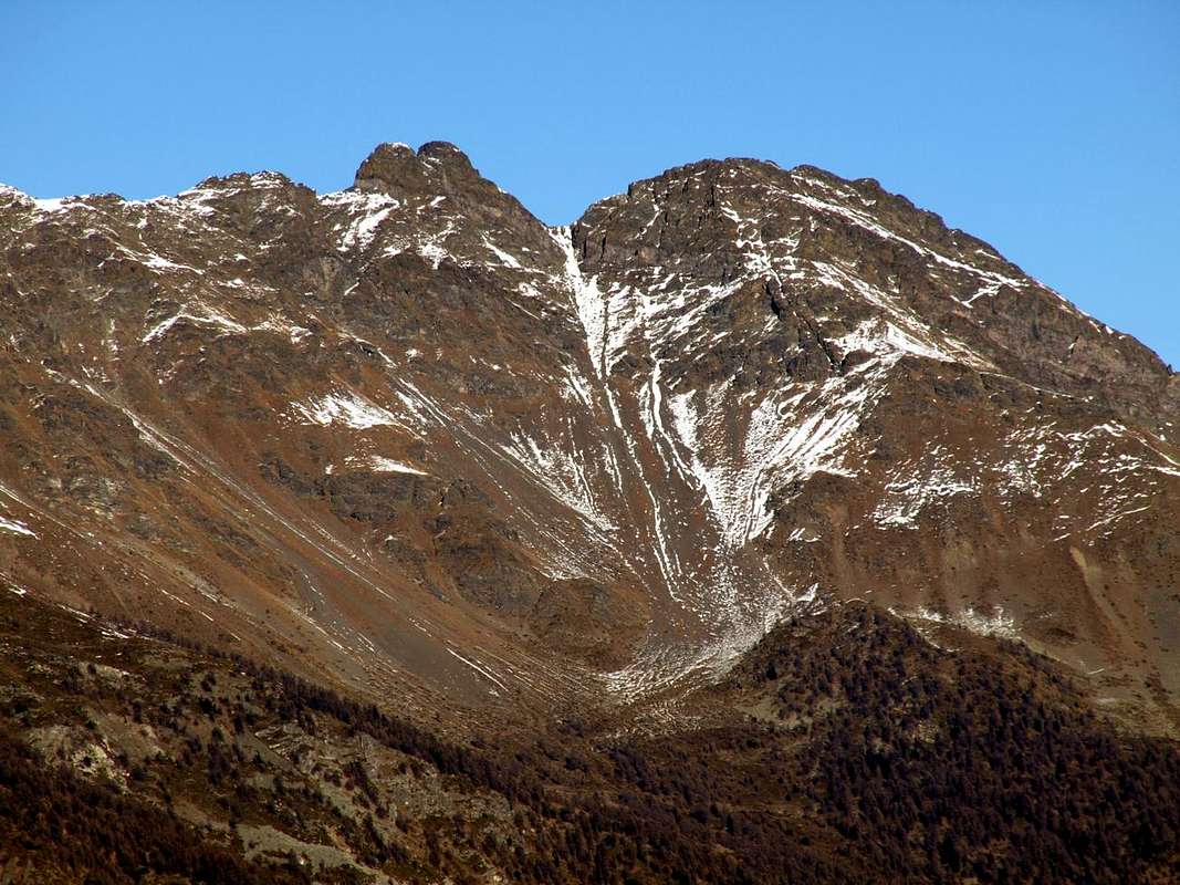
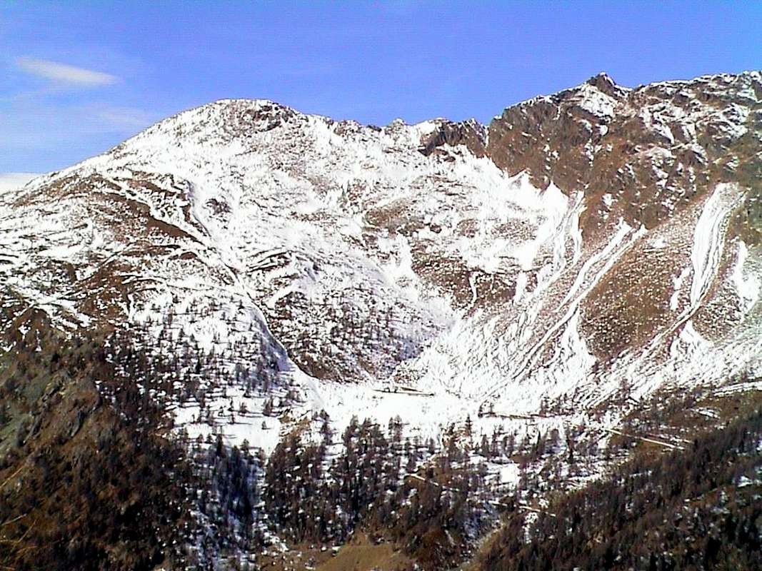
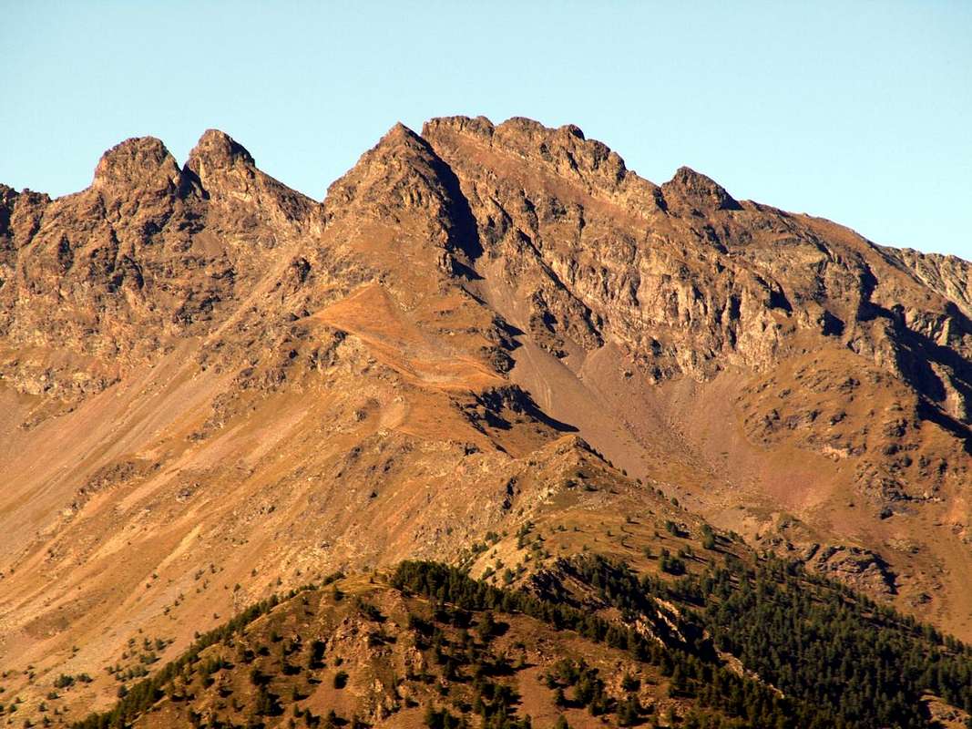
2) - the middle-upper area that, after the Trois Villes-Avisod Hamlet (1.390/8 m), reach the entrance on Cénevé Comba; dates back to the North from this bottleneck through numerous pastures and reaching the important but less popular Fana Pass (2.880m) with the adjacent Comba Dèche, leaving immediately to the West the two Summit of Tsaat a l'Etsena (2.967m, 2.971m). This is as the highest elevation of the entire basin, content to the East by a partition formed by a long Southern Ridge of Becchi di Fana (2.951m) reach the Croix de Fana (2.211/2m) up to the Villages of Fonteil (1.423m) and Avisod (1.398m) separating the Comba Cénevé from Comba Dèche, now just to the East.
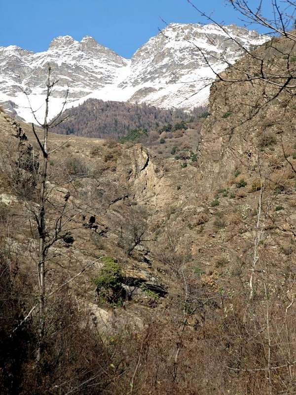
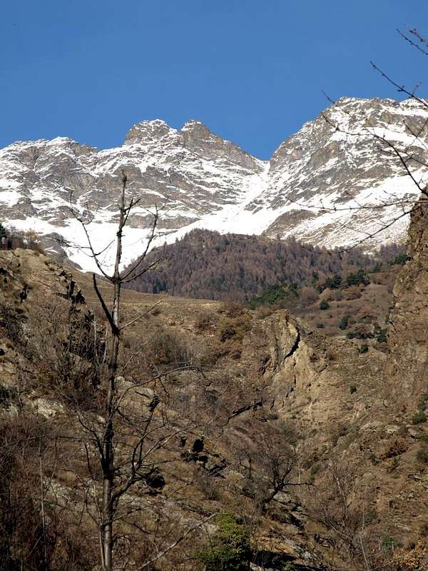
3) - underlying the two sectors of the upper basin, or real Comba of Sénevé, down shaped a funnel a steep rocky vallon that is formed by two gullies which meet at an altitude of 1.450/70 meters approximately, form a horrid throat known as Val Sainte or Valseinte. The same goes down increasingly narrow between high rocky cliffs reaching the Castle of Villair de Quart (740m), where it expands towards the Hamlet of Villair and above the valley floor of the Dora Baltea between the Commons of St. Christophe Quart (West).
Comba di Cenevé oppure Bacino di Senevé? La stessa cosa, poiché Comba significa una piccola valle od uno stretto bacino. Mentre per quanto concerne il toponimo, che é inoltre possibile pronunciare come Senevì, permane piuttosto avvolto nel mistero e si deve ricorrere ad un buon "patoisan", ovvero ad un ottimo conoscitore del dialetto locale. Proprio di fronte, ma sul lato opposto della Dora Baltea troviamo anche una Becca di Senèva o di Sèneva che viene pronunciata indifferentemente come parola sdrucciola o piana, mentre nella Conca di By riscontriamo un'Alpe di Senevéns o Seitives con o senza accento. Ma entrambe non aiutano ugualmente a risolvere il "busillis". Questo bacino montano, perfettamente semicircolare, sovrasta il Comune di Quart, anche se può essere raggiunto anche dal limitrofo di St. Christophe con la Strada Regionale che, raggiunto il bivio per "Montagne" (1.025 m) e lasciando ad Occidente la ramificazione verso il Villaggio di Blavy (1.475 m), prosegue in direzione opposta verso i Villaggetti di Cretallaz, Jeanceyaz, Morgonaz e Praillon o Prayon. Questa costituisce l'entrata Occidentale alla Comba di Senevé. L'altra parte invece dai Comuni di Nus o Quart raggiungendo il Villaggio di Trois Villes (1.390/8 m), dal quale inizia una strada poderale rivolta a nordovest che, lasciando in basso la Valseinte o Val Sainte, raggiunge una serie di alpeggi fino all'alpe di Cénevé (2.206 m); questa é raggiungibile anche con la prima ipotesi passando i Villaggetti di Les Ayettes, Lo Clou, Borelly, Chamerod e Prailles oppure Les Prèles. Una terza via intermedia risale direttamente la collina di Quart partendo dal bivio presso il Castello del Villair-de-Quart (740 m) ed arrivando a congiungersi con l'itinerario da St. Christophe presso la Cappella di Jeanceyaz (1.092 m), mentre quella proveniente da Nus, risalendo la Valle di St. Barthélemy fino a Lignan (1.633 m), é costituita da una stretta strada in asfalto che passa per i Villaggi di Clèmensod, Arlod, Valservière ed Effraz (1.487 m) raggiungendo Trois Villes-Avisod presso l'area del "Monument aux Maquisards" (1.364 m). Questo bacino a sua volta può essere suddiviso in due distinti settori nella parte superiore, mentre si differenzia notevolmente dalla medio-inferiore che viene convogliata in orrida gola, tal da originare la Valseinte terminando presso la biforcazione nelle vicinanze del Castello del Villair (740 m), nonché appena al di sopra del fondovalle.
 |
 |
 |
 |
1) - il settore più ad Ovest dell'area superiore che, partendo dal Versante Sudest del Mont Mary (2.815 m), sullo spartiacque Occidentale con il piccolo bacino di Viou-Blavy Parléaz, raggiunge l'Alpe di Cenevé (2.206 m). Da questa scende a Sud una grande foresta percorsa da poderale che, passando per le Alpi di Preilles, Chamerod, Borelly, Lo Clou, Les Ayettes raggiunge l'ultima di Praillon (1.262 m) e la strada asfaltata che scende verso i Villaggi di Morgonaz e Jeanceyaz, donde al Villair oppure al Comune di St. Christophe.
2) - la zona medio-alta che, dopo il Villaggio di Trois Villes-Avisod (1.390/8 m), raggiunge l'imbocco della Comba di Senevé; da questa strettoia risale verso Settentrione attraversando i numerosi Alpeggi di Valseinte (1.399 m), Vacheresse, Nouva, Chamoussin Dèsott e Damon, Planes, Lattaz (2.036 m) e Chavod (2.097 m) e quindi raggiungendo l'importante ma poco frequentato Colle di Fana (2.880 m) con la parte più Occidentale della Comba Dèche, lasciando subito ad Ovest le due Vette della Tsaat a l'Etsena (2.967 m, 2.971 m). Questa risulta come la massima elevazione di questo bacino contenuto ad Est da un divisorio formato dalla Cresta Meridionale che dagli adiacenti Becchi di Fana (2.951 m) raggiunge la Croix de Fana (2.211/2 m) sopra i Villaggi di Fonteil (1.423 m) ed Avisod (1.398 m) nonché separando la Comba di Cénevé da quella Dèche, subito ad Oriente.
3) - sottostantemente ai due settori del bacino superiore, o vera e propria Comba di Senevé, scende a forma d'imbuto un ripido vallone roccioso che, formato da due canaloni riunentisi a quota 1.450/70 metri circa, forma un'orrida gola conosciuta anche come Val Sainte o Valseinte. La stessa scende sempre più ristretta tra alti strapiombi raggiungendo il Castello del Villair-de-Quart (740 m), dove s'espande verso il Villair ed il sottostante fondovalle sulla Dora Baltea tra i Comuni di Quart e St. Christophe (Ovest).
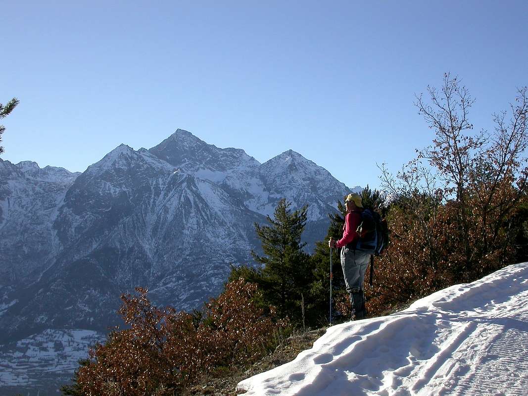
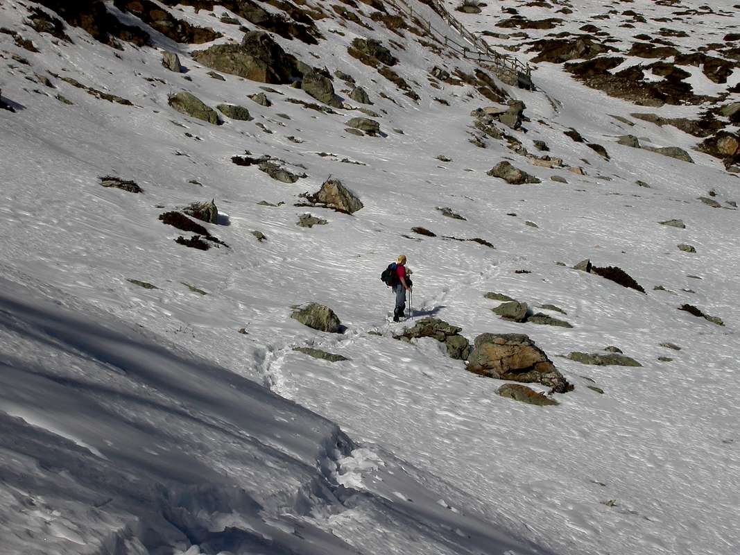
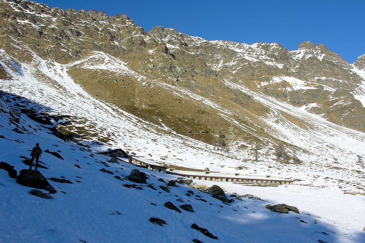
Senevé Topo & Surroundings
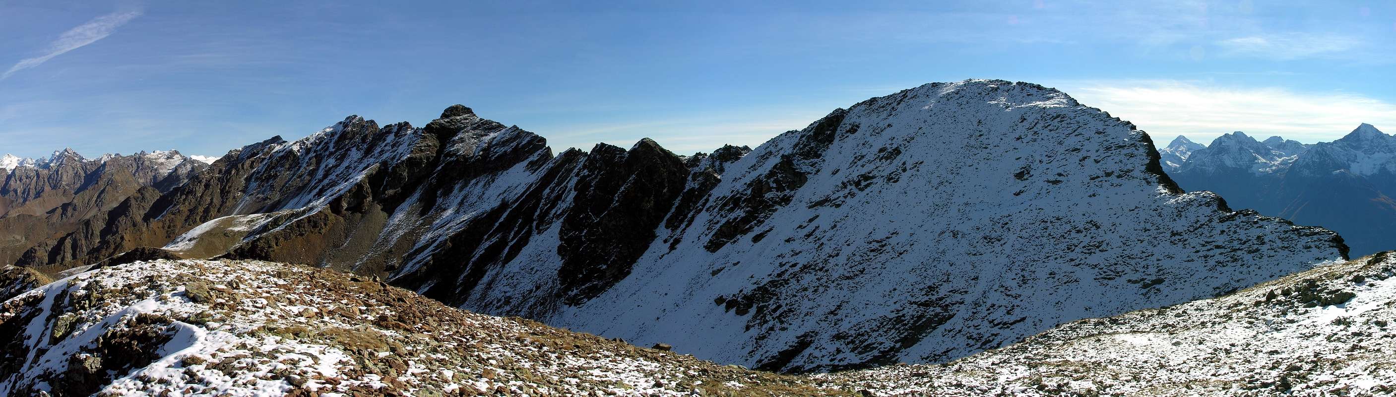 |
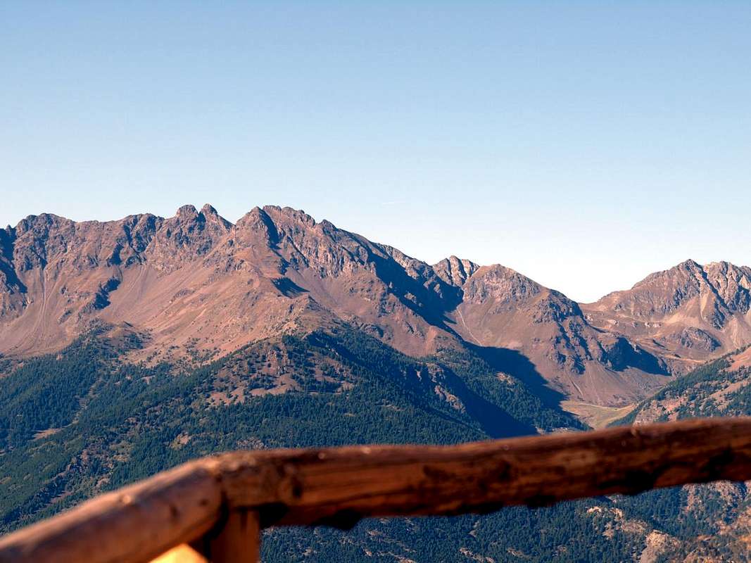
But looking further up into the mountains? This small basin concludes the watershed between the Central Valley of Dora Baltea in the South to the North and the Valpelline Valley. In fact, starting from the Vertex of the Eastern Tsaat a l'Etsena (2.971m), the partition between these two declines gradually forming the Western Summit (2.967m), the Tip Sénevé (2.928m), the Tête d'Arpisson (2.856m), the two small Summit of Les Prèles (2.752/3 meters around) and the Tip of Chamerod (about 2.750 meters), all over the Combe de Sénevé and the Municipality of Quart to reach Mount Mary. From this (2.815m) the watershed from the East / West is directed more towards the West-northwest reaching Colle and Becca Viou (2.856m); over the ridge downhill towards the Becca di Blavy or Quota 2.508 meters, between two Eastern and Western small Passes, and nameless. As he lays down again and for a short distance in that direction over the ending of Roisan Becca (2.496m) to finally "fall" on the homonymous municipality and the beginning of adjacent Valpelline. But even more precisly Comba of Senevé or Cénevé is dividing with the Vallons of Verdzignola, above the Common of Oyace, the Summit of the Eastern Tsaat a l' Etsena, the highest of all the watershed, until the Punta Sénevé, while from this and to Mont Mary separates from that of Arpisson that descends to that of Valpelline. Also from the Eastern Tsaat a l' Etsena to the East but in the direction of the underlying Colle di Fana (2.880m) and to the various Becchi di Fana (2.951m) starts the boundary with the more Western side of the adjacent Comba Dèche. This, after "Passo Alto" (2.540m; High Pass), Quota 2.484 meters, Col Cormet or Cornet (2.272 m), Altitude 2.306 meters, an unnamed Collar 2.226 meters reaches the wooden promontory of Croix de Fana (2.211/2 m) above the triple small Villages Trois Villes (Fonteil-Avisod-Porsan). Finally and to conclude, this basin forms a wide link between that of Roisan-Viou-Blavy Parléaz in West and the Comba Dèche to the East and to the Valley of St. Barthélemy.
Ma guardando più in alto verso le montagne? Questo piccolo bacino conclude lo spartiacque tra la Valle Centrale della Dora Baltea a Mezzogiorno e la Valpelline a Settentrione. Infatti, partendo dalla Sommità Orientale della Tsaat a l'Etsena (2.971 m) il divisorio tra queste due gradualmente declina formando la Sommità Occidentale (2.967 m), la Punta di Senevé (2.928 m), la Tête d'Arpisson (2.856 m), le due piccole Sommità de Les Prèles (2.752/3 metri circa) e la Punta di Chamerod (2.750 metri circa), tutte sopra la Comba di Senevé ed il Comune di Quart fino a raggiungere il Mont Mary. Da questo (2.815 m) lo spartiacque da Est/Ovest si indirizza maggiormente verso Ovest-nordovest raggiungendo il Colle e la Becca di Viou (2.856 m); oltre la cresta scende in direzione della Becca di Blavy o Quota 2.508 m, compresa tra due piccoli ed innominati colli. Poi si distende ancora e per breve tratto in quella direzione terminando sopra la Becca di Roisan (2.496 m) per infine "precipitare" sopra l'omonimo Comune e la Valpelline. Ma ancora più precisamente la Comba di Cénevé risulta divisoria con i Valloni di Verdzignola, sopra il Comune di Oyace, dalla Sommità Orientale della Tsaat a l'Etsena, la più elevata di tutto lo spartiacque, fino alla Punta di Senevé, mentre da questa e fino al Mont Mary separa da quello di Arpisson che scende verso quello di Valpelline. Sempre dalla Tsaat a l'Etsena Est ma in direzione del sottostante Colle di Fana (2.880 m) e verso i Becchi di Fana (2.951 m) inizia il confine con l'adiacente Comba Dèche; questo, dopo il "Passo Alto", la Quota 2.484 metri, il Col Cormet (2.540 m, 2.272 m), la Quota 2.306 metri ed il Colletto 2226 metri raggiunge la Croix de Fana (2.211/2 m) sopra il Villaggio di Trois Villes. Concludendo, questo bacino forma un largo trait d'union tra quello di Roisan-Viou-Blavy-Parléaz ad Ovest nonché la Comba Dèche a Levante e verso la Valle di St. Barthélemy.
 |
 |
 |
 |
Getting There
BY CAR: From Turin or Milan: Motorway A5. Exit in Aosta East (nearby Nus Commune) continuing to the West on Main Road n° 26 to various possibilities near Nus and Quart Fractions. From Switzerland: through the Grand St. Bernard Tunnel or the homonym Pass. Drive to Aosta, then follow, East direction on S.S. Road n° 26, to Quart and Nus Municipalities.
Specific Road: From Quart Municipality towards Trois Villes Hamlets
- 1) - Just after the Fraction of Quart Commune (Etolin, Vieille Morte, la Plantaz-Chétoz (better), turn to the left or North-northeast, in the direction of Trois Villes (parking).
- 2) - With alternative road: Aosta East toll of the highway follow on the right side toward Quart (556m near the Region Amérique); after the roundabout follow up toward Villair. After passing Argnod (857m), Vignil (946m), Fornail (1.082m) and Ville sur Nus (1.106m) turn left towards Trois Villes Avisod (1.398m), wherefrom you must start walking.
Specific and alternative or direct Road: From Villair-de-Quart towards Jeanceyaz Fraction with connection towards Morgonaz-Praillon Village
- 3) - By the Fraction of Villair-de-Quart reach, with Regional Road, the junction neaby Villair Castle (740m; parking); from this with large windings road to Elobert (961m) and Etavel (1.056m) Villages. Continue Northwest reaching the fork (1.087m) near the Chapel of Jeanceyaz (1.092m) and connection with the following route
- 4) - by St. Christophe Common. With this continue East reaching Morgonaz (1.181m) and Praillon (1.262m) Villages at the end of road in asphalt and at the beginning of dirt road to Senevé Basin. Alternative Western Road Road: From St. Christophe Commune towards the fork "La Montagne".
- 5) - By St. Christophe directly towards Sorreley Fraction up to the fork "la Montagne" (1.025m), immediately above the Lumian (984m) isolated Pasture and in East to Cretallaz (1.087m), Jeanceyaz (1.092m), Morgonaz (1.181m) and Praillon or Prayon (1.262m) small Villages at the end of road in asphalt and at the Western entrance on Senevé Basin. Alternative Eastern Road Road: From Nus Commune towards St. Barthélemy Valley and connection to Trois Villes-Avisod.
- 6) - From Aosta Town to address him to is long the SS.26, after the Commune of Quart coming in that of Nus (reached even with the same Eastern Road by Châtillon Common). From Nus (960m), with Regional Road before in North, towards Marsan (699m), Tolasèche (854m), Petit-Fénis (939m), Blavy (1.056m), Hamlets; after through the same but in Northeast crossing Val Dessous and Dessus (1.173m, 1.268) Villages below Mont de Pesse and above St. Barthélemy Torrent. Finally East-northeast towards the locality "Les Fabriques (1.411m), and Issologne (1.514m) Village under Mont Andér and Cima Longhede; hence, turning decisively West, up to Lignan-Saint Barthélemy Hamlet (1.633m) and the subsequent Clémensod Village (1.655m). From this last towards Regional connection Road in West towards Arlod (1554m), Valservière (1.502m), Effraz (1.487m) Villages at the foot of Becca d'Aveille (2.623m) and Trois Villes-Avisod Hamlets arriving neighboring the "Monument to Partisans" area (1.364m).
BY PLANE: Aeroporto "Corrado Gex" Saint Christophe (Aosta).
 |
 |
 |
 |
Books and Maps
BOOKS:- "Guida della Valpelline" de l'Abbè Joseph-Marie Henry - Societè Editrice Valdotaine 1925 II Edition e Collana Reprint Musumeci (1986).
- "Guida dei Monti d'Italia - Alpi Pennine (Vol. 2)" di Gino Buscaini - Club Alpino Italiano/Turing Club Italiano, Luglio 1970 (In Italian).
- "80 itinerari di Escursionismo Alpinismo e Sci Alpinismo in Valle d'Aosta", di Osvaldo Cardellina, Ed. Musumeci, Giugno 1977 (in Italian); seconda Ed. Luglio 1981; terza Ed. Luglio 1984; (in French), prima Ed. Febbraio 1978; seconda Ed. Marzo 1980.
 |
 |
- Kompass "Breuil/Cervinia-Zermatt" Carta turistica 1:50.000.
- I.G.C. Istituto Geografico Centrale "La Valpelline" (carta n° 115) Map1:30.000.
- I.G.M. Istituto Geografico Militare - Map1:25.000.
- L'Escursionista Ed. Rimini "Gran San Bernardo-Ollomont" (carta n° 5) 1: 25.000.
Important Information
- REGIONE AUTONOMA VALLE D'AOSTA the official site.
- FONDAZIONE MONTAGNA SICURA Villa Cameron, località Villard de la Palud n° 1 Courmayeur (AO) Tel: 39 0165 897602 - Fax: 39 0165 897647.
- A.I.NE.VA. (Associazione Interregionale Neve e Valanghe).
Useful numbers
- Protezione Civile Valdostana località Aeroporto n° 7/A Saint Christophe (Ao) Tel. 0165-238222.
- Bollettino Meteo (weather info) Tel. 0165-44113.
- Bollettino Valanghe Tel. 0165-776300.
- Unità Operativa di Soccorso Sanitario Tel. 118.