


-
 4424 Hits
-
 81.18% Score
-
 13 Votes
|
|
Area/Range |
|---|---|
|
|
45.91050°N / 7.35647°E |
|
|
Hiking, Mountaineering, Trad Climbing |
|
|
Spring, Summer, Fall, Winter |
|
|
9203 ft / 2805 m |
|
|
Note
La montagna chiama i suoi figli, ed essi rispondono fedelmente al suo appello… Osvaldo Cardellina, Diario alpinistico, 1964-65 Page texts: @ OsvaldoCardellina "Osva", passed away on May 2, 2022. Page owners: Christian Cardellina e Osvaldo Cardellina. Any updates from September 12, 2022: Antonio Giani, page administrator, friend and climbing companion. Testi della pagina: @ OsvaldoCardellina "Osva", scomparso il 2 maggio 2022. Proprietari pagina: Christian Cardellina e Osvaldo Cardellina. Eventuali aggiornamenti dal 12 settembre 2022: Antonio Giani, amministratore della pagina, amico e compagno di salite. |
Overview
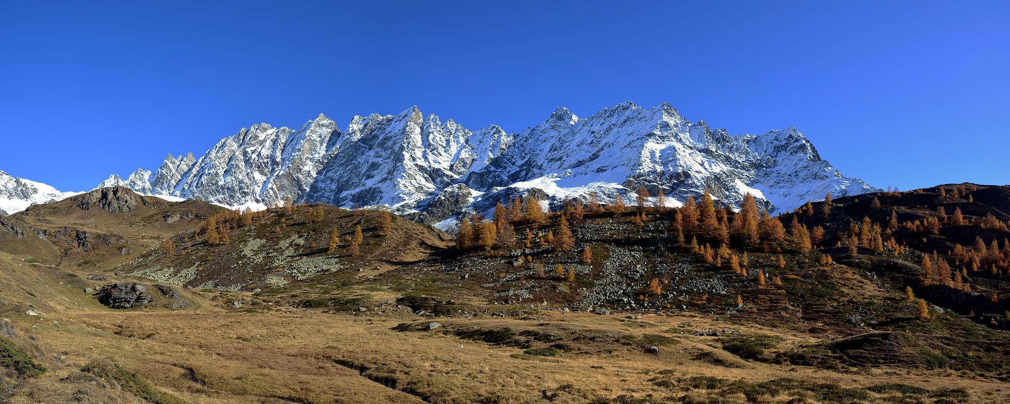 |
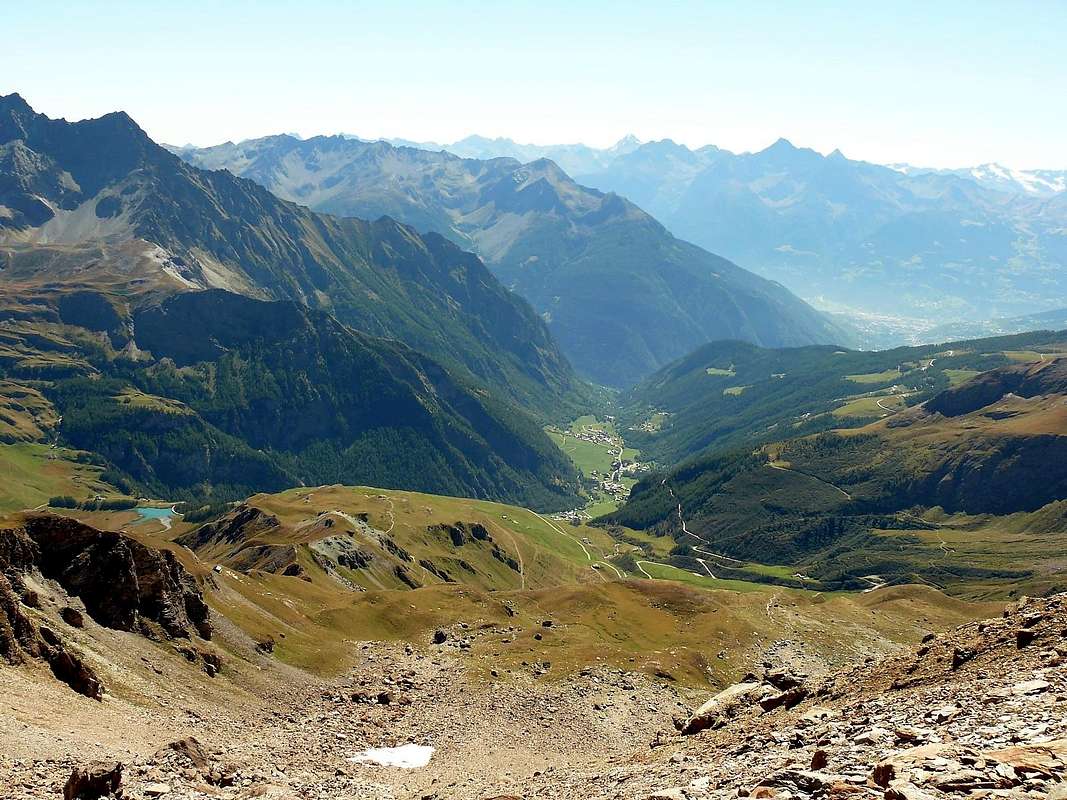
Ollomont Valley and the Basin By open, from West to the East, above the Commons of Allein, Doues and Ollomont, in the district stretching from the Mont Saron, towards the Salliousa and Mont Velan to the North, from the latter in East to the long ridge dividing border with the Swiss Valsorey and Val de Bagnes up to the Fenêtre Durand and Mont Gelé, here finally fall back to the South to the Chain of Monts Morion, the Punta Cesare Fiorio, Mont-de-Berrio, above Ollomont, and some less important elevations above the Common of Valpelline. But the whole area is dominated by the mass of the Grand Combin de Grafeneire (4.314m) which, although now completely in Switzerland, gives its name to this area called "Community of Grand Combin", while the valley, along with that of the neighbor Great San Bernardo, take the name of "Coumba Freida". In fact, these two valleys, together with the further East of Valpelline collect all the cold winds coming from the North to the Valley of Aosta, hence the "right" name. But if the various Combins, even if only slightly, are entirely in Swiss territory, the masses of Mont Velan (3.734m) to the West and Mont Gelé (3.518m) to the East are the watershed between these two Nations, often very rich a common History, while the beautiful pyramid of Salliousa (3.332m) to the West and the Mountain Chain of Morion (3.497m) in the opposite side to act as barriers entirely in Italian territory, separating this extensive basin and valley respectively from those of the Great St. Bernard Pass from Valpelline.
La Valle d'Ollomont e la Conca di By s'aprono, da Ovest ad Est, sopra i Comuni di Allein, Doues ed Ollomont, nel circondario che va dal Mont Saron alla Salliousa ed al Mont Velan verso Settentrione, da quest'ultimo verso Oriente alla lunga cresta di confine divisoria con le svizzere Valsorey e Val de Bagnes fino alla Fenêtre Durand ed al Mont Gelé per infine ripiegare a Mezzogiorno verso la Catena dei Morion, la Punta Cesare Fiorio, il Mont-de-Berrio, sopra Ollomont, ed alcune elevazioni meno importanti sopra il Comune di Valpelline. Ma tutta l'area é dominata dalla massa del Grand Combin de Grafeneire (4.314 m) che, anche se ormai completamente in Svizzera, dà il nome a tutta questa zona chiamata "Comunità del Grand Combin", mentre la vallata, insieme a quella del vicino Gran San Bernardo, prende il nominativo di "Coumba Freida". In effetti queste due valli, con quella più ad Est di Valpelline raccolgono tutti i venti freddi provenienti dal Settentrione in direzione della Valle di Aosta, donde il "giusto" appellativo. Ma se i vari Grand Combins, anche se di poco, son completamente in territorio elvetico, le masse di Mont Velan (3.734 m) ad Ovest e Mont Gelé (3.518 m) ad Est fanno da spartiacque tra queste due Nazioni, molto spesso ricche di una comune Storia, mentre la bella piramide della Salliousa (3.332 m) ad Occidente e la Catena dei Morion (3.497 m) all'opposto fungono da barriere laterali interamente in territorio italiano, separando questa estese conca e valle rispettivamente da quelle del Gran San Bernardo e dalla Valpelline.
 |
 |
 |
 |
 |
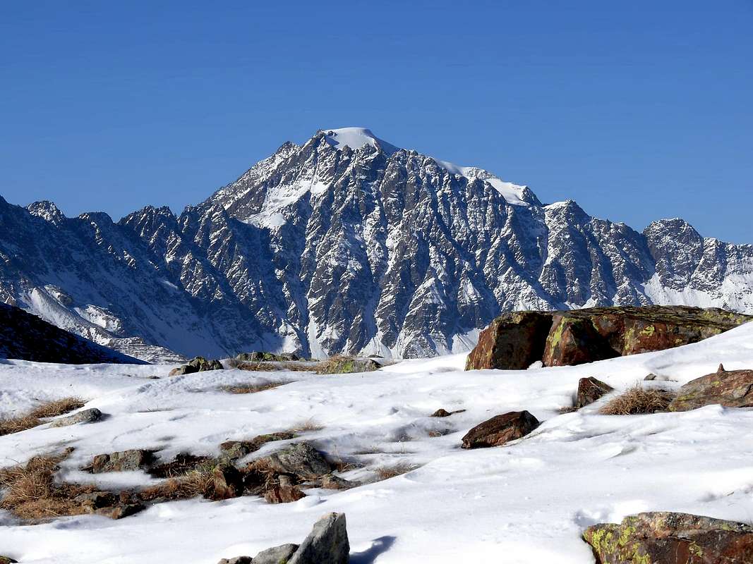
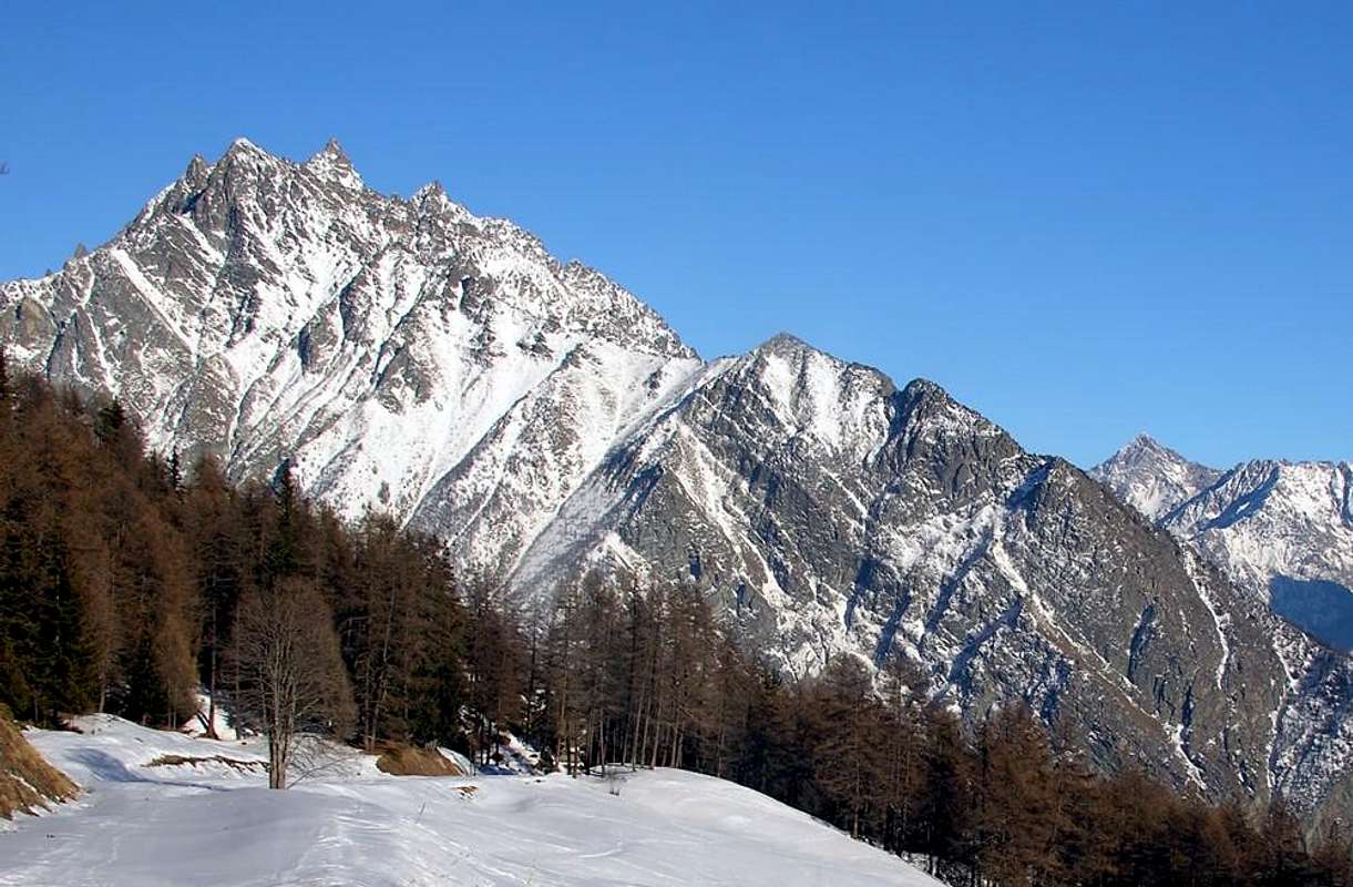
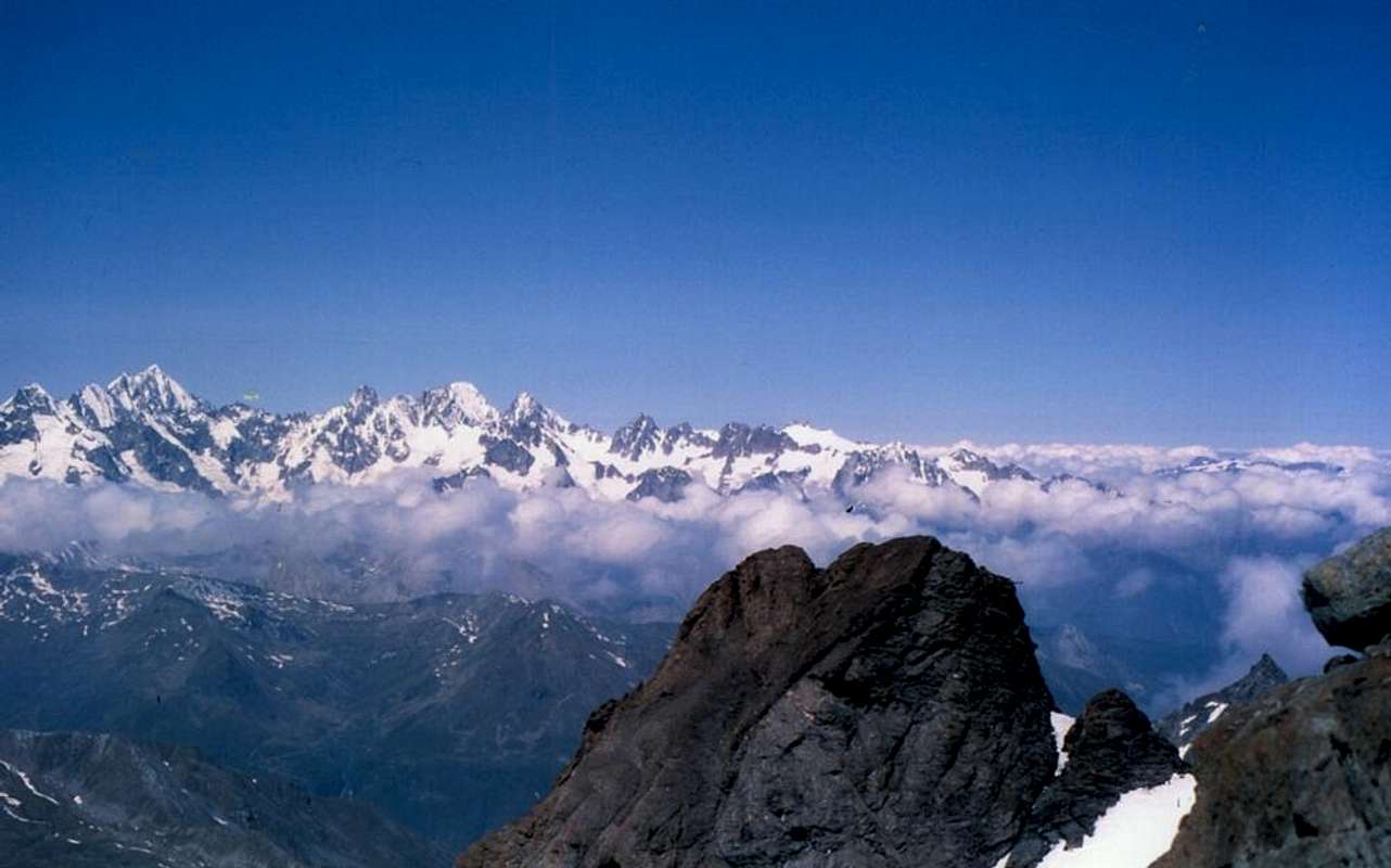
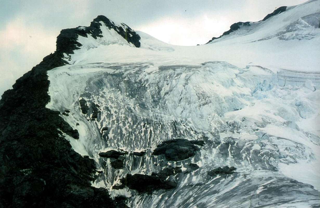
Ma, a nostro avviso, é il Mont Velan con la sua tondeggiante calotta glaciale che contraddistingue questa vallata. Visto da Mezzogiorno, fino alla Città di Aosta, si presenta con la sua mastodontica Parete Sud-sudest che dai Corni del Velan declina ad Oriente fino al Col de Valsorey (3.107 m), prima che la cresta di confine, sempre più indirizzata verso Nordest, si rialzi a formare tutta una serie di guglie (Petit Frère, les Trois Frères de Valsorey, i cinque Molaires de Valsorey, Les Aiguilles des Luisettes, le Rateau, il Grand Carré, le tre Les Luisettes, l'Aiguille Verte con la Sfinge di Valsorey, il Col Vert unico vero passaggio in questo tratto di catena, il Pic d'Amiante, il Mont Sonadon fino alla piramide della Grand Tête de By 3.588 metri, dove lo spartiacque ritorna ad Oriente. Da questo punto si aprono colli più transitabili (Amiante, By, Filon e del Mont Avril) che, intervallati tra la stessa, la Tête Blanche de By, la Tête du Filon, la Tête de Balme) che raggiungono il nodo estremo del Mont Avril (3.347 m) e subito appresso l'ampia Fenêtre Durand (2.805 m), comodo punto di transito dopo il ritiro progressivo nei Secoli dei Ghiacciai (Glacier de Fenêtre) in territorio svizzero. Lo stesso unisce Ollomont alla Val de Bagnes in un connubio che ha fatto registrare momenti fraterni ed amichevoli alternati ad altri di forti contrasti, soprattutto per motivi economici e di sussistenza legati al possedimento dei territori per l'agricoltura ed il pascolo, sfociati in violenti contrasti tali da sfociare in vere piccole guerre con relative sanguinose battaglie in campo aperto.
 |
 |
 |
 |
 |
 |
 |
 |
 |
 |
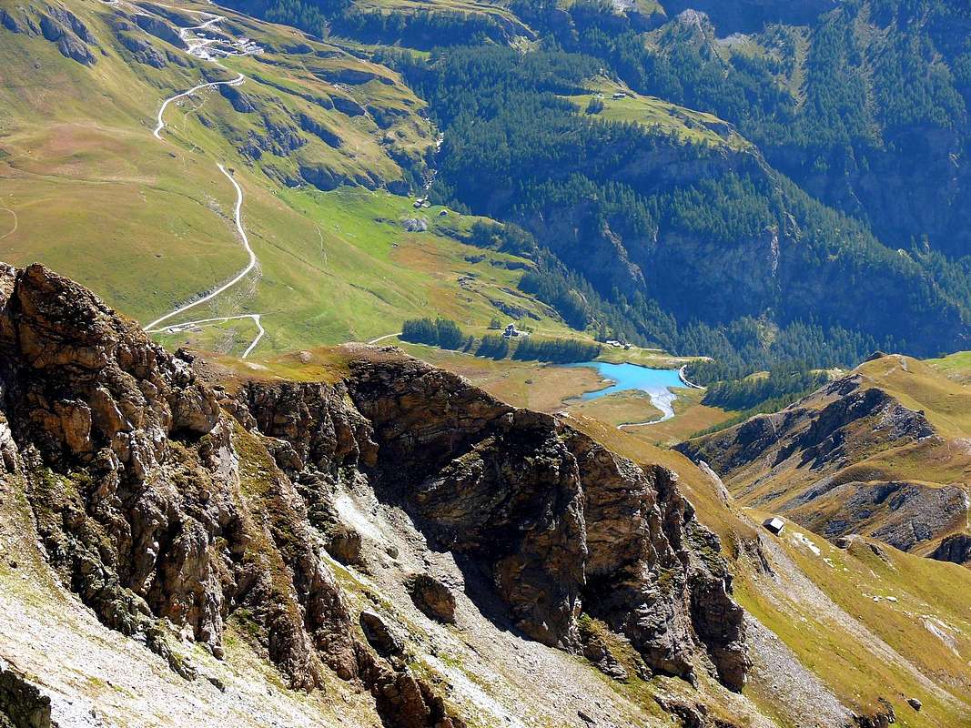
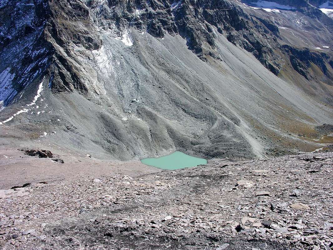
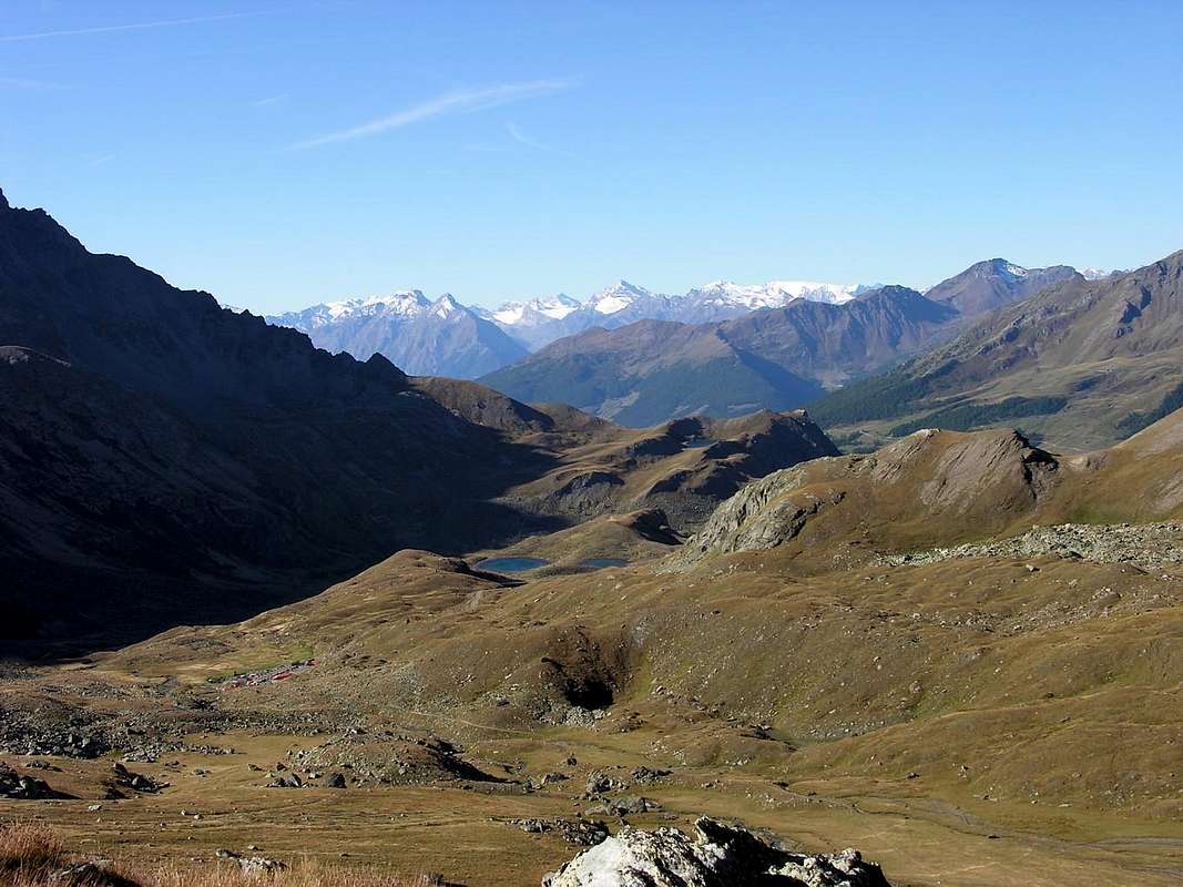
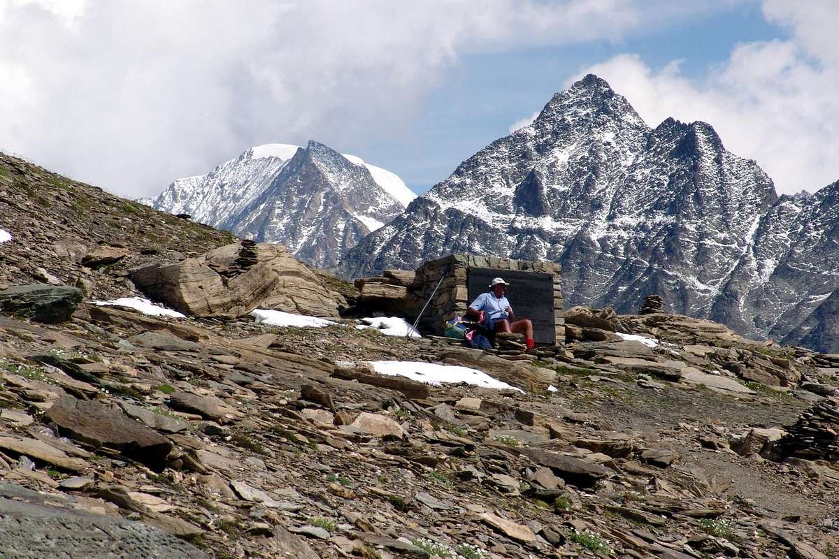
After the valley floor of Ollomont a high terrace rocky-grass stands up to the semi-flat Conca di By.
This artificial barrier was built at the edge of a pond (1.987m) below just above the Lac de By (2.165m) at the so-called "House Farinet", located immediately to the East of the same and at the Alpage Cheval Blanc (1.962m) and below the long farm dirt and private road which, starting at the beginning from the Alps Champillon (2.060m), with a wide circle first North and then to the Northeast connects almost all the pastures of the broad valley to the extreme of Thoules Alp (2.381m), below the Southwest Slope of Mont Gelé and Fenêtre Durand. Collects all the water below the peak section between Les Trois Frères and the Tête du Filon in the North and those that descend from "Arête de la Bonne Mort" or "Crest of the Good Death" (see above) in the East, that is between the overhanging Comba Farinet to the West and Comba de la Grande Maison in the opposite (Torrents de Clavette, Amiante and de la Grande Maison).Dopo il fondovalle di Ollomont un alto gradone roccioso-erboso si rialza fino alla semi pianeggiante Conca di By. Questo sbarramento artificiale é stato costruito al limite d'un laghetto (1987 m) sottostante l'appena superiore Lac de By (2.165 m) presso la cosiddetta "Casa Farinet", sita subito ad Oriente del medesimo e presso l'Alpe Cheval Blanc (1.962 m) nonché al di sotto della lunga strada poderale che, partendo dall'Alpe Champillon (2.060 m), con un largo giro prima a Nord poi a Nordest collega quasi tutti gli alpeggi dell' ampia conca fino all'estrema Alpe di Thoules (2.381 m), al di sotto del Versante Sudoccidentale del Mont Gelé e della Fenêtre Durand. Raccoglie tutte le acque sottostanti il tratto di cresta compreso tra Les Trois Frères e la Tête du Filon a Settentrione e quelle che scendono dalla "Arête de la Bonne Mort" ovvero "Cresta della Buona Morte" (vedi sopra) ad Oriente, cioé tra la Comba Farinet ad Ovest e la Comba de la Grande Maison all'opposto (Torrents de Clavette, Amiante e de la Grande Maison). The ancient Ollomont Coppermines
The Economy of the town was not only responsible for Agriculture and the Pasture. Already since 1700 and until the early 1900s was used a copper deposit in the three sectors of Vaux, Balme and Saint Jean, located between the Hamlet of Vaux in the North and the Municipality of Ollomont at midday. The veins consist of modest power (tens of meters about) with pyrite and chalcopyrite with this last that gave rise, in the gangue of quartz, with native gold. This production lasted until the First World War by donating labor, with the mines of Ollomont and blast furnaces down to Valpelline, to more than 1.000 between Miners and Workers. One of the wells was equipped with over 1000 steps reaching a depth of around 300 metres. This field was discovered in 1699 by Jean Antoine Campier Rechoz at the place called "Les Bétendes" ; the first (1700/1720) fù exploited with great profit by Baron Ferrod; after successive difficulty was sold to Captain Ansermin Valpelline (1730/1750), then it became property to the Lords Centurion and Constantine Rosset, who, in turn, sold it to the Industrial Argentier and Nigra. In 1787 they were bought by the Noble Family Perrone of San Martino di Quart who took the famous Engineer Di Robilant, inventor of a water wheel for water extraction from the mines, where is even today buried under the ceiling of the main gallery. Later, after the death of Count Perrone at the Battle of Novara in 1849, some speculation forced the mine to the gradual decline: by Count Valerio in 1855 was sold to the Count of Belgium Victor Seyssel d'Aix, then to the Marquis Cornelissen for inheritance; founded this with the huge amounts of capital "Cornelissen & Simons" which in 1880 passed the "Wellens" and in 1904 the "Elzear Alda" and in 1905 the "Company Ollomont", whence the former "Ansaldo" of Genoa, then "National Society Cogne" Aosta.
Le antiche Miniere di rame di Ollomont
C) - From Ollomont Common (1.335m) and the small built area of Glacier or Glassier small Hamlet (1.549m), where you must start walking. Enter the mule track to By before the bridge and follow up to Farinet House where you must take the left ramification towards Franco Chiarella-Amiante Shelter (2.979m; EE/F+; 4h'00/4h'30).
 |
L'Economia di questa località non era soltanto affidata all'Agricoltura ed alla Pastorizia. Già sin dal 1700 e fino agli inizi del 1900 veniva sfruttato un giacimento di rame nei tre settori di Vaux (oggi Vaud), Balme e Saint Jean, collocati tra il Villaggio di Vaux a Settentrione ed il Comune di Ollomont a Mezzogiorno. I Filoni composti da vene di modesta potenza (qualche decina di metri) con pirite e calcopirite con quest'ultima che dava origine, nella ganga di quarzo, ad oro nativo. Questa produzione durò fino alla Prima Guerra Mondiale donando lavoro, con le miniere di Ollomont e gli altiforni giù a Valpelline, a più di 1000 tra Minatori ed Operai. Uno dei pozzi era attrezzato con più di 1000 gradini raggiungendo una profondità di all'incirca 300 metri. Questo giacimento venne scoperto nel 1699 da un certo Signor Jean Antoine Campier Rechoz presso il luogo chiamato "Les Bétendes". Lo stesso inizialmente (1700/1720) fù sfruttato con ottimo profitto dal Barone Ferrod; in seguito a successive difficoltà venne ceduto al Capitano Ansermin di Valpelline (1730/1750), dopodiché passò di proprietà ai Signori Centurion e Costantino Rosset, che, a loro volta, lo cedettero agli Industriali Argentier e Nigra. Nel 1787 le miniere vennero acquistate dalla Nobile Famiglia Perrone di San Martino di Quart che assunse il famoso Ingegnere Di Robilant, inventore di una ingegnosa e famosa ruota idraulica per l'estrazione dell'acqua dalle miniere, dove é ancora oggidì rimasta sepolta sotto la volta della galleria principale. Successivamente, dopo la morte cruenta del Conte Perrone nella Battaglia di Novara del 1849, alcune malfatte speculazioni costrinsero la Miniera al progressivo declino: dal Conte Valerio nel 1855 venne ceduta al Conte del Belgio Victor Seyssel d'Aix, poi al Marchese Cornelissen per eredità; questi fondò con ingenti capitali profusi la "Cornelissen & Simons", che nel 1880 passò alla "Wellens e nel 1904 alla "Elzear Alda" ed ancora nel 1905 alla "Ditta Ollomont" donde all'ex "Ansaldo" di Genova, poi sin alla conversione nel 1916 nell'attuale "Società Nazionale Cogne" di Aosta. La Miniera, che aveva notevolmente elevato il tenore di vita dentro questa vallata, venne abbandonata durante la Seconda Guerra Mondiale (1940/45) e, prima con il suo declino poi la chiusura completa, molti di questi minatori ed operai furono reimpiegati in quest'ultima. Le due Guerre Mondiali richiedevano infatti più ferro ed acciaio che non rame e questo fù uno tra i tanti fattori che condussero alla chiusura della Miniera d'Ollomont, mentre la "Cogne" si espandeva complessivamente tra minatori a Cogne (Magnetite) e La Thuile (carbone per gli altoforni) ed operai in fabbrica ad Aosta a quasi 10.000 persone. Questo fattore, concomitante con la necessità di costruire alloggi per gli stessi, favorì una grande emigrazione dal Veneto e dalla Calabria con notevole espansione per l'edilizia. Nell'arco di due Guerre Mondiali la popolazione passò da 9800 unità nel 1917 a 39.000 nel 1941 e nel lato Ovest della Città sorse ex-novo un "Quartiere Operaio". La popolazione di Ollomont (Km 16,5 da Aosta), ma anche quella della sottostante Valpelline (Km 12,8) e fino al Comune di Oyace (Km 19), si trasferì nel lavoro in città pur continuando ad abitare nelle stesse località, onde svolgere il secondo lavoro che consisteva nell'agricoltura (fieni) intimamente connessa con l'allevamento del bestiame. Non era inusuale trovare operai che scendevano per tutti questi Km. (pure d'inverno) tramite la bicicletta per poi, finito il turno in fabbrica, faticosamente risalire per svolgere la seconda mansione. Oggi, insieme ad un turismo che pian piano và espandendosi, questa risulta la principale risorsa della vallata divenuta famosa per il locale formaggio conosciuto come la "Fontina", ma soprattutto per il rinomato burro della Conca di By.
Getting There
BY CAR:
- From TORINO, MILANO, etc: Motorway A5. Exit at IVREA or Quincinetto (PIEDMONT).
- From IVREA Town: before in West to Aosta, after in Northwest to Gignod, Etroubles, Saint-Oyen, Saint Rhémy en Bosses, (Southwestern and Northwestern Sides) and in North to Allein, Doues, Valpelline (Northeastern Side) Municipalities. From Courmayeur Resort: before in East to Aosta, after in Northwest to Gignod and in North to Allain, Doues, Valpelline and Ollomont Municipalities.
- From Aosta Town to Allein and Doues Common in By Basin From Aosta City towards Variney Fraction and Gignod Commune (988m) with Great Saint Bernard State Road n°27 up to the alternative 1.074 meters, just before Condemine Hamlet (1.137m). Before crossing North the Artanavaz Torrent or Buthier de Bosses after in the Northwest towards Allein Municipality; from the fork 1.253 meters nearby this last, always with the Regional Road in Northeast, towards Doues Commune.
- From Allain/Doues to Ollomont/Valpelline Communes with By Basin From Allein Commune (1.251m), with Regional and Municipal Roads, to By Basin; from the entrance of this (various alpages reached by private dirt farms roads), through paths, up to the Mont Saron Southern Antesummit (2.681m) and traverse on crest to Tête de la Praz (2.751m) and Crou de Bleintse (2.824m). From Doues Commune (1.176m), with in asphalt Municipal Road, to By Basin; from this, with paths or dirt roads, to Mont Saron (2.681m), Crou de Bleintse (2.824m), Letey Refuge below Champillon Pass (2.430), Mont Chenaille two Summits (3.144m), Tsa d'Ansermin (2.388m) and Monte Rotondo (2.572m). From Ollomont Commune (1.356m), trhough noumerous paths and variaous upper dirt farms roads, to By Conca; from this various routes in all directions up to the Maria Cristina Rosazza at Savoie Bivouac (2.674m). From Aosta Town to Ollomont Common in the homonym Valley From Aosta City towards Variney Fraction up to the alternative 786 meters (Savin Hamlet); continue North with the Regional Road towards Moulins between the two Torrents Rio Artanavaz also called Buthier de Bosses and Buthier de Valpelline, Rhins, Collin, Creusevy, Chanodaz, Liarey, Fabrique, Chez-les-Chuc Villages reaching in the Northeast Valpelline-Les Ansermins Municipality (996m). At the subsequent crossroads 1.059 meters (Chez-Cailleur Hamlet) turn left (North-northwest) reaching Chez-Collet, Clapet, Vesey Villages and Ollomont-Cognen Common (1.356m); continue North along the Buthier d'Ollomont towards Rey, Vaud, Glacier or Glassier (1.562m) Villages. From this towards the Refuge Franco Chiarella-Amiante (2.979m), Filon Alp (2.478m), Bonne Mort Pass (2.646m), Fenêtre Durand Hill (2.797m), Nino Regondi Bivouac (2.599m) and Lakes, Tsa de Berrio Alp (2.165m), Cormet Hill (2.354m) and Breuson Hill (2.194m).
- From FRANCE: through the Mont Blanc Tunnel to Entrèves-crossroads to Vény/Ferret Valleys - Mountain Guides of Courmayeur - La Saxe Rock Gym - Courmayeur. By Little Saint Bernard Pass, closed since November until half May to La Thuile Valley - Pré Saint Didier - Courmayeur. It is not necessary to take Motorway A5: you can drive on SS.26, in the direction of AOSTA - IVREA - TURIN.
BY PLANE:
- Aeroporto "Corrado Gex" Saint Christophe (Aosta).
 |
 |
 |
 |
 |
Easy Lakes Shelters Summits & Hills
Let's take a few small suggestions on easy Hiking, always starting from the reference point of a refuge or a bivouac that exist in the zone. In Area By-Ollomont, starting from the West, there are three refuges and one bivouac, the Nino Regondi at the foot of the imposing Chain of the three Morion, Mont Clapier and Punta Cesare Fiorio.
Diamo qualche piccolo suggerimento concernente facili Escursioni, sempre partendo dal punto di riferimento di un rifugio od un Bivacco che esistono in zona. Nell'Area di By-Ollomont, partendo da Occidente, troviamo tre rifugi ed un solo bivacco, il Nino Regondi ai piedi dell'imponente Catena dei tre Morion, del Mont Clapier e della Punta Fiorio.
By Basin area "Low" West
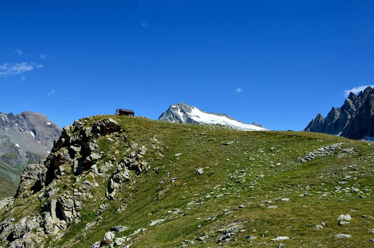
A) - (Letey Shelter and Champillon Hill): from Doues-Planavilla, with Municipal Road in Northwest towards Haut Praz-Bas Hamlet; from this continue in North to Pointier (1.635m), Piolet Dèsot (1.657m), Meitin, Piolet Damon Villages, Plan Taredaz (1.881m) nearby Farm Holidays "Vorbé", Cheséry (1.969m), Baita Novella, alternative 2.007 meters, Plan Debat, Notre Dame de Neige/Champillon (+ stone Cross; (2.078m; parking with wooden fountain; (2.050m; T/E; 1h '20/1h '40), at entrance in By Conca (Basin) and where ends the paved road. Splendid circular views to 180°. From Champillon parking in Northwest with the path High Route n° 1 towards, Pessinoille Pastures (2.146m), Alp Tsa (2.297m; source) nearby the new Letey Refuge; from the shalter through path to Champillon Pass (2.430m; E/F; 1h '45/2h '15).
1) - Col de Champillon (2.709 m; E/F; 1h'20), with traverse to the South towards Crou de Bleintse (2.824m), Tête de la Praz (2.751m), Mont Saron (2.681m; EEA/F+; 1h'30/2'00 for the crossing by hill) or to the North at Mont Chenaille (3.144 m; EEA/F+; 1h'45/2h'00 dal Col Champillon; 3h'15/3h'45 from Refuge Letey at Champillon).
Conca di By settore "Basso" Occidentale
A) - (Rifugio Letey e Colle di Champillon): da Doues-Planavilla, con la Strada Municipale verso Nordovest in direzione del Villaggio di Haut Praz-Bas; da questo continuare a Nord verso quelli di Pointier (1.635 m), Piolet Dèsot (1.657 m), Meitin, Piolet Damon, Plan Taredaz (1.881 m) vicino all'Agriturismo "Vorbé", Cheséry (1.969 m), Baita Novella, bivio 2.007 metri, Plan Debat, Notre Dame de Neige/Champillon (+ Croce in pietra; (2.078 m; parcheggio con fontana; (2.050 m; T/E; 1h '20/1h '40), all'ingresso della Conca di By e dove termina la strada asfaltata. Splendida vista circolare a 180°. Dal parcheggio di Champillon con sentiero Alta Via n° 1 verso Nordovest agli Alpeggi di Pessinoille (2.146 m) e Tsa (2.297 m; sorgente) presso il nuovo Rifugio Letey; da questo con sentiero al Colle Champillon (2.430 m; E/F; 1h'45/2h'15).
1) - Col Champillon (2.709 m; E/F; 1h'20), con traversata a Sud alla Crou de Bleintse (2.824 m), Tête de la Praz (2.751 m), Mont Saron (2.681m; EEA/F+; 1h'30/2'00 per la traversata dal Colle Champillon), oppure a Nord al Mont Chenaille (3.144 m; EEA/F+; 1h'45/2h'00 dal Col Champillon; 3h'15/3h'45 dal Rifugio ed Alpe Champillon).
 |
B) - From as soon as before the Village of Glacier (1.549m) to take the path n° 3/4/5 that verse is addressed reaching the Alpe Of it Pont (1.690m), it overcomes the Stream of By and it reaches the following of Crottes Pastures (1.733m); progressively becoming steep reaches the Alp Cheval Blanc (1.962m) and the neighbor Lake Farinet (1.987m). From this point, left on the right the paths n° 4/5, to continue by direction West-southwest crossing the emissary of the small lake and reaching the earth road to the hairpin bend 2.025 meters; leaving on the right the continuation in direction of the Les Eveques Pasture (2.038m) shortly and along to reach that some Alp Porchère (2.094m) and, through direction North, that that is than above or Tsa de Porchère (2.290m; spring). From this, proceeding through a long diagonal to the North-northwest, to reach an alternative to quota 2.400 meters about, from where two possibilities of continuation of the route they are verified:
a) - to directly continue on the path of right (East) reaching the thread of crest of the Dos de Boégno Bà and to actually follow it to the Quota 2.507 meters, old which folding up to the left slightly and with a steep final line to reach the Bivouac out Rosazza at the Savoie (2.651m; E/F; 3h'00).
b) - from the fork 2.400 meters around to take the branch of left (West) that it is addressed toward the Plan Bagò Pasture (2.436m) but not to reach her; to a further intersection in quota as the precedent to go up by a parallel trail always initialed n° 3 and coming from the Alp Chesal (2.039m); to climb again at first it toward North, after through a short diagonal to Northwest to reach the Torrent of Plan Bagò, near a characteristic great boulder. To get further on the right and, by a last upsurge, to reach from left toward right the Bivouac out Rosazza to the Savoie (2.651m; E/F; 3h'00).
2) - Col di Valsorey (3.107m), with crossing to the West towards the "Plateau de Cordine" (3.221 m) and to Mont Cordine (3.329m; EEA/F+; 1h'30 Savoie; 2h'30 in all). Conca di By settore "Alto" Settentrionale
B) - Da appena prima del Villaggio di Glacier (1.549 m) prendere il sentiero n° 3/4/5, che si indirizza verso Nordest raggiungendo l'Alpe Pont (1.690 m), supera il Torrente di By e raggiunge i successivi Alpeggi di Crottes (1.733 m); diventando progressivamente più ripido raggiunge l'Alpe Cheval Blanc (1.962 m) ed il vicino Lago Farinet (1.987 m). Da questo punto, lasciati sulla destra i sentieri n° 4/5, continuare con direzione Ovest-sudovest attraversando l'emissario del laghetto e raggiungendo la strada poderale al tornante 2.025 metri; lasciando sulla destra la continuazione in direzione dell'Alpe Les Eveques (2.038 m), brevemente e lungo la medesima raggiungere quello dell'Alpe Porchère (2.094 m) e, tramite direzione Nord, quella che sta di sopra o Tsa de Porchère (2.290 m; sorgente). Da questa procedendo con un lungo diagonale a Nord-nordovest raggiungere un bivio a quota 2.400 metri circa, donde si verificano due possibilità di continuazione del percorso:
a) - proseguire direttamente sul sentiero di destra (Est) raggiungendo il filo di cresta del Dos de Boégno Bà e seguirlo sino alla Quota 2.507 metri, superata la quale piegando leggermente a sinistra e con un tratto finale più ripido arrivare al Bivacco Rosazza al Savoie (2.651 m; E/F; 3h'00).
b) - dall'incrocio 2.400 metri circa prendere il ramo di sinistra (Ovest) indirizzantesi verso l'Alpe Plan Bagò (2.436 m) ma non raggiungerla; ad un ulteriore incrocio in quota come il precedente salire con un sentiero parallelo sempre siglato n° 3 e proveniente dall'Alpe Chesal (2.039 m); risalirlo dapprima verso Settentrione, poi con un corto diagonale a Nordovest raggiungere il Torrente di Plan Bagò presso un caratteristico grande masso. Allontanarsi sulla destra e, con un ultima impennata, raggiungere da sinistra verso destra il Bivacco Rosazza al Savoie (2.651 m; E/F; 3h'00).
2) - Col di Valsorey (3.107 m), con traversata ad Ovest al "Plateau de Cordine" (3.221 m) ed al Mont Cordine (3.329 m; EEA/F+; 1h'30 dal Savoie; 2h'30 in totale).
 |
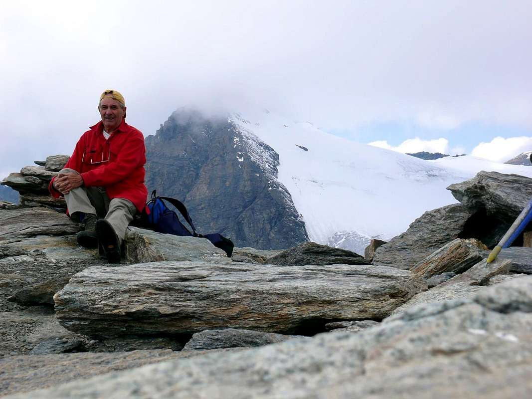
3) - Col du Gabelou (3.020 meters about) and "Nez" (3.129m), with ascent to the North towards Tête Blanche de By (3.413 m; EE/F; 1h'15/1h'30 by Amiante).
C) - Dal Comune di Ollomont (1.335 m) proseguire sino alla Frazione di Glacier o Glassier (1549 m), dove inizia l'itinerario a piedi. Da Glacier prendere la mulattiera prima del ponte, che sale a By, seguendola sino alla Casa Farinet, dove si prende il ramo di sinistra per il Rifugio Franco Chiarella-Amiante (2.979 m; EE/F+; 4h'00/4h'30).
3) - Col du Gabelou (3.020 metri circa) e "Nez" (3.129 m), con salita a Nord alla Tête Blanche de By (3.413 m; EE/F; 1h'15/1h'30 dal Rifugio dell'Amiante). By Basin area "Low" East
D) - (Gaula Oratory, Lakes and Nino Regondi Bivouac): By the regional Road towards Valpelline up to the deviation for Ollomont Common; leaving East the first continue North toward Glassier or Glacier Hamlet. From Glacier parking, through steep but short private dirt road concomitant with path n° 6 in South-southeast, to Crottes Pasture (1.591m); continue on nice path to Gaula Oratory, (+; 1.863m; T; 1h'00/1h'10). Places Alp (2.150m), small bridge 2.223 meters on Fenêtre Torrent, Plan de Breuil just above Comba des Eaux Blanches, fork 2.465 meters, between Clusa or Inclousa (2.418m)/Leita (2.538m)/Bonseya or de la Baseya (2.513m) Lakes to Regondi (EE; 4h'30/5h'00).
4) - Col du Mont Gelé (3.180m) with crossing on Glacier du Mont Gelé and Mont Gelé (3.518m; EEA/F+; 1h'45 to pass; in total 3h'00/3h'30 from Bivouac Regondi).
Conca di By settore "Basso" Orientale
D) - (Oratorio della Gaula, Laghi e Bivacco Nino Regondi): con la Strada Regionale per il Comune di Valpelline sino alla deviazione per quella diel Comune di Ollomont; lasciando ad Est la prima continuare a Nord verso il Villaggetto di Glassier o Glacier. Dal suo parcheggio, tramite la ripida strada poderale concomitante con il sentiero n° 6 verso Sud-sudest, in direzione dell'Alpeggio di Crottes (1.591 m); proseguire sul bel sentiero per l'Oratorio della Gaula, (+; 1.863 m; T; 1h'00/1h'10). Da questo raggiungere quello di Places (2.150 m), il successivo ponticello 2.223 metri sul Torrent Fenêtre ed il Plan de Breuil subito sopra la Comba des Eaux Blanches (dell'Acqua Bianca); da qui al bivio 2.465 metri, tra i Laghi Clusa od Inclousa (2.418 m)/Leità o Leitou (2.538 m)/Bonseya o de la Baseya (2.513 m) nell'immediate vicinanze del Bivacco Regondi (EE; 4h'30/5h'00).
4) - Col du Mont Gelé (3.180 m) con traversata del Glacier du Mont Gelé verso il Mont Gelé (3.518 m; EEA/F+; 1h'45 al colle; in totale 3h'00/3h'30 dal Bivacco Regondi).
MAPS:
Mountain Conditions
- You can get meteo information at the official site of the Regione Valle d'Aosta:
- Valle d'Aosta Meteo
Books and Maps
BOOKS:- "Guida delle Alpi Occidentali", di Giovanni Bobba e Luigi Vaccarone C.A.I. Sezione di Torino Volume II (parte II), 25 Maggio 1896.
- "Guida dei Monti d'Italia-Alpi Pennine" (Vol. I°) di Gino Buscaini-Club Alpino Italiano/Turing Club Italiano, Luglio 1971 (in Italian).
- "Guida della Regione Autonoma Valle d'Aosta" di Mario Aldrovandi; Ed. S.P.E. di Carlo Fanton, Torino 1964.
 |
 |
 |
- L'Escursionista "Valpelline, Saint Barthélemy" (carta n° 6) 1:25.000.
- C.N.S. "Mont Vèlan", foglio 1366, 1:25.000.
- Kompass "Breuil/Cervinia-Zermatt" Carta turistica 1:50.000.
- I.G.C. Istituto Geografico Centrale "La Valpelline, Ollomont, Saint Barthélemy", (carta n° 115) Map1:30.000.
Important Information
- REGIONE AUTONOMA VALLE D'AOSTA the official site.
- FONDAZIONE MONTAGNA SICURA Villa Cameron, località Villard de la Palud n° 1 Courmayeur (AO) Tel: 39 0165 897602 - Fax: 39 0165 897647.
- SOCIETA' DELLE GUIDE DELLA VALPELLINE Etroubles-Strada Nazionale, n° 13 - Tel +39 0165 78559 - Valpelline-Loc Capoluogo, n° 1 - Tel +39 0165 713502 (AO) Italia.
- A.I.NE.VA. (Associazione Interregionale Neve e Valanghe).
Useful numbers
- Protezione Civile Valdostana località Aeroporto n° 7/A Saint Christophe (Ao) Tel. 0165-238222.
- Bollettino Meteo (weather info) Tel. 0165-44113.
- Unità Operativa di Soccorso Sanitario Tel. 118.