* Jul 28, 2017 - Ownership switched by andrea * Aug 20, 2017 - Started the overhaul (Page under review) * Dec 14, 2019 - Overhaul
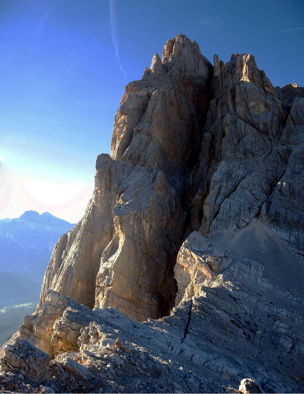
Croda Marcòra 3154 m is an imposing peak standing above San Vito di Cadore with its vertical South wall. For anyone on the road towards Cortina d'Ampezzo from the Val Boite, just before the town, it appears a huge wall of rock on the right. It's the West side of the Sorapìss group, whose main summit is hidden from here. The entire wall visible culminates in the "Croda Marcora"; when seen from other side it's inconspicuous and it's easily confused with towers and pinnacles that surround it. It is the second peak of the group in order of height and can be easily combined with the ascent to the nearby Fópa di Matìa and Sorapìss. In spite of its verticality on the side of the Val Boite, the summit is quite easy to reach, apart from the chimney common with the Normal route to Sorapíss, a III degree UIAA. The top is composed of a rocky ridge with easy approach on gravel steps, but when facing the SW side, you will see an abyss of 2000 meters! As few in the Alps. Good place for basejumpers! The show is stunning, the roofs of the houses of Cortina as seen from the window of an airplane.
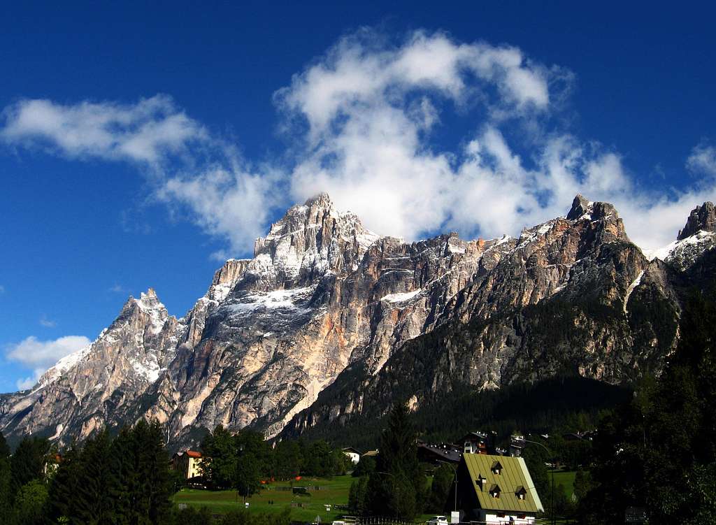
Croda Marcora from San Vito di Cadore
The Croda Marcora branches off to the NW with a long rocky ridge to the Punta Nera 2847m. Easily accessible from the cableways of "Faloria". While in the NE branch, there is a peak called Fopa di Mattia 3155m, just a meter higher, but not very important.
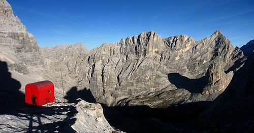
More or less at a height of 2500, the SW wall is crossed by a dizzying ledge, called "cengia del Banco", wherefrom passes the "Via Ferrata Berti". On its south side, the Croda Marcora, form a rocky outcrop of 450m, and at the base is placed a cozy bivouac called "Slataper" 2600m.
A few meters from the bivouac (forcella del Bivacco 2670m), you can look down from a natural balcony to the valley and, during the sunset, see the sun illuminating the tops of Antelao and Croda Marcora, while the valley is already in the darkness.
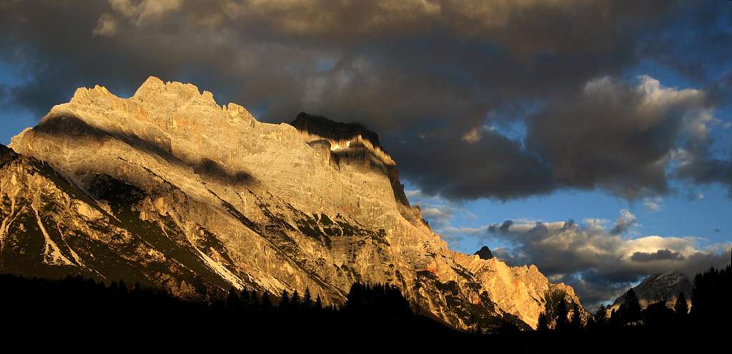
Croda Marcora seen from Cortina.
Getting There
The Sorapiss group is almost completely surrounded by roads and valleys, so there are more than one option.
Numerous routes to get there. Here the routes that take to the biavouac Slataper and the "normal route":
To and from Auronzo di Cadore (valle d'Ansiei) 864m:
By car:
Milano or Venice A4 - Belluno A27 - Longarone - Auronzo di Cadore
Bressanone - Dobbiaco - Sesto - Passo di Monte Croce Comelico - Auronzo di Cadore
Cortina d'Ampezzo - Passo tre Croci - Auronzo di cadore
Paths:
From val d'Ansiei - path 227 (sentiero "Osiride Brovedani") - biavouac Comici - path 247 - bivouac Slataper
From val d'Ansiei - path 217 - refuge Vandelli - path 215 - ferrata "Berti" - bivouac Slataper To and from Cortina d'Ampezzo 1211m:
By car:
Milano or Venice A4 - Belluno A27 - Pieve di Cadore - Cortina - passo 3 Croci
From Cortina - cablecar to Faloria 2123m - path 215 - ferrata "Berti" - bivouac Slataper
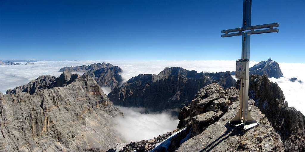
Croda Marcora and Sorapiss
To and from San Vito di Cadore 1010m:
By car:
Milano or Venice A4 - Belluno A27 - Pieve di Cadore - San Vito di Cadore
Bressanone - Dobbiaco - Cortina - San Vito di Cadore
Paths:
Cable car (or by car) to refuge Scotter 1580m - path 226 - refuge San Marco - path 226 - bivouac Slataper
From Chiappuzza (San Vito) - path 225 - refuge San Marco - path 226 - bivouac Slataper
The summit
Routes overview
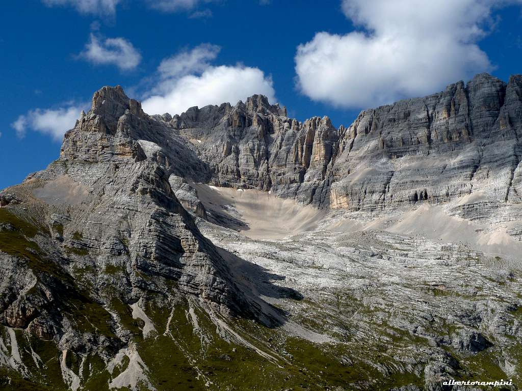
Croda Marcora SE spur seen from Passo del Bivacco 2670m
Normal route:
The normal route has half way in common with the normal route to Sorapiss.
From bivouac Slataper goes up through the scree of the "Fond de Rusecco" and leading to the attack under yellow rocks. Climb up on a first ledge and then on a second, than follow it to the left (more or less 100m).
Go up in a chimney of 15m, with a smooth wall to the right and up a boulder wedged (a passage of III, anchor for rappel). Few meters above takes another ledge to the left to follow 40m, then climb straight up the steep rocks but easy on the right of a large scree often with snow, Giaron Alto.
Here the junction for the Sorapiss. Keep going along the ledge that traverse the SE flank of the mountain to west direction. At the end of the ledge, there are 100 meters of steep gravel path, that takes to another ledge that permit to link again the route to Sorapiss. Point directly to the summit (Croda Marcora), with easy passages of I/I+. After that there is a small snow slope (size dependig of the season). The slope takes to a ridge where the cross of the top is placed. (350m - diff. I/II a passage of III)
Other routes:
From northwest - F.Lacedelli - 02/09/1864 - diff. II
From west wall - Hemery/G.Pampanin - 1909 - 750m - diff. II
Places: 9 Warning! only 3 beds at disposal actually. No water source around
Red Tape
No fees no permits required. The whole group is included among the nine ones acknowledged as an UNESCO World Heritage Site in 2009. More info about Dolomiti Unesco World Heritage here:
Parents refers to a larger category under which an object falls. For example, theAconcagua mountain page has the 'Aconcagua Group' and the 'Seven Summits' asparents and is a parent itself to many routes, photos, and Trip Reports.

 10224 Hits
 85.36% Score
 20 Votes