
-
 28340 Hits
-
 90.13% Score
-
 31 Votes
|
|
Mountain/Rock |
|---|---|
|
|
37.90340°N / 119.209°W |
|
|
Mono |
|
|
Hiking |
|
|
Summer |
|
|
12466 ft / 3800 m |
|
|
Overview
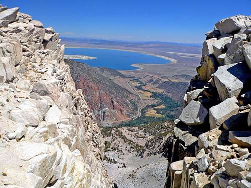
Mono Lake from the plateau
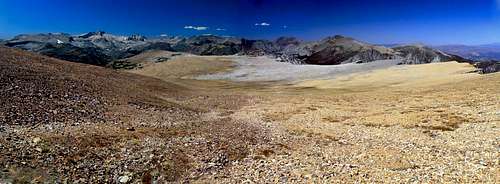
North from the plateau summit area
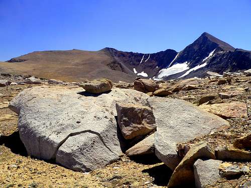
This is a huge high altitude mountain mesa 2 miles long and up to 3/4 mile wide ranging from 11,400' at the north end and gradually rising over 1,000' to a high point at the southwest end where it connects to Mt. Dana via a rugged cirque. Massive buttresses extending a mile down into Lee Vining Canyon appear as mountains themselves from below.
The northeast face of the plateau features the Third Pillar and other fine class 5 routes and is an impressive sight to travelers approaching Yosemite National Park via Hwy. 120 as it winds it's way up through Lee Vining Canyon toward Tioga Pass from the Mono Lake Basin. The whole plateau is worth exploring, especially the north and northeast edge.
There are fine views of the northern Sierra, jaw dropping looks down into Lee Vining Canyon, the Mono Lake Basin on out to the White Mountains and the eastern scarp of the Sierra as well as the northeast face of Mt. Dana.
Getting There
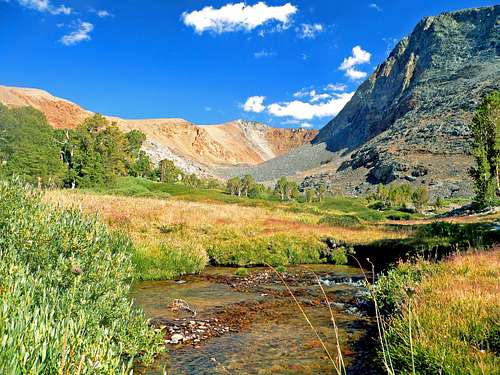
Glacier Canyon from stream from Dana Lake.
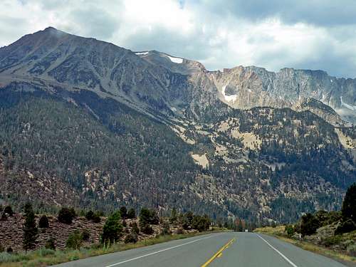
Northeast face of the Dana Plateau from Hwy. 120
Ellery Lake route: (class 1-2) From Hwy. 395 go 9.5 miles on Hwy. 120 to the west side of Ellery Lake or 2 miles north from Tioga Pass. Ascend the northwest ridge of easy stable metamorphic slate to the north end of the plateau. Go south to the high point.
Climbing routes: These routes are generally approached from the plateau the same as the others since an approach from the northeast would involve several thousand feet of gain with rugged bushwhacking to massive talus slogs.
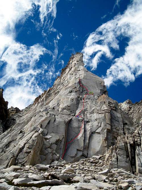
"Third Pillar", regular route 5.10 A. Phil Bircheff and Bill Bonebrake, July 1969. "The best 5.9 pitch in the Universe"- Richard Leversee
"The One That Almost Got Away", IV, 5.10 C. Miguel Carmona and Alois Smrz, Sept. 4, 1990
"Lenticular Limbo", III, 5.10C.
Detailed descriptions of the routes can be found in "The High Sierra Peaks, Passes and Trails" by R.J. Secor
Red Tape
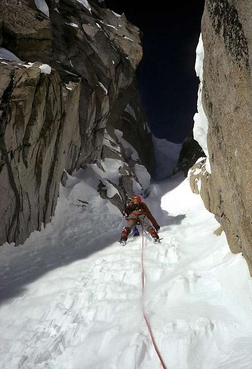
Climbing a chute on Third Pillar in winter
Third Pillar
Camping
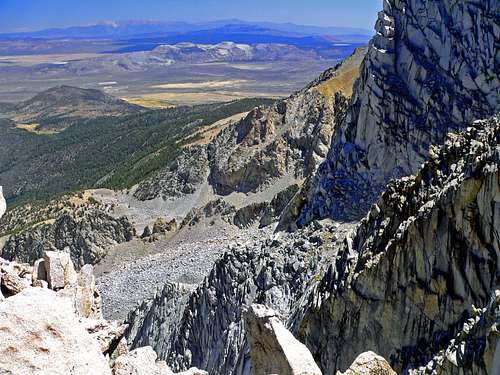
Southeast from the Plateau
The Dana Plateau and Mt. Dana from the northeast side
1-Tioga Lake, 1.2 miles north of the pass at 9.600'.
2-Ellery Lake, 2.3 miles north of the pass at 9,500'.
3-The northwest junction of Hwy. 120 with the Saddlebag Lake road at 9.600'.
4-Sawmill, 1.8 miles north on the Saddlebag Lake road at 9,750'.
5-At Saddlebag Lake, 2.6 miles at the end of the Saddlebag Lake Road at 10,100'.
6-Big Bend, 3.4 miles on Hwy. 120 from 395. go left 2,7 miles straight into Lee Vining Canyon. 7,700'.
7-Aspen, same as Big Bend but only go 1.5 miles into the canyon from the turn off Hwy. 120. 7,500'.
There are also several campgrounds starting a 2 miles west of 395 on Hwy., 120 at 7,200'.