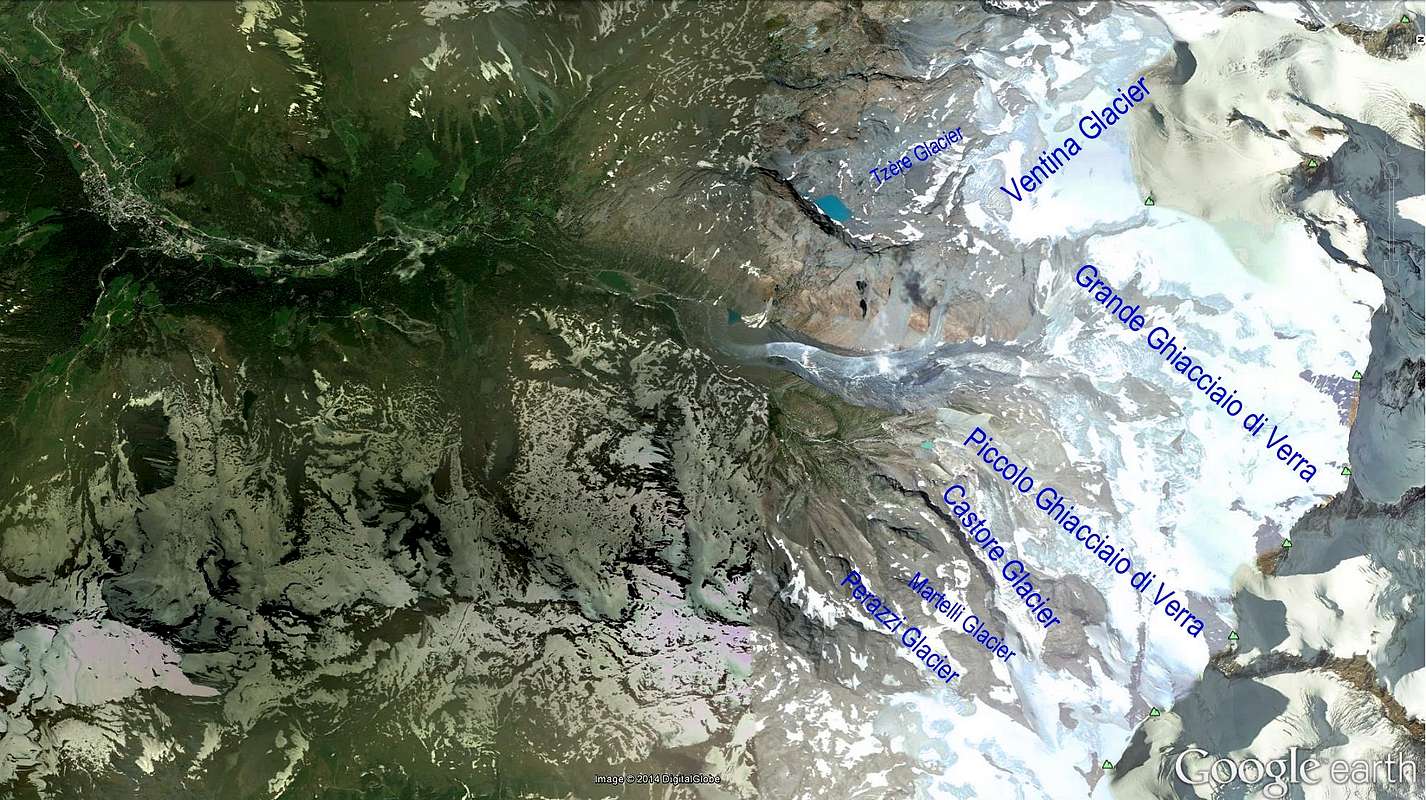
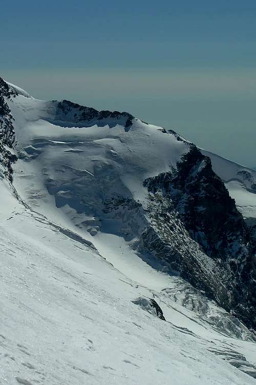
The "welding" between the Valleys of Ayas and Gressoney or Lys occurs, as well as through the hills sites on the watershed dividing the two, for the glaciers in the upper part of the same, merge into a single casting. After the Breithorns Glacier that tied the Valtournanche at the Ayas Valley and then that of the Torrent Marmore with Evançon, a series of glaciers, fan out into the valley accompanying the crest of Swiss-Italian border. First, to the Southwest with the Glaciers Aventine, practically a continuation of that of the Breithorns from which it is separated from the bulk Gobba (Hump) of Rollin (3.899m), and the two glacial "tongues" of the Grand and Petit Verra or Veraz, then from Glacier Castor, inserted between this summit and his shoulder Eastern or Punta Felik. Farther South is the direction and includes those Felik or Martelli, Perazzi and the much larger Western Lys, at the foot of the cirque between the two Lyskamms, Western and Eastern, but these is now leaning towards the Gressoney Valley.
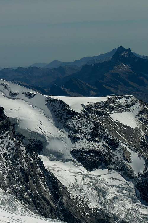
Then the long divider between the valleys of Ayas and Gressoney stretches Southward completely free of ice up above the Communes of Donnas and Pont Saint Martin, in the Central Valley of the River Dora Baltea. In the watershed between the Superior Bettolinaz Hill, the Testa Grigia (Gray Head; 3.313m) and the Ranzola Pass are only a series of lakes (among which we highlight those Pinter and Palasina) which suggest what would be the ancient expansion of the ice. Some signs of the snows are still at the Northern base of Mount Nery or Becca of Frudiera, but now it's snowfields overlying the two beautiful lakes and homonyms, witnesses of the withdrawal of the same. Still some small glacial firn in the Valley Chasten in the amphitheater at the base of Mount Voghel and the two Dames de Challand. But no shadow of glaciers and lakes even more signals, demonstrating that in this area the retreat of the ice was even more precocious. Analogously, back, on the spur partition with the Valtournenche Valley: from Gran Sometta and down until the Mount Zerbion ed alla Testa di Comagna above Chatillon and Saint Vincent Municipalities, we will not find more glaciers, while further inland, a more small, said Tzère, fastens, as an appendix, to the Aventine and its waters flow into the underlying Grand Lac, in a small basin enclosed amongst the Bivouac City of Mariano and the Rocca or Mont of Verra(z).
La "saldatura" tra le Valli di Ayas e di Gressoney o del Lys avviene, oltre che tramite i colli siti sullo spartiacque divisorio delle due, per i ghiacciai che, nella parte alta delle medesime, fondonsi in unica colata. Dopo il Ghiacciaio del Breithorn che legava la Valtournenche alla Valle di Ayas e quindi quella del Torrente Marmore con l'Evançon, una serie di ghiacciai, diposti a raggiera, scendon a valle accompagnando la cresta di frontiera italo-svizzera. Dapprima verso Sudovest con i Ghiacciai di Aventine, praticamente continuazione di quello dei Breithorn dal quale é separato dalla massa della Gobba di Rollin (3.899 m), e le due "lingue" glaciali del Grand e Petit di Verra o Véraz; poi dal Ghiacciaio del Castore, inserito tra questa Cima e la sua spalla Orientale o Punta Félik. Più in là la direzione é Sud e comprende quelli di Félik o Martelli, Perazzi ed il ben più vasto Occidentale del Lys, ai piedi del circo glaciale tra i due Lyskamms, Ovest ed Est, ma questi già protesi verso la Valle di Gressoney. Poi il lungo divisorio tra le Valli d'Ayas e di Gressoney si allunga verso Sud completamente privo di ghiacci fino sopra i Comuni di Donnas e Pont Saint Martin, nella Valle Centrale del Fiume Dora Baltea. Nello spartiacque tra il Colle della Bettolinaz Superiore, la Testa Grigia (3.313 m) ed il Colle della Ranzola troviamo solo una serie di laghi (tra i quali si evidenziano quelli di Pinter e di Palasina) che inducono a pensare a qual fosse l'antica espansione dei ghiacci. Qualche segnale di nevi lo troviamo ancora alla base Settentrionale del Mont Nery o Becca di Frudiera, ma ormai si tratta di nevai soprastanti i due splendidi ed omonimi laghi, testimoni del ritiro dei medesimi. Ancora qualche piccolo glacio nevato nel Vallone di Chasten nel grande anfiteatro alla base del Monte Voghel e delle due Dames de Challand. Ma nessuna ombra di ghiacciai e neppure più segnali di laghi, a dimostrazione che in questa area il ritiro dei ghiacci é stato ancor più precoce. Analogo discorso, tornando all'indietro, sul contrafforte divisorio con la Valtournanche: dalla Gran Sometta e giù fino allo Zerbion ed alla Testa di Comagna, sopra Chatillon e Saint Vincent, non troveremo più ghiacciai, mentre, più all'interno, uno più piccolo, detto di Tzère, s'allaccia, come appendice, a quello di Aventine e le sue acque confluiscono nel sottostante Grand Lac, in un ristretto bacino racchiuso tra il Bivacco Città di Mariano e la Rocca o Mont di Verra(z).
Dimensions and mass of glaciers in the Ayas Valley (Breithorns - Castore). The valley has seven glaciers as follows:
Dimensioni e massa dei ghiacciai della Valle d'Ayas (Breithorns - Castore). La valle possiede sette ghiacciai così ripartiti:
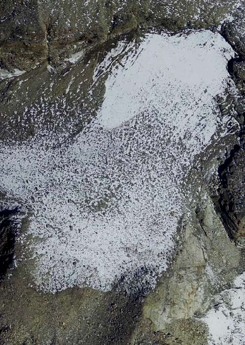
1) - Tzère Glacier
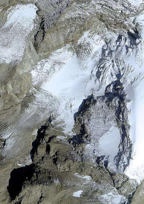
2) -Ventina Glacier
3) -Grande ghiacciaio di Verra
4) - Piccolo ghiacciaio di Verra
5) -Castore Glacier
6) -Martelli Glacier
7) - Perazzi Glacier
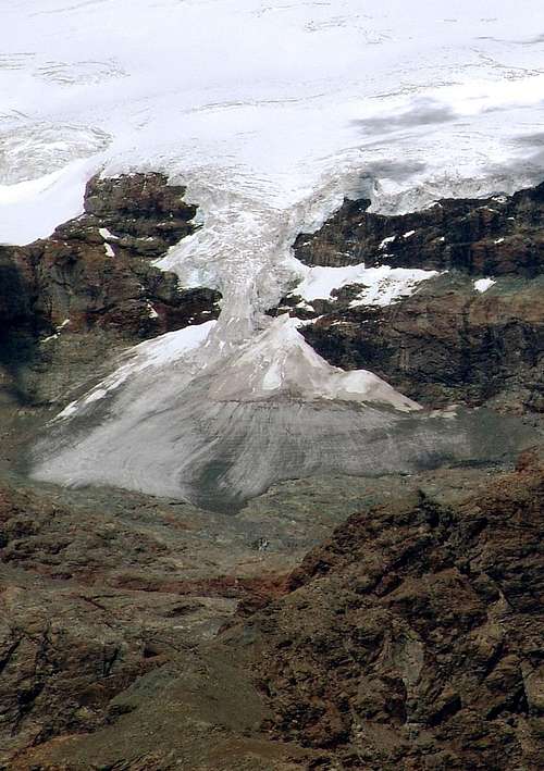
Tzère Glacier
Tzère Glacier
Features: Uncertain
Sector: Pennine Alps (Monte Rosa)
Surrounding summits: Gobba di Rollin 3.899m
Maximum altitude: 3.350m~
Minimum altitude: 3.000m~
Exposure: S-O
Maximum length: 730m~
Maximum width: 600m~
Maximum extension: 0,287km²~ 28,7ha~
Mean deep: -
Maximum deep: -
Activity: No sure
Mean slope: -
Caratteristiche: Incerte
Settore: Alpi Pennine (Monte Rosa)
Vette principali: Gobba di Rollin 3.899 m
Quota massima: 3.350 m~
Quota minima: 3.000 m~
Esposizione: S-O
Lunghezza massima: 730 m~
Larghezza massima: 600 m~
Estensione massima: 0,287 km²~ 28,7 ha~
Profondità media: -
Profondità massima: -
Attività: Incerta
Inclinazione media: -
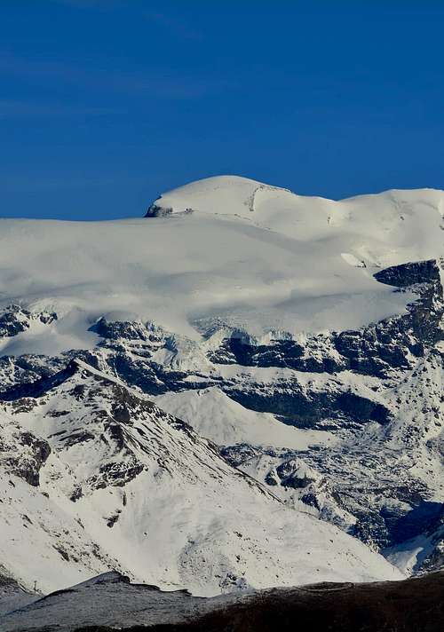
Ventina Glacier
Ventina Glacier
Features: Basin
Sector: Pennine Alps (Monte Rosa)
Surrounding summits: Gobba di Rollin 3.899m
Maximum altitude: 3.899m~
Minimum altitude: 3.090m~
Exposure: S-O
Maximum length: 2.450m~
Maximum width: 2.800m~
Maximum extension: 3,5km²~ 350ha~
Mean deep: 35m~*
Maximum deep: 50/70m~**
Activity: Moderate advanced
Mean slope: -
Caratteristiche: Bacino
Settore: Alpi Pennine (Monte Rosa)
Vette principali: Gobba di Rollin 3.899 m
Quota massima: 3.899 m~
Quota minima: 3.090 m~
Esposizione: S-O
Lunghezza massima: 2.450 m~
Larghezza massima: 2.800 m~
Estensione massima: 3,5km²~ 350ha~
Profondità media: 35m~*
Profondità massima: 50/70m~**
Attività: Moderata avanzata
Inclinazione media: -
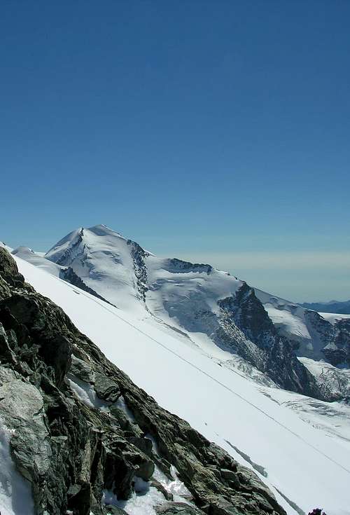
Grande ghiacciaio di Verra
Grande ghiacciaio di Verra
Features: Valley glacier with steps
Sector: Pennine Alps (Monte Rosa)
Surrounding summits: Castore 4.228m, Polluce 4.091m, Breithorn centrale 4.160m
Maximum altitude: 4.228m~
Minimum altitude: 2.650m~
Exposure: S
Maximum length: 5.020m~
Maximum width: 4.100m~
Maximum extension: 6,7km²~ 670ha~
Mean deep: 40m~*
Maximum deep: 90/140m~**
Activity: Not sure
Mean slope: -
Caratteristiche: Ghiacciaio vallivo a gradoni
Settore: Alpi Pennine (Monte Rosa)
Vette principali: Castore 4.228 m, Polluce 4.091 m, Breithorn centrale 4.160 m
Parents refers to a larger category under which an object falls. For example, theAconcagua mountain page has the 'Aconcagua Group' and the 'Seven Summits' asparents and is a parent itself to many routes, photos, and Trip Reports.

 4386 Hits
 80.49% Score
 12 Votes