-
 14796 Hits
-
 92.04% Score
-
 37 Votes
|
|
Mountain/Rock |
|---|---|
|
|
45.56310°N / 7.08138°E |
|
|
Aosta Valley |
|
|
11834 ft / 3607 m |
|
|
Overview
What's new:
- Jul 13th, 2017 Inherited the page from Andrea.it.
- Aug 11th, 2017 Started to modify the page and the other sections.
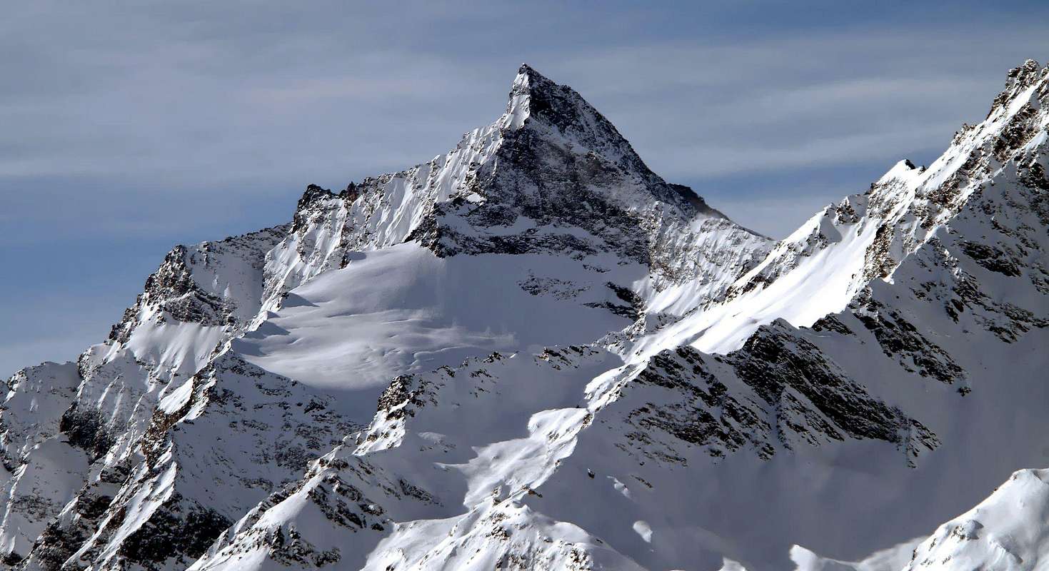
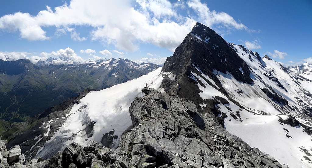
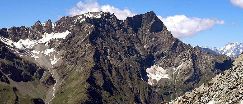
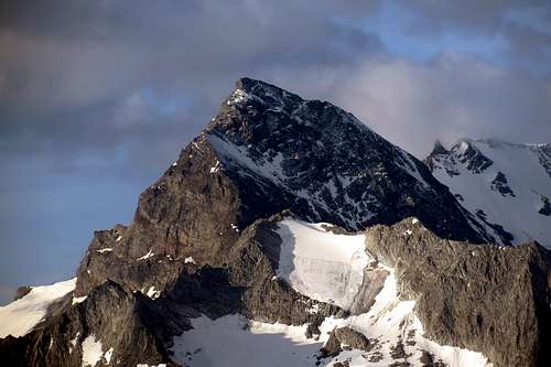
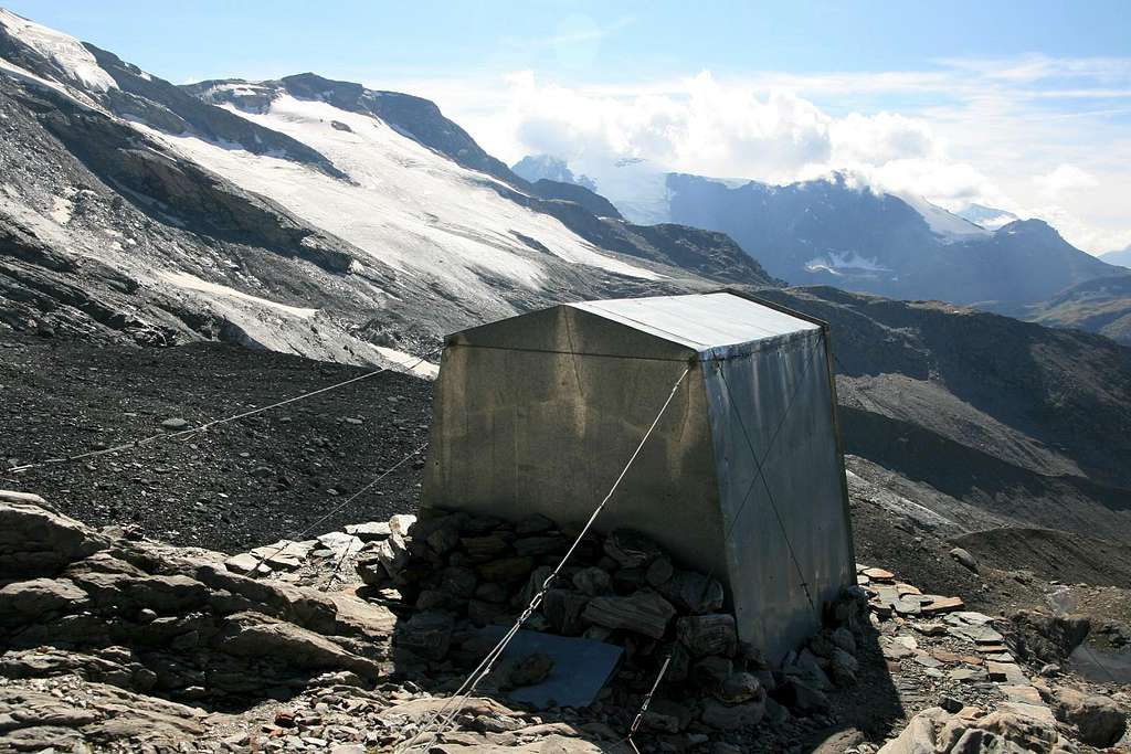
Montagna molto bella, con una morfologia molto complessa. Si trova sul versante che divide la Valgrisenche dalla Valle di Rhêmes, dove è la montagna più alta. Il vertice è costituito da due cime distanti l'una dall'altra circa 800 metri, Ia cima nord (3.607 m) e la cima sud (3.577 m). Il punto più basso tra di loro è chiamato "Colle della Grande Rousse" (3.516 m). Il lato della Val di Rhêmes è caratterizzato da 3 settori: Quello nel centro che si affaccia dalla cresta che collega le due cime, composta da una scoscesa parete alta circa 800 metri che precipita sul sottostante e oramai quasi estinto ghiacciaio del Pellaud. Il versante occidentale che culmina con la cima nord, si solleva con una bastionata rocciosa chiamata "Fort de Bard". Quella meridionale formata dal Ghiacciaio di Fos e dalla Becca di Fos, che culmina con il vertice sud. Il lato occidentale di Valgrisenche è quasi totalmente ricoperto di ghiaccio, e divisibile in 3 parti: i ghiacciai del Monte Forciaz, di Invergnan e di Giasson. La mancanza totale di bivacchi o rifugi sul lato est, la rende una montagna selvaggia con un approccio difficile. Sul lato ovest, il bivacco Ravelli (2.860 m) dà la possibilità di compiere la salita in due giorni e di avvicinarsi alla montagna dal percorso più facile e logico.
Approach
FROM ITALY:- From Valgrisenche: From the motorway A5 Montebianco (from Geneve, Turin, Milan), take the exit Aosta Ovest and follow the direction to Arvier-Valgrisanche.
- From Valle di Rhêmes: From the motorway A5 Montebianco (from Geneve, Turin, Milan), take the exit Aosta Ovest and follow the direction to Villeneuve - Val di Rhêmes.
- From Val d'Isere: From the village of Val d'Isere, enter in the area called "Reserve Naturelle de la Grande Sassiere". From here, few routes, through Col de Rhême Golette and Col de la Tsanteleina, permits to reach the Italian side the foot of this mountain.
- Is possible to reach the Aosta Valley also through the: France - pass of Piccolo St. Bernardo (closed in winter). France - Tunnel of Mont Blanc. Swiss - Tunnel of Grand St. Bernardo. Swiss - pass of Grand St. Bernardo (closed in winter).
Route History
- From Glacier Invergnan - Blansford, Neighbour, Nichols, Roswell, Favret, Brunod 13/08/1864 (first ascent).Routes
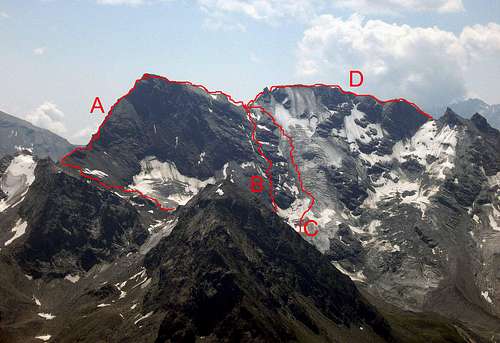
- From Glacier Invergnan and Colle Grande Rousse - Normal route (from biv. Ravelli PD+/AD)(C in the pic). - Northwest spur - 2° Normal route (from biv. Ravelli PD+/II+)(B in the pic). - North wall - Bad rocks (600m AD+/D). - From Glacier Forciaz and north ridge - Friable rocks (from biv. Ravelli III°/IV°)(A in the pic). - East ridge - Difficult but safe (III°/IV°). - From east flank and Colle Grande Rousse - Very long and not recommended (PD+). - South ridge - Safe and most logic (AD/III°)(D in the pic). - SKI route - Very hard ascent. From biv. Ravelli OSA.Gear
Standard mountaineering equipment: Rope, iceaxe, crampons and helmet.Refuges and Bivouacs
Bivouac Luigi Ravelli 2.860m 9 places, always open. From Uselleres (1.778m), take the path n°10 (3h'00 diff. T).Campings
Remember that free camping is forbidden (except for emergency reasons, over 2.500m, from darkness until dawn).Mountain Conditions
- You can get meteo information at the official site of the Regione Valle d'Aosta:
- Valle d'Aosta Meteo
Webcam
- WEBCAM on Aosta Valley:
- Webcam
Books and Maps
BOOKS:- "Guida delle Alpi Occidentali", di Giovanni Bobba e Luigi Vaccarone C.A.I. Sezione di Torino Volume II (parte II), 25 Maggio 1896.
- "Guida dei Monti d'Italia–Alpi Graie Centrali" di Alessandro Giorgetta - Club Alpino Italiano/Touring Club Italiano, 1985 (in Italian).
- "Diari Alpinistici" di Osvaldo Cardellina e Indice Generale accompagnato da Schedario Relazioni Ascensioni 1964-2019 (unpublished).
- "La Valle di Rhêmes" di Lorenzo Rossi di Montelera, Ed. Tamari Bologna, Giugno 1978.
- Kompass "Gran Paradiso Valle d'Aosta Sentieri e Rifugi", Carta turistica 1:50.000.
- Studio F.M.B. "Gran Paradiso" Bologna 1:50.000.
- L'Escursionista "Valgrisenche Val di Rhêmes", Carta dei sentieri (n° 3) 1:25.000.
- Enrico Editore Ivrea-Aosta "Gruppo del Gran Paradiso" 1:50.000.
- I.G.C. Istituto Geografico Centrale Torino "Il Parco Nazionale del Gran Paradiso", 1:50.000.
Important Information
- REGIONE AUTONOMA VALLE D'AOSTA the official site.
- FONDAZIONE MONTAGNA SICURA Villa Cameron, località Villard de la Palud n° 1 Courmayeur (AO) Tel: 39 0165 897602 - Fax: 39 0165 897647.
- SOCIETA' DELLE GUIDE DI VALGRISENCHE.
- A.I.NE.VA. (Associazione Interregionale Neve e Valanghe).
Useful numbers
- Protezione Civile Valdostana località Aeroporto n° 7/A Saint Christophe (Ao) Tel. 0165-238222.
- Bollettino Meteo (weather info) Tel. 0165-44113.
- Unità Operativa di Soccorso Sanitario Tel. 118.


