|
|
Mountain/Rock |
|---|---|
|
|
36.19753°N / 75.22553°E |
|
|
Nagar / Gojal |
|
|
Mountaineering, Big Wall, Mixed |
|
|
Summer |
|
|
24380 ft / 7431 m |
|
|
Overview
Kunyang Chhish East is an impressive summit that is located in the Hispar Muztagh, a major sub-range of the Karakoram. It may have comparatively small prominence compared to some of its neighbours, however the south-west face is one of the most awesome spectacles the region. It forms part of Kunyang Chhish massive, which also contains Kunyang Chhish Main (7852m), West (7350m), South (7620m) and North (7108m). Kunyang Chhish Main is the second highest peak in the Hispar Muztagh and 21st highest in the World. Kunyang Chhish translates as "Hidden Peak" but is not to be confused with Gasherbrum I, which is also called Hidden Peak. Kunyang Chhish East lies at the head of the Pumari Chhish glacier, which extends north from the Hispar, the 5th largest glacier in the Karakoram. To the north of the mountain is the beautiful Yazghil Glacier which has ten +7000m peaks in total rising above it. To the east of the mountain is the West Jutmo glacier which also eventually flows in to the Hispar Glacier via the main artery of the Jutmo glacier. Kunyang Chhish East is difficult to climb from all directions. It was first climbed in 20134 by Simon Anthamatten (Switzerland), Hansjörg Auer, and Matthias Auer (both Austria) via the south-west face (ca 2700m). Prior to that there were three official attempts on the mountain, also from the south-west via the Pumari Glacier. A Polish and American expedition made failed alpine-style attempts of the SW face and a Korean team tried to siege the mountain via a longer to the west that skirted close to Ice Cake (6400m). There may be other attempts that have been made without a permit that I am not aware of. The Korean expedition report mentions a French expedition at base camp without a liason officer (and therefore probably without a permit) but does not mention anything about an attempt. Valery Babanov and Patrick Delaney had planned to attempt the peak in 2007. According to their web blog the latter was "psychologically unready for it".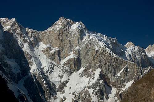
Climbing History and Route Descriptions
The ten man Korean expedition led by Sung Man Park was the first to try the peak in June 2003. They attempted to climb the mountain via a route that initially stated close by the summit of Ice Cake to the west. They fixed rope for much of the way and gave up at only 6100m feeling it was too difficult to trace a route higher. The team summited Ice Cake before returning to base camp.The second attempt came only two months by a Polish expedition consisting of Grzegorz Skorek, Janusz Golab and Stanislaw Piechuch. They attempted the more direct SW face. Climbing began at 5.30pm once temperatures had dropped enough for climbing conditions to improve. They climbed over 1000m up an ice field (maximum inclination 70°) before making a bivi at 4am. At 5.30am they were on the move again however climbing a difficult steep mixed section (crux) consisting of thin ice and no belays. As snow conditions began to deteriorate during the day the trio were forced to wait until 5pm before once more climbing at night. Climbing was harder on the second night and, unlike the first, belays had to be adopted. A bivouac was made at 6300m. Again climbing commenced early morning and the team reached 6700m by the afternoon before making a third bivouac. Next morning the weather started to change for the worse and the team decided to descend back to base camp. At point of retreat they had climbed 2300m with 60° snow, 90° ice, mixed climbing at M6, rock to French 6a, and a verticle 20m pitch of A2, all on excellent granite.The third attempt came this September when the American pair of Steve House and Vince Anderson attempted the SW face. In 2005 they had made an Alpine-style ascent of the Rupal Face of Nanga Parbat – one of the most impressive Alpine ascents ever! The pair passed the Poles high point of 6700m on their second day noting the crux pitch was easier than expected. On the third morning they completed the final 300m of the southwest face and had only 300m remaining between them and the summit. A steep step on the ridge crest however stopped all progress. “To the right was a massive cornice, to the left was steep, blank rock”. With a minimal Alpine rack and bad rock the exhausted pair turned around some time around 2 or 3pm. Weather turned for the worse late that day forcing them to halt their descent. After a stressful night the pair made it back down the following morning.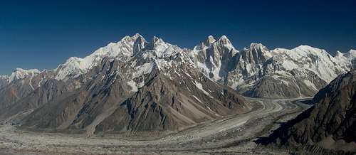
Getting There
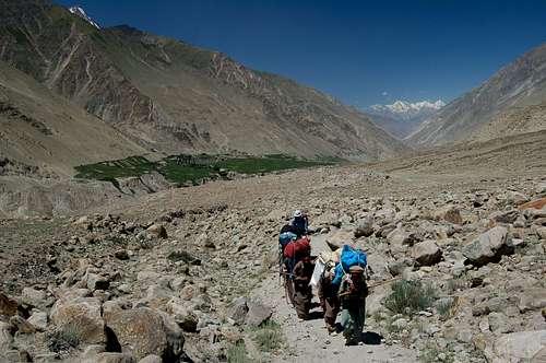
General information about reaching the Karakoram area can be found on the SP Karakoram page.From either Karimabad or Aliabad in Hunza first arrange a Jeep to the village of Nagar and then arrange a further one to the village of Hispar at the western end of the Hispar glacier. It is not possible to take a Jeep from Hunza directly to Hispar unless to driver is from Nagar as the road beyond Nagar is privately owned and only local Nagar drivers are allowed to use it. This unfortunately will put you in a poor bargaining position. Since there is no public transport between the villages having arranged a fee for your ‘special hire’ half the village will likely to join you for the journey without contributing to the fair. Public transport from Aliabad to Nagar leaves regularly as soon as vehicles fill up. They are likely to charge a little extra if you are carrying an expedition load on the roof. The road to Hispar sometimes blocks after rain and you may need to arrange porters on route, such as the village of Huru, as we had to.A base camp can be reached in two or three days from Hispar village. If you have more than five porters then a guide is compulsory according to village rules (but not government rules). Hispar porters unfortunately do not have a reputation for being the most reliable so a guide may not be such a bad idea for this trek in. Steve House and Vince Anderson were the latest people to have porter problems this year highlighting that their bad reputation is unfortunately still justified. Porters ask for Rs450 per stage including wapasi (so Rs300in effect). Wapasi is what you pay to the porter to return to where the trek began if it has finished elsewhere. For every stage half a stage is paid in Wapasi. I am not sure of the specific number of stages to base camp but it will be around five.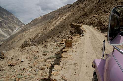
Red Tape
Royalty Fees
$250 royalty fee is payable for peaks between 7001 and 7500m, which covers a party up to seven. An additional $40 dollars is payable for each additional member above this number. These low rates apply only for the Gilgit region of the Karakoram, which includes Hunza and Gojal (Upper Hunza). No Liaison Officer is currently required for the Gilgit region. Peak royalties are half the above figures for a winter attempt.Visas
A valid visa is required. Visas are NOT issued at the airport and must be obtained prior to arrival. Some embassies such as those in Central Asia are reluctant to issue visas and advise you to obtain them from your home country. A single-entry tourist visa is valid for 3 months from the date of arrival in Pakistan and for 6 months from the date of issue. Some visas are only valid for 3 months from the date of issue so check if necessary when applying. Visa prices vary. Americans pay the most for their visa whilst Japanese get theirs free! Visa extensions and reentry stamps used to almost impossible to obtain however the process has become remarkably easier in the last few years. Gilgit DC is a good place to try. Some country's embassies will need a letter of invitation from a trekking company or similar when applying for a visa.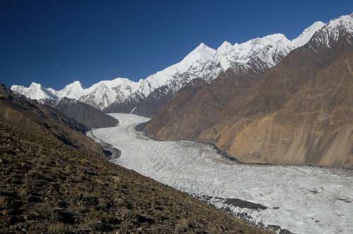
Camping
A base camp can be made at Phush Dalala (dirty-smell place) at 4200m, which is approximately one hours walk north up the Pumari Chhish glacier. The campsite takes its name from stones that have a chemical smell. Further south a base camp could alternatively be made at Dachigan on the west side of the Pumari Chhish Glacier where it meets the Hispar Glacier. From Dachigan the mountain can easily be reached by following the lateral moraine along the west side of the glacier. There is also an expansive flat, grassy area on the east side of the Pumari Chhish glacier however there is no water here.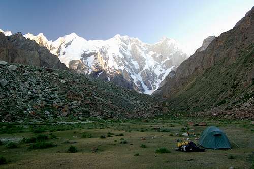
Maps
The only map that I have seen that accurately surveys the height of Khunyang Chhish East is the Russian maps which are available in 1:50,000 and 100,000 editions. They are available online (ask no questions about copyright!) via the links below. It is these maps that I have based Kunyang Chhish East's altitude. The Russian maps are expensive to buy at around $75 and $50 respectively. There is also a series of Japanese maps that claim to have fully surveyed all peaks on their sheets however I have not seen these as they do not appear to be widely distributed. The Swiss maps are fine for general route finding and readily available. The two sheets cover the entirety and most people who have climbed in the Karakoram own a copy. Kunyang Chhish East is stated as being c.7400m high and this is the height more commonly quoted for the mountain (even though it is only an estimate). The Swiss map is considerably better than the Leomann and AMS maps which are also readily available but not worth purchasing in my opinion.External Links
The excellent film about the first ascent on Vimeo https://vimeo.com/ondemand/kun...
The report in Alpinist about the first ascent http://www.alpinist.com/doc/we...
The AAJ first ascent report http://publications.americanal...

