


-
 3472 Hits
-
 81.18% Score
-
 13 Votes
|
|
Mountain/Rock |
|---|---|
|
|
45.60160°N / 7.32739°E |
|
|
Hiking, Mountaineering |
|
|
Spring, Summer, Fall |
|
|
8274 ft / 2522 m |
|
|
Note
La montagna chiama i suoi figli, ed essi rispondono fedelmente al suo appello… Osvaldo Cardellina, Diario alpinistico, 1964-65 Page texts: @ OsvaldoCardellina "Osva", passed away on May 2, 2022. Page owners: Christian Cardellina e Osvaldo Cardellina. Any updates from September 12, 2022: Antonio Giani, page administrator, friend and climbing companion. Testi della pagina: @ OsvaldoCardellina "Osva", scomparso il 2 maggio 2022. Proprietari pagina: Christian Cardellina e Osvaldo Cardellina. Eventuali aggiornamenti dal 12 settembre 2022: Antonio Giani, amministratore della pagina, amico e compagno di salite. |
Acute Overview "Euille"
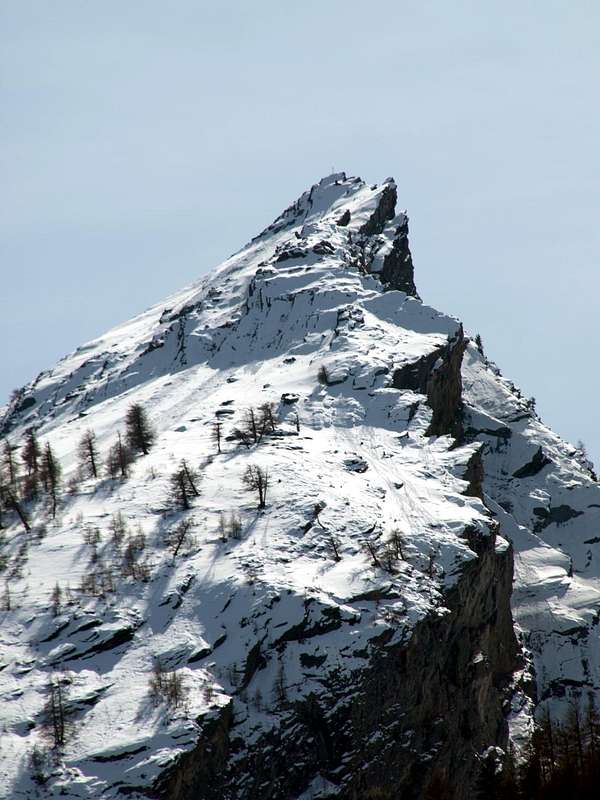
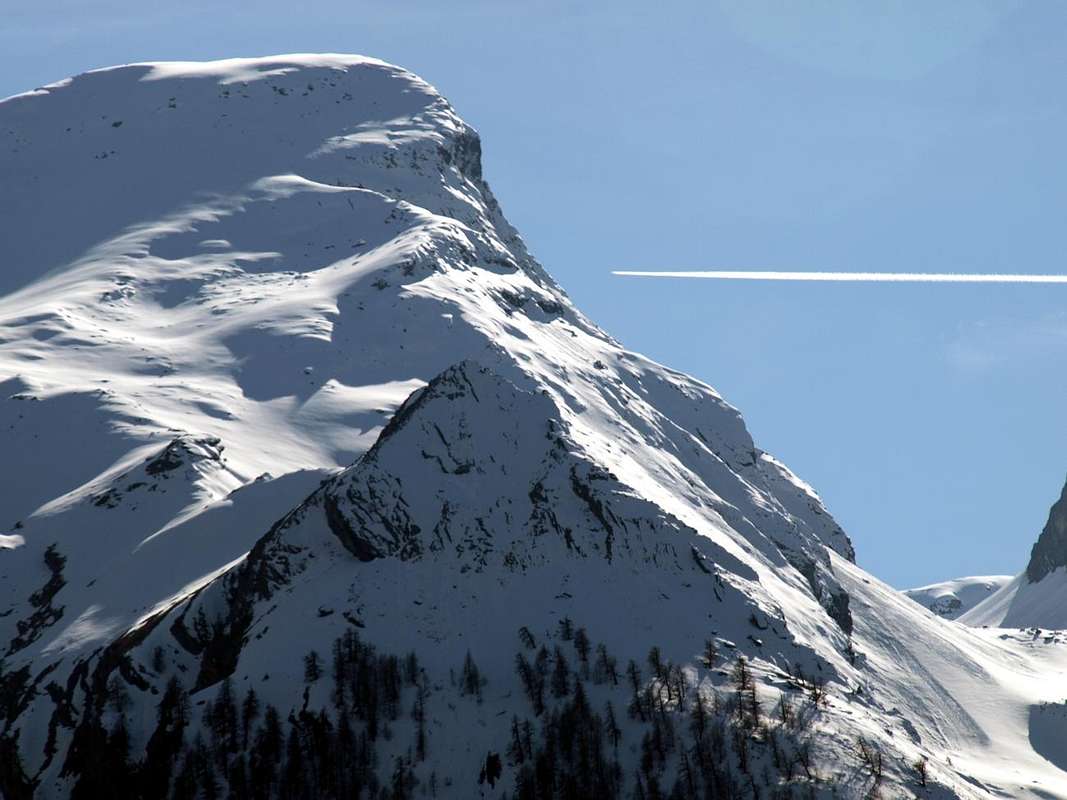
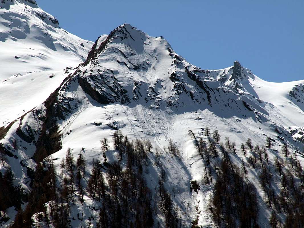
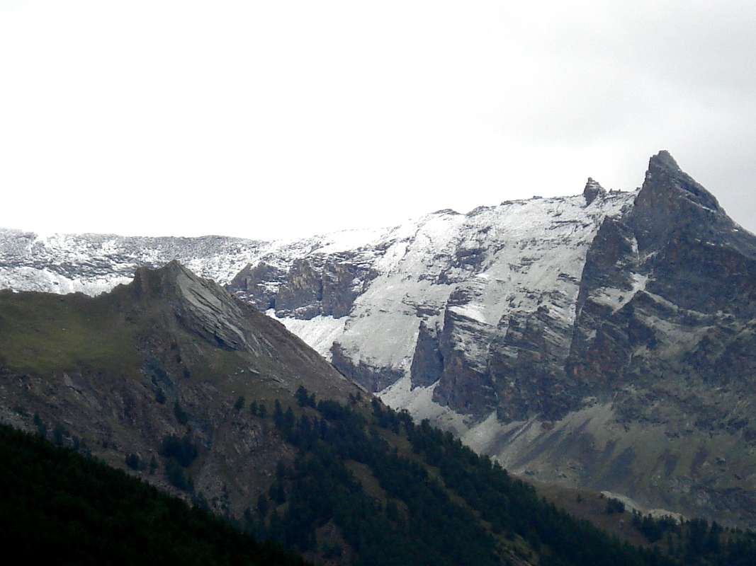
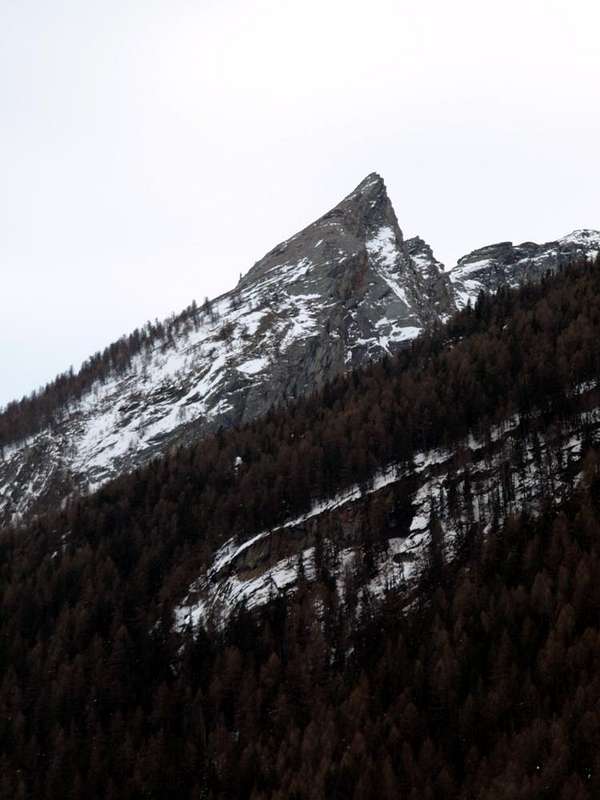
Ouille or "Euille" which in local dialect means Aiguille namely slender and acute Summit, almost sharp, as this small Spire placed between Crétaz and Cogne. An ancient name that, without resorting to the famous Aiguilles du Mont Blanc, is also assigned to the Mont Ouillie in the Valley of the Little Saint Bernard and to the Oulle Cecca in Valpelline on the border with Switzerland. So we find them on pages 220 and 317 of the "Guide of the Western Alps in 1896" by Giovanni and Luigi Bobba Vaccarone, while in other "newer" as in "Pennine Alps Vol°. 1971" by Gino Buscaini latter becomes a 'graceful transformation in dialect Aosta / Valais the Aouille Tseucca, or the "dry" spire or that is stripped from the snowpack. But in the past it was also the Oulie Cecca, Mont Oulie, The Ouille Secca, The Ouille Tseuque, Becca Scorna, where the Abbé Henry in "Guide du Valpelline 1925" indicates a spire without horns, while Marcel Kurz in "Guide des Alpes Valaisannes 1963" makes it more elegant her rendering as Aouille Tseuque in French. A place name that is lost in the mists of time, a "tourbillon" almost overwhelming and that Cogne's inhabitants have simplified with "Euille" then the modern Cartographers have graced with Ouille adding the term of Pointe as to make it more fashionable, definitely "more and more chic" ...
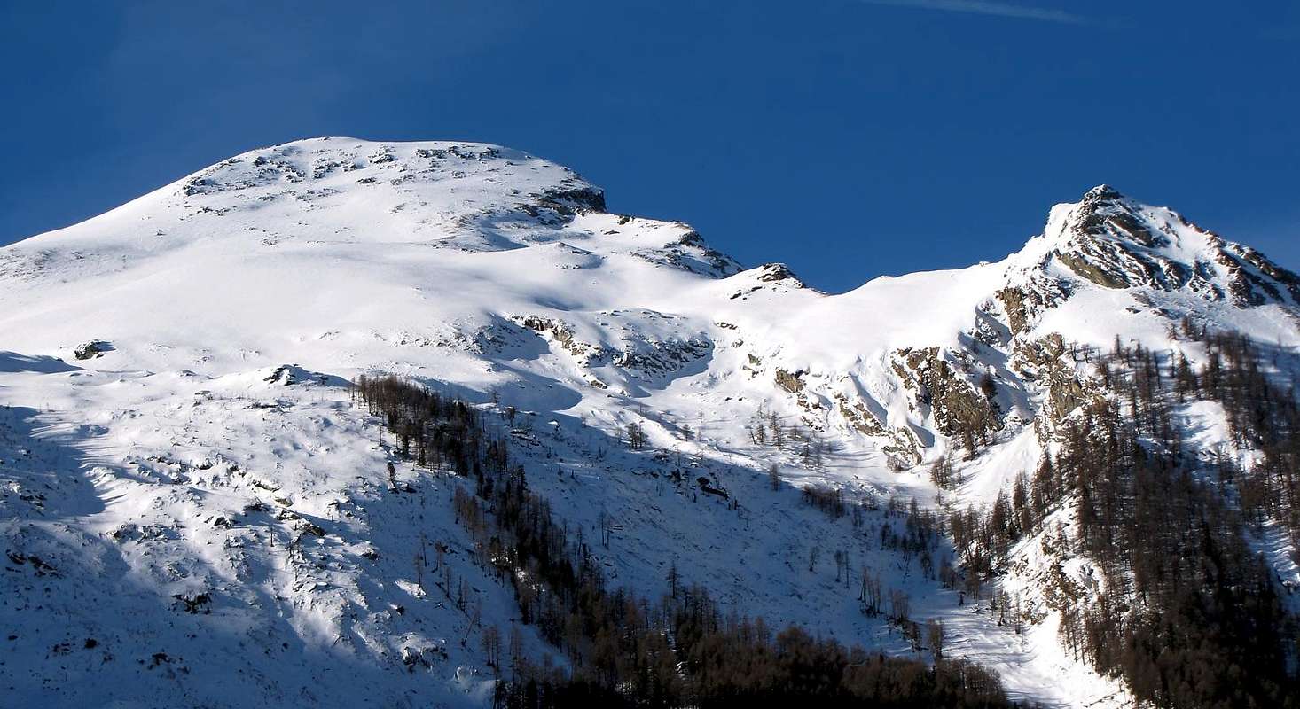
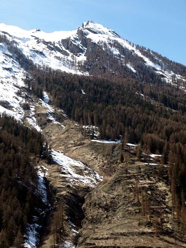
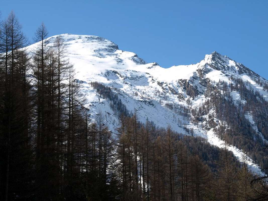
"Our" instead is only a "Cimetta", very slender and sharp, almost pungent, that coming from Crétaz Cogne presents the ticket of entrance into Gran Paradiso. An usher who, after the "bombastic" Pousset, alerts you with its bold shapes that are about to arrive in a Kingdom of Summits, manned by an unique Italian 4.000 in Valley. A tiny dwarf "given birth" by the powerful Monte Herban (3.001m), that, after the Cote de Forcia, proudly raises his head above the Vanontey and the Cogne Resort dominating the underlying Village of Crétaz. Coming from the latter appears even more impressive in respect so much the "vaunted" Pousset (3.045m), but when you turn the corner on the bridge that leads to Cogne the values are restored. In any case a pleasant little Summit reached with a crossing by the Vittorio Sella Refuge or from the valley adjacent to the East of Pousset and known as Plan Varioz. A small trail climbs from Crétaz in this direction, reaches the Seiser Alp Vermiana Dessus, and bending to the east going to the fork 2.492 meters, right at the base of the Normal. This is short but not so simple, because you have to know how to find the way to the East, avoiding the steep South Crest then around in North to the summit turret, formed by treacherous rocky plates. Instead the hillside crossing by Lauson's Vallon is easy and suitable for all Hikers. Without prejudice to the final part that requires more attention and care since the saddle 2.492 meters the path rejoins the previous ...
La "nostra" invece trattasi d'una Cimetta, slanciata ed affilata, quasi pungente, che arrivando da Crétaz a Cogne presenta il biglietto d'ingresso al Gran Paradiso. Quasi un usciere che, dopo il "roboante" Pousset, v'avvisa con forme ardite che state per arrivare in un Regno di Vette, presidiato dall'unico 4.000 completamente italiano in Valle. Un nanetto "partorito" dal potente Monte Herban (3.001 m) che, dopo la Cote de Forcia, rialza orgogliosamente la testa sopra la Vanontey e l'abitato di Cogne dominando il sottostante Villaggio di Crétaz. Arrivando da questo ultimo appare anche più imponente del tanto "decantato" Pousset (3.045 m), ma quando si gira l'angolo sul ponte che conduce a Cogne i valori vengono ristabiliti. Poi, risalendo la Valnontey, si comprende la differenza. Il Pousset rimane il "mitico Pousset", mentre l'Eulie rimane soltanto quale "piccolo scudiero". In ogni caso una Cima piacevole da raggiungere in traversata dal Rifugio Vittorio Sella oppure dal vallone adiacente ad Oriente quello del Pousset e conosciuto con il nome di Plan Varioz. Un sentierino sale da Crétaz in questa direzione e, raggiunta l'Alpe di Vermiana Dessus, piega ad Est risalendo alla forcella 2.492 metri, proprio alla base della Via Normale. Questa é breve ma non così semplice, perché bisogna sapere trovare la via evitando ad Est la ripida Cresta Sud per poi aggirare a Settentrione la torretta sommitale su placche rocciose infide. Invece la traversata a mezzacosta del Monte Herban partendo dal Vallone del Lauson risulta facile ed adatta per ogni tipo di Escursionista. Ferma restando la parte finale che richiede sempre attenzione e prudenza, poiché dalla sella 2.492 metri il percorso và a ricongiungersi con il precedente ...
First Ascents
- First known on the Summit: unknown.
- First in Winter: unknown.
- Western Face: Osvaldo Cardellina, lone; August 27th, 1995, in ascent from Crétaz Hamlet until Vermiana Dèsott Alp.
- Northern Face (directly): Osvaldo Cardellina, and Gianfranco Vicentini; August 31th, 1999, in ascent from Crétaz through Vermiana Dèsott Pasture.
- South Crest (integral): Osvaldo Cardellina, Danilo Garzotto and Gianfranco Vicentini; September 12th, 1999, in ascent from Crétaz Village until Vermiana Damon Alp with traverse from saddle 2.492 meters in East Slope under the South Crest and descent complete on South Crest.
Getting There
BY CAR:
- From TORINO, MILANO, etc: Motorway A5. Exit at IVREA or Quincinetto (PIEDMONT) also Pont St. Martin, Châtillon, AOSTA East (Nus), West (Aymavilles) Municipalities.
- From Aymavilles towards Cogne Valley Aymavilles (646m) towards Cogne Valley with Regional Road: Vieyes (1.132m) Fraction; continue to Epinel, Crétaz (1.436/52m, 1.494m) Villages, by path in Pousset Vallon at Vermiana Dessus Alp (2.382m) and with a small path and traces in terminal part towards the small saddle (2.492m), between Mont Herban e Pointe-de-l'Ouille.
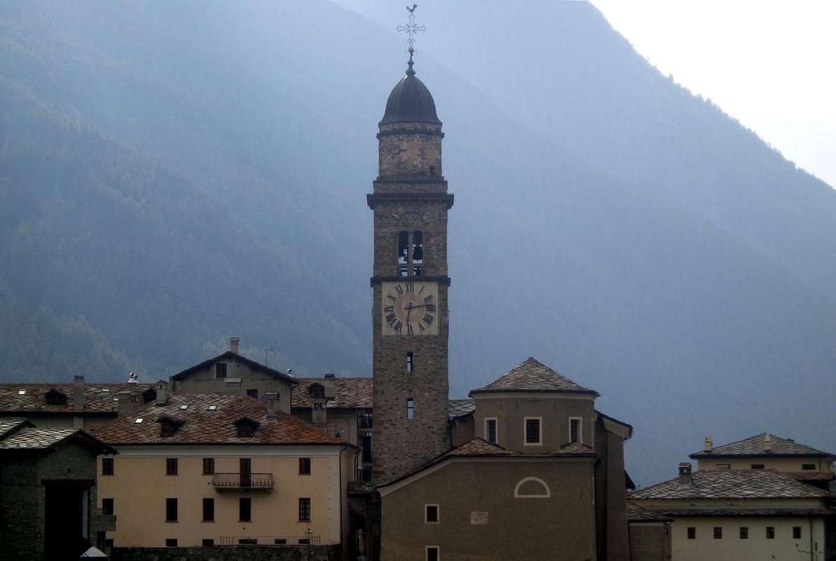
![Cogne Municipality Chief Town...]()
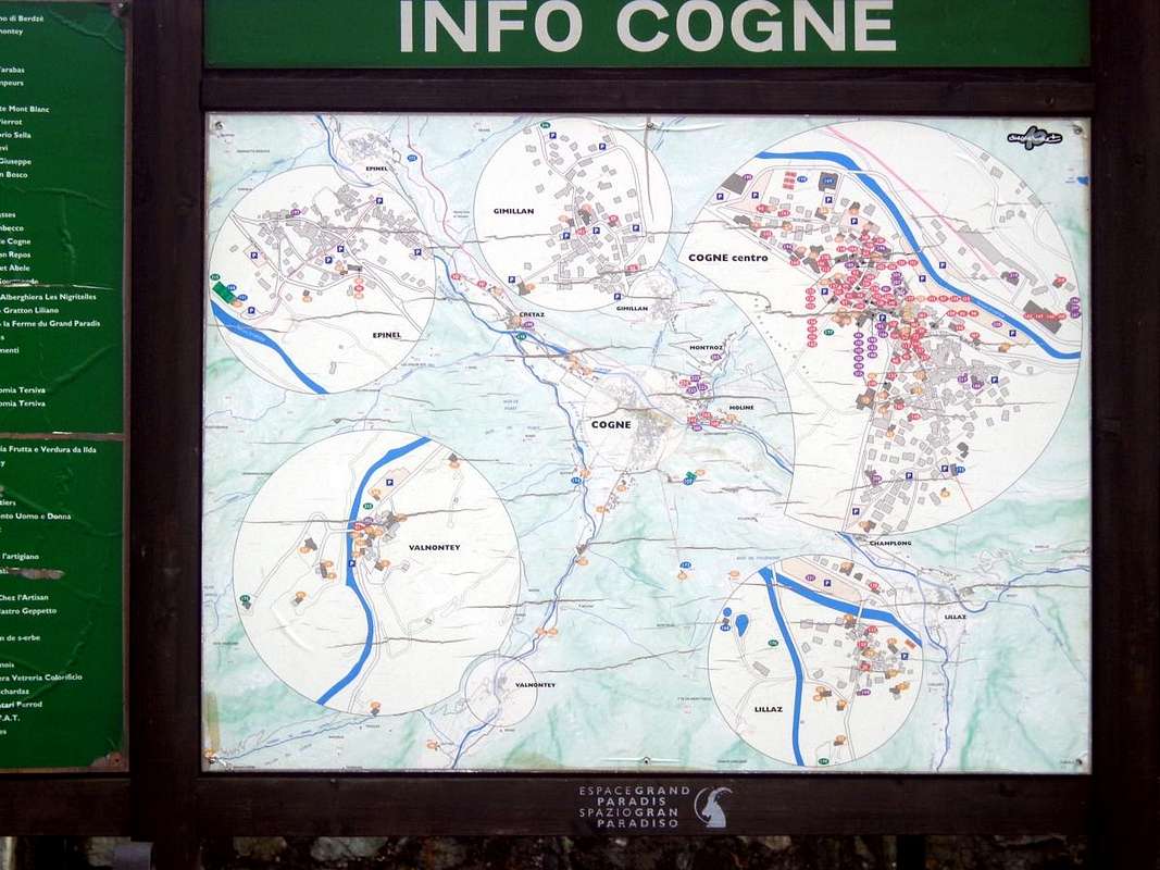
![Cogne Valley Info Cogne Common & Surroundings]()
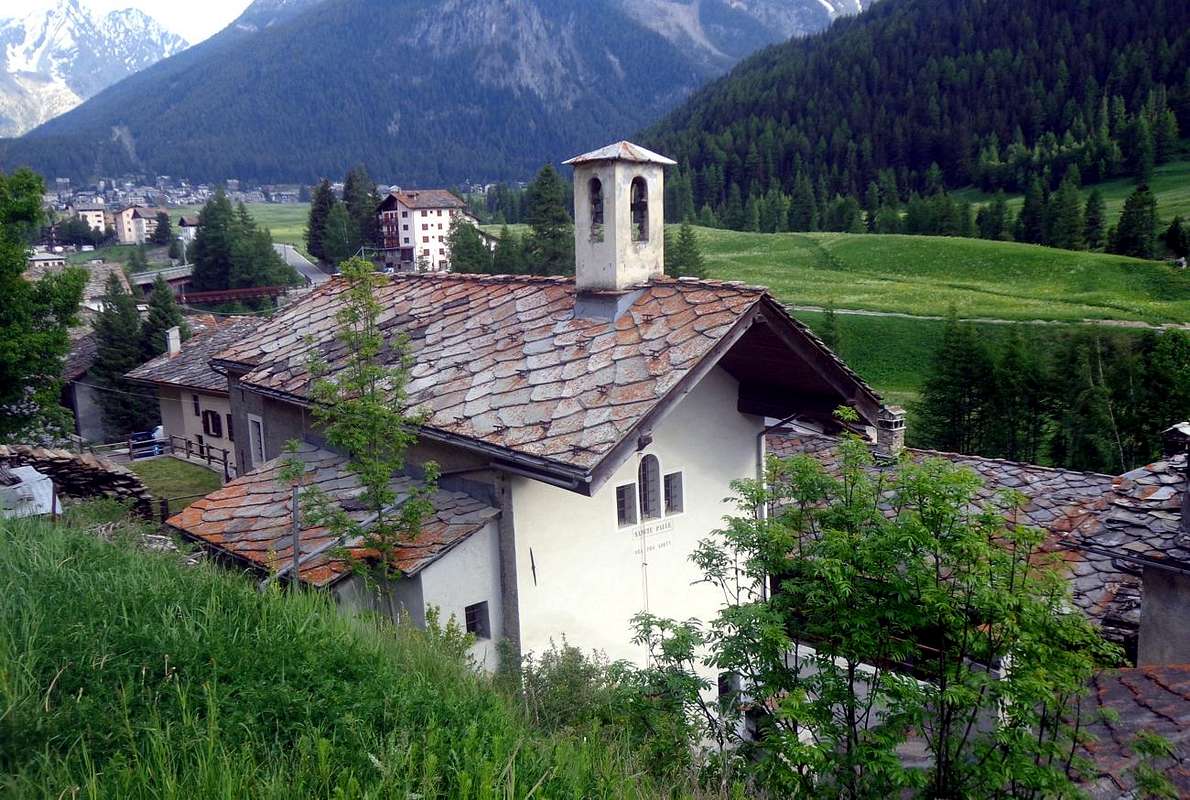
![Crètaz Church in Cogne Valley]()
Approach & Route
From the small Hamlet of Crétaz (1.494m; parking) in the municipality of Cogne, cross the two bridges one on Grand'Eyvia and one that comes down from Torrente Valnontey. Climb to the Alpe Ronc (1.663m) with the trail n° 25 that goes through the woods of "les Fontaines Robat" and, after the reporting sign the boundaries of the National Park of Gran Paradiso continue slightly to the right until you reach the Pastures of Les Ors Dèsott and Dessus (1.944m, 2.052m). Goes up always on the right (South-southwest) and reach the ridge that separates the Vallons of Alp Vermiana from that of Pousset, where it meets the Casotto of Rangers (2.289m), which discards to the right (Est). Continue instead with the same direction to reach Alp Vermiana Dessus (2.382m), the Western slopes of the Pointe-de-l'Ouille (TE/F; 2h'30/2h'45). Abandoned in the South trail n° 25/TVC which is directed towards the Vallon du Plan Varioz to reach the Colle della Rossa (3.190m), turn decidedly East-southeast taking the path n° 18D. This, after wading in altitude 2.284 meters the Torrent des Ors, goes through a narrow gorge that with less traces and flexing just right (South) through scattered blocks and debris reaches the saddle 2.492 meters. From this continue under the Ridge South to the North reaching the summit turret that hovers on delicate rocky plates often covered with soil in North. With short but not difficult passages that require attention you get to the narrow Summit (EEA/F/F+ ; 0h'45/1h'00 from saddle; 3h'30/4h'00 altogether by Crétaz).
Dalla piccola Frazione di Crétaz (1.494 m; parcheggio) nel Comune di Cogne, oltrepassare i due ponti uno sulla Grand'Eyvia e uno che scende dal Torrente della Valnontey. Risalire verso l'Alpe Ronc (1.663 m) con il sentiero n° 25 che si inoltra tra i boschi di "les Fontaines e Robat" e, superato il cartello segnalante i confini del Parco Nazionale del Gran Paradiso proseguire leggermente sulla destra sino a raggiungere gli Alpeggi di Les Ors Dèsott e Dessus (1.944 m, 2.052 m). Continuare sempre sulla destra (Sud-sudovest) e raggiungere la dorsale che separa i Valloni di Vermiana da quello del Pousset, dove si incontra il Casotto del Guardaparco (2.289 m), che si scarta sulla destra. Proseguire invece con la stessa direzione raggiungendo quello di Vermiana Dessus (2.382 m), alle pendici Occidentali della Pointe-de-l'Ouille (TE/F; 2h'30/2h'45). Abbandonato a Meridione il sentiero n° 25/TVC che si indirizza verso il Vallon du Plan Varioz per raggiungere il Colle della Rossa (3.190 m), si svolta invece decisamente ad est-sudest prendendo il sentiero n° 18D. Questo, dopo aver guadato in altitudine 2.284 metri il Torrent des Ors, risale una stretta gola che con tracce meno evidenti e flettendo appena a destra (Sud) attraverso blocchi sparsi e detriti raggiunge la sella 2.492 metri. Da questa continuare sottocresta (Est) verso Nord raggiungendo la torretta sommitale che si aggira su delicate placche rocciose spesso ricoperte da terriccio a Nord. Con brevi passaggi non difficili ma richiedenti attenzione s'arriva alla ristretta Vetta (EEA/F/F+ ; 0h'45/1h'00 dalla sella).
Difficulties & Equipment
This route can be considered EE/F (Experts Hikers) until the saddle 2.492 meters; EEA/F/F+ (Experts Hikers and Mountaineers) in final part; BSA in winter (even by Ski).L'itinerario è EE/F (Escursionisti Esperti) sino alla sella 2.492 metri; EEA/F/F+ (Escursionisti Esperti od Alpinisti) nel tratto finale; BSA in inverno (anche in Scialpinismo).
High Hiking gear, in winter as for Ski-Mountaineering.
Da Alto Escursionismo, in inverno da Scialpinismo.
 |
 |
 |
 |
 |
Mountain Condition
- Meteo: you can find all the needed informations at the official site of the Valle d'Aosta Region:
- Valle d'Aosta Meteo
Books and Maps
- "Guida dei Monti d'Italia-Gran Paradiso Parco Nazionale" E. Andreis, R. Chabod, M. C. Santis, Club Alpino Italiano/Touring Club Italiano, prima Ed. 1939; seconda Ed. 1963; terza Ed. 1980.
- "Diari Alpinistici" di Osvaldo Cardellina e Indice Generale accompagnato da Schedario Relazioni Ascensioni 1964-2019 (inediti).
 |
 |
- Kompass "Gran Paradiso Valle d'Aosta Sentieri e Rifugi" Carta Turistica 1:50.000.
- Enrico Editore Ivrea-Aosta "Gruppo del Gran Paradiso" 1:50.000.
- I.G.C. Istituto Geografico Centrale "Il Parco Nazionale del Gran Paradiso" 1:50.000.
- L'Escursionista "Valle di Cogne Carta dei Sentieri" (n° 10) 1:25.000.
- L'Escursionista "Tour de la Vallée de Cogne Grand Paradis" 1:25.000.
![P. Pousset just in West by P. de l'Ouille...]()
![Pousset Vallon...]()
![Pointe de l'Ouille or Eulie...]()
![Pointe de l'Ouille NW Faces...]()
![M. Herban & Pointe de l'Ouille...]()


Important Information
- REGIONE AUTONOMA VALLE D'AOSTA the official site.
- FONDAZIONE MONTAGNA SICURA Villa Cameron, località Villard de la Palud n° 1 Courmayeur (AO) Tel: 39 0165 897602 - Fax: 39 0165 897647.
- SOCIETA' GUIDE ALPINE DI COGNE Tel. 347/9473526 – 328/1373728.
- A.I.NE.VA. (Associazione Interregionale Neve e Valanghe).
- A.IA.T. Cogne Gran Paradis via Bourgeois n° 34 Tel. 0165-74040. E-mail: aiat@cogne.org
- Ezio Sport articoli sportivi - via Bourgeois n° 64 Tel. 0165-74204.
Useful numbers
- Soccorso Alpino Cogne (SAR) Tel. 3482685406.
- Protezione Civile Valdostana località Aeroporto n° 7/A Saint Christophe (Ao) Tel. 0165-238222.
- Bollettino Meteo (weather info) Tel. 0165-44113.
- Bollettino Valanghe Tel. 0165-776300.
- Unità Operativa di Soccorso Sanitario Tel. 118.