
-
 15818 Hits
-
 93.35% Score
-
 42 Votes
|
|
Area/Range |
|---|---|
|
|
38.02322°N / 107.67218°W |
|
|
Hiking, Mountaineering, Trad Climbing, Sport Climbing, Toprope, Ice Climbing, Mixed, Scrambling |
|
|
Spring, Summer, Fall, Winter |
|
|
7872 ft / 2399 m |
|
|
Overview and Getting There


The best guide book for the local climbs is Ouray Rock, the book is available at Ouray Mountain Sports for 18$.
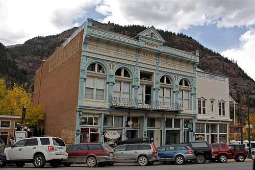
Ouray was originally established by miners chasing silver and gold in the surrounding mountains. Prospectors arrived in the area in 1875. The town is named after Chief Ouray of the Utes, a Native American tribe. By 1877 Ouray had grown to over 1000 in population and was named county seat of the Ouray County. The entirety of Main St. is registered as a National Historic District with most of the buildings dating back to the late nineteenth century. The entire present day economy of Ouray is based on tourism. In the summer, much of the tourism is focused on hiking and four wheel drive expeditions into the San Juan Mountains. Ouray has also become a popular destination for motorcyclist. Ouray is the winter ice climbing capital of the U.S. The world's first ice climbing park consists of waterfalls from 80 to 200 feet high along more than a mile of the Uncomphagre Gorge. It started first on natural waterfalls, but now more water is supplied by a sprinkler system developed and maintained by a volunteer organization and supported by donations from local businesses, gear manufacturers and climbers.
Ouray is a small mountain town, as of the census in 2000, there were 813 people.
The closest airport would be in Montrose, 40 miles north, Montrose can be expensive to fly to. Grand Junction, about 100 miles north, offers usually cheaper flights.
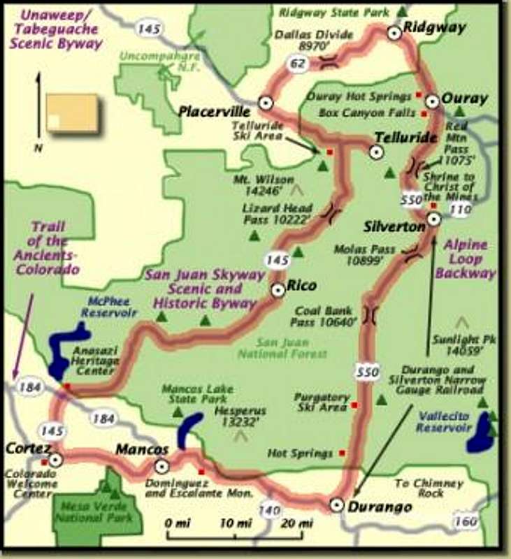
The Million Dollar Highway going south towards Silverton, and then to Durango is very scenic, offering great views of the mountains. Another nice drive is north towards Ridgeway, and then west in Ridgeway towards Telluride.
Brief information about climbing areas
| Cliff | |||||
| Rotary Park | Sandstone | Sport, Mixed | Great family place, picnic tables | ||
| Pool Wall | Metamorphic Sandstone | Sport, Trad, Mixed | Close to the hot springs! | ||
| Sandias | Sandstone | Sport, Trad, and Mixed | Great views of Ouray below | ||
| Overlook | Limestone | Sport | Routes mostly 5.10 to 5.12 range | ||
| Camp Bird Boulders | Volcanic tuff | Bouldering | Right next to the Camp Bird road | ||
| Engineer Pass Turn-off | Quartzite | Trad | Alpine climbing, great views | ||
| Chimney Peak | Conglomerate | Trad | Nice summit, amazing views! |
The Rotary Park

Directions: From Ouray, go north on US Hwy 550 towards Ridgeway 1 mile. Look for the hockey rink on the right and turn into Rotary Park. Park by the big wall of red sandstone. Approach time: seconds. Look for a handful of short, well protected sport climbs (some are mixed).
 |  |  |  |  |  |  |  |  |  |
The Pool Wall

The Pool Wall area has severa sections: The Alcove, The Bay of Pigs, The Wading Pool, The Deep End, The Upper Wall, and The Backyard. Sport climbing area.
 |  |  |  |  |  |
The Sandias

Directions: From town, drive west on 7th Ave and take a left at it's end. Drive up the hill and take a right on Queen St. Park in the small area. Hike up the road. At the top of the road go right to the Old Twin Peaks trailhead. The trail is nice and easy to follow, and it will bring you to several good climbing spots. You can even walk from town, it will maybe add 5 to 10 minutes to the approach time.
Dihedral Wall - with several routes from 5.6 to 5.12, all bolted, single pitch climbs. See photo on the left more information.
Grey Matter Wall - the wall starts just as the trail turns corner into Oak Creek Canyon. The rock is gray colored sandstone. Most of these routes are traditional with occasional bolts. Bolt of tree anchors are at the top of the routes. All routes are about 25-30 meter long, single pitch, and have funny medical names, like Cerebellum corner, Medula, Oblongata etc.
 |  |  |  |
The Overlook

Most climbs at the Overlook are 5.10s and higher up rating. The area is sport climbing with closely spaced bolts.
 |  |  |  |  |  |  |  |
The Camp Bird Boulders

Directions: Head south on Hwy 550 from Ouray. After the 1st switchback, turn right onto Camp Bird Road. You will see obvious boulders after about 10 min of driving on your right side (see photo - it shows an obvious turn off into the bouldering area).
 |  |  |  |  |
Engineer Pass Turnoff

Waterfall Wall

Tyrolean Traverse
 |  |  |
Chimney Peak

Approach time: about 1 to 1.5 hrs. It is a traditional climb, the rock is good, and it is rated 5.6 (3 long pitches, sometimes broken into 4). There are fixed anchors on climb.
Photoalbum
SP route description
SP rock description
Red Tape
There are no fees. All climbing and parking is free.The best source of information is at local climbing shop - Ouray Mountain Sports (see the link below).
I will keep adding more climbs and photos to this site as I get to climb them. Thank you for visiting.
External Links
Weather
 |