
-
 2191 Hits
-
 83.1% Score
-
 16 Votes
|
|
Mountain/Rock |
|---|---|
|
|
44.54900°N / 7.02058°E |
|
|
Piemonte |
|
|
Hiking, Mountaineering, Via Ferrata |
|
|
Summer |
|
|
10052 ft / 3064 m |
|
|
Overview
Pelvo d'Elva 3064 m
Pelvo d’Elva 3064 m is a fine mountain belonging to the Alpi Cozie Meridionali (Southern Cottian Alps) located on the watershed between the Val Maira and the Val Varaita. The summit is in fact on the border between the municipalities of Elva in the Maira valley and Bellino in the Varaita di Bellino valley. The mountain, made up of quartzite-type rocks, has a pyramidal shape and projects the buttress of the Bric Camosciera towards the West.
Together with Monte Chersogno and Rocca Marchisa it forms an important triad of mountains West of the village of Elva. all overcoming the 3000 meters of altitude. Clearly visible from afar, it is a beautiful rocky mountain with an imposing appearance especially when viewed from Elva and from Colle della Bicocca.
Getting There
Both itineraries start from Colle Bicocca 2285 m, a pass connected by a 6 km dirt road to Colle di Sampeyre 2284 m, an alpine road pass that connects Sampeyre in the Varaita valley with Elva in the Maira valley.
Road access to Colle Sampeyre from Val Maira
From Dronero 622 m, a small town 20 km. from Cuneo, which is the main town in this area, follow the SS 22 rising along the beautiful Maira Valley - or Macra Valley - 45 km. long, where Maira Rivers runs going down towards the plain and Po River. The road goes up the valley and after reaching Macra reachs a crossroads on the right from where the SP 335 for Elva and Colle Sampeyre originates. Take this road rising to the Colle Sampeyre.
Road access to Colle Sampeyre from Val Varaita
From the A6 Torino-Savona motorway exit Bra-Marene and take the road to Savigliano, Saluzzo and Valle Varaita (road n. 8). Once you enter the Valle Varaita, drive to Sampeyre. In Sampeyre take the road that climbs to the namesake hill 2284 m above sea level, connecting the Val Varaita with the Val Maira. The pass is part of the Strada dei Cannoni, a 26 km route built in 1740 by the Piedmontese army to connect the Valle Stura di Demonte to the Val Varaita through the Val Maira. Make sure that the road is viable.
Colle Sampeyre is connected to Colle della Bicocca by a 6 km dirt road which, if in good condition, can be traveled up to the Colle della Bicocca car park.
Pelvo d'Elva Normal Route from Lago delle Camoscere (SSW ridge)
Difficulty: EE
Difference in level: 779 m from Colle Bicocca, but long development
First ascent: Capt. Cossato and topographers, 1836
It is the easiest route to summiting, but also the longest.
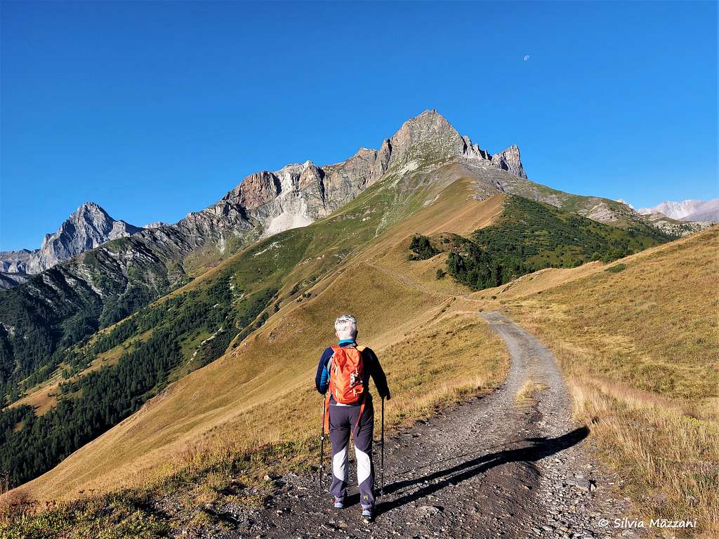
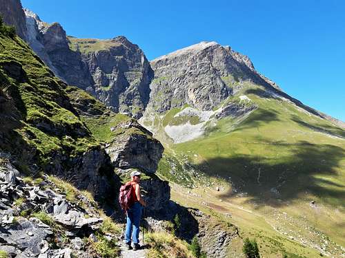
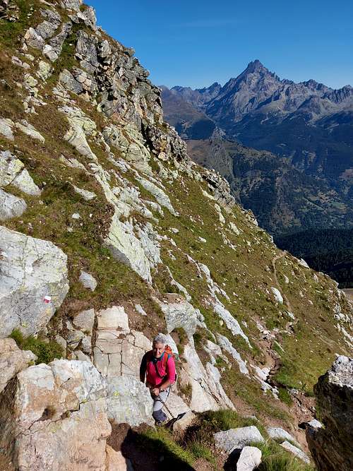
From Colle della Bicocca 2285 m, take the path towards the NE ridge of Pelvo d’Elva until you soon reach a crossroads: on the right it starts the Direct route (see the next chapter), while on the left you go towards Lago Camoscere and the Bivacco Elio Bonfante. It starts a long traverse mostly flat or slightly uphill through the steep grassy slopes above the Vallone del Rio Fonte Mattè.
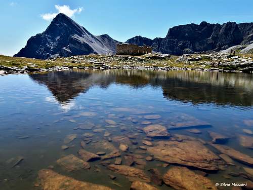
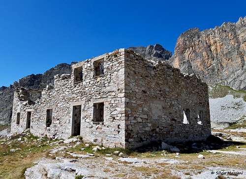
Then, with a few hairpin bends, the path takes you to the slopes of the Rocca dell'Asino and with a further traverse on the southern slopes of Monte Camosciere. After the long traverse, a final uphill stretch leads to the ruins of a military building and to Lago Camoscere 2644 m. dominated by the steep reddish walls of Rocca Gialeo. In front of us it stands the beautiful pyramid of Monte Chersogno. Shortly before the lake, some signposts show us the detour to the Bivacco Elio Bonfante, a 10-minute walk from the junction.
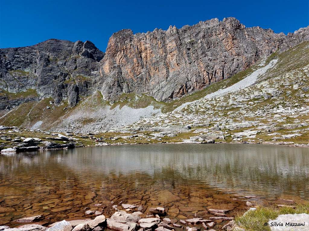
Near the lake it begins a trace of a path rising steeply. It leads to the base of the whitish Monte Camoscere, going around the top of Bric Camoscere closely. A ridge will lead us to our destination, taking place on the Varaita side, towards the Sant'Anna di Bellino valley. Cairns and tracks with some ups and downs on stones and a stretch of large boulders lead after a slight descent to Colle Camosciera 2899 m, located between the obvious peak of the Pelvo and a minor summit.
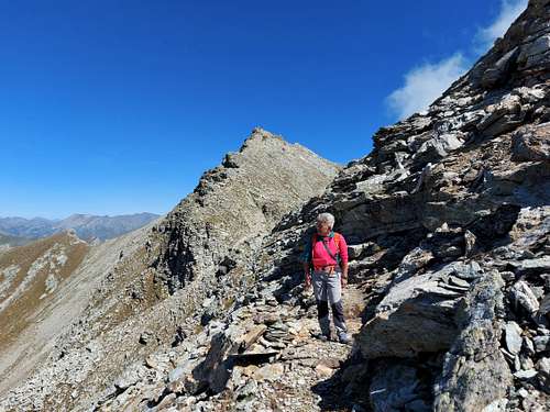
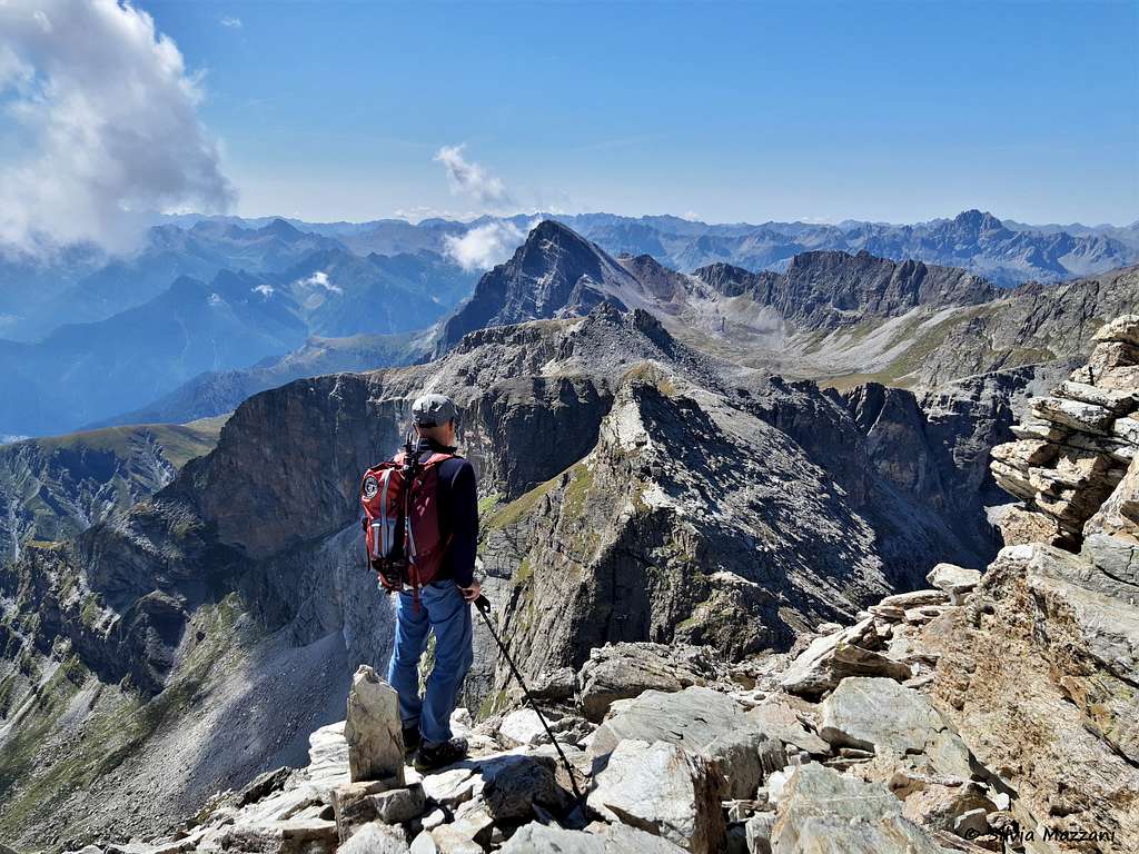
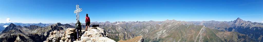
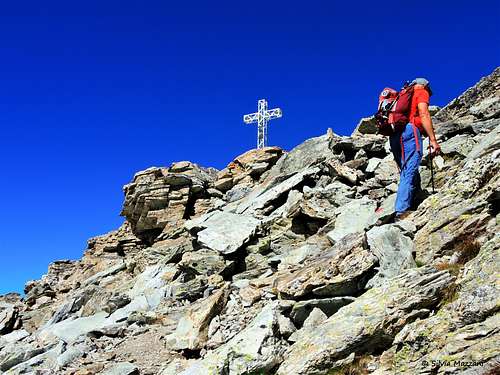
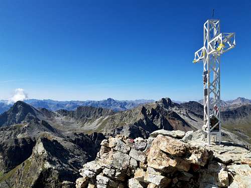
From here a last steep ascent on rocks and debris leads to the summit cross of Pelvo d'Elva. From the summit you can enjoy a wide and spectacular panorama over all the South-Western Alps, with the Monviso and the peaks of the namesake group to the north. In the distance you can see Brec de Chambeyron and Aiguille de Chambeyron, closer the Rocca la Marchisa and Monte Chersogno.
Pelvo d'Elva Direct route from Colle Bicocca (East side)
Difficulty: EEA
Difference in level: 779 m from Colle Bicocca
Exposition: East
First ascent: William August Brevoort Coolidge and Christian Almer, 1890
A direct route involving some easy climbing aided by metal chains and well indicated.
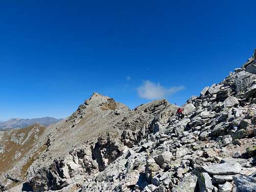
From Colle della Bicocca 2285 m take the path that runs along the Varaita - Maira watershed, staying on the Elva (Maira) side. After a short stretch you will come to a crossroads: on the left you go towards Lago Camoscere and the Bivacco Elio Bonfante, on the right you go towards the Pelvo d’Elva. Take the branch on the right which rises immediately to reach the ridge and follows the ridge, first grassy and then detrital up to the rocky slopes of the Eastern side of the Pelvo. The route has seven sections equipped with metal chains and it's marked with clear white-red signs and some discolored yellow signs and runs on rocky ground interspersed with grassy stretches.
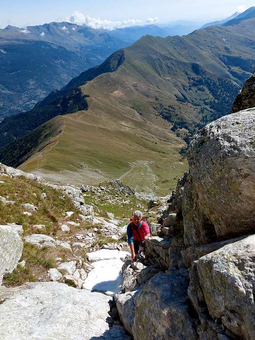
After the first chain, the itinerary heads to the left crossing the East wall of the Pelvo to take a large channel of rocks. With some narrow hairpins it climbs up the channel then it reachs a series of smooth rocky slabs and dihedrals, which can be overcome directly with the help of several sections of metal chains.
Beyond the slabs, the path goes up again for tight hairpin bends until it comes out at the exit of the channel (stone cairn) on a wide slope of slightly inclined stones, which must be followed towards the NW along traces and cairns until the white summit cross of Pelvo d'Elva.
Pelvo d'Elva crossing
This is the most profitable itinerary for summiting the Pelvo d'Elva. It is an extremely interesting ring that combines the two itineraries described above with departure and arrival at Colle Bicocca. The recommended sequence is the ascent along the Via Diretta, the slightly more demanding itinerary, and the descent along the normal Camosciere route.
Red Tape
No fees no permits required
When to Climb
The best climbing period is summer (July to September).
Accomodation
Guest-house in Elva.
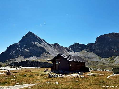
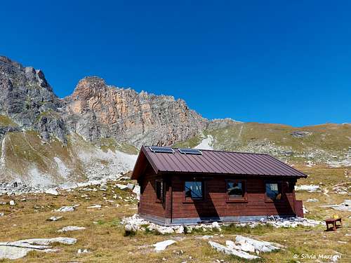
The Bivacco Elio Bonfante is located at 10 minutes by walk from the Normal route across Lago Camoscere.
Meteo
Guidebooks and maps


“Monte Viso – Alpi Cozie Meridionali” by Michelangelo Bruno – Collana CAI-TCI Guide dei Monti d’Italia
Maps
"Monviso-Valle Varaita-Valle Po-Valle Pellice" - IGC sheet 106 1:25000
"Mont Viso" - French 3637OT 1/25000