
-
 2703 Hits
-
 81.84% Score
-
 14 Votes
|
|
Mountain/Rock |
|---|---|
|
|
44.69983°N / 7.07065°E |
|
|
Piedmont |
|
|
Mountaineering, Trad Climbing, Mixed, Scrambling |
|
|
Summer |
|
|
10154 ft / 3095 m |
|
|
Overview
Punta Venezia 3095 m
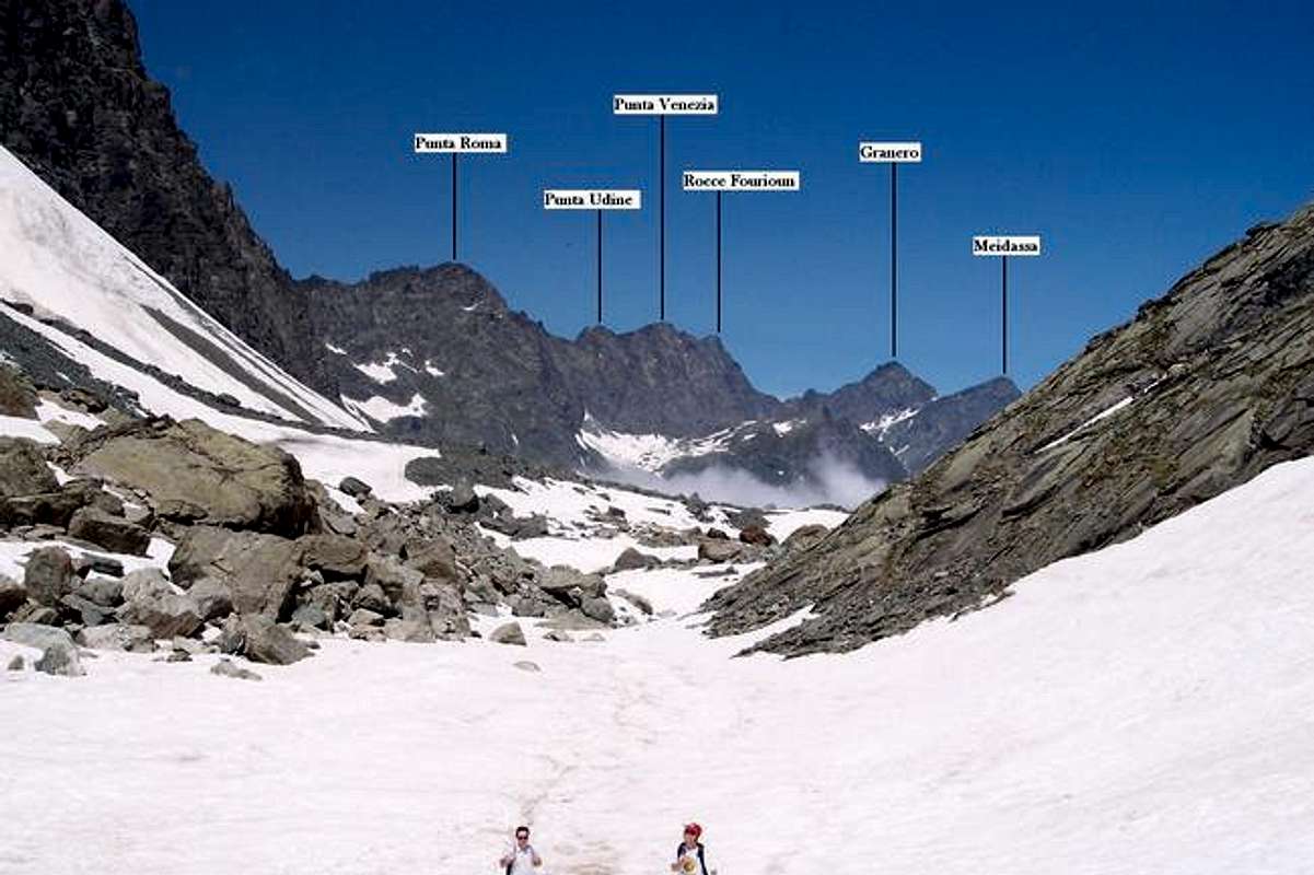
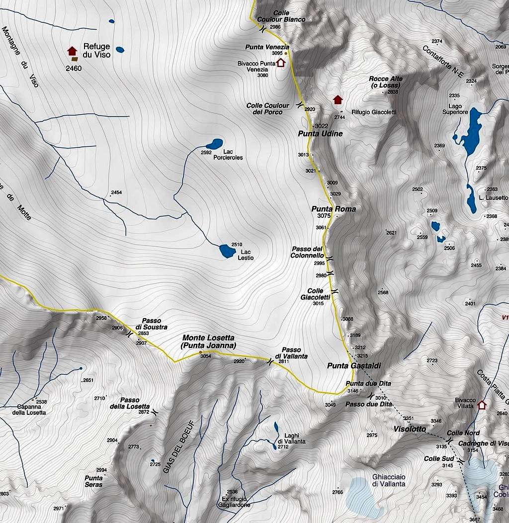
Punta Venezia 3095 m is a mountain crossing the threshold of 3,000 meters above sea level. It's a massive peak standing out on the main watershed on Italy-France border, between the Po valley and the Guil Valley, and belonging to the Alpi Cozie. It's one of the best known mountains in the Monviso Group. The mountain has fairly steep faces on the Eastern side. The West face is more regular and it's situated in France. To the south Punta Venezia is bounded by the Colle del Coulour del Porco that separates it from the nearby Punta Udine 3022 m, while to the north it is bounded by the Colle del Coulour Bianco, which separates it from the Rocce Fourioun, 3153 m.
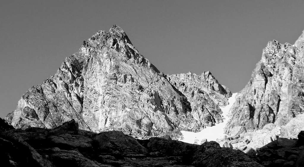
Punta Venezia is constituted like the other summits of the group by metamorphic rocks (calcescisti with ophiolites, green stones) and it is rather frequented, like the near Punta Udine, due to the beauty of the environment and the relative ease of the stantard route to the summit.
First ascent: the first known ascent to Punta Venezia is by W.A.B Coolidge with the Swiss Guides Ulrich and Christian Almer, on 28th August 1888.
Getting There
The best starting points are Pian del Re 2020 m in upper Valle Po and the Rifugio Giacoletti 2741 m
Road Access to Pian del Re
From Torino or from Cuneo reach the town of Saluzzo 340 m. Here take the road of the Valle Po, crossing Sanfònt 490 m, Paesana 614 m, Oncino 1220 m and Crissolo 1318 m. The last road hairpins lead to Pian del Re 2020 m, where the road ends (41 km. from Saluzzo). Parking ticket: € 10
Walking approach to the Rifugio Giacoletti
There are different routes to reach the Rifugio Giacoletti from Pian del Re.
- From Pian del Re 2020 m follow the good path (marks GTA, V16) to Colle delle Traversette, rising towards NW and reaching the altitude of 2115 m. From here leave the main path and turn to left on another good path (marks V17) rising below Rocce Alte del Losas and leading to the fine lake named Lago Superiore m. 2313. The path skirts the East shore of the lake; at the fork with the path V14 carry on along the path V17 getting to the Rifugio Giacoletti 2741 m (2 hours from Pian del Re).
- Another possibility is to follow the trail to the Refuge Quintino Sella (path n. V13). Reached Lake Fiorenza after about 20 minutes, ignore the main path (signpost for Quintino Sella) and take a path to the right that joins the previous route.
Punta Venezia Normal Route
Summit elevation: 3095 m
Difficulty: Alpine F
Exposition: mainly SE
Difference in level: 1075 m from Pian del Re, 360 m from Rifugio Giacoletti
Starting point: Pian del Re 2020 m
An interesting ascent in a beautiful environment to a peak of over 3000 meters. This climb is performable in a day with a drop of over 1000 meters, but to take it easy you can stay overnight at the Giacoletti Hut.
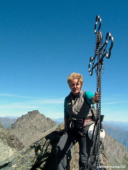
From Pian del Re climb up to Rif. Giacoletti 2741 m. From the refuge we head westwards gaining, along the moraines often snow-covered until late season, the bottom of the upper part of the Coulour del Porco, the obvious gully separating Punta Udine on the left from Punta Venezia on the right. With snow the ascent is made directly on the gully with slopes about 35° steep, while in summer conditions we scramble up the path equipped with numerous fixed ropes, placed on the right (orographic left of the gully). You will soon reach the col at 2920 m of altitude, from which the two normal routes start: the route to Punta Udine (20 minutes) and Punta Venezia (40 minutes). To climb Punta Venezia we turn right and, after passing a stony ground, we reach the south ridge of Punta Venezia. Go up the ridge and reach the small bivouac of Cai Cavour from where the view of the summit tower opens up. After passing some easy rocks, we reach the base of the summit castle. Go past a short wall (5 m, II +, protected with 3 bolts) leading to the small metal summit cross of Punta Venezia 3095 m.
Descent: reverse the same route
Climbing routes
Most of the routes on the Eastern walls of Punta Venezia are located just at a few minutes from the hut.
Fable de Venise
Red Tape
No fees no permits required.
In winter the road is open up to Pian Melzè or Pian della Regina 1714 m, while in summer it reaches Pian del Re 2020 m. During the summer holidays, given the reduced width of the road, the transit of campers is regulated.
When to Climb
The best period goes from the middle of June to the end of September
Hut
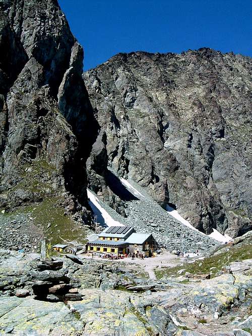
Rifugio Vitale Giacoletti 2741 m
Situation: Monviso Group, Colle Losas
Open: from middle June to middle September
Size: 56 persons
Owner: CAI Barge
Guardian: Guida alpina Andrea Sorbino
Refuge's phone: 0121.82127 - 0175.940104
Mobile: 347.9637442
Owned by the CAI Section of Barge, the Vitale Giacoletti refuge is located on the Losas hill, under the eastern ridge of Punta Udine. The refuge was originally called the Losas refuge, the name was later modified in Vitale Giacoletti, mountaineer, founder of the CAI Barge section and died in a climb on Matterhorn - Cervino.
Bivouac
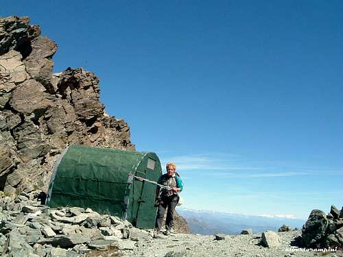
Near the summit of Punta Venezia, on a saddle at the altitude of 3080 m, there is a small emergency bivouac. It have not a defined name and its known as the Bivouac of Punta Venezia. It is a small metal construction of the kind "barrel roof". Always open with 2 places.
Other accomodation
Different kind of accomodation in Valle Po: agriturismo, apartments, hotels, B&B
Meteo
Guidebooks and maps

“Monte Viso – Alpi Cozie Meridionali” by Michelangelo Bruno – Collana CAI-TCI Guide dei Monti d’Italia “Pays du Viso –Escalade en Queyras

entre France et Italie” by Sylvain Pusnel and Guillaume Vallot
Maps
"Monviso-Valle Varaita-Valle Po-Valle Pellice" -IGC sheet 106 1:25000