
-
 2042 Hits
-
 83.1% Score
-
 16 Votes
|
|
Mountain/Rock |
|---|---|
|
|
44.58007°N / 6.95978°E |
|
|
Piedmont |
|
|
Hiking, Trad Climbing, Sport Climbing, Via Ferrata |
|
|
Summer |
|
|
8038 ft / 2450 m |
|
|
Overview
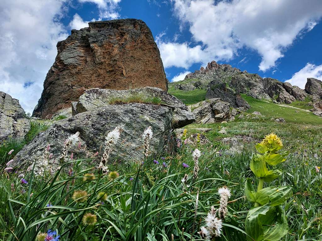
Rocca Senghi 2450 m
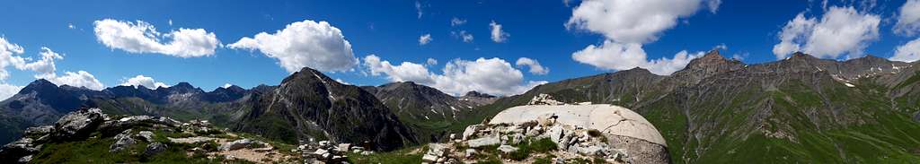
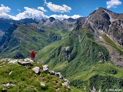
Rocca Senghi is a magnificent and vertical peak of yellow ocher rock, a true natural monument, an apparently inaccessible tower from which the view can sweep towards the numerous high mountains bordering the Valle Maira and France. Actually, the overhanging tower has a weak point and the path of the standard route to reach the summit follows this itinerary, passing to the right of the steep walls and bypassing the difficulties from the North.
Getting There
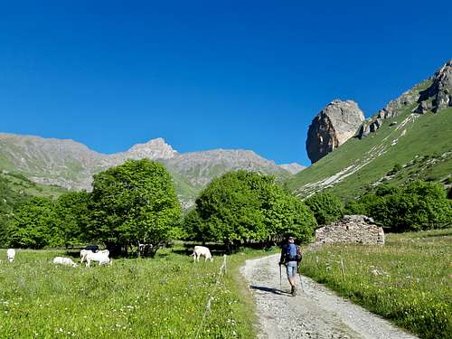
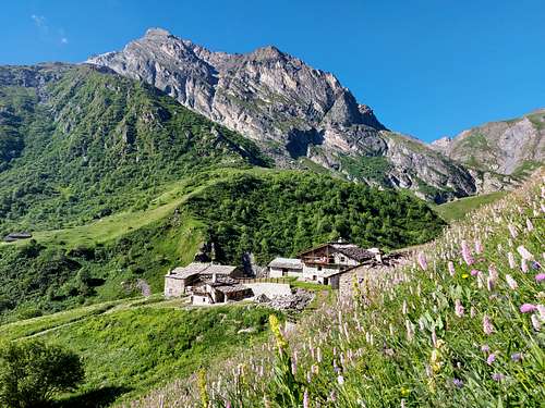
The approach to Rocca Senghi starts from the hamlet of Sant'Anna di Bellino in a lateral valley of Valle Varaita.
From the A6 Torino-Savona motorway exit Bra-Marene and take the road to Savigliano, Saluzzo and Valle Varaita (road n. 8). Once you enter the Valle Varaita, drive to Sampeyre and Casteldelfino, overcoming different villages. At the junction in Casteldelfino take to the left the road to S. Anna di Bellino entering the Vallone di Bellino and follow it up to the hamlet of San Anna, pass the bridge over the stream. Drive along the valley and after passing some pretty villages, including Chiazale, reach the hamlet of Sant'Anna, pass the bridge over the stream and park your car in a parking lot just upstream of the Melezè refuge (info panels) at about 1940 m of altitude. From here the impressive Rocca Senghi is perfectly in sight.
Normal Route
Rocca Senghi standard route
Difficulty: E
Difference in level: 510 m
From the parking lot take on the right the unpaved road (signpost U26), pass a house on the right, reaching a junction where you must ignore the main path on the left and take the right path to reach the beautiful hamlet of the Grange Cruset. Pass the small nucleus of alms and continue slanting right on the narrow path rising steeply on the vegetated slope. The steep slope is thus climbed to the right of the East oriented orange rocky fortress of Rocca Senghi in the direction of the Senghi collar where there are the remains of a military barracks.
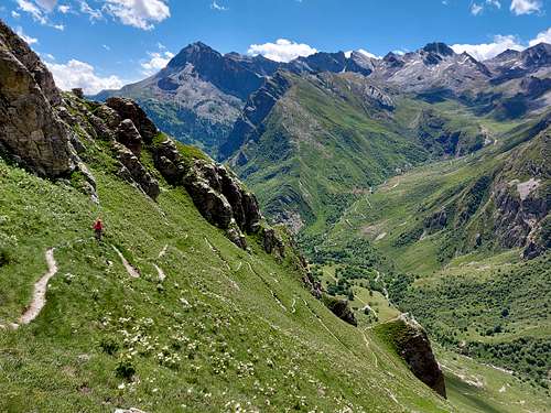
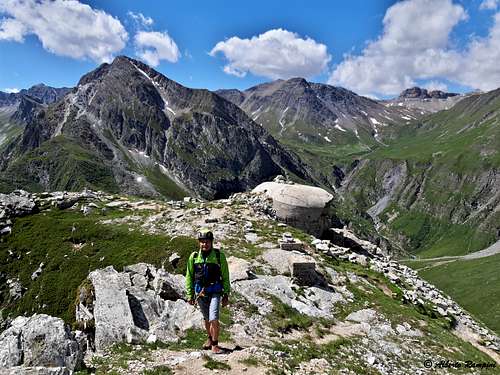
After the first hairpin bends you reach two successive rocky leaps, then cross diagonally to the right overcoming a steeper area with closer hairpin bends. At an altitude of about 2300 meters we are close to the wall and, leaving the start of the Via ferrata on the left, we proceed to the right. Continuing to proceed on the narrow path, you reach the semi-ruined barracks, near which you to the left can see the outlet of a military gallery that we will visit on our return. We go to the right up again for a while, bypassing the barracks and the gallery on the north side and reaching a collar. We continue to climb and soon we reach the summit cross. The view is superb.
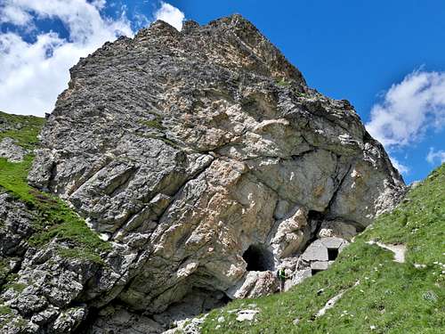
Descent: from the top go back down a bit passing near the western outlet of the military tunnel, which connects the two sides of the Rocca Senghi and comes out near the military shelter. The beginning of the tunnel is downhill, equipped with metal steps and ropes for safety (easy). To carry out the route use a frontal torch. Soon we find ourselves at the eastern exit of the tunnel near the military barracks. Retracing the path we return to the parking lot.

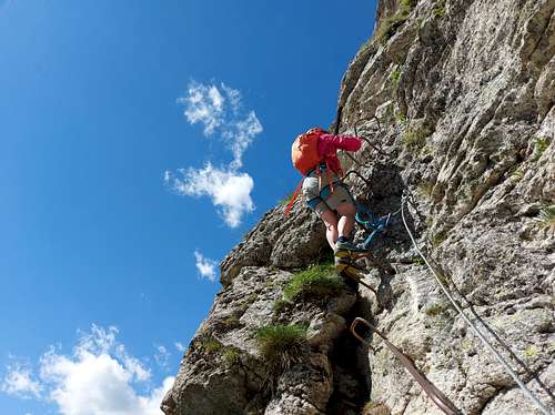
Vie Ferrate
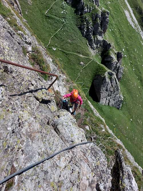
First Via Ferrata Rocca Senghi (the most difficult, climbing the ridge)
Altitude at the start: 2190 m
Length: 200 m
Difficulty: various overhanging sections, only for experts
Orientation: East
There are two Via Ferrata on Rocca Senghi. The via ferrata that you meet first going up the slope next to the Rocca Senghi is the most demanding one and follows the entire edge between the eastern and southern walls of Rocca Senghi. The first part is vertical or overhanging and continuous and can be very difficult for those who are not trained on the arms. After about 150 meters it joins the easier itinerary.
Approach: the approach is the same as the Via Normale. Walking up the slope with vegetation to the right of Rocca Senghi, at a certain point you reach a small basin with large boulders at 2190 m near the base of the yellowish wall. To the right the path, with numerous serpentines, continues to climb the steep grassy gully that flanks the eastern wall of the fortress (Via Normale), while a branch to the left. leads to the start of the Via Ferrata, aerial and fully equipped with metal steps (for experts only).
Second Via Ferrata Rocca Senghi
Altitude at the start: 2240 m
Length: 150 m
Difficulty: medium experience, not for beginners
Orientation: East
Continuing a little longer on the path, a second branch, always to the left, leads to the second Via ferrata which in the lower part runs along a ledge and joins the upper part of the previous one. Equipped with metal ropes and steps, it is certainly less demanding than the previous one, but not to be underestimated (for mountaineers with medium experience of via ferrata, but not for beginners).
Red Tape
No fees no permits required.
When to Climb
From June to middle October
Accomodation
The nearest possibility is the Rifugio Meleze. Other possibilities in Valle Varaita and Sant'Anna di Bellino.
Meteo
Guidebooks and maps

“Monte Viso – Alpi Cozie Meridionali” by Michelangelo Bruno – Collana CAI-TCI Guide dei Monti d’Italia
Maps
"Monviso-Valle Varaita-Valle Po-Valle Pellice" -IGC sheet 106 1:25000
"Mont Viso" IGN 3637 OT