-
 21489 Hits
-
 87.76% Score
-
 25 Votes
|
|
Mountain/Rock |
|---|---|
|
|
40.74485°N / 111.76366°W |
|
|
Salt Lake |
|
|
Hiking, Skiing |
|
|
Spring, Summer, Fall, Winter |
|
|
7491 ft / 2283 m |
|
|
Overview
Perkins Peak is the prominent summit on the Salt Lake City skyline north of Granduer Peak and Parleys Canyon. It is one of the smaller Wasatch summits, however the views offered from the peak are outstanding. The summit itself is very angular when seen from almost any angle, almost a perfect pyramid. Perkins Peak and Dale Peak, are the two southernmost summits of the northern Wasatch Range. The route leading to Perkins Peak on the Emigration Ridge offers exceptional winter ski/snowshoeing opportunities!Perkins Peak has exceptional views of the Salt Lake Valley, Big Beacon directly to the north, the Millcreek Ridge to the south, Granduer Peak, and Mt. Olympus.
The uplift of the Emigration and Parley's canyon areas formed during the Cretaceous era, 65-144 million years ago. Cretaceous strata in the Wasatch Range is strangely absent, partially due to Sevier Thrust fault. This thrust fault caused the Emigration and Parley's synclines, which are also Cretaceous in age. Actual rock strata on the ridge line is primarily older Jurassic Twin Creek Limestone and Nugget Sandstone, the youngest rocks in the Wasatch Range other than the prominent igneous intrusive granite rocks further south. The summit of Perkins Peak is Nugget Sandstone, which is also present at the mouth of Parleys Canyon. The sandstone is orange in color, and seems to really contrast with the other strata of the Wasatch Mountains.
Getting There
The most popular access to Perkins Peak is the Emigration Ridge, and the same approach from Dale Peak.Here is the same access info from the Dale Peak page:
Best access to this peak is from the Little Mountain Summit pass area. There are two ways to access this pass from the Salt Lake area:
Emigration Canyon access:
Starting at the mouth of Emigration Canyon, drive up the canyon (east) 8.5 miles to the pass. Use caution as Emigration Canyon serves both residential, commercial, and outdoor enthusiasts alike.
Parleys Canyon access:
Once entering Parleys Canyon on I-80, continue north east for 6 miles, and take the Mountain Dell exit heading north on highway 65. Continue for 2.45 miles, and turn left, west. Continue upward to the Little Mountain Summit area for 2.1 miles.
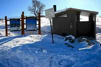
Once reaching the pass area there is a dirt parking area with a restroom facility available. This marks the start of the route for Dale Peak. GPS info for this area is: 40.46493 N, 111.43123 W, 6,270 feet.
Red Tape
The area close to the Emigration Ridge is both of public and private domain, also a watershed exists closer to the Little Mountain Summit area. Be sure to research your route otherwise if not following the ridge directly to the summit.Fortunately as of now there are no fees to access this area. The Little Mountain Summit area has a high pressure gas turbine facility very near the parking area, and slightly above about 300 yards are some other gated facilities, mainly utilities.
The parking area can be somewhat congested on weekends, in both winter and summer. Mountain biking is popular on the Great Western Trail to the north, and during winter the area is used for folks on inner tubes, sleds, ...etc.
Camping
Camping in this area could be interesting, however with Parley's Canyon and I-80 below, some may find it less than pleasant. Your probably better off reserving a campsite in nearby Big or Little Cottonwood Canyons. Reserve early on to get a site, they go quick during the summer season. Both canyons require a fee to camp in the designated campsite areas.Route description.
Elevation gain: 1261 feet. However with the extra terrain covering minor summits along the way add another 600-700 feet.Round trip mileage: 8.5 Miles.
Approximate time needed: 5-8 hours round trip.
Start from the parking area, passing the gate up a maintenance road, which turns west. After about .25 of a mile, and passing most of the utility installations, follow an old jeep track which continues along the ridge crest for about two miles. You'll encounter several small hills going through this section. After approximately two miles, the jeep track disappears. Follow prominent game trails on the crest, which provides a decent alternative to bushwacking. After .25 miles you'll arrive at the base of the peak. Make you way up to the top of the sub-peak, which is about 500 vertical feet. The top of this sub-peak is covered with juniper trees. About 300 yards to the west is the summit of Dale Peak. The route continuing to Perkins Peak is explained below.
The route to Perkins Peak starts where Dale Peak's route is in place. Perkins Peak is 1.5 miles further west along the Emigration Ridge, and 115 feet higher than Dale Peak. There are no special difficulties along the way than some sporadic bushwacking, primarily about .3 miles east of the summit of Perkins. The route ranges from class 1-2. Plan on ski's or snowshoes in winter, there is no special avalanche danger in the area unless you get off route.
Keep your eyes peeled for deer and elk, they are everywhere along the Emigration ridge!


Dean - Oct 3, 2010 3:51 pm - Voted 10/10
Pk 7500Not far from Perkins peak is Pk 7500, a peak with 1273' of prominence. It is a bit of ridge scramble but a bit higher (by only 9 feet) than Perkins Peak and is worth adding to the itinerary.