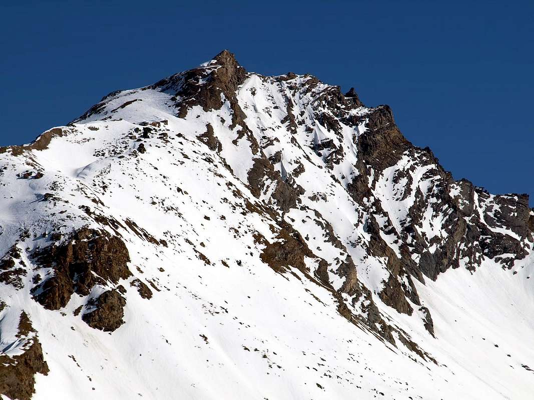
Three cornered pyramid thet from Feluma Pass (3.001m) goes to Tzaboc Pass (3.082m) joining, a little before, to the Becca di Luetta (3.214m); between the two summits the small Luetta Glacier, whose dimension is clearly reducing in the last 20 years.
Piramide triangolare che dal Colle di Feluma (3.001 m) si indirizza al Colle di Tzaboc (3.082 m) unendosi, poco prima alla Becca di Luetta o di Tzaboc (3.214 m); tra le due cime si insinua l'oramai piccolo Ghiacciaio della Luetta, in evidente fase di ritiro negli ultimi vent'anni.
First Ascents
First on the summit: Giovanni Bobba and Casimiro Thérisod, (Jul 14th, 1891).
In winter: Mario Debenedetti and E. Zangelmi, (Mar 20 th, 1948).
W Arête (for Alpe Plonta): Giovanni Bobba and Casimiro Thérisod, (Jul 14th, 1891).
NW Slope (direct route): Osvaldo Cardellina, Giuseppe Lamazzi, Raffaella Lamazzi, Danilo Garzotto and Enzo Cattani, (Oct 02th, 1994), in descent.
NE Arête (for Luetta Glacier): Giovanni Bobba and Casimiro Thérisod, (Jul 14th, 1891), in descent.
S Arête (for Colle di Feluma): Lorenzo Rossi di Montelera and F. Valfrè, (Jun 24-25th, 1972).
Getting There
BY CAR:
From Torino, Milano, etc: Motorway A5. Exit at Aosta Ovest.
From Switzerland: through the Grand Saint Bernard Tunnel or the namesake pass.
From France: through the Mont Blanc Tunnel or Petit Saint Bernard Pass: It is not necessary to take Motorway A5: you can drive on SS.26, in the direction of Leverogne.
BY PLANE:
Aeroporto "Corrado Gex" Saint Christophe (Aosta).
Itinerary
From the City of Aosta (583m) follow SS.26 toward Mont Blanc. Once close to the Village of Leverogne (780m), turn left on the Regional Route for Valgrisenche. Pass many small villages, including Rochefort, La Ravoire, Chamencon, La Bethaz, and the town of Valgrisenche. Turn right for the Village of Bonne (1.810m) located near the huge dam that forms the Beauregard Reservoir. Past the small Village of Menthieu (1.842m), continue for approximately 5 km along the paved road, which follows the shore and leads to the old Pasture of Surier (1.758m), near the Village of Usellières (1.758m).
Dalla Città di Aosta (583 m) si percorre la SS.26 per il Monte Bianco e giunti nei pressi dell'abitato di Leverogne (780 m) si imbocca sulla sinistra la Strada Regionale per la Valgrisenche, dopo aver superato le Frazioni di: Rochefort, La Ravoire, Chamencon, La Bethaz ecc ecc e, dopo aver superato il capoluogo di Valgrisenche, si continua sulla destra per la Frazione di Bonne (1.810 m) situata proprio di fianco all'enorme sbarramento artificiale che racchiude il Lago di Beauregard. Dopo aver superato il piccolo Villaggio di Menthieu (1.842 m), si prosegue per circa 5 km lungo la strada asfaltata che costeggia il lago e che porta al vecchio Alpeggio di Surier (1.758 m), vicino al Villaggio di Usellières (1.758 m).
Route
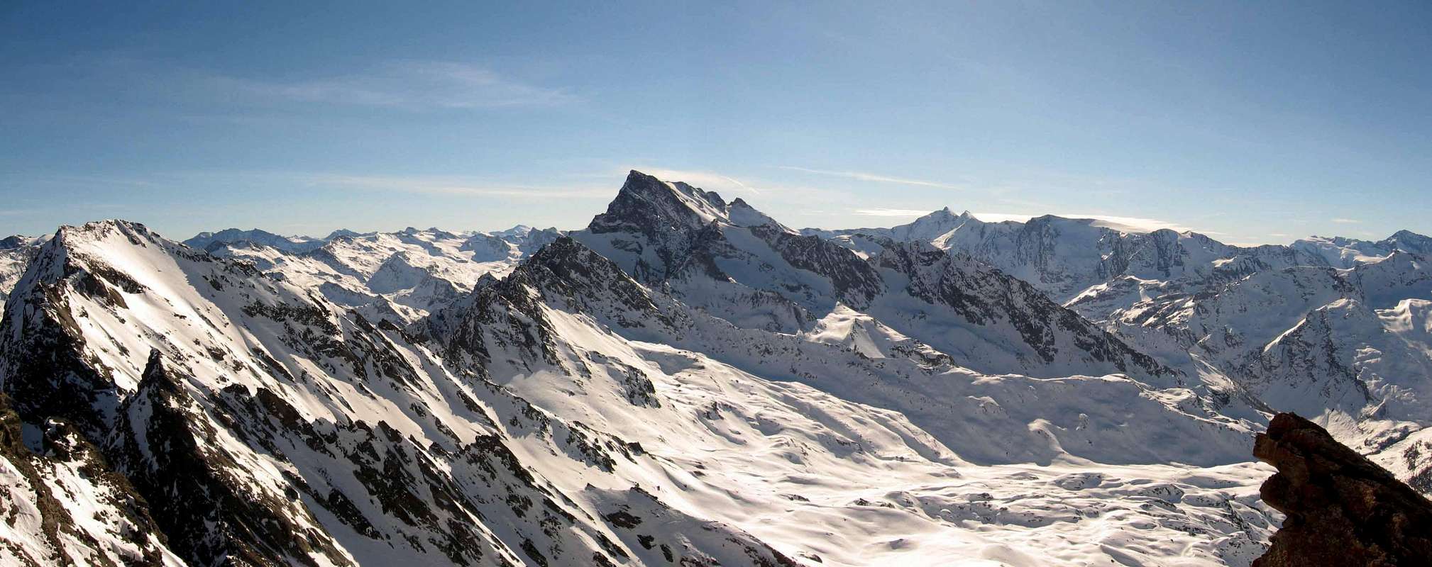
From the car parking in Usellières (1.758m) up to the Alpe Nouva (2.135m) and, following to NE, cross the Bouque Stream, pass over other houses ans once at the Pra Londzet Pasture follow along the "Alta Via" n° 2 up to Plonta Pasture (2.303m). To the N toward the Colle 2.619m East of the Becca dei Quattro Denti (Four teeth); along the path "nuovo" (new path) to NE up to the upper plain (~3.000m). Toward S up to the West ridge and follow it, climbing some easy rocks (1° UIAA) before the summit (cornices in the last part). You can also get the summit following the glacier to the East up to the notch 3100m and along the easy NNE ridge (Time required 5h'00/5h'30). Descent: NW slope direct.
Da Usellières (1.758 m), risalire dal parcheggio alla soprastante Alpe Nouva (2.135 m) e continuando a NE guadare il Torrente de Bouque; superate altre baite e raggiunto l'Alpe di Pra Londzet proseguire lungo l'Alta Via n° 2 sino all'Alpeggio di Plonta (2.303 m). Risalire a N verso il Colletto 2.619 m ad E della Becca dei Quattro Denti; prendere il sentiero "nuovo" a NE sino al ripiano superiore a 3.000 metri circa, lasciando in basso un piccolo laghetto (2.871 m). Continuare verso S sino a raggiungere la cresta W, risalendola facilmente superando alcuni spuntoni precedenti la vetta (I° cornici, nel tratto finale). Invece che la cresta si può salire continuando sul ghiacciaio verso E sino al Colletto 3.100 m, per la facile cresta N-NE (5h'00/5h'30). Discesa: Per il versante NW.
Difficulty
This route can be considered EE/F+.
L'itinerario è classificato EE/F+.
Gear
Hiking gear.
Da escursionismo.
Campings
Remember that free camping is forbidden (except for emergency reasons, over 2.500m, from darkness until dawn).
Mountain Conditions
You can get meteo information at the official site of the Regione Valle d'Aosta:
A.I.NE.VA. (Associazione Interregionale Neve e Valanghe).
Useful numbers
Protezione Civile Valdostana località Aeroporto n° 7/A Saint Christophe (Ao) Tel. 0165-238222.
Bollettino Meteo (weather info) Tel. 0165-44113.
Unità Operativa di Soccorso Sanitario Tel. 118.
Acknowledgements
I am greatly indebted to my friend "Osva" for the detailed description of the route. In addition i want to thank Gabriele Roth for the translation of the text from italian.
Parents refers to a larger category under which an object falls. For example, theAconcagua mountain page has the 'Aconcagua Group' and the 'Seven Summits' asparents and is a parent itself to many routes, photos, and Trip Reports.

 6399 Hits
 88.61% Score
 27 Votes