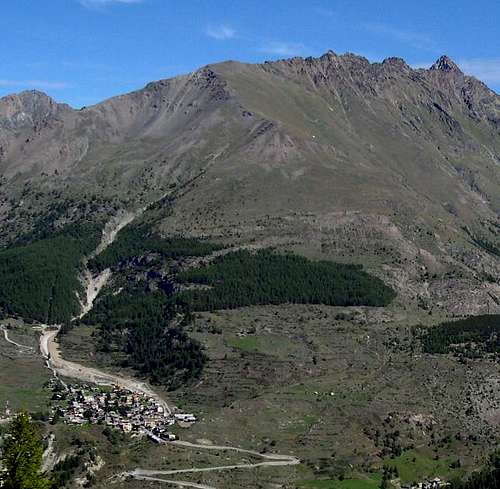
Compared to the surrounding mountain ranges, Punta di Arpisson (3.030m), placed NW of the Village of Gimillan (1.787m) and easily visible also from Cogne (1.534m), is not an imposing mountain. Placed at the end of the SW spur of Punta Garin (3.448m), it descends towards SE with a grassy slope to Punta Tsaplana (2.659m); to the south with a short wall made of broken rocks and westwards (Vallone di Arpisson) with a series of ruining rocky spurs alternating with steep detritic gullies: in fact, ascending Vallone di Arpisson towards Colle Garin, it's very usual to hear the deep roar of landslides and falling rocks. The 2.978m benchmark, placed by Istituto Geografico Militare (I.G.M.) at the intersection of SW and SE ridges marks only a secondary summit of the true Punta di Arpisson (3.030m), located a hundred or so meters to the north.
Colle di Pila (whose name comes from the pastures below, in Vallone di Grauson) is only a few meters lower than the summit and connects Punta di Arpisson to the spur descending from the remarkable Punta Garin (3.448m), including also Pointe Fleurie (3.258m), Pointe Lavà (3.214m) and Pointe Coppi (3.231m), whose original name is probably Pointes Coupèes d'Arpisson.
First Ascents
First ascent: Unknown.
First winter climb: Osvaldo Cardellina, Giuseppe Lamazzi and Marco Cossard, (Jan 08th, 1978).
S-W Arête: Unknown.
W Arête: Osvaldo Cardellina, (Jul 05th, 1987).
Getting there
BY CAR:
From Torino, Milano, etc: Motorway A5. Exit in Aosta Ovest. Drive to the nearby Aymavilles. Follow in the direction of Valle di Cogne.
From Switzerland: through the Grand St. Bernard Tunnel or the namesake Pass). Drive to Aosta, then follow Courmayeur direction along SS.26. Just after Sarre, turn to the left, in the direction of Valle di Cogne.
From France: through Mont Blanc Tunnel (or Petit St. Bernard Pass). It isn't necessary to enter Motorway A5, you can drive through SS.26, Aosta direction. Before arriving at the Village of Sarre, follow the sign and turn right towards Valle di Cogne. After Aymavilles, SR.47 crosses the Villages of Vieyes, Epinel and Cretaz and after about 25 km arrives at Cogne (1.534m).Follow the road signs for Gimillan and Lillaz; arrived at a roundabout, recently built in proximity of the St. Antonio Chapel, go left along the scenic route leading to the Village of Gimillan (1.787m), 3 km after Cogne. Usually no parking problem.
BY PLANE:
Aeroporto "Corrado Gex" Saint Christophe (Aosta).
Itinerary
Starting from the large square in Gimillan, cross the village going up northwards and, near a chapel dedicated to Maria Immacolata
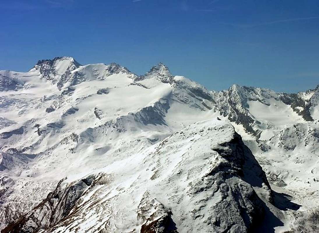
(Immaculate Virgin), turn left along a country road that, with some hairpins, after a riding school reaches a trail going left. (You can also go straight from the chapel alongside the creek, arriving at the same point). The trail that turns left leads both to Arpisson Alpage (2.294m) and Punta Tsaplana (2.659m). After a quarter of an hour's walk on a gentle slope in a beautiful pine forest the path forks: ignoring the trail (n° 3b) that continues straight towards Arpisson Alpage, turn right onto a small trail (n° 3) that goes up steeply, arriving at an old ruined alpage named Alpe Perché (2.396m), after 1h'30/2h'00 from the start. Continue to climb as far as Cima Tsaplana (2.659m), about an hour after Alpe Perché, where a white little statue of the Virgin is placed. Here one can rest and enjoy the magnificent panorama including Tersiva and most of the Gran Paradiso Massif.
Start again to climb northward along the sweeping grassy ridge as far as the cairn of Punta di Arpisson (3.030m). Overall time of climb: 3h'45/4h'15 h for an elevation gain of about 1.300m. Following along the ridge coming from Punta Garin, one can also reach the more difficult Punta Coppi (3.231m), or Pointes Coupèes d'Arpisson. Descend along the same route.
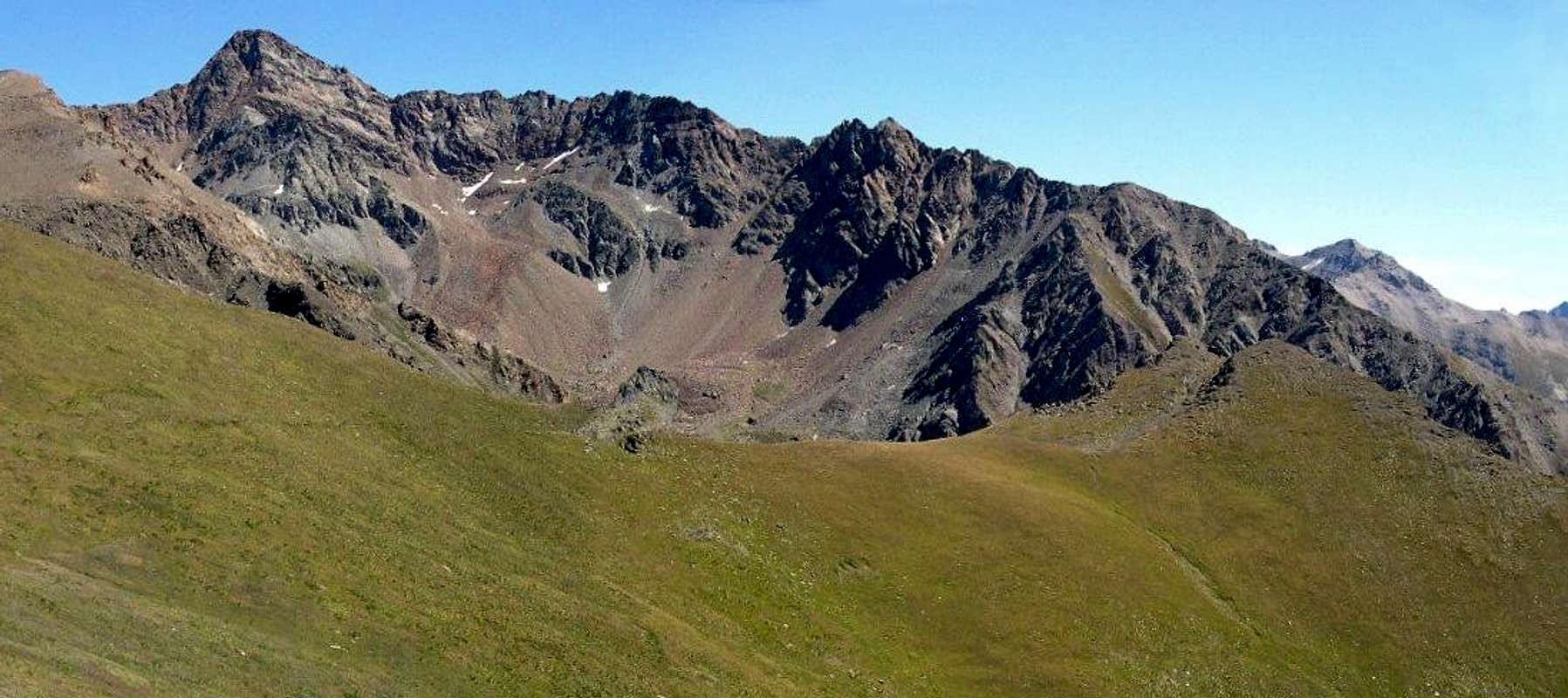
Views from Testa Tsaplana and Punta di Arpisson
Red tape
No restriction at all: Punta Arpisson is outside the borders of the Gran Paradiso National Park.
Bus lines
SAVDA bus lines connect Aosta to Cogne. In addition, both in summer and in winter, SAVDA shuttle bus connect Cogne with the near villages (Gimillan in our case).
Campings
In all the Aosta Valley the camping is allowed only above 2.500 meters.
Mountain Condition
Meteo: you can find all the needed informations at the official site of the Valle d'Aosta Region:
"Racchette da Neve a Cogne" di Ezio Savin e Luca Zavatta l'Escursionista Editore Novembre 2003.
"80 itinerari di Escursionismo Alpinismo e Sci Alpinismo in Valle d'Aosta", di Osvaldo Cardellina, Ed. Musumeci, Giugno 1977 (in Italian); seconda Ed. Luglio 1981; terza Ed. Luglio 1984; (in French), prima Ed. Febbraio 1978; seconda Ed. Marzo 1980.
"Guida del Monte Emilius" di Osvaldo Cardellina Editore in collaborazione con il Club Alpino Italiano Sezione di Aosta Dicembre 1978.
"Guida dei Monti d'Italia – Emilius-Rosa dei Banchi-Parco del Mont Avic" di Giulio Berutto e Lino Fornelli - Club Alpino Italiano/Touring Club Italiano, Marzo 2005.
"Diari Alpinistici" di Osvaldo Cardellina e Indice Generale accompagnato da Schedario Relazioni Ascensioni 1964-2020 (unpublished).
MAPS:
Kompass Gran Paradiso Valle d'Aosta "Sentieri e rifugi-Carta turistica" 1:50000.
L'Escursionista "Valle di Cogne Carta dei Sentieri" (n° 10) 1:25.000.
L'Escursionista "Tour de la Vallée de Cogne Grand Paradis" Carta dei sentieri 1:25.000.
IGC-Istituto Geografico Centrale "Gran Paradiso La Grivola Cogne" Carta 1:25000.
Hapax "Les Sentiers" Comunità Montana Monte Emilius luglio 2000 1:25.000.
Parents refers to a larger category under which an object falls. For example, theAconcagua mountain page has the 'Aconcagua Group' and the 'Seven Summits' asparents and is a parent itself to many routes, photos, and Trip Reports.

 10492 Hits
 90.13% Score
 31 Votes