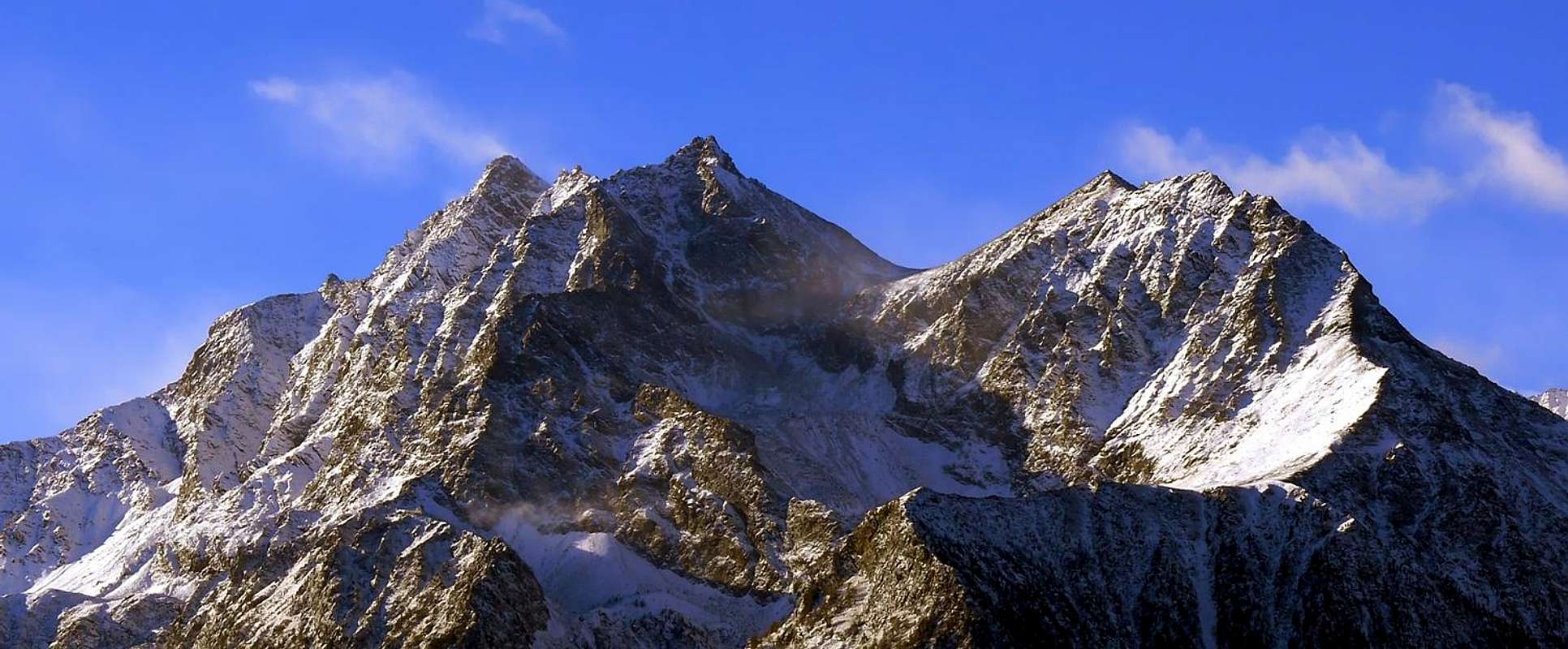
The Grande Roise is the higher summit on the watershed between the Valleys of Saint Marcel and Laures; locally known also as Testa Plana or Grande Roëse (big Roëse Glacier) in Aosta dialect "patois". It is not improbable that its name were given to the whole Emilius Group that, as for the morains, could have very big and thick glaciers. It is formed by the long watershed ridge that connects the Punta di Leppe with Becca of Salé in an ideal link between the Valley of Cogne (Grauson branch of Lussert) and the Central of Dora Baltea (above the Municipality of Grand Brissogne). Its main ridges are therefore two: the South, or Normal Route, which links it to the Punta Ilario Antonio Garzotto and the North in the direction of Punte Gianni Junod and Petite Roise. Other ridges less pronounced but very steep and vertiginous fall inserted into the large Eastern Wall to the Valley of Saint Marcel, while on the side of Laures descends towards the West-southwest bold and jagged ridge that separates Long Lake from the small Vallon of Leppe. Its walls are facing South towards a small side walloon with respect to the latter, to the West on an ancient Glacier of the Grande Roise, now extinct, and the predicted lake and finally to the East with the aforementioned face. Between this and Junod two Summits there is another narrow wall facing North-northeast, which overlooks a dark canyon ravine. Is projected menacingly toward the moraines above the Praborna Mines and House Hunting Mulac-St. Louis. Generally its ascent is via the South Crest quite easy, also used in the course of the first ascent, but downhill. Certainly the number of ascents is somewhat limited as also stated the mountaineer-hunter Giovanni Matteo called "Agostino" Zulian, the expert in this area, not least because it has no easy routes; also the lack of knowledge of the area means that they are only local climbers or poachers to attend. The passage of the latter is marked by a number of bullet casings found in the sockets at the base, especially on the Eastern Slope. The mountaineering explorations in general belong to the beginning of the '900 while recently registered is a "wake-up" by fans, always local. These were addressed, starting from the 80s, a little of all this small mountain range from the Leppe to Junod Summits, Little Roise, Becca-Tower of Salé, above the Grand Brissogne Municipality. We record a "search" in fact, that goes since 1983 (SE Wall of Petite Roise) until 2006. Located in a central area of the Valley of Aosta, allowing stunning panoramic 360° entirely on the same, while the front to the West rises the Monte Emilius with his fearsome and vertical Wall East, overlooking the beautiful Lakes Laures colors more variety. Also interesting and unusual views of the Alps Graian East dominated by the trio Mount Avic, Mount Glacier and Punta Tersiva; but the quick-glances are the most interesting ones were those same wild chain, more rarely visited and therefore the most unknown.
La Grande Roise è la massima elevazione divisoria separante i Valloni di Saint Marcel e di Laures, localmente anche conosciuta con il nome di Testa Plana o Grande Roëse (grande ghiacciaio da roëse in dialetto valdostano "patois"). Non è improbabile in antichità che il nome fosse genericamente rivolto al Gruppo intero dell'Emilius che doveva possedere, come testimoniano i resti morenici, enormi e alti ghiacciai. Essa é formata dalla lunga cresta spartiacque che collega la Punta di Leppe con la Becca di Salé in un ideale legame tra la Valle di Cogne (Grauson, ramo del Lussert) e quella Centrale della Dora Baltea (sopra il Comune di Grand Brissogne). Le sue creste principali quindi sono due: la Sud, o Via Normale, che la unisce alla Punta Ilario Antonio Garzotto e la Nord in direzione delle Punte Gianni Junod e della Petite Roise. Altre creste meno accentuate ma molto ripide e vertiginose scendono inserite dentro la larga Parete Orientale verso il Vallone di Saint Marcel, mentre dalla parte delle Laures s'allunga verso Ovest-sudovest un'audace e frastagliato crestone atto a separare il Lago Lungo dal piccolo vallone di Leppe. Le sue pareti sono rivolte a Sud verso un piccolo vallone laterale rispetto a questo ultimo, ad Ovest sopra un antico Ghiacciaio della Grande Roise, ormai estinto, ed il predetto lago ed infine ad Est con la parete succitata. Tra questa e le Punte Junod esiste un'altra stretta parete rivolta a Nord-nordest sovrastante un orrido e scuro canalone, proiettantesi al di sopra delle morene soprastanti le antiche Miniere di manganese di Praborna e la Casa di Caccia di Mulac-Saint Louis. Generalmente la sua salita avviene tramite l'abbastanza facile Cresta Sud, utilizzata anche nel corso della prima ascensione, ma in discesa. Certamente il numero di ascensioni é alquanto limitato come affermava anche "Agostino" Zulian, il più profondo conoscitore di quest'area, anche perché la medesima non presenta itinerari semplici; inoltre la scarsa conoscenza della zona fa si che sian solo alpinisti locali o bracconieri a frequentarla. Il passaggio di questi ultimi viene contrassegnato dai numerosi bossoli che si trovano negli zoccoli alla base, soprattutto sul Versante Orientale. L'esplorazioni alpinistiche in genere appartengono all'inizio del '900 mentre ultimamente s'é registrato un certo "risveglio" da parte di appassionati, pur sempre locali. Sono state rivolte, partendo dagli anni '80, un pò a tutta questa piccola catena dalla Punta di Leppe fino alle due Punte Gianni Junod, Petite Roise, Becca/Torre di Salé, sovra il Comune di Grand Brissogne. Registriamo una "ricerca" infatti che va dal 1983 (Sudest Petite Roise) al 2006. Posizionata in un'area centrale della Valle di Aosta, consente panoramiche stupende a 360° sulla'intera medesima, mentre frontalmente ad Ovest si erge il Monte Emilius con la sua temibile e verticale Parete Est, che domina gli splendidi Laghi delle Laures dai colori più svariati. Inoltre interessanti ed inusuali viste sulle Alpi Graie Orientali dominate dal trio Monte Avic, Mont Glacier e Punta Tersiva; ma i colpi d'occhio più interessanti sono quelli rivolti alla stessa selvaggia catena, sempre raramente visitata e perciò ai più sconosciuta.
First Ascents
First on the summit (from N Arête): Albino Lucat, Angelo Decaroli with Valtournanche Mountain Guide Jean Antoine Carrel, (Jul 17th, 1875), in ascent from St. Marcel Municipality and through the Arpisson Vallon, Salè and Bonplan Pastures, Salé Col and crossing on Petite Roise.
In winter: Unknown.
E Wall (NE rocky Spur of Quota 3.250 meters) and S Ridge Osvaldo Cardellina, lone (Aug 18th, 2006), in ascent from Les Druges Alte towards Vargney, Servette Mines, E'teley Pasture, Mulac-Saint Louis Hunting House Plan Rué, Emonin Pastures, Layet Loch and Alp, Crétonaz, Rualla Alps.
E Wall (E-SE Couloir and N-E Arête): Jean d'Entréves and Luigi Carrel, (Jun 24th, 1921), in ascent from Mulac Baron Peckoz Hunting House.
E Wall and N-E Arête: Sergio Pession and Piero Pieiller, (Aug 18th, 1983),in ascent from Les Druges Alte Village to Mulac Hunting House.
E Wall (Left Rib): Osvaldo Cardellina, lone (Sep 10th, 2006), in ascent from Les Druges Alte to Mulac, Plan Rué, Emonin, Layet, Cretonaz, Rualla Alps.
W Wall and N Arête: abati N. Blanc and O. Crétaz, (Aug 10th, 1906), in ascent from Les Laures Alp and Grande Roise Glacier.
N Wall and N Arête: Barone E. De Peckoz with Mountain Guides, (Aug 18th, 1913), in ascent from La Chaz-Vauvire Alps.
W Wall (Left or Northern Rib): Jean and Carlo d'Entrèves, (Aug 31th, 1919), in ascent from Les Laures Alp and old Grande Roise Glacier.
W Wall (Central or Southern Rib directly to South Summit): Osvaldo Cardellina, solo (Oct 15th, 2011), in ascent from Pila, Chamolé Pass, Arbole, Lac Gelé, Col d'Arbole with descent to Lac - d'En - Haut, Torrent Montet, Lago Lungo along Southern shore; in descent South Ridge to Les Laures and Arbolle Pass .
S Arête: Agostino Ferrari and Mountain Carrier B. Glarey, (Sep 15th, 1898), with crossing from Punta Ilario Antonio Garzotto.
S-SW Wall: Osvaldo Cardellina, lone (Aug 02th, 1998), after the first descent from Grande Roise W-SW Ridge.
W-SW Ridge: Osvaldo Cardellina, lone (Aug 02th, 1998), in ascent from Gremonenche-L'Arp to Les Laures.
Getting There
BY CAR:
From Torino, Milano, etc: Motorway A5. Exit at Aosta Est.
From Switzerland: through the Grand Saint Bernard Tunnel or the namesake Pass. Drive to Aosta.
From France: through Mont Blanc Tunnel or Petit Saint Bernard Pass. It isn't necessary to take Motorway A5: you can drive on SS.26, in the direction of Aosta.
Specific Road: from Exit out of Motorway A5 continue on SS.26 up to the Quart-Villefranche Commune; from this turn left (South) and toward the great bridge above Dora Baltea reach an important alternative. Leaving right (West) the Regional Road to Pollein/Charvensod Communes and just after abandoning East various secondaries deviations to St. Marcel Commune, go up a wooded promontory and, crossing Laures Torrent, continue before to the South after West to Grand Brissogne Municipality.
BY PLANE:
Aeroporto "Corrado Gex" Saint Christophe (Aosta).
Route
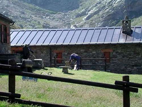
ROUTE from Leppe Hill (1898): From the Grand Brissogne (894m), go along the road till the Alpe di Gremonenche (1.000m). From here along the dirt road up to l'Arp (1.310m; inscription above the corner of the wall) then, along a path that, bordering the stream (des Laures), leads to La Vieille (1.623m) and to Le Tramail (1.951m) (good shelter when weather is bad). Crossing some small bridges up to the altitude of (2.200m), (starting from this point a steep but faster path goes, at right (West), toward the slopes of Becca di Seneva). Better go on toward East forwarding the Becca di Salè (for the inhabitants "Black Fountains") and climb the last 400 meters on wide slopes till the top of the terraces (2.600m) (here a small chapel dedicated to Dino and Jean Charrey brothers, and Cino Norat dead in 1929 on the East Wall of Monte Emilius). A short descent leads to the Refuge Ernesto Menabreaz (2.542m, private), the refuge has an open free part (with covers) usable as winter room (8 places), on the eastern bank of Lago Inferiore di Laures. From here toward South getting, after a short step above the homonym alp, the Lago Lungo di Laures (2.630m), walk all along the western bank on the path that fastly becomes a track turning toward the lower part of the big Ridge Southwest of Grande Roise. First to South (toward the Punta di Lussert 3.221m) then to East along snowfields, bordering on the right the remains of the old Leppe Glacier, you can get easily to the Colle di Leppe (3.110m), located between this Summit and the small but beautiful pyramid of Punta Ilario Antonio Garzotto (3.274m). From that Colle follow, keeping the left side, the easy Southern Ridge on rocks and debris, rounding immediately to the West the Punta Ilario Antonio Garzotto always along the ridge with some difficulties (III°) at all and, after crossing an unnamed small top (3.249m; III°, II°) you get the Summit, (I°, II°- exposed part).
ALTERNATIVE ROUTE DOWNHILL or STANDARD ROUTE (1875): Follow the previous route till 2.780m, then leaving the way to the "Colle di Leppe", head North towards the Grand Roise. Reached a small amphitheatre, with remain of snowfield at the bottom of the South-southwest Wall and between the Grande Roise and West Face of Punta Garzotto, decidedly go on Eastward though a little mouldy canal for more than 100 meters to a saddle on the Southern ridge. Proceed with the Normal Route to the peak. (Actually Standard Route: probably the firts mountaineers 1875, in descent).
VIA dal Colle di Leppe (1898): Da Grand Brissogne (894 m), percorrere la strada poderale fino all'Alpe di Gremonenche (1.000 m). Da qui sempre sulla sterrata fino a l'Arp (1.310 m; iscrizione sull'angolo della baita); da questo punto inizia il sentiero che nella parte più elevata si tramuta in bella mulattiera e risale lungo un percorso che, costeggiando il Torrente des Laures, conduce a La Vieille (1.623 m) e Le Tramail o Tramouail (1.951 m; buon riparo quando il tempo è cattivo). Attraversando alcuni ponticelli fino all'altitudine di 2.200 m~, (a partire da questo punto un sentiero ripido ma più veloce va a destra od Ovest, verso le pendici della Becca di Seneva) meglio proseguire in senso opposto in direzione della Becca di Salè (località, chiamata dai residenti, delle "Fontane Nere") e risalire gli ultimi 400 metri su ampi pendii fino al raggiungimento d'una zona di terrazzamenti rocciosi a quota 2.600 metri (qui é stata eretta una cappelletta dedicata ai fratelli "Dino" e Jean Charrey morti insieme a Cino Norat il 25 di Agosto del 1929 sulla parete Est del Monte Emilius). Una breve discesa porta al Rifugio Ernesto Menabreaz (2.542 m, privato); lo stesso possiede una parte libera aperta, con coperte, utilizzabile come sala d'inverno (8 posti letto), sulla sponda Orientale del Lago Inferiore delle Laures. Da qui indirizzarsi verso Sud raggiungendo su sentierino, dopo un breve passaggio sopra l'omonima alpe, il Lago Lungo di Laures (2.630 m), nei pressi della sponda Occidentale; continuare sempre tramite lo stesso che tende a volgere verso la parte inferiore della grande cresta Sudovest della Grande Roise. Dapprima con percorso verso Mezzogiorno in direzione della Punta di Lussert 3.221 m), poi ad Oriente lungo morene e nevai, confinanti sulla destra coi resti dell'antico Ghiacciaio di Leppe, si arriva facilmente al Colle omonimo (3.110 m), posto tra questa punta e la piccola ma bella piramide della Punta Ilario Antonio Garzotto (3.274 m). Dal Colle risalire sulla sinistra la facile cresta Sud per roccette e detriti evitando appena al di sotto in Ovest la Punta Ilario Antonio Garzotto (3.274 m), continuare la salita della cresta con qualche difficoltà (III°) e, dopo aver scavalcato un'altra piccola punta innominata, (3.249 m; III°/II°) si guadagna la Vetta /I°/II° con tratti abbastanza esposti).
VIA ALTERNATIVA di DISCESA o VIA NORMALE (1875): Come l'itinerario precedente sino a quota 2.780 m, lasciare a destra la via per il Colle di Leppe, puntando a Nord in direzione della Grande Roise. Giunti in una piccola conca, sottostante alla Parete Sud-sudovest tra la medesima e la Parete Ovest della Punta Garzotto, volgere decisamente ad Est e tramite un canalino angusto di oltre 100 metri si esce sopra una forcella sulla cresta Sud, donde con l'itinerario precedente insino alla vetta. (Via normale di salita e discesa, per la quale probabilmente scesero i primi salitori 1875).
Difficulties
The route is for Mountaineers (A), with difficulty PD+. The variant, really the Standard Route, for EE/A and is to assess the overall from F+ to PD-.
L'itinerario è da considerarsi per Alpinisti (A) e nell'insieme PD+. La Variante, in realtà attuale Via Normale, in generale da F+ a PD-.
"Guida delle Alpi Occidentali" di Giovanni Bobba e Luigi Vaccarone C.A.I. Sezione di Torino Volume II (parte II), 25 Maggio 1896.
"Guida del Monte Emilius" di Osvaldo Cardellina Editore in collaborazione con il Club Alpino Italiano Sezione di Aosta, Dicembre 1978 (in Italian).
"Guida dei Monti d'Italia – Emilius Rosa dei Banchi-Parco del Mont Avic" di Giulio Berutto e Lino Fornelli - Club Alpino Italiano/Touring Club Italiano, Marzo 2005.
"Diari Alpinistici" di Osvaldo Cardellina e Indice Generale accompagnato da Schedario Relazioni Ascensioni 1964-2019 (unpublished).
MAPS:
Kompass "Gran Paradiso Valle d'Aosta Sentieri e Rifugi" Carta Turistica 1:50.000.
Hapax "Les Sentiers" Comunità Montana Monte Emilius, Luglio 2000 1:25.000.
Enrico Editore Ivrea-Aosta "Gruppo del Gran Paradiso" 1:50.000.
L'Escursionista "Valle di Cogne" Carta dei Sentieri 1:25.000.
L'Escursionista "Tour de la Vallée de Cogne Grand Paradis" Carta dei Sentieri 1:25.000.
Hapax "Les Sentiers de Charvensod" Comune di Charvensod, Giugno 2003 1:25.000.
FONDAZIONE MONTAGNA SICURA Villa Cameron, località Villard de la Palud n° 1 Courmayeur (AO) Tel: 39 0165 897602 - Fax: 39 0165 897647.
A.I.NE.VA. (Associazione Interregionale Neve e Valanghe).
Useful numbers
Protezione Civile Valdostana località Aeroporto n° 7/A Saint Christophe (Ao) Tel. 0165-238222.
Bollettino Meteo (weather info) Tel. 0165-44113.
Unità Operativa di Soccorso Sanitario Tel. 118.
Acknowledgements
I am greatly indebted to my friend "Osva" for the texts and detailed description of the routes. In addition I want to thank Gabriele Roth and Osvaldo for the translation of the text from italian.
Parents refers to a larger category under which an object falls. For example, theAconcagua mountain page has the 'Aconcagua Group' and the 'Seven Summits' asparents and is a parent itself to many routes, photos, and Trip Reports.

 9856 Hits
 90.13% Score
 31 Votes