

-
 17678 Hits
-
 89.39% Score
-
 29 Votes
|
|
Area/Range |
|---|---|
|
|
45.04764°N / 6.44787°E |
|
|
Hiking, Trad Climbing, Sport Climbing |
|
|
Summer, Fall |
|
|
10594 ft / 3229 m |
|
|
Overview
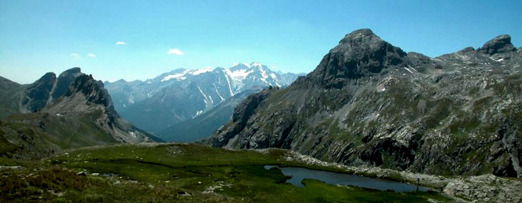
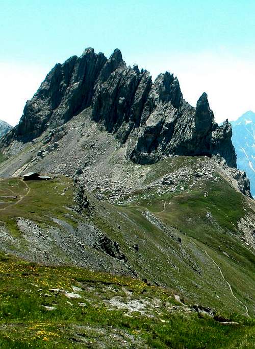
The Massif des Cerces is an alpine group located in the Western Alps, mainly in the French territory, but a little also in the Italian one. On the French side, it occupies the departments of Hautes-Alpes and Savoie. Its gegrafic limits are: Col de Galibier, Col Rochilles, Valleé della Clarée, Valleé della Guisane, Briançon. The Cerces is surrounded by the Massif of the Vanoise to the North, Mont-Cenis to the North-East, the Alpi Cozie to the East, the Massif des Arves to the West and Queyras and Ecrins to the South.
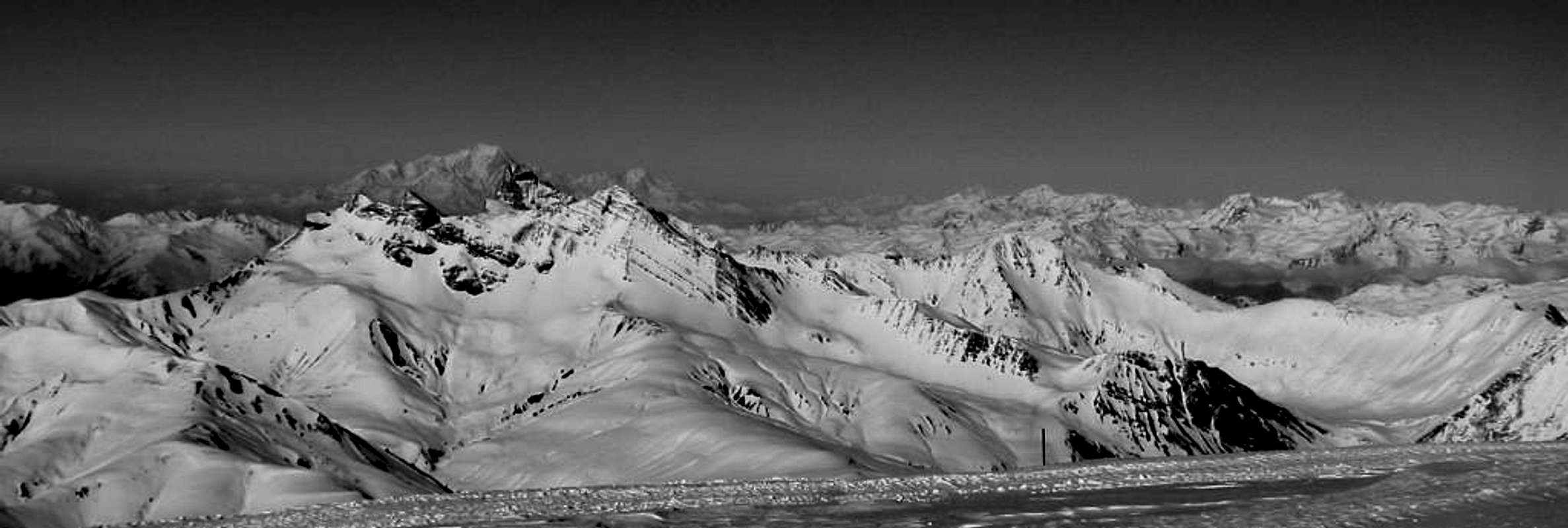
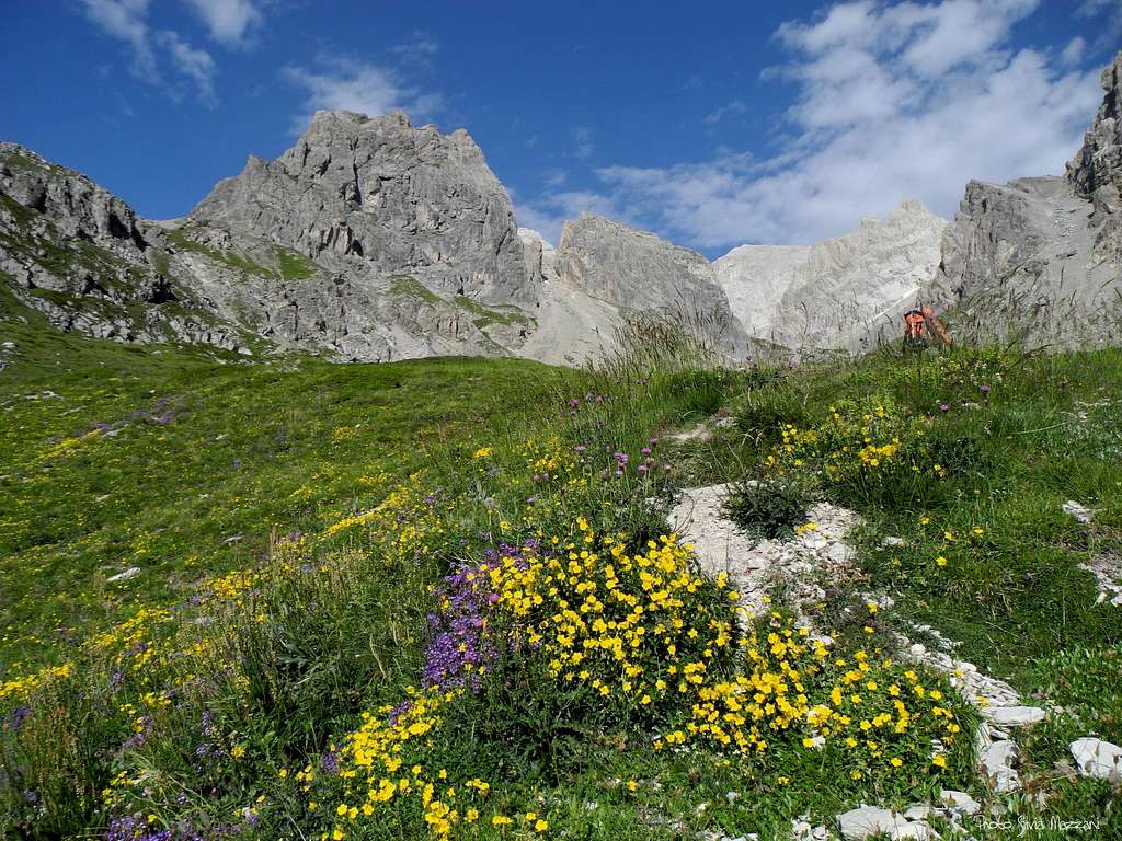
The Cerces massif is a partly crystalline massif, with a predominance of quartzite, and partly also calcareous. The glaciers have almost completely disappeared and the region is full of lakes of various sizes that make the territory particularly attractive for the hikers. Also rock climbing is a highly developed and practiced activity in the massif by both French and Italian climbers, with the presence of numerous modern and classic routes and peaks around 2500-3000m high. Lakes, flowers, sweet smells and rock: a perfect combination!

|

|

|
")
|
The highest summits are:
- Grand Galibier 3229 m
- Roche Bernaude 3225 m
- Pic du Thabor 3207 m
- Monte Thabor 3178 m
- Chaberton 3131 m
- Pic des Trois Evechés 3116 m
- Pointe des Cerces 3097 m
Getting There
The nearest town is Briançon.
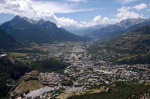
Road access to Briançon
A - From Turin (Italy) Via Monginevro Col
In Turin follow the ring road then take the A32-E70 Motorway entering Val di Susa and exit to Oulx, reach Cesana Torinese and Claviere, then Monginevro Col m. 1854, on Italy-France border; from here the road N94 descents towards Briançon.
B - From Grenoble (France)
Follow the road N85 to Vizille, then the road N91 rising to Col du Lautaret; reach the Col du Lautaret m. 2057 and the town of Briancon. Follow the road N94 for a few kilometres, then turn to left and enter the Val Clareé. From Val Clareé reach the Chalets de Laval as the previous points.
Once you reach the town of Briançon there are two main approachs to the massif:
- SW access
From Briançon, drive NW on road N91 for about 20km up to Le Lauzet.
You can easily park. From there follow trail GR50 to get deep inside Massif des Cerces.
- NE access
From Briançon, drive NE on D994 up to Val Clareè and Nevache for about 20km.
Park there and follow trail GR57 to step into the range.
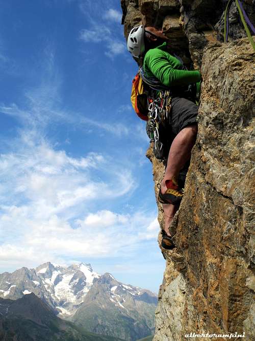
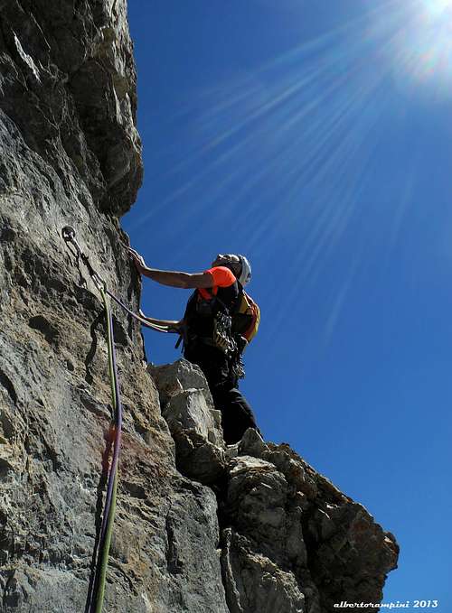
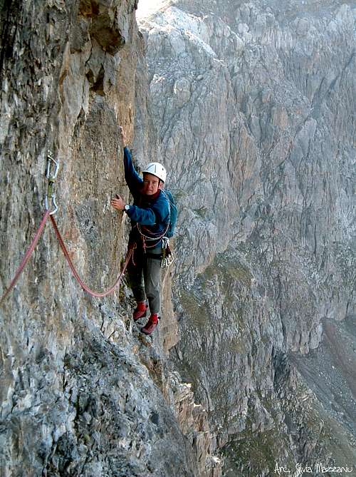
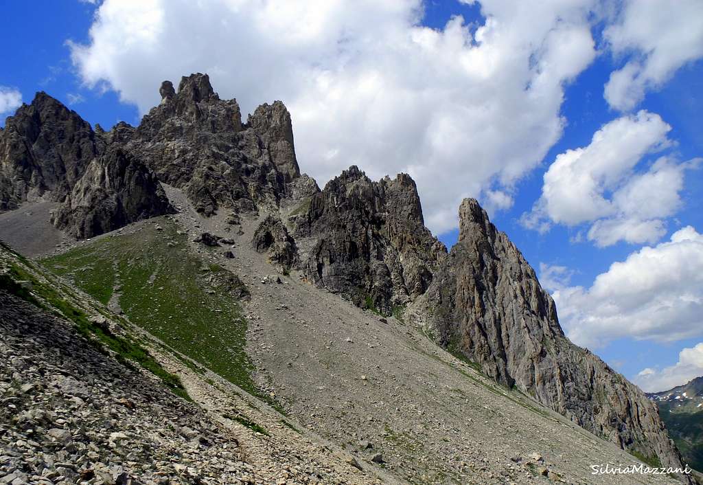
Climbing
It is possible to climb on many peaks in Massif des Cerces.
To approach: no glaciers to cross, a little snow in June, so hiking boots are enough.
To climb: a lot of equipped modern routes and some classic ones; the usual climbing equipment is needed, including friends for the classic routes and sometimes also for the modern routes to integrate.
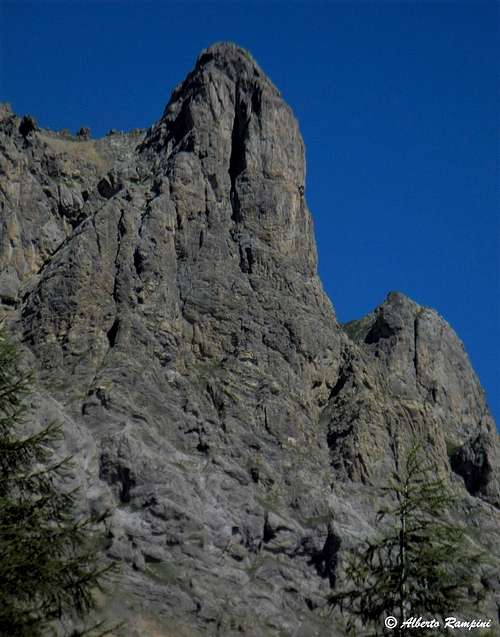
1. Tour Termier 3070 m
SW Face > 6 routes / 200 to 280m / TD to ED
S Face > 5 routes / 220m to 300m / D to ABO-
2. Tête de Colombe 3020 m
Paroi Gauche > 2 routes / 160 to 180m / ED+ to ABO-
Ecaille > 4 routes / 100 to 200m / TD to ABO-
SW Face > 5 routes / 220 to 350m / TD to ABO
SE Face > 2 routes / 350m / TD- to TD
SE Pillar > 7 routes / 250 to 350m / TD- to ED

|

|

|
")
|
3. Roche Robert 2399 m
SW Face > 13 routes / 90 to 170m / AD to ED+
E Face > 9 routes / 120 to 150m / TD to ED
SE Face > 5 routes / 300m / D to TD+
4. Roche Colombe 2832 m
Le temple du soleil TD- / Millesime Grand Cru TD / Couloir Sud AD+ / Arête SW AD
5. Aiguillette du Lauzet 2611 m
W Face > 4 routes / 150 to 300m / TD to ED-
S Face > 6 routes / 150 to 200m / TD+ to ED
6. Chemin du Roy 2250 m
SW face > Sector Eperon de la Route / 100 m / AD to TD+
SW face > Sector La Lauziere / 150 m/ D+ to ED+
6. Tours de la Moulette
Tour 1 SW Face > 7 routes / 300 to 350m / AD to ABO
Tour 2 SW Face > 4 routes / 300m / D+ to TD+
7. Pointe de Buffère 2742 m
S Face > 3 routes / 170m / AD Éperon des Bouffons / Voie de l'Éperon / Les Trois Générations
E Face > 1 route / 170m / TD-
8. Crête du Diable 2689 m
W Face > 1 route / 350m / TD+ L’enfer du decor
9. Crête du Raisin 2818 m
N Ridge > 370m / TD Arêtes N du Raisin
E Face > 7 routes / 250 to 300m / TD- to ABO Sous l'oeil des choucas
W Face > 2 routes / 300m / TD Le raisin giclera trois fois / Les mystères de l'ouest
10. Pavé du Chardonnet 2600 m
E Face > 2 routes / 200m / TD- Dessine-moi un 4 sup / Retour en Névachie
11. Aiguillette du Queyrellin 2600 m
Tour 1 SW Face > 5 routes / 150m / TD to TD+
Tour 2 W Face > 2 routes / 200m / TD- to TD
Tour 3 W Face > 4 routes / 350m / TD to ED
Tour 4 W Face > 2 routes / 300m / TD to ED-
12. Crête de Moutouze 2862 m
Le Bal des vents pires TD, 6b max
13. Aretes de la Bruyere 2619 m
Normal Route > N to S Ridge / AD
SW Face > 5 routes / 250 to 280m / TD+ to ED
14. Rocher de la Mandette 2400 m
4 routes / 80m / TD+ to ED-
And a few more routes on :
Main de Crepin 2940 m
Paroi des Militaires (2000m)
Tour Germaine
Red Tape
No permit no fees required. Be aware that during summer the traffic of the private vehicles rising to the upper part of the Val Clareè is subject to regulation from 9 o clock to 18 o’clock. A service of public minibus is available.
When to hike and climb
Summertime and early Fall
Where to stay
A lot of possibilities of accomodation in the area, different kind: hotels, apartments, gites, camping or huts in the mountains.
1. CAMP SITES
- Camping du Monêtier
Le Village
05220 Le Monêtier Les Bains
Tel : +33 04 92 46 10 08
- Camping Les Deux Glaciers
Le Casset
05220 Le Monêtier Les Bains
Tel : +33 04 92 46 10 08
- Camping de Fontcouverte
Fontcouverte
05100 Névache
Tel : +33 04 92 21 38 21
- Camping de la Lame
Le Robion
05100 NEVACHE
Tel : +33 04 92 20 51 91
2. HUTS
- Refuge du Chardonnet 2227 m
Chardonnet
05100 Névache
Hut Phone: +33 (0)4 92 21 31 80
Meteo
Meteo France Briancon
Meteo Regione Piemonte
Guidebooks and Maps

The ideal handbook is :
Oisans Nouveau Oisans Sauvage (Est)
The ideal map is :
IGN 35350T Nevache/Galibier
And for Weather predictions :
Meteo France > Nevache/Monêtier