-
 28129 Hits
-
 88.01% Score
-
 26 Votes
|
|
Area/Range |
|---|---|
|
|
45.79817°N / 9.60205°E |
|
|
Hiking, Mountaineering, Sport Climbing, Via Ferrata, Skiing |
|
|
Spring, Summer, Winter |
|
|
8270 ft / 2521 m |
|
|
a small preliminary remark ...
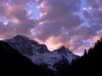
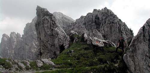
a late fall view ...
the goal of this page is to introduce some starting knowledge of this wide area, sometimes underrated and often stridden by big quantities of tourists along some popular routes.
Out of those ones this area hosts and offers some very fine environments where nature looks uncontaminated and wild ... despite their nearness to a densely populated country.
Here you will find only the main geographic and logistic info: the complete description of the main summits should belong only to summit pages
Overview
With the name of Prealpi Lombarde is normally intended the big area between the Lago Maggiore (Verbano lake) and the Lago di Garda (Benaco lake).
All these mountains, subgroups, groups are quite near to some important towns of Northern Italy, so someone can think of them as tame mountains : nothing wronger than it !
There are a lot of villages, joined by good and bad roads, and a lot of paths, easy and well marked, but, out of them you can often find absolute wilderness and some real danger, first of all the risk to loose bearings and to find yourself in strange situations : the most frequent is the track ending over a big rocky wall.
Differences in elevation are often not small, 1000-1500 m are normal here ...
So, the best way to amuse these environments is well studying maps and tracks before starting or, better, go there with someone who well knows the area.
Geographic Overview
As previously said with the name of Prealpi Lombarde is normally intended the big limestone area between the Lago Maggiore (Verbano lake) on the west side and the Lago di Garda (Benaco lake) on the east side.
The norther borders are much more difficult to find : geologically it should be the Dinaridi limit (the border of the ancient Tethys sea) 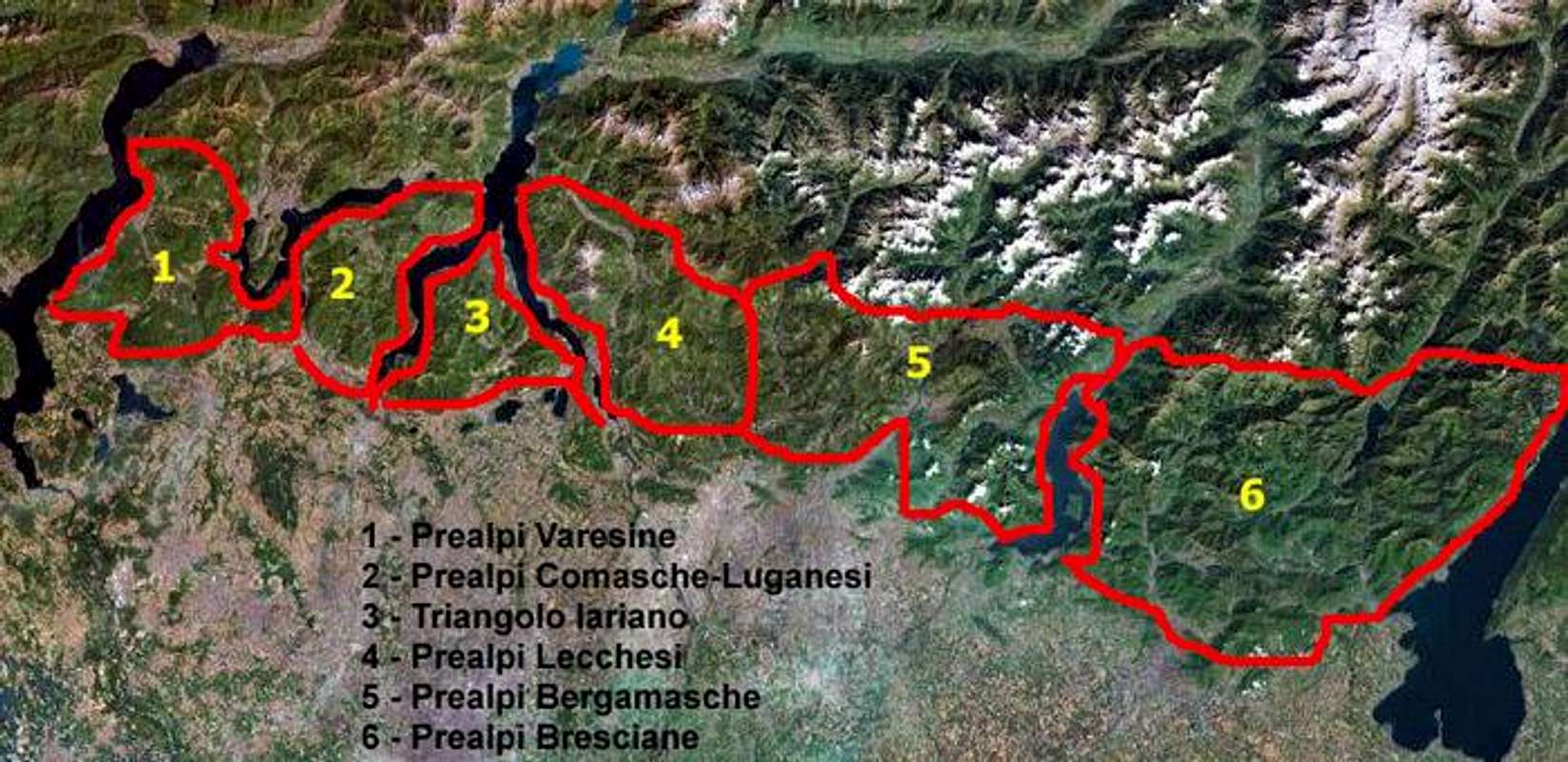
google map
so we can define 3 different sections :
Western Lombardic Prealps
starting from Bellinzona the border arrives, along the Passo di San Iorio to Gravedona, on the western bank of Lario lake (Lago di Como)
north of this border the Lepontine Alps
- Prealpi Varesine
- Prealpi Luganesi-Comasche
Central Lombardic Prealps
on the eastern bank of Lario lake (Lago di Como), the border starts from Bellano, goes along the Valsassina, the Piani di Bobbio and gets down to Piazza Brembana, goes on to the Passo della Marogella to come down to Val Canale, on the bottom of Val Seriana, then after Valbondione and Passo della Manina, the Val di Scalve and the Passo del Vivione goes down to the Valcamonica
north of this border the Alpi Orobie range - Prealpi Lecchesi
- Prealpi Bergamasche
Eastern Lombardic Prealps
here the geological borders are not so easy to find, but geographically we can easy find the northern border : the valley leading to the Passo di Croce Domini
north of this border the Adamello group
then the sourh border of Giudicarie till the Benaco lake (Lago di Garda)
north of this border the Brenta group - Prealpi Bresciane
Getting There
I can't hope (believe) that someone can cross the ocean to come here to hike and/or climb :)
So this page can be used by those ones that live or work - in Milan (or neighbouring towns : Varese, Como, Lecco, Sondrio, Bergamo, Lecco, Brescia) and in the whole range north of Po river)
- in Lugano, Bellinzona (or even beyond the Gotthard tunnel)
starting from these towns the approach to the main valleys leading to the various subgroups is easy and (often) fast along the motorways or SS leading to the closer places wherefrom start the roads entering in the groups along the below quoted valleys.
Just to make an example, I live few km N of Milan and used to start from home on saturday at 2PM to climb the Cassin Route to the Medale (400m of pure rock - D) or at 10AM to climb the other routes on the same wall :))
So, starting from Padana plan these are the main starting points : - for Prealpi Varesine : Varese - Lugano
- for Prealpi Luganesi-Comasche : Lugano - Como
- for Prealpi Lecchesi : Como - Lecco - Bergamo
- for Prealpi Bergamasche : Lecco - Bergamo
- for Prealpi Bresciane : Brescia
Prealpi Varesine
with the only exception of Campo dei Fiori, on whose N side there's a wide rocky wall hosting many short (2-3 pitches) routes of traditional and sport climbing, the whole area looks made for fine sweet hiking and, in winter, after the first snowfalls, a good training ground for ski-mountaneering
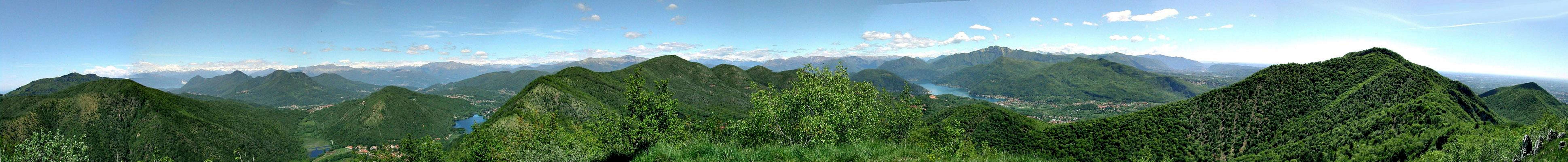
![]()
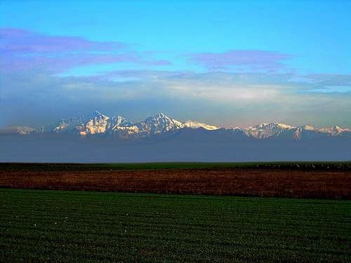
a 6504 x 651 pixels pano of the Alps from a minor summit in Varese Prealps
main summits
Monte Nudo (1235m)
Campo dei Fiori (1226m)
Monte Lema (1621m)
Monte Gradiccioli (1935m)
Monte Tamaro (1961m)
Monte Paglione (1594m)
main valleys - clockwise from S
Val Travaglio
Val Tresa
Val Veddasca
Magadino Plan
Val d'Agno
meteo - google map
Prealpi Luganesi-Comasche
easy hiking range for family trips in spring, avoid summer ... too hot
main subgroups and summits
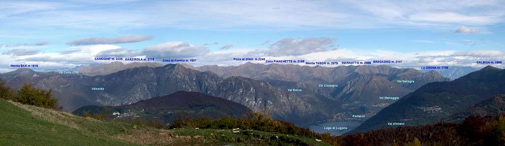
![]()
- Gino group :
sweet mountains in summer, very good and somehow engaging ski-mountaneering, especially on the summits starting from Pizzo di Gino toward East
Monte Bar (1916m)
Monte Garzirola (2116m)
Monte Grande (2136m)
Cima Verta (2094m)
Monte Albano (2027m)
Pizzo di Gino (2245m)
Cima Pianchette (2156m)
Monte Tabor (2079m)
Monte Bregagno (2107m)
the S border of this group is the Monte Grona (1736m), a rocky structure with an interesting ferrata

- Camoghè group
sweet mountains, fine for spring easy hiking
Cima di Medeglia (1260m)
Pizzo di Corgella (1703m)
Pizzo Camoghè (2226m) - Fiorina group
Denti della Vecchia is a locally well known rock climbing training ground, with all kind of difficulties on short (2-4 pitches) routes
Denti della Vecchia (1500m)
Cima di Fiorina (aka Foiorina) (1810m)
Monte Prade (1607m)
Monte Bronzone (1434m)
Pizzoni (1303m) - Generoso group
very fine sweet easy hiking here in all seasons
Monte Generoso (1701m)
Monte Crocione (1491m)
Sasso Gordona (1418m)
Monte San Bernardo (1348m)
Colmegnone (1383m)
Monte Bisbino (1325m)
North of the Generoso, on the N side of the Val d'Intelvi, a small group, made of sweet mountains (with very steep slopes on their flanks) :
Monte Galbiga (1698m)
Monte Tremezzo (1700m)
Monte Crocione (1641m)
and some minor ones
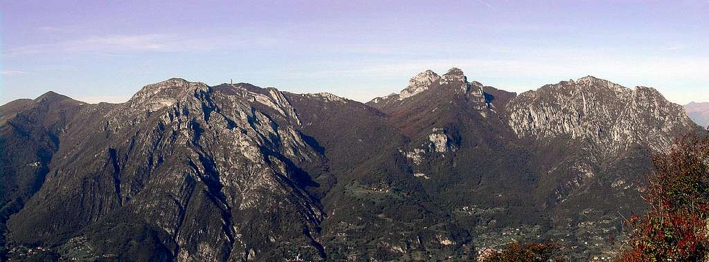
![Monte San Primo]()
Monte San Primo from SW
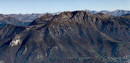
![Monte San Primo]()
Monte San Primo from NE - Camoghè group
![fall colours in the triangolo lariano]()
Monte San Primo from its E ridge
main valleys - clockwise from S
Val di Gaggio
Val Giurada
Valassina - Gino group :
- corni di Canzo group
this subgroup has a minor extension but is quite different from the previous one, rocky structures come out of the meadows and woods, southern and eastern borders are steep and hiking is limited to few paths. Many hunters paths somewhere dangerous ... careful
Its south border is a wonderful place for paragliding
Corni di Canzo (1373m)
Moregallo (1276m)
Corno Rai (1261m)
Cornizzolo (1211m)
![]()
main valley
Valassina
Meteo - google map
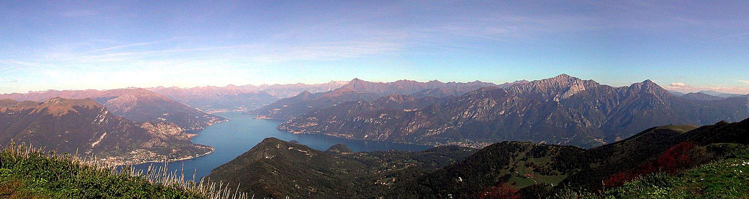
Prealpi Lecchesi
This range has all a hiker and/or a climber can ask to the mountain :
fine hike, fine rock climbing, extreme and long rock routes, from this range came out some famous climbers : two above all Cassin and Bonatti
main subgroups and summits- Campelli group
Zuccone di Campelli (2161m)
Corna Grande (2089m)
Cima di Piazzo (2057m)
Monte Sodadura (2010m)
Monte Araralta (2009m)
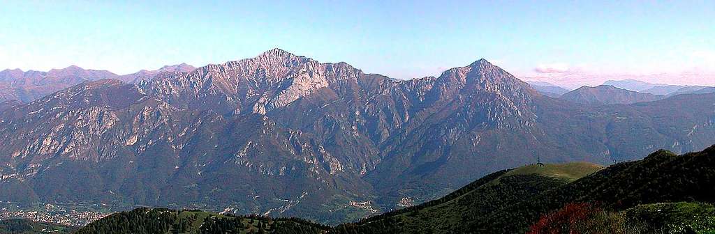
![Zuccone di Campelli]() Zuccone di Campelli from East ridge of Grignetta (W)
Zuccone di Campelli from East ridge of Grignetta (W)![Monte Sodadura]() Monte Sodadura
Monte Sodadura![Monte Sodadura]()
:Monte Sodadura in winter - Grigne group
Pizzo della Pieve (2257m)
Grigna Settentrionale (2410m)
Grigna Meridionale (2184m)
Monte Coltignone (1479m)
![]()
- Resegone group
Monte Due Mani (1666m)
Resegone (1875m)
Corna Camozzera (1452m)
Lo Spedone (1104m)
Monte Tesoro (1432m)
Monte Albenza (1392m)
![Resegone]()
Resegone from Valmadrera (West)
![Monte Due Mani]()
Monte Due Mani from Monte Barro
main valleys - clockwise from S
Valsassina
Val Torta
Val Taleggio
Val Brembilla
Valle Imagna
Meteo - google map
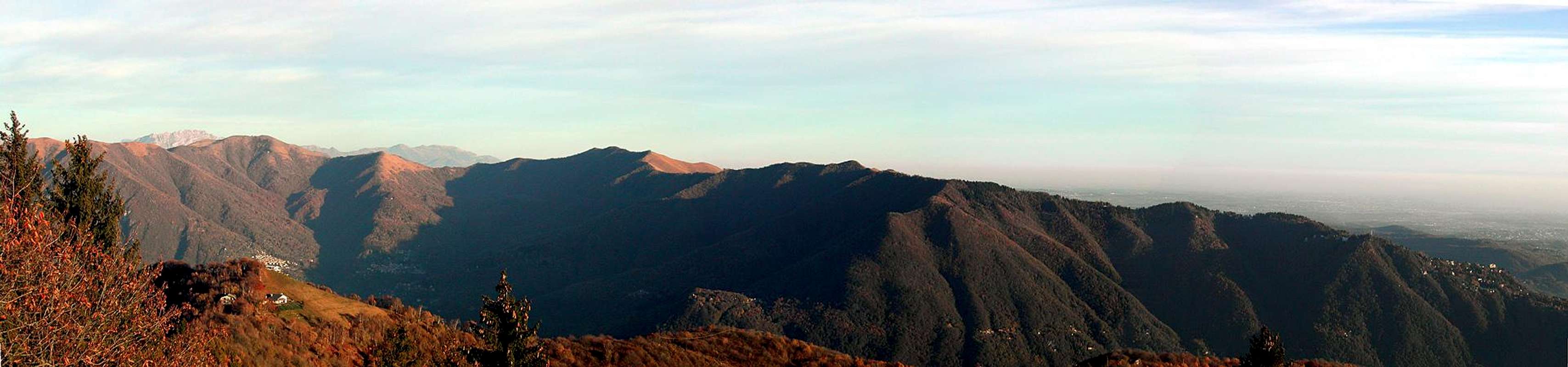
Prealpi Bergamasche
The same as for the previous section, but even a little wilder, mountains are well detached from each other and in their small surrounding valleys we can think to live in another world - Resegone group
- Arera group
Pizzo Arera (2512m)
Cima di Menno (2300m)
Corna Piana (2302m)
Cima di Fop (2322m)
Cima di Grem (2049m)
Cima Foppazzi (2097m)
Cima di Valmora (2198)
Monte Secco (2267) from Val Canale it rises for over 1000m with a huge rock wall
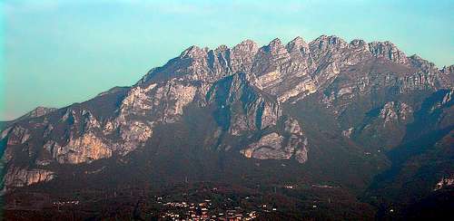
![Pizzo Arera]()
Pizzo Arera NE side![Pizzo Arera]()
Pizzo Arera N face![Arera & Corna Piana]()
Arera and Corna Piana
![Cima del Fop]()
Cima del Fop - Alben group
Monte Alben (2019m)
Cima della Croce (1978m)
Cima di Spada (1952m)
Monte Suchello (1542m)
Cima di Claviera (1320m)
![Monte Alben]()
Monte Alben from its North ridge
- Campelli group
- Presolana group
Monte Vigna Soliva (2356m)
Monte Vigna Vaga (2333m)
Monte Ferrante (2426m)
Pizzo della Presolana (2463-2521-2447m)
Monte Visolo (2369m)
Cima di Timogno (2173m)
![Presolana]()
Presolana North side while ascending to Rifugio Albani![Western Presolana N wall]()
- Formico group
Pizzo Formico (1637m)
Monte Grione (1380m)
Monte Torrezzo (1376m)
Monte Bronzone (1334m) - Camino group
Cima di San Fermo (2356m)
Pizzo Camino (2492m)
Monte Sossino (2396m)
Cima d'Ezendola (2174m)
![Monte Sossino]()
![Pizzo Camino]()
- Concarena group
Cimon della Bagozza (2409m)
Monte Campione (2174m)
Cima della Bacchetta (2460m)
![Cimone della Bagozza from...]()
Cimon della Bagozza![Concarena Group]()
![Val di Scalve]()
![the Concarena group]()
main valleys - clockwise from S
Val Brembana
Val Secca
Val Seriana
Val di Scalve
Val Camonica
Meteo - google map
Prealpi Bresciane
wild, wild environment ... to be discovered and better known - Western chain
Punta dei Setteventi (2250m)
Monte Guglielmo (1949m)
Monte Muffetto (2060m)
Dosso Alto (2065m) - Central chain
Dosso Alto (2006m)
Corna Blacca (2096m) - Eastern chain
Monte Tremalzo (1975m)
Monte Cablone (1977m)
Cima Tombea (1947m)
main valleys - clockwise from S
Val Camonica
Val Caffaro
Val Trompia
Meteo - google map
When To Climb
all year long
Red Tape
no fees no permits required
Camping
almost all the trips can be done in one day starting from the neighbouring towns