


-
 2448 Hits
-
 79.04% Score
-
 10 Votes
|
|
Area/Range |
|---|---|
|
|
45.80050°N / 7.39709°E |
|
|
Hiking, Mountaineering, Sport Climbing |
|
|
Spring, Summer, Fall, Winter |
|
|
9747 ft / 2971 m |
|
|
Note
La montagna chiama i suoi figli, ed essi rispondono fedelmente al suo appello… Osvaldo Cardellina, Diario alpinistico, 1964-65 Page texts: @ OsvaldoCardellina "Osva", passed away on May 2, 2022. Page owners: Christian Cardellina e Osvaldo Cardellina. Any updates from September 12, 2022: Antonio Giani, page administrator, friend and climbing companion. Testi della pagina: @ OsvaldoCardellina "Osva", scomparso il 2 maggio 2022. Proprietari pagina: Christian Cardellina e Osvaldo Cardellina. Eventuali aggiornamenti dal 12 settembre 2022: Antonio Giani, amministratore della pagina, amico e compagno di salite. |
Overview
Surely this area than the North Dora Baltea River and towards the East in respect of Town of Aosta, that by the same stretches Eastward to reach the Basin Verrayes-St. Denis Municipalities at the foot of the Cima di Longhede and Becca d'Aver, offers fewer opportunities for excursions and Walking or Snowshoeing than the Western counterpart. In fact, despite being extended to over twenty miles on the longitudinal axis, it loses in depth than the previous from Courmayeur in Aosta City, formed not only by various terraces above the Dora Baltea (see the wide Basin Vetan) but also by small but long valleys that descend perpendicularly towards the same. For here is a series of small basins parallel from under the Becca of Roisan (above Roisan Common) are directed Eastward, forming a series of other combe (Viou and Sénevé) until you reach the Croix de Fana (2.212m), large wooded promontory above the triple village of Trois Villes (1.391m) on the border amongst the Municipalities of Quart, Saint Barthélemy and Nus. Over, and now the interior of the Valley of Saint Barthélemy, opens the Comba Deche, that has a vertical depth reaching the hill with the same name. As well as very important Pass (2.645m) towards the Valpelline, between Becca Conge (2.954m) and Punta Verdona (2.868m) and just before the beautiful pyramid of Mount Faroma (3.073m), now belonging fully to this valley. An aggregation perhaps, for this comba, somewhat arbitrary but certainly practical for even the farm road that runs, reaching in succession the mountain pastures of Nouva, Flemagne, Salé, Cré, Brunier, Clavel, La Seyvaz and Valchourda (2.392m) leave just from Trois Villes beginning on top of Fonteil Village (1.423m). Likewise the Southwestern Appendices of the watershed between the Valley of Saint Barthélemy and Valtournanche (Area of the Torgnon Common) are widely justified as also belonging to the Basin Verrayes/Saint Denis (Becca d'Aver, Cima di Longhede, Filone Pass, Monte Ander and Mont de Pesse), where he is the only lake of Loson Picnic Area (1.525m), albeit tiny, of this whole area. From Becca d'Aver one another partition falls instead to form to the Southeast the Hills of Aver, des Bornes and the famous and important of Saint Pantaléon (1.650m) on which passes the Regional Road connecting the Municipalities of Chambave, Verrayes and Saint Denis with that of Torgnon in Valtournanche. Besides the partition expires at the "Chapel of Saint Evence" (1.500m), the Village of Champlong to end just above the Castle of the "Passerin d'Entrèves" (550m), now just outside the Municipality of Châtillon. So a broad area, starting from the Municipality of Roisan the entrance of the Valley of San Bernardo, reaches the latter. Along this route many Hilltop, starting from Becca of Roisan (2.546m) to that d'Aver (2.469m), through the West Tsaat a l'Etsena (2.971m), maximum Vertex of the whole area.
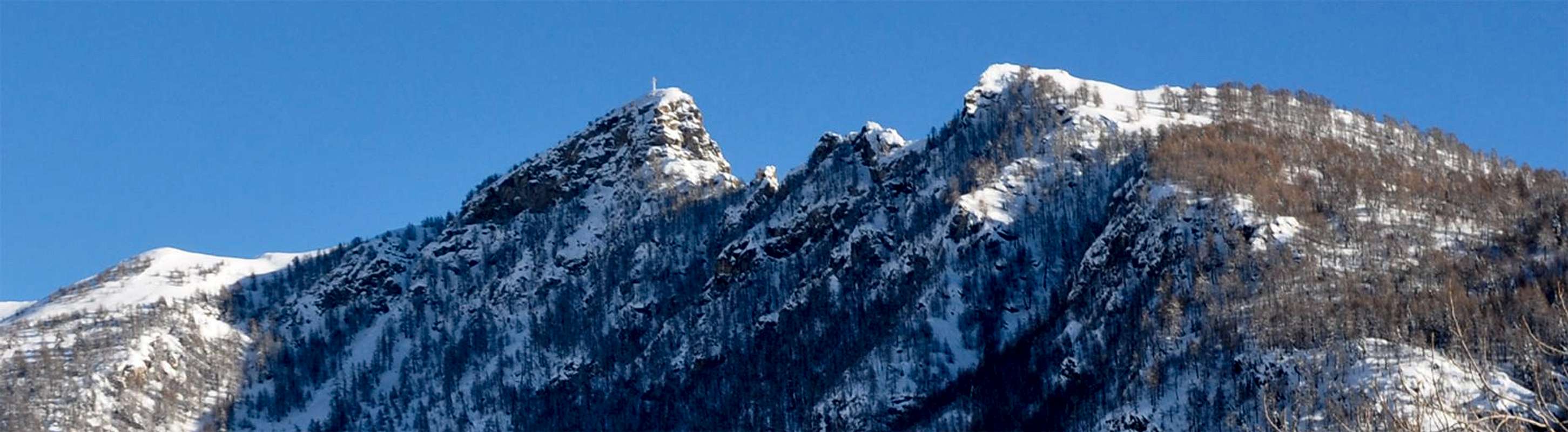 |
Sicuramente quest'area Settentrionale rispetto alla Dora Baltea ed ad Oriente della Città di Aosta, che dalla medesima si allunga verso Oriente fino a raggiungere la Conca di Verrayes-St. Denis ai piedi della Cima di Longhede e della Becca d'Aver, offre un numero inferiore di opportunità per gite Escursionistiche o con Racchette da neve rispetto alla omologa Occidentale. Infatti, pur essendo estesa per oltre una ventina di Kilometri sullo asse longitudinale, perde in profondità rispetto alla precedente da Courmayeur ad Aosta, formata oltre che da vari terrazzamenti sopra la Dora Baltea (vedi la Conca di Vetan) anche da lunghi valloni che scendono perpendicolarmente verso la stessa. Qui infatti si tratta di una serie di piccoli bacini paralleli che da sotto alla Becca di Roisan si indirizzano verso Oriente formando una serie di altre combe (Viou e Senevé) fino a raggiungere la Croix de Fana (2.212 m), grande promontorio boschivo sopra il triplice villaggio di Trois Villes al confine tra i Comuni di Quart, Saint Bartélemy e Nus. Oltre, ed ormai allo interno della Valle di Saint Barthélemy, si apre la Comba Dèche che possiede una profondità in verticale raggiungendo lo omonimo nonché molto importante Colle verso la Valpelline (2.645 m), collocato tra la Becca Conge (2.954 m) e la Punta di Verdona (2.868 m) ed appena prima della bella piramide del Monte Faroma (3.073 m), ormai appartenente in modo completo a questa valle. Una aggregazione forse, quella di questa comba, un poco arbitraria ma sicuramente pratica poiché anche la strada poderale che la percorre raggiungendo in successione gli Alpeggi di Nouva, Flemagne, Salé, Cré, Brunier, Clavel, la Seyvaz e Valchourda (2.392 m) partono proprio da Trois Villes con inizio al Villaggio superiore di Fonteil (1.423 m). Parimenti le appendici Sudoccidentali dello spartiacque tra la Valle di Saint Barthélemy e la Valtournanche (Area del Comune di Torgnon) trovano ampia giustificazione poiché appartenenti anche alla Conca di Verrayes/Saint Denis (Becca d'Aver, Cima di Longhede, Colle del Filone, Monte Ander e Mont de Pesse), dove trovasi anche l'unico lago all'Area Picnic del Loson (1.525 m), pur se minuscolo, di questa intera zona. Dalla Becca d'Aver uno altro divisorio scende invece verso Sudest e forma i Colli d'Aver, des Bornes ed il famoso nonché importante di Saint Pantaléon (1.650 m) sul quale passa la Strada Regionale collegante i Comuni di Chambave, Verrayes e Saint Denis a quello di Torgnon in Valtournanche. Oltre il divisorio si estingue verso la "Cappella di Saint Evence" (1.500 m), il Villaggio di Champlong per terminare proprio al di sopra del Castello dei "Passerin d'Entrèves", ormai alle porte del Comune di Châtillon. Quindi un'area lata che, partendo dal Comune di Roisan allo ingresso della Valle del San Bernardo, raggiunge questo ultimo. Lungo questo percorso si snodano molte Cime, dalla Becca di Roisan (2.546 m) a quella d'Aver (2.496 m), passando per la Tsaat a l'Etsena (2.971 m) Vertice di tutta la zona.
BY CAR:
- From TORINO, MILANO, etc: Motorway A5. Exit at IVREA or Quincinetto (PIEDMONT) From IVREA Town: in West towards Pont Saint Martin, Donnas, Arnad, Verrès, Bard, St. Vincent, Châtillon, Chambave, Nus, Quart, St. Christophe and Aosta Municipalities. From Courmayeur Resort: in East to Morgex, La Salle, Saint Pierre, Sarre, Aosta, Saint Chistophe, Quart, Nus, Chambave, Verrayes, Saint Denis, Châtillon, Saint Vincent, Emarese Municipalities. From Aosta Town towards Châtillon/St. Vincent Municipalities.
- From Saint Christophe-Prevot (about 640m), reached by Regional Road from Aosta, to Sorreley Village; from this, with Municipal, towards Veynes Fraction. From subsequent alternative before Lumian (1.025m): *** in East deviation towards Cretallaz, Jeanceyaz, Morgonaz Villages at the entrance on Senevé Comba). On asphalt road in Northwest, to Parléaz Village (1.274m), Blavy Hamlet (1.475m) and, through dirt road or path, to Viou Alpages, in Blavy Viou small Basin.
- From Quart-Villair towards Epilaz, Argnod Villages or from SS.26 nearby La Plantaz (540m), with Regional and Municipal Roads, towards Chétoz, Vignil, Fornail, Ville sur Nus-Planeville, Buignod, Porsan Villages to Trois Villes-Avisod Village (1.398m). From this to Senevé Alps (2.206m), in Senevé Comba.
- From Quart to Fonteil with previous route; from this through dirt road, towards La Seyvaz (2.184m), Valchourda Alps (2.392m), in Comba Dèche. From Nus-La Plantaz in State Road to Ville sur Nus-Planeville (1.113m); from this, towards Buignod, Avion (1.312m) Villages. Also from Porsan through Trois Villes (1.398m), Avion, fork (1.250m) to Effraz Village (1.487m), with Municipal Roads. From this to Ronc (1.737m), Machaussy Alps, in Effraz Comba.
- From State road n° 26, nearby Chambave, to Regional Road; towards Ollières, Marseiller (801m) to Verrayes (991m). With Municipal Road towards Tessellaz, Marquis, Dorinaz (1.323m), Charrière Villages to Grand-Villa Hamlet (1.423m), in Verrayes/Saint Denis Basin and to Aver-Longhede Area. From
- A) - Verrayes, with Regional Road, towards Del (1.260m), Plau (1.305m), Semon to Cheresoulaz (1.487m) Villages. Also from
- Saint Denis (803m; reached from Chambave, Marseiller) with Regional Road towards Gubioche, Etrobleyaz, Petit Bruson, to Del Villages.
- C*** Road Connection towards Roves, Lozon (1.520m), Clavon, Fontane Villages, Pastures to Bornes Alp).
- From Cheresoulaz, through Municipal/Regional Roads, to Saint Pantaléon Hill (1.650m). From Châtillon (549m), with Municipal Road, towards Chavod, Domianaz to Nissod Villages (1.371m); from this, through dirt road to Nuarsaz Alp (1.713m).
- From Saint Vincent (575m), with Regional Road, towards Moron (844m), Grun (991m), Salirod (1.102m), Amay (1.466m) Hamlets to Joux Hill (1.635m).
- From Saint Vincent, towards Cillian, Feilley Villages also from SS.26, towards Estaoud (595m), the both with Regional Roads, to Emarese Commune (1.048m); from this towards Erésaz (1.163m), Cuignon/Sommarèse/Longeon (1.549m, 1.536m, 1.516m) Hamlets to Zuccore Hill (1.607m).
- From FRANCE: through the Mont Blanc Tunnel to Entrèves-crossroads to Vény/Ferret Valleys - Mountain Guides of Courmayeur - La Saxe Rock Gym - Courmayeur. By Little Saint Bernard Pass, closed since November until half May to La Thuile Valley - Pré Saint Didier - Courmayeur. It is not necessary to take Motorway A5: you can drive on SS.26, in the direction of AOSTA - IVREA - TURIN.
BY PLANE:
- Aeroporto "Corrado Gex" Saint Christophe (Aosta).
All Eastern Central Valleys by Baltea to the North & some advice
 |
 |
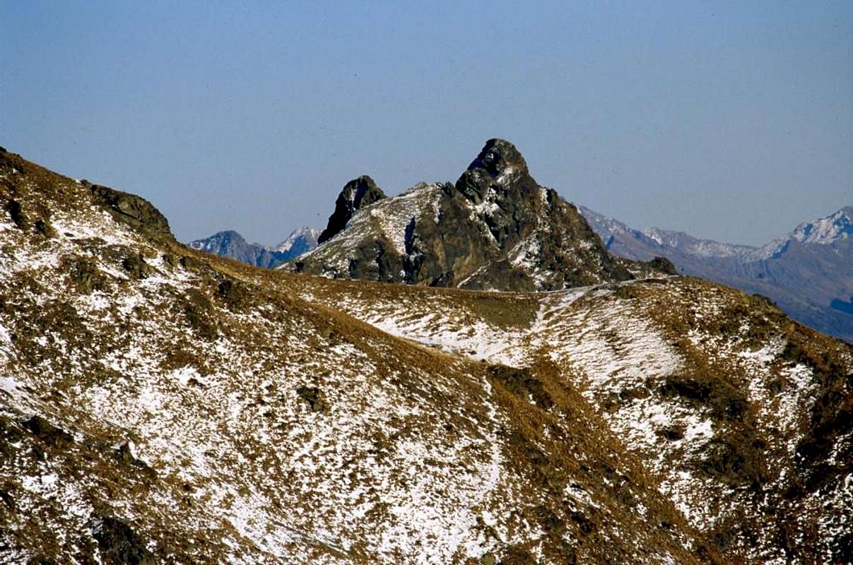 |
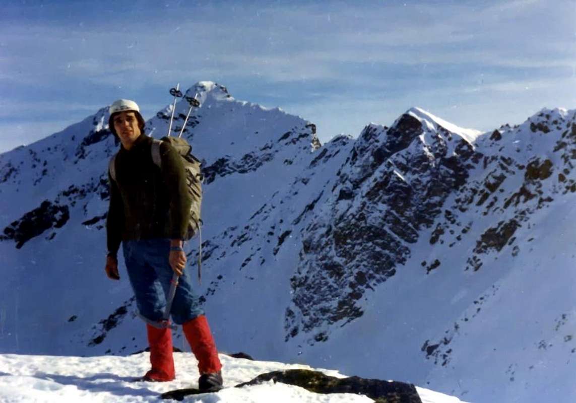
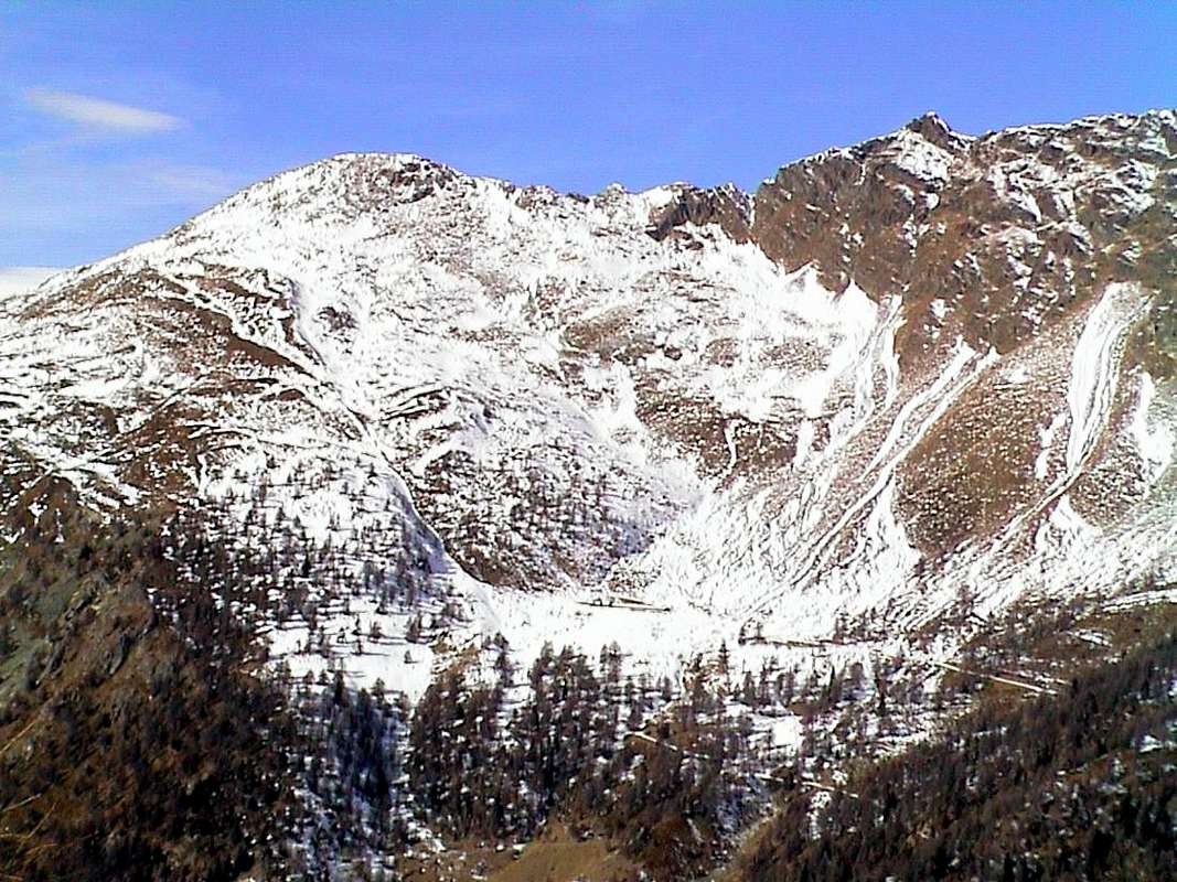
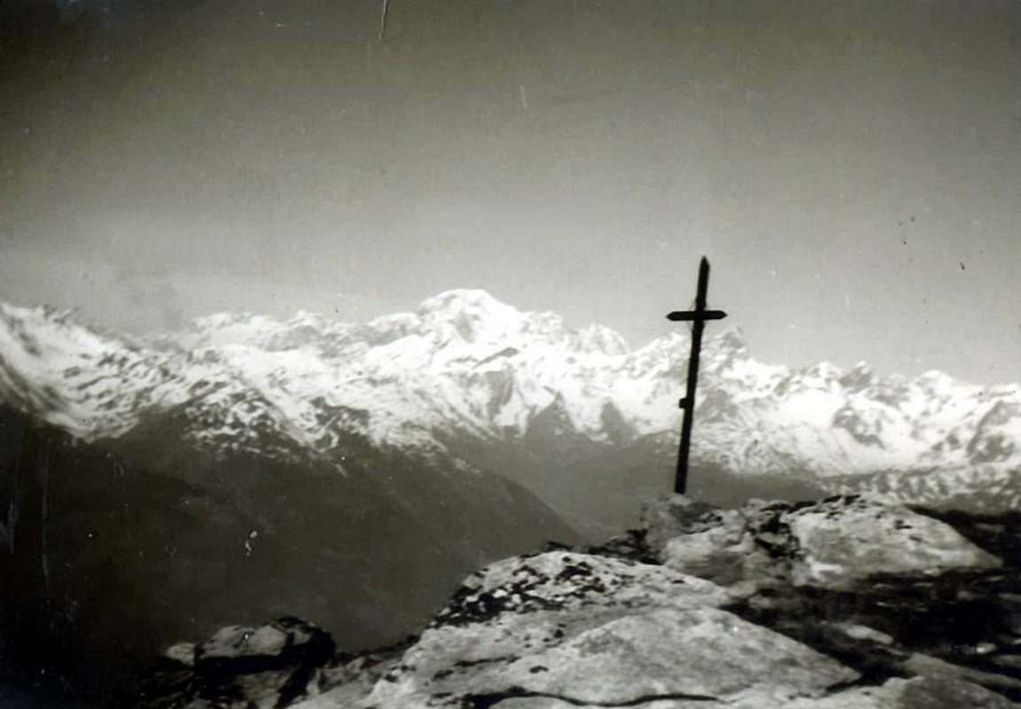
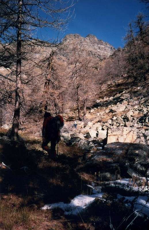
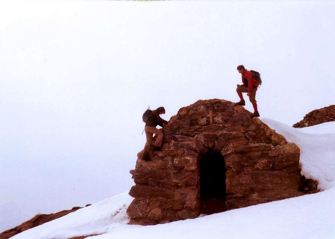
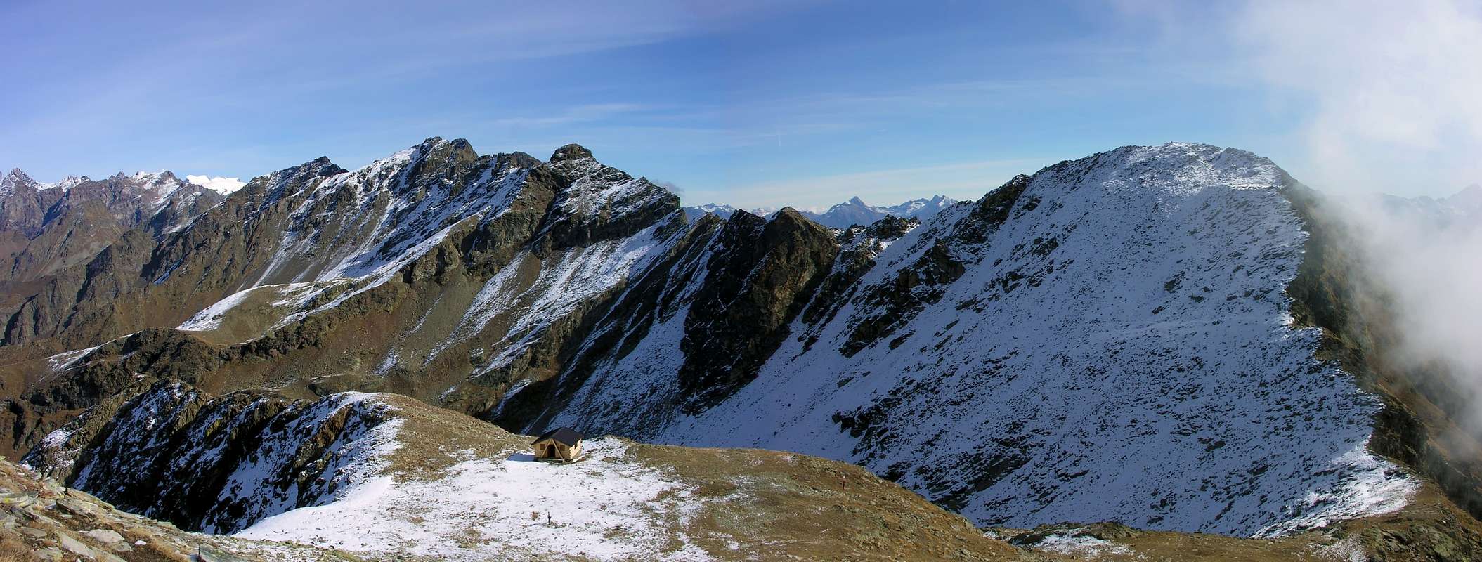
Also here to make contact and knowledge with this large area are enough half a dozen Trips. From the table here underexposed it can extrapolate what you want, but I'll try to give advice starting from the West (Roisan Common) to arrive at the gates of the Municipaly of Chatillon. From small Becca Roisan the watershed between the Central Valley of Baltea and Valpelline stands up to Becca Viou (2.856m) and, after the eponymous Hill, reaches Mont Mary (2.815m), now on the border between the Commons of Saint Christophe and Quart. There are three easy excursions where, paradoxically, the more tiresome is the one facing the Summit that is less high as that starting from Roisan Commune, passing in the first case to the Praperia or Praperiaz Pasture (1.737m) and in the second from Blavy Village (1.475m) by the first part of the farm dirt road to the Alpages of Viou (2.078m, 2.202m). We recommend the Becca Viou, traditional trip by Aosta, which, through the Hill of the same name at the "Bivouac Penne Nere" ("Black Feathers"; 2.730m), which allows a more easy climb. If desired, from the hill you can do in a short time the pairing with the Mont Mary for easy Crest Northwest, on which, however, care must be taken in the presence of hard snow or ice (usually at the beginning or end of the season after the first snowfall, but also to Viou we must be careful to the fact that to get to the hill there are clusters of snow). To Mary can be reached easily by the opposite side, that is, starting from the Farm Prayon (1.128m) and passing at the Village renovated Chamerod (1.615m); or from Trois Villes-Avisod (1.398m) that it reaches the Alp Sénevé or Cénevé (2.206m) in the homonymous Basin. In any case, the final part takes place through the easy but boring Slope Southeast. Almost better the simple outing with Snowshoes to Alp. Over the whole basin are raised a series of Summit (Tête d'Arpisson, Tip Sénevé, the two Tsaat a l'Etsena, Beaks of Fana) interspersed with steep hills (Fana) or even more inaccessible carvings (Tsaat a l'Etsena and others) that are more dangerous for the bad quality of the rock, with very rubbles and often grass, that not difficult. Mountaineers have turned to experts and who know the territory. Yet all have already been climbed in winter, but it did not because it makes text made by Climbers very practical on the area. Better to avoid. Beautiful instead the excursions, starting from here, to the "Passo Alto" (High Pass; 2.540m) or to the underlying Cornet Col (2.280m). The first allows a fairly easy and safe ascent towards the Becchi of Fana (2.951m) via the simple South Crest, while the second allows the crossing to the South in the direction of the Croix de Fana (2.212m), just above Trois Villes. This is reached by small Villages Davisod or Fonteil with paths, or from Flemagne Pastures (1.709m), now in Comba Dèche. The next watershed between Comba Dèche and to Verdzignola in Valpelline does not allow easy ascents for the same reasons mentioned above (Becchi of Fana, in the Eastern Tsaat a l'Etsena, Pointe Joseph Henry, Becca Conge), while the ridge that rises from Hill of St. Barthelemy towards this last is easy and safe with a fun final step above a notch. After Punta Verdona (2.868m; easy but with an exposed section at the start) on the watershed of the right (East) which descends from Mont Faroma two easy trips to the Grand Pays (2.726m) via Col Lèche or Lechy (2.298m) or while continuing on the watershed and, after the Col Collet (2.500m), the Becca d'Aveille or Avouille (2.623m), above the Village Effraz (1.478m). A short but delicate step between the antetop and Summit on North-northwest Ridge, where you have to use caution in the presence of new snow or ice. Passing by the other side, then crossing over the Valley of St. Barthélemy, get the Appendices Southern of the watershed between the valley and the Valtournanche, above the large sunny Conca-Basin Verrayes and St. Denis. Easy trips lead us to Becca d'Aver (2.469m) and crossing the nearby Cima di Longhede (2.416m), both easy hikes earlier in the season and also with Snowshoes starting from Champlong Village, at the nice Pond Loson. While from the ancient Village of Grand-Villa (1.423m) you can make beautiful walks to Mont Ander, Cols de Joux and Filone, instead from Champlong you can reach the Col des Bornes (1.781m) with relative crossing towards Torgnon Plan-Proz Rion (1.768m), feasible even in winter by Snowshoes. Always in Rackets, recommended by St. Denis-Semon (1.359m) the "Tour de St. Evence" better at night and maybe with the full moon, rising from Col St. Pantaléon (1.650m).
Viou-Mary Basin: from Aosta Town to Theuvex/Senin Fractions (766m, 782m) by Municipal Road; between the same starts North the path n°26 to old Parleyaz or Parléaz Village (1.274m; Napoleonic chimney, little Chapel). Continue into small walloon to Crete Pasture (1.398m) and in West, before crossing little torrent, to Blavy Hamlet (1.471/5m; nice tiny Church with beautiful sundial on wall); from this in North with path n° 25/105 to Varbre Pasture (1.674m; ruins) and dirt road (from Roisan or Saint Christophe Municipalities) in altitude 1.830 meters about. Crossing the same and torrent the muletrack turn East to Viou Pasture (2.078m; source below the house); continue into forest reaching the Tsa de Viou Alp (2.202m) and, in North after a morainic basin, Viou Hill (2.698m), nearby Penne Nere Bivouac (2.730m; always open), between Becca Viou (2.856m)/Mount Mary.
 |
 |
 |
 |
Cretallaz-Cerisolaz-Voltola(i)naz small Valley: from Saint Christophe Commune with Municipal Road to alternative above Lumian Village (894m); before leaving East the road to Crétallaz/Jeanceyaz/Morgonaz Hamlets, immrdiately after turn left or Northwest near a second fork 1.350 meters around. Leaving West the continuation to Blavy Hamlet, turn North and through a long Northeast diagonal on dirt road reach Voltola(i)naz Hamlet (1.492m), above Cerisolaz Village (1.159m).
1) - Crossing various brooks in Northeast to walloon floor on main torrent; along the same (borderland Saint Christophe/Quart Municipalities) directly, pathless, go up in North on very wild small walley ("Death or Moon Vallon") to Mount Mary (2.815m) Sourhern Slopes.
2) - (better) through a dirt above Parleyaz reach the thread of the long South-southwest Ridge and with rare traces to Summit.
Senevé Comba:
A) - from Saint Christophe Commune (573m) with Municipal Road to Sorreley (805m), Veynes (834m) Hamlets up to the alternative above Lumian Village (894m); leaving West the road to Parleyaz/Blavy Hamlets, continue in East to Crétallaz (1.087m), Jeanceyaz (1.092m), Morgonaz (1.205m) Hamlets and Prayon Farm (1.128m; just after, signal no transit); from this with dirt road in North to Les Ayettes (1.463m), Borelly (1.477m), Chamerod (1.615m), Les Preyes or Prèles (1.802m) Pastures. Always before with dirt, after path, passing an old in ruins alp and through the forest on a round promontory, with a Northern diagonal route in terminal part to Senevé Alpages (2.206m), below Mount Mary/Tête of Arpisson (2.856m).
B) - From Trois Villes-Avisod (1.398m), above Quart Commune, with dirt road in West-northwest, passing over Valseinte (1.399m), Chacotte (1.426m), Rapaille (1.541m) Pastures to Champchamoussin Desott, Damon (1.851m) Alps; from this with dirt, more in Northwest, to Lattaz (1.935m; semi in ruins)), Chavod (2.029m) and in West Senevé Alpages. From this last various ascents, all through steep but rotten and broken rocks, to
1) - Mount Mary (ski-mountaineering),
2) - Chamerod Top,
3) - Les Preles Summits,
4) - Chaudière Northeast Pass (2.746m) to Arpisson Vallon,
5) - Tête of Arpisson,
6) - Senevé Point (2.928m),
7) - Tsaat à l'Etsena Western (2.967/8m), Pass to Verdzignola Comba, Tsaat Eastern (2.974/5m) Summits,
8) - Fana Pass to Tall Dèche Comba and Fana Beaks (2.951m),
9) - Passo Alto (2.540m; good by snow rackets) to Middle Comba Dèche. Trois Villes Basin: from Trois Villes-Fonteil (1.423m; parking), in Northwest with unnumbered path to Croix de Fana (2.211m; even by snowshoes). Verrayes-Saint Dénis Northern Basin: from National Road SS.26 to Verrayes/Saint Dénis Municipalities through Regional Roads.
 |
 |
 |
A) - from Verrayes Municipal Road to Grand-Villa Hamlet (1.437m), Vieille (1.450m), Vencorère (1.563m; small parking), Prelaz (1.712m) Villages. From this in Southwest
1) - la Bourra Alp (1.748m), through dirt road, Mount de Pesse (1.708m) with path n° 3C;
2) - from Prelaz, pathless, to Mount Ander (1.931m) and with dirt to Filon Hill (1.894m).
3) -From Grand-Villa, with asphalt road, to Clavon (1.644m)/Petit Lozon or Loson/Low Lozon (1.525m; parking; pond) and from these to Fontane, Champlong Damon, Bornes Alps, Bornes Hill (1.774m), with path n° 1. From the Bornes Alp with path n° 1 in Northeast to fork 2.050 meters (path n° 2 from Gr. Villa), Becca of Aver (2.469m) and traverse in Southwest on ridge with path n° 16A to Cima of Longhede (2.416m; ski-mountaineering and snowshoes).
B) - From Chambave to Saint-Denis Communes with Regional Road and from this to Del (1.260m), Plau (1.305m), Semon (1.428m), Cheresoulaz (1.487m) Hamlets, Saint Pantaléon Hill (1.650m); from Semon through "Tour of Saint Evence" with dirt road-path n° 2 to Chapel (1.500m; beautiful by snow rackets, even in night) and in North-northwest to Sanctuary, just below the hill. Dèche Comba: from Trois Villes-Fonteil (1.423m; signal no transit) through farm dirt road, concomitant with path n° 3/4/5 in North to Nouva (1.733m), Brunier (1.761m), Clavel (1.994m), La Seyvaz (2.184m), with path n° 3/4 Valchourda (2.392m) Pastures; from this last in West-northwest with path n° 3/105 to
1) - Saint Barthélemy Hill (2.639m). In Southeast with path n° 4/105 to
2) - Léchy Hill (2.585m); from this in South on easy ridge, path n° 4, to
3) - Mount Grand Pays (2.724m; ski-mountaineering or snowshoes). From La Seyvaz in Southeast with path n° 5 to
4) - Collet Pass (2.500m) and in South with n° 5 up to the North Shoulder, after through steep and rotten rocks, to
5) - Becca d'Ave(u)ille (2.623m). From fork 2.100 meters around before La Seyvaz in Southwest with unnumbered path to
6) - to Cornet Hill (2.280m); descent on Senevé Comba. From Brunier Pasture before in South, after in Northwest with path n° 2 to
7) - Croix de Fana (2.211m). Variant: from Fonteil or from Trois Villes directly in North towards the junction with path n° 2 in altitude 1.570/80 meters around and through East-southeast Crest, towards the forest, to Summit.
Ander Southern Comba & Southwestern Appendages:
1) - from alternative 1.900 meters around in Southwest with path n° 5 to Joux Alpage (1.803m), below Mount Ander (1.931m). Before the pasture in East, pathless, to narrow Filone Hill (1.894m). Also continue towards La Pesse Pasture (1.600m) and with path n° 3/3C to La Bourra Hill (1.748m); from this easily in crest to Mont de Pesse (1.708m).
2) - From the Bridge after Issologne (1.514m) in Southwest with path n° 3 to La Pesse and same routes.
3) - From Nus Commune through Regional Road to Petit-Fénis, Blavy Hamlets (1.056m); from this through dirt road or path n° 3 to Le Noueus (1.181m), Praille (1.242m) Pastures. Continue in North, crossing a first, reaching a second dirt road and with path n° 3 to
4) - La Pesse Alp or with path n° 3B to
5) - Mount La Pesse.
6) - Starting directly from valley floor (Nus-Le Bourg 540m) in North with path n° 3 towards Plane (718m), Petit Fénis, Blavy Hamlets and to Prailles Pasture and previous route.
Anche qui per prendere contatto e conoscenza con questa larga area sono sufficienti una mezza dozzina di Gite. Dalla tabella qui sopraesposta ne potete extrapolare quante ne volete, ma un consiglio ve lo proviamo a dare partendo da Ovest (Comune di Roisan) per arrivare alle porte del Comune di Chatillon. Dalla piccola Becca di Roisan lo spartiacque tra la Valle Centrale della Dora e la Valpelline si rialza alla Becca di Viou (2.856m) e, dopo l'omonimo Colle, raggiunge il Mont Mary (2.815m), adesso al confine tra i Comuni di Saint Christophe e Quart. Sono tre facili escursioni dove, paradossalmente, la più faticosa risulta quella rivolta alla Cima meno elevata sia partendo da Roisan che da Blavy (1.475 m) passando nel primo caso per l'Alpe di Praperia o Praperiaz (1.737 m) e nel secondo tramite la prima parte della poderale per gli Alpeggi di Viou (2.078 m, 2.202 m). Consigliamo la Becca di Viou, gita tradizionale da Aosta, che, passando all'omonimo Colle presso il "Bivacco Penne Nere" (2.730 m), consente una più che facile salita; volendo, dal colle si può fare in breve tempo l'abbinamento con il Mont Mary per la facile Cresta Nordovest, sulla quale però bisogna fare attenzione in presenza di neve dura o ghiaccio (in genere ad inizio o fine stagione dopo le prime nevicate, ma anche alla Viou bisogna stare attenti al fatto che per arrivare al colle non ci siano gonfie di neve). Al Mary si può arrivare facilmente anche dal versante opposto, cioè partendo dalla Fattoria di Prayon (1.128 m) e passando presso il Villaggio ristrutturato di Chamerod (1.615 m); oppure da Trois Villes-Avisod (1.398 m) con poderale che anche essa raggiunge l'Alpe di Senevé o Cénevé (2.206 m) nell'omonima Conca. In ogni caso la parte finale si svolge tramite il facile ma noioso Versante Sudest. Quasi meglio la semplice gita con racchette da neve sino all'alpe. Sopra l'intero Bacino si alzano una serie di Sommità (Tête d'Arpisson, Punta di Senevé, le due Tsaat a l'Etsena, Becchi di Fana) intervallate da ripidi colli (Fana) od ancora più impervi intagli (Tsaat a l'Etsena ed altri) che sono più pericolose per la pessima qualità della roccia, con molto detrito e spesso erba, che non difficili; sono rivolte ad Alpinisti esperti e che conoscano bene il territorio. Eppure tutte sono già state salite in inverno, ma la cosa non fà testo perchè realizzate da Arrampicatori molto pratici della zona. Da evitarsi. Belle invece l'escursioni, da qui partendo, al Passo Alto (2.540 m) od al sottostante Col Cornet (2.280 m). Il primo permette una abbastanza facile e sicura salita ai Becchi di Fana (2.951 m) tramite la semplice Cresta Sud, mentre il secondo consente la traversata verso Mezzogiorno in direzione della Croix de Fana (2.212 m), proprio sopra Trois Villes. questa é raggiungibile anche dai piccoli Villaggi di Davisod o Fonteil con sentieri, oppure dall'Alpe Flemagne (1.709 m), ormai in Comba Dèche. Il successivo spartiacque tra la Comba Dèche e quella di Verdzignola in Valpelline non consente facili ascensioni (Becchi di Fana, Tsaat a l'Etsena Orientale, Punta Joseph Henry, Becca Conge), mentre la cresta che sale dal Colle di Saint Barthélemy a questa ultima é facile e sicura, con un divertente passaggio finale sopra ad un intaglio. Dopo la Punta di Verdona (2.868 m; facile ma con un tratto esposto all'inizio) sullo spartiacque di destra (Est) che scende dal Monte Faroma due facili gite al Gran Pays (2.726 m) passando dal Col Lèche o Lechy (2298 m), oppure sempre continuando sullo spartiacque e, dopo il Col Collet (2.500 m), alla Becca d'Aveille o Avouille (2.623 m), sopra il Villaggio di Effraz (1.478 m). Un breve passaggio delicato tra antecima e Vetta sulla Cresta Nord-nordovest, dove bisogna usare molta cautela in presenza di neve fresca o ghiaccio. Passando dall'altra parte, e quindi scavalcando la Valle di St. Barthélemy, arriviamo alle appendici Meridionali dello spartiacque tra questa valle e la Valtournanche, sopra l'ampia e soleggiata Conca-Bacino di Verrayes e St. Denis. Facili gite ci portano alla Becca d'Aver (2.469 m) ed in traversata alla vicina Cima di Longhede (2.416 m), entrambe escursioni d'inizio stagione ed anche con Racchette da neve partendo dal Villaggetto di Champlong (1.648 m), presso il grazioso Laghetto Loson. Mentre dall'antico Villaggio di Grand-Villa (1.423 m) si possono effettuare belle passeggiate al Mont Ander, Cols de Joux e del Filone, da Champlong invece si può raggiungere il Col des Bornes (1.781 m) con relativa traversata a Torgnon-Plan Proz Rion (1.768 m), fattibile anche d'inverno con Racchette da neve. Sempre in racchette, consigliabile da St. Denis-Semon (1.359 m) il "Tour de St. Evence", meglio in notturna e magari con luna piena, passando dal Col St. Pantaléon (1.650 m) alla Cappella.
 |
Campings
Remember that free camping is forbidden (except for emergency reasons, over 2.500m, from darkness until dawn).Mountain Condition
- Meteo: you can find all the needed informations at the official site of the Valle d'Aosta Region:
- Valle d'Aosta Meteo
Books and Maps
BOOKS:
- "Guida della Valpelline" de l'Abbè Joseph-Marie Henry - Societè Editrice Valdotaine 1925 II Edition e Collana Reprint Musumeci (1986).
- "Guida dei Monti d'Italia - Alpi Pennine (Vol. 2)" di Gino Buscaini - Club Alpino Italiano/Turing Club Italiano, Luglio 1970 (In Italian).
- "80 itinerari di Escursionismo Alpinismo e Sci Alpinismo in Valle d'Aosta", di Osvaldo Cardellina, Ed. Musumeci, Giugno 1977 (in Italian); seconda Ed. Luglio 1981; terza Ed. Luglio 1984; (in French), prima Ed. Febbraio 1978; seconda Ed. Marzo 1980.
- "Dove andiamo in montagna? in Valle d'Aosta" di Domenico Caresio Edit. Tipografia Ferraro Ivrea, Marzo 1996.
- "Ascensioni 1964-1969" Diario Alpinistico di Ilario Antonio Garzotto (unpublished).
 |
 |
MAPS:
- Kompass "Breuil/Cervinia-Zermatt" Carta turistica 1:50.000.
- I.G.C. Istituto Geografico Centrale "La Valpelline" (carta n° 115) Map 1:30.000.
- I.G.M. Istituto Geografico Militare - Map 1:25.000.
- L'Escursionista Ed. Rimini "Gran San Bernardo-Ollomont" (carta n° 5) 1: 25.000.
Important Information
- REGIONE AUTONOMA VALLE D'AOSTA the official site.
- FONDAZIONE MONTAGNA SICURA Villa Cameron, località Villard de la Palud n° 1 Courmayeur (AO) Tel: 39 0165 897602 - Fax: 39 0165 897647.
- SOCIETA' DELLE GUIDE DELLA VALPELLINE Etroubles-Strada Nazionale, n° 13 - Tel +39 0165 78559 - Valpelline-Loc Capoluogo, n° 1 - Tel +39 0165 713502 (AO) Italia.
- A.I.NE.VA. (Associazione Interregionale Neve e Valanghe).
Useful numbers
- Protezione Civile Valdostana località Aeroporto n° 7/A Saint Christophe (Ao) Tel. 0165-238222.
- Bollettino Valanghe Tel. 0165-776300.
- Bollettino Meteo Tel. 0165-44113.
- Unità Operativa di Soccorso Sanitario Tel. 118.