
-
 4664 Hits
-
 79.78% Score
-
 11 Votes
|
|
Mountain/Rock |
|---|---|
|
|
39.14767°N / 106.6418°W |
|
|
Hiking |
|
|
Summer |
|
|
13033 ft / 3972 m |
|
|
Overview
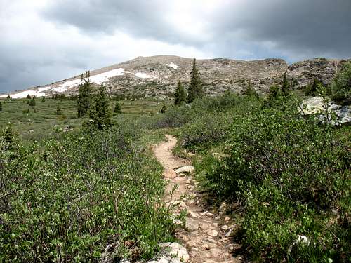
The Williams mountains is a small rugged sub-range of the Sawatch range west of Independence pass and north of Route 82. Every mountain above 13,000 feet in this range contains the name "Williams Mountain." Williams Mountain South C is the lowest one in this range and is the most southern peak. It is also the easiest one to hike and it is very accessible. The Elevation gain is approximately 2,550 feet, mostly on trail. The last 1,000 feet is up the broad ridge line on mainly grassy slopes. The final 200 feet is class 2+ with a possible class 3 move here and there depending on the route you pick.
Williams Mountain South C's trail head is directly across from Lost Mans Campground. If you find yourself camping here, this mountain is a great choice to hike since you don't have to drive to the trail head. There are only 9 or 10 spots to camp but not very many people choose to camp here. Most everybody tries to snag a site closer to Aspen.
The views from this peak are magnificent. The rugged maroon and white peaks of the Elk Range is unobstructed from the summit and is fairly close while many of the Sawatch peaks towers above you to the south and west.
Colorado Rank: 619
Prominence: 493 feet
Quadrangle: Thimble Rock
 Williams Mountain, the high point of the range Williams Mountain, the high point of the range |  Williams Mountain South A Williams Mountain South A |  Peak 12,995 Peak 12,995 |
 Castle Peak Castle Peak |  Pyramid Peak and the Maroon Bells Pyramid Peak and the Maroon Bells | 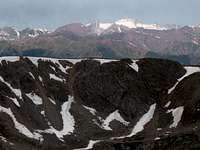 Snowmass Mountain Snowmass Mountain |
Getting There/Route
Take Route 82 East from Aspen for about 20 miles to the Lost Mans Campground.If your heading west, take Route 82 west over Independence Pass. The Trail Head is located just after a hairpin turn in the road.
There is a pullout on the north side of the road to park.
The Route
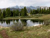
start by heading west along the Lost Man trail. The trail will shortly turn north after it crosses the creek. Shortly after take the the Midway trail. The trail has quite a few switchbacks as it heads up the mountainside. Once you reach the Hunter-Frying Pan Wilderness you have reached the top of the switchbacks. The trail takes you west to a small lake. Once you reach the lake head up the slope to the peak. The upper part of the mountain is enjoyable as you scramble up the boulders. This is mainly class 2+, but has a few class 3 moves.
 The start of the off trail ascent The start of the off trail ascent |  The boulderous top The boulderous top |