-
 807 Hits
-
 79.04% Score
-
 10 Votes
|
|
Mountain/Rock |
|---|---|
|
|
Hiking, Skiing |
|
|
Spring, Summer, Fall, Winter |
|
|
5814 ft / 1772 m |
|
|
Overview
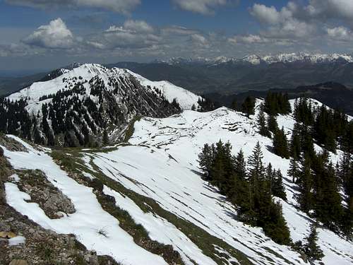
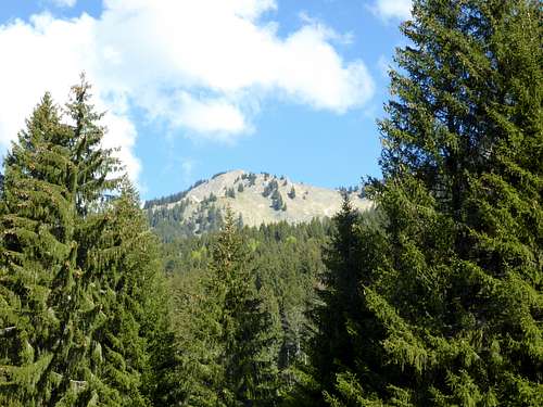
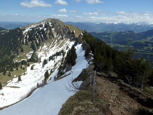
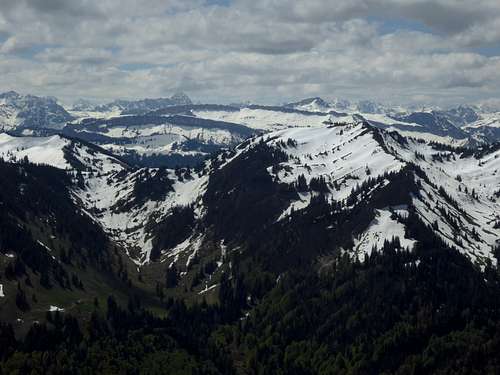
Among the many beautiful summits of Nagelfluhkette, part of Allgäu Alps, Buralpkopf is one of the less visited goals. Lying in between the crowded peaks of Hochgrat to the west, highest summit of Nagelfluhkette and well served with a cablecar and Stuiben – Mittag region, again well served with a cablecar to Mittag summit, Buralpkopf is mostly visited during a traverse of several Nagelfluh peaks.
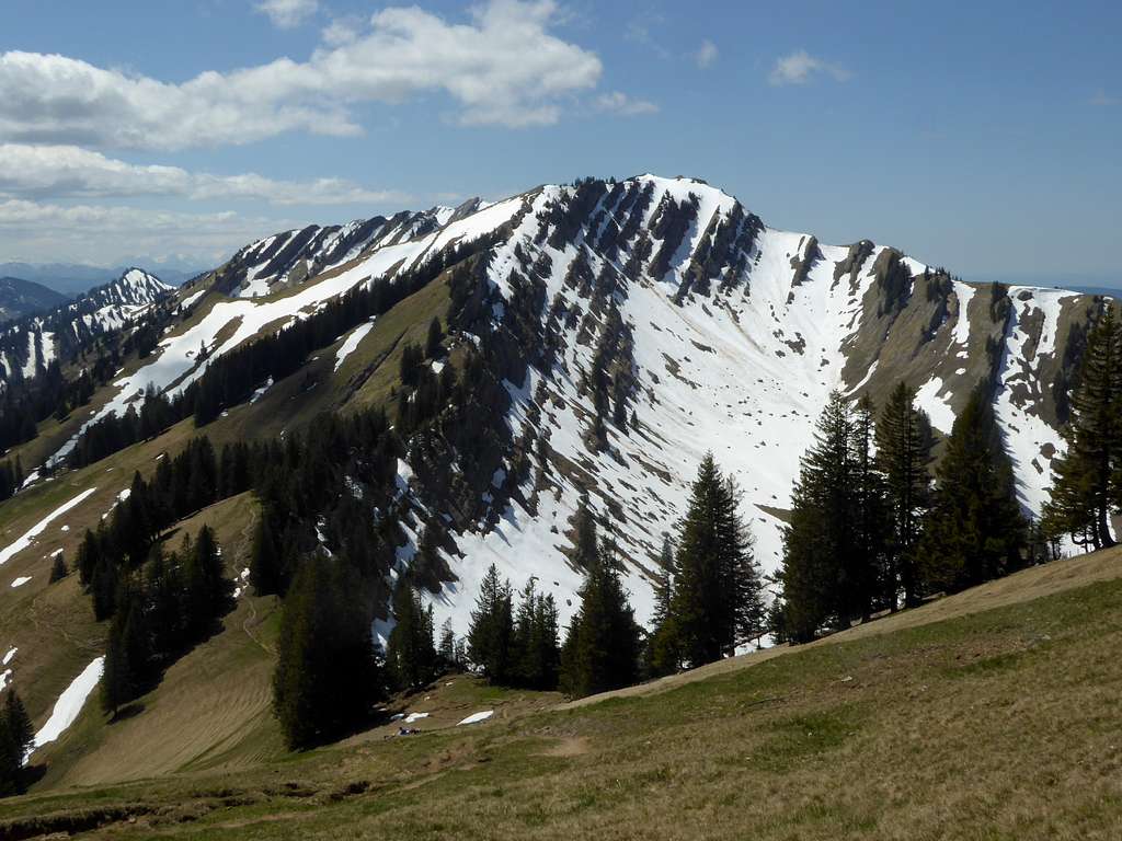
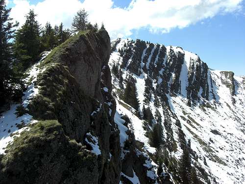
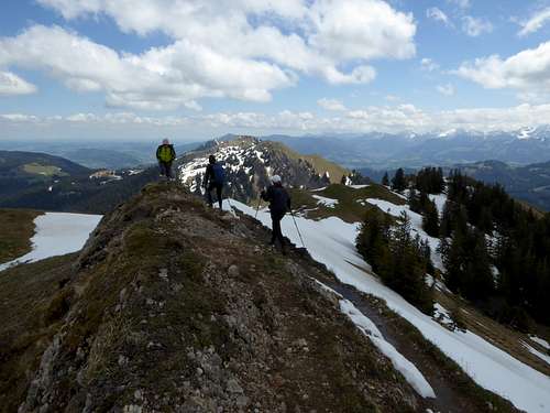
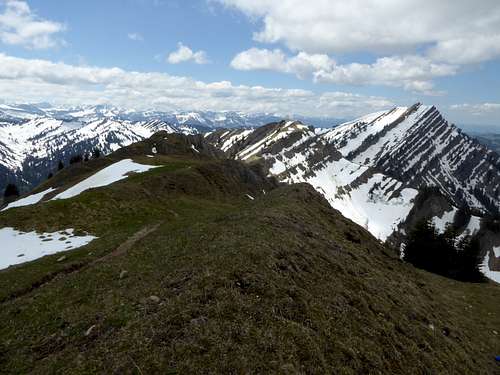
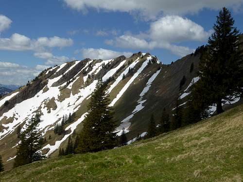
To the west, nearby Gündleskopf, some meters lower than Buralpkopf, is linked with our summit by a sharp rocky ridge. To the east Nagelfluh ridge drops down to Gatterstuiben col; next summit is Sederer Stuiben, a sidekick and secondary summit of Stuiben.
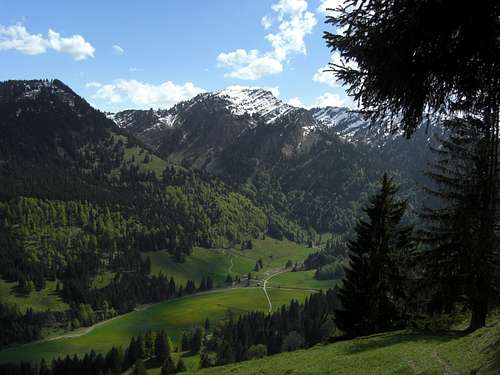
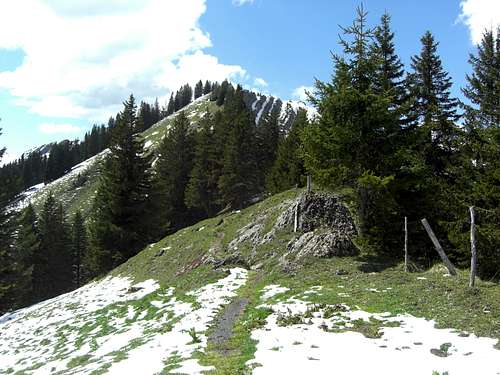
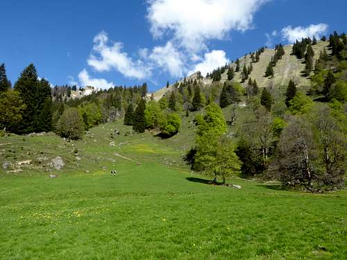
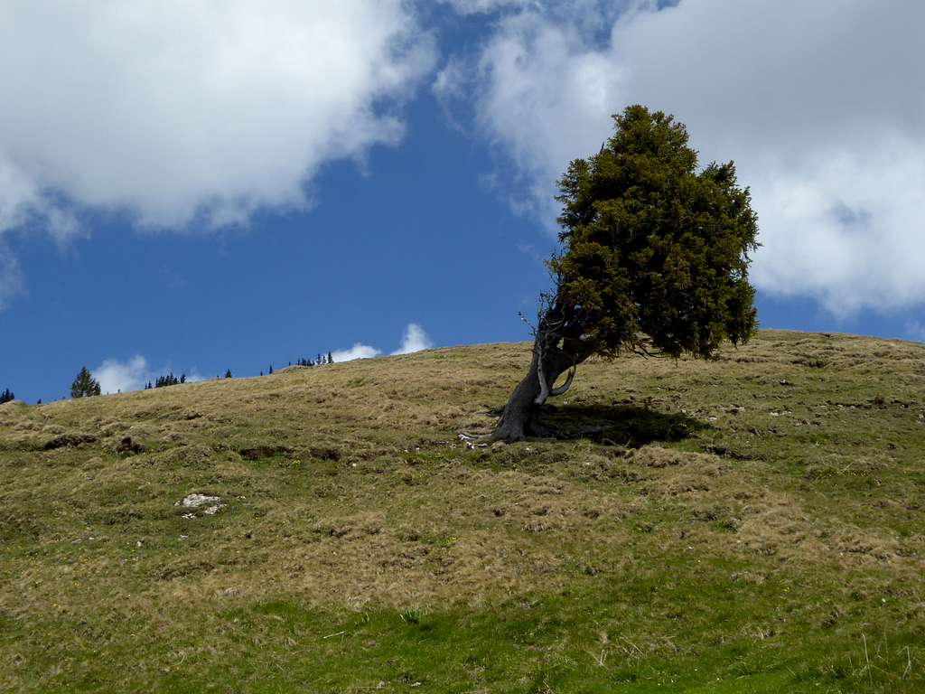
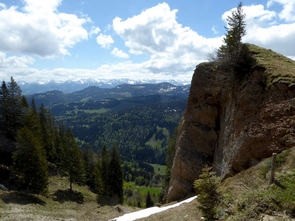
The southern slopes of Buralpkopf down to Gunzesried valley are beautiful and, in some parts, steep meadows and alpine woods. In late spring and early summer you will find an abundance of rare and splendid wildflowers, among them many rare orchids.
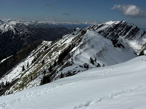
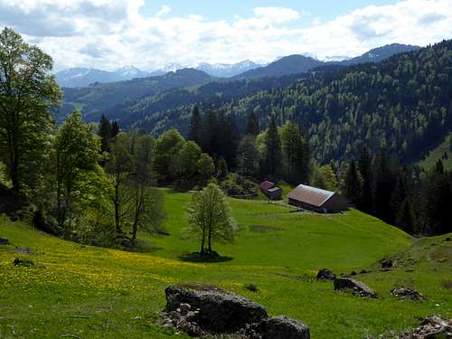
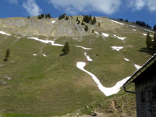
The north slopes, however, show some rock faces and, below, small cirques with Alm huts. The rocks are conglomerates of tertiary age. It is erosion gravel of the early alpine orogeny, transported to the northern foreland and later included and fold up in the late alpine orogenic processes.
Buralpkopf is a year round summit. In late spring, summer and autumn it is a beautiful hike. In winter and spring Buralpkopf is visited by ski tourists. The complete ski tour traverse of the Nagelfluh range is a wellknown and epic undertaking.
Getting There
- Trailhead for the northeastern ascent or for the traverse Mittag – Buralpkopf: Immenstadt / parking area Mittagbahn cableway.
- Trailhead for the northwestern trailhead: Hochgrat cablecar valley station.
- Trailhead for the south ascent: Gunzesried Amtsäge, parking area or parking area “Hintere Aualpe” along the toll road to Scheidwangalpe.
See the Nagelfluhkette area page for general advice how to get to the area.
By car:
Immenstadt can be reached on road B 19 coming from the north (Kempten) or on road number B 308, coming from the west / Austria or from the east (Bad Hindelang / Tannheim valley).
Follow Immenstadt center via B 308 and then the signposts for Mittagbahn cableway. There is a free parking area at the valley station.
For Hochgrat cable car valley station follow road number B 308 from Immenstadt to Oberstaufen. Turn on road number St2005 to the village of Weißach. Immediately after the village turn left on the road to Steibis village, go further on and reach the cable car valley station parking area.
For Gunzesried trailheads follow B 19 to Sonthofen exit. Follow the signposts for Gunzesried (Illerstraße and road number OA27). Cross the village of Gunzesried and proceed on Talstraße until you reach Gunzesried / Amtssäge.
There is a hiker parking area (day fee required) on the left at the beginning of the village.
Alternatively use the toll road from Gunzesried / Amtssäge to Alpe Scheidwang. There is a small (!) hiker parking area at Alpe Hintere Au, about 4 km from the toll station.
Public transportation
Next railway station for the southern trailheads is Blaichach / Allgäu.
Bus number 20 goes from Blaichach Bahnhof to Gunzesried Säge
The railway station for the northern trailhead is Immenstadt. The cablecar valley station of Mittag is about 800 m away.
Routes Overview
Most common routes to Buralpkopf start at the indicated southern trailheads within Gunzesried valley or use the traverse trail between Mittag summit to the east and Hochgrat summit to the west.
- From Alpe Vorsäß III in Gunzesried valley, about 2 km from the toll station (no parking area!) follow the forest road to Wieslealpe. Take the trail up to Gündlesalpe. Follow off-trail the south ridge of Buralpkopf to the summit.
- Alternatively go right at the first trail junction about 20 minutes from Alpe Vorsäß III and ascend to Gatteralpe and Gatterstuiben, the col between Sederer Stuiben and Buralpkopf. Take trail number R18 up the east ridge to Buralpkopf.
Buralpkopf is part of the full (or partly) traverse between Hochgrat to the west and Mittag summit to the east. It is marked “M”, is part of the long distance hiking trails “E4” and “E5” and partly marked as trail number R18. You can start and end this traverse easily at nearly each col, separating the many Nagelfluh summits (from west to east: Hochgrat, Rindalphorn, Gündleskopf, Buralpkopf, Sederer Stuiben, Stuiben, Steineberg, Mittag).
A long and I think rather unusual route starts at the valley station of Hochgrat cable car. It is narked trail R18. Follow the forest road of Ehrenschwanger valley to Hohe Brücke. Ascend to Rindalpe and to Gündlesscharte col. Ascend Gündleskopf via west ridge and proceed to Buralpkopf. Descend to Gatterstuiben, ascend Sederer Stuiben and leave the main ridge between Sederer Stuiben and Stuiben to the left, descending to Alpe Gund, Alpe Unteregg and return on the forest road of Ehrenschwanger valley to the trailhead. Long day!
Ski routes
North route
From parking area Hochgrat cable car into Ehrenschwanger valley, Rindalpe and Gündlesscharte col. Ascend Gündleskopf, descend to Gündlesalpe (south side) and ascend Buralpkopf via its south ridge. Descend like ascend, as the north side is wildlife protection area!
South routes
- AlpeVorsäß III to Gatteralpe. Ascend Buralpkopf via the slopes of its southeast cirque and the upper south ridge.
- Parking area Hintere Aualpe to Gündlesscharte col, Gündleskopf via west ridge. Downhill to Gündlesalpe and ascend to Buralpkopf via south ridge.
These routes can be linked together to a loop route. Please note that the toll road Gunzesried – Scheidwangalpe is closed until end of may!
The very epic but wellknown ski traverse route from Hochgrat to Stuiben or Mittag includes Buralpkopf as follows (from west to east):
Gündlesscharte col – Gündleskopf via west ridge – downhill to Gündlesalpe – ascend to Buralpkopf via south ridge – downhill via upper south ridge and southeast cirque of Buralpkopf to Gatteralpe – ascend to Sederer Stuiben via Gatterstuiben col.
Red Tape & Accommodation
Buralpkopf is part of “Naturpark Nagelfluhkette”. Naturpark Nagelfluhkette is not exactly a protected National Park. Nevertheless there are regulations which should be followed and which are indicated at several locations with a variety of restrictions. These are mainly seasonal blocked or regulated access to defined areas. These regulations are mainly for the protection of wildlife and wildflowers.
A winter wildlife protection area is located on the whole north side of Buralpkopf, it stretches from Gündleskopf to the west to Sederer Stuiben to the east; the entry is forbidden for ski touring and snow shoe hikers during the whole winter and spring, as long as there is a complete snow cover. The hiking and skiing routes, however, do not cross this (very steep) area and can be used without restriction. You find these areas on the Alpenverein map, indicated in the "Maps & Guid Books" section below. Please respect them, stay on the trails and marked routes or keep out of blocked areas (mainly in winter).
Accommodation The following towns and villages offer a great variety of accommodation: Immenstadt Sonthofen Gunzesried Ofterschwang
Gear & Mountain Condition
Buralpkopf is a year round summit. In late spring, summer and autumn it is an easy hiking summit.
The ridge traverse to Gündleskopf and to Sederer Stuiben has some short and easy rock scrambling parts.
You need normal hiking gear and should be able to scramble up or down some steep rocks with the help of fixed steel ropes. In winter and spring you need full ski tour and avalanche gear. Check the Bavarian avalanche bulletin here.
Weather condition:
Valley weather, Immenstadt
Mountain weather Buralpkopf
Map & Guides
Deutscher Alpenverein:
Allgäuer Voralpen West, Nagelfluhkette, Hörnergruppe scale 1 : 25.000, number BY 1, 2012,
with trails, ski routes and UTM grid
Landesamt für Vermessung und Geoinformation Bayern:
Lindau - Naturpark Nagelfluhkette; scale 1 : 50.000, number UK50-45, 2012,
with trails and UTM grid
Guide Books Dieter Seibert: Allgäuer Alpen und Ammergauer Alpen, alpin; Bergverlag Rudolf Rother, München, 13th edition, 2013
Dieter Seibert, Heinz Groth: Allgäuer Alpen, Gebietsführer für Wanderer und Bergsteiger; Bergverlag Rudolf Rother, München, 9th edition, 1999 – actually out of stock but available as antiquarian book
Dieter Seibert: Allgäu 3, Oberstaufemn und Westallgäu; Rother Wanderführer, München, 6th edition, 2014


