-
 8107 Hits
-
 72.08% Score
-
 2 Votes
|
|
Trailhead |
|---|---|
|
|
46.41437°N / 114.27038°W |
|
|
Ravalli |
|
|
Spring, Summer, Fall |
|
|
5762 ft / 1756 m |
Climbers’ Access for Gash Point
From Highway 93 turn west on 5th Avenue in Victor (1 block south of Main Street) and go .9 miles to the Tee.
Turn left (south) onto Pleasant View. Follow Pleasant View to the end of the pavement.
Note: Pleasant View first appears to end when it reaches Red Crow Road but resumes (to the right) in a 100 yards.
The trailhead is approximately 9.1 miles from the end of the pavement.
Stay on the main road as you pass several private residences and other turns off. When you have gone about 2.25 miles from the point the road turned to gravel, you will come to a junction. Currently it is not marked. The road going to your left (west) is FR 1325, but you want to go straight ahead (north) onto FR 737.
About 5 miles from the junction, the road gets a little rougher but is still easily passable by a passenger car.
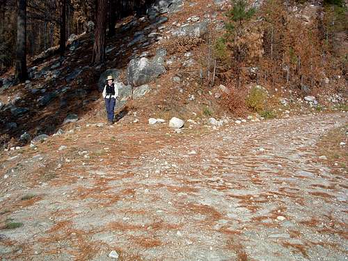
From this point he road continues upward before proceeding downhill. As you're traveling downhill, look sharp in a left-turning switchback for a trail leading to your right (west). That is the trailhead for Gash Point.
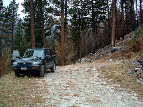
This wide space in the road has only enough parking for a car or two, but that should be plenty given the low use of this trail.
From US Highway 93 go west on Bear Creek (about 3 miles south of Victor) for 2.3 miles to where it “tees” into Red Crow Road.
Turn Right (north) onto Red Crow Road and follow it for about 2 miles.
Turn left (west) onto Pleasant View Drive and follow it as it makes several right and left 90 degree turns. After about 1.8 miles it turns into a good gravel road.
The trailhead is approximately 9.1 miles from the end of the pavement.
Stay on the main road as you pass several private residences and other turns off. When you have gone about 2.25 miles from the point the road turned to gravel, you will come to a junction. Currently it is not marked. The road going to your left (west) is FR 1325, but you want to go straight ahead (north) onto FR 737.
About 5 miles from the junction, the road gets a little rougher but is still easily passable by a passenger car.
From this point he road continues upward before proceeding downhill. As you're traveling downhill, look sharp in a left-turning switchback for a trail leading to your right (west). That is the trailhead for Gash Point.
This wide space in the road has only enough parking for a car or two, but that should be plenty given the low use of this trail.
For information about the climbers' route accessed from this trailhead, see the link included in the picture's description.
 |
|---|


