
-
 9783 Hits
-
 84.82% Score
-
 19 Votes
|
|
Mountain/Rock |
|---|---|
|
|
38.00450°N / 107.9303°W |
|
|
San Miguel |
|
|
Hiking, Mountaineering |
|
|
Spring, Summer, Fall, Winter |
|
|
12311 ft / 3752 m |
|
|
Overview
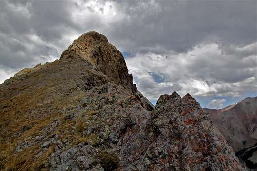
Point 12,311 feet
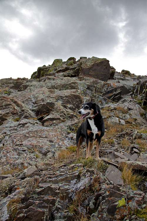
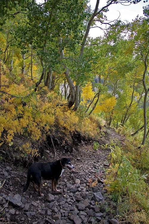
Duchess coming down from Point 12,311
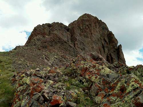
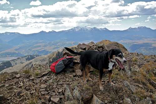
rugged peak
Name: List of John gives it a name of "S 10". The letter "S" is commonly used for many peaks in this area. "S" standing for Sneffels, the highest point in the area. However other resources = 13ers.com, attributes the name of "S 10" to Peak 13,020, located 2 miles north of Peak 12,311, and its proximate parent.
There is not much information on-line regarding Peak 12311 (I found only List of John, and peak bagger - see external link section below). Guide to Colorado Mountains with Robert Ormes does not mention it. There are simply way too many peaks in Colorado. Despite the lack of advertising and popularity it offers a very nice scramble, excellent views, and overview of rarely explored western side of Mount Sneffels range.
Don Scarmuzzi in his Telluride Trails provides a nice description of the hike up Whipple Mountain (11,922 feet) and Whipple Mountain Trail. You can use the information for gaining the top of the pass of Whipple Mountain trail (= pass between Whipple Mountain and point 12,311). Off note, you actually have to descend from the Whipple Mountain Pass for the summit of Whipple Mountain in the opposite direction of Peak 12,311. Whipple Mountain is marked on maps, but looks really unimpressive from this approach.
Colorado Rank: 1132
Rise: 331 feet
Saddle: 11,980 feet
Parent Lineage: 13,020
Isolation: 2.03 miles
Wilderness: Mount Sneffels
Class: 2
How To Get There
From Telluride, travel approximately 3.5 miles west on State Hwy 145 right (north) onto the Last Dollar Road, Forest Road # 638. Proceed for approximately 5.5 miles north, past the airport and through the Greyhead subdivision, to the Whipple Mountain Trailhead. Look for the trailhead sign on the east side of Forest Road # 638. High clearance, 4 WD vehicles are recommended.
Whipple Mountain Trail
This trail is located close to Telluride, Colorado. It is well marked trail # 419. The trailhead is located off Last Dollar Road, and is especially popular in the autumn when aspens are turning gold.Whipple Mountain Trail is 7.2 miles hike accessible via two trailheads: a western trailhead (Upper Whipple) featuring a 100 feet gain in elevation, and eastern trailhead (Lower Whipple) near Deep Creek road with an elevation gain of 2,900 feet.
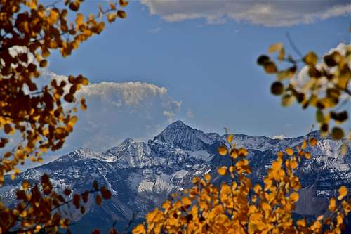
From the Westward trailhead parking area this hike climbs gradually to the east through the Mount Sneffels Wilderness and offers outstanding views of Mt. Wilson and the La Salle mountain range in Utah. After about 3/4 mile hike uphills it descends into the West Fork of Deep Creek. The trail continues through thick aspen groves near the avalanche slide path to the north. The trail then enters conifer forest as it continues to climb to the Whipple Mountain saddle, raising 11,600 feet. Eventually it drops into a large meadow and meets up with Deep Creek Trail # 418. Descending on Deep Creek Trail leads to a junction for Iron Mountain Road where you continue hiking uphill for a short distance. Continuing on Deep Creek trail makes its way towards Telluride and finishes at the Last Dollar Road eastern trailhead.
 Wilson Peak as seen from the trail Wilson Peak as seen from the trail | 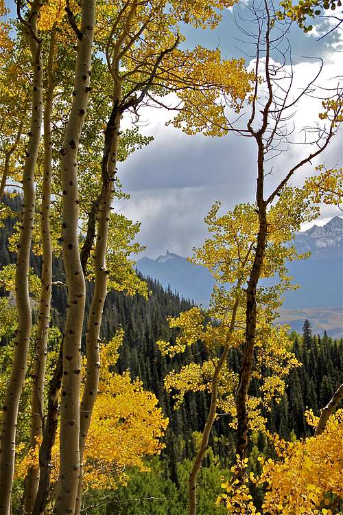 Tiny Lizard Head Tiny Lizard Head |
 Whipple Trail #419 Whipple Trail #419 | 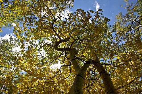 Aspens turning gold Aspens turning gold |
Route
The route is pretty straight forward. From the top of the Whipple Mountain Pass turn north and follow the faint trail/or bushwhack at places on the ridge. Soon, the Point 12,311 will come into the view. Look for the path of least resistance. I hiked it with my dog and decided to circumvent around the western side of the mountain until I found an easier path and we ascended relatively stable rock to the summit. There was a long summit ridge we had to negotiate, nothing too technically difficult. There was a small cairn, no summit register (and if you find old sunglasses, those were mine:).
 Summit of Point 12,311 | 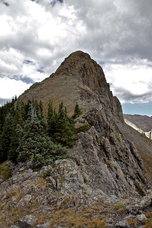 Rugged Point 12,311 |
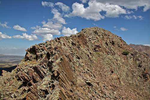 Summit Ridge | 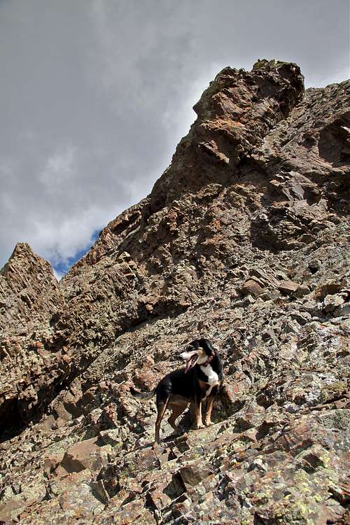 Scrambling up Point 12,311 |