
-
 864 Hits
-
 80.49% Score
-
 12 Votes
|
|
Route |
|---|---|
|
|
45.65531°N / 6.95206°E |
|
|
Hiking |
|
|
Summer, Fall |
|
|
E |
|
|
Overview
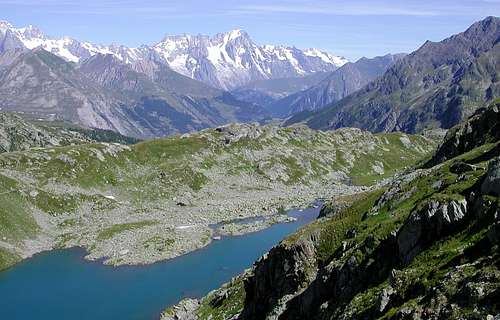
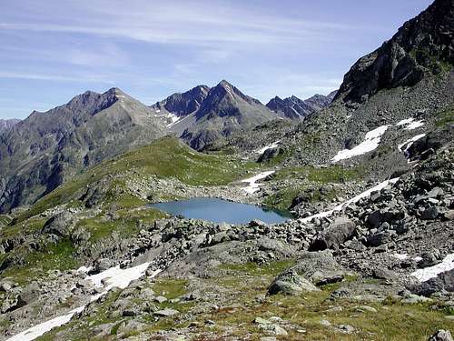
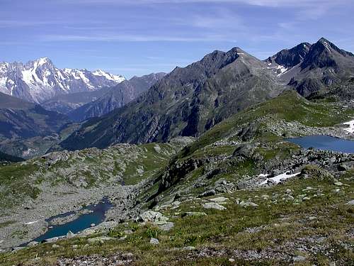
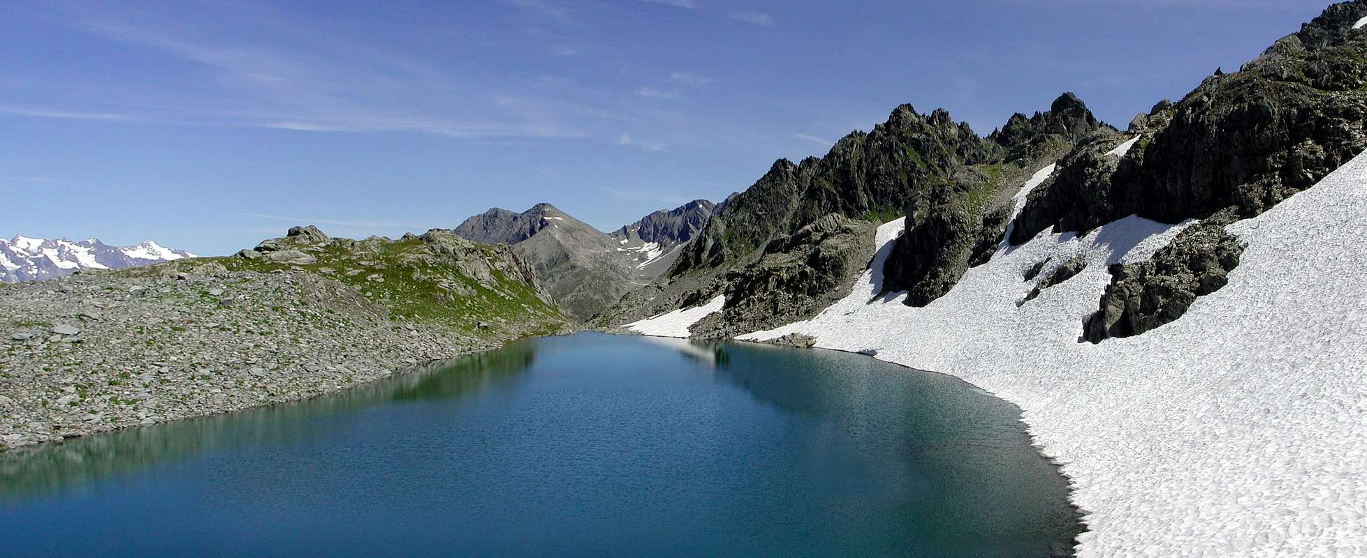
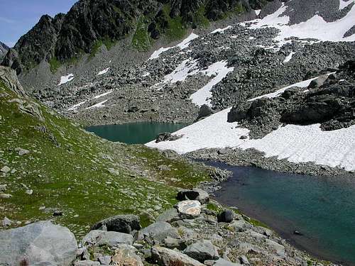
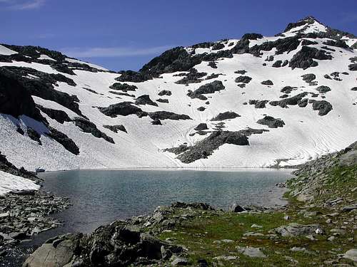
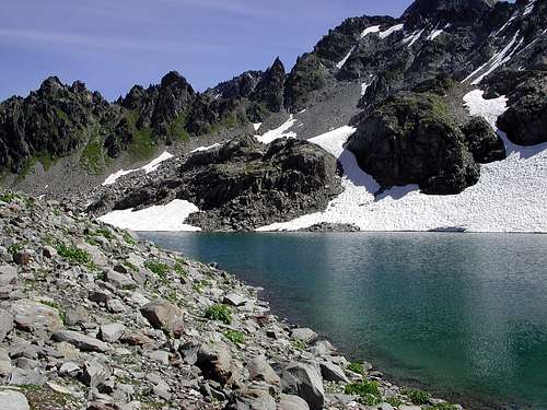
Series of four beautiful lakes between the homonymous Punta del Tachuy and Mont Charvet and located on the border between France and Italy, located above the magnificent lakes of Bella Comba and rarely and unjustly little frequented because little known (almost also absent on the one located in the hamlet of La Joux) and difficult to reach given the length of the route. From the lakes you can enjoy an excellent view of the Colmet, Lussè and Grande Assaly Mountains and the underlying Bella Comba valley while the Mont Blanc Group is to the North West.
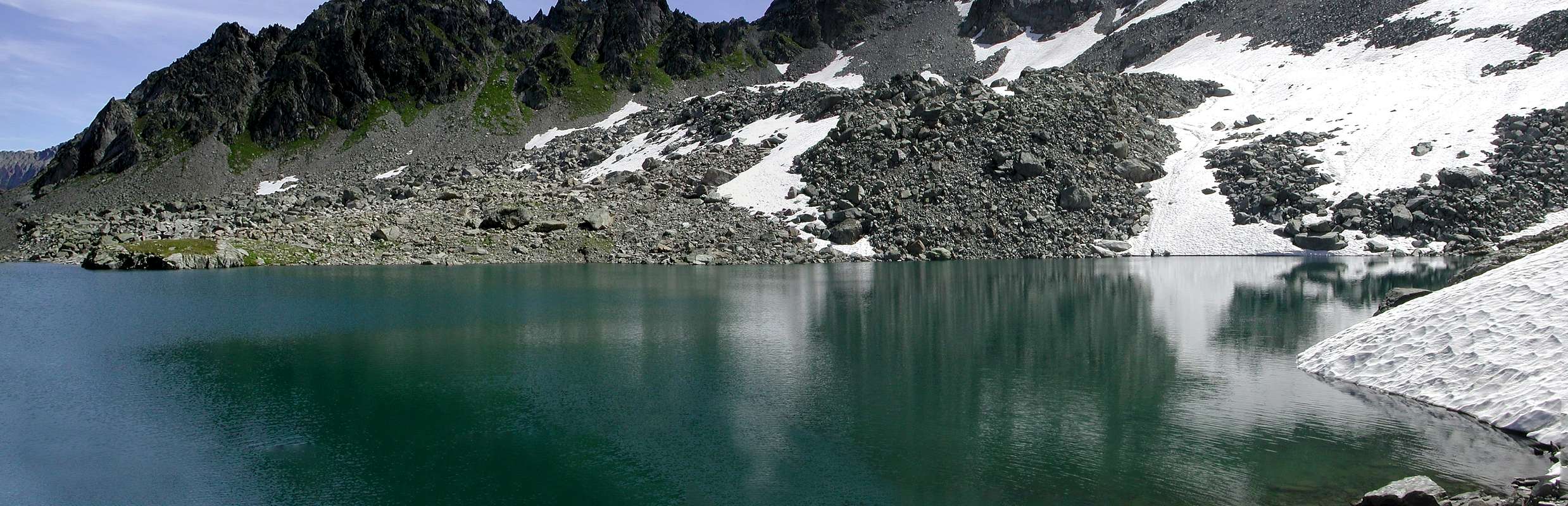 |
Serie di quattro bellissimi laghi tra l’omonima Punta del Tachuy e il Mont Charvet e posti al confine tra la Francia e l’Italia, siti al di sopra dei magnifici laghi di Bella Comba e raramente e ingiustamente poco frequentati perché poco conosciuti (segnaletica pressoché inesistente anche su quella posta alla frazione di La Joux) e faticosi da raggiungere visto la lunghezza del percorso. Dai laghi si gode un ottimo panorama sui Monti Colmet, Lussè e Grande Assaly e sul sottostante vallone di Bella Comba mentre a Nord Ovest il Gruppo del Monte Bianco.
Getting There
BY CAR:
- From Torino, Milano, etc: Motorway A5. Exit at Morgex. Drive to the near Pré Saint Didier Municipality. Follow the directions to the South for Valle di La Thuile.
- From Switzerland: through the Grand Saint Bernard Tunnel or the namesake Pass. Drive to Aosta, then follow the direction for Courmayeur on SS.26. Just after Pré Saint Didier Municipality, turn to the left, always South, in the direction of La Thuile Valley.
- From France: through Mont Blanc Tunnel or Petit St. Bernard Pass. It isn't necessary to take Motorway A5: you can drive on SS.26, in the direction of Aosta. Before arriving at the Pré Saint Didier Municipality, turn right or South following the sign for La Thuile Valley.
 |
 |
 |
 |
 |
 |
Roads Route
From the exit of Motorway A5 (921m) neighboring Morgex Municipality, continue for about 3 km on SS.26 towards Pré Saint Didier (1.017m). SS.26 becomes the main street of the small city and then continues toward Colle del Piccolo San Bernardo (2.188m). After several hairpins, and past the Villages of Elevaz (1.302m) and La Balme (1.309m) reach the famous ski resort of La Thuile (1.441m). Turn left on the bridge that crosses Dora di La Thuile in the direction of the Village of La Joux. After about 2 km from the bridge, having past a large square, cross another bridge on the Dora to the right. (From this point on, the road, although paved, is quite narrow. Proceed with caution.) After 1 km get to La Joux (1.607m) and park in one of the two parking lots, which are large but sometimes fill up in August. For this reason, access past the second bridge is limited at certain times. Be there before 9 AM to avoid problems, or take the shuttle bus to cover the last stretch.
 |
 |
 |
 |
 |
 |
Dall'uscita dell'Autostrada A5 nei pressi del Comune di Morgex (921 m) proseguire per circa 3 km lungo la SS.26 verso il Paese di Pré Saint Didier (1.017 m); addentrarsi nella via centrale del paese e proseguire sempre lungo la SS.26 che porta al Colle del Piccolo San Bernardo (2.188 m). Dopo numerosi tornanti e, superate le Frazioni di Elevaz (1.302 m) e La Balme (1.309 m), si giunge alla famosa località sciistica di La Thuile (1.441 m); svoltare a destra sul ponte che attraversa la Dora di La Thuile e dirigersi verso la Frazione di La Joux (1.607 m). Dopo circa 2 km e superato un ampio piazzale, riattraversare sempre sulla destra un altro ponte sulla Dora (attenzione da questo punto la strada, seppur asfaltata, è molto stretta, procedere con cautela) e dopo circa 1 km. si giunge a La Joux (1.607 m); qui posteggiare l'auto in uno dei due ampi parcheggi a volte insufficienti nel mese di agosto. Per questo motivo, relativamente al tratto dopo il secondo ponte, c'è una limitazione oraria all'accesso dei mezzi privati, che comunque non tocca chi arriva prima delle 9. In alternativa esiste comunque una navetta bus.
Route
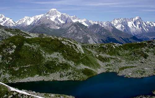
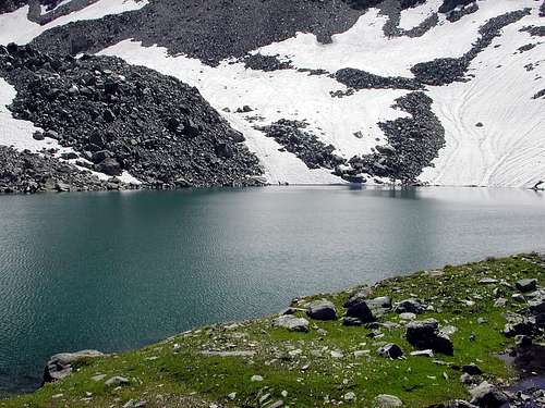
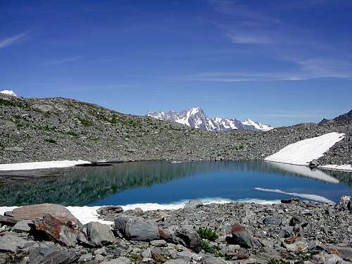
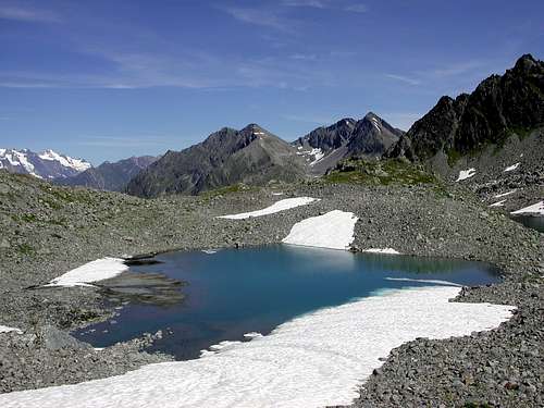
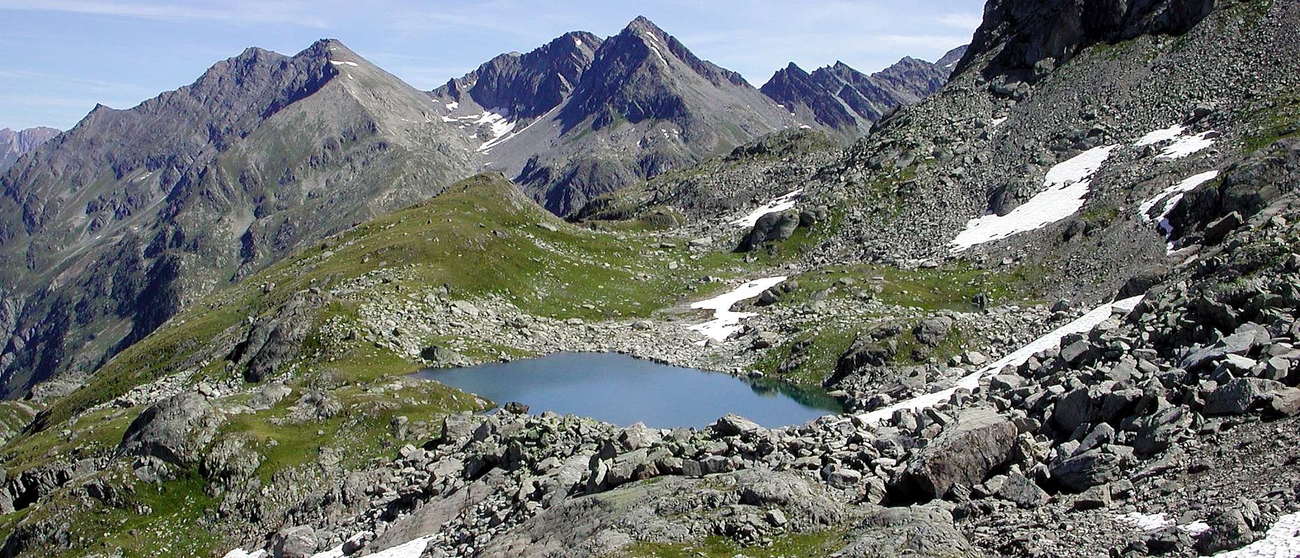
The itinerary is practically identical to the one that leads to the Albert Deffeyes refuge and the Rutor lakes up to the crossroads located above the three magnificent Rutor waterfalls at about (2.110m of altitude) from this point continue for about 0h'10 on the path, almost flat, bearing the n° 8 that overlooks the third waterfall until you reach a small wooden bridge (2.133m) that crosses the stream that descends from the glacier, after passing two fairly steep sections you reach the Vallone di Bella Comba, from the end of the second section, a magnificent view from the Aiguille du Glacier to Mont Dolent. Continue along the valley, here the path climbs more gently and passes the ruins of an ancient hunters' shelter (2.315m) and another small bridge leading to the Albert Deffeyes refuge. From this point, after about 0h'25/0h'30 you reach the first lake (2.373m), the two lakes are separated by a short stretch of stream, and after 0h’05/0h’10 the second lake located at (2.375m), 3h'00/3h'30 from La Joux.
 |
L’itinerario e praticamente identico a quello che porta al rifugio Albert Deffeyes e ai Laghi del Rutor sino al bivio posto sopra le tre magnifiche cascate del Rutor a circa (2.110 m di quota) da questo punto si prosegue per circa 0h'10 sul sentiero, quasi pianeggiante, recante il n° 8 che sovrasta la terza cascata sino a raggiungere un piccolo ponte in legno (2.133 m) che oltrepassa il torrente che scende dal ghiacciaio, dopo aver superato due tratti abbastanza ripidi si raggiunge il Vallone di Bella Comba, dalla fine del secondo tratto, vista grandiosa dall’Aiguille du Glacier al Mont Dolent. Continuare lungo il vallone, qui il sentiero sale più dolcemente e superate le rovine di un antico ricovero per cacciatori (2.315m) e un altro piccolo ponte conducente al rifugio Albert Deffeyes. Da questo punto dopo circa 0h'25/0h'30 si raggiunge il primo lago (2.373m), i due laghi sono separati da un breve tratto di torrente, e dopo 0h'05/0h'10 il secondo lago posto a (2.375 m), 3h'00/3h'30 da La Joux.
Specific Route
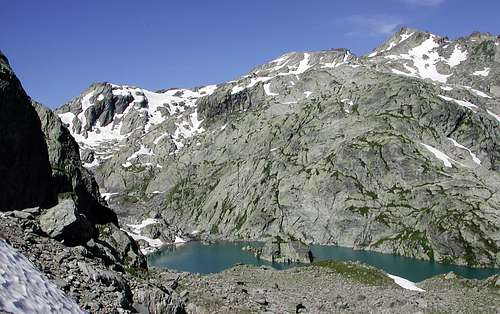
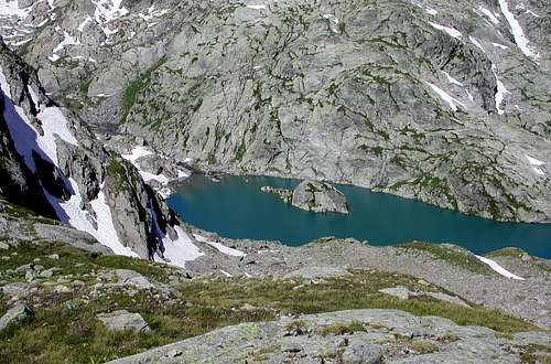
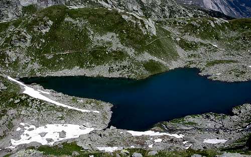
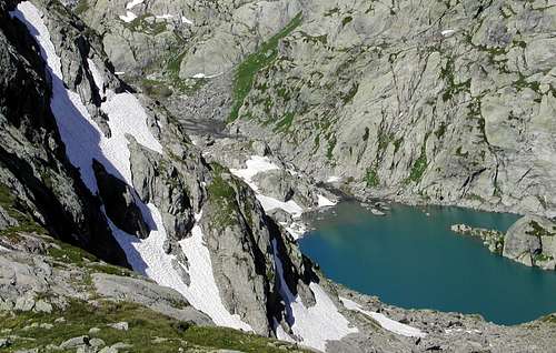
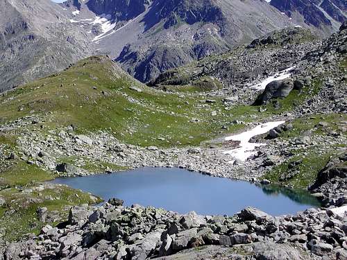
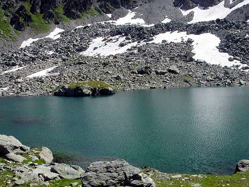
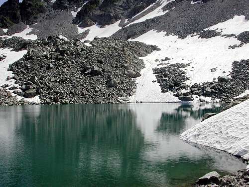
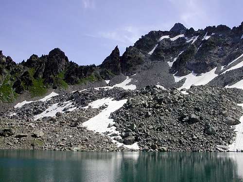
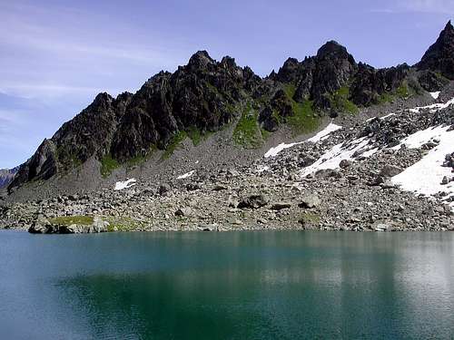
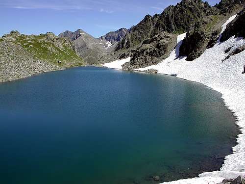
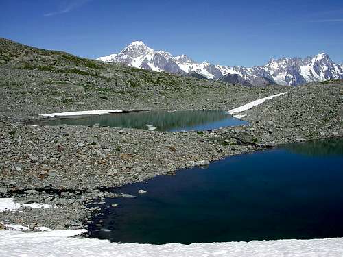
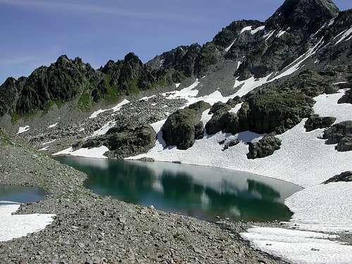
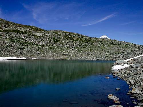
Between the first and second lakes of Bella Comba, start the ascent along the rocky spur along the rocky spur and after a traverse on the stony ground, head towards Colle del Tachuy (2.671m) until you reach the second lake (2.560m, the largest) 0h'25/0h'30 from the Bella Comba lakes (2.573m/2.575m), the first (2.517m) can be reached after about 0h'10 east of the second lake. From the second lake go along the north shore and after another 0h'10 you will be at the third lake (2.585m), the fourth lake (2.586m) is a few meters away north of the third lake, (3'h35/4h'00 ) from La Joux.
 |
 |
 |
 |
 |
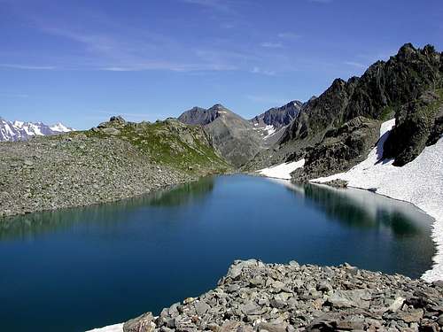 |
Tra il primo e il secondo lago di Bella Comba iniziare la salita, su tracce di sentiero poco visibili, lungo lo sperone roccioso e dopo un traverso sulla pietraia dirigersi in direzione del Colle del Tachuy (2.671 m) fino a raggiungere il secondo lago (2.560 m, il più grande) 0h'25/0h'30 dai Laghi di Bella Comba (2.573 m/2.575 m), il primo (2.517 m) è raggiungibile dopo circa 0h'10 a est del secondo lago. Dal secondo lago costeggiare la sponda a nord e dopo altri 0h'10 sarete al terzo lago (2.585 m), il quarto lago (2.586 m) è a pochi metri di distanza a nord del terzo lago, (3'h35/4h'00) da La Joux.
Difficuty
The itinerary is considered E.
L'itinerario è considerato E.
Equipment
For Hiking.
Da Escursionismo.
 |
 |
 |
 |
 |
 |
Important Information
- REGIONE AUTONOMA VALLE D'AOSTA the official site.
- FONDAZIONE MONTAGNA SICURA Villa Cameron, località Villard de la Palud n° 1 Courmayeur (AO) Tel: 39 0165 897602 - Fax: 39 0165 897647.
- COMPAGNIE DES GUIDES RUTOR Fraz. Entrèves tel/fax 0039.0165.885574 e-mail Guidealpine@lathuile.it
- A.I.NE.VA. (Associazione Interregionale Neve e Valanghe).
Useful numbers
- Protezione Civile Valdostana località Aeroporto n° 7/A Saint Christophe (Ao) Tel. 0165-238222.
- Bollettino Valanghe Tel. 0165-776300.
- Bollettino Meteo Tel. 0165-44113.
- Unità Operativa di Soccorso Sanitario Tel. 118.
 |