
-
 985 Hits
-
 79.04% Score
-
 10 Votes
|
|
Route |
|---|---|
|
|
45.59940°N / 7.52112°E |
|
|
E |
|
|
Overview
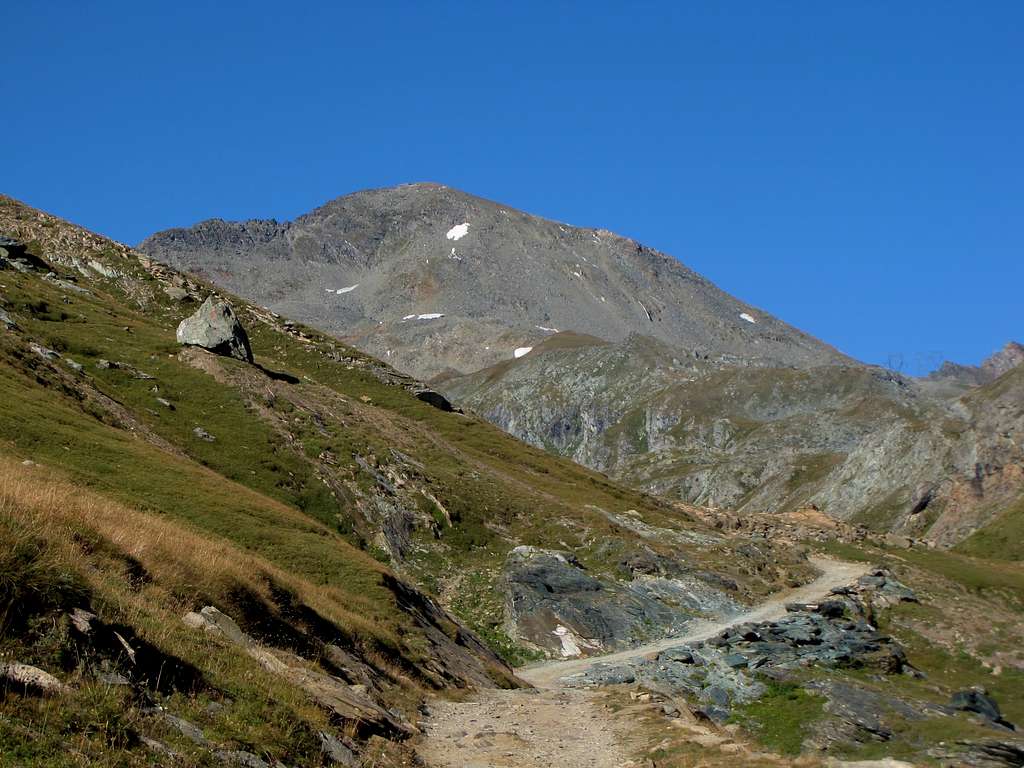
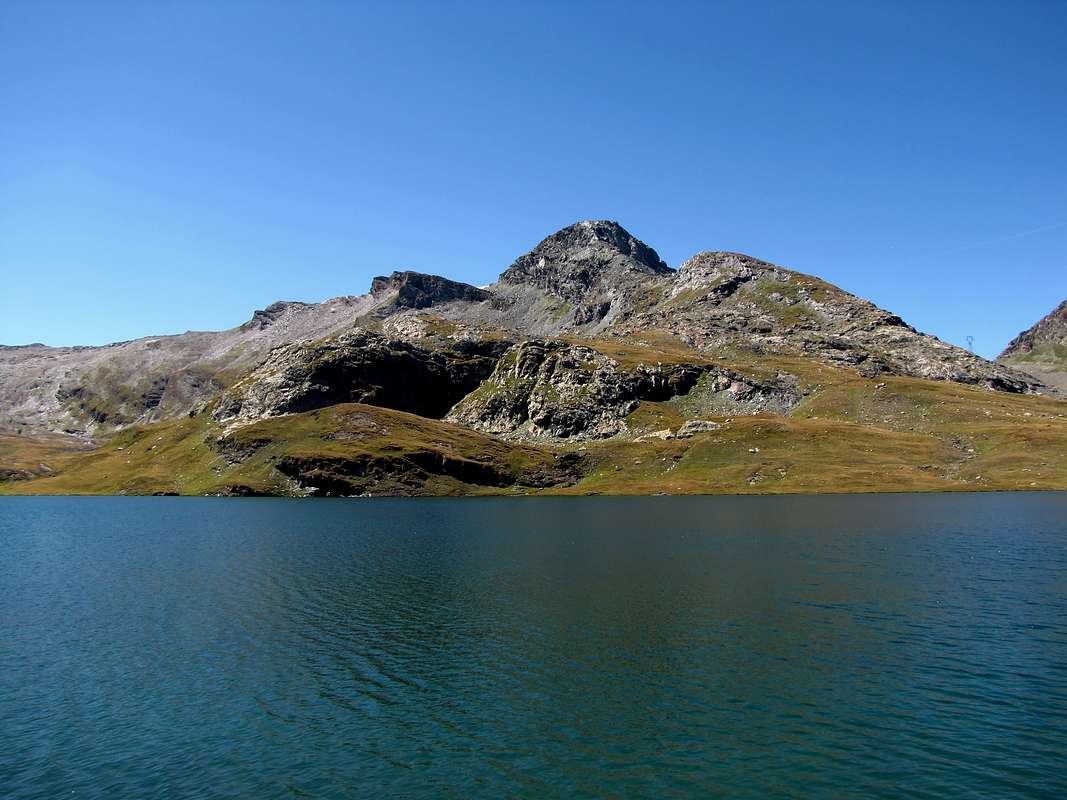
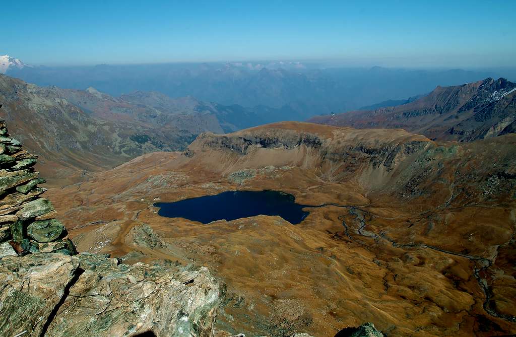
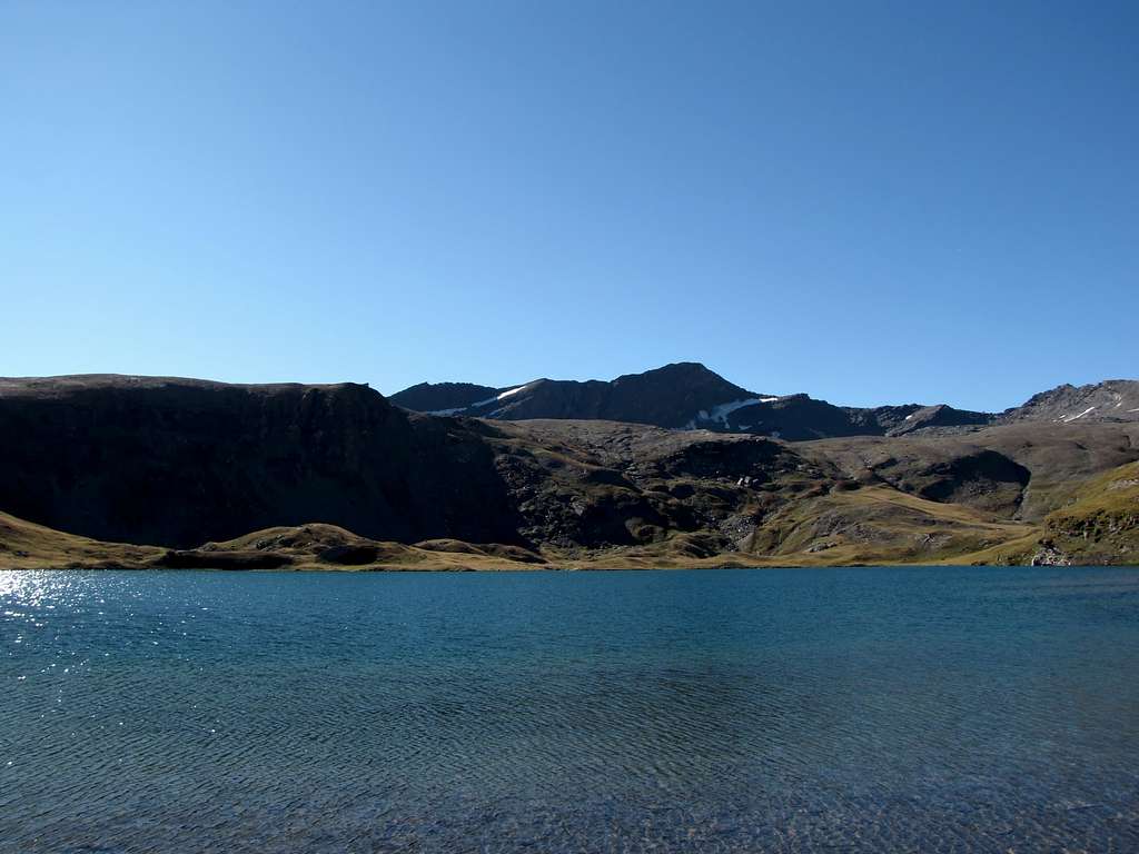
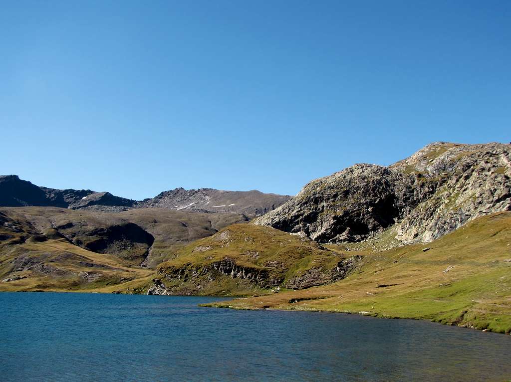
The Champorcher Valley, the first valley on the left going up from Valle d'Aosta, is a valley full of small and less small lakes, certainly not an area where you can admire the great massifs of the Alps unless you go up in altitude to for example at Fenetre de Champorcher (2.826m) magnificent panorama on the Gran Paradiso group or from the peaks of Mont Delà (3.139m) or Mont Glacier (3.185m) where you can enjoy a 360° panorama over the entire Valle d'Aosta and beyond. The Champorcher Valley, however, certainly deserves a visit for its excursions from easy to more demanding.
 |
La Valle di Champorcher, prima valle alla sinistra salendo lungo da Valle d’Aosta, è una valle ricca di laghi piccoli e meno piccoli sicuramente non è una zona dove di possono ammirare i grandi massicci delle Alpi a meno che non si salga di quota ad esempio alla Fenetre de Champorcher (2.826 m) magnifico panorama sul gruppo del Gran Paradiso oppure dalle vette del Mont Delà (3.139 m) o del Mont Glacier (3.185 m) dove si gode di un panorama a circa 360° sull’intera Valle d’Aosta e oltre. La Valle di Champorcher merita però sicuramente una visita per le sue escursioni dalle facili alle più impegnative.
Getting There
BY CAR:
- From Torino, Milano, etc: Motorway A5. Exit Pont Saint Martin for then to continue on SS.26 toward Hone Bard.
- From Switzerland: through the Grand Saint Bernard Tunnel or the namesake pass. Drive to Aosta, Verrès and Hone Bard..
- From France: through Mont Blanc Tunnel or Petit Saint Bernard Pass. It isn't necessary to take Motorway A5: you can drive on SS.26, in the direction of Aosta and Verrès and Hone Bard.
 |
 |
 |
 |
 |
Specific Road
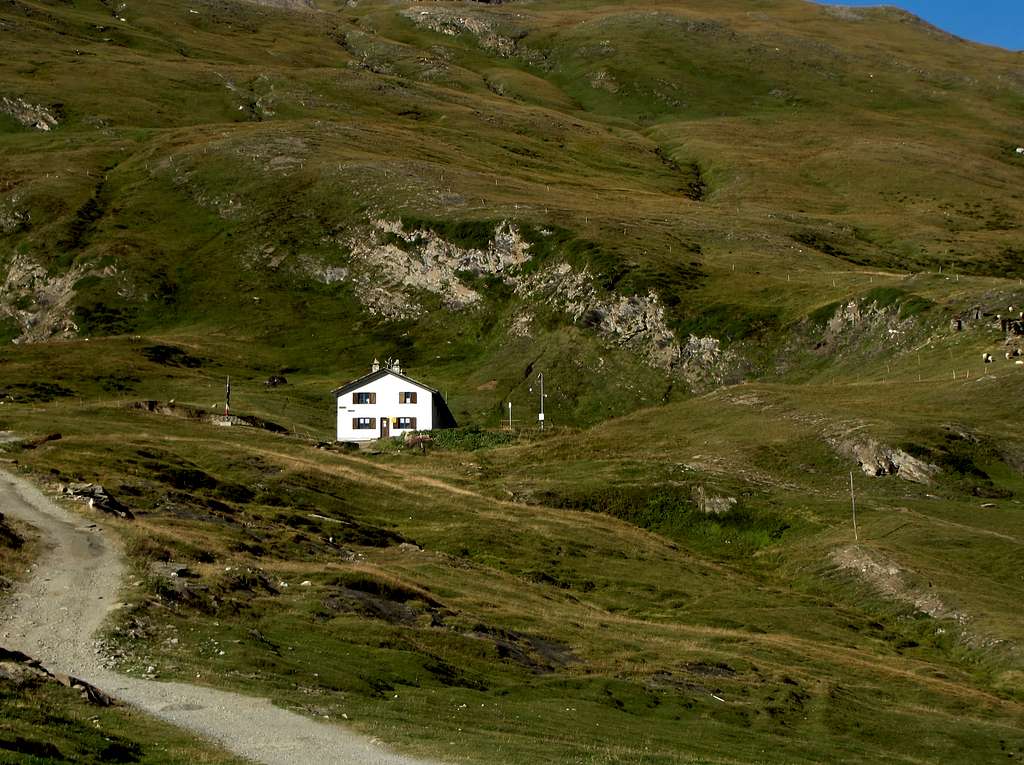
If you take the motorway, exit in Pont San Martin and follow the direction Aosta along the normal route; take care after Donnas: right side, immediately after the village, you can see approx. 100 meters of the roman consular road and a nice arc. A few hundreds meters after the fort there is a bridge left side, over the Dora Baltea River, with the indication Champorcher; follow it. Drive a few km, till the village of Chateau, and look right side for the indication Petit Mont Blanc. Follow this road, not too large, for a lot of km. Part is asphalted, the most part no. Usually the conditions of this second part are good, ask in the area. Follow this road till Dondena Village. At the end a sign forbids the traffic after the parking; there are 3/4 parking area, but the road is steep and demaged. Take care and park in the upper one. When you start walking, you will find a table with the indications, and the map of the area. Come down left till the Torrent Ayasse, pass over the small bridge and along the road shortly time arrive to the Refuge of Dondena (2.192m; 0h'15 from Parking).
 |
 |
Con l'Autostrada Torino-Aosta ed uscita al Casello di Pont Saint Martin; continuare sulla S.S. per Aosta (un centinaio di metri dopo il centro di Donnas ed a destra sull'attigua strada consolare romana si può ammirare un bel arco nella roccia); non molto più avanti si incontra il Forte di Bard, famoso per la resistenza effettuata conto l'Armata di Napoleone, e, tramite un ponte sulla Dora Baltea, passare sul lato opposto della medesima in direzione del centro di Hone (cartelli indicatori per la Valle di Champorcher). Percorrere tutta la strada regionale della vallata e, dopo il Comune di Pont Bozet, raggiungere quello di Champorcher in località Chateau. Voltando a destra sulla piazza centrale continuare verso i Villaggi di Mont Blanc e Petit Mont Blanc in stretta strada in asfalto e, successivamente, sulla strada sterrata costituente la ex Strada Reale per Dondena, generalmente in discrete condizioni. Raggiunto il Parcheggio con divieto di proseguimento per i mezzi e con abbondante segnaletica tramite panneaux, cartelli e mappe, scendere brevemente verso il Torrente Ayasse, presso una caratteristica casa contro un roccione. Oltrepassarlo tramite un ponticello e continuando con alcuni tornanti sulla poderale, in breve tempo pervenire al Rifugio di Dondena (2.192 m 0h'15 dal Parcheggio).
Route
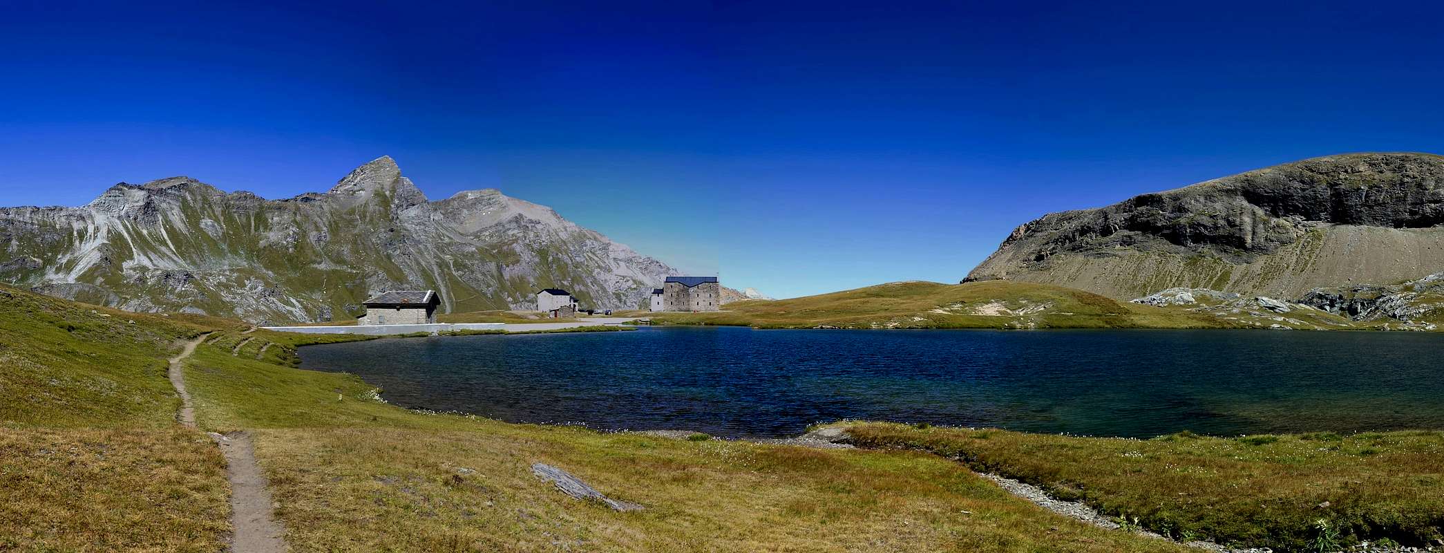
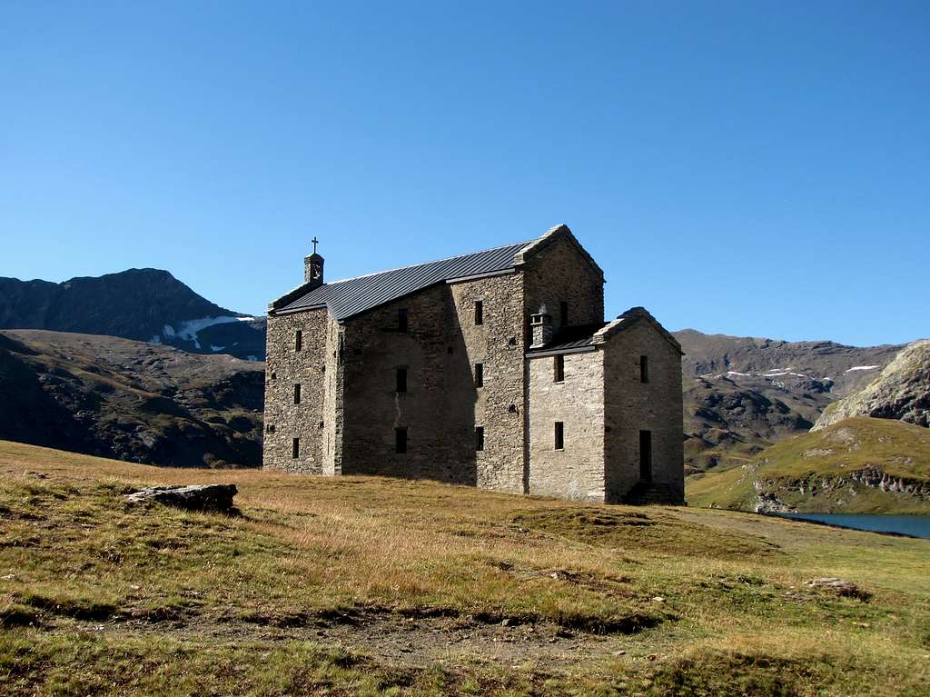
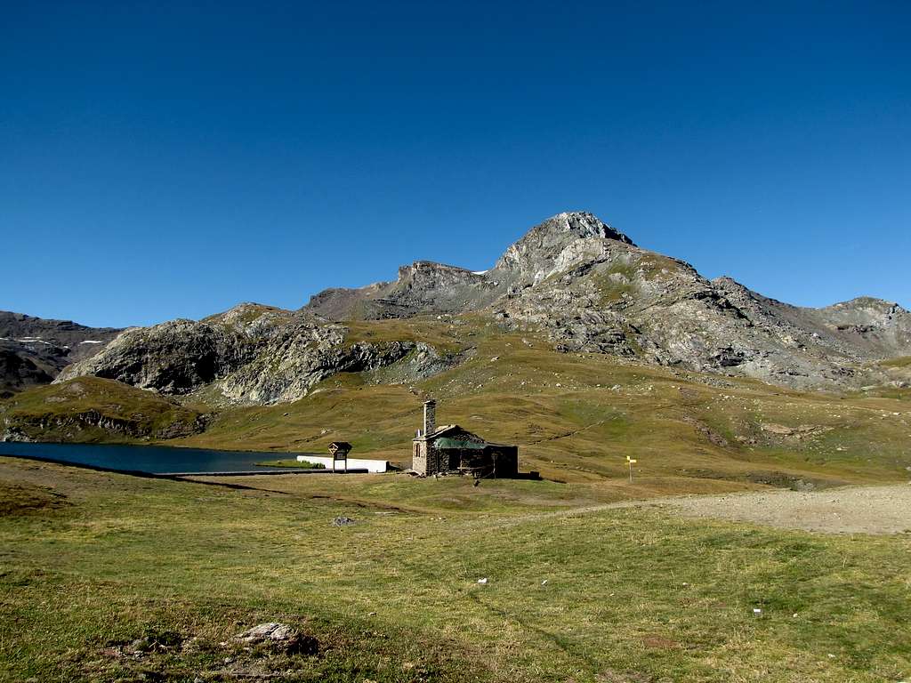
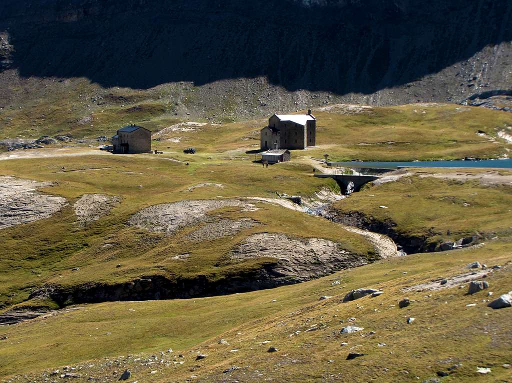
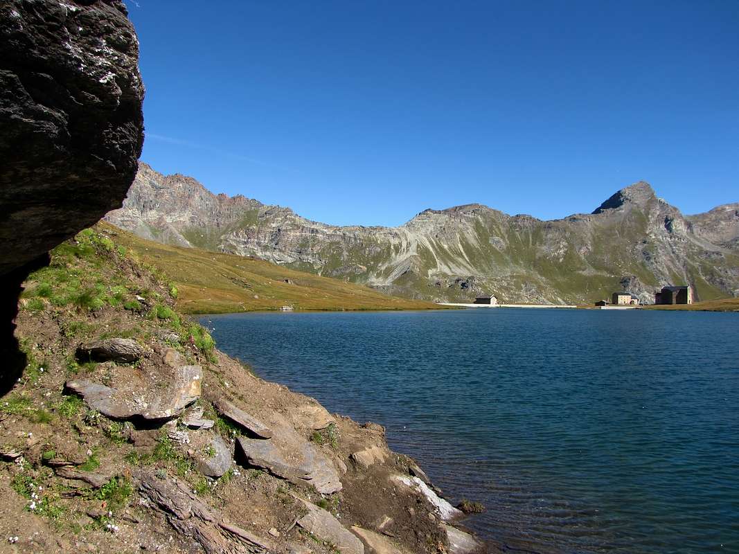
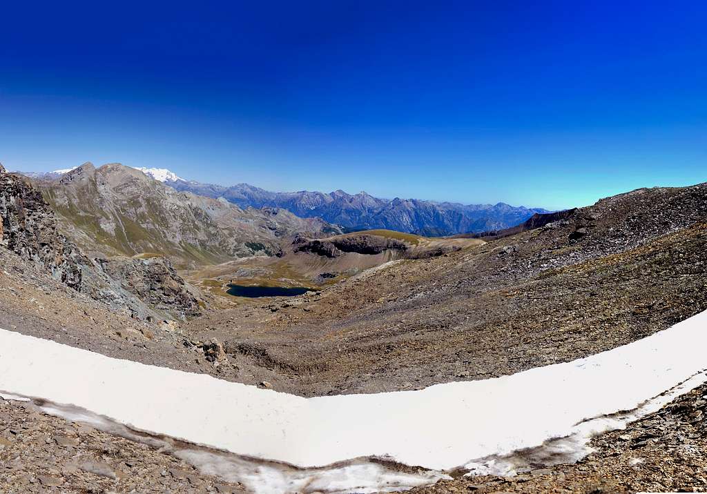
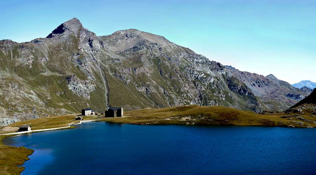
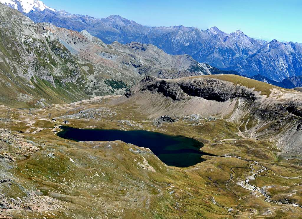
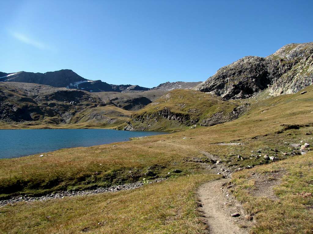
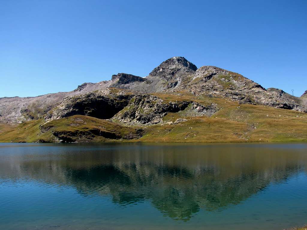
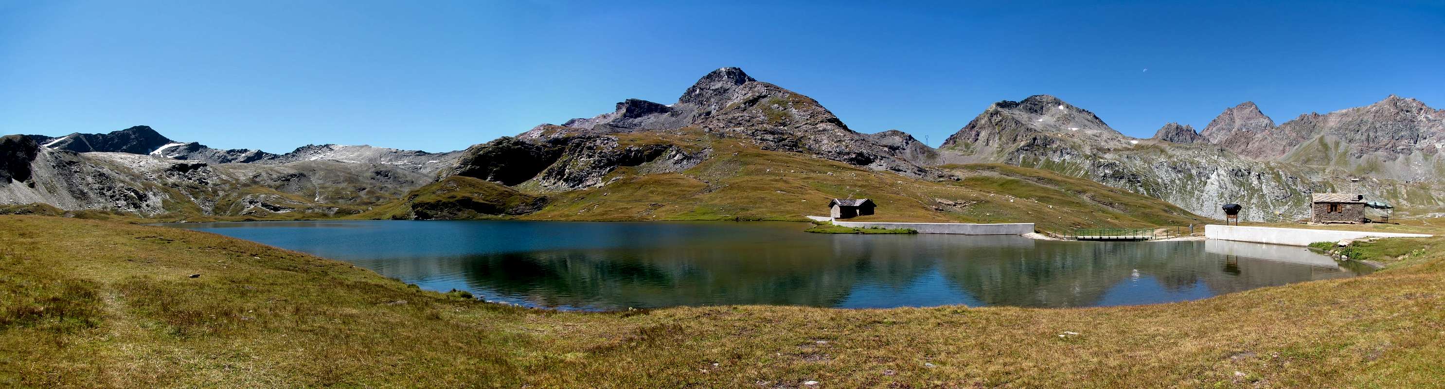
From the village of Dondena (2.114 m) continue to the refuge of the same name (2.192m) continue along the farm road "Chemin du Roi" Alta Via n° 2 paths n° 7A/7B, up to a crossroads at an altitude of approximately 2.441 meters, magnificent views of the Rosa dei Banchi (3.164m) the Tour Ponton (3.101m) to the Punta Tersiva (3.515m) to the Mont Moussaillon (3.072m) to the Mont Delà (3.139m) and the Mont Glacier (3.185m), continue along the left path, Alta Via n° 2, until you reach the plateau where the Miserin refuge (2.583m) is located, the lake of the same name (2.576m) and the Sanctuary dedicated to Notre Dame de la Neige (2.588 m), 1h'30/2h'00 from the village of Dondena.
 |
 |
 |
 |
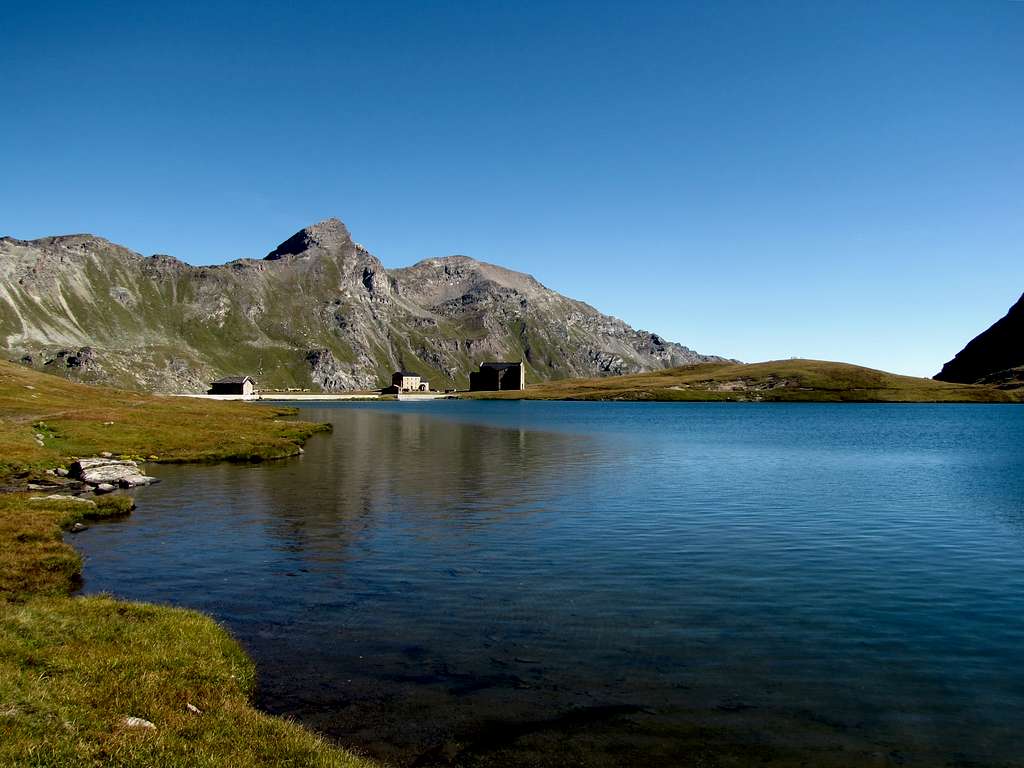 |
Dal villaggio di Dondena (2.114 m) continuare fino all’omonimo rifugio (2.192 m) proseguire lungo la strada poderale “Chemin du Roi” Alta Via n° 2 sentieri n° 7A/7B, sino a un bivio posto a quota 2.441 metri circa, magnifiche viste sulla Rosa dei Banchi (3.164 m) sulla Tour Ponton (3.101 m) sulla Punta Tersiva (3.515 m) sul Mont Moussaillon (3.072 m) sul Mont Delà (3.139 m) e sul Mont Glacier (3.185 m), continuare lungo il sentiero di sinistra, Alta Via n° 2, fino a raggiungere il pianoro dove e posto il rifugio Miserin (2.583 m) l’omonimo lago (2.576 m) e il Santuario dedicato alla Notre Dame de la Neige (2.588 m), 1h'30/2h'00 dal villaggio di Dondena.
Difficulty
The route can be classified as E.
L'itinerario è classificato E.
Essential Gear
For Hiking.
Da Escursionismo.
 |
 |
 |
 |
 |
External Links
- REGIONE AUTONOMA VALLE D'AOSTA the official site.
- FONDAZIONE MONTAGNA SICURA Villa Cameron, località Villard de la Palud n° 1 Courmayeur (AO) Tel: 39 0165 897602 - Fax: 39 0165 897647.
- SOCIETA' GUIDE ALPINE DI COGNE Tel. 347/9473526 – 328/1373728.
- A.I.NE.VA. (Associazione Interregionale Neve e Valanghe).
Important Information
- Protezione Civile Valdostana località Aeroporto n° 7/A Saint Christophe (Ao) Tel. 0165-238222.
- Bollettino Meteo (weather info) Tel. 0165-44113.
- Unità Operativa di Soccorso Sanitario Tel. 118.
 |