-
 863 Hits
-
 78.27% Score
-
 9 Votes
|
|
Route |
|---|---|
|
|
45.64303°N / 7.47884°E |
|
|
Hiking |
|
|
Spring, Summer, Fall |
|
|
E/F |
|
|
Overview
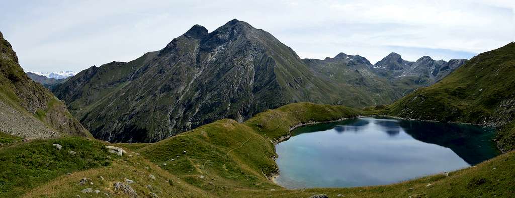
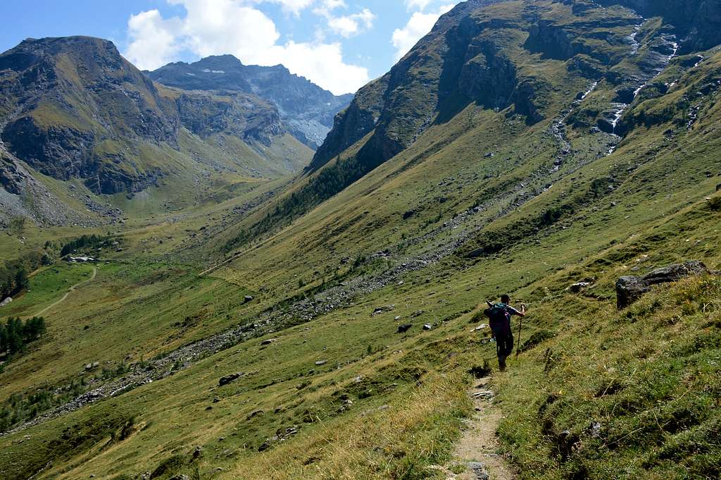
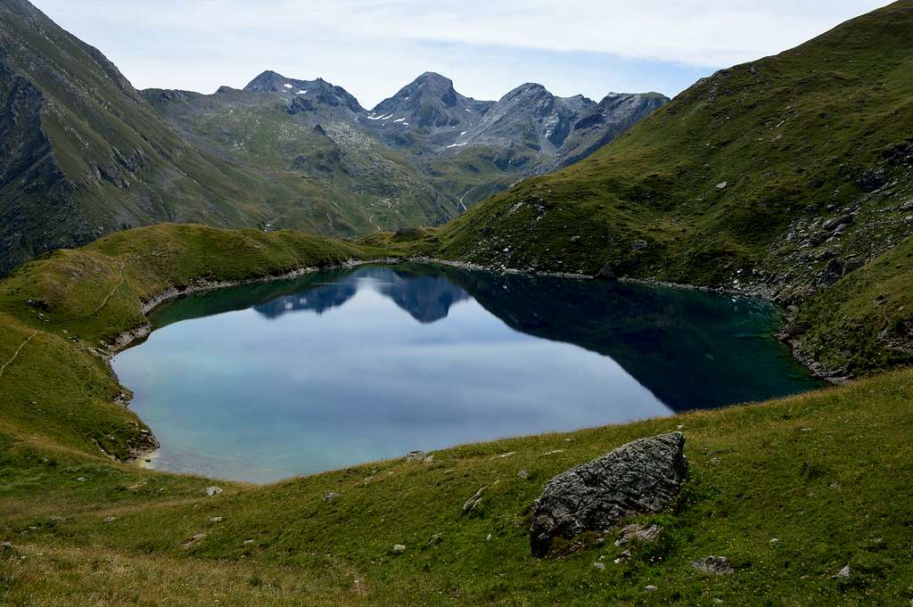
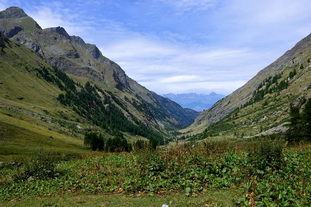
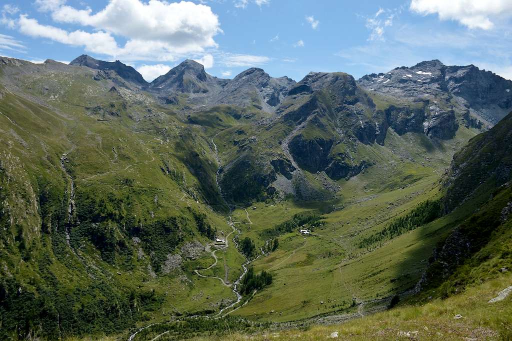
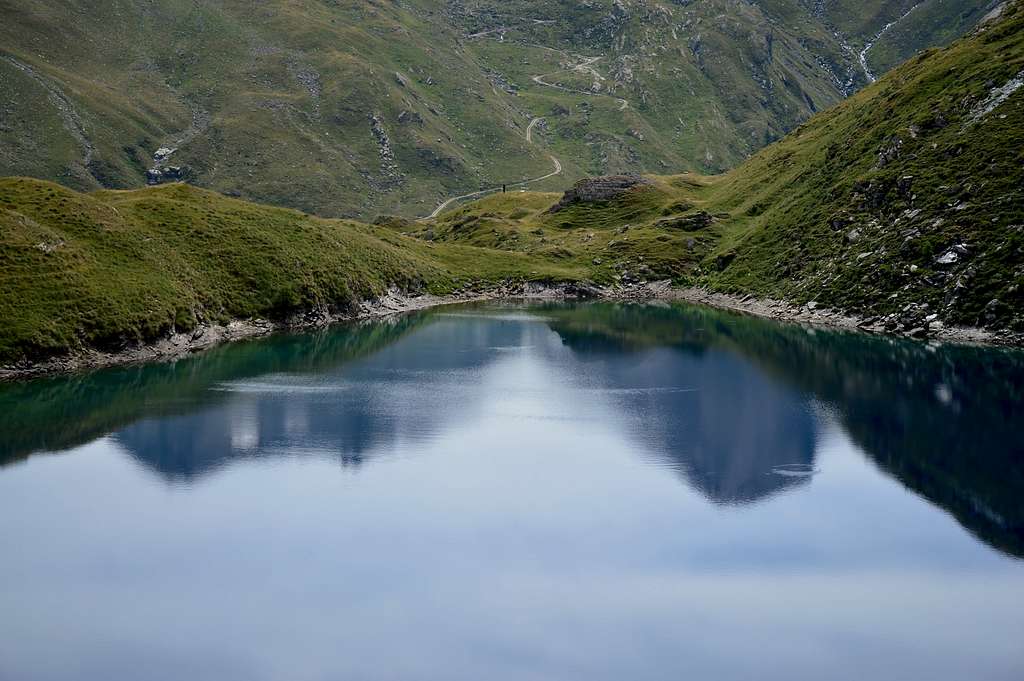
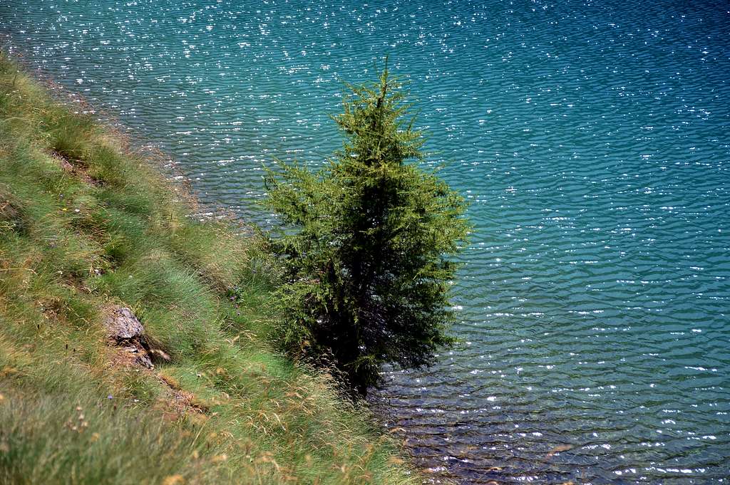
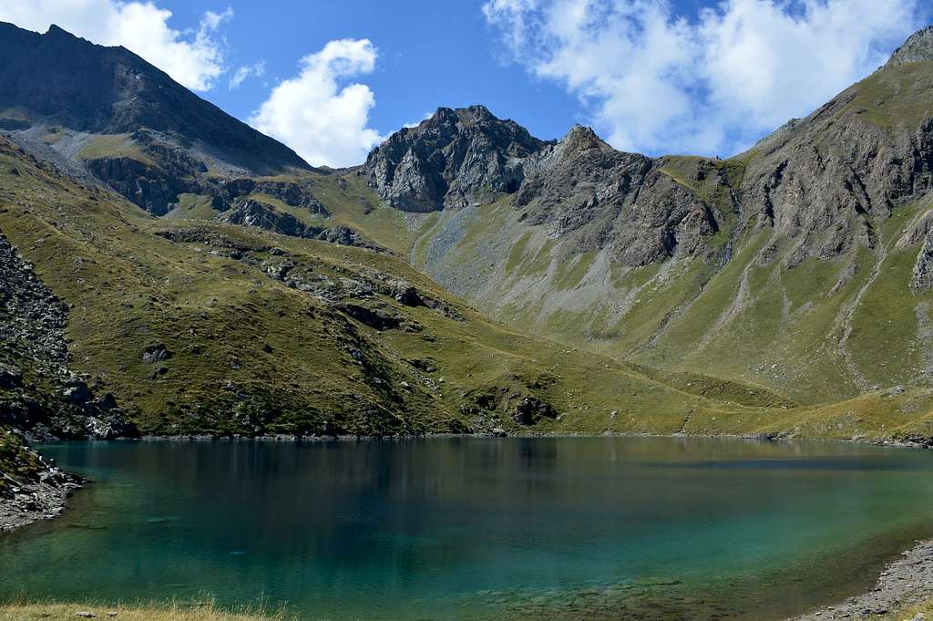
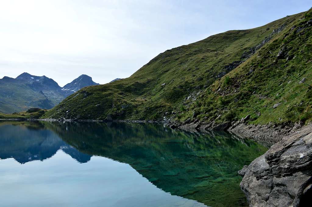
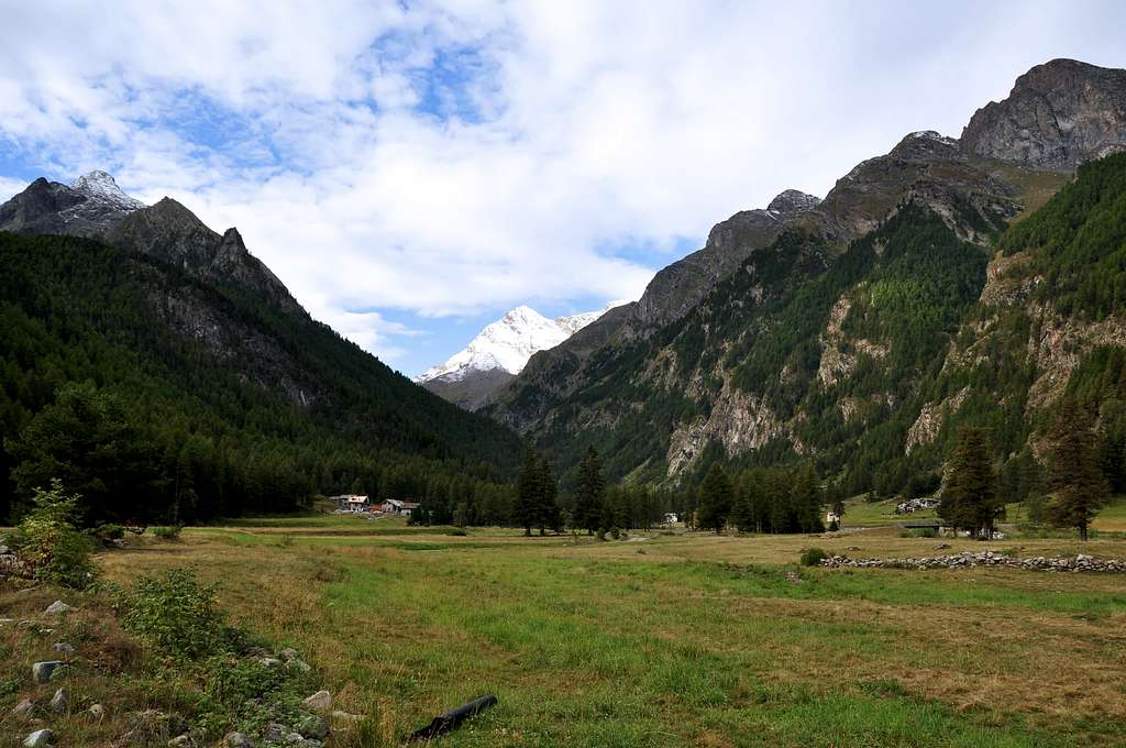
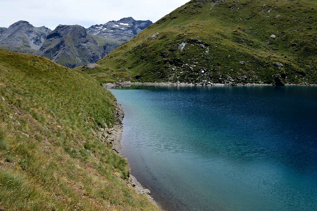
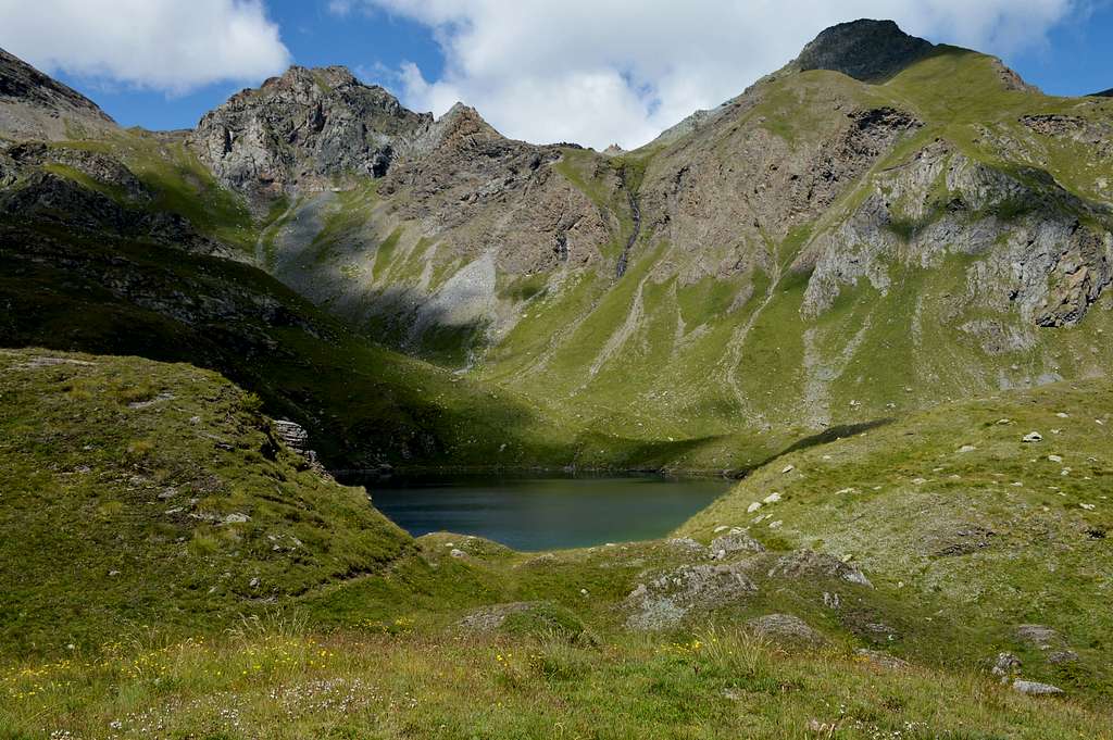
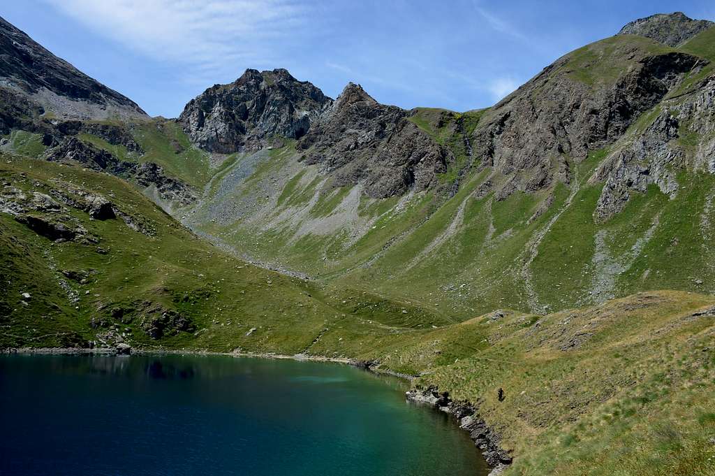
This small quadrangular lake remains nestled at the foot of the coast/watershed, capable of separating the Vallone di Saint Marcel (to the West) from that of Fénis/Clavalité /Alta Comba Tersiva (to the East), which descends from the Tersiva (3.515m) towards the Northwest reaching first Punta del Tessonet (3.264/6m) and then the Petit Avert (2.946/7m), after having crossed the Col di Lavodilec (2.863m). Easily and in a short time reachable from the Alpe di Grand'Alpe (2.120m) or from the just above Rifugio Egidio Borroz (2.156m) owned by the Rotary Club of Aosta-Clavalité, instead it presents a long approach if departing from the Municipality of Fénis via the road interpoderale with prohibition to unauthorized vehicles starting from the locality of Lovignana located at the entrance of this long valley that reaches the distant Col di Fénis (2.857m), on the border with the Champorcher Valley, as well as the nearby Val di Cogne by means of the almost adjacent to Col Pontonnet (2.897m). Located in a solitary and pleasant place, it offers splendid views of the nearby pyramids of the Tersiva (3.515m) and of Mont Raffrey or Rafrey and, besides, Mont Rafray (3.146m), while towards the South you can see the mass of the more squat Mont Moutsaillon also Moussaillon (3.072m). Surely it is a nice walk for those who have the possibility to start either from Grand'Alpe or from the Egidio Borroz Refuge (2.156m), otherwise it consists of a long, almost exhausting, excursion if starting from the valley floor, or from Barche towards Lovignana Pasture. If you want, you can easily continue to the Colle di Lavodilec and the overlying Petit Avert.
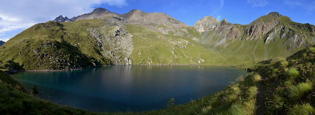
Questo piccolo lago quadrangolare rimane incastonato alle falde della costiera, atta a separare il Vallone di Saint Marcel (ad Occidente) da quello di Fénis/Clavalité/Alta Comba Tersiva (ad Oriente), che scende dalla Tersiva (3.515 m) verso Nordovest raggiungendo dapprima la Punta del Tessonet (3.264/6 m) e poi il Petit Avert (2.946/7 m), dopo aver oltrepassato il Col di Lavodilec (2.863 m). Facilmente ed in breve tempo raggiungibile dall'Alpeggio di Grand'Alpe (2.120 m) oppure dall'appena soprastante Rifugio Egidio Borroz (2.156 m) di proprietà del Rotary Club di Aosta-Clavalité, invece presenta un lungo avvicinamento se con partenza dal Comune di Fénis tramite la strada interpoderale con divieto ai mezzi non autorizzati a partire dalla località di Lovignana posta all'ingresso di questa lunga valle che raggiunge il lontano Col di Fénis (2.857 m), al confine con la Valle di Champorcher, nonché la vicina Val di Cogne per mezzo del quasi adiacente Col Pontonnet (2.897 m). Sito in un luogo solitario ed ameno, prospetta splendide vedute sulle vicine piramidi della Tersiva (3.515 m) e del Mont Raffrey oppure Rafrey ed, inoltre, Mont Rafray (3.146 m), mentre verso Meridione si scorge la massa del più tozzo Mont Moutsaillon oppure Moussaillon (3.072 m). Sicuramente é una bella passeggiata per chi ha la possibilità di partire o da Grand'Alpe oppure dal Rifugio Egidio Borroz (2.156 m), altrimenti consiste in una lunga, quasi estenuante, escursione se con partenza dal fondovalle, cioé da Barche per l'Alpeggio di Lovignana. Volendo continuare si può facilmente proseguire per il vicino Colle di Lavodilec ed il soprastante Petit Avert.
 |
 |
 |
 |
 |
Getting There
BY CAR:
From Torino, Milano, etc: Motorway A5. Exit Aosta est For Grand Brissogne and Saint Marcel. From Switzerland: through the Grand St. Bernard Tunnel or the homonym Pass. Drive to Aosta, For Grand Brissogne and Saint Marcel. From France: through Mont Blanc Tunnel or Petit St. Bernard Pass. It isn't necessary to enter in Motorway A5, you can drive through SS.26 Aosta direction. Exit Aosta est For Grand Brissogne and Saint Marcel.
Road Route
From Fénis Municipality: by the town utilize and follow the signs brown (with indication Barche locality; 607 meters) to the Valley Fénis/Clavalité/High Comba Tersiva.
Dal Comune di Fénis: utilizzare per salire i cartelli color marrone (con indicazione località Barche; 607 metri) per la Valle di Fénis/Clavalité/Alta Comba Tersiva.
 |
 |
 |
 |
 |
Approach & Route
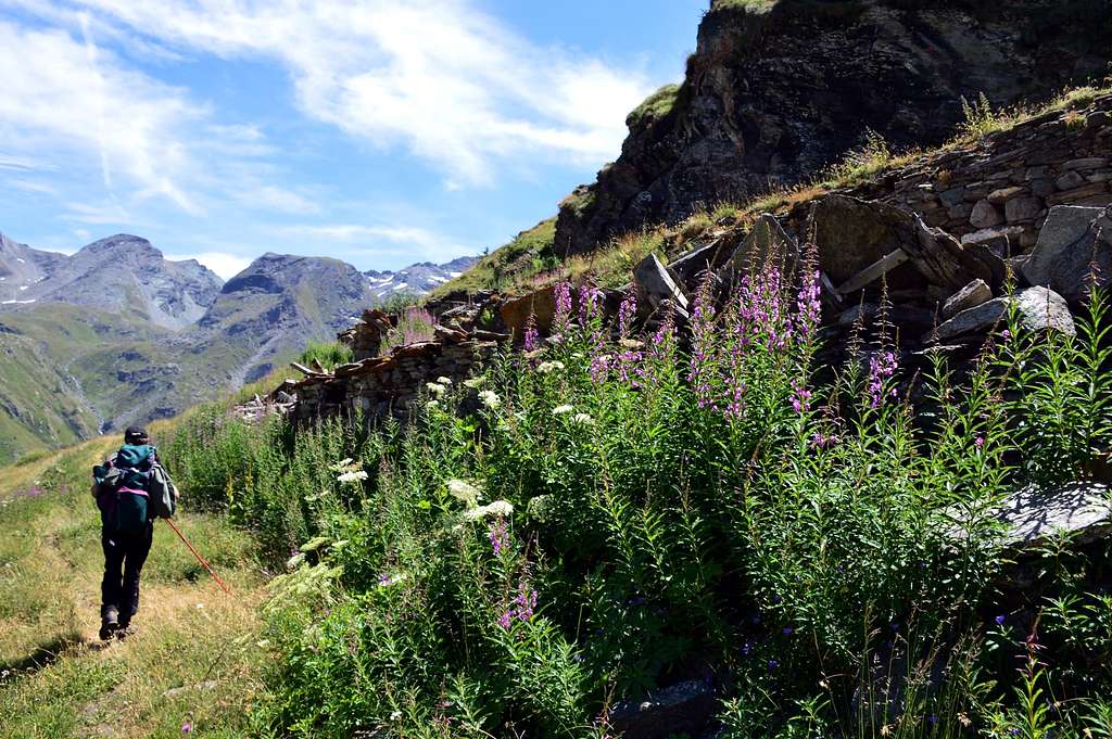
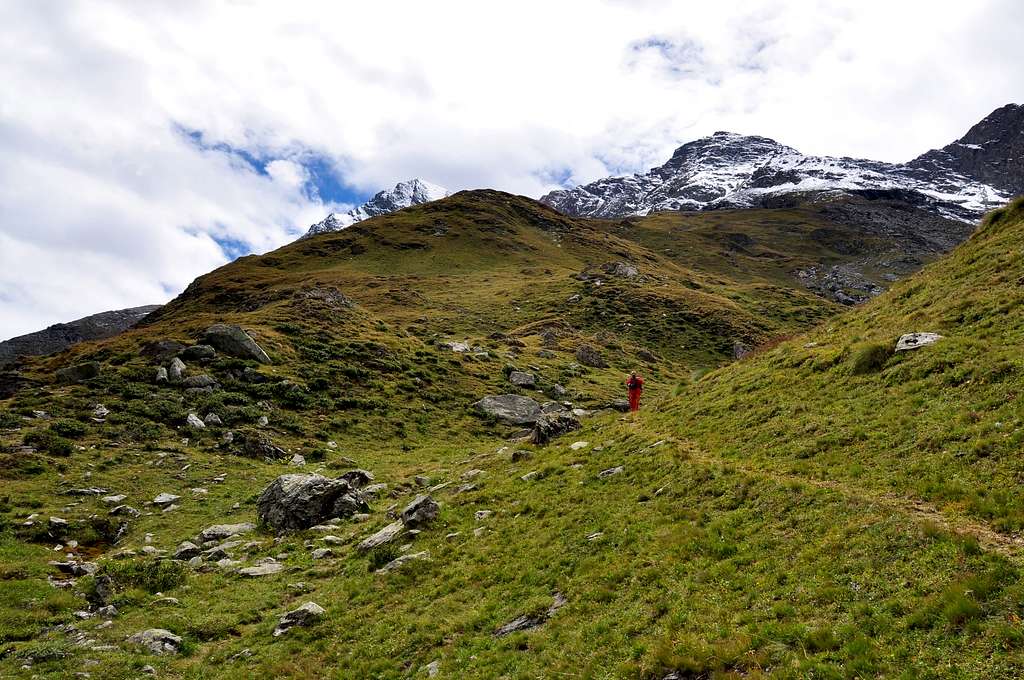
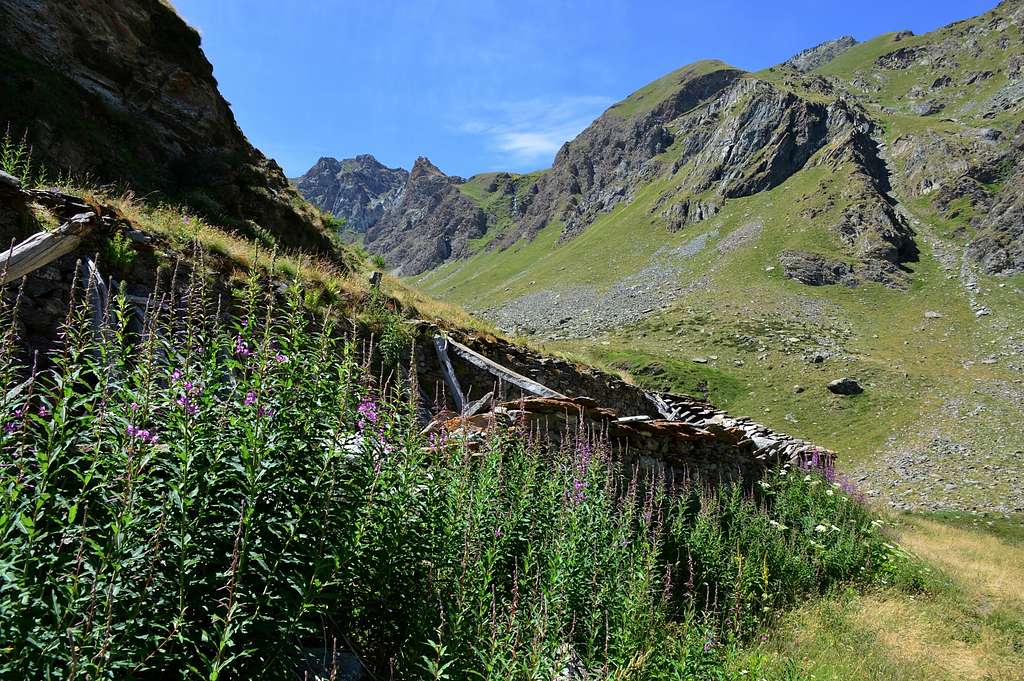
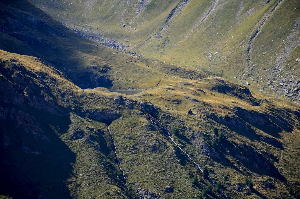
The ban is to continue towards Lovignana Pastures (1.169m) along the entire Vallone, passing amongst the mountain Alps of Fontana, Robbio, Maisonasse, Bioley Dèsot e Damon, Coujeic, Beneyte, Meney Dèsot, Meney di Meitin e Meney Damon up to the Grand'Alpe Pasture (2.129m), through the local trail n° 2 , from the last Pasture of Grand Alpe continue diagonally with the path n° 7/intervalleys 102 with which you reach Lake Lavodilec (2.359m) and the overlying hill by a long diagonal to the West and over a rocky rampart (5h'00/6h'00 from the ban).
Il divieto di proseguire si trova all'Alpe di Lovignana (1.169 m); percorrere tutto il Vallone, passando gli Alpeggi di Fontana, Robbio Maisonasse, Bioley Dèsot e Damon, Coujeic, Beneyte, Meney Dèsot, Meney di Meitin e Meney Damon, fino all'Alpe Grand'Alpe (2.129 m), tramite il sentiero locale n° 2, dall'Alpeggio finale di Grand Alpe proseguire in diagonale con il sentiero n° 7/intervallivo102 tramite il quale si raggiunge il Lago di Lavodilec (2.359 m) ed il soprastante colle tramite un lungo diagonale verso Occidente e sopra uno spalto roccioso (5h'00/6h'00 dal divieto).
 |
 |
 |
 |
 |
Direct Variant: by making a day trip from Lovignana Alpage, but did not reach Grand Alpe Pastures 1 Km. about before, immediately after the Alp di Meney Damon (1.952m), take just to right (West) a small shortcut reported that, with semi-circular course, the path reaches diagonally from Grand Alps exatcly at 2.100 meters.
Variante Diretta: con gita in giornata dall'Alpeggio di Lovignana, non raggiungere Grand Alpe bensì 1 Km. circa prima, subito dopo l'Alpe di Meney Damon (1.952 m), prendere sulla destra (Ovest) una piccola scorciatoia segnalata che, con percorso semi circolare, raggiunge il sentiero in diagonale da Grand Alpe esattamente a quota 2.100 metri.
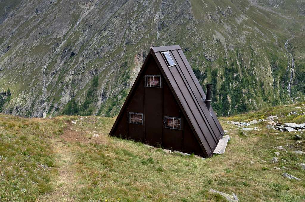
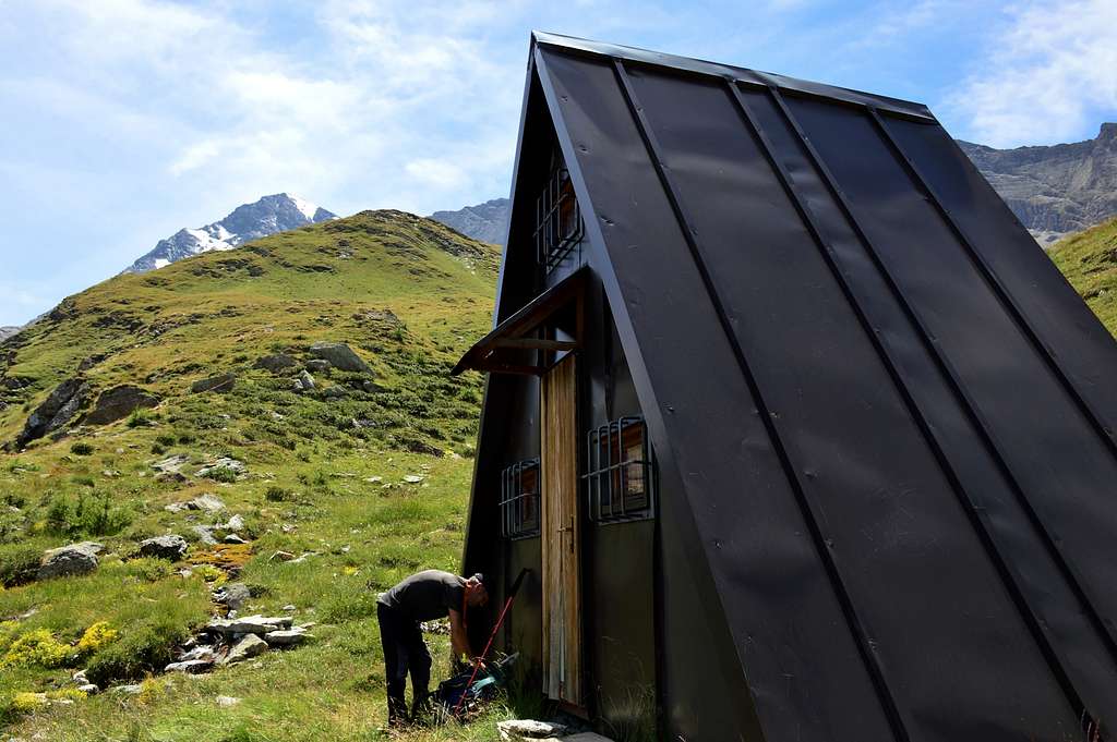
Huts
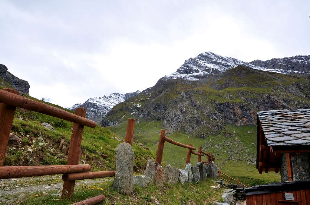
Bivacco Egidio Borroz (2.156m)
Difficulties
The route can be classified as E but F.
L'itinerario è classificato da E, a F.
Essential Gear
For Hiking.
Da escursionismo.
 |
 |
 |
 |
 |
External Links
- REGIONE AUTONOMA VALLE D'AOSTA the official site.
- FONDAZIONE MONTAGNA SICURA Villa Cameron, località Villard de la Palud n° 1 Courmayeur (AO) Tel: 39 0165 897602 - Fax: 39 0165 897647.
- A.I.NE.VA. (Associazione Interregionale Neve e Valanghe).New section
Useful numbers
- Protezione Civile Valdostana località Aeroporto n° 7/A Saint Christophe (Ao) Tel. 0165-238222.
- Bollettino Meteo (weather info) Tel. 0165-44113.
- Unità Operativa di Soccorso Sanitario Tel. 118.