
-
 1263 Hits
-
 79.78% Score
-
 11 Votes
|
|
Route |
|---|---|
|
|
45.67021°N / 6.98617°E |
|
|
Hiking |
|
|
EE/F/F+ |
|
|
Overview
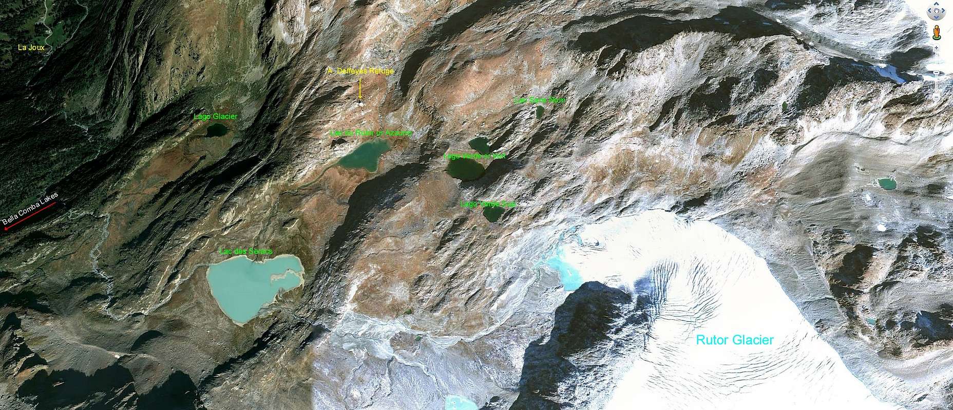
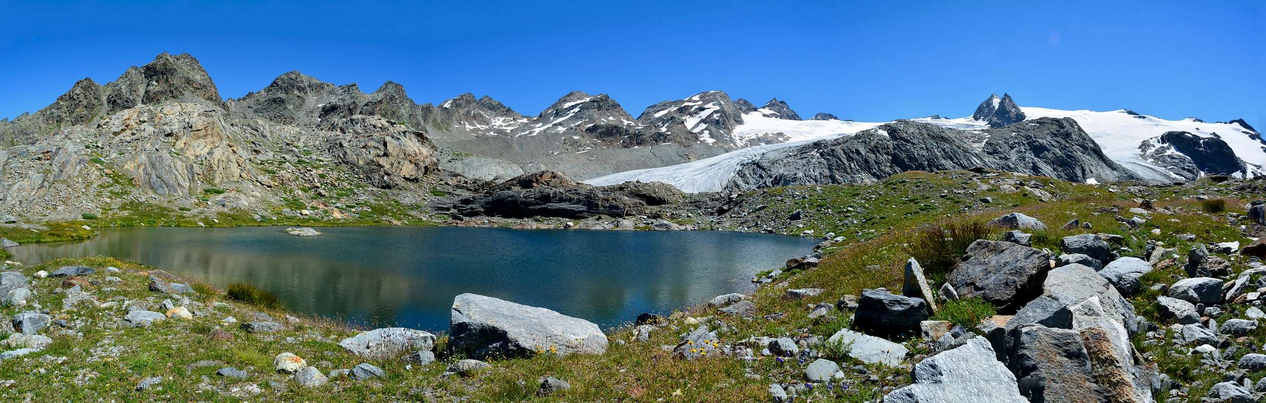
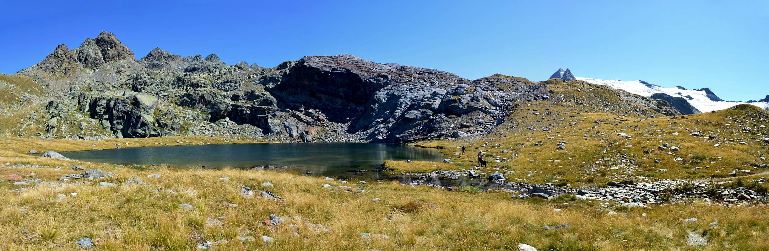
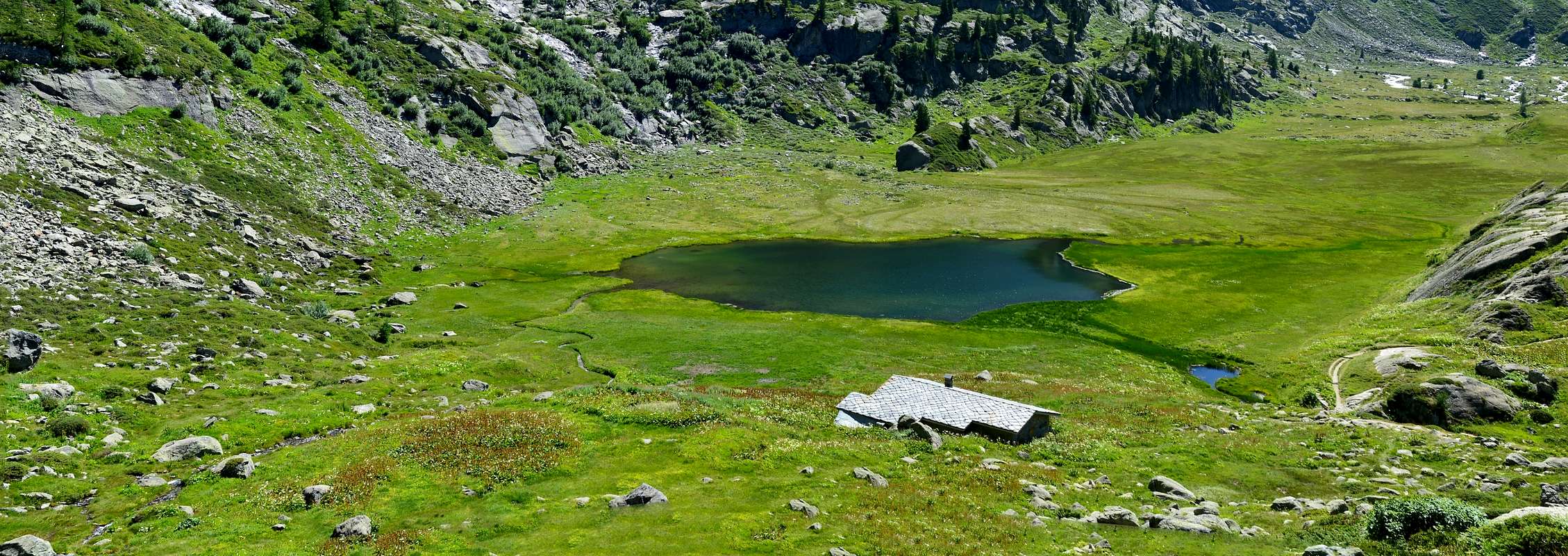
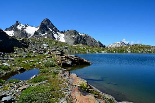
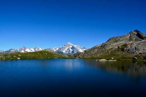
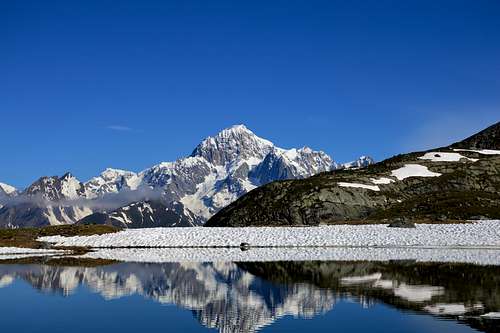
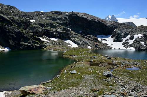
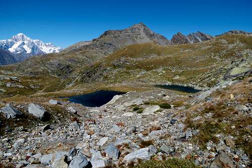
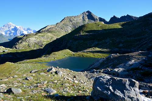
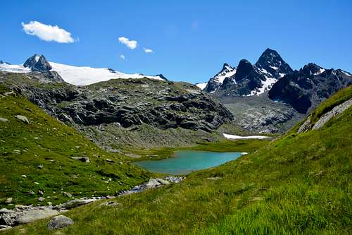
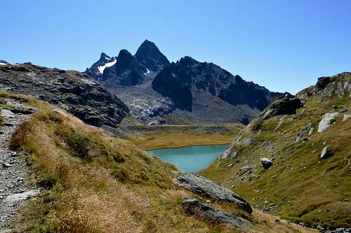
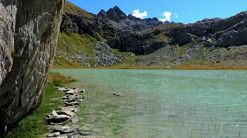
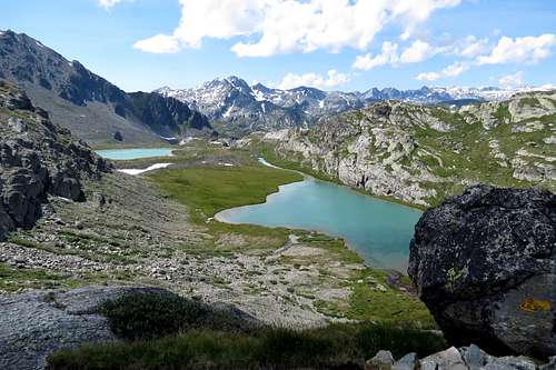
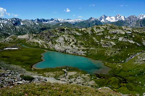
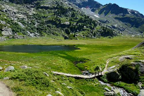
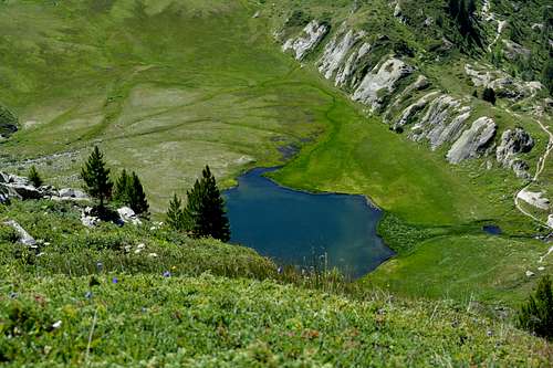
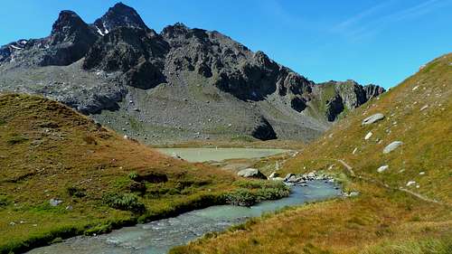
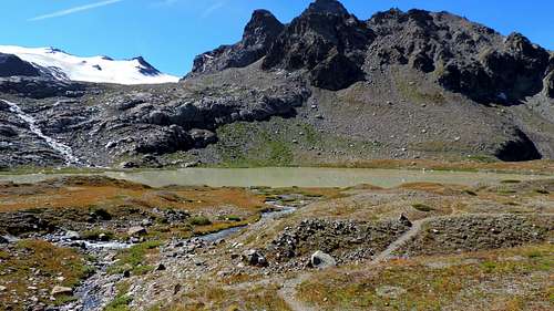
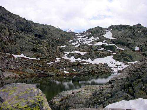
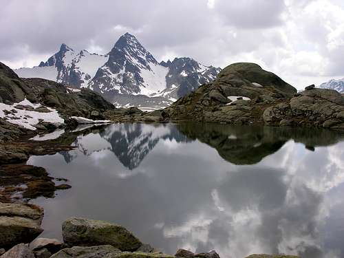
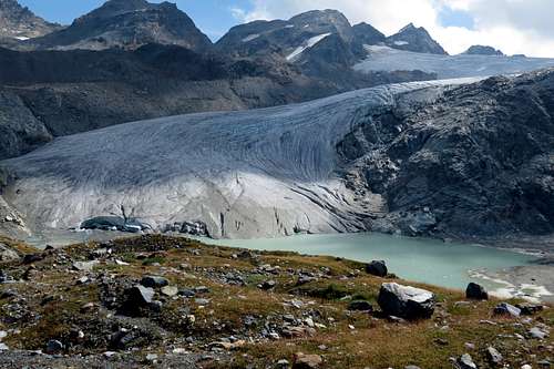
The Valley of La Thuile has a whole series of lakes formed by the retreat of the its glaciers; this is much older in the West and in the East, but now even in great evidence especially in the South. In fact, on the first of these two sides we find the Verney Lake and the Tormotta Lakes in the Piccolo San Bernardo Valley and the Bella Comba Lakes in the homonymous vallon. To the East instead spreads the Lacs des Ussellettes, a group of small lakes at the foot of the Testa del Paramont (3.140m) as well as the pyramid of Mont Paramont (3.301m). To the South, at the foot of the mighty and magnificent Glacier du Rutor or Ruitor between the watershed with Vanoise (France) to the southeast and the watershed with Valgrisenche on the opposite side, a series of lakes, little lochs and ponds are displayed from the large Lac des Seracs (2.387m) to the Southwest at the foot of Grand Assaly (3.172m), from the high two and twin Lacs Neuves (2.551m) at the foot of Testa d' Assaly, to the tiny Lac Glacial Marginal, from the slightly larger Lacs Superieur, Gris, Vert e Lac dans la Roche up to the lowest and on average extended (but much more famous if only for the floods caused in past centuries on the entire Valle d'Aosta and even reaching the City of Ivrea in Piedmont) towards the Lac du Rutor or Azzurro (2.428m), where the Albert Deffeyes Refuge (2.494m) is located. A series of beautiful walks and excursions are aimed at both tourists for the simpler and shorter journeys and for experienced hikers in longer and more demanding trips approaching the great glacial expanses for which experience, preparation and adequate equipment are required. But now we are beyond the lakes, which instead we can admire among breathtaking views. Do not go out of the way and measure your strengths and abilities ...
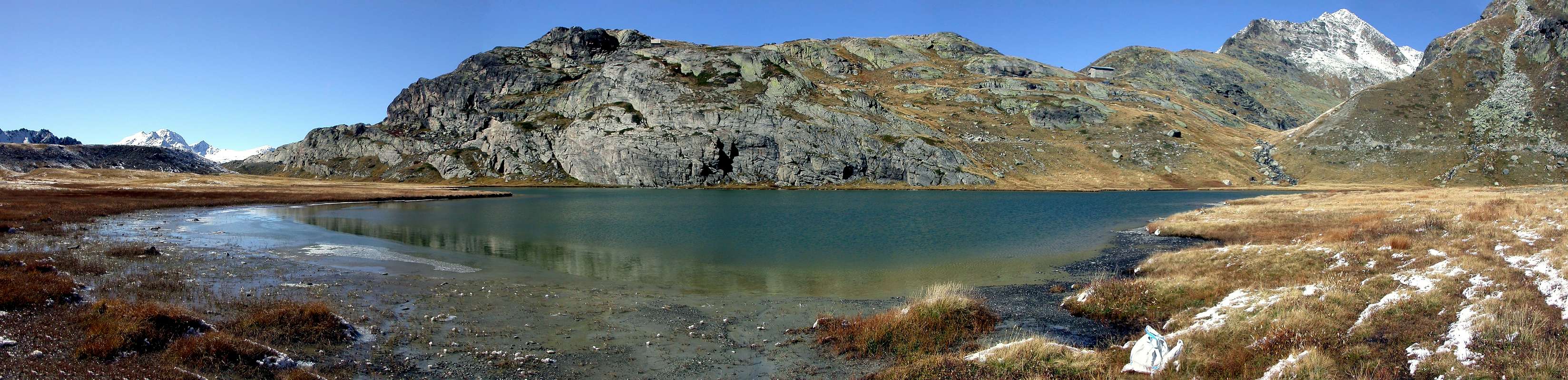
La Valle di La Thuile presenta tutta una serie di laghi formata dal ritiro dei suoi ghiacciai; questo si presenta come molto più antico ad Occidente ed ad Oriente, ma ormai anche in grande evidenza soprattutto a Meridione. Infatti sul primo di questi due lati troviamo il Lago Verney ed i Laghi della Tormotta nel Vallone del Piccolo San Bernardo ed i Laghi di Bella Comba nell'omonimo vallone. Ad Est invece si spargono il Lacs des Ussellettes, gruppo di laghetti ai piedi della Testa del Paramont (3.140 m) nonché della piramide del Mont Paramont (3.301 m). A sud, ai piedi del possente e magnigico Glacier du Rutor o del Ruitor compreso tra lo spartiacque frontaliero con la Vanoise (Francia) a Sudest e con il divisorio con la Valgrisenche sul lato opposto, si mettono in mostra una serie di laghi e laghetti che vanno dal grande Lac des Seracs (2.387 m) a Sudovest ai piedi del Grand Assaly (3.172 m), dagli alti e gemelli Lacs Neuves (2.551 m) ai piedi della Testa d'Assaly, al minuscolo Lac Glacial Marginal, dagli appena più estesi Lacs Superieur, Gris, Vert e Lac dans la Roche fino al più basso e mediamente esteso (ma ben più famoso se non altro per le inondazioni provocate nei secoli passati sull'intera Valle d'Aosta e raggiungendo perfino la Città di Ivrea in Piemonte) Lac du Rutor o Azzurro (2.428 m), presso il quale é collocato il Rifugio Albert Deffeyes (2.494 m). Una serie di bellissime passeggiate ed escursioni sono rivolte sia ai turisti per i tragitti più semplici e brevi ed agli escursionisti esperti nelle gite più lunghe ed impegnative avvicinandosi alle grandi distese glaciali per le quali viene richiesta esperienza, preparazione ed attrezzatura adeguata. Ma ormai siamo al di là dei laghi, che possiamo ammirare tra panorami mozzafiato. Non "uscire dal seminato" e misurare le proprie forze e capacità ...
Getting There
BY CAR:
- From Torino, Milano, etc: Motorway A5. Exit at Morgex. Drive to the near Pré Saint Didier Municipality. Follow the directions to the South for Valle di La Thuile.
- From Switzerland: through the Grand Saint Bernard Tunnel or the namesake Pass. Drive to Aosta, then follow the direction for Courmayeur on SS.26. Just after Pré Saint Didier Municipality, turn to the left, always South, in the direction of La Thuile Valley.
- From France: through Mont Blanc Tunnel or Petit St. Bernard Pass. It isn't necessary to take Motorway A5: you can drive on SS.26, in the direction of Aosta. Before arriving at the Pré Saint Didier Municipality, turn right or South following the sign for La Thuile Valley.
Roads Route
From the exit of Motorway A5 (921m) neighboring Morgex Municipality, continue for about 3 km on SS.26 towards Pré Saint Didier (1.017m). SS.26 becomes the main street of the small city and then continues toward Colle del Piccolo San Bernardo (2.188m). After several hairpins, and past the Villages of Elevaz (1.302m) and La Balme (1.309m) reach the famous ski resort of La Thuile (1.441m). Turn left on the bridge that crosses Dora di La Thuile in the direction of the Village of La Joux. After about 2 km from the bridge, having past a large square, cross another bridge on the Dora to the right. (From this point on, the road, although paved, is quite narrow. Proceed with caution.) After 1 km get to La Joux (1.607m) and park in one of the two parking lots, which are large but sometimes fill up in August. For this reason, access past the second bridge is limited at certain times. Be there before 9 AM to avoid problems, or take the shuttle bus to cover the last stretch.
Dall'uscita dell'Autostrada A5 nei pressi del Comune di Morgex (921 m) proseguire per circa 3 km lungo la SS.26 verso il Paese di Pré Saint Didier (1.017 m); addentrarsi nella via centrale del paese e proseguire sempre lungo la SS.26 che porta al Colle del Piccolo San Bernardo (2.188 m). Dopo numerosi tornanti e, superate le Frazioni di Elevaz (1.302 m) e La Balme (1.309 m), si giunge alla famosa località sciistica di La Thuile (1.441 m); svoltare a destra sul ponte che attraversa la Dora di La Thuile e dirigersi verso la Frazione di La Joux (1.607 m). Dopo circa 2 km e superato un ampio piazzale, riattraversare sempre sulla destra un altro ponte sulla Dora (attenzione da questo punto la strada, seppur asfaltata, è molto stretta, procedere con cautela) e dopo circa 1 km. si giunge a La Joux (1.607 m); qui posteggiare l'auto in uno dei due ampi parcheggi a volte insufficienti nel mese di agosto. Per questo motivo, relativamente al tratto dopo il secondo ponte, c'è una limitazione oraria all'accesso dei mezzi privati, che comunque non tocca chi arriva prima delle 9. In alternativa esiste comunque una navetta bus.
 |
 |
 |
 |
 |
Approach & Route
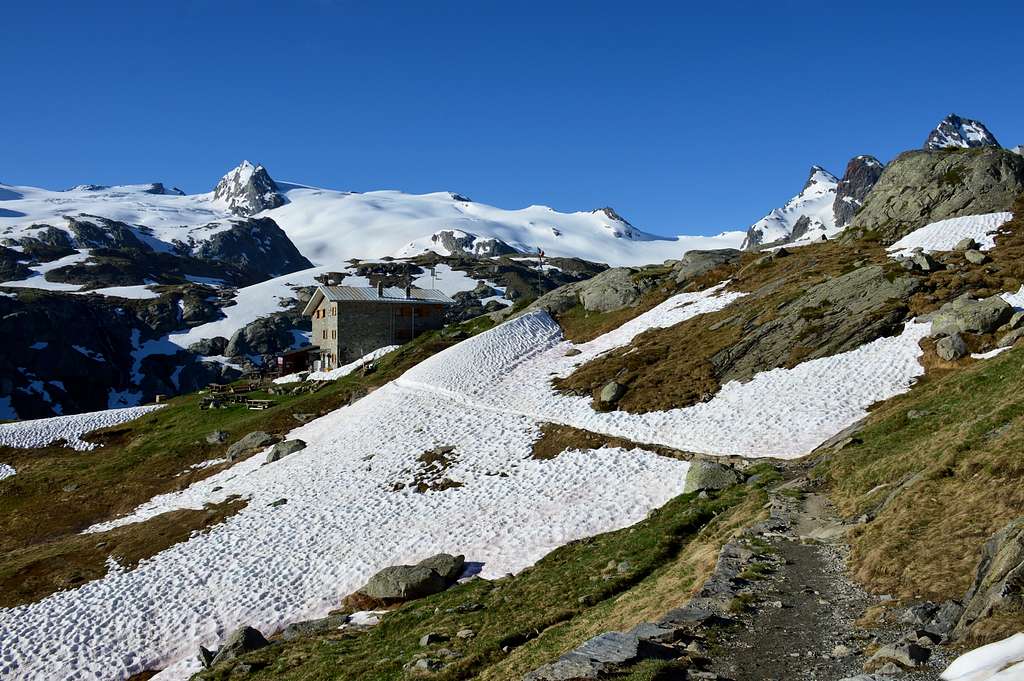
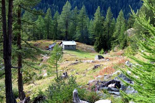
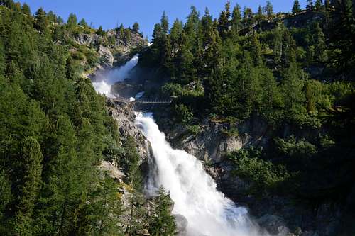
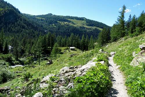
Approach: From La Joux (1.607m) walk along the path that borders to the E the stream of Rutor and its three fine waterfall. More precisely: the ascent for Rifugio A. Deffeyes starts in front of "Bar Delle Cascate" on trail n° 3. Pass a wooden bridge on the left and after about 10 minutes you'll come to the first of the three spectacular Rutor Falls. Continue along the trail and leave Alpeggio di Parchet (1.772m) to your right. The trail continues up large steps and in a bit less than one hour passes by the second waterfall, which is not visible from the trail, but is marked by a sign. After another 15 minutes you'll reach the sign for the the third waterfall. Continue on the steep trail for another 20 minutes to a fork. Take the well-marked left branch that leads to the hut. (The right branch, numbered 8, leads to the beautiful Lakes of Bella Comba.) Climb to the Small Col (2.130m) and then descend bending slightly to the right until Lago Glacier (2.143m). Cross the small wooden bridge over the lake outlet and, leaving Alpeggio Glacier to your right, climb steeply along wide hairpins to the plateau where Rifugio A. Deffeyes is located at 2.494m This is a good place to spend the night. Once at the fork (2.100m) turn to the right along the path leading to the Valley of Bella Combe; after a few abandon it and go toward SE to reach the lake named Lac des Seracs (2.387m). Walk along the stream, along tiring moraines, to get the Lacs Neuves (2.551m) reaching the same (rom the shelter 2h'30/3h'00).
 |
 |
 |
 |
 |
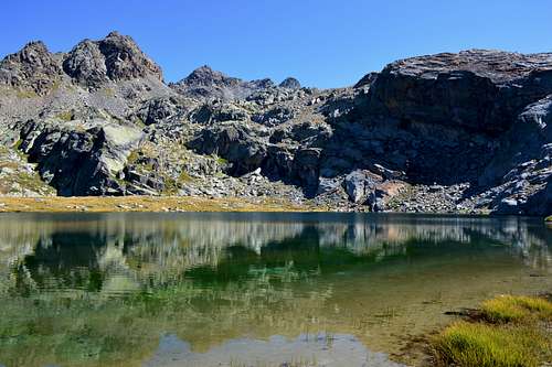
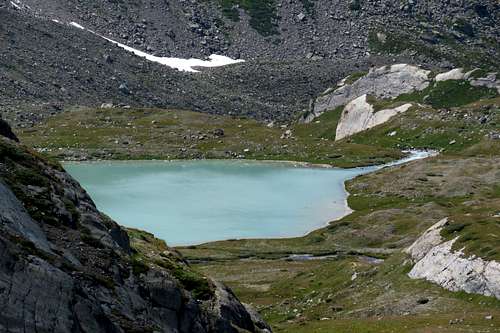
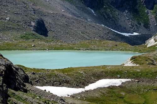
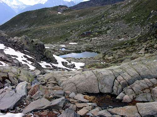
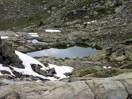
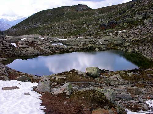
Route Go down the path that leads to the tributary of Lago Azzurro for about 50 meters, cross the wooden bridge and take the path on the right that leads to the Upper Rutor Lakes (2.539m), after about 10 'the path n° 3 splits, continue on the one left; shortly after we will skirt a small lake known as Dans la Roche or "Lac Sans Nom" (2.602m), located on the Western slopes of the Pointe des Invergneures (3.019m). Climb up to the small collar at about 2.680 meters, after which, leaving the path n° 16 on the left (east) that leads to the Planaval Pass (3.016m), continue instead on an unnumbered path that leads to Lac Superieur . In this part of the route you leave Lac Vert (2.534m) and Lac Gris (2.539m) just at the bottom, which are easily and quickly reachable. If you want to continue, you can:
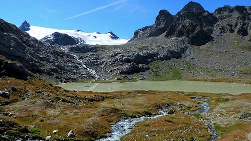
a) - continue upwards, first reaching Lac Marginal and then turning Northwest to Lac des Seracs (2.387m), located at the foot of Petit Assaly (2.930m). From this an again unnumbered path, descending towards the Northeast, reaches again Lac du Rutor or Azzurro (2.428m) at the foot of Sainte Marguerite (2.463m) and in a moment the Albert Deffeyes Refuge. Also
b) - anticipate the descent and with an equally circular but less "widened" and unnumbered path that from the junction 2.545 meters descends directly to the North and, passing between Lac Gris and Vert and the Eastern shore of Lac du Ruitor , it also arrives at the same refuge. A third possibility is
c) - when you reach the crossroads at an altitude of 2.100 meters, turn right onto the path n° 8 and after not numbered, that leads to the long Bella Combe Vallon, leaving it early and, heading Southeast, reach Lac des Seracs (2.387m). Follow the tributary, with a very tiring unnumbered path on moraines, coming from Lacs Neuves (2.551m), and reach them (From Albert Deffeyes Refuge 3h'30/3h'30).
Descent Coming back is along the same route.
 |
 |
 |
 |
 |
Avvicinamento: Dalla Frazione di La Joux (1.607 m) risalire il sentiero che a E fiancheggia il Torrente du Rutor e le sue tre belle cascate. Più precisamente: iniziare la salita verso il Rifugio A. Deffeyes sul sentiero davanti al "Bar delle Cascate" contrassegnato con il n° 3, dopo aver oltrepassato un ponte in legno sulla sinistra e dopo circa 0h'15 si incontra la prima delle tre spettacolari Cascate del Rutor, proseguire lungo il sentiero e oltrepassare (sulla destra) l'Alpeggio di Parchet posto sulla destra (1.772 m). Continuare sempre lungo il sentiero che ora si inerpica a gradoni e dopo circa 0h'55 si oltrepassa la seconda cascata (segnalata da un cartello e non visibile dal sentiero principale), dopo circa altri 10' si incontra il cartello della terza cascata; continuare sul ripido sentiero per altri 20'; qui il sentiero si divide, prendere quello sulla sinistra ben segnalato che conduce al rifugio (quello di destra recante il n° 8 porta ai magnifici Laghi di Bella Comba). Risalire sino al Colletto (2.130 m) per poi scendere leggermente sulla destra e proseguire fino al Lago Glacier (2.143 m); oltrepassare il ponticello in legno che sovrasta l'emissario del lago e, lasciando sulla destra l'omonimo alpeggio, riprendere a salire decisamente lungo ampi tornanti fino a raggiungere l'altipiano dove è sito il Rifugio A. Deffeyes (2.494 m): qui conviene pernottare (2h'45/3h'00 da La Joux).
 |
 |
 |
 |
 |
Via Ridiscendere per circa 50 metri il sentiero che conduce all'immissario del Lago Azzurro, attraversare il ponticello in legno e portarsi sul sentiero di destra che porta ai Laghi Superiori del Rutor (2.539 m), dopo circa una decina di minuti il sentiero n° 3 si sdoppia, continuare su quello si sinistra od Est; poco tempo dopo si costeggerà un laghetto conosciuto come Dans la Roche o "Lac Sans Nom" (2.602 m), posto alle pendici Occidentali della Pointe des Invergneures (3.019 m). Salire sino al piccolo colletto posto a circa 2.680 metri, dopodiché, abbandonato sulla sinistra (sempre Est) il sentiero n° 16 che conduce al Passo di Planaval (3.016 m), continuare invece su di un sentiero non numerato conducente al Lac Superieur. In questo tratto di percorso si lasciano appena in basso il Lac Vert (2.534 m) ed il Lac Gris (2.539 m), peraltro facilmente ed in breve tempo raggiungibili. Volendo proseguire si può:
a) - continuare verso l'alto raggiungendo dapprima il Lac Marginal e poi svoltando a Nordovest il Lac des Seracs (2.387 m), posto ai piedi del Petit Assaly (2.930 m). Da questo un sentiero ancora non numerato, scendendo verso Nordest raggiunge nuovamente il Lac du Rutor o Azzurro (2.428 m) ai piedi di Sainte Marguerite (2.463 m) ed in un attimo il Rifugio Albert Deffeyes. Oppure
b) - anticipare la discesa e con percorso altrettanto circolare ma con sentiero non numerato nonché meno "allargato" che dal bivio 2.545 metri scende direttamente a Nord e, passando tra i Lac Gris e Vert e la sponda Orientale del Lac du Rutor, perviene ugualmente allo stesso rifugio. Una terza possibilità consiste in
c) - raggiunto il bivio a quota 2.100 metri, svoltare verso destra (Ovest) sul sentiero n° 8 e poi non numerato, che conduce al lungo Vallone di Bella Combe, abbandonandolo presto e, con direzione Sudest raggiungere il Lac des Seracs (2.387 m). Seguire l'immissario, con percorso veramente faticoso su sentiero non numerato su morene, proveniente dai Lacs Neuves (2.551 m), e raggiungerli (Dal rifugio 3h'00/3h'30).
Discesa Per la stessa via di salita.
Difficulty
Difficulty EE; from F to F+.
EE; da F a F+.
 |
 |
 |
 |
 |
Equipment
For Hiking but for high mountain equipment.
Da Escursionismo ma per alta montagna.
 |
 |
 |
 |
 |
Important Information
- REGIONE AUTONOMA VALLE D'AOSTA the official site.
- FONDAZIONE MONTAGNA SICURA Villa Cameron, località Villard de la Palud n° 1 Courmayeur (AO) Tel: 39 0165 897602 - Fax: 39 0165 897647.
- COMPAGNIE DES GUIDES RUTOR Fraz. Entrèves tel/fax 0039.0165.885574 e-mail Guidealpine@lathuile.it
- A.I.NE.VA. (Associazione Interregionale Neve e Valanghe).
 |
 |
 |
 |
 |
Useful numbers
- Protezione Civile Valdostana località Aeroporto n° 7/A Saint Christophe (Ao) Tel. 0165-238222.
- Bollettino Valanghe Tel. 0165-776300.
- Bollettino Meteo Tel. 0165-44113.
- Unità Operativa di Soccorso Sanitario Tel. 118.