
-
 638 Hits
-
 80.49% Score
-
 12 Votes
|
|
Route |
|---|---|
|
|
45.61310°N / 7.30760°E |
|
|
Hiking |
|
|
Overview
Excellent trip along the Urtier valley, even if the route does not present particular difficulties and a good workout is required due to the length of the journey which can be covered in part along the farm road and along the path.
Ottima gita lungo il vallone dell’Urtier, anche se il percorso non presenta particolari difficoltà e necessario un buon allenamento per via della lunghezza del tragitto che può essere percorso in parte lungo la strada poderale e lungo il sentiero.
Getting There
BY CAR:
- From Torino, Milano, etc: Motorway A5. Exit at Aosta Ovest. Drive to the near Aymavilles. Follow the directions for Valle di Cogne.
- From Switzerland: through the Grand Saint Bernard Tunnel or the namesake Pass. Drive to Aosta, then follow the direction for Courmayeur on SS.26. Just after Sarre, turn to the left, in the direction of Valle di Cogne.
- From France: through Mont Blanc Tunnel or Petit St. Bernard Pass. It isn't necessary to take Motorway A5: you can drive on SS.26, in the direction of Aosta. Before arriving at the Village of Sarre, turn right following the sign for Valle di Cogne. After Aymavilles, the SR.47 crosses the Villages of Vieyes, Epinel and Crétaz and after about 25 Km arrives at Cogne (1.534m). From Cogne you can get the Village of Lillaz (1.617m).
BY PLANE:
- Aeroporto "Corrado Gex" Saint Christophe (Aosta).
![]()
Route
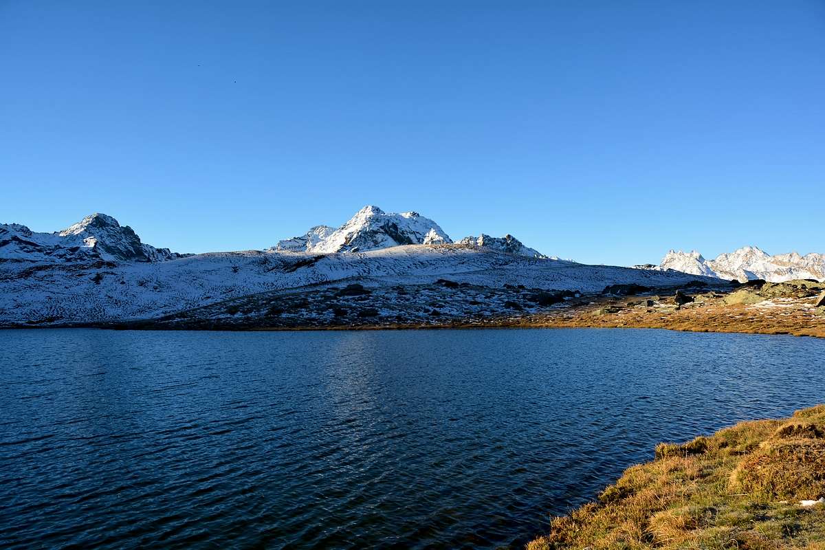
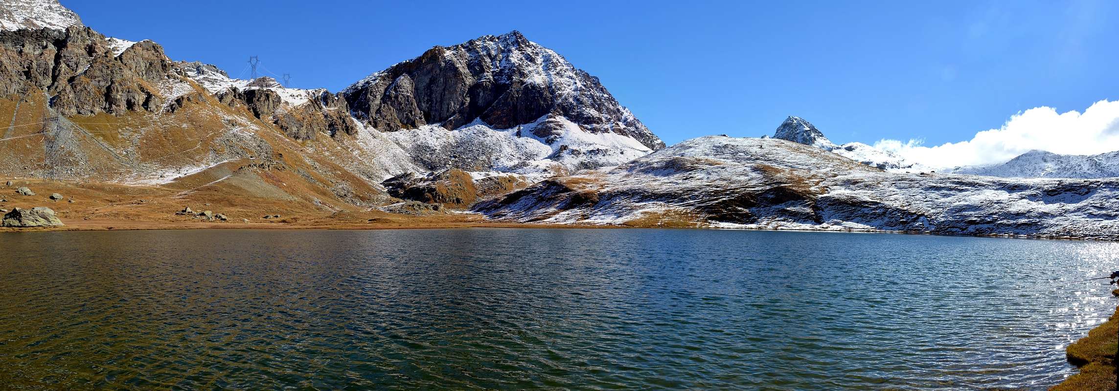
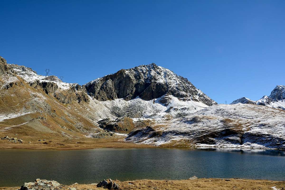
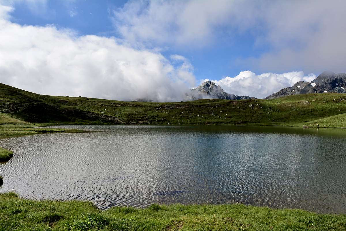
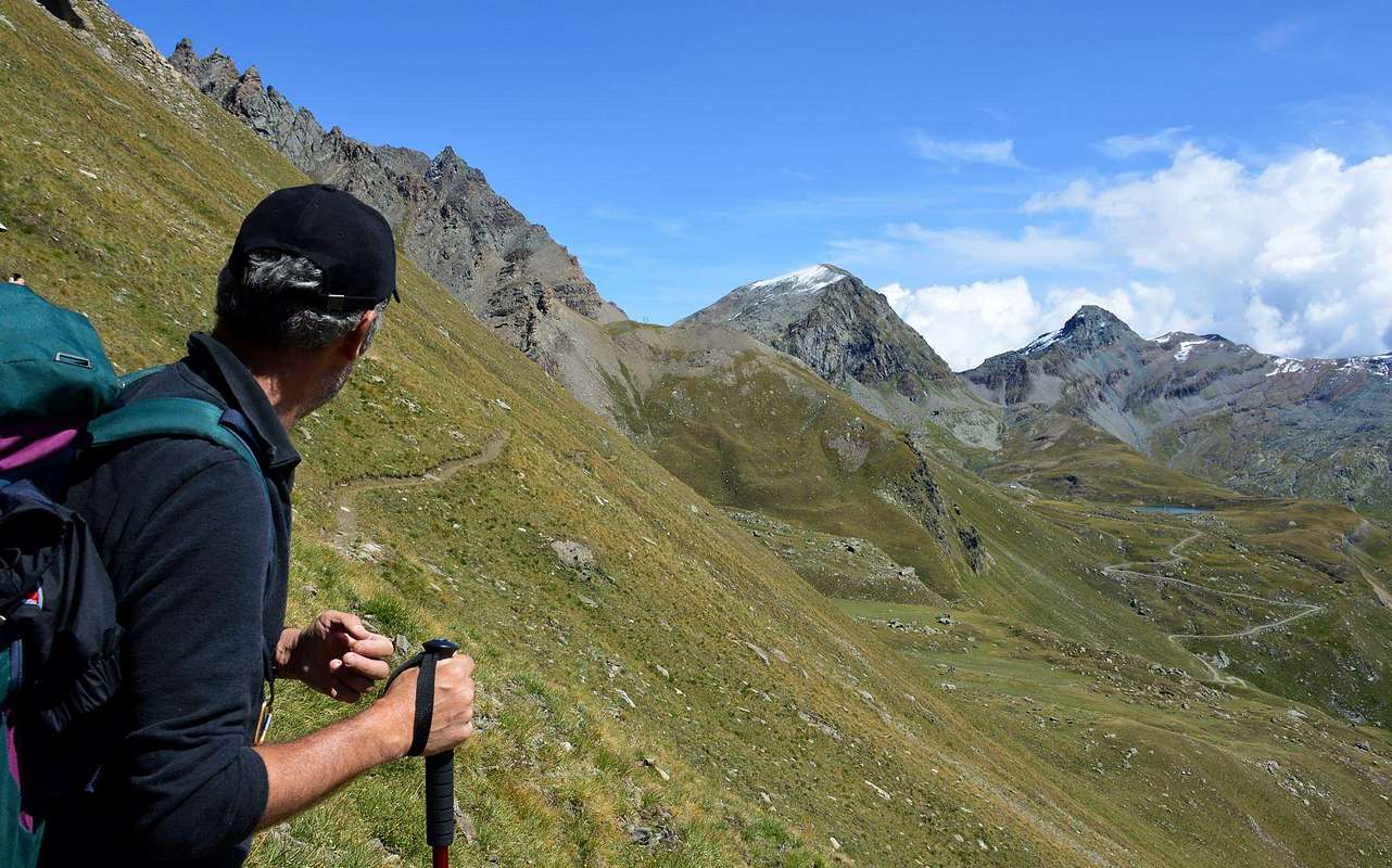
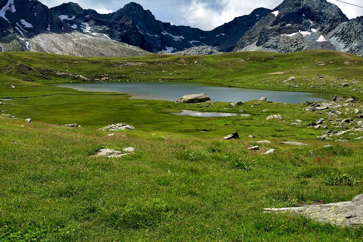
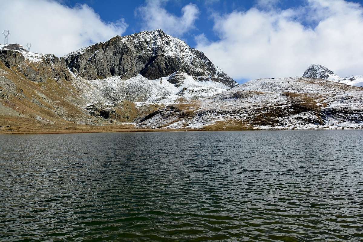
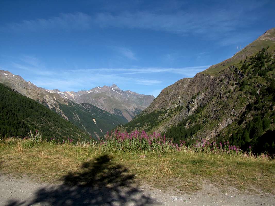
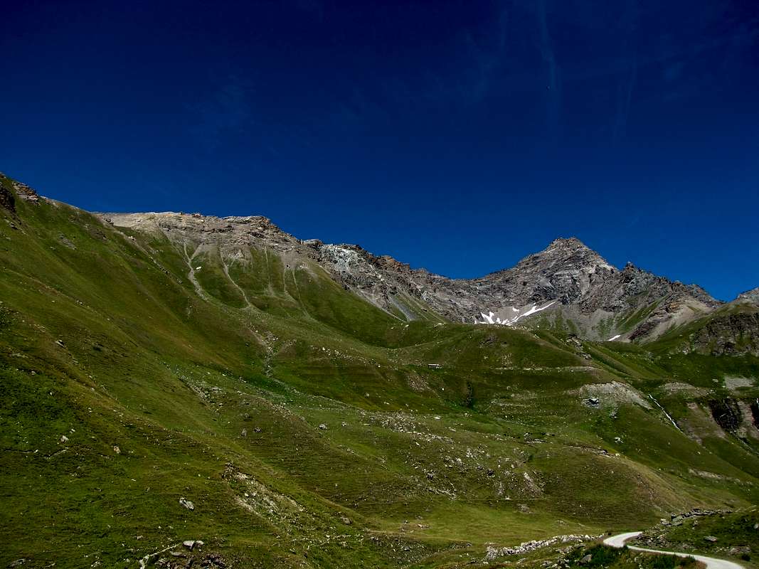
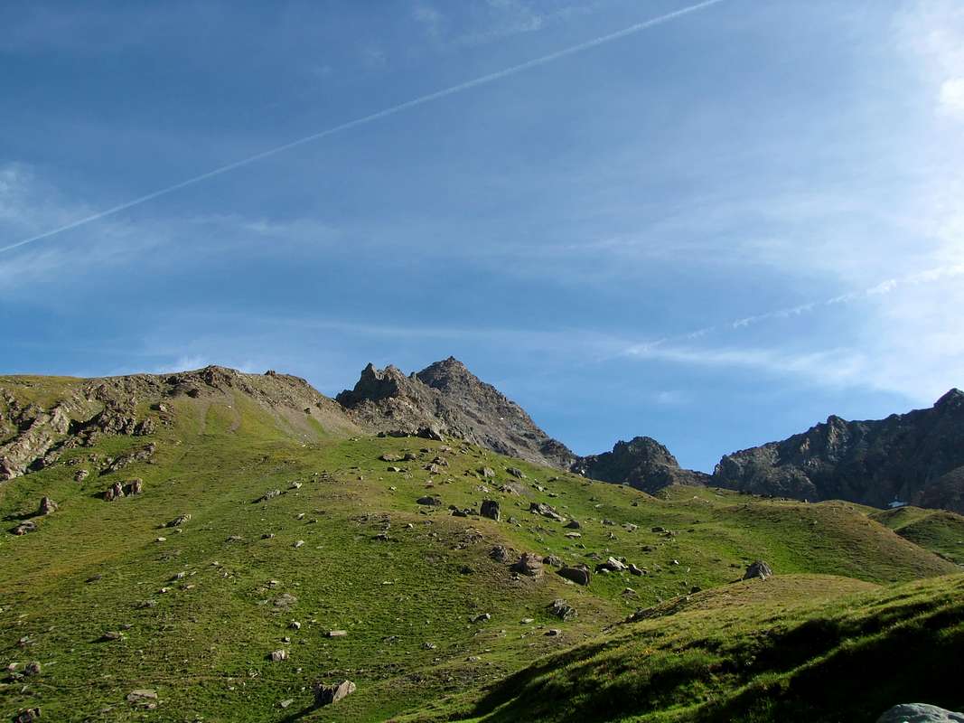
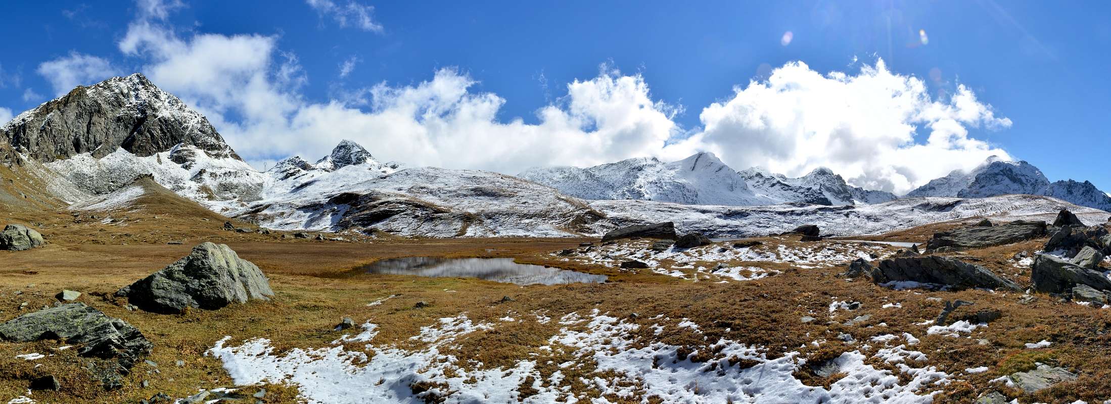
From Cogne (1.534m) reach the hamlet of Lillaz (1.631m) by bus or car. From the parking lot, where there are countless trail signs (1.612m), you can choose whether to go up following the farm road, longer but more also followed by those who go up and down on a mountain bike, or along the AltaVia path n° 2, path n° 13 and trail sign 10. We will follow the road of the interpoderale 10H: from the parking lot along the road, after the numerous paved road you reach the pastures of Goilles Dessus (1.869m) and Goilles dessot (1.838m). From Goilles Dessus continue along the valley up to the locality of Crêt (2.024m Cappella degli Alpini 2.020m) from here, now on an almost flat route, you reach some steep hairpin bends (asphalted) and once you pass you find yourself in front of a magnificent waterfall, from this point the interpoderale becomes the n° 10 continue to follow it for about 1h'15 until you reach a flat stretch where on the left there is a wooden bridge (about 2.395m) which crosses the Urtier stream. From here, along the 10D road, pass the Invergneux pasture (2.521m) and reach a magnificent plateau, Alpe Ponton (2.631m), from where you can enjoy a magnificent panorama of the Tersiva (3.515m), the Torre Ponton (3.173m) the Becco Costazza (3.092m) and the entire Gran Paradiso Group (4.061m). A real pity that everything is disturbed by the imposing power line that crosses the area. The Ponton lake (2.601m) is located just below the Alpe itself. Duration of the uphill route from 4'15 to 5h'00. From the parking lot to the lake.
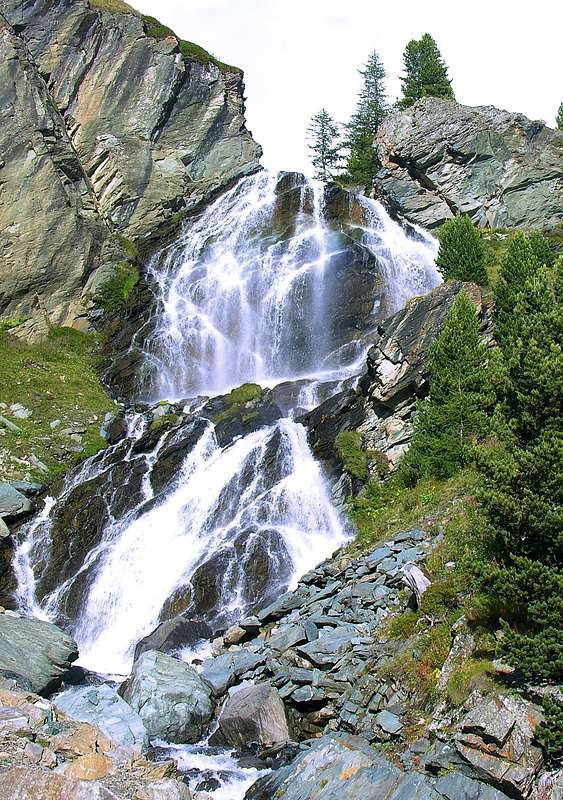
Da Cogne (1.534 m) raggiungere in bus o in auto la Frazione di Lillaz (1.631 m), dal parcheggio, dove sono posti innumerevoli segnavia (1.612 m), si può scegliere se salire seguendo la strada interpoderale, piu’ lunga ma piu’ comoda seguita anche da chi sale e scende in Mountain Bike, oppure lungo il sentiero AltaVia n° 2, sentiero n° 13 e segnavia 10. Noi seguiremo la via dell’interpoderale 10H: dal parcheggio lungo la strada superati i numerosi tornanti in un primo tempo asfaltati si raggiugono gli alpeggi di Goilles Dessus (1.869 m) e Goilles dessot (1.838 m). Da Goilles Dessus continuare lungo il vallone fino alla località Crêt (2.024 m Cappella degli Alpini 2.020 m) da qui, ora su percorso quasi pianeggiante si raggiugono alcuni ripidi tornanti (asfaltati) e superati ci si ritrova innanzi a una magnifica cascata, da questo punto l’ interpoderale diventa la n° 10 continuare a seguirla per circa 1h'15 fino a raggiugere un tratto pianeggiante dove sulla sinistra si trova un ponte in legno (2.395 metri circa) che supera il torrente Urtier. Da qui lungo la strada 10D superare l’alpeggio Invergneux (2.521m) e raggiunto un magnifico altopiano, Alpe Ponton (2.631 m), da dove si gode un panorama grandioso sulla Tersiva (3.515 m), la Torre Ponton (3.173 m) il Becco Costazza (3.092 m) e l’intero Gruppo del Gran Paradiso (4.061 m). Un vero peccato che il tutto sia disturbato dall’imponente elettrodotto che attraversa la zona. Il lago Ponton (2.601 m) di trova appena al di sotto della stessa Alpe. Durata del percorso in salita da 4'15 a 5h’00. Dal parcheggio al lago.
 |
 |
 |
 |
 |
Difficuty
The itinerary is considered E.
L'itinerario è considerato E.
Equipment
For Hiking.
Da Escursionismo.
Mountain Condition
- You can get meteo information at the official site of the Regione Valle d'Aosta:
- Valle d'Aosta Meteo
Webcam
- WEBCAM on Aosta Valley:
- Webcam
 |
 |
 |
 |
 |
Books and Maps
BOOKS:
- "Il Parco Nazionale del Gran Paradiso (Valli di Champorcher-Clavalitè-Saint Marcel-Laures-Cogne-Valsavarenche-Conca di Pila" di Giulio Berruto 3/volume 2°, IGC, Torino 1981, 2a Ed. 2000. (in Italian)
- "dove si specchia il cielo I LAGHI DELLA VALLE D'AOSTA" di Sergio Piotti, Ferrari Editrice.
- "Guida dei Monti d'Italia-Gran Paradiso Parco Nazionale" E. Andreis, R. Chabod, M. C. Santis, Club Alpino Italiano/Touring Club Italiano, prima Ed. 1939; seconda Ed. 1963; terza Ed. 1980.
MAPS:
- Kompass "Gran Paradiso Valle d'Aosta Sentieri e rifugi" Carta turistica 1:50.000.
- L'Escursionista "Tour de la Vallée de Cogne Grand Paradis" Carta dei sentieri 1:25.000.
- I.G.C. Istituto Geografico Centrale "Gran Paradiso-La Grivola-Cogne" Carta turistica 1:25.000.
- I.G.M. Istituto Geografico Militare Foglio 41 1:25000: I SO Gran Paradiso - I NE Cogne.
- A.IA.T "Cogne Gran Paradiso Cogne Aymavilles-Walking map" 1:25.000.
- L'Escursionista "Valle di Cogne" Carta dei sentieri (n° 10) 1:25.000.
![]()
Important Information
- REGIONE AUTONOMA VALLE D'AOSTA the official site.
- FONDAZIONE MONTAGNA SICURA Villa Cameron, località Villard de la Palud n° 1 Courmayeur (AO) Tel: 39 0165 897602 - Fax: 39 0165 897647.
- SOCIETA' GUIDE ALPINE DI COGNE Tel. 347/9473526 – 328/1373728.
- A.I.NE.VA. (Associazione Interregionale Neve e Valanghe).
- A.IA.T. Cogne Gran Paradis via Bourgeois n° 34 Tel. 0165-74040. E-mail: aiat@cogne.org
- Ezio Sport articoli sportivi - via Bourgeois n° 64 Tel. 0165-74204.
Useful Numbers
- Soccorso Alpino Cogne (SAR) Tel. 3482685406.
- Protezione Civile Valdostana località Aeroporto n° 7/A Saint Christophe (Ao) Tel. 0165-238222.
- Bollettino Meteo (weather info) Tel. 0165-44113.
- Unità Operativa di Soccorso Sanitario Tel. 118.