
-
 42529 Hits
-
 92.59% Score
-
 39 Votes
|
|
Route |
|---|---|
|
|
42.44000°N / 19.81000°E |
|
|
Hiking, Mountaineering |
|
|
Spring, Summer, Fall, Winter |
|
|
Expedition |
|
|
Varies |
|
|
Overview - Introduction
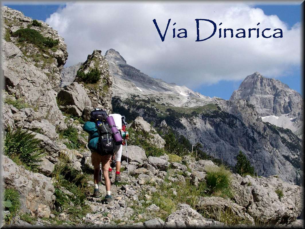 |
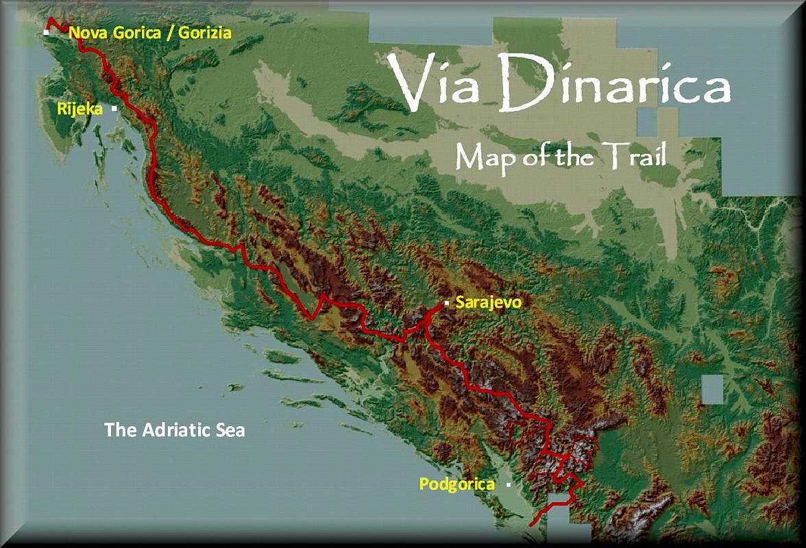
Via Dinarica is a virtual project of a long-distance trail, a personal suggestion based on my years-long exerience, of a trail that passes through the most attractive mountain areas of the Central Belt of the Dinaric Alps, spanning Slovenian/Italian town of Nova Gorica/Gorizia with Albanian Shkodër (Scutari) and passing through 5 Western Balkan countries (Slovenia, Croatia, Bosnia and Herzegovina, Montenegro and Albania).
Via Dinarica is a trail that in many of its sections connects or follows more already existing local trails and mountain paths. In some areas where a practical connection does not exist I have tried to present you the most practical (and attractive) options to walk from one mountain area to the next one. There, where a description of a section (or a part of it) exists on SP, a link to that SP page has been specified.
The main aim of a long-distance trail (transverzal) is that one visits some of the most interesting parts and attractions in a mountain chain by using one single (usually) marked trail.
The tradition of mountaineering trails (transversals) in countries that are located in the Dinaric mountains is several decades long. But with the breakdown of former Yugoslavia some of these long-distance hiking trails ceased to exist, for the reason that the most of hiking routes remainded in now separate states, separated by new borderlines, or in some cases separated by lethal mine fields – dark remnants of recent war activities in some areas.
Mostly due to crisis and conflicts in the region if u look at the map of trans-european or international walking trails/pathways (Wiki – European Long Distance Paths or European Ramblers’ Association) you could easily notice a big „black spot“ in the Region of South-eastern Europe (Western Balkans where the Dinaric Alps are spreading) poorly covered with international/European long distance trails.
This is pitty, because the Dinaric Alps is an area of specific beauty, atractivity and diversity; from deep vast woods, pastures, blossoming meadows, endemic species and relicts, rugged carstic landscapes and attractive morphological forms, sea-views from top of the mountains to the blue Adriatic Sea and its numerous islands and beautifull sunsets, deep river canyons with blue-green water and numerous travertine waterfalls; here u could pass by alpine landscapes with alpine-like villages, from mediterannean-type of settlements to oriental towns, all with its medieval castles and fortresses, churches and monasteries of three main European religions – Roman-catholic, Ortodox or Islamic.
| Via Dinarica – Highlights | |
| Karstic features (dolinas, poljas, caves, underground streams …) | |
| Variety of land features – some of the most rugged terrains in Europe, rocky peaks, rounded forested mountains, highland pastures | |
| Sea views (islands, sunsets..) along the mountain trail | |
| Deep river canyons | |
| Preserved forests | |
| Biodiversity (endemic species of flora and fauna, large carnivore habitats) | |
| Hikers-friendly, welcoming local people | |
| Natural and Cultural heritage (national parks and other protected areas, archaeological sites, historical locations) | |
| Diverse cultural zones – Central European, Mediterannean, Dinaric, Oriental-Ottoman, Balkan | |
| Cultural and religious crossroads – Roman-Catholic – Eastern Ortodox – Muslim-Islamic | |
Personal note
On many occasions during the past decade, on my hiking tours of Dinaric Alps especially in Montenegro and Bosnia&Herzegovina I was telling to local mountaineers that I am working on a virtual project of an interstate hiking trail that would pass through all length of Dinaric Alps from Italy/Slovenia to northern Albania, and talking to them about some details about the name of he trail I have chosen - namely Via Dinarica, about specific sections, exloring personally possible detours (because of present borderlines and mine fields etc.) by hiking them personally. Additionally, in 2006. on local SP forum I also wrote (Link to SRB-CG-BIH-SLO-HR-MAK Team) about transverse hiking route from Nova Gorica (Slovenia) to Maja Jezerce (Albania) and thanked one SP member about information on one new eco-lodge which would fit perfectly along Via Dinarica route.
In 2011 I saw that one organization in the Region was talking about „the new project“ that was almost a copy-paste of what was I announcing publicly years before, including the exact name for the project, the name I had made up from my head years before and with specific logic and reason. I wrote to this organization that „someone in their rows“ has taken this idea from me, but received not even a polite answer from them, despite they are official structures. Of course I did not have intention of establishing copyrights on Via Dinarica and its name because I find such ideas only a benefit for the all, but I found their act was not correct. I am writing you this for you will encounter a parallel Via Dinarica on the Internet, to know what is this all about. Now, lately, I am very happy that, thanks to the new people and initiatives, this "parallel" Via Dinarica has received very official shape and strong popular support (including mine ;)), for the benefit of all us admirers of these magic mountains!
 |
The Name and Logo
 |
Logo This self-made logo combines sharp and rounded shapes, both common in the diverse mountains of Dinaric Alps, as well as green color of its vegetation turning into blue at the bottom which talks about connections of Dinaric Alps to neighboring blue Adriatic Sea and with deep river canyons and mountain lakes you can find across this mountain chain.
Trail Concept
The basic route of Via Dinarica is created for ideal conditions, like if there were no state borders (which we hope one day will be removed) or mine fields (hope that this problem will be solved in a near future, too). Until that 'happier time' comes few detours (alternatives) have been explored and recommended in the following Sections Overview. Sections are set up to connect two interesting points along the trail; many times those points are major summits and settlements or appropriate places for overnight accommodation of any type (a settlement, mountain hut, bivouac, camping ground). It take you from 2 to 7 hours to walk each section over. So a person in average physical condition could walk at least one section a day, and depending on other conditions even more of them (2, 3 sections).Also, the intention is that the trail passes through a larger settlement in a period of every 4-7 days of walk so that a hiker can take supplies there, and use other services he is in the need of.
Practical Information
Markations |
Most used way for marking mountain trails in the Region (used in Slovenia, Croatia, Bosnia&Herzegovina and Montenegro) is Knefeljc´s Marking (Knefeljcova markacija) a round marking - red ring with a white circle in the middle, diam 12 - 15 cm. In addition to round, the horizontal markings could be used to, or other variation of red and white (the red tape between the two which one is white, then the directional road signs - the red arrows at the crossroads and the signpost). Some sections are still unmarked, some of the easy to pass because they follow old shepherds routes, while on the others u have to use more orientation skills (those sections are mostly rated as Very Dififcult).
Where to stay – accommodation
Mountain houses, huts, bivouacs and shelters (owned by mountaineering clubs or private)
There are many mountain houses, huts, bivouacs and shelters along the Trail; the most frequent are on Croatian and Slovenian Sections and less on Bosnian&Herzegovian, Montenegrin and Albanian. Mountain accommodation objects in Bosnia & Herzegovina are not so infrequent but the most of them are key-locked and could be open only upon previous request from a mountaineering club that takes care about it, which can be a problem if you are on a multi-day hike. More mountain houses along the trail that are closed in winter time have so called “winter room”, a small room, usually with a modest number of beds, that can be entered freely in a period when the main object is not open.
Other accommodation in mountains
In mountain areas without a long tradition of mountain club´s huts like in Montenegro or Albania (but also in other countries) a different kind of accommodation is being developed, lately. So called Eco katuns, <b, despite they work on more profitable basis, offer good quality and cheap accommodation together with possibilities to try a locally food specialties or even try some of the other organized activities in the area (rafting, jeep-safari ctc.)
Camping and “wild Camping”
More and more camping sites are being established in the area but on many parts of Dinaric trail and Dinaric Alps generally, there are neither mountain houses, nor camping places. Sometimes, even in wider area you will not be able to find such objects at convenient distance. By state laws (like everywhere else in the world!) the camping is not allowed outside camping areas mostly because some would avoid to pay for accommodation, or present a danger from forest fires, but there are so remote and touristic undeveloped areas where many laws simply have no sense. So hikers very often put up their tents by lakes in the area or close to the huts. There are no special rules on camping. No one can stop you from putting it up, especially when you have no alternative to find another accommodation before night. But even if you camp on that "wild" way, BEHAVE ECO-CONSCIOUSLY!
Accomodation offered by local people
In many parts of Dinaric, especially in Bosnia&Herzegovina and Montenegro you can try to ask (many times they will offer you the same by themselves!) local shepherds for a sleeping place in their huts in Katuns (summer periodical settlements nihgh in the mountains). They are modest people, they will never try to profit from you, not even ask money from you, so don’t take advantage of them. An offer to pay for accommodation, even to give some sweets to their children would be very nice and I strongly recommend it to you. And especially from June to early September, there will always be some people on many of those Katuns.
Other
Other accommodation possibilities are in areas, villages, towns and cities along the trail, ranging from simple private rooms to rent (“Sobe” in south Slavic languages”) to motels, hostels and hotels. From my personal experience, if u find yourself in a small town or a city a good idea is to ask local taxi driver about budget accommodation (private rooms).
| My favorite sections | |
| Section Samarske stijene - Bijele stijene | |
| Sections Zavižan – Veliki Alan | |
| Section Dabarski kukovi | |
| Section Zrmanja – Krupa (detour) | |
| Sections Čvrsnica | |
| Sections on Prenj | |
| Sections Zelengora | |
| Sections Maglić to Bioč | |
| Sections Durmitor | |
| Section Komovi | |
| Section Tepishta – Grebaje | |
| Sections Gusinje – Maja Jezerce - Thethi | |
| Section Thethi - Valbona | |
The trail is designed that every-while (at maximum of 5-7 days) u pass by a settlement (a hamlet, a village, a town, a city) along the trail where u can find grocery shops, bakeries, inns, restaurants, a post-office, telephone, medicine facilities and other useful services.
Water supply
Despite large precipitation in Dinaric Alps, because of their geological structure (limestone mostly), in many mountain areas surface water is difficult to find; there could be sections without any water spring or well. So just in case every time you have the opportunity refill your water reserves.
When to go
Best period to take the hike is from May to September. Although in some areas u could still face snow covered areas in May and on the highest sections (esp. in Prokletije), even untill August. Generally, probably the most pleasant months are June and September. July and August can sometimes be very hot to climb because of influence of nearby Mediterannean climate.</b
Red Tape
Fees:Generally you have to pay a entrance ticket when entering National parks along the trail (in Croatia: Risnjak, Northern Velebit and Paklenica NPs; in Bosnia&Herzegovina: Sutjeska, and in Montenegro: Durmitor and Biogradska gora NPs), although in practice the Via Dinarica Trail passes through only two entrance points where u are obliged to pay (Paklenica and Biogradska gora), while in other National park it is up to a situation whether u will meet national park rangers along your way or not. In more Croatian national park mountaineers can get a ticket discount by presenting their mountaineering club members card.
Mines Awareness
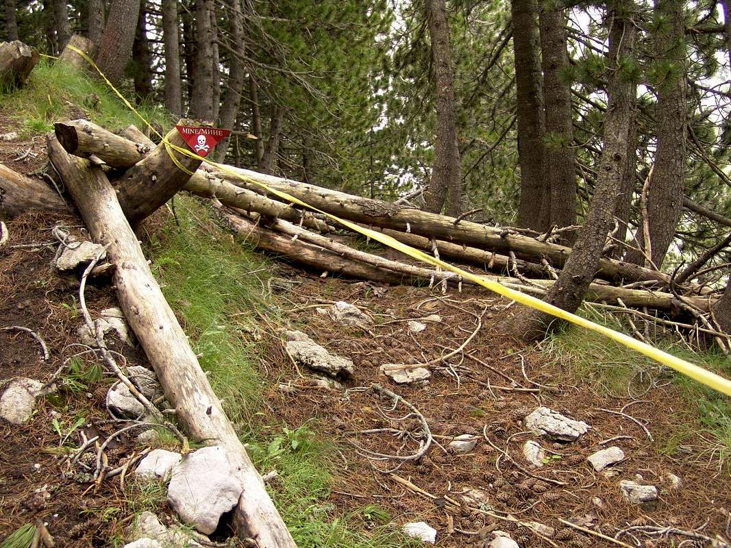
There are magnificent mountains like Treskavica, south of Sarajevo, where mine situation is so complex that people avoid to climb it in summer (there were winter climbs though, thanks to thick snow layer covering mine fields).
- Situation in Bosnia an Herzegovina (Source: BIH MAC) More information, including a mine-risk map of Bosnia and Herzegovina on BH MAC - Bosnian-Herzegovian Mine Action Center and mine.ba
- Situation in Croatia Also struck by war activities in 1990s, but as a popular tourist location nowadays, Croatia set up a National Mine Action Program, determining the objective: to demine the Croatian territory by the year 2019. The number of mine fields and the overall danger is much lower than in Bosnia and Herzegovina, but it is still present in some areas (luckily the most popular tourist areas are 100 percent safe). But confrontation lines passed over the Dinarics in Croatia also, making still some mountain areas inapproachable. More information on HCR - Croatian Mine Action Center page and Mine sites maps link.
Border Areas, Frontier Zones
One mountain range, but many states - Be cautious when climbing close to border areas. While there are some regions with so called "tourist zones" proclaimed between two states where people with strictly tourist/mountaineering intentions have relative freedom of movement in those border areas (Dinara massif between Croatia and bosniaHerzegovna or hike from Sutjeska river valley in Bosnia&Herzegovina to Mratinje lake in Montenegro), there are also many other border areas (Prokletije Range, between Montenegro and Albania) which are subject to much stricter police control because of the presence of smugglers in nearby area.
Wild animals
As very rugged and mostly under-populated Area, many mountains of the Dinaric Alps abound in animal life, including the larges carnivores: bear, wolf, lynx, wild cat. Although statistically the risk that these animals would attack you is very low, you have to be aware of their presence in the area where you plan to climb. So the forests of High Dinaric Alps, from Slovenia, over Croatia to Montenego-Bosnia-Herzegovina border and Northern Albania are habitats of bear, wolf and lynx. The attacs on humans are very rare, and the most often the victims would be sheep or goats in nearby villages or mountain cottages. Wolfs are the most dangerous in herds an in winter time, especially when they descend from cold mountains into warmer areas of Dalmatian coast hinterland (Dalmatinska Zagora), Lower Herzegovina and Montenegrin Coast hinterland, and continental parts of Slovenia, Croatia, Bosnia-Herzegovina, Montenegro, Albania. Bears are dangerous in spring if you meet a mother-bear with her young cubs, because she will try to do anything to protect them. Snakes are present like everywhere on the Mediterranean and in the mountains - respect them, they will respect you. If you think about them as a "biodiversity stuff" you will psychologically feel much better! Because the danger of the snakes is of course present, but it is more psychological fear than the real danger (at least statistically).
Extreme Weather Conditions
As a transitional area where more types of climate touch, or better say crush, sudden weather changes and the extreme weather conditions are very much present here. Especially extreme weather conditions are in the High Dinarics and in transitional area between the Adriatic Coast with Mediterranean climate and the highest mountains of Dinarics in the background.Climbing the mountains in the Dinarics you could feel the forces of the Sun, the wind, the snow and the rain. But despite lots of precipitation, the mountains in the Area are made of limestone which does not keep the liquid at the surface, so on many mountains water sources are scarce, and as a precaution always take all the water you need with you, during all periods.
Bad markations or non-existence of marked trails
Still many mountain trails in the Dinaric Alps are not yet marked, or they are marked badly, so you will be forced to explore sources, in advance, trying to find more information including good maps on your targets. Since, from my experience, many times you will find very scarce information on many mountains in the Dinarics, you will be many times simply forced to ask locals or use your own sense of orientation. From my experience the mountain areas which are the best marked and covered are in western parts of the Chain (in Slovenia, Croatia and all along the Adriatic Coast). Outside this area there are some very well covered area like Durmitor, Bjelasnica (Sarajevo), some mountains of Herzegovina and some other areas in Montenegro (Komovi, Bjelasica).
Sections Overview
![Dinaric Alps]()
Acknowledgments
I thank all Summitpost members whose SP-photos were used to present different sections of the Trail. Each member´s name was stated (with link to Member´s Profile) on the right side of each photo. Original photo-contribution can be reached by clicking on the photo itself.
Gordan
Some sections are in construction at the moment (if u don’t see symbols in the Table functionally, please try with the latest version of your browser or try to open this page with another browser)
Table Index ![Via Dinarica - Logo]()
Photo: Via Dinarica - Logo
Section´s Major Points
¤ Settlement
µ Attractive location – by the Trail
¶ Attractive location - off the Trail, in nearby area
▲ Summit
± Height (meters/feet above sea level)
)( Mountain pass
⌂ Mountain house / Hut / Bivouac
y Border crossing / Frontier
S Water (well, spring, reservoire)
ã Possible Accomodation in a solid object
ä Food and drinks available in object or settlement
M DANGER! (mined area in the vicinity – strictly follow markations)
Section Info
· Walking time (on climb: ö; descentø)
¢ Markations (Orientation signs)
4 Difficulty – Easy Walk
44 Difficulty – Difficult terrain
444 Difficulty – Very difficult terrain
y Mountain area / Mountain
O Country
8 Other links
Ü Name of existing local trail(s) on the same section as Via Dinarica
1. Nova Gorica/Gorizia - Sveta gora 
Photo: The View from Škabrijel by Vid
¤ Nova Gorica/Gorizia; Pop. 32,763 N. Gorica); Elev. 93 m (305 ft); S ã ä Wiki (N.Gorica) Wiki (Gorizia)
¤ Solkan; Pop. 3,272 (2002.); 94 m (309 ft); S ã ä Wiki
¶ Solkan Attractions: Railway bridge with the biggest stone arch in the world
)( Preval (Skalnica); pass; Elev. 325 m (1,066 ft.); S ä
µ Sveta gora (Pilgrimage site, Monastery, Museum, ▲ Skalnica, 682 m/2238 ft); S ä Wiki More Info
· 2,30 h (Walking time on sub-sections: Preval (Skalnica) – Sveta Gora: 55 min by this old pilgrims´ path)
4 Difficulty – Easy Walk
¢ Partially marked
y Kras Wiki; Trnovski gozd (SP)
O Slovenia/Italy2. Sveta gora - Trnovo 
Photo: Trnovski gozd by Vid
µ Sveta gora (Pilgrimage site, Monastery, Museum, ▲ Skalnica, 682 m/2238 ft); S ä Wiki More Info
¤ Grgar; Pop. 748 (2002); 297.4 m (976 ft) S Wiki
¤ Zagorje; hamlet of Grgar; S
¤ Sedovec; hamlet; S
¤ Trnovo (Trnovo nad Gorico); Pop. 305 (2002.); 780.8 m (2,562 ft); S ä Wiki
¶ Trnovo Attractions: WW2 Memorial monument on nearby ▲ Kobilnik summit 813 m (2,667 ft.)
· - h
4 Difficulty – Easy Walk
¢ Partially marked
y Trnovski gozd (SP)
O Slovenia3. Trnovo - Čaven 
Photo: Descending from Kucelj by Vid
¤ Trnovo; Pop. 305 (2002.); 780.8 m (2,562 ft); S ä Wiki
¤ Rijavci; S ã 15 beds Info ä
▲ Čaven; 1,185 m (3,888 ft)
▲ Kucelj; 1,237 m (4058 ft); Info SP
⌂ Mountain hut: Koča Antona Bavčerja na Čavnu; 1,242 m (4,075 ft); open Sat, Sun, holidays 7-19 May-Sep. S ã Accomod. for 40 persons ä
· 3 h
4 Difficulty – Easy Walk
¢ Marked
y Trnovski gozd (SP)
O Slovenia4. Čaven - Kovk 
Photo: Between Kovk and Sinji vrh by Vid
⌂ Mountain hut: Koča Antona Bavčerja na Čavnu; 1,242 m (4,075 ft); open Sat, Sun, holidays 7-19 May-Sep. S ã Accomod. for 40 persons ä
¤ Predmeja; Pop. 363 (2002.); 896.5 m (2,941 ft); Wiki
µ Otliška jama – Naravno okno (Otlica natural window) SP
▲ Sinji vrh (Kovk); 1,002 m (3,287 m); SP
· 4 h
4 Difficulty – Easy Walk
¢ Marked
y Trnovski gozd (SP)
O Slovenia5. Kovk - Col 
Photo: Sinji vrh by Vid
▲ Sinji vrh (Kovk); 1,002 m (3,287 ft); SP
▲ Podrta gora; 827 m (2,713 ft)
▲ Kovk peak; 961 m (3,153 ft); SP
¤ Col; Pop. 498 (2002.); 611.3 m (2,006 ft) Wiki
· 3 h
4 Difficulty – Easy Walk
¢ Marked
y Trnovski gozd (SP)
O Slovenia6. Col - Abram 
Photo: View from Trnovski gozd in direction of Nanos by Vid
¤ Col; Pop. 498 (2002.); 611.3 m (2,006 ft) Wiki
¤ Podkraj; Pop. 437 (2002.); 808.2 m (2,652 ft) Wiki
⌂ Mountain hut: Furlanovo zavetišče pri Abramu; 900 m (2,953 ft); open all the time
· 3 h
4 Difficulty – Easy Walk
¢ Marked
y Trnovski gozd (SP); Nanos (SP)
O Slovenia7. Abram - Pleša 
Photo: Mountain hut: Vojkova koča on Nanos by vili
⌂ Mountain hut: Furlanovo zavetišče pri Abramu; 900 m (2,953 ft); open all the time
¤ Nanos; 790-900 m (2,592-2,953 ft)
⌂ Mountain hut: Vojkova koča na Nanosu (transl., on Nanos); 1,240 m (4,068 ft); open Wed-Sun from begin. of June to end Sept & on Sat, Sun and holidays in other months
▲ Pleša; 1262 m (4140 ft.)
· 2 h
4 Difficulty – Easy Walk
¢ Marked
y Nanos (SP)
O Slovenia8. Pleša - Predjama 
Photo: Nanos from Šmihel by vili
⌂ Mountain hut: Vojkova koča na Nanosu (transl., on Nanos); 1,240 m (4,068 ft); open Wed-Sun from begin. of June to end Sept & on Sat, Sun and holidays in other months
µ Sv. Brikcij (church)
¤ Strane; Pop 72 (2002.); 658 m (2,159 ft); Wiki
¤ Šmihel pod Nanosom; Pop 171 (2002.); 585 m (1,920 ft); Wiki
µ Šmihel archaeological site on Pivka Park of Military History site Info
¤ Predjama; Pop 85 (2002.); Elev. 509 m (1,669 ft) ã ä Wiki
· ø (Pleša-Predjama) 2 h; ö (Predjama – Pleša) 3 h (Walking time on sub-sections: Pleša to Šmihel 1,30 h; Šmihel to Predjama 30 min; Strane to Šmihel 30 min.)
4 Difficulty – Easy Walk
¢ Marked
y Nanos (SP); Pivško podolje
O Slovenia9. Predjama - Postojna 
Photo: Postojna Cave by vili
¤ Predjama; Pop 85 (2002.); Elev. 509 m (1669 ft) ã ä Wiki
µ Predjama attractions; Predjamski grad (Predjama castle) Info 1, Info 2; Jama pod gradom (The cave bellow Predjama castle) Info; Erazmova lipa (Erazem's Linden) Info; Cerkev Žalostne Matere Božje (Church of Our Lady of Sorrows) Info
¤ Pristava (hamlet of Predjama)
ã ä Pension Erazem
µ Polhovica (forested karstic area)
¤ Zagon; Pop 177 (2002.); Elev: 549 m (1,800 ft) Wiki
µ Betalov spomdol (cavity; archaeological site Info)
¤ Veliki Otok; Pop 148 (2002.); Elev. 540 (1,771 ft) Wiki
µ Veliki Otok attractions; Sv. Andreja (St. Andrew church); Otoška jama (Otok Cave, karstic cave, 1 Km N od Veliki Otok); Lekinka (karstic cave)
µ Postojnska jama (Postojna Cave) Info - Official Site Wiki
¤ Postojna; Pop. 14,581 (2002.); Elev. 556 m (1,824 ft) ã ä Wiki
· 2h
4 Difficulty – Easy Walk
¢ Marked
y Pivško podolje
O Slovenia10. Postojna – Rakov Škocjan 
Photo: One of the many caves at Rakov Škocjan. by wuedesau
¤ Postojna; Pop. 14,581 (2002.); Elev. 556 m (1,824 ft) ã ä Wiki
⌂ Mountain hut: Koča Mladika na Pečni rebri (transl., Mladika Hut on Pečna reber); 733 m (2,405 ft); open every day, except Wed, Thu & Fri 14-22 h; Sat&Sun open 08-22 h ã ä
▲ Pečna reber Elev. 763 m (2503 ft)
▲ Veliki Javornik 1268 m (4160 ft)
¤ Rakov Škocjan; Pop. 1,958 (2002.); Elev. 532 m (1,747 ft) ã ä
· 4-5 hours (Walking time on sub-sections: Postojna to Koča Mladika 30-40 min; Koča Mladika to Veliki Javornik 2:30 h; Veliki Javornik to Rakov Škocjan 2 h)
4 Difficulty – Easy Walk
¢ Marked
y Javorniki
O Slovenia11. Rakov Škocjan - Slivnica 
Photo: Periodical Cerknica lake (Cerkniško jezero)by wuedesau
¤ Rakov Škocjan; Pop. 1,958 (2002.); Elev. 532 m (1,747 ft) ã ä
µ RAKOV ŠKOCJAN NATURE RESERVE (valley, Large and Small natural bridges, caves, Natural Science Educational Trail)
µ Zelške jame (Zelše Caves) Wiki in Slovenian
¤ Zelše; Pop 86 (2002.); Elev. 559 m (1,834 ft.) Wiki
¤ Podskrajnik; Pop. 54 (2002.); Elev. 560 m (1,838 ft.) Wiki
¤ Cerknica; Pop. 10,284 (2002.); Elev. 559 m (1,834 ft.) ã ä Wiki Wiki in Slovenian
µ Cerknica attractions; Župnijska cerkev Marijinega rojstva (Parish Church of the Nativity of Mary); Lake Cerknica (Cerkniško jezero) (karstic phenomena, periodical, intermittent lake, wildlife resort Wiki); Museum of Lake Cerknica (Muzej Cerkniškega jezera) Official Site
⌂ Mountain hut: Dom na Slivnici (transl., Mountain Hut on Slivnica); 1,075 m (3,527 ft) ã ä; open 1.3.-31.10. 10-19 h; Sat, Sun & holidays 7-20 h; 1.11.-28.2. Sat, Sun & Holidays 8-18 h
▲ Velika Slivnica, summit 1,114 m (3,655 ft.)
· 4 h (Walking time on sub-sections: Cerknica to Slivnica summit 1:40 h Description - hribi.net)
4 Difficulty – Easy Walk
¢ Partially marked
y Javorniki; Slivnica
O Slovenia12. Slivnica – Stari trg pri Ložu 
Photo: Autumn on Bločice by ivanzab (Panoramio.com)
⌂ Mountain hut: Dom na Slivnici (transl., Mountain Hut on Slivnica); 1,075 m (3,527 ft) ã ä; open 1.3.-31.10. 10-19 h; Sat, Sun & holidays 7-20 h; 1.11.-28.2. Sat, Sun & Holidays 8-18 h
▲ Mala Slivnica 863 m (2,831 ft)
¤ Bločice; Pop. 97 (2002.); Elev. 623 m (2,042 ft) Wiki Attractions: Church of St Primus and Felician (Cerkev Sv. Primoža in Felicijana)
¶ Off Trail Nearby (Križna jama – worldwide known karst cave Official Site Wiki; ¤ Podšteberk ã ä µ and nearby Šteberk - ruins of medieval castle)
▲ Križna gora 857 m (2,812 ft) Info; µ Church of Holly Cross (Sveti Križ)
¤ Sveta Ana pri Ložu; Pop. 7 (2011.)
¤ Lož; Pop. 539 (2002); Elev. 590m (1,935 ft); Attractions: Lož Castle (Grad Lož) Wiki
¤ Stari trg pri Ložu; Pop. 838 (2002.); Elev. 592 m (1,942 ft) ã ä Wiki; Attractions: Church of St. George (Cerkev sv. Jurija)
· unknwn (Walking time on sub-sections: Sveta Ana – Križna gora 20 min; Lož – Stari trg pri Ložu 15 min)
4 Difficulty – Easy Walk
¢ Partially marked
y Notranjska Region
O Slovenia13. Stari trg pri Ložu – Grad Snežnik (Snežnik castle) – Mašun 
Photo: Snežnik castle by Vid
¤ Stari trg pri Ložu; Pop. 838 (2002.); Elev. 592 m (1,942 ft) ã ä Wiki
¤ Nadlesk; Pop. 154 (2002.); Elev. 580 m (1,904 ft) Wiki
¤ Šmarata; Pop. 97 (2002.); Elev. 578 m (1,897 ft) Wiki
µ Snežnik Castle (Grad Snežnik; 13th ct. castle; Museum) Wiki
µ Snežnik forests (Snežniški gozdovi)
Martinčev laz; meadow 924 m ( 3,031 ft.)
)( Vratca pass 998 m ( 3,274 ft.)
¤ Mašun; 1025 m ( 3,363 ft.) a hamlet situated in thick Snežnik forests ã ä Open: NON-STOP Info on Boarding House Mašun – Gostišče Mašun Wiki in Slovenian
· 5-5,30 h (Walking time on sub-sections: Stari trg pri Ložu – Snežnik Castle 1,30 h; Snežnik Castel – Mašun 3,30-4 h)
4 Difficulty – Easy Walk
¢ Marked
y Notranjska Region; Snežnik
O Slovenia14. Mašun - Snežnik 
Photo: Snežnik from Babno polje by JFS
¤ Mašun; 1025 m ( 3,363 ft.) a hamlet situated in thick Snežnik forests ã ä Open: NON-STOP Info on Boarding House Mašun – Gostišče Mašun Wiki in Slovenian
▲ Mali Snežnik (Lesser Snežnik) 1694 m (5,558 ft.)
▲ Veliki Snežnik (Large Snežnik) 1796 m (5,892 ft.) Snežnik – SP Wiki
⌂ Mountain hut: Koča Draga Karolina na Velikem Snežniku (transl., Mountain Hut Draga Karolina on Veliki Snežnik) 1796 m (5,892 ft.); Open: May – July and Sept. – Oct every Sat, Sun and holidays; in August open every day
· 3,30 h (Walking time on sub-sections: Mali Snežnik – Veliki Snežnik 30 min.)
4 Difficulty – Easy Walk
¢ Marked
y Notranjska Region; Snežnik – SP
O Slovenia15. Snežnik - Obruč
SummitPost Description – Part
Photo: Pakleno area by Vid
⌂ Mountain hut: Koča Draga Karolina na Velikem Snežniku (transl., Mountain Hut Draga Karolina on Veliki Snežnik) 1796 m (5,892 ft.); Open: May – July and Sept. – Oct every Sat, Sun and holidays; in August open every day
µ Klanska polica
µ Gomance; meadow; y Slovenia-Croatia frontier
µ Pakleno; attractive karstic area
▲ Obruč 1377 m (4,518 ft.) Obruč – SP
⌂ Mountain hut: Planinarski dom Hahlić 1097 m (3,599 ft.); Open: weekends and holidays
Here u can make break off the trail (for supplies, or rest) to walk to Klana village and port of Rijeka
NOTE: Before Schengen agreement is implemented between Slovenia and Croatia when u will be able to cross the border between two countries without passport and border-police controls, the next itinerary is suggested: Veliki Snežnik – Kozlek + Kozlek – Rupa + Rupa – Klana + Klana – Hahlići (Obruč). See Detour of Section 15
· 3-3:30 h
44 Difficulty – Difficult
¢ Not marked
y Notranjska Region; Snežnik - SP; Kvarner; Obruč – SP; Gorski kotar
O Slovenia / CroatiaDetour of Section 15: Snežnik - Obruč 
Photo: View from Snežnik toward Učka by alex_vega
Detour points (sub-sections): Veliki Snežnik – Kozlek + Kozlek – Jelšane/Rupa + Rupa – Klana + Klana – Hahlići (Obruč)
Details:
⌂ Mountain hut: Koča Draga Karolina na Velikem Snežniku (transl., Mountain Hut Draga Karolina on Veliki Snežnik) 1796 m (5,892 ft.); Open: May – July and Sept. – Oct every Sat, Sun and holidays; in August open every day
⌂ Mountain hut Planinski dom na Sviščakih 1242 m (4,075 ft.)
⌂ Mountain hut Planinska koča na Kozleku 997 m (3,2712 ft.)
¤ Trpčane; Pop. 122 (2002.); Elev. 430 m (1,410 ft.) Wiki
¤ Novokračine; Pop. 225 (2002.): Elev. 490 m (1,607 ft.) Wiki
y Border crossing Jelšane-Rupa (Slovenia – Croatia)
¤ Lipa; Pop. 136 (2001.) Wiki in Croatian
¤ Škalnica
¤ Klana; Pop. 1931 (2001.) Here u can make break off the trail to walk to Kastav village and port of Rijeka
▲ Obruč 1377 m (4,518 ft.) Obruč – SP
⌂ Mountain hut: Planinarski dom Hahlić 1097 m (3,599 ft.); Open: weekends and holidays
· xxx h (Walking time on sub-sections: Veliki Snežnik-Mountain hut Planinski dom na Sviščakih 1,30 h; Mountain hut Planinski dom na Sviščakih – Mountain hut Planinska koča na Kozleku 3 h; Obruč summit-Mountain hut Hahlić 1,30 h)
4 Difficulty – Easy Walk
¢ Partially marked
y Notranjska, Primorska, Kvarner
O Slovenia / Croatia16. Obruč - Platak 
Photo: View down the soft grassy southern slopes of Obruč mountain by Velebit
⌂ Mountain hut: Planinarski dom Hahlić 1097 m (3,599 ft.); Open: weekends and holidays
µ Nebesa; area
µ Mali Pribeniš; meadow
µ Platak 1100 m (3,609 ft.); area, more meadows with ski lifts a hotel and Mountain hut
⌂ Hut: Dom Sušak (Mali dom) 1127 m (3,698 ft.); Open: NON-STOP S ã ä
⌂ Hut: Dom Platak (Veliki dom) 1111 m (3,645 ft.); Open: NON-STOP S ã ä
· 3:30 h
4 Difficulty – Easy Walk
¢ Marked
y Kvarner, Gorski kotar
O Croatia17. Platak - Risnjak
SummitPost Description
Photo: Snježnik and its summit ridge seen from Risnjak mountain by Branko
⌂ Hut: Dom Sušak (Mali dom) 1127 m (3,698 ft.); Open: NON-STOP S ã ä
⌂ Mountain hut: Planinarska kuća Snježnik (in reconstruction 2011. Not open)
▲ Snježnik; summit 1506 m (4,941 ft.)
)( Rimska vrata (Roman gate); mountain pass 1352 m (4,436 ft.)
)( Cajtige; mountain pass
µ NATIONAL PARK RISNJAK Official Site
⌂ Mountain hut: Planinarski dom Schlosserov dom (Risnjak) 1418 m (4,652 ft.); 43 beds; Open: From 1.5. to 1.11. all time except Tuesdays; closed in winter but has so called winter-room with 4 beds S ã ä
▲ Veliki Risnjak; summit 1528 m (5,013 ft.)
· 4 h (Walking time on sub-sections: Platak – Snježnik 1,20 h; Snježnik – Risnjak 2,30 h)
4 Difficulty – Easy Walk
¢ Marked
y Kvarner; Gorski kotar; Snježnik; Risnjak - SP
O Croatia18. Risnjak – Gornje Jelenje 
Photo: Risnjak by Branko
⌂ Mountain hut: Planinarski dom Schlosserov dom (Risnjak) 1418 m (4,652 ft.); 43 beds; Open: From 1.5. to 1.11. all time except Tuesdays; closed in winter but has so called winter-room with 4 beds S ã ä
µ Medvjeđa vrata; area, crossroad
µ Suha rečina; area
¤ Lepenice; hamlet, weekend houses
)( Gornje Jelenje (Lepenice); mountain pass; bus connection in Rijeka&Zagreb directions
· 2,30 h (Walking time on sub-sections: Risnjak – Medvjeđa vrata 30 min; Medvjeđa vrata-Gornje Jelenje 2 h)
4 Difficulty – Easy Walk
¢ Marked
y Gorski kotar; Risnjak - SP, Tuhobić
O Croatia19. Gornje Jelenje - Fužine 
Photo: Risnjak seen from Tuhobić by Branko
)( Gornje Jelenje (Lepenice); mountain pass; bus connection in Rijeka&Zagreb directions
⌂ Hut: Izviđački dom Lepenica (transl. Scouts´ Hut Lepenica); ã possible accommodation; 20 beds
▲ Tuhobić; summit 1109 m (3,638 ft.)
¤ Gornji Benkovac
¤ Fužine; Pop. 1,855 (2001.); Elev. 730 (2,395 ft.) Wiki Tourist Board Site ã ä
· 4 h (Walking time on sub-sections: Gornje Jelenje – Tuhobić 1,30 h; Tuhobić-Gornji Benkovac 1,30 h; Gornji Benkovac-Fužine 1 h)
4 Difficulty – Easy Walk
¢ Marked
y Gorski kotar; Tuhobić
O Croatia20. Fužine – Burni Bitoraj 
Photo: Town of Fužine by Tourist Board of the Municipality Fužine
¤ Fužine; Pop. 1,855 (2001.); Elev. 730 (2,395 ft.) Wiki Tourist Board Site ã ä
µ Fužine attractions; Crkva Sv. Antona Padovanskog (The church of St. Anthony of Padua)
¶ 3 km from Fužine: Špilja Vrelo (Vrelo cave); 3 km from Fužine: Lič village - Svetište Majke Božje Snježne (The Sanctuary of Blessed Virgin Mary of Snow) - Etnografska zbirka Lič (The Ethnographic collection) – Paragliding; near Vrelo cave is Ranch Vrelo (sports riding, trekking riding)
¤ Vrata; Pop. 285 (2011.); Elev. ( ... ft.) ã ä Paintball Park
⌂ Mountain shelter Bitorajka (Planinarsko sklonište Bitorajka) 1,303 m (4,275 ft.); wooden cottage; open all time; ã accomodation for cca 12 persons; S Water well by the Shelter Info
▲ Bitoraj summit 1.386 m (4,547 ft.); 15 minutes from Mountain shelter Bitorajka Bitoraj on SP
· 3 h (Walking time on sub-sections: Vrata to Mountain shelter 2,30 h; Shelter to Bitoraj summit 15 min)
4 Difficulty – Easy Walk
¢ Marked
y Gorski kotar – Velika Kapela - Burni Bitoraj
O Croatia21. Burni Bitoraj – Tuk Mrkopaljski 
Photo: View from Bitoraj summit in direction of Mrkopalj by Branko
▲ Bitoraj summit 1.386 m (4,547 ft.); 15 minutes from Mountain shelter Bitorajka Bitoraj on SP
µ Jožina plana; meadow
µ Titov dolac; meadow
µ Hunting lodge
µ Pušina Unka; hill; area
µ Jarčina; meadow
▲ Čelimbaša summit 1084 m (3,556 ft.) local ski center Info in Croatian
¶ Off the Trail, nearby: ¤Mrkopalj; Pop. 1,407 (2001.); Elev: 824 m (2,703 ft.) S ã ä Wiki
¤ Tuk Mrkopaljski S ã ä
⌂ Mountain hut: Planinarski dom Bijele stijene, Tuk Mrkopaljski (transl, Mountain hut White Rocks in Tuk); 875 m (2,871 ft.); Open: NON-STOP; 49 beds; S ã ä ¶ 3 km to Mrkopalj town
· 7 h (Walking time on sub-sections: Bitoraj – Čelimbaša 6 h; Čelimbaša – Tuk Mrkopaljski 1 h)
4 Difficulty – Easy Walk
¢ Marked
y Gorski kotar – Velika Kapela - Burni Bitoraj, Čelimbaša
O Croatia22. Tuk Mrkopaljski - Samarske stijene 
Photo: In Samarske stijene by DINARIC-ZG
⌂ Mountain hut: Planinarski dom Bijele stijene, Tuk Mrkopaljski (transl, Mountain hut White Rocks in Tuk); 875 m (2,871 ft.); Open: NON-STOP; 49 beds; S ã ä
µ Matić poljana; meadow; WW2 memorial area dedicated to frozen partisans
µ Mlečikov lug, so called 13th km; crossroad, turn right of the main non-paved road
µ Strogi prirodni rezervat Bijele i Samarske stijene (Strictly protected area White and Samar Rocks) Info on SP
⌂ Mountain shelter: Planinarsko sklonište Ratkovo sklonište (transl. Mountain Shelter Samar Rocks); 1174 m (3,852 ft.); Open: NON-STOP; ã accomodation for cca 12 persons; S Water well by the Shelter
¶ Samarske stijene; area; hike off V. Dinarica Trail into 2 groups of Samarske stijene: Southern and Northern Group, where the summit of Samarske stijene is located ▲ Elev. 1302 m (4,272 ft.)
· 2,30 h (Walking time on sub-sections: Tuk – Mlečikov lug 1,30 h; Mlečikov lug – Ratkovo sklonište 1 h)
4 Difficulty – Easy walk
¢ Marked
y Gorski kotar – Velika Kapela: Bijele and Samarske stijene – SP
O Croatia23. Samarske stijene – Bijele stijene 
Photo: Ljuska (A Nutshell) in Bijele stijene by DINARIC-ZG
⌂ Mountain shelter: Planinarsko sklonište Ratkovo sklonište (transl. Mountain Shelter Samar Rocks); 1174 m (3,852 ft.); Open: NON-STOP; ã accomodation for cca 12 persons; S Water well by the Shelter
µ Strogi prirodni rezervat Bijele i Samarske stijene (Strictly protected area White and Samar Rocks) Info on SP
µ Vihoraški put (transl. Vihors´path); very attractive mountaineering path through rocky wilderness of Bijele stijene (in winter hardly passable!)
µ Suha dolina (transl. Dry valley); depression
µ Natašin dol (transl. Nataša´s meadow); small meadow
µ Ljuska (transl. A Nutshell, Shell); rocky area
µ Kako je lijepa moja zelena dolina (transl. How beautiful is my green valley); meadow
▲ Bijele stijene summit Elev. 1335 m (4,380 ft.)
⌂ Mountain house: Planinarska kuća Bijele stijene (transl. Mountain House White Rocks); 1280 m (4,199 ft.); Open: upon request, arrangement with Mtn. Club Kapela, Zagreb; ã accomodation for cca 14 persons; S Water well by the Shelter
⌂ Mountain shelter: Planinarsko sklonište Miroslav Hirtz (transl. Mountain Shelter Miroslav Hirz on White Rocks); 1280 m (4,199 ft.); Open: NON-STOP; ã accomodation for cca 30 persons; S Water well by the House
· 5 h
44 4 Difficulty – Very Difficult
¢ Marked
y Gorski kotar – Velika Kapela: Bijele and Samarske stijene – SP
O Croatia24. Bijele stijene – Duliba 
Photo: Bijele stijene by DINARIC-ZG
⌂ Mountain house: Planinarska kuća Bijele stijene (transl. Mountain House White Rocks); 1280 m (4,199 ft.); Open: upon request, arrangement with Mtn. Club Kapela, Zagreb; ã accomodation for cca 14 persons; S Water well by the House
⌂ Mountain shelter: Planinarsko sklonište Miroslav Hirtz (transl. Mountain Shelter Miroslav Hirz on White Rocks); 1280 m (4,199 ft.); Open: NON-STOP; ã accomodation for cca 30 persons; S Water well by the Shelter
µ Walk through vast preserved forest area of SW part of Velika Kapela mtn. group
µ )( Vrata; pass
▲ Velika Javornica; peak 1375 m (4,511 ft.)
µ Bunjevačka poljana; meadow
µ dolac Tri javora; Three maples meadow
µ Jasenak – Novi Vinodolski paved road
⌂ Mountain house: Planinarska kuća Stalak (transl. Mountain House Stalak); 1046 m (3,432 ft.); Forester´s house, left side used by mountaineers; Open: upon request, arrangement with Mtn. Club Strilež, Crikvenica; ã accomodation for cca 16 persons; S Water well by the Shelter but obligatory boil the water!
µ Abandoned mountain shelter Duliba
⌂ Mountain shelter: Planinarsko sklonište Duliba – “Zelena kuća” (transl. Mountain Shelter Duliba, so called “Green House”); 750 m (2,461 ft.); Former forester´s house, painted in green; modest accommodation used by mountaineers; Open: NON-STOP; ã accomodation for cca 8 persons; S Water well by the Shelter but obligatory boil the water!
· 5,30 h (Walking time on sub-sections: Bijele stijene – Velika Javornica 1,30 h; Velika Javornica – Stalak 2,30 h; Stalak – Duliba 1,30 h)
44 Difficulty – Difficult
¢ Marked
y Gorski kotar – Velika Kapela
O Croatia25. Duliba – Krivi Put 
Photo: Kolovratske stijene by Croatian Mountaineering Associotion
⌂ Mountain shelter: Planinarsko sklonište Duliba – “Zelena kuća” (transl. Mountain Shelter Duliba, so called “Green House”); 750 m (2,461 ft.); Former forester´s house, painted in green; modest accommodation used by mountaineers; Open: NON-STOP; ã accomodation for cca 8 persons; S Water well by the Shelter but obligatory boil the water!
▲ Kolovratske stijene – Eastern Peak 1090 m (3,576 ft.); climb to Western Peak 1099 m (3,606 ft.) not marked
µ Abandoned Foresters´House Rušička kuća 950 m (3,117 ft.) ã provisory accommodation-in case of need; S Water well by the House, but obligatory boil the water!
µ Sučević bilo; area; ridge
µ walk under Bliznica hill 1029 m (3,376 ft.)
µ Jasenovo bilo; area; ridge
▲ Alino Bilo 1103 m (3619 ft.)
¤ Krivi put; Pop. 58 (2001); 820 m (2,690 ft.) Wiki; possible supplies (small shop) and 14 km by bus/car to the town of Senj (supplies; beach; camping, bus connections; Tourist Info Official Site Wiki); S
⌂ Mountain shelter: Planinarsko sklonište Krivi put (transl. Mountain Shelter Krivi put); 820 m (2,690 ft.); Open: NON-STOP; ã shelter is one room for hikers in Public school – accommodation for cca 12 persons; ask for the key at the neighboring house S Water well in the courtyard of the School
· 7 h (Walking time on sub-sections: Duliba – Kolovratske stijene 1 h; Kolovratske stijene – Rušička kuća 30 min; Rušička kuća – Krivi put 5,30 h)
44 Difficulty – Difficult
¢ Partialy marked
y Gorski kotar; Velika Kapela
O Croatia26. Krivi Put – Vratnik 
Photo: Vratnik pass sea view by velebit
⌂ Mountain shelter: Planinarsko sklonište Krivi put (transl. Mountain Shelter Krivi put); 820 m (2,690 ft.); Open: NON-STOP; ã shelter is one room for hikers in Public school – accommodation for cca 12 persons; ask for the key at the neighboring house S Water well in the courtyard of the School
¤ Nikolići; hamlet of Krivi Put S
µ walk under Plan hill 1029 m (3058 ft.)
¤ Šojatski Dolac; hamlet of Krivi Put S
¤ Donji Veljun; Pop 91 (2001.); hamlet of Veljun Primorski Wiki in Croatian S
)( Vratnik pass 698 m (2,290 ft.); bus connections in direction of Senj and Zagreb; by bus/car to the town of Senj (supplies; beach; camping, bus connections; Tourist Info Official Site Wiki)
· 2 h
4 Difficulty – Easy Walk
¢ Marked
y Gorski kotar; Velika Kapela, Velebit; Senjsko bilo
O Croatia27. Vratnik - Oltari 
Photo: View from the Oltari - Zavižan hut route by velebit
)( Vratnik pass 698 m (2,290 ft.); bus connection in directions of Senj and Zagreb; by bus/car to the town of Senj (supplies; beach; camping, bus connections; Tourist Info Official Site Wiki)
µ Park prirode Velebit (Velebit Nature Park; UNESCO - Man and Biosphere protected Area) Official Site
¤ Alan (Biondići; senjski Alan); hamlet S
¤ Žukalj; hamlet of Stolac village; S
¤ Liskovac; hamlet of Stolac village; S
¤ Tuževac; hamlet of Biljevine village: S
¤ Rakita; hamlet and mountain pass S
¤ Lumbarda; mountain pass
¤ Oltari 940 m (3,084 ft.) Wiki in Croatian; bus connections in direction of Senj and Krasno; S
⌂ Mountain shelter: Planinarska kuća Oltari (transl. Mountain House Oltari); 940 m (3,084 ft.); Open: upon request, arrangement with Mtn. Club Sisak, Sisak; ã accommodation for cca 22 persons + 1 in winter room; S
· 5 h (Walking time on sub-sections: Vratnik – Biondić 1 h; Vratnik – Žukalj 2,30 h; Žukalj – Oltari 2,30 h; Rakita – Oltari 1h)
4 Difficulty – Easy Walk
¢ Marked
y Velebit; Senjsko bilo
O Croatia28. Oltari - Zavižan 
Photo: Zavižanska kotlina basin by velebit
⌂ Mountain shelter: Planinarska kuća Oltari (transl. Mountain House Oltari); 940 m (3,084 ft.); Open: upon request, arrangement with Mtn. Club Sisak, Sisak; ã accommodation for cca 22 persons + 1 in winter room; S
µ Babić Siča; Foresters´ House and Entrance to National Park Northern Velebit
µ Nacionalni park Sjeverni Velebit (Northern Velebit National Park) Official Site Wiki
µ Bijele stijene (transl. White Rocks); rocky area
µ Zavižan; area SP (Zavižan & Rajinci)
⌂ Mountain hut: Planinarski dom Zavižan (transl. Mountain Hut Zavižan); 1594 m (5,230 ft.); Open: NON-STOP; ã accommodation for cca 28 persons ä S
· 3 h (Walking time on sub-sections: Oltari – Babić Siča 1,30 h; Babić Siča – Zavižan 1,30 h)
4 Difficulty – Easy Walk
¢ Marked
y Velebit - Northern; SP (Zavižan & Rajinci)
O Croatia29. Zavižan – Rožanski kukovi
SummitPost Description
Photo: Approaching Rožanski Kukovi group by velebit
µ Zavižan; area SP (Zavižan & Rajinci)
⌂ Mountain hut: Planinarski dom Zavižan (transl. Mountain Hut Zavižan); 1594 m (5,230 ft.); Open: NON-STOP; ã accommodation for cca 28 persons ä S
¶ off the Trail: ▲ Vučjak; peak 1645 (5397 ft.); 5 minutes walk from Mtn. Hut Zavižan SP – Description
µ Velebitski botanički vrt (Velebit Botanical Garden) in Modrić dolac (depression) SP - Description
¶ off the Trail: ▲ Veliki Zavižan peak 1676 m (5,499 ft.); 40 min off the Trail SP – Description
µ Premužićeva staza (transl. Premužić´s Hiking Path); the beginning of a 57 km long hiking path built in 1930-1933, passing thorugh some of the most impressive parts of Velebit mtn. massif; Wiki in Croatian
¶ off the Trail: Vukušić snježnica; karstic pit with permanent snow; 5 minutes from the beginning of Premužićeva staza
µ Smrčeve doline (transl. Spruces´ Valleys)
µ Strict Natural Reserve Rožanski i Hajdučki kukovi (kukovi, transl. = steep rocks) SP - Description
¶ off the Trail: ▲ Gromovača peak 1676 m (5,499 ft.); 20 min off the Trail SP - Description
)( small pass at 1620 m (5,315 ft.), the highest point on Premužić´s Hiking path
µ Fabin dolac; meadow, karstic depression
µ Jerković dolac; meadow, karstic depression
⌂ Mountain shelter: Planinarsko sklonište Rossijevo sklonište (transl. Mountain shelter Rossijevo sklonište); 1580 m (5,184 ft.); beautifull vistas on the Adriatic Sea and its islands from its terrace; Open: NON-STOP; ã in July 2011 stil under major renovation - so accommodation not yet possible inside the building; in case of need camping possible on nearby meadow; S Water well by the Shelter
· 3 h
4 Difficulty – Easy Walk
¢ Marked
y Velebit - Northern; SP (Zavižan & Rajinci), Rožanski kukovi
O Croatia30. Rožanski kukovi – Veliki Alan
SummitPost Description Map
Photo: Rožano and Krajačev kuk by velebit
⌂ Mountain shelter: Planinarsko sklonište Rossijevo sklonište (transl. Mountain shelter Rossijevo sklonište); 1580 m (5,184 ft.); beautifull vistas on the Adriatic Sea and its islands from shelter´s terrace; Open: NON-STOP; ã in July 2011 stil under major renovation - so accommodation not yet possible inside the building; in case of need camping possible on nearby meadow; S Water well by the Shelter
µ Continue by Premužićeva staza (transl. Premužić´s Hiking Path)
µ Jerković dolac; meadow, karstic depression
¶ off the Trail: ▲ Rossijev kuk peak 1615 m (5,299 ft.)
µ Gornji Božin dočić; tiny meadow, karstic depression
µ Donji Božin dočić; tiny meadow, karstic depression
µ 50 meters off the Trail is the entrance of Jama Velebita (transl. Velebita underground pit) believed to have the world's deepest subterranean free-fall vertical drop, at nearly 513 m (1,683 ft.) Info on Croatial Speleological Server
▲ Crikvena; peak 1641 m (5,384 ft.) SP – Description
¶ off the Trail: ▲ Krajačev kuk peak 1659 m (5,443 ft.); 30 min off the Trail SP – Description; Veliki Lubenovac large picturesque meadow; 1.30 h off the Trail
µ Rožano; high plateau SP – Description
¶ off the Trail: ▲ Seravski vrh; peak; 1661 m (5,449 ft.); 15 min. off the Trail SP – Description
¶ off the Trail: ▲ Alančić; peak; 1611 m (5,285 ft.); 15 min. off the Trail SP – Description
⌂ Mountain hut: Planinarska kuća Alan (transl. Mountain House Alan); 1340 m (4,396 ft.); Open: Non-stop in summer; in other seasons u can use so called winter room that is open all time ã accommodation for cca 40 persons (7 in winter room) ä S Info
)( Veliki Alan pass 1412 m (4,633 ft.) SP – Description
· 3 h
4 Difficulty – Easy Walk
¢ Marked
y Velebit - Northern; Rožanski kukovi, Alan – Alančić –Rožanski vrh – Seravski vrh
O Croatia31. Veliki Alan – Ograđenica (Šatorina)
SummitPost Description
Photo: View from Matijević brijeg by velebit
⌂ Mountain hut: Planinarska kuća Alan (transl. Mountain House Alan); 1340 m (4,396 ft.); Open: Non-stop in summer; in other seasons u can use so called winter room that is open all time ã accommodation for cca 40 persons (7 in winter room) ä S Info
µ Continue by Premužićeva staza (transl. Premužić´s Hiking Path)
¶ off the Trail: ▲ Zečjak; peak; 1623 m (5,325 ft.); 1 hour off the Trail
⌂ Mountain shelter: Planinarsko sklonište Ograđenica (transl. Mountain Shelter Ograđenica); 1400 m (4,593 ft.); metal container turned into shelter; 20 minutes off Premužić´s Hiking Path; Open: NON-STOP; ã accommodation for cca 4 persons; no water in the vicinity (cca 30 min to the nearest water source – see the next Section – Gornja korita water-source) SP - Description
¶ off the Trail: ▲ Ograđenik; peak; 1604 m (5,262 ft.); 30 minutes from the Shelter; worth climbing because of vistas from the top; ▲ Šatorina; the highest peak on Central Velebit; 1622 m (5,322 ft.); 1,40 h from the Shelter
· 3-3,30 h
4 Difficulty – Easy Walk
¢ Marked
y Velebit - Central; Alan – Alančić –Rožanski vrh – Seravski vrh, Šatorina
O Croatia32. Ograđenica - Skorpovac
SummitPost Description – Part 1.
Photo: Budakovo brdo by velebit
⌂ Mountain shelter: Planinarsko sklonište Ograđenica (transl. Mountain Shelter Ograđenica); 1400 m (4,593 ft.); metal container turned into shelter; 20 minutes off Premužić´s Hiking Path; Open: NON-STOP; ã accommodation for cca 4 persons; no water in the vicinity (cca 30 min to the nearest water source – see this Section forward – Gornja korita water source) SP - Description
µ Descend 10-20 minutes to reach Premužićeva staza (transl. Premužić´s Hiking Path) and continue by it in SE direction
µ Miliništa; karstic field, polje
S Gornja korita water source
µ Radlovac; karstic field (polje) and hamlet
¤ Pejakuša; abandoned hamlet
¤ Skorpovac; abandoned hamlet
⌂ Mountain Shelter: Planinarsko sklonište Skorpovac (transl. Mountain Shelter Skorpovac); 958 m (3,117 ft.); Open: NON-STOP; ã accommodation for cca 12 persons S Water well by the Shelter Info
· 2 h (Walking time on sub-sections: Ograđenica – Premužić´s Path – Gornja korita 30 min; Gornja korita – Skorpovac 1,30 h)
4 Difficulty – Easy Walk
¢ Marked
y Velebit - Central; Šatorina
O Croatia33. Skorpovac – Ravni Dabar ![South Velebit and Baške Oštarije]()
Photo: Bačić Kuk seen from Kuk od Visibabe by Branko
⌂ Mountain Shelter: Planinarsko sklonište Skorpovac (transl. Mountain Shelter Skorpovac); 958 m (3,117 ft.); Open: NON-STOP; ã accommodation for cca 12 persons S Water-well by the Shelter Info¤
▲ Budakovo brdo; peak; 1317 m (4,321 ft.) Info
µ Dabarski kukovi (kukovi, transl. = steep rocks); very picturesque mountain group with numerous steep rocks SP - Page
¶ off the Trail: ▲ Bačić kuk; peak; 1304 m (4,278 ft.); 45 min off the Trail to the summit Info
)( Bačić kosa small saddle
▲ Visibaba (Kuk od Visibabe); peak; 1160 m (3,806 ft.)
⌂ Mountain Hut: Planinarski dom Ravni Dabar (transl. Mountain Hut Ravni Dabar); 723 m (2,372 ft.); Open: weekends; ã accommodation for cca 50 persons ä S Info
· 4,30 h (Walking time on sub-sections: Skorpovac – Budakovo brdo 1,30 h; Budakovo brdo – Junction to Bačić kuk 1 h; Junction to Bačić kuk – Bačić kosa pass 20 min; Bačić kosa saddle – Visibaba 25 min; Visbaba – Ravni Dabar 1 h)
4 Difficulty – Difficult
¢ Marked
y Velebit - Central; Dabarski kukovi
O Croatia34. Ravni Dabar – Baške Oštarije 
Photo: South Velebit and Baške Oštarije by velebit
⌂ Mountain Hut: Planinarski dom Ravni Dabar (transl. Mountain Hut Ravni Dabar); 723 m (2,372 ft.); Open: weekends; ã accommodation for cca 50 persons ä S Info
)( Dabarska kosa; mountain pass 943 m (3,094 ft.)
¤ Stupačinovo; hamlet
S Petrovac water spring in Stupačinovo
¤ Baške Oštarije; Pop. 30 (2001.); Elev. 927 m (3,041 ft.); village and important mountain pass over Velebit massif between towns of Gospić (supplies, highway connection) and Karlobag (by the Sea; supplies, beach); bus connection in both directions; S ã ä
Budget Accomodation in Baške Oštarije
⌂ Mountain Hut: Planinarska kuća Vila Velebita (transl. Mountain House Vila Velebita); 920 m (3,018 ft.); situated on Karlobag – Gospić road; Open: upon request, arrangement with Mtn. Club Željezničar, Gospić; ã accommodation for cca 32 persons S Info
⌂ Mountain Hut: Planinarski dom Prpa (transl. Mountain Hut Prpa); 927 m (3,041 ft.); at the western edge of Baške Oštarije field; Open: NON-STOP ã accommodation for cca 50 persons ä S Info
⌂ Camping: Kamp Velebit; 926 m (3,038 ft.); Open: June 1st – August 31st ã campsites + 20 indoor beds for rent S Camping Info
· 3-3,30 h (Walking time on sub-sections: Ravni Dabar – Dabarska kosa 40 min; Dabarska kosa – Stupačinovo 2 h; Stupačinovo – Baške Oštarije 30 min)
4 Difficulty – Easy Walk
¢ Marked
y Velebit - Central; Dabarski kukovi
O Croatia35. Baške Oštarije – Šugarska duliba 
Photo: South Velebit from Visočica peak by velebit
¤ Baške Oštarije; Pop. 30 (2001.); Elev. 927 m (3,041 ft.); village and important mountain pass over Velebit massif between towns of Gospić (supplies, highway connection) and Karlobag (by the Sea; supplies, beach); bus connection in both directions; S ã ä
µ Sladovačko brdo; hill
µ Sladovača; meadow
¶ off the Trail: ▲ Veliki Sadikovac; peak 1.30 h from Sladovača meadow
)( Bukovo razvršje; saddle
µ Kljajina dolina; valley, karstic depression
µ Jurkova dolina; valley, karstic depression
µ Markova paljevina; location; area
µ Piskovita kosica; high area; saddle
µ Šikića jatara; karstic depression
)( Jurlino sedlo; saddle
µ Jurline vrleti; karstic area
µ Dolac Zapeć; meadow, karstic depression
µ Špilja Milkovića peć; cave
µ Bukova draga; woody area; bukva=beech
µ Jasenovački doci; meadows; depressions
µ Ripište; area; meadow
⌂ Mountain shelter: Planinarsko sklonište Šugarska duliba (transl. Mountain Shelter Šugarska duliba); 1220 m (4,003 ft.); metal container turned into shelter; Open: NON-STOP; ã accommodation for cca 11 persons; S Water-well by the Shelter Info
· 6-7 h (Walking time on sub-sections: Baške Oštarije – Šikića jatara 3 h; Šikića jatara – Lukovo Šugarje 3h)
4 Difficulty – Difficult
¢ Marked
y Velebit - Southern
O Croatia36. Šugarska duliba - Stap 
Photo: Stapina monolith by velebit
⌂ Mountain shelter: Planinarsko sklonište Šugarska duliba (transl. Mountain Shelter Šugarska duliba); 1220 m (4,003 ft.); metal container turned into shelter; Open: NON-STOP; ã accommodation for cca 11 persons; S Water-well by the Shelter Info
¶ off the Trail: ▲ Veliki Stolac; peak 1406 m (4,613 ft.) 45 minutes from Šugarska duliba shelter
)( Stružice; grassy saddle
▲ Panos; peak 1258 m (4,127 ft.); abandoned military object at the top
µ Jelova ruja, woody karstic depression (dolina), valley;SOld water-well by the remains of foresters´ house, but not recommended to drink!
µ Gornje njivice; meadow (transl. Upper fields)
¶ off the Trail: ▲ Debeli kuk; peak 1269 m (4,163 ft.) 25 minutes from Gornje njivice
µ Donje njivice; field (<i<transl.< i=""> Lower fields)
µ Stap; vast grassy meadow
⌂ Mountain shelter: Planinarsko sklonište Tatekova koliba na Stapu (transl. Mountain Shelter Tatek´s Cabin on Stap); 860 m (2,822 ft.); Open: NON-STOP; ã accommodation for cca 10 persons; S Water-well in a narrow cave 30 meters from the Shelter Info
</i<transl.<>
· 5 h (Walking time on sub-sections: Šugarska duliba – Jelova ruja 2,30 h; Jelova ruja – Stap 2,30 h)
4 Difficulty – Easy walk
¢ Marked
y Velebit - Southern Stap
OCroatia37. Stap – Veliko Rujno
SummitPost Description
Photo: Rujno from Stapina by velebit
⌂ Mountain shelter: Planinarsko sklonište Tatekova koliba na Stapu (transl. Mountain Shelter Tatek´s Cabin on Stap); 860 m (2,822 ft.); Open: NON-STOP; ã accommodation for cca 10 persons; S Water-well in a narrow cave 30 meters from the Shelter Info
▲ Stapina; rock 1124 m (3,688 ft.); almost 100 meters high, the largest steep solitary rock (kuk) on southern Velebit
¶ off the Trail: Špilja u Vodenom docu (transl. cave in Vodeni dolac), 6 minutes off the Trail
µ Čanjkove njivice; few meadows
¶ off the Trail: Kamena galerija (transl. Stony Gallery); 15 minutes off the Trail; a rocky area with many karstic phenomena; marked circle walk around the Gallery takes 1 h;
µ Biljevine; meadow
¶ off the Trail: jama Vrtlina (transl. Vrtlina pit), 15 minutes off the Trail
µ Čarabuša; meadow
µ Malo Rujno; high plateau at cca 800 m alt. (2,620 ft.), 3 kms long, field (transl. Small Rujno) SP – Description
¶ off the Trail 1 h: ⌂ Mountain shelter: Planinarsko sklonište Zavrata (transl. Mountain Shelter Zavrata); 860 m (2,297 ft.); Open: NON-STOP; old shepherds´ house turned into modest shelter; ã accommodation up to 10 persons; S Water-cistern behind the Shelter Info
µ Veliko Rujno; high plateau 850-900 m alt. (2,780-2,950 ft.), field (transl. Large Rujno) SP – Description
¤ Jovići; old hamlet
¤ Krapići; old hamlet
¤ Marasovići; old hamlet on Veliko Rujno plateau
µ Gospa od Rujna (transl. St. Mary church of Veliko Rujno); S Water-well by the Church
· 5,30 h (Walking time on sub-sections: Stap – Malo Rujno 3,30 h; Malo Rujno – Veliko Rujno 2 h; Stap – Stapina 20 min)
4 Difficulty – Easy Walk
¢ Marked
y Velebit - Southern Stap Višerujna and Rujno
O Croatia38. Veliko Rujno – Starigrad-Paklenica
SummitPost Description – Part 1.
Photo: Velika Paklenica canyon by velebit
µ crkvica Gospa od Rujna (transl. St. Mary church of Veliko Rujno); S Water-well by the Church
µ Veliki dolac; meadow, depression
µ Bojinac; karstic area, steep rocks and other relief forms; also an annex to Paklenica National Park Bojinac (Bojin kuk) – SP Description Paklenica NP – Official Site Paklenica – Wiki
⌂ Shelter: Sklonište u stijeni pod Bojincem (transl. Natural refugee in a small cave under Bojinac)
¶ off the Trail: ▲ Bojin kuk; peak 1110 m (3,642 ft.) 40 minutes from the Cave refugee; also more climbs and a circular sighseeing route
µ Jagin kuk; steep picturesque rock
µ Velike krševine; karstic depression
µ Veliki Vaganac; plateau, field, parking at the end of asphalt road
µ asphalt road to Starigrad - Paklenica; 7 km by the road; possiblle short cut: asphalt road – Milovci Bristovac – Zavitrenik – Opuvani dolac – Starigrad-Paklenica
¤ Starigrad – Paklenica; Pop 1,154 (2011); small seaside resort and also an outdoors hub (rock climbing – great variety of targets and of various difficulty possible to climb in all seasons; mountainering/hiking; rafting, canoening, speleology, jeep safaris etc.); supplies (including equipment for mountains – open in summer), variety of accommodation (from camps, private room to rent, hotels), beaches; S ã ä Wiki Tourist – Info
· 4,5 - 5 h (Walking time on sub-sections: Veliko Rujno – Veliki dolac 1 h; Veliki dolac – Cave refugee 15 min.; Cave refugee/Bojinac – Veliki Vaganac
/asphalt road 1,30 h; Veliki Vaganac – Starigrad-Paklenica 1,30 h)
4 Difficulty – Difficult
¢ Marked
y Velebit - Southern Višerujna and Rujno Bojinac (Bojin kuk)
O Croatia39. Starigrad-Paklenica - Struge
SummitPost Description – Part 1.
Photo: Anića kuk in Velika Paklenica by velebit
¤ Starigrad – Paklenica; Pop 1,154 (2011); small seaside resort and also an outdoors hub (rock climbing – great variety of targets and of various difficulty possible to climb in all seasons; mountainering/hiking; rafting, canoening, speleology, jeep safaris etc.); supplies (including equipment for mountains – open in summer), variety of accommodation (from camps, private room to rent, hotels), beaches; S ã ä Wiki Tourist – Info
¤ Marasović; old hamlet; traditional buildings - Etno House Marasović small museum-exibition; S
µ Paklenica NP Paklenica NP – Official Site Paklenica – Wiki
µ National Park Entrance; entrance fee!
µ Velika Paklenica Canyon; 14 kn long and 500-800 m wide canyon
µ Atomic Shelter; huge underground shelter dig during tensions between Yugoslavia and USSR (late 1940s); organized tours
µ Anića kuk; highest and the most famous rock in Croatia (more than 300 m or 1772 ft. high); rock climbing or hiking to the summit ▲ Anića kuk 712 m (2,336 ft.); hike from Anića luka meadow 1,15 h
S Water spring
µ Anića Luka; meadow
¶ off the Trail: Manita peć; cave; 540 m (1,772 ft.); 40 minutes from the Trail; organized tours
⌂ Mountain hut: Planinarski dom Paklenica (transl. Mountain Hut Paklenica); 480 m (1,575 ft.); Open: from 15.6.-15.9. all time; no food, drinks only; ã accommodation for cca 35-40 persons; S Info
¤ Ramići; small almost abandoned hamlet
µ Brezimenjača; torrent; periodical creek
)( Buljma; pass 1394 m (4,573 ft.)
µ Struge 2,5 long and 1 km wide plateau; meadows; 1400 m (4,593 ft.) ; SP – Description
⌂ Mountain shelter: Planinarsko sklonište Struge (transl. Mountain Shelter Struge); 1400 m (4,593 ft.); Open: NON-STOP; ã accommodation for cca 15 persons; S Water-well Marasovac 10 minutes away from the Shelter Info
· 6 h (Walking time on sub-sections: Starigrad-Paklenica – National Park Entrance 45 min; NP Entrance – Velika Paklenica canyon 15 min.; Velika Paklenica – Mountain Hut Paklenica 2 h; Mountain hut – Paklenica – Struge 3 h)
4 Difficulty – Difficult
¢ Marked
y Velebit - Southern Paklenica
O Croatia40. Struge – Vaganski vrh (peak) 
Photo: Babin Vrh & Babino Jezero by velebit
⌂ Mountain shelter: Planinarsko sklonište Struge (transl. Mountain Shelter Struge); 1400 m (4,593 ft.); Open: NON-STOP; ã accommodation for cca 15 persons; S Water-well Marasovac 10 minutes away from the Shelter Info
S Marasovac; water-well
µ Marasova gora; deciduous forest
¶ off the Trail: ▲ Babin vrh; peak 1723 m (5,653 ft.); cca 15-20 minutes from the Trail; the ascent not marked; SP – Description
µ Babino jezero (transl. Granma´s Lake); 1589 m (5,213 ft.), size: 20x40 m; never dries up; SP – Description
¶ off the Trail: ▲ Zoranićev vrh; peak 1702 m (5,584 ft.); the ascent 30 minutes from the lake; SP – Description
▲ Vaganski vrh; peak 1757 m (5,764 ft.); the highest peak of Velebit massif
· 2-2,30 h
4 Difficulty – Easy Walk
¢ Marked
y Velebit - Southern Paklenica
O Croatia41. Vaganski vrh (peak) – Sveto brdo 
Photo: Sveto brdo from Liburnija by velebit
▲ Vaganski vrh; peak 1757 m (5,764 ft.); the highest peak of Velebit massif
M DANGER! Mined area in the vicinity – strictly follow markations; the Trail itself is safe
)( Saddle between peaks : ▲ Segestin 1715 m (5,627 ft.) SP – Description) and Brundo 1710 m (5,610 ft. SP – Description)
µ Malovansko jezero (transl. Malovan´s Lake); cca 1600 m (5,249 ft.); actually a pond that sometimes dries up in summer
¶ off the Trail: ▲ Malovan; peak 1709 m (5,607 ft.); SP – Description
µ Čičina dolina; valley; depression
¶ off the Trail 1 h: ⌂ Mountain shelter: Planinarsko sklonište Ivine vodice (transl. Mountain Shelter Ivine vodice); 1250 m (4,101 ft.); less than 1 hour down from Čičina dolina; Open: NON-STOP; ã accommodation up to 10 persons; S Water-cistern by the Shelter Info
¶ off the Trail: ▲ Babin vrh; peak 1723 m (5,653 ft.); SP – Description
▲ Sveto brdo (transl. Holy Peak); peak 1751 m (5,745 ft.); SP – Description; second highest peak of Velebit; probably most recognizable peak of Velebit with its „pyramid look“
· 4 h
44 Difficulty – Difficult
¢ Marked
y Velebit - Southern, Sveto brdo
O Croatia42. Sveto brdo – Tulove grede (Mali Halan) 
Photo: Breath of Bura on Sveto Brdo by velebit
▲ Sveto brdo (transl. Holy Peak); peak 1751 m (5,745 ft.); SP – Description; second highest peak of Velebit; probably most recognizable peak of Velebit with its „pyramid look“
⌂ Mountain shelter: Planinarsko sklonište Vlaški grad (transl. Mountain Shelter Vlaški grad); 1280 m (x,xxx ft.); 1-1,30 hour from Sveto brdo; Open: NON-STOP; ã accommodation up to 10 persons; S Small water spring by the Shelter
▲ Vlaški grad peak 1383 m (x,xxx ft.), 20 minutes from the Shelter; great viewpoint
S Pećica water spring
µ Malo Libinje (Small Libinje) plateau
µ Sveti Ivan (St. John´s) church remains
µ Ivanjska lokva (pond); heard of wild horses in the area
µ Veliko Libinje (Large Libinje)
⌂ Mountain shelter: Planinarsko sklonište Veliko Libinje (transl. Mountain Shelter Veliko Libinje); xxxx m (x,xxx ft.); a metal container modified for accommodation, beds, stove; Open: NON-STOP; ã accommodation up to xx persons; S Water well 50 meters from the Shelter
µ Bukva; Gornja Bukva (Upper Bukva); area; small field; also a crossroad, here turn left if coming from Sveto brdo direction
¤ Alanac; shepherds huts; cottages S
¤ Vrhprag; shepherds huts; cottages; huge wall against bora wind; Tulov dolac; small field; meadow – a base point for a 1 hour climb to Tulove grede M DANGER! Mined area in the vicinity – the climb to the summit of Tulove grede is at your own risk, not recommended if u are not followed by an experienced climber of this area
µ Tulove grede 1120 m (x,xxx ft.); a group of impressive steep rocks
· xxx h
4 Difficulty – Easy Walk
¢ Marked (on some subsections marcations faded)
y Velebit - Southern, Sveto brdo, Tulove grede
O Croatia43. Tulove grede (Mali Halan) – Crnopac 
Photo: SW side of Tulove grede by velebit
Note: Tulove grede – Muškovci – Zrmanja – Krupa – Tremzina – Otrić
¤
· xxx h
4 Difficulty –
¢ xxx marked
y xxx
O Croatia44. Crnopac - Tremzina 
Photo: View from summit of Crnopac towards Lika region by velebit
¤
· xxx h
4 Difficulty –
¢ xxx marked
y xxx
O CroatiaDetour of Sections 43. and 44.: Tulove grede - Tremzina 
Photo: Krupa river canyon by velebit
Note: Tulove grede – Muškovci – Zrmanja – Krupa – Tremzina
¤
· xxx h
4 Difficulty –
¢ xxx marked
y xxx
O Croatia45. Tremzina - Otrić 
Photo: Poštak above Otrić by DINARIC-ZG
¤
· xxx h
4 Difficulty –
¢ xxx marked
y xxx
O Croatia46. Otrić - Pribudić 
Photo: Misije rock, under the foot of Mt. Poštak by toc
¤
· xxx h
4 Difficulty –
¢ xxx marked
y xxx
O Croatia47. Pribudić - Knin 
Photo: Town of Knin, Dinara mt. behind by velebit
¤
· xxx h
4 Difficulty –
¢ xxx marked
y xxx
O Croatia47. Knin - Brezovac (Dinara) 
Photo: Dinara by velebit
¤
· xxx h
4 Difficulty –
¢ xxx marked
y xxx
O Croatia48. Brezovac (Dinara) – Cetina 
Photo: Cetina source by velebit
¤
· xxx h
4 Difficulty –
¢ xxx marked
y xxx
O Croatia49. Cetina – Ježević (Troglav) 
Photo: Velebit & Dinara from Troglav by velebit
¤ Cetina
· xxx h
4 Difficulty –
¢ xxx marked
y xxx
O Croatia / Bosnia&Herzegovina50. Veliki Troglav – Vrdovo 
Photo: Veliki Troglav by vaude
¤
· xxx h
4 Difficulty –
¢ xxx marked
y xxx
O Croatia / Bosnia&Herzegovina51. Vrdovo – Kurtegića dolac 
Photo: Kurtegića dolac mt. hut by Vaude
Vaganj
¤
· xxx h
4 Difficulty –
¢ xxx marked
y xxx
O Croatia / Bosnia&Herzegovina52. Kurtegića dolac – Kamešnica – Pešino vrilo 
Photo: Kamešnica by zoro
Note: Kurtegića dolac – Kamešnica – Voštane - Aržano (border crossing) - Podgradina¤
· xxx h
4 Difficulty –
¢ xxx marked
y xxx
O Croatia / Bosnia&HerzegovinaDetour of Section 52. Kurtegića dolac – Kamešnica – Pešino vrilo 
Photo: Kamešnica by LeonardoDj
Note: Kurtegića dolac – Kamešnica – Voštane - Aržano (border crossing) - Podgradina¤
· xxx h
4 Difficulty –
¢ xxx marked
y xxx
O Croatia / Bosnia&Herzegovina53. Pešino vrilo – Livno 
Photo: View on Tušnica from Buško jezero (lake) by LeonardoDj
¤
· xxx h
4 Difficulty –
¢ xxx marked
y xxx
O Bosnia&Herzegovina54. Livno – Cincar 
Photo: Vast space of Krug Planina by velebit
¤
· xxx h
4 Difficulty –
¢ xxx marked
y xxx
O Bosnia&Herzegovina55. Cincar – Šuica 
Photo: View from top of Cincar by 5ani
¤
· xxx h
4 Difficulty –
¢ xxx marked
y xxx
O Bosnia&Herzegovina56. Šuica – Ljubuša - Rama 
Photo: Rama lake at the foot of mt. Raduša by toc
¤
· xxx h
4 Difficulty –
¢ xxx marked
y xxx
O Bosnia&Herzegovina57. Rama – Blidinje 
Photo: Čvrsnica from Dugo polje by velebit
¤
· xxx h
4 Difficulty –
¢ xxx marked
y xxx
O Bosnia&Herzegovina58. Blidinje – Veliki Vilinac (Čvrsnica) 
Photo: Vilinac hut by justahiker
¤
· xxx h
4 Difficulty –
¢ xxx marked
y xxx
O Bosnia&Herzegovina59. Veliki Vilinac (Čvrsnica) – Diva Grabovica 
Photo: Above Diva Grabovica by 5ani
· 0,00 h
4 Difficulty –
¢ Partially marked
y Kras Wiki; Trnovski gozd (SP)
O Bosnia and Herzegovina60. Diva Grabovica - Glogovo 
Photo: Nera Glogovo by Treska
¤
· xxx h
4 Difficulty –
¢ xxx marked
y xxx
O Bosnia&Herzegovina61. Glogovo - Lupoglav 
Photo: Lupoglav (2.102m) summit view by justahiker
¤
· xxx h
4 Difficulty –
¢ xxx marked
y xxx
O Bosnia&Herzegovina62. Lupoglav - Tisovica 
Photo: Otiš and Zelena glava from Tisovica by DINARIC-ZG
¤
· xxx h
4 Difficulty –
¢ xxx marked
y xxx
O Bosnia&Herzegovina63. Tisovica - Jezerce 
Photo: Sivadije,view form Taraš by Chupo
¤
· xxx h
4 Difficulty –
¢ xxx marked
y xxx
O Bosnia&Herzegovina64. Jezerce – Konjic 
Photo: Prenj massif from town of Konjic by nonna (Dino Kasalo)
¤
· xxx h
4 Difficulty –
¢ xxx marked
y xxx
O Bosnia&Herzegovina65. Konjic – Lukomir 
Photo: View on Visočica from Lukomir village (Bjelašnica) by Azra (bubica)
¤
· xxx h
4 Difficulty –
¢ xxx marked
y xxx
O Bosnia&Herzegovina66. Lukomir – Sitnik 
Photo: Krvavac by Azra (bubica)
¤
· xxx h
4 Difficulty –
¢ xxx marked
y xxx
O Bosnia&Herzegovina67. Sitnik – Bjelašnica (summit) 
Photo: Mountain hut Sitnik by Azra (bubica)
¤
· xxx h
4 Difficulty –
¢ xxx marked
y xxx
O Bosnia&Herzegovina68. Bjelašnica summit – Veliko polje (Igman) 
Photo: Bjelašnica, summit ridge by DINARIC-ZG
¤
· xxx h
4 Difficulty –
¢ xxx marked
y xxx
O Bosnia&Herzegovina69. Veliko polje – Ilidža - Sarajevo 
Photo: Igman woods by toc
¤
· xxx h
4 Difficulty –
¢ xxx marked
y xxx
OBosnia&Herzegovina70. Sarajevo - Trebević 
Photo: Sunset above Sarajevo by justahiker
Present situation (suggested walk - due to mined areas):
Sarajevo – Hrasnica – Veliko polje (Igman)
Veliko polje (Igman) – Bjelašnica summit
Bjelašnica- Šabići – Sinanovići
Sinanovići – Visočica
Visočica – Ljuta – Kalinovik
· xxx h
4 Difficulty –
¢ xxx marked
y xxx
O Bosnia&HerzegovinaDetour of Sections 70. to 73. Sarajevo – Kalinovik 
Photo: Puzim on Visočica mtn. by Azra (Bubica)
Note: Veliki Snežnik – Kozlek + Kozlek – Rupa + Rupa – Klana + Klana – Hahlići (Obruč)
· xxx h
4 Difficulty –
¢ xxx marked
y xxx
O Bosnia&Herzegovina71. Trebević - Trnovo 
Photo: View from the summit of Trebević mtn. by justahiker
¤
· xxx h
4 Difficulty –
¢ xxx marked
y xxx
O Bosnia&Herzegovina72. Trnovo – Treskavica 
Photo: Veliko jezero (Great lake) on Treskavica by Treska
¤
· xxx h
4 Difficulty –
¢ xxx marked
y xxx
O Bosnia&Herzegovina73. Treskavica - Kalinovik 
Photo: Treskavica plateau, view from Treskac summit by Arbajram
¤
· xxx h
4 Difficulty –
¢ xxx marked
y xxx
O Bosnia&Herzegovina74. Kalinovik – Lelija 
Photo: View from Velika Lelija by Arbajram
¤
· xxx h
4 Difficulty –
¢ xxx marked
y xxx
O Bosnia&Herzegovina75. Lelija – Zelengora 
Photo: View from Orlovacko lake by Arbajram
¤
· xxx h
4 Difficulty –
¢ xxx marked
y xxx
O Bosnia&Herzegovina76. Zelengora – Tjentište (Sutjeska) 
Photo: Ardov ridge by justahiker
¤
· xxx h
4 Difficulty –
¢ xxx marked
y xxx
O Bosnia&Herzegovina77. Tjentište (Sutjeska) – Maglić 
Photo: Maglić summit by vvujisic
¤
· xxx h
4 Difficulty –
¢ xxx marked
y xxx
O Bosnia&HerzegovinaDetour of Sections 77. to 82. Maglić – Todorov do ![Map]()
Photo: Štuoc by Marija Jokanovic
· xxx h
4 Difficulty –
¢ xxx marked
y xxx
O Bosnia&Herzegovina / Montenegro78. Maglić – Trnovačko jezero 
Photo: Trnovačko jezero (lake) by dragan2
Due to present-day borderline, suggested route is:
Maglić – Vučevo – Foča – Šćepan polje (border crossing) – Pivska planina - Sušica¤
· xxx h
4 Difficulty –
¢ xxx marked
y xxx
O Bosnia&Herzegovina / Montenegro79. Trnovačko jezero – Bioč 
Photo: Bioč by vvujisic
¤
· xxx h
4 Difficulty –
¢ xxx marked
y xxx
O Montenegro80. Bioč – Stabna 
Photo: Vitlovi by Marija Jokanovic
¤
· xxx h
4 Difficulty –
¢ xxx marked
y xxx
O Montenegro81. Stabna - Plužine 
Photo: Malo Stabansko jezero (Small Stabna lake) by ottricha
¤
· xxx h
4 Difficulty –
¢ xxx marked
y xxx
O Montenegro82. Plužine – Todorov do (Durmitor NP) 
Photo: Prutaš from Todorov do by vaude
¤
· xxx h
4 Difficulty –
¢ xxx marked
y xxx
O Montenegro83. Todorov do – Prutaš – Škrka 
Photo: Prutaš and Škrka by velebit
¤
· xxx h
4 Difficulty – <br¢ xxx marked
y xxx
O Montenegro</br84. Škrka – Bobotov kuk 
Photo: Bezimeni vrh and Bobotov kuk by vvujisic
¤
· xxx h
4 Difficulty –
¢ xxx marked
y xxx
O Montenegro85. Bobotov kuk – Žabljak 
Photo: Durmitor by Zaricc
¤
· xxx h
4 Difficulty –
¢ xxx marked
y xxx
O Montenegro86. Žabljak – Zminičko jezero (lake) 
Photo: Tibetian scenery of Eastern Durmitor by vvujisic
¤ Žabljak Pop. 1937 (2003.); Alt. 1456 m (4,777 ft.); ã ä S Wiki
¶ off the Trail: Tara river canyon; for sure one of the most attractive river canyons in Europe; rafting, camping SP - Description Wiki
µ Junčev do; field at the outskirst of Žabljak
µ Rudinovača; grassy area, crossroad at 1352 m (4,436 ft), few scaterred houses S
µ Rudinovača; gentle saddle 1375 m (4,5111 ft.)
µ Ćukovo polje; field, a small cementery and a water cistern Kaljuša 1334 m (4,3777 ft.) S
¤ Suvodo 1336 m (4,383 ft.); settlement S
¤ Njegovuđa; Pop. 227 (2003.); Alt. 1314 m (4,311 ft.) S Wiki
¤ Zminica 1340 m (4,396 ft.); village by the Zminica lake (Zminičko jezero) S
µ Zminičko jezero (lake) 1290 m (4,232 ft.)
· 4-5 hours
4 Difficulty – Easy Walk
¢ Marked
y Durmitor Sinjajevina
O Montenegro87. Zminičko jezero (lake) – Zabojsko jezero (lake) 
Photo: Zabojsko jezero (lake) by vvujisic
¤ Zminica 1340 m (4,396 ft.); village by the Zminica lake (Zminičko jezero) S
µ Zminičko jezero (lake) 1290 m (4,232 ft.)
µ Kalice; forest, in August enjoy in plenty of sweet strawberries and blueberries by the trail
µ Pašino polje; field; crossroad 1542 m (5,059 ft.)
¤ katun Pašino polje; periodical summer settlement 1530 m (5,019 ft.) S
¤ katun Mandića do; periodical summer settlement 1596 m (5,236 ft.) S
¤ katun Čolanov do; periodical summer settlement 1646 m (5,4000 ft.) S
)( Saddle between ▲ Veliki Kurozeb (Large Kurozeb) and ▲ Mali Kurozeb (Small Kurozeb 1812 m ; 5,945 ft.)
¶ off the Trail: ▲ 15 minutes easy climb from the saddle to Veliki Kurozeb; 1886 m (6,188 ft.) an excellent viewpoint (all Sinjajevina massif, Durmitor etc.)
µ Šaransko polje; field; crossroad at 1660 m (5,446 ft.) and summer settlement katun Konate 1595 m (5,233 ft.) S
µ Šančevi; area; liter. transl as “trenches”; 1656 m (5,433 ft.)
)( Mramorje pass 1672 m (5,485 ft.); SE of the Pass are the first houses of ¤ Planinica katun (periodical summer settlement) S
µ Stanišića cottage; S in August plenty of strawberries and blueberries by the Trail
¤ katun Zaboj; periodical summer settlement 1524 m (5,000 ft.) S
¶ off the Trail: 2 hours walk (descent) to ¤ Gornja Dobrilovina ("Upper Dobrilovina"; village by Mojkovac-Đurđevića Tara road; Pop. 55 (2003.); 17th ct. monastery of St. George Info; Crna Poda primeval pine forest) and Tara river canyon; for sure one of the most attractive river canyons in Europe SP - Description Wiki
µ Zabojsko jezero (Zaboj´s lake) 1486 m (4,875 ft.); possible camping by the lake; S fresh water springs along the lakes´s shore
· 7-8 hours
4 Difficulty – Difficult Walk
¢ Marked
y Sinjajevina
O Montenegro88. Zabojsko jezero – Katun Okrugljak (Ružica church) 
Photo: Map by DINARIC-ZG
µ Zabojsko jezero (Zaboj´s lake) 1486 m (4,875 ft.); possible camping by the lake; S fresh water springs along the lakes´s shore
µ Javorje; area, nearby peak ▲ at 1759 m (5,771 ft.)
µ Planinica; 1723 m (5,653 ft.); area; gentle pass and nearby summer periodical settlement (¤ katun Planinica)
S Škalje water spring; 1608 m (5,276 ft.)
µ Suvi Pećarac; 1842 m (6,043 ft.); area; gentle pass
µ Ognjenovo polje; field at 1765 m (5,791 ft.) with the pond (1760 m – 5,774 ft.) of the same name
µ Pribranci; location; crossroad 1785 m (5,856 ft.)
¤ katun Okrugljak; 1738 m (5,702 ft.); periodical summer settlement S
µ crkva Ružica (transl. Ružica church), between katun Okrugljak and ¤ Martinićki katun; folks and religious gatherings, especially on August 2nd each year (Ilindan – the day of st. Elijah)
· 4 hours
4 Difficulty – Easy walk
¢ Marked
y Sinjajevina
O Montenegro89. Katun Okrugljak (Ružica church) – Mojkovac 
Photo: Sinjajevina by Darek
¤ katun Okrugljak 1738 m (5,702 ft.); periodical summer settlement S
¤ Martinićki katun 1678 m (5,505 ft.); periodical summer settlement S
µ Borova glava 1725 m (5,659 ft.); crossroad and nearby peak ▲ 1854 m (6,083 ft.)
µ Petrova kosa; 1790 m (5,873 vft.); area
µ Rabrenov do; 1682 m (5,518 ft.); depression
µ Bregovi; 1731 m (area 5,679 ft.); area
¤ katun Ckara; 1548 m (5,079 ft.); periodical summer settlement; ã mountain house in construction (status in 2011.) – planned as a hotel-type of accomodation with cca 25 beds; S
µ Katuničko brdo; 1311 m (4,301 ft.); hill
µ Topovi 1192 m (3,911 ft.); crossroad (path to Podbišće village); nearby hill ▲ Topovi at 1208 m (3,963 ft.)
µ Paljokina kosa; 1010 m (3,314 ft.); area
µ bridges over Tara river 810 m (2,657 ft.); monument of the Battle of Mojkovac (Wiki); SP - Description Wiki
¤ Mojkovac; Pop. 4,120 (2003.); 836 m (2,743 ft.); bus and train connections ("Adriatic road" Podgorica-Bijelo Polje/Rožaje; Belgrade-Bar Railway; Mojkovac-Žabljak/Pljevlja road); S ã ä Wiki
· 7-8 hours
4 Difficulty – Easy walk
¢ Marked
y Sinjajevina
O Montenegro90. Mojkovac – Mountain Hut Džambas 
Photo: Mojkovac and Bjelasica by DINARIC-ZG
¤ Mojkovac; Pop. 4,120 (2003.); 836 m (2,743 ft.); traffic connections ("Adriatic road" Podgorica-Bijelo Polje/Rožaje; Belgrade-Bar Railway; Mojkovac-Žabljak/Pljevlja road); S ã ä Wiki
µ Suvovrh; 1162 m (3,812 ft.); area
µ Bojna njiva; 1162 m (3,812 ft.); meadow; historic site, old graveyard and monument to the fallen in the Battle of Mojkovac; ã eko-katun Filipović; Open: upon request, arrangement with the owner (Tel. +382 (0) 67 517 956); accommodation for cca 43 people; S (water, by asking the owner of katun)
µ Razvršje; 1184 m (3,884 ft.); area
µ Mjedeno guvno; 1162 m (3,812 ft.); area; historic location (the Battle of Mojkovac)
¤ katun Kutijevac; periodical summer settlement
⌂ Mountain Hut: Planinarski dom Džambas (transl. Mountain Hut Džambas); 1446 m (4,744 ft.); in katun Kutijevac; Open: upon request, arrangement with Mtn. Club Džambas, Mojkovac / tel: +383 (0)67 878 938; Ranko Mišnić, +381(0) 84 47 32 21, Mobile: +382(0) 69 02 36 97; ã accommodation for cca 40 people ä S (if the Lodge is open only)
· 2 h
4 Difficulty – Easy Walk
¢ Marked
y Bjelasica
O Montenegro91. Mountain House Džambas – Katun Šiška 
Photo: Šiško jezero (lake) by Zaricc
Mountain Hut: Planinarski dom Džambas (transl. Mountain Hut Džambas); 1446 m (4,744 ft.); in katun Kutijevac; Open: upon request, arrangement with Mtn. Club Džambas, Mojkovac / tel: +383 (0)67 878 938; Ranko Mišnić, +381(0) 84 47 32 21, Mobile: +382(0) 69 02 36 97; ã accommodation for cca 40 people ä S (if the Lodge is open only)
S Vrioca spring: 1476 m (4,842 ft.)
¤ Žarski katun; 1660 m (5,446 ft.); periodical summer settlement; S
S Prodana stream; has permanent water flow
¤ katun Marinkovac 1704 m (5,590 ft.); periodical summer settlement and mountain saddle; S
▲ Bjelogrivac (western peak); 1959 m (6,427 ft.)
▲ Bjelogrivac; area 1917 m (6,289 ft.)
µ Mokro polje; field
¤ katun Lumer 1845 m (6,053 ft.); periodical summer settlement; water spring S
µ crossroad for ¤ katun Kojanovac; crossroad at 1773 m (5,187 ft.); katun at 1753 m (5,751 ft.)
µ NATIONAL PARK BIOGRADSKA GORA Wiki
µ Šiško jezero (Šiško lake); 1660 m (5,446 ft.)
¤ katun Šiška S
· 3-4 h
4 Difficulty – Easy Walk
¢ Marked
y Bjelasica
O Montenegro92. Katun Šiška – Katun Vranjak 
Photo: Ursulovačko lake (Ursulovačko jezero) by DINARIC-ZG
¤ katun Šiška S
µ Ševarina; lake 1650 m (5,413 ft.)
µ Reljina; area - cirque
µ Ursulovačko jezero (Ursulovac´s lake); 1895 m (6,217 ft.)
µ Galica; mountain area
▲ Crna glava; 2139 m (7,018 ft.); the highest peak of Bjelasica massif
µ Galica; mountain area
▲ unnamed peak 2098 m (6,883 ft.)
)( Saddle to Pešića jezero (Pešić´s lake); 1972 m (6,470 ft.); ¶ Off Trail descent to Pešića jezero 1829 m (5,971 ft.) lake and Studena voda spring S
µ Kršara 1910 m (6,266 ft.); area, crossroad of non-paved roads
S Savina bara spring; 1845 m (6,053 ft.)
S The spring of Biogradska rijeka; 1800 m (5,905 ft.)
µ Jagančarske rupe; rocky area; 1853 m (6,079 ft.)
)( V. Čkala; mountain pass; 1923 m (6,309 ft.)
¤ katun Vranjak; 1765 m (5,791 ft.); periodical summer settlement and eco-katun/lodge (Eko katun Vranjak - Jelka); Eco katun is open upon request, arrangement with Milorad Bulatović; Tel. +382 69 400 094; ã accommodation ä S (possible to hire mountain horses, mtn.-bikes) Info
· xxx h
4 Difficulty – Easy walk
¢ Marked
y Bjelasica
O Montenegro93. Katun Vranjak – Krivi do 
Photo: Pešića jezero (Pešića lake) by DINARIC-ZG
¤ katun Vranjak; 1765 m (5,791 ft.); periodical summer settlement and eco-katun/lodge (Eko katun Vranjak - Jelka); Eco katun is open upon request, arrangement with Milorad Bulatović; Tel. +382 69 400 094; ã Accomodation for cca 55 people ä S (possible to hire mountain horses, mtn.-bikes) Info
)( Raskrsnica; mountain pass; area (lit. transl. crossroad); 1725 m (5,659 ft.)
µ Klisura; mountain slopes, area 1780 m (5,840 ft.); ▲ nearby peak Klisura 1827 m (5,994 ft.)
¤ katun Čkala; cca 1750 m (5,741 ft.); periodical summer settlement S
⌂ Mountain Hut: Planinarski dom Krivi do (transl. Mountain Hut Krivi do); at cca 1800 m alt. (5,905 ft.), situated in katun Krivi do; Open: upon request, Mobile: +382 (0) 67 243-510; +382 (0) 69 043-622; ã Accomodation for cca 30 people; S (if the Hut is open only)
· 2,5 – 3 h
4 Difficulty – Easy walk
¢ Marked
y Bjelasica
O Montenegro94. Katun Krivi do – Trešnjevik pass Photo: Pešića jezero (Pešića lake) by DINARIC-ZG
⌂ Mountain Hut: Planinarski dom Krivi do (transl. Mountain Hut Krivi do); at cca 1800 m alt. (5,905 ft.), situated in katun Krivi do; Open: upon request, Mobile: +382 (0) 67 243-510; +382 (0) 69 043-622; ã Accomodation for cca 30 people S (if the Hut is open only)
¤ katun Krivi do; cca 1690 m (5,545 ft.); periodical summer settlement S; ▲ nearby peak Lumer 1863 m (6,112 ft.)
¤ katun Bačko brdo; periodical summer settlement; ridge; 1678 m (5,505 ft.); S
¤ katun Asanovića; periodical summer settlement; S
µ Šemin javor; locality
µ kosa Zanoga; area; mountain slope
▲ Lisa, peak 1878 m (6,161 ft.)
)( Mountain pass under Lisa peak; nearby Jovanov grob, a small picturesque graveyard
¤ katun Lisa (Prisojački katun); periodical summer settlement; cca 1720 m (5,643 ft.); S
)( Trešnjevik pass; 1573 m (5,161 ft.), on Mateševo – Andrijevica road (7 km to Andrijevica, 15 km to Mateševo, 28 km to Kolašin); ã (Eko dom Trešnjevik & FB Accomodation for 10-15 people, Info at Tel: +382(0)67 400 361; Eko – Tours Komovi & FB Accomodation for 10 people, Info at Tel: +382(0)69 491 920 and +382(0)63 224 524; Savova kafana / Krčma kod Sava (Sava´s Inn) open April to October); ä S
· 2,5 – 3 h (Walking time on sub-sections: katun Krivi do to katun Bačko brdo 30 min; katun Bačko brdo to Lisa peak 1 h; Lisa peak to Trešnjevik pass 1 h)
4 Difficulty – Easy walk
¢ Marked
y Bjelasica
O Montenegro95. Trešnjevik Pass – Katun Štavna (Komovi) 
Photo: Katun Štavna below Komovi by DINARIC-ZG
¤
· 1 h
4 Difficulty – Easy walk
¢ Marked
y Komovi
O Montenegro96. Katun Štavna – Katun Carine 
Photo: Komovi by vvujisic
Note: From here (because of present day borders suggested sections are – Carine – mojkovačka rijeka – Kuti – Visitor – Plav – Gusinje – Grebaje – or Maja Rosit & Maja Jezerce then continue to albaninan Prokletije by passing Grnčar/Vermosh border point – Tepishta – Cafa Pejes – Maja Jezerce – Thethi
Another great off-trail walk is in direction of Žijovo Kučka krajina mountians) from Carine in SW direction¤
· xxx h
4 Difficulty –
¢ xxx marked
y xxx
O Montenegro97. Katun Carine - Pojenice Photo: Map by DINARIC-ZG
¤katun Bindža
Mojan/Marlulles
· xxx h
4 Difficulty –
¢ xxx marked
y xxx
O Montenegro / Albania98. Pojenice – Vermosh 
Photo: A broad view on Plav-Gusinje-Vermosh valley by DINARIC-ZG
¤
· xxx h
4 Difficulty –
¢ xxx marked
y xxx
O Albania99. Vermosh – Tepishta 
Photo: Lepushë by kamil
¤Lepushë
· xxx h
4 Difficulty –
¢ xxx marked
y xxx
O Albania100. Tepishta – Popadija – Grebaje 
Photo: Prokletije peaks above Grbaja valley - Karanfili Group by vvujisic
¤
· xxx h
4 Difficulty –
¢ xxx marked
y xxx
O Albania / Montenegro101. Grebaje – Gusinje 
Photo: Grebaje Valley in Summer by vvujisic
Reccomended Round-Trip Eastern Prokletije: Gusinje – Greben – Visitor – Plav – Babino Polje – Bogićevica – Đeravica – Dečani – Maja Rops - Maja Leqinat – Peć - Hajla - Čakor – Plav
¤
· xxx h
4 Difficulty –
¢ xxx marked
y xxx
O Montenegro>102. Gusinje – Ropojana – Zastan 
Photo: Ropojana Valley by vvujisic
¤
· xxx h
4 Difficulty –
¢ xxx marked
y xxx
O Montenegro
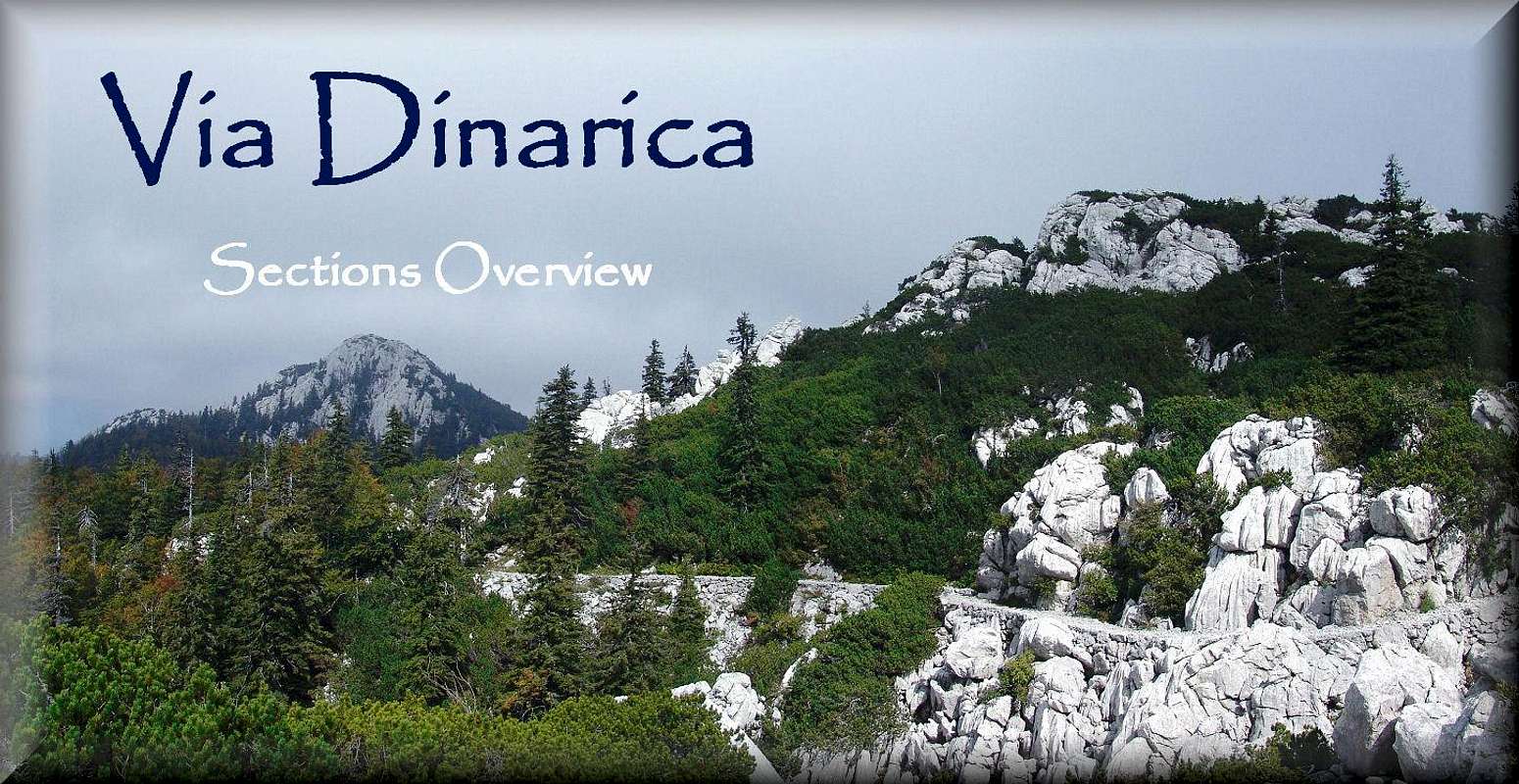
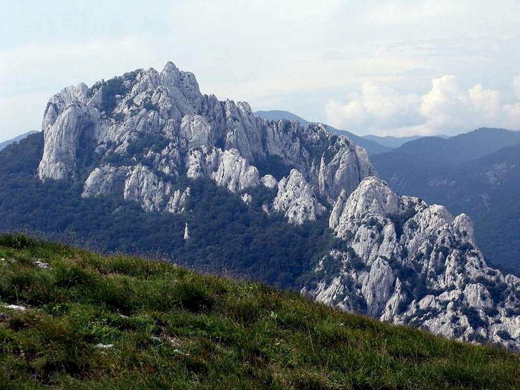
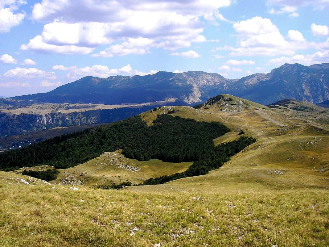
| 106. Buni i Gropa e Ujt – Qafa Pejes – Thethi | ||
 |
Photo: Buni i Gropes Bokoll by DINARIC-ZG ¤ |
|
|---|---|---|
· xxx h 4 Difficulty – ¢ xxx marked y xxx O Albania |
||
| 107. Thethi – Rragam (Valbona) | ||
 |
Photo: Thethi and Pejës Pass by DINARIC-ZG ¤Qafa Valbonës |
|
|---|---|---|
· xxx h 4 Difficulty – ¢ xxx marked y xxx O Albania |
||
| 108. Thethi Rragam – Valbona Valley - Dragobi | ||
 |
Photo: Maja Rosit (2525 m) summit view to Valbona Valley by vvujisic ¤ |
|
|---|---|---|
· xxx h 4 Difficulty – ¢ xxx marked y xxx O Albania |
||
| 109. Dragobi – Curraj i Eperm | ||
 |
Photo: Maje Krasniqes by DINARIC-ZG ¤ Maje Krasniqes (Qafë Droçes) |
|
|---|---|---|
· xxx h 4 Difficulty – ¢ xxx marked y xxx O Albania |
||
| 110. Curraj i Eperm – Curraj – Lekbibaj | ||
|
Photo: Map by DINARIC-ZG ¤ |
|
|---|---|---|
· xxx h 4 Difficulty – ¢ xxx marked y xxx O Albania |
||
| 111. Lekbibaj – Komani Lake Ferry | ||
|
Photo: Map by DINARIC-ZG ¤Komani Lake Ferry (Breglumë) |
|
|---|---|---|
· xxx h 4 Difficulty – ¢ xxx marked y xxx O Albania |
||
| 112. Koman – Shkodër | ||
|
Photo: Map by DINARIC-ZG ¤ |
|
|---|---|---|
· xxx h 4 Difficulty – ¢ xxx marked y xxx O Albania |
||