

|
|
Area/Range |
|---|---|
|
|
35.61100°N / 83.425°W |
|
|
Hiking |
|
|
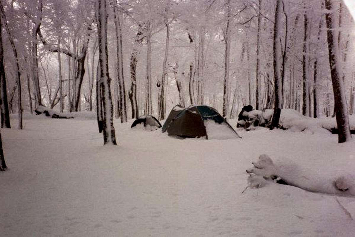
Spring, Summer, Fall, Winter |
|
|
6643 ft / 2025 m |
|
|
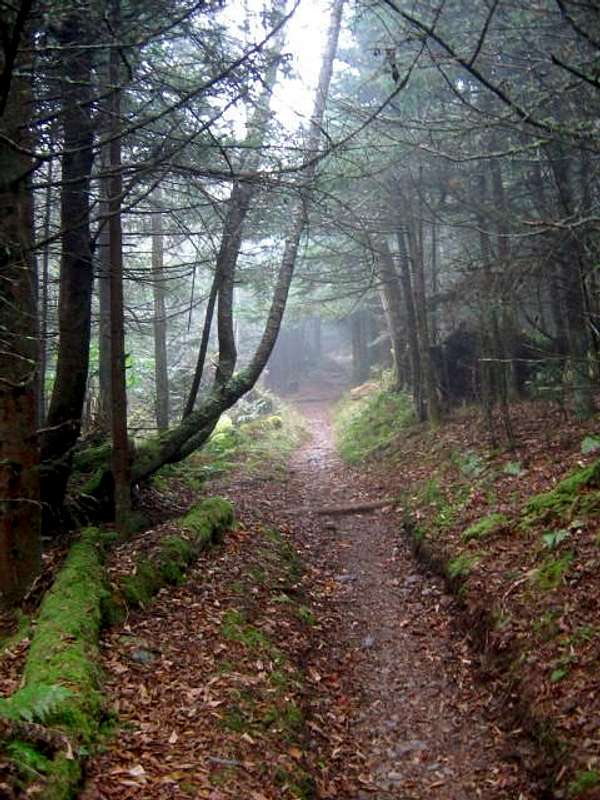
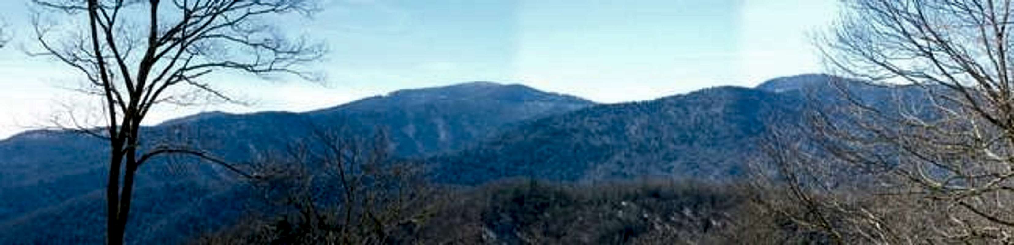
The Smokies
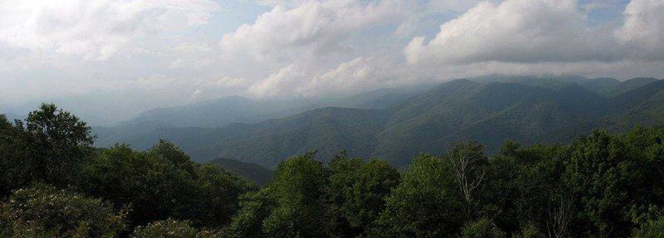
The Great Smoky Mountains are one of the highest ranges in Eastern America and easily the most visited. The range includes 25 peaks over 6000’, 12 of which are included on the South Beyond 6000 list. Dozens more top out above 5000’. The range is aligned in a general east-to-west direction, rising from the Pigeon River gorge and extending over 70 miles to the Little Tennessee River. The Appalachian Trail follows the spine of the range, crossing peaks such as Thunderhead Mt.(5527’) , Silers Bald(5607’), Clingmans Dome(6643’) , Mt. Collins(6188’) , Mt. Kephart(6217’) , Charlies Bunion(5376’) , Tri-Corner Knob(6120’) , Mt. Guyot(6621’) , Old Black(6370’) , and Mt. Cammerer(4928’) along the way. The AT logs 71.4 miles traversing the range and spends almost half (34 miles) of that distance above 5000’. This page has been created to give you an idea of what this range offers.
Great Smoky Mountains National Park was created in 1934 and now includes around 522,000 acres of some of the most rugged high mountain wilderness in eastern America. Around 9,000,000 people visit the park in a given year. That may be enough to keep most demo phobic backpackers away but consider the following facts…
In a recent survey conducted by the park service only 44% stated their purpose for visiting the Smokies was for a day hike, only 12% stated they were there to camp, and only 2% said they intended to use backcountry campsites or shelters. This means less than half the people who visit the park even intend to get out of their vehicles and 98% would wander no farther than their next meal away from a trailhead!!! To put this in perspective, out of the 24,000-ish daily visitors to the park, only about 450 are in the backcountry! Needless to say, the 400,000 or so acres in the park away from the roads combined with 600+ miles of trails should provide those 450 people plenty of alone time.
The Nature of the Smokies...
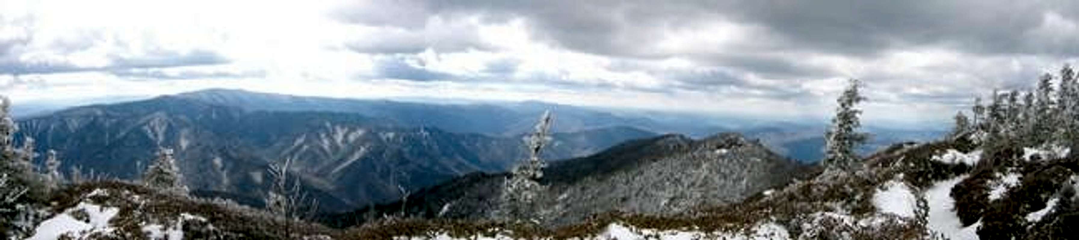
Books could, and have been written about the rich natural diversity of the Smoky Mountains. Their mid-latitude location combined with elevations that range from 840' at Abrams Creek to 6643' at the summit of Clingmans Dome creates one of the most complex ecosystems in America. In fact, the park has been recognized as as an International Biosphere Preserve.
The Great Smoky Mountains are home to 65 species of mammal, the most widely advertised is the Black Bear. There are around 600 bear in the park so proper food storage is always a must. Another popular resident of the Smokies, just recently re-introduced, is the Elk. Elk once roamed all over the Southern Appalachians but were killed off by the mid 19th Century. In 2001 the Park Service released 24 Elk in the Cataloochee Valley with more transported in the following years. From what I have heard it has been a stunning success. Other animals that are common include, but are not limited to, deer, beaver, raccoons, squirrels, opossums, skunks, snakes, fox, otter, rabbits, and even wild hogs!
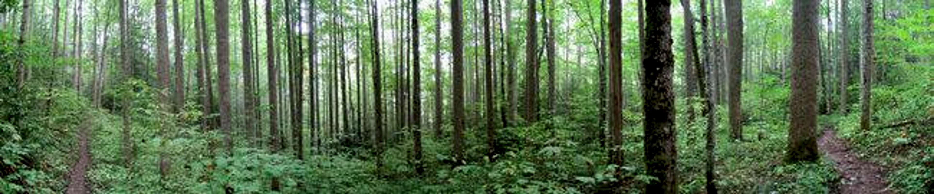
The Great Smoky Mountains most incredible feature is its plant-life. According to the Park Service website the mountians are home to over 5500 known species of plant! There are more types of plant life in the 815-ish square miles of the park than on the entire continent of Europe!!! Taking a walk from one of the lower campgrounds to the ridgetop is the ecological equivalent of traveling from Georgia to Maine! On top of it all the Smokies are home to the greatest concentration of old-growth forest in the east. About 25% of the existing forest is original growth. One of the best places experience this is in the eastern part of the park at Half Acre Ridge , listed below.
Unfortunately, this wealth of biodiversity is very fragile. Numerous diseases and pests(i.e. bugs and humans) have and still do take their toll. Two of the greatest concerns right now are air pollution and the Hemlock Woolly Adelgid, whose work you can see in the immense "ghost forests" atop the Smokies highest peaks. To learn more about these issues you can visit here.
Also, another of the Smoky Mountains most beautiful natural features is its cascades and waterfalls. The mountains are home to around 70 named falls and countless other small cascades. A couple of my personal favorites are "The Place of a Thousand Drips" and the "Ramsay Cascades." You can find a wealth of knowledge by visiting NCWaterfalls.com's Great Smoky Mountains page.
The Peaks
There are just too many peaks in the Smoky Mountains to give descriptions on each. What I will try to do is list those included on the South Beyond 6000 list and a few others of the lesser but more well-known in the park as they are added to Summitpost. Also, surprisingly, many of these peaks do not have trails accessing the summits. For more info on how to reach them visit the Carolina Mountain Club’s SB6K - Smoky Mountain page here.
6000' Peaks
| Clingmans Dome 6643' |
|
Highest peak in the Smokies and probably the most crowded. Can be reached by road and short summit trail. On the AT 7.7 miles south of Newfound Gap. |
| Mt. Guyot 6621' |
|
2nd highest peak in the Smokies. The AT passes the summit ¼ mile to the west and a tough bushwhack is required to reach the summit. Guyot is about 16.6 miles from both Newfound Gap and Big Creek . It can also be reached by ascending via the Snake Den Ridge and Appalachian Trails from Cosby Campground . |
| Mt. LeConte 6593' |
 |
Third highest peak in the Smokies. Numerous trails access the summit area which houses the LeConte Lodge. The summit is comprised of four peaks the highest of which is called, appropriately, High Top. |
| Mt. Chapman 6417' |
The AT passes the summit just to the east, requiring a short bushwhack. It is located 14.5 miles from Newfound Gap. |
| Old Black 6370' |
 |
As with many of the 6000-footers the AT does not travel over the summit, passing it to the west. A short bushwhack is required. The summit is 14.5 miles from the Big Creek area via the AT. |
| Luftee Knob 6234' |
 |
One of only three 6000-footers not along the AT, it is most easily accessed from Balsam Mountain Gap Road and then a 7.1 mile hike via the Balsam Mountain Trail. Unfortunately no trail accesses the summit and it is a tough bushwhack. Also, make sure you head for the correct peak; the south summit is the highest. |
| Mt. Kephart 6217' |
 |
Kephart is reached by heading north on the AT 2.8 miles to The Boulevard, turning onto The Boulevard briefly, then taking a right onto the unnamed summit spur. The summit is tree-covered and viewless but a short distance further is a place called the Jumpoff with spectacular views to the north and west. |
| Mt. Collins 6188' |
 |
Located along perhaps the busiest section of the AT in the park, Collins is only 4.7 miles south of Newfound Gap or 3 miles north of Clingmans Dome. |
| Marks Knob 6169' |
 |
A hard one to get to. You have your choice of hiking 16.5 miles from Newfound Gap via the AT and Balsam Mountain Trail or 9.3 miles up the Balsam Mountain Trail from Balsam Mountain Gap Rd . Either way from the trail it is another 1.5 mile bushwhack to reach the summit. |
| Big Cataloochee 6155' |
|
One of only three 6000’ peaks not along the AT. It is reached by ascending 4.3 miles via the Balsam Mountain Trail from Balsam Mountain Gap Road . Then, it’s about a 1 mile bushwhack to the summit. |
| Tri-Corner Knob 6120' |
A vertical twin of neighboring Mt. Yonaguska, you must hike one or the other to claim an ascent on the SB6K list. A short bushwhack from the Tri-Corner Knob Shelter , 15.6 miles from Newfound Gap via the AT, is required. |
| Mt. Seqouyah 6003' |
Barely making the list, Sequoyah is thankfully easy to get to…if you don’t mind a long hike. The AT crosses the summit 13.1 miles from Newfound Gap. |
Other Peaks
The peaks listed here are those currently with pages at Summitpost. I will try to keep this updated if more are added.
| Inadu Knob 5925' |
 |
A beautiful peak located just north of higher Old Black (see above). It can be most easily reached via a 5.3 mile hike up the Snake Den Ridge Trail from Cosby Campground. |
| Andrews Bald 5920' |
|
Located 1.8 miles south of the Clingmans Dome Parking Area. A beautiful “bald” with amazing views. Because of these reasons it can be busy. |
| Mt. Sterling 5842' |
 |
Not a 6000-footer but still has one of the finest views in the Smokies. Located at the easternmost end of the park. It is most easily climbed from Mt. Sterling Gap, following its namesake trail 1.8 miles to the summit. |
| Silers Bald 5607' |
 |
A nice peak about 5 miles west of Clingmans Dome via the AT. Don't hike here for the views, though there are some nice ones. Hike Silers to appreciate the solitude and the simple things the Smokies have to offer. As far as avoiding the tourists at the Clingmans Dome Parking Lot...forget the deoderant at home and they'll leave you all alone:) |
| Charlies Bunion 5565' |
 |
Easily one of the most beautiful spots in the Smoky Mountains. Its close enough to Newfound Gap(4.4 miles) to do as a day hike but far enough to loose most(note I said most) of the crowds. Just GO TO THIS ONE! |
| Thunderhead Mountain 5527' |
 |
Located on the AT this is the highest peak in the west end of the park. Thunderhead is a heath bald with no views from the summit but there are many stunning overlooks nearby. Makes for a great day-hike from Cades Cove via Anthony Creek/Bote Mountain Trails and then a short bit north on the AT. |
| Cosby, Ross, & Camel Hump Knobs 5200' |
 |
These three knobs are located along the AT about halfway between Mt. Cammerer and Tricorner Knob. Though unremarkable on their own these peaks still offer some great views along a quieter section of the Appalachian Trail. Combined with nearby Inadu Knob, a trip over them makes for a nice dayhike loop from Cosby Campground . |
| Nettle Creek Bald <> 5160' |
 |
Relatively unknown (I hadn't heard of it) due to the fact that the beauty here is more subtle. A short day hike off US-441, what the peak lacks in sweeping views it more than makes up for in botanical variety. A good hike for the true nature-lover |
| Maddron Bald 5100' |
 |
Main access is from Cosby Campground . Beautiful views from the top but the highlight of this peak is the virgin forest of Albright Grove. Located just off the Maddron Bald Trail, here you can wander through impressive stands of giant Poplars, Maples, and Hemlocks, among others. |
| Gregory Bald 4949' |
 |
A traditional southern bald near the western end of the Smokies. It is less visited than most peaks in the Smokies and has beautiful views. |
| Mt. Cammerer 4928' |
 |
Proves the adage, “Bigger isn’t always better.” Its 65-year old lookout tower offers amazing views. You can reach it from three directions. From Cosby Campground , to the west, it’s 5.2 miles via the Low Gap Trail and the AT. From the Big Creek area , to the east, it’s a 4.4 mile ascent via the Chestnut Branch Trail and the AT. The distances aren’t great but from either way you’ll climb almost 3000’. |
| Dripping Spring Mt. 4801' |
 |
A peak to "get away from it all." The views from this forested, trailless peak are non-existent but, more importantly perhaps, so are the crowds. There are some limited views to be had but mostly this is just a great place to go for a nice walk in the woods. A good day hike from the Elkmont area. |
| Chimney Tops 4700' |
 |
A contender for busiest peak in the Smokies. Only a 2-mile hike from US-441 via the Chimney Tops Trail. Views are incredible but be prepared to share them with a dozen or more people. |
| Cove Mountain 4150' |
 |
Located along the northwest border of the park, one of the most popular routes to this peak is past beautiful Laurel Falls. During summer the crowds at Laurel Falls can be nearly unbearable but push on past the falls and things should quiet down considerably. Old growth forests mixed with a dizzying variety of accompanying flora are highlights of this hike. |
| Half Acre Ridge 3900' |
 |
Part of the Cataloochee Divide at the far eastern end of the Smokies. Home to one of the finest areas of old growth forest in eastern America. Elk are also found here. |
Trails
Great Smoky Mountains National Park has something on the order of 800+ miles of trails. I won’t try to list all of them here but I’ll hit the major ones. To help locate the trails listed below I suggest downloading the NPS Trail Map .
The Appalachian Trail follows the spine of the Smokies for 71.4 miles. It is, therefore, the workhorse of the Smoky Mountains. It enters the park at Fontana Dam and spends the next 7-ish miles climbing to the ridge at Doe Knob (4520’). From here it follows the spine of the Smokies, spending most of its time at elevations in excess of 5000’, reaching busy Newfound Gap at mile 37.4 and dropping from Mt Cammerer (4928’) to Davenport Gap near I-40 30-miles later. It is one of the premier stretches on the entire AT.
Twenty-Seven Trails access the AT on its trip through the Smokies. From south-to-north they are…
| Trail | Trailhead | Length | Distance to Fontana | Distance to Newfound Gap |
| Lost Cove | Lakeshore Trail | 2.7 miles | 3.7 miles | 33.5 miles |
| Twentymile | Twentymile Ranger Station off NC-28 | 5.0 miles | 3.7 miles | 33.5 miles |
| Gregory Bald | Parson Branch Rd. | 7.3 miles | 6.8 miles | 30.4 miles |
| Russell Field | Anthony Creek Trail from Cades Cove | 3.5 miles | 11.7 miles | 25.5 miles |
| Eagle Creek | Lakeshore Trail | 8.9 miles | 14.3 miles | 22.9 miles |
| Bote Mountain | Laurel Creek Rd. | 6.9 miles | 14.3 miles | 22.9 miles |
| Jenkins Ridge | Hazel Creek Trail from Lakeshore Trail | 8.9 miles | 14.9 miles | 22.3 miles |
| Greenbrier Ridge | Prong Trail from Middle Prong Rd. | 4.2 miles | 20.7 miles | 16.5 miles |
| Miry Ridge | Jakes Creek Trail from Elkmont Campground | 5.0 miles | 23.1 miles | 14.1 miles |
| Welch Ridge | Bear Creek Trail from Lakeshore Trail | 7.3 miles | 24.8 miles | 12.4 miles |
| Goshen Prong | Little River Trail from Elkmont Campground | 7.6 miles | 27.3 miles | 9.9 miles |
| Forney Ridge | Springhouse Branch Trail from Noland Creek Trail from Lakeshore Trail | 5.6 miles | 29.2 miles | 8.0 miles |
| Clingmans Dome By-Pass | Forney Ridge Trail from Clingmans Dome Parking Area | 0.5 miles | 29.2 miles | 8.0 miles |
| Clingmans Dome | Clingmans Dome Parking Area | 0.5 miles | 29.2 miles | 8.0 miles |
| Sugarland Mountain | Little River Road | 11.9 miles | 32.7 miles | 4.5 miles |
| Road Prong | Chimney Tops Trail from US-441 | 2.4 miles | 35.5 miles | 1.7 miles |
| Trail | Trailhead | Length | Distance to I-40 | Distance to Newfound Gap |
| Sweat Heifer Creek | Kephart Prong Trail from US-441 | 3.7 miles | 28.7 miles | 1.7 miles |
| The Boulevard | Mount LeConte | 5.4 miles | 27.7 miles | 2.7 miles |
| Dry Sluice Gap | Bradley Fork Trail from Smokemont Campground | 4.2 miles | 26.0 miles | 4.4 miles |
| Hughes Ridge | Chasteen Creek Trail | 5.0 miles | 21.0 miles | 10.4 miles |
| Balsam Mountain | Balsam Mountain Gap Rd. | 10.1 miles | 15.8 miles | 15.6 miles |
| Snake Den Ridge | Cosby Campground | 5.3 miles | 12.1 miles | 19.3 miles |
| Camel Gap | Gunter Fork Trail from Big Creek Campground | 4.7 miles | 9.8 miles | 21.6 miles |
| Low Gap | Cosby Campground or Big Creek Trail from Big Creek Campground | 5.4 miles | 7.4 miles | 24.0 miles |
| Mt. Cammerer | Mt. Cammerer | 0.6 miles | 5.3 miles | 26.1 miles |
| Lower Mt. Cammerer | Cosby Campground | 7.5 miles | 3.0 miles | 28.4 miles |
| Chestnut Branch | Big Creek Ranger Station | 2.1 miles | 2.0 miles | 29.4 miles |
Worth mentioning also is the Lakeshore Trail . This trail never gains the ridge but is a trailhead for numerous trails in the western half of the park. The trail is 35 miles long and follows the north shore of Fontana Lake from Lakeview Drive to the Fontana Dam area. Despite its name it very rarely gets near the lake. It is one of the newer trails in the park and not as well used, which may be attractive to some.
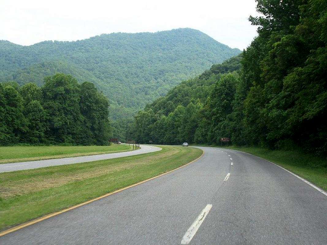
Getting There & Roads
You can download the NPS road map here.
- US-441 bisects the park, running north-to-south from Gatlinburg, TN to Cherokee, NC. It is the interstate of the Smoky Mountains and in any season can see traffic jams miles long. The best way to beat this is by heading out early or just avoiding it altogether.
The rest of the roads in the National Park tend to stick to the edges; counter-clockwise from the Gatlinburg area they are:
- The Little River/Laurel Creek Road along with the Cades Cove Loop in the northwest section of the park is probably the second-worst in terms of traffic. Numerous trails leave this road heading south for the main ridge. Elkmont and Cades Cove Campgrouds are located along these roads.
- Two dirt roads provide an exit from the Cades Cove Loop. Rich Mountain Road winds its way north out of the valley and the park to Townsend, TN. The other road, Parsons Branch, leaves the Cades Cove Loop at about its halfway point. Few trails are located along it but it is the only road to give any trail access in the western end of the Smoky Mountains.
- US129/NC115 and NC28 run along the southwest border of the park. These roads serve as the exit point for the above-mentioned Parsons Branch Road as well as access the Appalachian Trail at the Fontana Dam area.
- Access to the other end of Fontana Lake as well as the Deep Creek area on the south side of the park is found along Lakeshore Dive and Deep Creek Road. These roads both head out of Bryson City, NC.
- The Blue Ridge Parkway has its southern terminus at US-441 just inside the park north of Cherokee, NC. There is no trail access from the parkway. However, the Balsam Mountain Road enters the park from the Blue Ridge Parkway giving access to one of the nicer(I think) drive-in campgrounds in the Smoky Mountains, Balsam Mountain Campground . Just north of the campground entrance the Balsam Mountain Road becomes the one-way, dirt Balsam Mountain Gap Road. This road, while being very scenic, also gives numerous trail access points in the southeastern half of the park. The road becomes Straight Fork Road near its bottom end before reaching pavement again in the Big Cove area.
- The Cove Creek Mountain and Mt. Sterling Roads connect Cove Creek, NC with TN-32. The roads serve as access to the Cataloochee area and campground as well as giving trail access at numerous points as it passes over the far eastern end of the Smoky Mountain ridge.
- TN32 along with US321/TN73 follow the northeastern border of the park connecting I-40 with Gatlinburg, TN. Numerous trails leave from side roads off the main route, the most notable gives access to Cosby Campground .
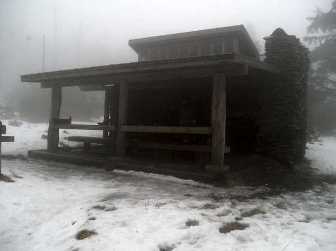
Campgrounds & Shelters
The 114 backcountry campsites and shelters are your only choice for staying overnight in the backcountry of the Smokies. Camping elsewhere is prohibited. To stay in the backcountry you also need a free permit which you can obtain at just about any Ranger Station or Visitors Center.
- The only choice for backcountry accommodations directly on the Appalachian Trail, other than site #113(see below), is in one of 12 shelters. Reservations must be made to use these shelters and can only be made up to 30 days in advance. Visit the Great Smoky Mountain NP Camping Page for more info.
AT Shelters – South of Newfound Gap...
| Shelter | Elevation | Capacity | Distance to Newfound Gap |
Nearby Peaks/Trails |
| Mollies Ridge | 4570' | 12 | 29.7 miles | Gregory Bald(6 miles) |
| Russell Field | 4360' | 14 | 25.5 miles | at Russell Field Trail; 5 miles S of Thunderhead Mt. |
| Spence Field | 4900' | 12 | 24.3 miles | Bote Creek/Eagle Creek Trails; 2 miles S of Thunderhead Mt. |
| Derrick Knob | 4890' | 12 | 18.0 miles | Greenbrier Ridge Trail |
| Silers Bald | 5460' | 12 | 12.5 miles | Welch Ridge Trail; 4.5 miles S of Clingmans Dome |
| Double Spring Gap | 5507' | 12 | 10.8 miles | Goshen Prong Trail; 2.6 miles S of Clingmans Dome |
| Mt. Collins | 5870' | 12 | 4.5 miles | Sugarland Mountain Trail just N of Mt. Collins |
AT Shelters – South of Newfound Gap...
| Shelter | Elevation | Capacity | Distance to Newfound Gap |
Nearby Peaks/Trails |
| Icewater Spring | 5920' | 12 | 3.0 miles | The Boulevard, nearby are Mt. Kephart & Charlies Bunion ; Mt. LeConte is 5.5 miles N |
| Pecks Corner | 5280' | 12 | 10.4 miles | Hughs Ridge Trail; 2.7 miles N to Mt. Sequoyah , 4.1 miles N to Mt. Chapman |
| Tri-Corner Knob | 5920' | 12 | 15.6 miles | Balsam Gap Trail; aneasy day hike from all the following: Mt. Chapman , Marks Knob , Tri-Corner Knob , Mt. Guyot , Old Black , Inadu Knob , and Luftee Knob |
| Cosby Knob | 4700' | 12 | 23.3 miles | About midway between Low Gap and Camel Gap Trails; Just under 4 miles to both Mt. Cammerer & Inadu Knob |
| Davenport Gap | 2600' | 12 | 30.4 miles | Just S of Chestnut Branch Trail; About 2.5 miles from Mt. Cammerer |
Shelters not on the AT...
| Shelter | Elevation | Capacity | Trail Location | Nearby Peaks |
| Mt. LeConte | 6440' | 12 | The Boulevard | Just below summit of Mt. LeConte |
| Kephart | 3900' | 14 | Sweat Heifer/Grassy Branch/Kephart Prong Trails | Within 4 miles of both Mt. Kephart & Charlies Bunion |
| Laurel Gap | 5600' | 14 | Balsam Mountain & Mt. Sterling Trails | Next to Big Cataloochee and within 3 miles of Luftee Knob |
 Below is a list of the backcountry campsites in the Great Smoky Mountains. Visit the Great Smoky Mountain NP Camping Page for more info. Campsites where reservations are required are marked “Yes.” To help locate the campsites listed below I suggest downloading the NPS Trail Map .
Backcountry Campsites North of the AT…
| Campground | Site # | Elevation | Reservations Required? |
Comments/Location |
| Ace Gap | #7 | 1680' | No | 2 sites; Ace Gap Trail 4.5 miles from Rich Mountain Road |
| Anthony Creek | #9 | 3200' | Yes | Large camp; Anthony Creek Trail 2.9 miles from Cades Cove Campground |
| Beard Cane | #11 | 1530' | No | Small camp; Beard Cane Trail 6.5 miles from Cades Cove Loop |
| Birch Spring Gap | #113 | 3680' | Yes | 6 sites, formerly a shelter; only campsite on AT, 4.6 miles from Fontana Dam |
| Camp Rock | #23 | 3200' | Yes | 6 sites; Goshen Prong Trail 4.4 miles from AT just N of Double Spring Gap |
| Cane Creek | #2 | 1320' | No | Seldom used; Cane Creek Trail 3.8 miles from Abrams Creek Campground |
| Cooper Road | #1 | 1200' | No | Accommodates 10; Cooper Road Trail 1.6 miles from Abrams Creek Campground |
| Dalton Branch | #95 | 2360' | No | Wolf Ridge Trail 2.0 miles from Twentymile Ranger Station |
| Dripping Spring Mountain | #26 | 4400' | No | Miry Ridge Trail 3.1 miles from AT at Cold Spring Knob |
| Flint Gap | #14 | 2050' | No | Hannah Mountain Trail 4.3 miles from Parsons Branch Road |
| Forge Creek | #12 | 2600' | No | Gregory Ridge Trail 1.7 miles from Parsons Branch Road |
| Gilliland Creek | #35 | 2680' | No | 5 sites; Lower Mt Cammerer Trail 3.3 miles from Cosby Campground or 4.2 miles from the AT just N of Mt. Cammerer |
| Hesse Creek | #3 | 1360' | No | Remote, along Beard Cane Trail 6.2 miles from Rich Mountain Rd |
| Injun Creek | #32 | 2280' | No | Grapeyard Ridge Trail 3.2 miles from Greenbrier Rd |
| Kelly Gap | #4 | 1930' | No | 4 sites; Ace Gap Trail 2.3 miles from Rich Mountain Rd |
| King Branch | #20 | 2520' | No | 5 sites; Meigs Mountain Trail 2.3 miles from Elkmont Campground |
| Ledbetter Ridge | #10 | 3000' | Yes | 2 sites; Russell Field Trail 2.4 miles from Cades Cove or 2.7 miles from the AT at Russell Field |
| Little Bottoms | #17 | 1240' | No | Little Bottoms Trail 2.5 miles from Abrams Creek Campground |
| Lower Jakes Gap | #27 | 3520' | No | 4 sites; Jakes Creek Trail 2.6 miles from Jakes Creek Rd |
| Marks Cove | #28 | 3490' | No | 10 sites; Lynn Camp Prong Trail 4.4 miles from the AT at Cold Spring Knob |
| Medicine Branch Bluff | #21 | 3780' | No | 3 sites; Sugarland Mountain Trail 7.9 miles from Little River Rd |
| Otter Creek | #28 | 4560' | Yes | 3 sites; Maddron Bald Trail 2.3 miles from the AT at Inadu Knob |
| Porters Flat | #31 | 3400' | No | Accommodates 15; end of Porters Creek Trail 4.6 miles from Greenbrier Rd |
| Rabbit Creek | #15 | 1550' | No | Rabbit Creek Trail 4.1 miles from Abrams Falls Trailhead on Cades Cove Loop |
| Rich Mountain | #5 | 3400' | No | Grave Gap Trail 1.9 miles from Rich Mountain Rd |
| Rough Creek | #24 | 2860' | Yes | Accommodates 15; Little River Trail 4.4 miles from Elkmont |
| Scott Gap | #16 | 1700' | No | Hannah Mountain Trail 2.7 miles from Abrams Creek area |
| Settlers Camp | #33 | 1960' | No | Settlers Trail approx. 8 miles from Greenbrier Rd |
| Sheep Pen Gap | #13 | 4640' | Yes | Wolf Ridge Trail 6.8 miles from Twentymile Ranger Station. Just below Gregory Bald |
| Sugar Cove | #34 | 3240' | No | Accommodates 15; Gabes Mountain Trail 4.8 miles from Cosby area |
| Three Forks | #30 | 3400' | No | Accommodates 15; end of Little River Trail 6.2 miles from Elkmont |
| Turkeypen Ridge | #6 | 3400' | No | 2 sites; Scott Mountain Trail 2.3 miles from Cades Cove Loop Rd |
| Twentymile Creek | #93 | 1880' | No | Twentymile Trail 1.8 miles from Twentymile Ranger Station |
| Upper Flats | #92 | 2520' | No | Long Hungry Ridge Trail 4.2 miles from Twentymile Ranger Station or 3.0 miles from the AT at Sassafras Gap |
| Upper Henderson | #19 | 2880' | No | 3 sites; Meigs Mountain Trail 4.6 miles from road to Elkmont |
| West Prong | #18 | 1600' | No | 5 sites; West Prong Trail 2.1 miles from Tremont Rd or 1.9 miles from Laurel Creek Rd |
Backcountry Campsites South of the AT…
| Campground | Site # | Elevation | Reservations Required? |
Comments/Location |
| Bald Creek | #61 | 3560' | Yes | Noland Creek Trail 5.7 miles from Clingmans Dome Rd |
| Bear Pen Branch | #65 | 2040' | No | Noland Creek Trail 1.3 miles from Lakeview Drive |
| Big Hemlock | #40 | 3100' | No | Rough Fork Trail 1.5 miles from Cataloochee Road |
| Big Walnut | #97 | 2400' | No | Eagle Creek Trail 4.3 miles from the AT at Spence Field Shelter |
| Bone Valley | #83 | 2280' | Yes | Accommodates 20; Hazel Creek Trail 9.7 miles from the AT just north of Spence Field Shelter |
| Bryson Place | #57 | 2360' | Yes | Deep Creek Trail 6.0 miles from Deep Creek area |
| Bumgardner Branch | #60 | 2120' | No | Deep Creek Trail 2.5 miles from Deep Creek area |
| Burnt Spruce | #56 | 2405' | No | Deep Creek Trail 6.5 miles from Deep Creek area |
| Cabin Flats | #49 | 3060' | No | 5 sites; Cabin Flats Trail 4.1 miles from Smokemont |
| Caldwell Fork | #41 | 3360' | No | Caldwell Fork Trail about 5 miles from Cataloochee |
| Calhoun | #82 | 2720' | No | Hazel Creek Trail 6.4 miles from the AT at Silers Bald |
| Chambers Creek | #98 | 1720' | No | Lakeshore Trail 9.6 miles from Lakeview Drive trailhead |
| Double Island | #78 | 1720' | No | On island in Fontana Lake; Boat access only |
| Eagle Creek Island | #96 | 2880' | No | 4 sites; on island in Eagle Creek; Eagle Creek Trail 8.7 miles from Fontana Dam or 6.3 miles from the AT at Spence Field |
| Enloe Creek | #47 | 3620' | Yes | Enloe Creek Trail about 8 miles from Smokemont |
| Forney CCC | #71 | 2180' | Yes | Accommodates 12; Forney Creek Trail 9 miles down from the Clingmans Dome area |
| Goldmine Branch | #67 | 1840' | No | Goldmine Loop Trail 1.5 miles from end of Lakeview Drive |
| Gunter Branch | #72 | 1720' | No | Boat Access only from Fontana Lake |
| Huggins | #69 | 2800' | No | Accommodates 12; Forney Creek Trail 6.5 miles down from the Clingmans Dome area |
| Jerry Flats | #63 | 2920' | No | A popular horse camp; Noland Creek Trail 5.5 miles from trailhead at Lakeshore Drive |
| Jerry Hollow | #87 | 1720' | No | Boat Access only from Fontana Lake |
| Jonas Creek | #70 | 2400' | No | Jonas Creek Trail 6.5 miles from AT at Silers Bald or 8.4 miles from Clingmans Dome area |
| Kirkland Creek | #76 | 1770' | No | Lakeshore Trail 11.9 miles from trailhead at Lakeview Drive |
| Lost Cove | #90 | 1760' | No | Lakeshore Trail 5.6 miles from trailhead at Fontana Dam or 3 miles from the AT at Sassafras Gap |
| Lone Pine | #73 | 1720' | No | Boat Access only from Fontana Lake |
| Lower Chasteen | #50 | 2360' | Yes | Chasteen Creek Trail 1.2 miles from Smokemont |
| Lower Ekanetlee | #89 | 1880' | No | 6 sites; Eagle Creek Trail 7.2 miles from Fontana Dam or 7.3 miles from the AT at Spence Field |
| Lower Forney | #74 | 1720' | No | Lakeshore Trail 3.1 miles from trailhead at Lakeview Drive |
| Lower Noland Creek | #66 | 1720' | No | Boat Access only from Fontana Lake |
| Lower Walnut Bottom | #37 | 3000' | Yes | Big Creek Trail 5.3 miles from Big Creek Campground or 3 miles from the AT at Low Gap just N of Cosby Knob |
| McCracken Branch | #59 | 2320' | No | Deep Creek Trail 5 miles from Deep Creek Campground |
| McGee Spring | #44 | 5040' | No | Hyatt Ridge Trail 3.5 miles from Balsam Mountain Gap Rd |
| Mill Creek | #64 | 2540' | No | Large camp; Noland Creek Trail 4.1 miles from trailhead on Lakeview Drive |
| Mt. Sterling | #38 | 5820' | Yes | Accommodates 12; Highest campsite in park at summit of Mt. Sterling 1.9 miles from Mt. Sterling Gap or 6.1 miles from Big Creek |
| Nettle Creek | #54 | 2600' | No | Deep Creek Trail 6.6 miles from trailhead at Clingmans Dome Road near Mt. Collins |
| Nicks Nest Branch | #58 | 2360' | No | Deep Creek Trail 8.8 miles from trailhead at Clingmans Dome Road near Mt. Collins or 5.4 miles from Deep Creek area |
| North Shore | #81 | 1800' | No | Very Remote; Lakeshore Trail 13.8 miles from trailhead at Fontana Dam |
| Pilkey Creek | #77 | 1800' | No | Very Remote; Lakeshore Trail 18.0 miles to trailhead at Fontana Dam or 16.6 miles to other trailhead at Lakeview Drive |
| Newton Bald | #52 | 5000' | No | 4 sites; Ridge-top site on Newton Bald Trail 4.7 miles from US-441 near Smokemont |
| Poke Patch | #53 | 3000' | No | Deep Creek Trail 3.9 miles from US-441 just S of Newfound Gap or 5.1 miles from Clingmans Dome Road near Mt. Collins |
| Pole Road | #55 | 2410' | Yes | Deep Creek Trail 6.5 miles from Deep Creek Campground or 9 miles from Clingmans Dome Road near Mt. Collins |
| Poplar Flats | #75 | 2800' | No | Bear Creek Trail 5.1 miles from Lakeview Drive |
| Pretty Hollow | #39 | 3040' | No | Pretty Hollow Gap Trail 2 miles from Cataloochee Road |
| Proctor | #86 | 1680' | No | Lakeshore Trail 10.4 miles from trailhead at Fontana Dam |
| Sawdust Pile | #85 | 2000' | No | Hazel Creek Trail 13.5 miles from Fontana Dam |
| Spruce Mountain | #42 | 5480' | No | Spruce Mountain Trail 1.1 miles from Balsam Mountain Gap Road |
| Steeltrap | #68 | 3960' | No | Accommodates 8; Forney Creek Trail 3.5 miles from Clingmans Dome Parking Area |
| Sugar Fork | #84 | 2160' | No | Hazel Creek Trail 15.0 miles from Fontana Dam or 9 miles up to the AT just N of Spence Field |
| Upper Chasteen | #48 | 3320' | No | Chasteen Creek Trail 3.6 miles from Smokemont or 6.5 miles from the AT at Pecks Corner |
| Upper Lost Cove | #91 | 2040' | No | Lost Cove Trail 6.2 miles from Fontana Dam or 2.1 miles from the AT at Sassafras Gap |
| Upper Ripshin | #62 | 3160' | No | Noland Creek Trail 6.7 miles from the trailhead at Lakeview Drive or 7.3 miles from Clingmans Dome Rd |
| Upper Walnut Bottom | #36 | 3040' | Yes | Equestrian Campsite |
Front Country Camping is available at 10 sites around the perimeter of the park. Campgrounds have showers and flush toilets but no electricity or water hookups.
| Campground | Elevation | # of Sites | Cost('06) | Location |
| Abrams Creek | 1125' | 16 | $14 | Happy Valley Rd off Foothills Parkway - W end of park |
| Balsam Mountain | 5310' | 46 | $14 | Balsam Mountain Road off Blue Ridge Parkway |
| Big Creek | 1700' | 12 | $14 | N end of Mt. Sterling Rd near I-40 |
| Cades Cove | 1807' | 161 | $17-$20 | entrance to Cades Cove Loop Rd |
| Cataloochee | 2610' | 27 | $17 | off Mt Sterling/Cove Creek Gap Rd |
| Cosby | 2459' | 157 | $14 | off TN-32 |
| Deep Creek | 1800' | 108 | $17 | north of Bryson City, NC |
| Elkmont | 2150' | 220 | $17-$23 | off Little River Rd |
| Look Rock | 2600' | 96 | $14 | off Foothills Pkwy - W end of park |
| Smokemont | 2198' | 140 | $17-$20 | US-441 near South Entrance |
More Info / Links
Official National Park Service Page
NPS Road & Trail Closure Page
National Park Service Camping Page
National Park Service Maps Page
Carolina Mountain Club South Beyond 6000 Smokies Page
Smoky Mountain Info Page
Look Rock Webcam
Purchase Knob Webcam
AT Distance Calculator
NCWaterfalls.com - The best waterfall site I know of. Excellent info and photos from all over the Southern Appalachians.
National Geographic Trails Illustrated Map for the Smoky Mountains
DWhike's Adventures - Shameless self promotion...come visit my website for more pics of the Great Smoky Mountains and other places that I have wandered off to in recent years...

dwhike - Jul 29, 2006 3:10 am - Hasn't voted
Re: waterfallsExcellent idea, It's a great website I use quite a bit. I'll try to get it in there as soon as I can. Thanks for the tip! -Dan
Eleutheros - Apr 18, 2011 7:59 pm - Voted 10/10
Mount GuyotI posted a page on Mount Guyot. You can link to it if you like, thanks! Best, Eleutheros
BobSmith - Apr 19, 2011 4:59 pm - Voted 10/10
Re: Mount GuyotI'll post it on the Sixers page.
silversummit - Jan 6, 2014 3:08 pm - Voted 10/10
NPS Trail Map link has changedHere is the current link I believe: http://www.nps.gov/grsm/planyourvisit/upload/trail-map_JULY13-full.pdf Thanks! Kathy